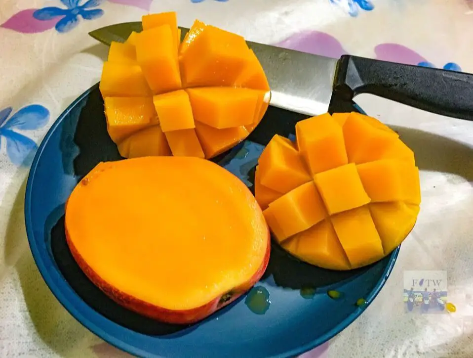
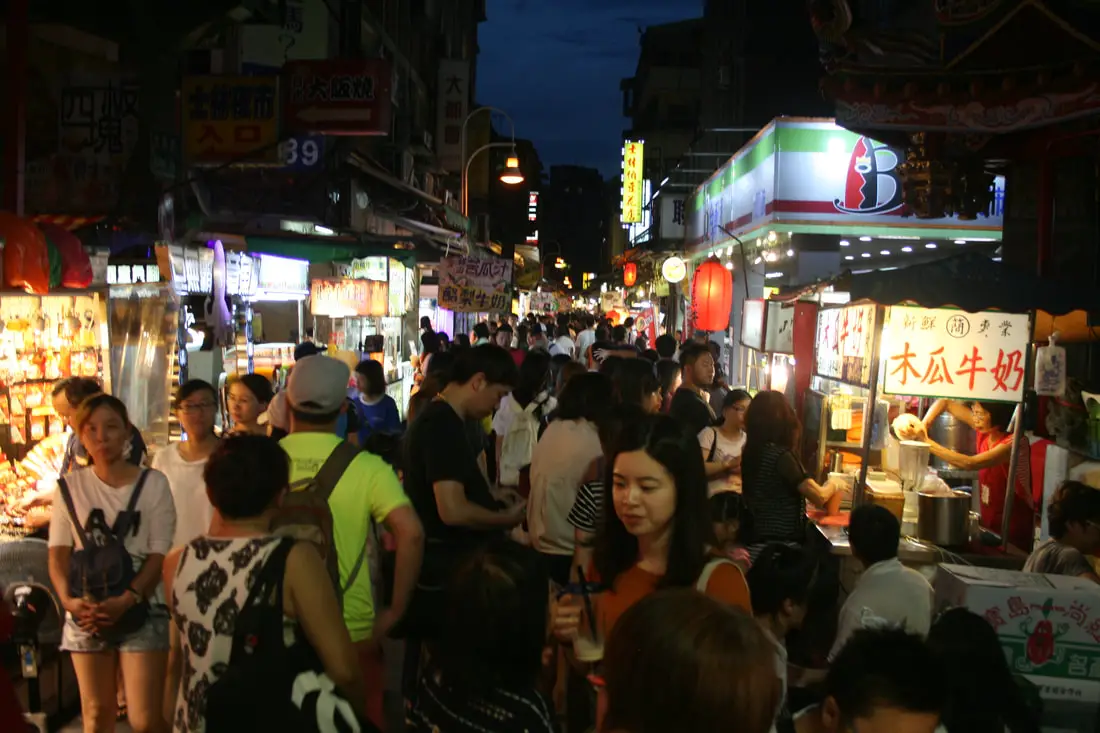
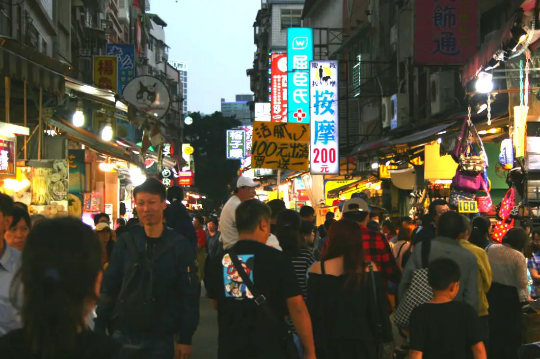
The Zuoying Confucius Temple (aka Kaohsiung Zuoying Confucius Temple) is a large Confucius Temple in Taiwan. It sits near the beautiful Lotus Pond, and is surrounded by countless other temples in the area. Today it is an important place for Confucian learning and a popular tourist attraction in Kaohsiung City.
Historical Background: The Zuoying Confucius Temple was completed in 1974 over the ruins of the former Qishan Shinto Shrine. Covering an area over 6000 cubic meters, it is one of the larger Confucious temples in Taiwan. It was built after the northern Taiwan temple style, resembling the Forbidden City in Beijing. Zuoying's Confucius Temple is not the only Confucius temple in Kaohsiung. There is another one in Qishan, so the temples trade years for annual Kaohsiung City Confucius ceremonies. Hours: 9 AM to 5 PM (closed on Mondays) Price: Free How to get there: By Car/Scooter: From central Kaohsiung, go north on provincial highway 17 and then turn north on Xinzhuang 1st Road. The pond is on your left and is hard to miss. There is free and paid parking all around the lake. By Train: From the north you can walk to the pond from Zuoying HSR station, or from the south you can walk there from Zuoying Jiucheng TRA Station. Map: Please see below:
0 Comments
Lengshuikeng in Yangmingshan National Park is a small area with hiking trails, natural hot springs, waterfalls, and wildlife. Even though the name means "cold water hole," the water here is not cold, and there are plenty of hot springs around including a public hot spring bath house. It is a quiet a pleasant stop on the mountain and worth a visit on your trip to Yangmingshan.
Background: The area known as Yangmingshan now was formed by volcanoes about 700,000 years ago, forming many mountains about 1000 meters or less in northwestern Taiwan. The park still features active volcanoes, vents, and hot springs. The original name of the area was Caoshan (grass mountain 草山). During the Qing Dynasty, the area was used to harvest sulfur, and many of the hills were burned to help catch sulfur thieves. In 1927 during the Japanese era, Yangmingshan was made as the first national park in Taiwan, then known as Datunshan National Park Association. In 1950 after the ROC took Taiwan Chiang Kai-shek renamed the park after the philosopher Wang Yangming, and called the area Yangmingshan. In 1985, after resolving many land disputes, Yangmingshan National Park was officially designated as a national park in the ROC era. Lengshuikeng (literally "cold water crater" gets its name because the hot spring waters here are only 40 degrees centigrade, the coldest hot spring waters on Yangmingshan. Lengshuikeng has the only sulfur deposit sediment layer in Taiwan. Nearby are many hot springs and vents. It is a popular stop in Yangmingshan and has two parking lots and visitor's center. Hours: The visitor's center is open from 9 AM to 4:30 PM. Price: Free How to get there: By Car/Scooter: From Taipei, take provincial highway 2A north to Chungshan Hall, and take a right, then continue down the road up the mountain to the left until you reach Lengshuikeng. By Bus: From Shilin MRT Station, take bus S15 to Lengshuikeng Service Station. Map: Please see below:
The Lotus Pond in Zuoying District of Kaohsiung is one of the most beautiful scenic areas in Taiwan. Much of the lake is full of traditional Chinese temples, gardens, and architecture. Because of its size, it cannot be properly appreciated by only going there for one afternoon; there are simply too many things to see and do there. In this blog, we will provide you a detailed virtual tour of the entire lake.
Historical Background: Lotus Pond was originally a small natural pond next to what is now the Zuoying Confucious Temple. Starting from 1686 after the Qing Dynasty captured Taiwan from the Kingdom of Tungming, the pond was gradually expanded for water storage and irrigation purposes. Also, lotus plants were cultivated on the pond, giving it its name. It was known as one of the eight beautiful scenes of Fengshan Old City. It also became a hotbed for temple building, and now over 20 temples stand by the lake. In 1951 the Qiming Temple, Spring and Autumn Pavilions, and Guanwu God Temple were completed. In 1976 the Dragon and Tiger pagodas were completed. In 1978 Wuli Pavilion was completed. Every year over a million visitors come to the park, although these numbers have gone down in recent years due to aging infrastructure and lack of new attractions. It is a haven for retired Taiwanese people to come and relax. Due to its close proximity to the Zuoying Jiucheng TRA station and Zuoying HSR station, it is also a popular attraction for tourists in Kaohsiung. Price: Free Hours: 8 AM - 6 PM (Dragon and Tiger Pagodas) How to Get There: By Car/Scooter: From central Kaohsiung, go north on provincial highway 17 and then turn north on Xinzhuang 1st Road. The pond is on your left and is hard to miss. There is free and paid parking all around the lake. By Train: From the north you can walk to the pond from Zuoying HSR station, or from the south you can walk there from Zuoying Jiucheng TRA Station. Map:
Niugangleng Mountain (aka Niuganglengshan Trail or mispronounced Niugangling) is a short and easy trail in New Taipei with perhaps some of the best views of the Taipei Basin. This popular and easy hike covers is located in the Guanyinshan Recreation Area, in Wugu District of New Taipei, and offers excellent views of the Wugu, Luzhou, Sanchong, Bali, Tamsui and rest of downtown Taipei. It should be on your list of places to visit in Taipei.
Background: Niugangleng Mountain is a peak sitting next to the slightly taller Guanyinshan. The mountain lies at 469 meters above sea level, and Guanyinshan, the highest peak in the area, is 616 meters above sea level. These mountains lie on the Datun (大屯山系統), which starts in Yangminshan National Park, and goes through Linkou District of New Taipei . The rock formations that form the Datun Mountain Chain formed by volcanic eruption nearly 600,000 years ago, and has been cut down slowly by the Tamsui River. Currently the Guanyinshan and Niugangling trails are one of the most popular trails in New Taipei. Hours: 24/7 Price: Free Length: Niugangling: 1 hour 2 KM one way Total of about 117 meters in elevation gain Guanyinshan: 3-4 hours 6.1KM one way Total of about 322 meters in elevation gain Difficulty: Easy, although there are many steep steps at the beginning. How to get there: By Bus: Take the Orange Line MRT to the Luzhou Station stop. Then take bus 020 to the Guanyin Tourist Center stop. The trailhead is right to the south of the Guanyinshan visitor's center. By Scooter/Car: From Luzhou, go across the bridge to Wugu and then take Zhongzhi Road up the mountain to the Guanyinshan Visitor's Center. There is free car and scooter parking in front of the visitor's center. Map: Please see below:
Taiwan is a place that should be explored not just with public transportation (as convenient as it is). If you only take public transportation everywhere you go, you are missing out on a huge part of Taiwan. You could take taxis everywhere to see these sights, like a rich Chinese person, or you can take the cheaper option and rent a vehicle. Many of the scenic and rural sights of Taiwan can’t be experienced except by hiring your own vehicle.
Renting cars or scooters in Taiwan: Taiwan is the scooter capitol of the world. Driving a scooter is dangerous, but scooters are fun. You can stop pretty much anywhere on the side of the road easily and take photos and enjoy the scenery. They are also pretty easy to learn how to operate; if you can already drive a car and/or ride a bike, picking up riding a moped shouldn’t be that hard. There’s not much better of way to experience Taiwan than cruising down the streets like everyone else with the wind blowing in your face. However, if you are afraid that scooters are dangerous, I would suggest renting a car.
Yinhedong Waterfall (aka Yinhe Cave Waterfall) is an easily accessible sight in Xindian District of New Taipei, and perhaps the most picturesque in all of Taiwan. It is easily accessible by public transportation, and the hike takes less than ten minutes to get there from the trailhead. The waterfall includes a cave and temple that are great for taking phots. It's spectacular cascading falls are definitely worth a stop for anyone in Taiwan.
Background: Yinhedong Waterfall is about 30 meters high and is separated into two parts by a cave in the middle of the waterfall. It is located near the town of Xindian, and it's name literally means "Silver River Cave" or "Milky Way Cave." The waterfall lies a tributary of the Qingtan River which runs down tho the Xindian River, which runs into the Tamsui River. The rocks here easily erode, making for odd shapes in the riverbed. The earliest known discovery of the waterfall is by Chen Qiuju, who led a rebellion against the Japanese and used the cave as his hideout. The Japanese later discovered the cave and in 1914 a temple was built in the cave. The temple was renovated in 1958, and now the main god worshipped is Guanyin Bodhisattva. Now the waterfall is a popular attraction in the mountains of New Taipei with many other popular trails nearby. Hours: 24/7 Price: Free How to get there: By Gondola: From Xindian MRT station, you can take the green 12 bus to Yinhedong Station. According the Google the fastest way to get to Yinhe Cave from central Taipei is by taking the Maokong Gondla to Maokong Station, then taking the trail down to Yinhe Road and the waterfall trail entrance. I't about a hal hour or 2KM walk from the Maokong Gondola to the trail entrance. By Car/Scooter: Take provincial highway 9 east from Xindian toward Pinglin, then turn left off the main highway once you reach Yinhe Road. The waterfall is to the right of the first switchback in the road, and car and scooter parking are free on the side of the road near the entrance. Map: Please see below
The Pingxi Railway in New Taipei has some of the most popular attractions in Northern Taiwan. With a total of 7 stations (plus 2 if you count Ruifang and Houtong), there are endless places to explore, eat, hike, and enjoy Taiwan's history, culture, and natural beauty all in one place.
Background: Before the Pingxi Railway was built, during the Qing Dynasty a section of the Danlan Old Trail ran through roughly the same area, connecting Yilan to Tamsui. The Japanese completed the Pingxi Railway in 1921 in order to transport coal from the area. Most all of the stations and villages along the line were economically reliant on the coal industry until its downfall in the late 1990s. The coal industry remained strong after the ROC took over Taiwan after WWII, but slowly waned in the 1980s and 1990s due to the decrease in global coal prices. In the year 2000, Sanxia’s Lifeng Mine shut down operations, and Taiwan’s mining company closed, and thus all coal mining in Taiwan effectively stopped. The Pingxi Railway is a single track that is 12.9 KM long with 7 stations. Recently the government has offered many plans to connect the Pingxi Railway to the Taipei MRT via Jingtong to Jingmei, however due to many factors these plans have never been approved. The area around Pingxi and Ruifang is made up of sedimentary rock which easily erodes, creating many large waterfalls such as Shifen Falls, and pointy jagged peaks like the Pingxi Crags. Popular activities along the Pingxi Railway include hiking, river tracing, eating at one of the many old streets, setting off sky lanterns, and exploring the many historical coal mining sites. Hours: The first train reaches Sandiaoling daily at 5:25 AM and the last train leaves Jingtong at 8:33 PM. Price: 80 NT per person for a one day pass When to go: Any time of year is great. However, waterfalls are most enjoyable during the hot summer, and you may want to come for lantern festival when hundreds of sky lanterns are set off at once. To avoid crowds and packed trains, do not go on weekends or holidays. How to get there: By Train: Take the TRA to Ruifang Station, buy the Pingxi Railway line one day pass, and then switch to the Pingxi Railway line. Get off at any station! By Car/Scooter: Take provincial highway 2 east toward Pinglin, then get off the main highway once you reach Shifen. You can drive right or left to reach all of the stations on the Pingxi Railway line. But please know there is limited car parking around the stations. Map: Please see below:
The Pingxi Crags are a set of hiking trails that traverse steep mountain peaks and rock cliffs in the mountains south of Pingxi Village. The sedimentary rocks here stick out of the forest at the tops of the mountains, making for great views but also dangerous climbs.
Background: The rock formations that form the Pingxi crags hike formed as sediment under the ocean millions of years ago and were then uplifted thanks to the collision of the Eurasian and Phillipine plates. The rocks are mainly sedimentary and are part of the same formation that forms the special rock formations on the northern coast around Keelung. The area also has some coal deposits, and there is an abandoned mine on the trail. There are basically six main peaks along the Pingxi Crags trail: Xiaozishan (孝子山), Cimu Peak (慈母峰), Cien Peak (慈恩嶺), Putuoshan (普陀山), Choutoutshan (臭頭山) and the Zhongyangjian Peak (中央尖) which is the highest peak in that chain of mountains. Xiaozishan is 140 (459 feet) above sea level. Much of the climbing is medium to difficult, and includes rock scrambling and rope climbs up steep cliffs with carved steps and footholds, as well as ladder crossings and chain ladder climbs in some places. The area is popular with hikers and can get busy on the weekends. Hours: 24/7 Permits Required: None Duration: The trail is technically 1.6 KM to Zhongyanjian, but it could take you most of the day because the hike is steep and there is lots of rope climbing. The difficulty here is medium because you are not gaining tons of elevation but there are some really scary rope climbs, rock scrambling, and near vertical rock climbs in some places. When to go: On a sunny dry day. The rocks can get slippery and a fall on some of the trails could kill you. When not to go: Don't go when it is raining. You could slip right off a cliff to your death, plus it will be cloudy with no good views. Don't bring children under 12 years old. How to get there: By Train: Take the TRA to Ruifang Station, and then switch to the Pingxi Railway line. Get off at Pingxi Station, and then walk south past the river toward the mountains. The trailhead starts right to the right of the public bathroom. By Car/Scooter: Take provincial highway 2 east toward Pinglin, then get off the main highway once you reach Shifen. Then turn right and go west on county road 106 until you reach the Pingxi Old street and turn left up the mountain after you reach the Taiwan Power Company. There is a parking lot and trail head at the end of the road. Maps: You can check out the full trail map here or here. For the location of the start of the trail, please see below:
Gangshan's Skywalk Bridge (aka Xiaogangshan Skywalk Park) is a tourist attraction in Gangshan District of Kaohsiung, which features great views of Agongdian Reservoir and norther Kaohsiung City. The bridge is in the shape of a violin, and there is constant music playing here. If you visit Kaohsiung, this place should definitely be on your list.
Background: Siaogangshan Skywalk Park was completed in 2018 at the price of 128,000,000 NT. It is 40 meters tall and 88 meters wide. It officially opened February 14th, 2018. The main pylon resembles a violin and includes 24 suspension cables that look like violin strings. It's Chinese name literally means "the eye of Gangshan." Hours: 9 AM to 9 PM, closed Mondays Price: 60 NT per person Tickets are free until the end of December 2020! How to get there: By Car/Scooter: Take Jiaxing East Road east out of Gangshan until it becomes Dazhuang Road, then park at the parking lot in front of the dam. There is a shuttle bus that will take you to the top of the mountain for 25 NT per trip. Vehicle traffic is not allowed up the mountain. The shuttle bus comes about every half hour. By Bus: From Gangshan MRT Station, take buys R68 A or B to Siaogangshan Station. The trip takes over an hour. Map: Please see below:
Ximending is a historical neighborhood and shopping district in west Taipei. Originally built by the Japanese as an entertainment district, it later became the first designated pedestrian zone in Taiwan. Here you can find night market like food choices, historical sights, and endless shopping options. It is definitely worth a stop on your trip to Taipei.
Historical Background: The land that Ximen Shopping District stands on was once part of Basay tribal land. The Basay people had lived on the land for thousands of years before the first Chinese settlers. Sections of the area indicate that there was settlements here during the Dutch rule in the 1600s. The name Ximending refers to the neighborhood just outside the west gate of Taipei City. Before the Japanese colonization of Taiwan, this area was wilderness connecting Taipei with Bangka. The Japanese decided to develop it into an entertainment area around the turn of the 20th century. The walls of Taipei were later torn down in 1905. One historical building here is the Red House Theater (紅樓劇場) which was built in 1908. Originally the building was a department store, but after 1945 the building was transformed into a theater. After a fire in the year 2000, it was renovated and turned into a museum with shops and theater with more modern equipment. In the year 2000, Ximending was designated as a pedestrian zone, the first in Taiwan. Because if its popularity, the area is also known for more crime and illicit activities. Currently the area sees over 300 shoppers per month. The area is also especially popular with young people because there are many high schools and cram schools nearby. Price: Free Hours: 24/7 How to get there: By Car/Scooter: From Taipei Main Station, go east on Zhongxiao East Road until you reach Zhonghua Road and take a left. Take another right on Chengdu Road and you are there. There is some scooter parking on the street, but if you are driving a car I suggest parking at Carrefour and walking over. By MRT: Take the green line to Ximen Station. The shopping district can be found at exit 6. Map: Please see below:
Cheng Ching Lake (aka Cheng Cing Lake or Ching Qing Lake) in Kaohsiung is one of the most beautiful parks in Taiwan. Much of the lake is full of traditional Chinese gardens and architecture. Because of its size, it cannot be properly appreciated by only going there for one afternoon; there are simply too many things to see and do there. In this blog, we will provide you a detailed virtual tour of the entire lake.
People often don’t realize that Kaohsiung has a lot to offer to tourists. Many of the places down south aren’t represented as well in English as other sites in Taipei, which is why we want to help everyone realize what a great place it is. I used to live in Kaohsiung and exercised at Cheng Ching Lake daily, and it was like living in paradise every day. There are many Kaohsiung residents that visit the lake daily for free, and I envy them. Historical Background: Cheng Ching lake is the largest lake in Kaohsiung. Originally it was only a small irrigation pond, but in 1940 the Japanese diverted water here from the Gaoping River to act as a water supply for the surrounding area. During that time it was called Dabei Lake (大埤湖), however Chiang Kai-Shek (the leader of the ROC) renamed it Cheng Ching Lake (澄清湖) in 1963. The ROC army used the lake as a base shortly after the Chinese Civil War, and built an underground tunnel and bunker to prevent against nuclear attack, which has now been converted into the Cheng Ching Lake Exotic Marine Life Museum. The lake contains a number of memorials to ROC soldiers, such as memorial plaques, army veterans mausoleum, and Fuguo island to commemorate soldiers that fled to the island of the same name in Vietnam during the Chinese Civil War. The lake is meant to resemble Xihu (西湖, west lake) in Hangzhou, China. Chiang Kai-shek built a winter chateau on the lake, one of 30 guests houses that were built for him in Taiwan. Surrounding the lake are a number of other notable sites including the Kaohsiung Yuanshan Hotel Resort, Cheng Ching Lake Baseball Field, Cheng Ching Golf Club, Kaohsiung number 7 waterworks station, Kaohsiung Chang Gung Memorial Hospital, and Cheng Ching Lake Youth Activity Center. Chengqing Lake is also a water source for a large area of Kaohsiung. Because of this (as well as risk of drowning), fishing and swimming in the lake are forbidden. Every year over a million visitors come to the park, although these numbers have gone down in recent years due to aging infrastructure and lack of new attractions. It is a haven for retired Taiwanese people to come and relax, and more and more young people seem to forget it exists. Price: 100 NT per person 50 NT for students, 60/100 NT for cars (there is a discount for cars on weekdays), and 30 NT for scooters. Kaohsiung residents: free! Hours: 4 AM - 9 PM (no entry after 6 PM) How to Get There: By Car/Scooter: There are two entrances to the park, one on the north side and one of the south side. There are plenty of places to park once inside. The price is 60/100 NT for cars (there is a discount for cars on weekdays), and 30 NT for scooters. By Bus: From the Weiwuying MRT station, you can take the 70A bus straight to the main entrance. Map:
Huaxi Street Night Market (aka Snake Alley) is a mostly indoor night market that stretches from Bangka Old Street to Longshan Temple in Wanhua District of Taipei. Some specialties of this market include snake meat and turtle meat. Overall it is a unique night market experience in Taiwan that feels more like it is in Southeast Asia.
Historical Background: The land that Huaxi Street Night Market stands on was once part of Basay tribal land. The Basay people had lived on the land for thousands of years before the first Chinese settlers. The area at Bangka was a trading center for the Basay people before Chinese settlers ever came. Maps dating to the Dutch rule in the 1600s marked Bangka as a trading location. The name Bangka (or Měngjiǎ in Taiwanese Mandarin) comes from the fact that the Basay tribe called the Chinese trading ships that visited "Bangka" which means canoe, and was transliterated into Southern Min as (Bangkah 艋舺) which literally means small boat. Later when the Japanese came they mistakenly heard Bangka as “Mange” in Japanese (Wàn huá 萬華 in Chinese), which is the current name of the area. The settlement at Bangka (Měngjiǎ 艋舺) quickly grew into the largest settlement in Northern Taiwan. Settlements at Dadaocheng and Bopiliao nearby also began to sprout up. Huaxi Street Night Market has been established for over 50 years. It used to be a red light district before prostitution was banned in Taiwan in 1991. Now it specializes in strange meats such as snake, turtle, and deer meat as well as animal blood. It is also known as "Snake Alley." You can also find normal Taiwanese night market snacks here. Price: Free Hours: 4 PM to midnight every day How to get there: By Car/Scooter: From Ximending, go west on Guilin Road until you reach Huaxi Street. There is plenty of scooter parking on the street and paid car parking nearby. By MRT: Take the blue line to Longshan Temple station, then walk northwest about two blocks to the night market. Map: Please see below:
Fengshan Reservoir in Kaohsiung lies on the top of Fengshan Mountain in Xiaogang District of Kaohsiung, and is a nice area to relax and enjoy views of the surrounding area.
Background: Fengshan Reservoir was completed in 1984 to provide water for the surrounding industrial areas in Xiaogang and Linyuan. The reservoir itself lies across three districts of Koahsiung: most of it is in Xiaogang, about one third of it lies in Linyuan, and one industrial spillway lies in Daliao. The dam holds 7.8 million tons of water, making it a medium to small sized reservoir in Taiwan. The road around the area is open at the hours listed below. Swimming, bicycle riding, barbequing, and fishing are prohibited. Hours: 5 AM to 8 AM and 2 PM to 5 PM How to get there: By Car/Scooter: You can enter from the east or west gate which can be reached from Dapingding or Daliao (see map below). The gates are only open in the early morning and in the afternoon as noted above. By Bus: From Xiaogang MRT station, you can take bus R8 E to Daliao Yuantong Temple station. From there you can walk about 30 minutes up the hill to the reservoir's east entrance. Map: Please see below:
As someone contemplating expat life in Taiwan, you may be afraid of what life is actually like living here as a foreigner. Therefore we have created this short list of the main things you should consider before taking the plunge and moving to Taiwan. All things considered, you should move here; it's perhaps the best country in the world to live for expats.
To say that Taiwan is a good place for great food would be a massive understatement. From the hawker stalls at the Shilin Night Market to the many dedicated restaurants in the cities, Taiwan is home to its fair share of places where you can sample authentic and contemporary Vietnamese cuisine.
The fact that there are so many authentic places for Vietnamese cuisine in Taiwan is not surprising either. Although separated by oceans, there’s a relatively short distance between the two countries. And in terms of food culture, there are many similarities between them as well. In a guide to Vietnam by Expatbets, the site discusses how the country is very welcoming of not just foreigners but their respective cultures as well. Much like Taiwan, Vietnam is home to many expats and the culinary ingredients and recipes that they take with them abroad. And both countries are home to many places for sampling foreign cuisine.
Mu Viet restaurant in Taipei is one such location. In a guide to Mu Viet by TPEats, the restaurant review site notes how the place is home to moderately priced classic Vietnamese fare, including fresh spring rolls, sugarcane shrimp, fried soft-shell crab in tamarind sauce, and classic ice-drip coffee. Complimented by its vintage Indochinese decor, you might be surprised to find out that this authentic Vietnamese restaurant is actually not a mom-and-pop operation but part of a corporate restaurant chain. It’s arguably proof that even when it comes to ‘fast food,’ chefs that specialize in Vietnamese cuisine always mean business.
If you’re more a fan of classic Vietnamese pho, look no futher than Hong Gong Gong Vietnamese Pho Noodle Soup. With their seven types of broth, obsession for the freshest ingredients, and penchant for contemporary experimentation, Hong Gong Gong is a casual dining experience whose authentic pho is far from casual. From refreshing clear broths to more flavorful, ramen-like contemporary takes on pho soups, this place is a must-visit for lovers of fresh vegetables, tender meats, al dente noodles, and Asian herbs and spices. A similar experience can be found in the über trendy Corner 21, a trendier pho restaurant with a focus on modern fusion.
Meanwhile, if your interests in Vietnamese food are centered around its iconic banh mi sandwich, you’re going to want to visit Lò Bánh Mì Pasteur. Ran by Vietnamese baker and chef Nuong, Lò Bánh Mì Pasteur’s mission is to recreate the perfect banh mi with local Taiwanese ingredients, leading to both subtle and overt differences in flavor. Using ancestral recipes for Vietnamese sandwich bread, pickles, and even ham – but recreated using locally sourced ingredients – Nuong’s banh mi represents the truest fusion of Vietnamese and Taiwanese cuisine.
This is just a handful of the many places in Taiwan where you can experience authentic Vietnamese fare. Whether you’re a local or a foreigner who’s curious about what Taiwan has to offer, any of these restaurants can offer you a taste of the best Vietnamese food in the East Asian region.
Taiwan's northern coast is an amazing, beautiful area with unique geology and rocks, lots of sandy beaches, amazing mountain views and hikes, old streets, night markets, historical sites, and much more to discover. Don't not come here.
Here is a map of the locations we will cover in this blog:
The Wanli UFO Houses (aka Futuros) are a neighborhood of abandoned futuristic houses near Wanli Beach (aka Emerald Bay, Green Bay, or Feicuiwan) in Wanli District of New Taipei, and are some of the most popular urban exploration and Instagram destinations in northern Taiwan.
If you are looking for the Sanzhi UFO houses (三芝飛碟屋), stop looking; the Sanzhi UFO houses were destroyed in 2010. There are UFO houses all around Taiwan, but Wanli has the largest group of these houses. Go see them soon before they are demolished too! Background: The UFO house village was created in the 1970s by a Taiwan construction company. At the time during martial law, Wanli beach (Feitsui Bay) was one of the few places that American servicemen could enjoy a beach vacation, as most beaches were closed off at the time. These UFO houses had these servicemen in mind. However, a slowing economy and the severing of official diplomatic ties with the USA prevented the area from taking off, and the UFO resort town fell into decay. For a more complete historical background on this area, check out this blog by Josh Ellis. Common Courtesy When Visiting:
Hours: 24/7 Price: Free How to get there: By Bus: There are many buses that pass the area. You'll want to get off at Green Bay (翡翠灣). By Car/Scooter: Take Provincial highway 2 west out of Keelung, and keep going until you reach the Howard Green Bay Resort. Map: Please see below:
Qishan Old Street is a large a popular historical street in Qishan District of Kaohsiung City. Originally a major industrial hub for sugar cane during the Japanese era, now it is a quite agricultural town in rural Kaohsiung. It is one of the best old streets in Taiwan for its many agricultural products and snacks, as well as the many well preserved historical buildings in the area.
Background: The original name of Qishan was Taburian, a name given by the Makatao Siraya Aboriginal Tribe that had inhabited the area for thousands of years. During the Qing Dynasty, the local Han farmers who began to cultivate the area first planted sweet potatoes (Fanshu 蕃薯) so the area was named Fanshu Village. During the Japanese Era in 1920, the name was changed again to Qishan. They re-planned the city streets, making them look like a chess board. Also they created what is now Zhongshan Road, or Qishan Old Street, and many western baroque style houses were built along the street at the time. Qishan station was completed in 1910 for the Taiwan sugar company, to ship sugar cane from Qishan to Jiuqutang Station in Dashu. The railway line included many stations in between. After World War 2, the railway line was still in use and began accepting passengers in 1973, as the sugar cane industry died down. By 1979, passengers were banned on the line and the line was dismantled. Qishan is still mostly a rural area, with the main agricultural products being bananas, rice, beans, gourds, and other fruits and vegetables. On the old street some popular local delicacies are Rouyuan, Mantou Buns, Tangyuan, and Zongzi. Now Qishan station and many of the western style houses has been registered as historical monuments. Qishan Old street is also a popular spot for tourists on weekends, and is usually closed to vehicle traffic during the day on weekends and holidays. Delicacies: Qishan is still mostly a rural area, with the main agricultural products being bananas, rice, beans, gourds, and other fruits and vegetables. On the old street some popular local delicacies are Rouyuan, Mantou Buns, Tangyuan, and Zongzi. Hours: Every Day from about 9 AM to 10 PM, with more shops opening later in the day. Price: Qishan Old Street: Free Qishan Station: 30 NT When to go: If you go during weekends or holidays, it can get really crowded but that is also the time when most all of the shops and stalls are open. If you want to avoid the crowds you can try going early in the afternoon when it is not as busy, How to get there: By Scooter/Car: From central Kaohsiung, take provincial highway 29 north (scooters) or national freeway 10 (cars) until you reach Zhongshan Road in downtown Qishan. This is the old street. By Bus: From Zuoying HSR station or Kaohsiung main station there are many intercity busses that can take you to Qishan Station in about an hour. Map: Please see below:
Bangkok, the capital of Thailand, is a bustling city with vibrant street life, delicious food, amazing temples, and the grand palace. Here in this blog I will take you on our four day three night journey to Bangkok.
Before the Pandemic began, I had planned a trip to Thailand for the summer of 2020. Obviously that didn't happen, and to console myself here is a blog detailing our trip to Bangkok and Ayutthaya. Background: Bangkok is the most populous city in Thailand with over 10 million residents, and is also the nation's capitol. During the Ayutthaya Kingdom, it was merely a small trading post. In the late 1700s, it was named the capital of Siam (as Thonburi and Rattanakosin). The city has been the center of modernization in the country, and the heart of the government, which is ruled by constitution but also includes monarchy and has undergone numerous military coups. Currently, democratic rights are being contested by young people who feel they do not have a voice in the government. Ayutthaya Historical Park is an old capital of Thailand (Ayutthaya Kingdom), and was the capital of Thailand for the longest period of time from around 1351 to 1767 when it was destroyed by the Burmese, ending the empire. Here is a map of Bangkok Below:
Fisherman's Wharf is a popular leisure fishing port in Tamsui. The area features a pedestrian bridge with great views, and a long pier with tons of food options, especially seafood. Popular activities here include watching the sunset, enjoying the scenery, and enjoying local snacks.
Background: Fisherman's Wharf is officially known as Tamsui Fishing Harbor No. 2 (淡水第二魚港). It was an important harbor for fisherman, along with Tamsui port for the past 200 years due to its geographic location on the westernmost end of the Tamsui River. In 2001, it was changed into it's current form as a tourist destination. However, it still continues to be used as a fishing harbor. There are two other official Fisherman's Wharf's in Taiwan, one Kaohsiung and one in Chiayi. The fisherman's wharf station on Tamsui's Danhai light rail line (LRT) opened November 15th, 2020. Hours: Food stalls are open from roughly 11 AM to 8 PM. Price: Free How to get there: By Car/Scooter: Take provincial highway 2 as far west as possible and you will reach the wharf. There is paid parking inside. By bus: Take Red Bus 26 from Tamsui MRT station west to Fisherman's Wharf station. By light rail: The fisherman's wharf station on Tamsui's Danhai light rail line (LRT) is expected to open November 15th, 2020. The walk from the LRT station takes about 10 minutes. Map: Please see below:
Ever want to see an active volcano up close? You can at the mud Volcanos in Wushanding Nature Preserve, Yanchao District of Kaohsiung. These spew out mud all day, which piles up and then gets washed away by rain. It is a unique and beautiful geological oddity worth visiting. These are the largest and most concentrated mud volcanoes in Taiwan.
Geological History: Wushanding Mud Volcanoes are part of a stretch of badlands that cover a large swath of southern Taiwan near the central mountain range in rural Tainan and Kaohsiung. Typical badlands are found in dryer climates, are composed of sedimentary rocks, typically have very little vegetation, and have deep valleys or ravines. The badlands in Taiwan are unique in that they are in a tropical rain forest. How is this possible? The soil at Wushanding is composed of mudstone, sandstone, shale, and chalk. Because of high alkaline levels due to chalk in the soil, trees and grass cannot grow very well. The lack of vegetation as well as high rainfall gives way to quick eroding hills, or badlands. The local Rivers also helped to carve out the landscape and bare hills. Due to vents in the earth's crust as well as deep pressures, water is pushed up to form these mud volcanoes. Nearby are also some natural gas vents, such as the ones at Guanziling Fire and Water Cave. The area around Yanchao is full of badlands and mud volcanoes, but the volcanoes at Wushanding are the most concentrated and pronounced in all of Taiwan. Wushanding was declared a protected area in 1992. Because of limited public transportation, normally there are not too many visitors but the weekends can be busy. Hours: 9 AM to 4:30 PM every day Price: Free! But you have to register in order to enter the park. How to Get There: By Bus: From Eda World, take bus 7A to Kaohsiung Normal University. It is about a 20 minute walk from the university. By Car/Scooter: Take National Freeway 10 East out of Kaohsiung and get off at the Yanchao exit (or travel by scooter under the freeway). Then travel east on provincial highway 22 passed National Kaohsiung University of Science and Technology. You will have to use google Maps to turn left onto a one lane country back road to find the mud volcanoes. Map: Please refer to the map below:
Buying a car as a foreigner in Taiwan can be a confusing and stressful experience. If you do not live near a train station, chances are that you have thought about at least buying a car for long trips. Taiwan is a place that should be explored not just with public transportation, but by car or scooter. If you only take public transportation everywhere you go, you are missing out on a huge part of Taiwan. To make you buying experience smoother, we have created this guide to let you know what to expect and answer any questions.
The Caoling Old Trail (aka Caoling Historic Trail) is a section of the Danlan Old Trail connecting Gongliao District of New Taipei to Dali District of Toucheng Township in Yilan. In the past it was an important shipping route for goods from Yilan to Tamsui. Now it is a popular and family friendly hiking route due to its convenient public transportation, slow elevation gain, grassy mountain hills, and great views of the surrounding area.
Background: The name Caoling comes from the mang grass (silver Miscanthus flowers 芒草) that grows on the top of the ridge on the east border of Yilan and New Taipei where there are almost no trees. The trail is said to first be made by the Plains Aboriginies to connect their tribes in the mountains of New Taipei. During the Qing Dynasty, the Caoling Old trail was an important part of the Danlan Old Trail (淡蘭古道 which means the road between Tamsui and Yilan), which was split into three paths, and the Caoling Old Trail was on the Northern Path. The Northern Path was the first path created between Yilan and Tamsui, and winded from Mengjia Old Street to Nuannuan, then to Ruifang, and onto Jiufen and Houtong. From Houtong, the road then went to Mudan and then Shuangxi, then went over the Caoling pass to Yilan. During this time, most of the things traded were tea leaves and agricultural goods. Also, it was the main route for Han Chinese immigrants to come to Yilan. In 1867 Liu Mingdeng, the commander general of Taiwan at the time, walked along the Caoling Old Trail and ran into thick fog and evil spirits. Therefore he made two stone tablets: the "tiger" tablet and the Xiongzhenbianyan Tablet to ward off evil sprits and bring good luck. Before the old Caoling Railway tunnel was completed, the last train along the Yilan Railway line stopped at Fulong, and people then walked along the Caoling Old Trail to Yilan. This is part of the reason why the trail is still preserved today. However after the tunnel was completed, people were able to travel to Yilan by train and the trail lost its importance. Later on, provincial highway 2. Now the trail see a fair amount of tourists, especially during mang grass season (from September to November). Hours: 24/7 Price: Free Difficulty: Easy but long. Length: 9.5 KM Elevation Gain: 500 meters Time Needed: Roughly 4-6 hour round trip When to go: If you don't mind the crowds, the best time to go is in Autumn during the Mang Grass season from September to November. Spring will also have nice temperatures but fewer people and no Mang Grass. Other than that, in the summer it can get really hot because there is little shade on the grassy mountain top, and in the winter it can get really cold and windy. How to get there: By Train: Take the TRA to Fulong Station (or Dali Station), the old trail starts from each station. By Car/Scooter: From Taipei, on provincial highway 5 until you reach Keelung, then take provincial highway 2B to Gongliao. If you want to shorten the hike, you can park at Yuanwangkeng Park (遠望坑親水公園), but you will have to turn around once you reach the top. If you start from either of the train stations, you can walk the full 9.5 KM loop and get back to where you started by train. Map: Please see below (the trail is the path on the left):
The Kaohsiung Confucius Temple (aka Qishan Confucius Temple) is the largest Confucius Temple in Taiwan. It was built over the former Qishan Shinto Shrine. Today it is an important place for Confucian learning and a popular tourist attraction in former Kaohsiung County.
Historical Background: The Kaohsiung Confucius Temple was completed in 1985 over the ruins of the former Qishan Shinto Shrine. Covering an area over 4 hectares, it is the largest Confucius Temple in Southeast Asia, if you count Taiwan as Southeast Asia. The Qishan Shinto Shrine was built in Gushan Park in 1936. It was later destroyed by the KMT after the Japanese left Taiwan after WWII. Parts of the original Shinto Shrine can be found around the park. Qishan's Confucius Temple is not the only Confucius temple in Taiwan. There is another one in Zuoying, so the temples trade years for annual Kaohsiung Confucius ceremonies. Hours: 9 AM to 5 PM (closed on Mondays) Price: Free How to get there: By Car/Scooter: Kaohsiung, take National Highway 10 or provincial highway 28 to Qishan. The temple is on the top of the hill near the center of town. By Bus: From Zuyping HSR station, you can take the E01A bus to Qishan. It's about a 20 minute walk from the Qishan Bus Station. Map: Please see below:
(Please note that the following questions and answers are for reference only and are not a comprehensive list of regulations. Local laws and regulations are constantly changing, and different cities, counties, and private property owners have differing droning rules. Please double check with Taiwan's Civil Aviation Bureau, local authorities, national parks, or property owners if you have any doubts about flying your drone in a certain area.
Flying a drone (quadcopter, RC helicopter, remote UAV etc.) in Taiwan can be fun, safe, and positively impact the community if you do it right. For some of our own drone videos in Taiwan, check out the video below, as well as my drone playlist on Youtube, and don't forget to subscribe to our Youtube Channel here. |
Author 作家We are US Expats that have extensive experience living, working, and travelling in Taiwan. In our day, we had to learn many things about Taiwan the hard way. But we have come to learn that Taiwan is one of the best places in the world for Foreigners to live. Our blog does not represent the opinions of every foreigner in Taiwan. We are just trying to help others learn more about this beautiful country. Archives 檔案
January 2021
Categories
|