

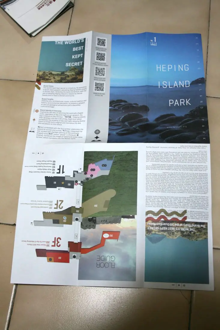
Heping Island Park is a geo-park and water park on Heping Island, just outside of downtown Keelung. Here you can find many interesting sedimentary rock formations along the seashore. There are also salt water swimming pools, amazing places to go diving, a playground, hiking trails, and historical sights. Some would say this island is the world's best kept secret. It is definitely worth stopping here along Taiwan's northern coast.
Historical Background: Heping Island was formed as sediment under the ocean millions of years ago and were then uplifted thanks to the collision of the Eurasian and Philippine plates. The rocks have then been slowly eroded away by wind and water, creating odd shapes that you see today. You can see similar formations atYehliu Geopark. Heping island is the closest island to the main island of Taiwan. It first part of Basay aborigine lands. Chinese fisherman first called the island Greater Keelung Island. The island was first settled by the Spanish in 1626, as their first settlement in what became their rule of northern Taiwan until they were defeated by the Dutch and left Taiwan in 1642. On Heping Island they built Fort San Salvador (聖薩爾瓦多城), which was destroyed and abandoned by the Dutch in 1668. The ruins of the fort were not confirmed to be found on the island until excavations in 2019. After the Japanese occupation of Taiwan, the island was renamed Sheliao Island (社寮島). After WWII, as part of the White Terror Movement, on March 8th, 1947 KMT soldiers kidnapped and shot some of about 30 civilians on the island that were suspected enemy conspirators, known as the Sheliao Incident "社寮事件." After this, the people on the island decided to change to island's name to "Peace Island" or Heping Island in Chinese, so that the KMT would stop harassing the local people and bring peace to the island. The Island was under KMT military control until the 1970s, after which tourists were allowed to enter the island. Now it is a popular daytime and weekend destination for many Taiwanese. Hours: 8 AM to 6 PM Price: 80 NT per person You can buy a discount entrance ticket to Heping Island Park on Klook here or KKday here. Tours: You can also book a tour to Heping Island on TripAdvisor here, Klook here, or KKday here. When to go: During the summer (May to November) when the water is warm and calm for swimming and diving. Activities: Don't forget that there are many activities available along Taiwan's Northern Coast such as Wakeboarding, Surfing, Speedboat Surfing, SUP / Paddle Boarding, Diving, Snorkeling Kayaking, Canoeing, Water Biking, River Tracing / Canyoneering, ATVing, Horse Riding, Archery, Tree Climbing, Glamping, Motorcycling, Motorbike Tour, Dragon Boat Racing, Shen'ao Rail Bike, and more on Tripadvisor here, Klook here, or KKday here. Hotels in Keelung: We recommend Just Live Inn-Keelung and Yung Feng Hotel, which are two great quality hotels for a reasonable price in Keelung's City Center. You can book Just Live Inn-Keelung on Booking.com here, Agoda here, Klook here, Hotels.com here, Trip.com here, or Kayak here. You can book Yung Feng Hotel on Booking.com here, Agoda here, Hotels.com here, Trip.com here, Klook here, or Kayak here. How to get there: By Car/Scooter: Take provincial highway 2 north out of Keelung and take a left at Zhengbin Road. Cross the bridge over to the island and head to the park which is on the north side of the island. There is paid parking in front of the park. There is paid parking in front of the park. If you are looking for car rentals, you can also search Qeeq here, Klook here, or KKday here. You can also check out our car rental guide here. Looking for scooter rental in northern Taiwan? You can search on Klook here or KKday here to search for options. You can also check out our scooter rental guide here. By Bus: From Keelung, take Keeling Bus 101 to Heping Island bus stop. You can purchase a discount easy card to use on the MRT and buses from Klook here or KKday here. You can also book an MRT travel pass on Klook here. By Bicycle: Cycling is the best way to enjoy Taiwan's landscapes if you have the time and energy. Looking for bicycle rentals in Taiwan? You can use Taiwan's many Youbike sharing stations, or search for rentals on KKday here, and search for tours on Klook here. You can also check out our Taiwan cycling guide here. You can also book a cycling tour on TripAdvisor here. For more information, check out our Taiwan transportation guide here. Map: Please see below: Our Journey: We have been to Heping Island once during a day in February. The swimming pools were open then, but I'm sure the water was cold. I have always wanted to go back for a swim in the summer, and I will get around to it someday. See below for our drone footage to get a better picture of the area. Please note this footage was taken before March 31st, 2020 when the area was banned from drone flying.
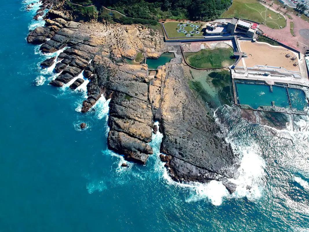
It was a great day to get some drone footage. Sadly you can't fly drones here anymore.
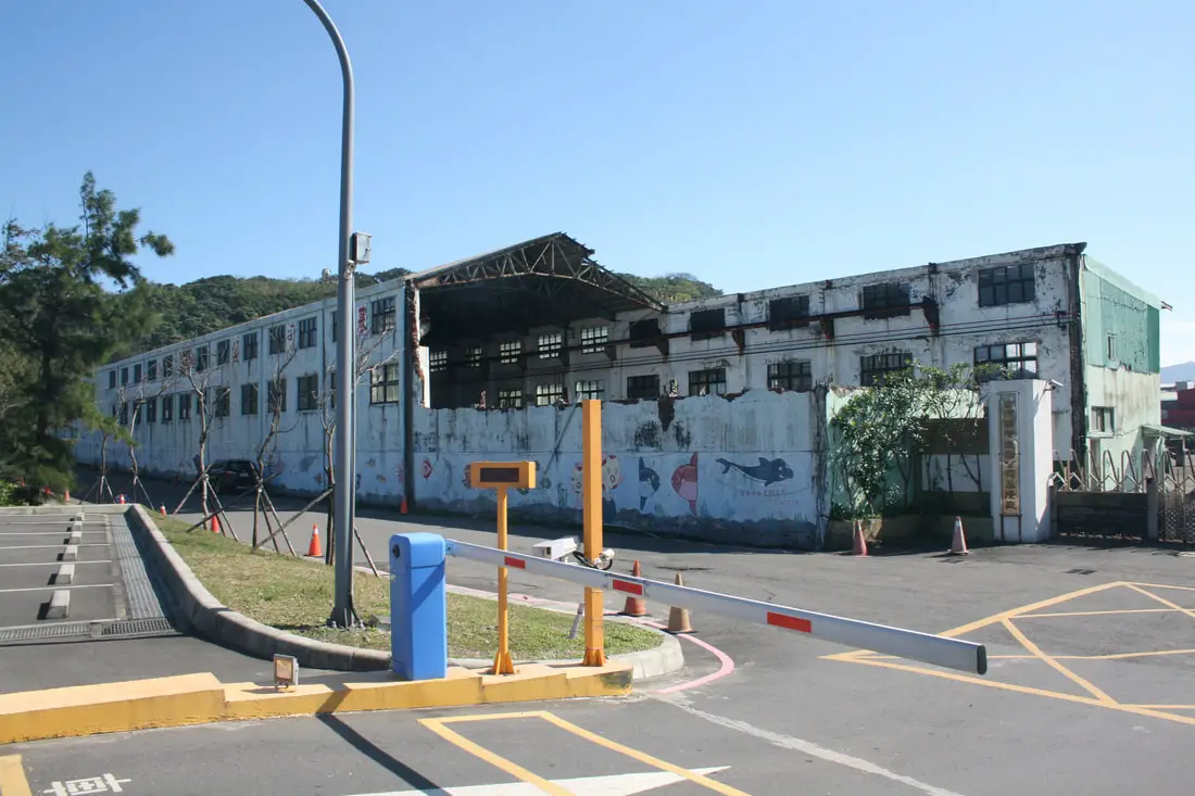
The parking lot in front of the park is not hard to find. There is also a giant deserted warehouse in front of it if you lose your way.
You can also book a tour to Heping Island on TripAdvisor here, Klook here, or KKday here. 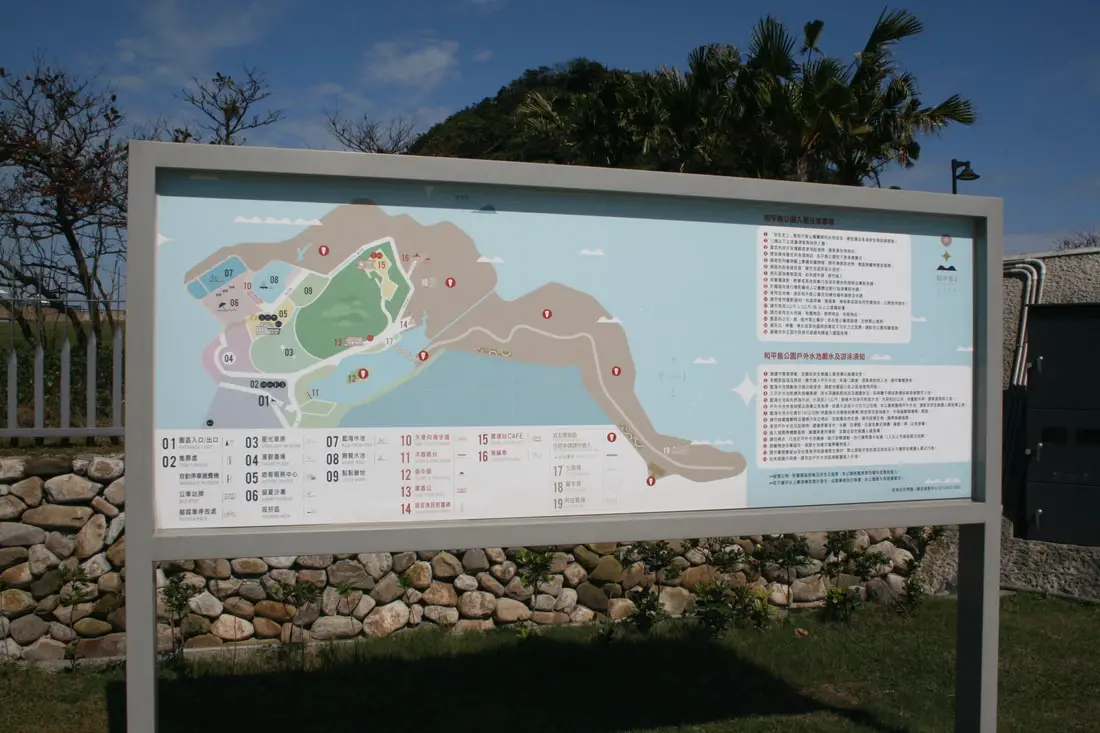
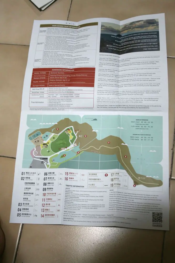
Map of the park.
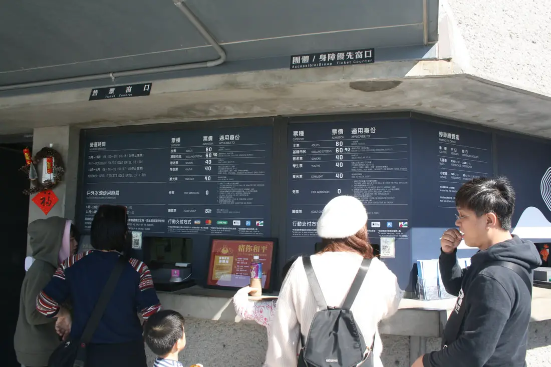
You must purchase a ticket to get in, 80 NT per person.
You can buy a discount entrance ticket to Heping Island Park on Klook here or KKday here. 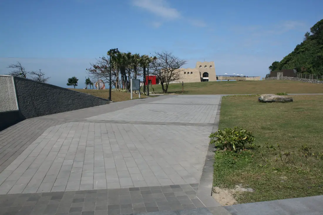
After you buy a ticket, there is a bit of a walk to the visitor's center and swimming pools. I imagine the visitor's center was built to somewhat resemble for San Salvador.
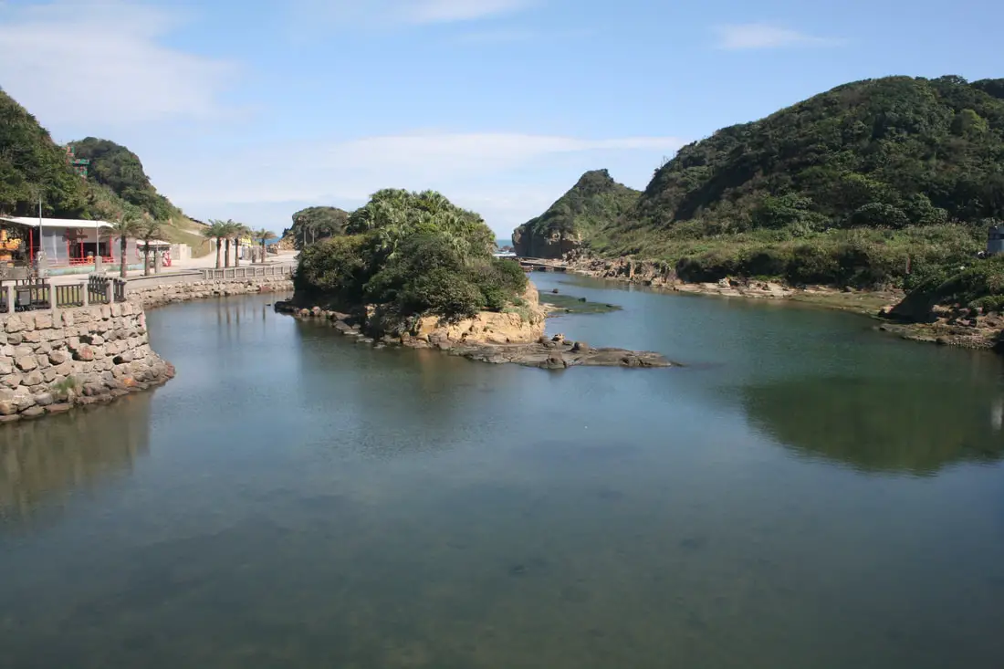
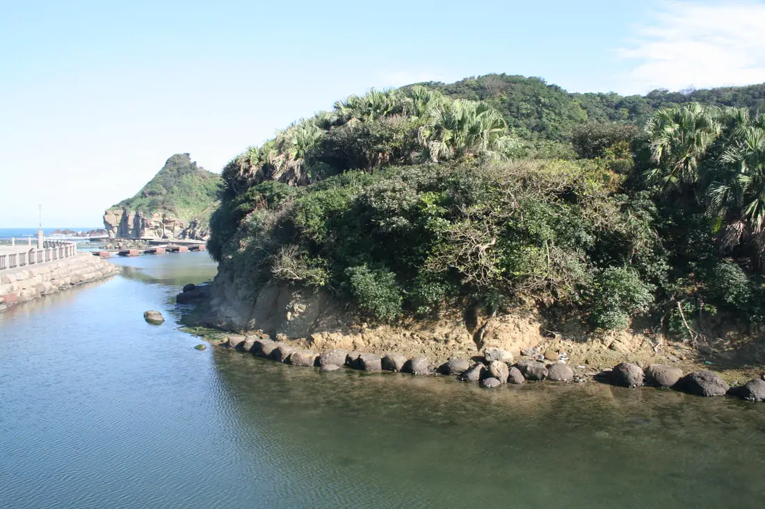
Another island inside the island.
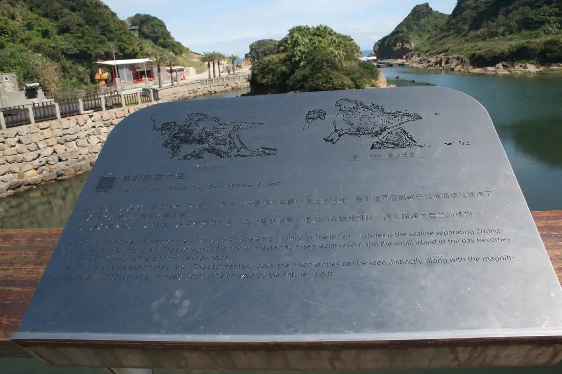
"The past and the present life of Heping Island"
"Called "The Big Cave" in the past, the small bay area where the "Island in the Island" resides is the sealine separating Zhongshan Island and Sokima Island. The two islands are now connected from sea reclamation, and the small island in the bay becomes the beautiful "Island in the Island" we know today. The coastal plants are lush on the Island! The sedimentary rocks, the onion stones can be seen distinctly, along with the magnificent sea view, school of fish swim freely, you weill be amazed by the nature's gift." 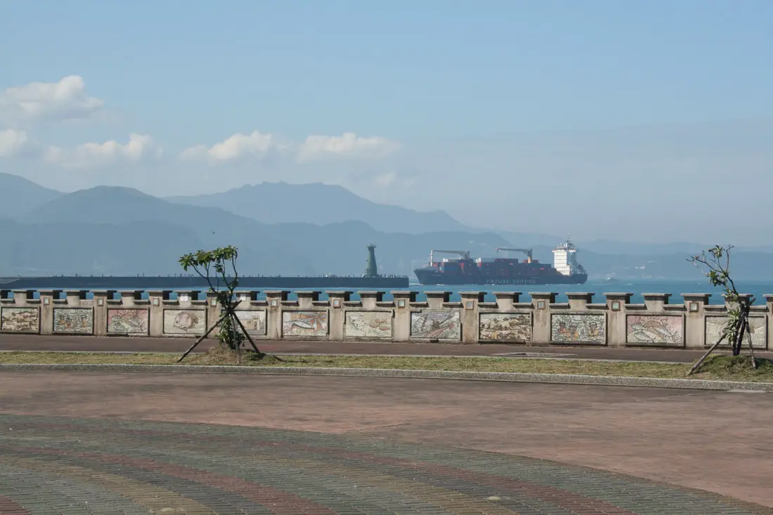
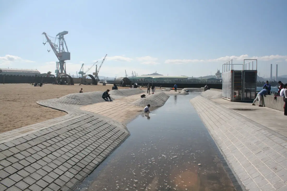
A ship coming into Keelung Harbor.
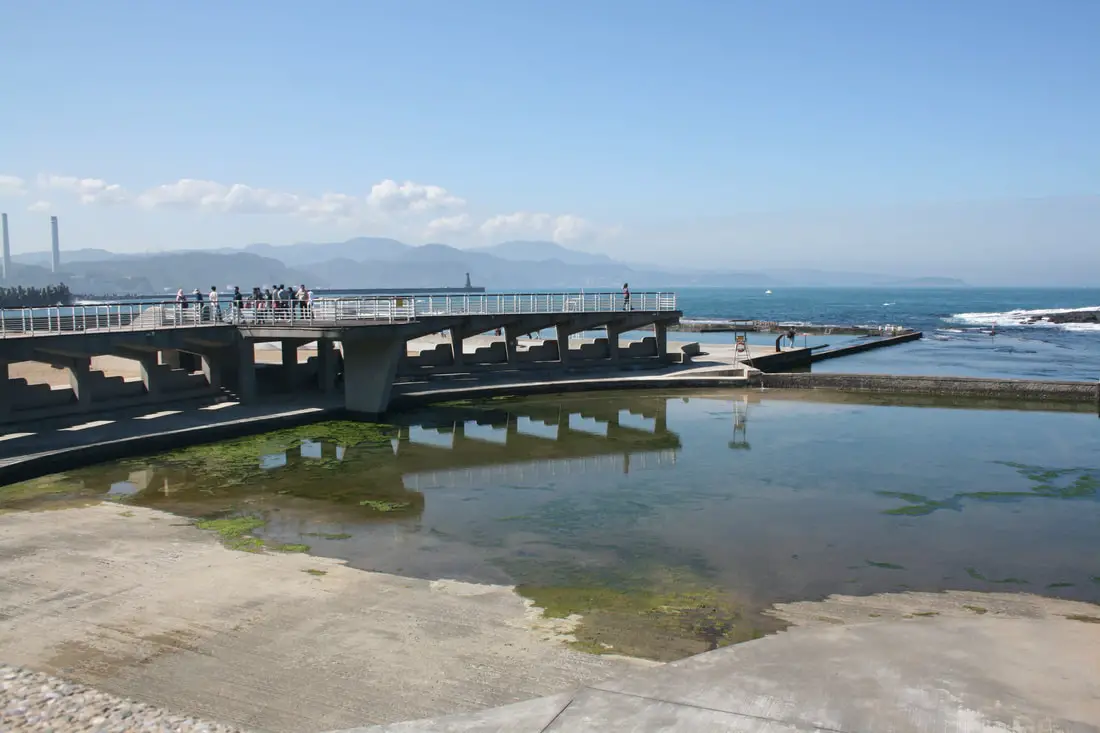
View of the saltwater swimming pools.
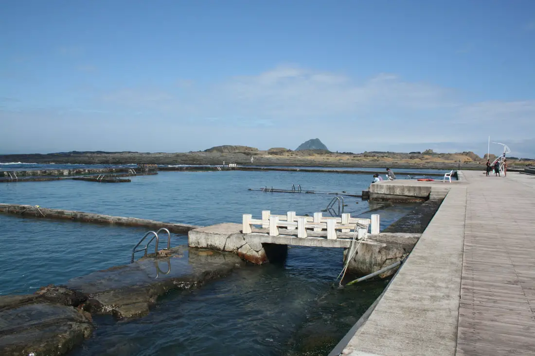
More swimming pools. There were not many people swimming on this day in February because the water was a bit cold.
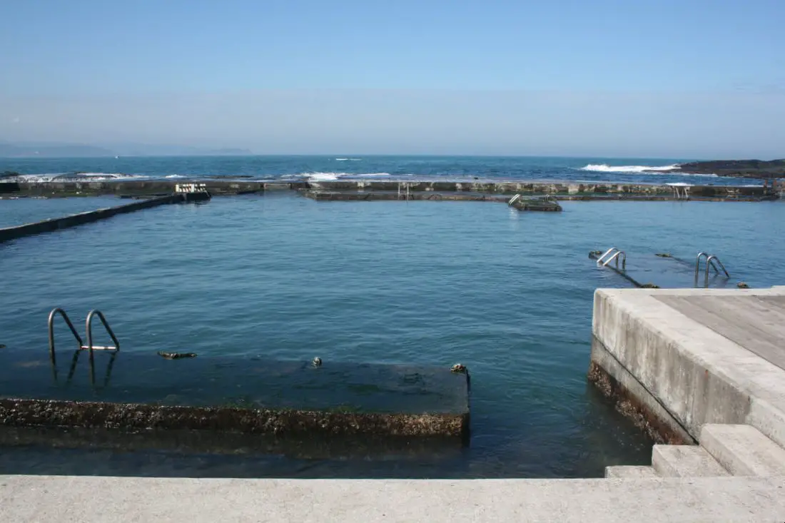
Another view of the pools. These are the only seawater swimming pools I have seen in Taiwan besides the one in Penghu.
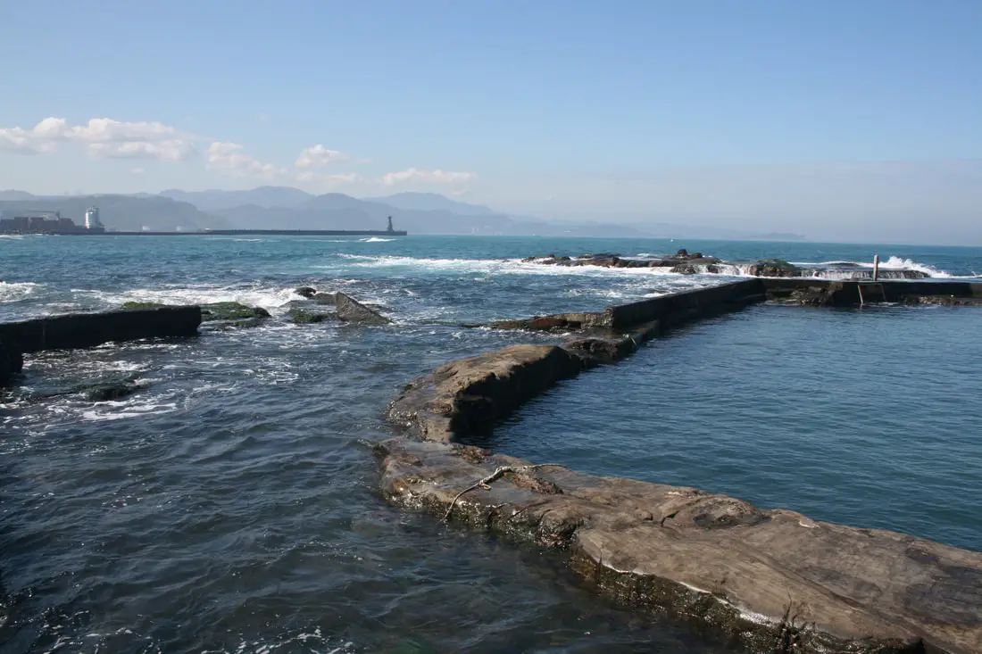
Near the pools you can see a long line of eroded sandstone rocks.
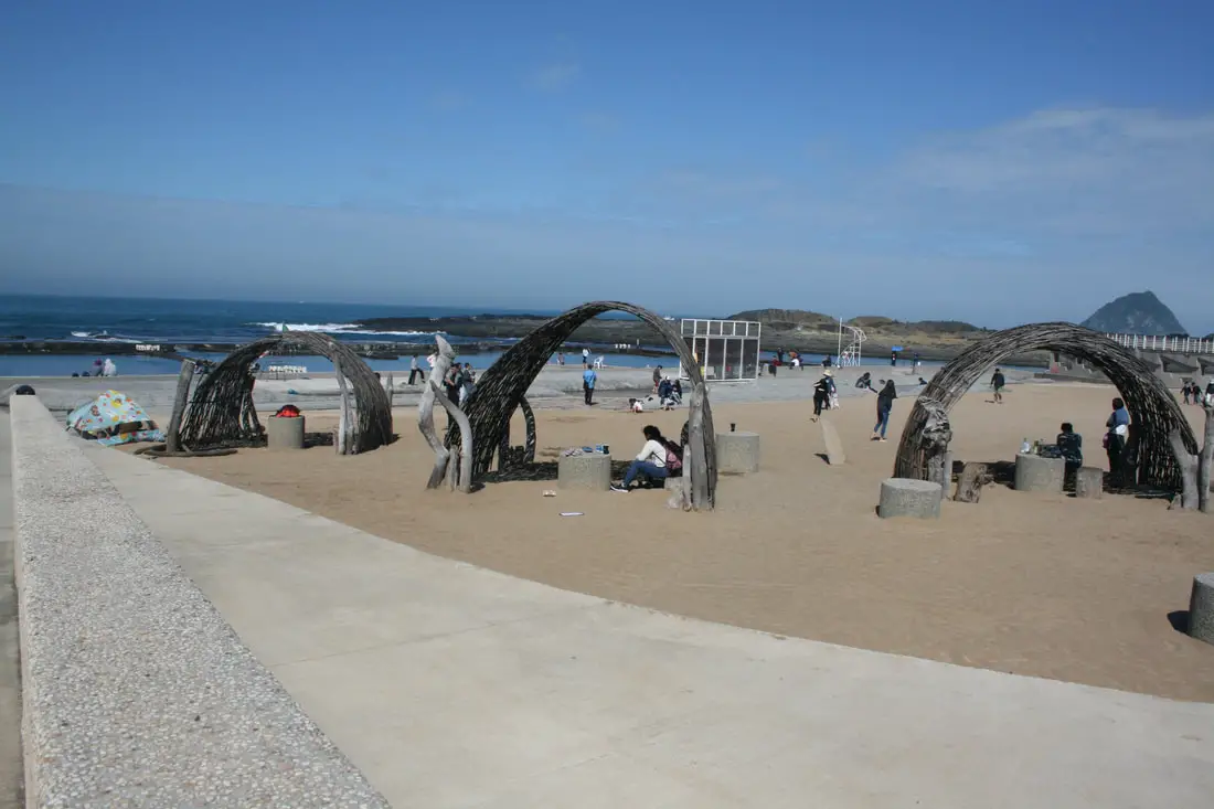
There is also a nice sand pit and some coverings near the pools.
In the middle of the park there is a kiddy-pool area and a sand pit to the left.
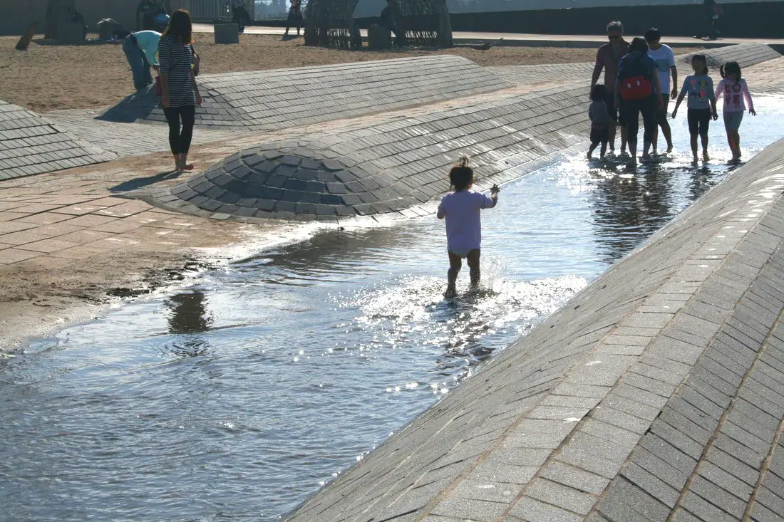
Definitley a fun place to bring toddlers.
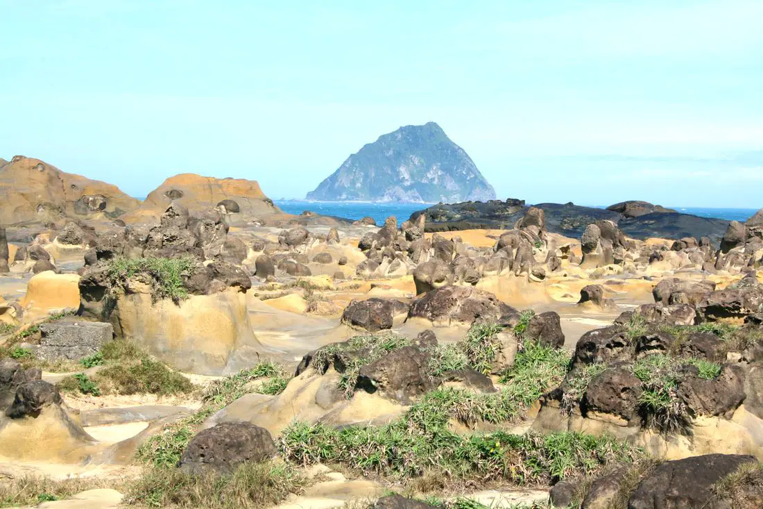
In the distance you can see Keelung Island, which has recently been opened to tourists.
Another view of an unused pool.
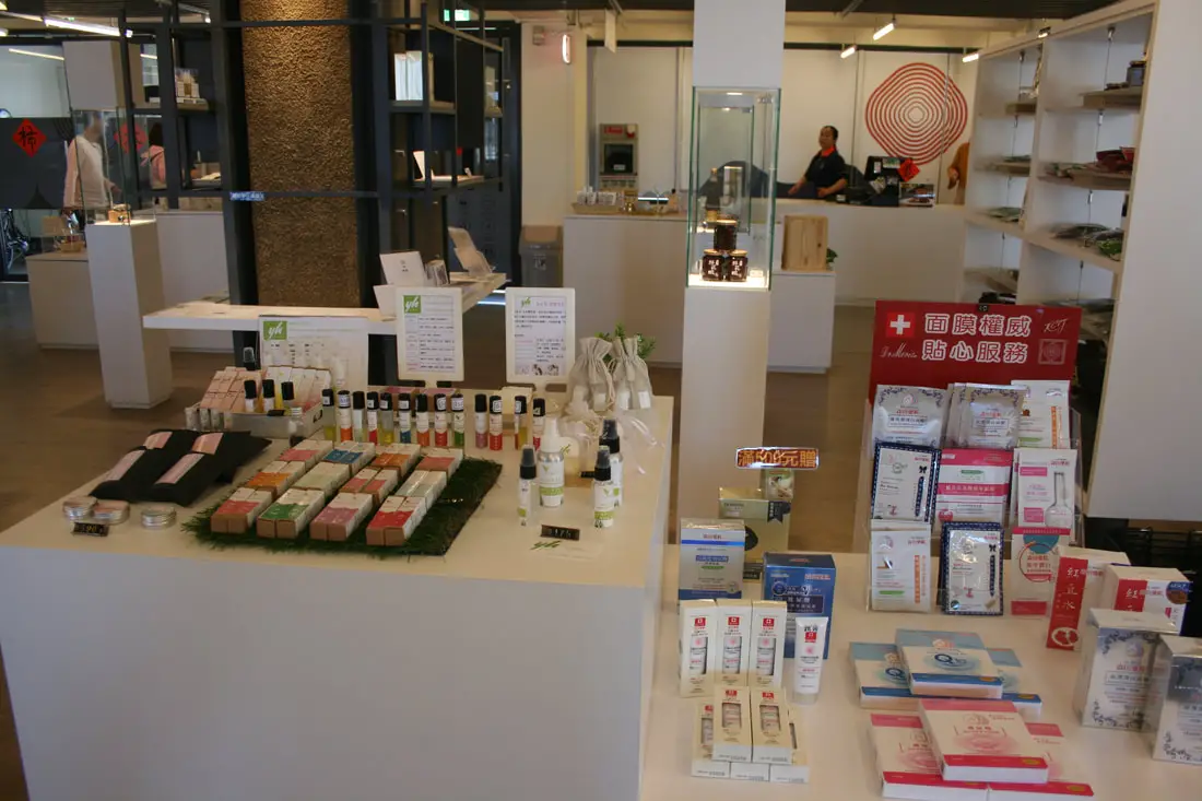
Gift shop inside the visitors' center.
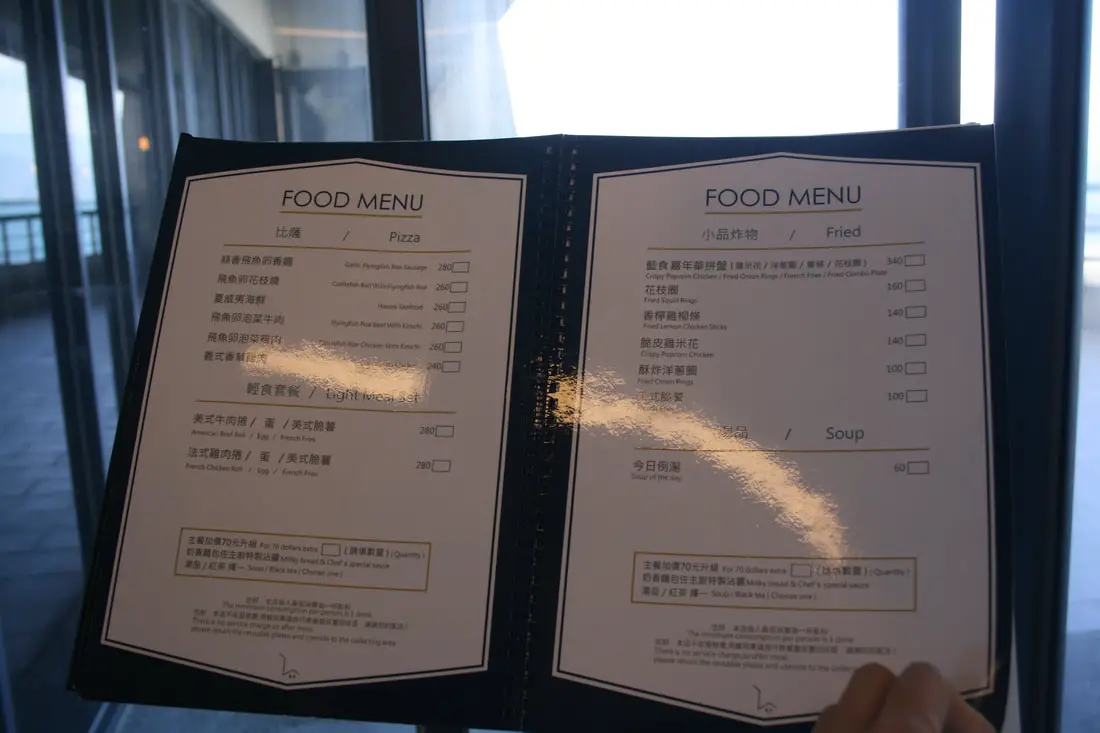
Restaurant on the second floor, which has a nice view of the ocean.
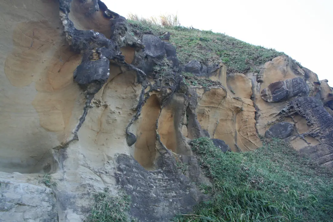
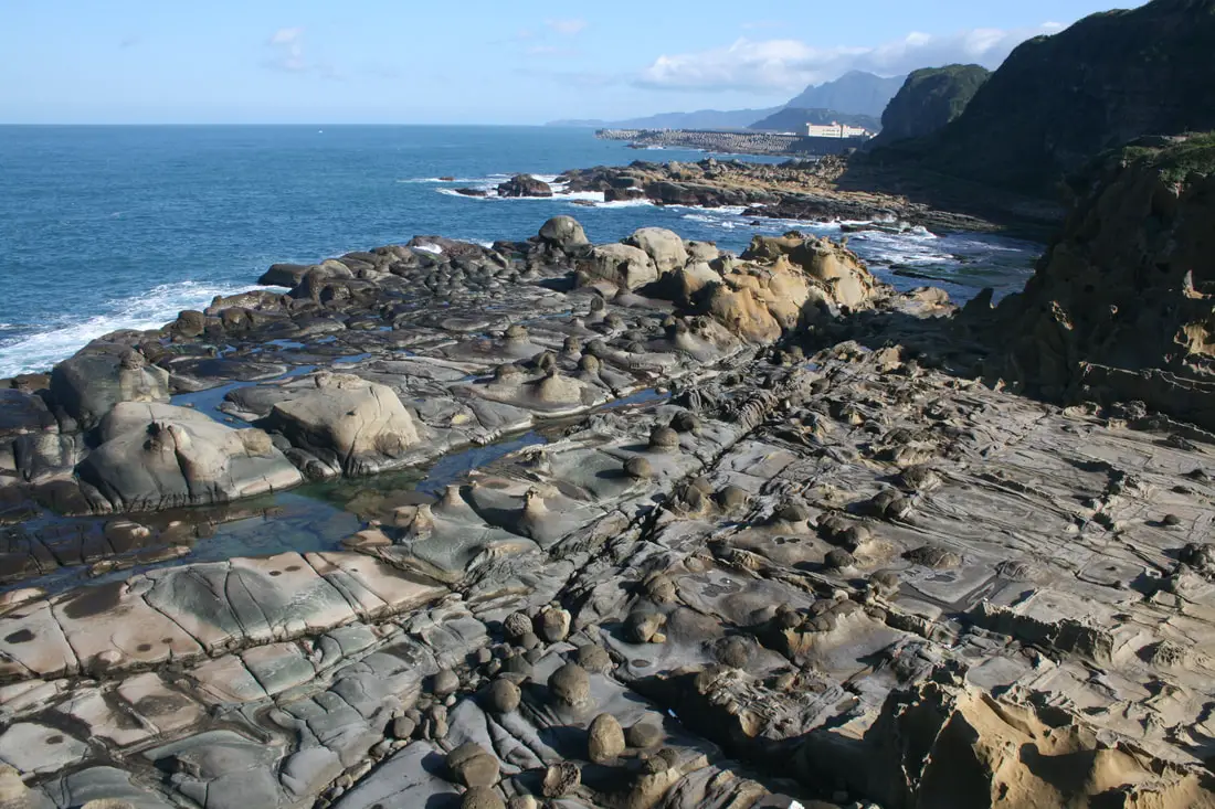
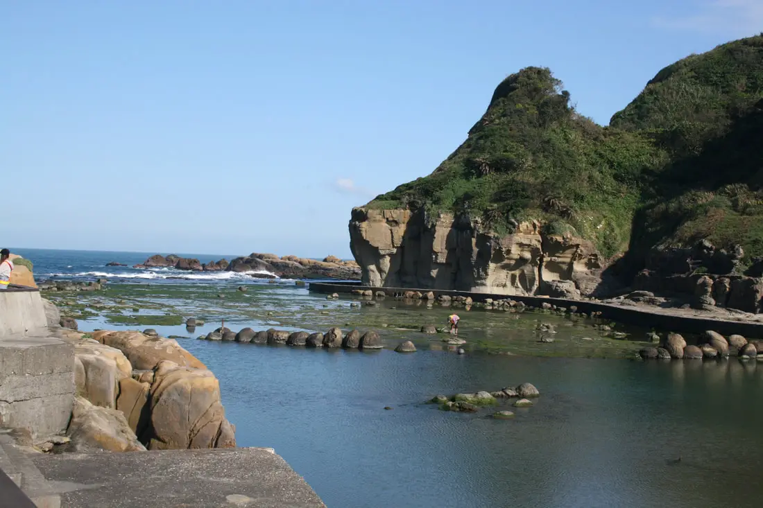
Another view of the rocks on the north side of the island.
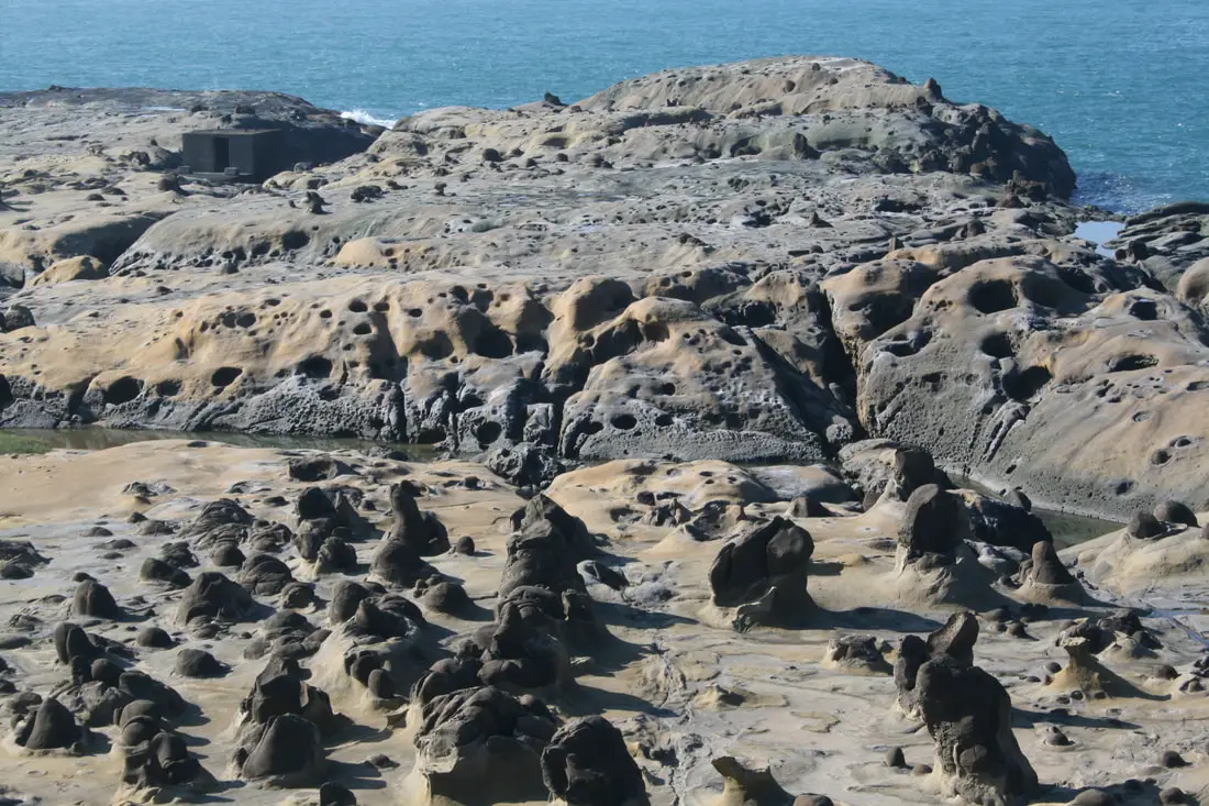
Closer view of the rock formations.
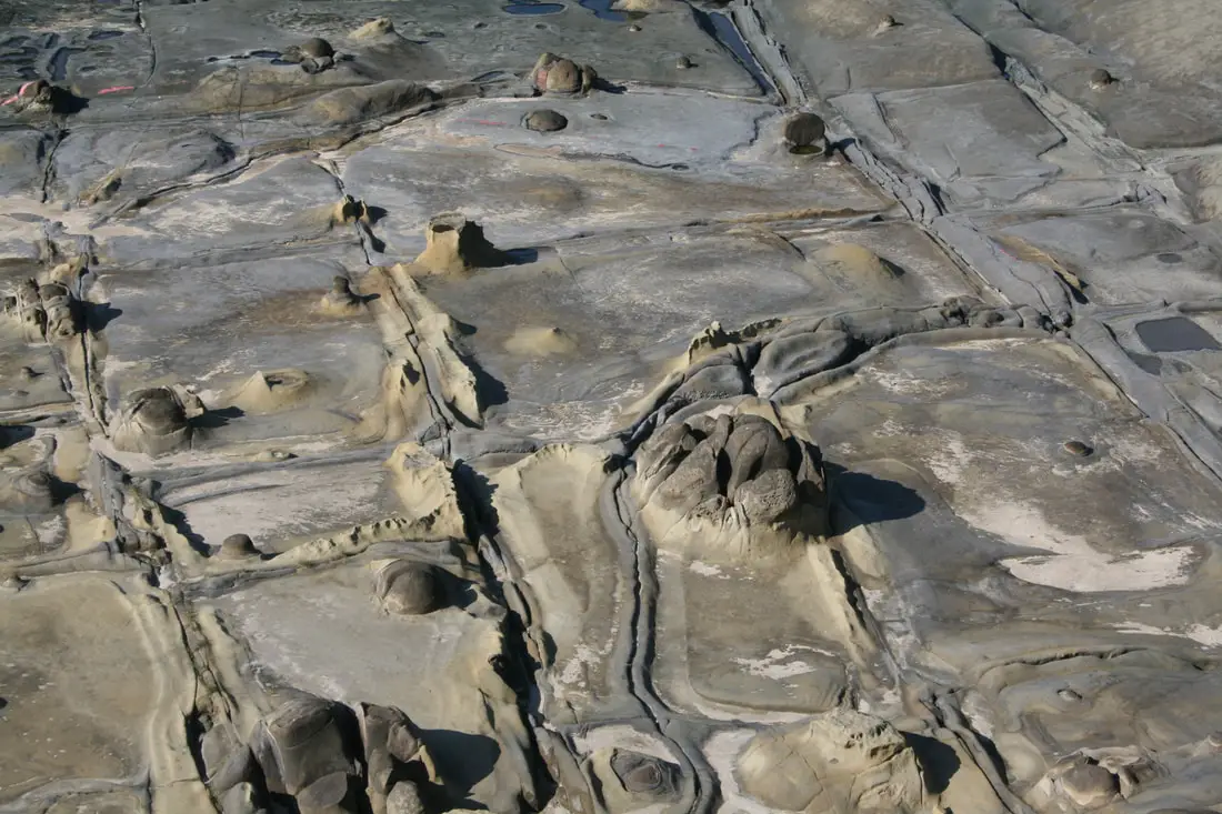
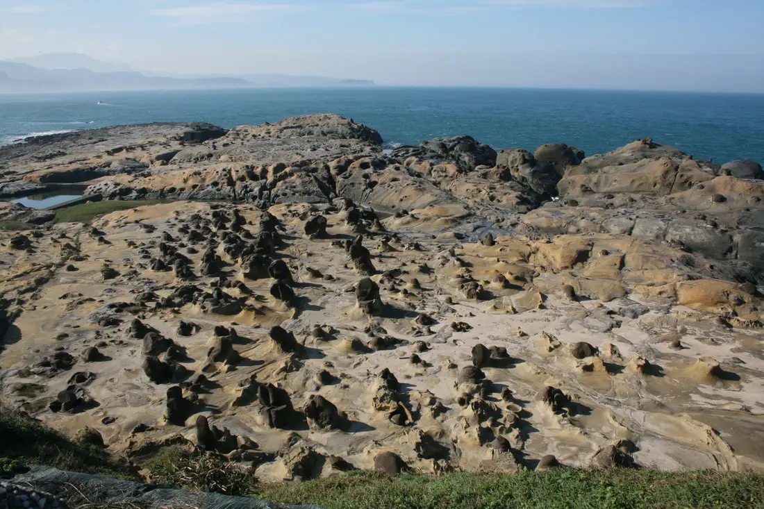
There are interesting square shaped cracks in the rocks, likely formed by wind and water. These are called Tofu Rocks (豆腐岩).
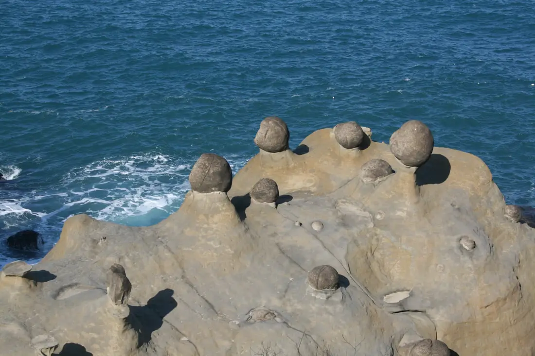
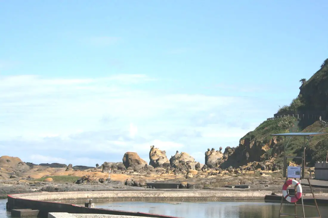
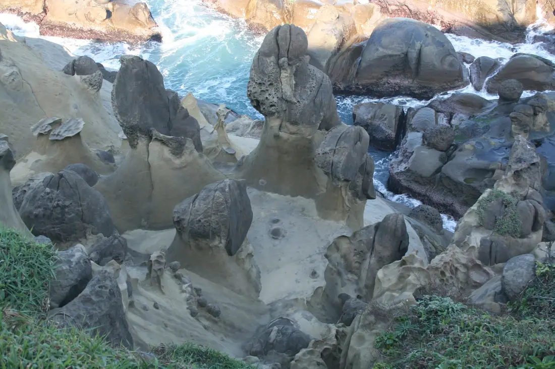
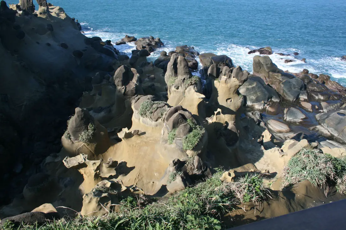
Mushroom shaped rocks on the shore. These are considered Hoodoos.
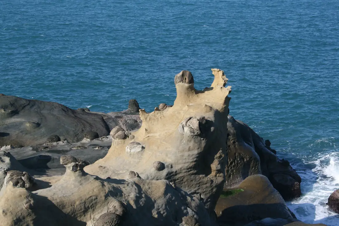
More oddly shaped hoodoos.
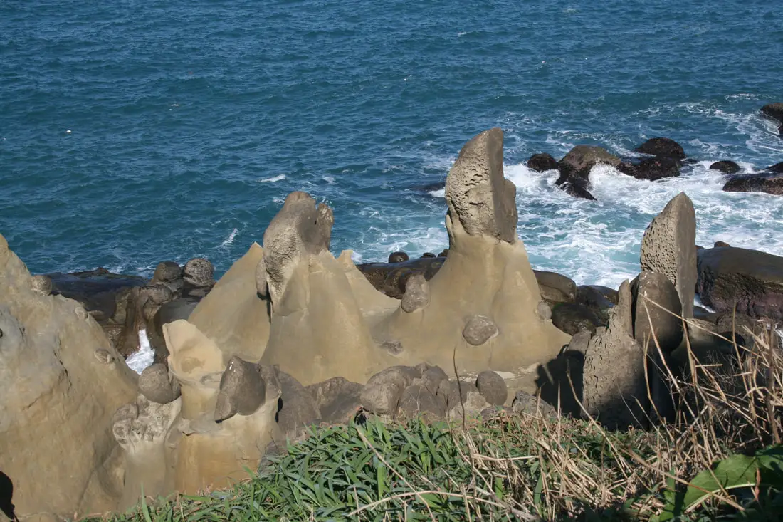
Another view of the interesting geological formations.
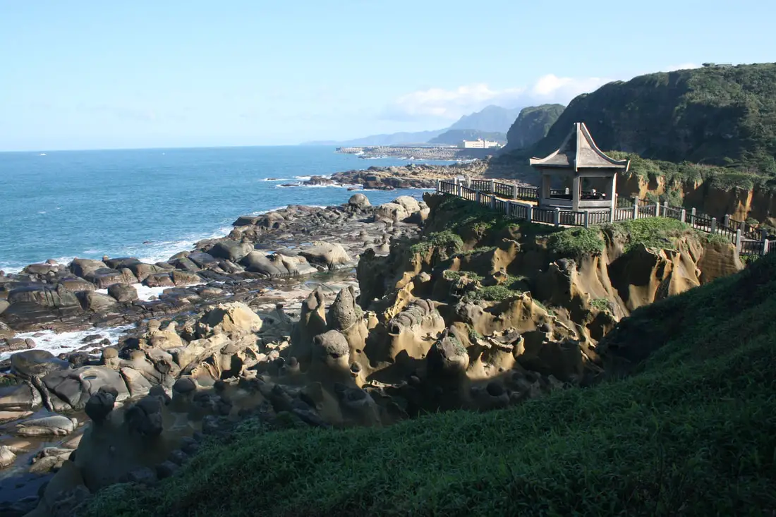
A pavilion looking over the seaside park.
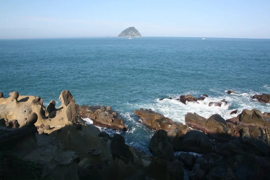
View looking toward Keelung Island.
Waves crashing onto the sandstone.
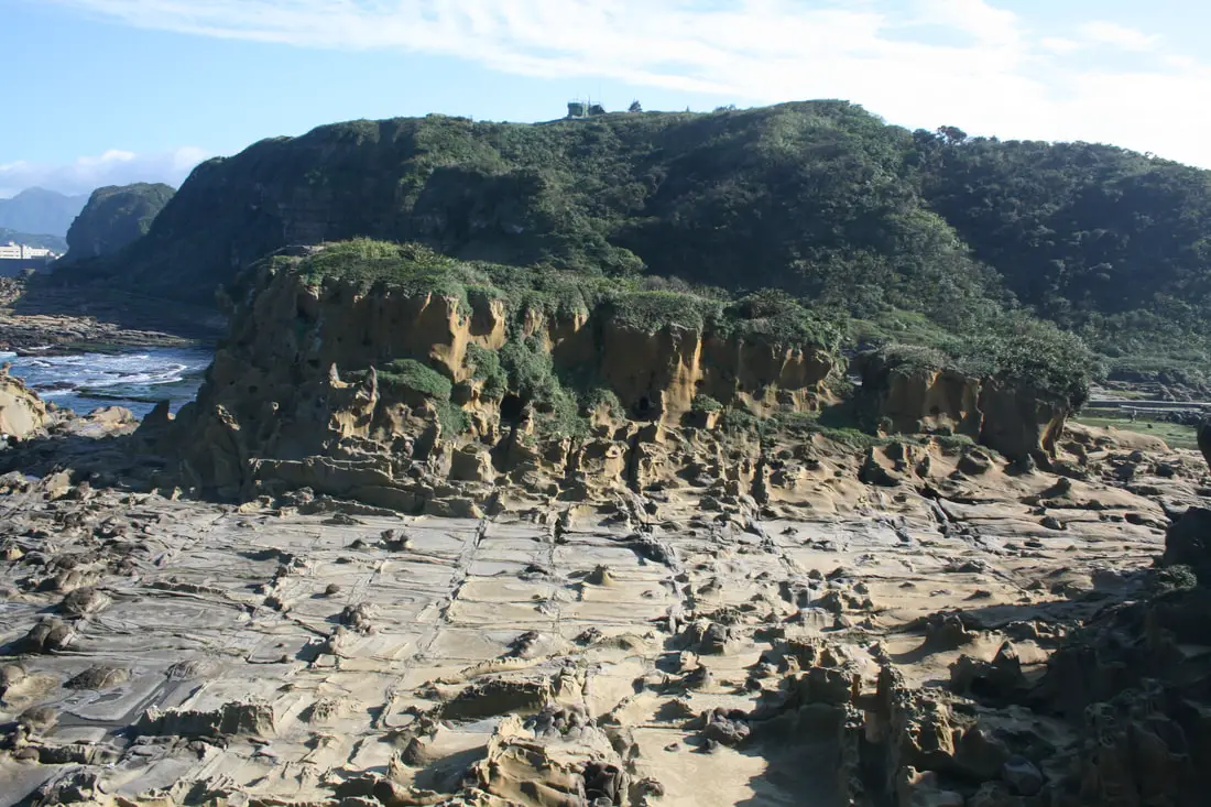
View of sandstone cliffs above the trail.
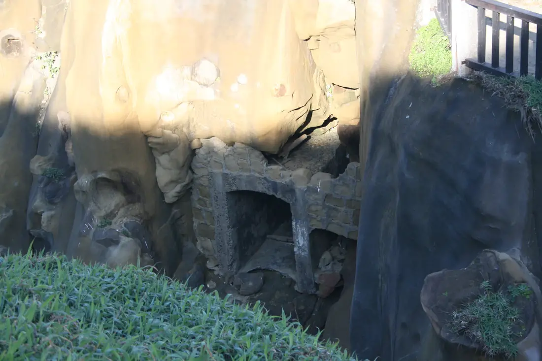
Remnants of an old bunker I assume.
Another view of the rocks.
More rocks in different light.
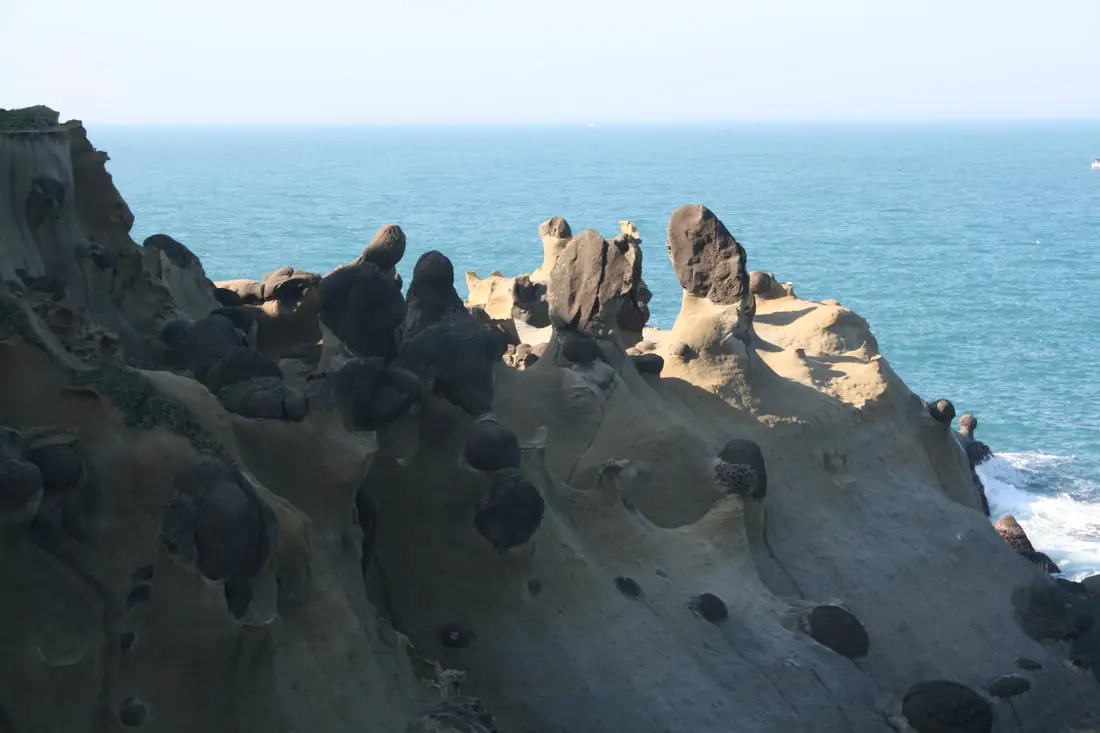
More coastline, off limits to walking unless you ask a guide to go with you. Lots of Tofu rocks here.
Looking at the island within the island, with more tofu rocks in the foreground.
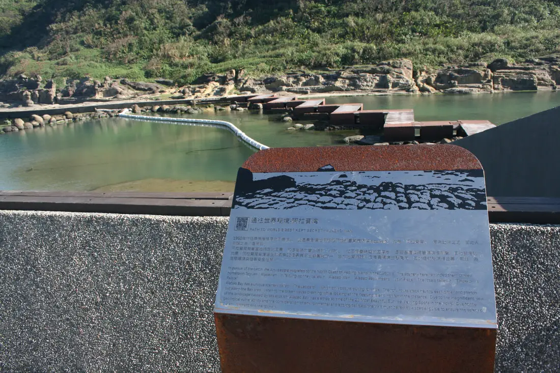
"Path to the world;s best kept secret - Alabao Wan"
"In pursuit of the catch, the Ami people migrated to the North Coast of Heping Island i the 1960s. The scenery here reminded them of their hometown Taiyuan in Taitung, so they called in Alabao Wan, means Lost Place. The locals called it "Emporer's Palace." Alabao Bay has a unique scenery called "the leapard" which only occurs dirng low tied. The tofu rocks stakc next to each other and stretch out along the bay area. Listen to the ocean waves crashing while looking at the Keelung Island not far in the distance. Due to the magnificent view of the landscape caused by sea erosion, Alabao Bay was elected as one of the 21 most beautiful sunrise viewing spots in the world. Due to the geological vulnerability and the consideration of environmental and ecological load, the visit must be led by a special guide to ensure the safety of the environment and the tourists." 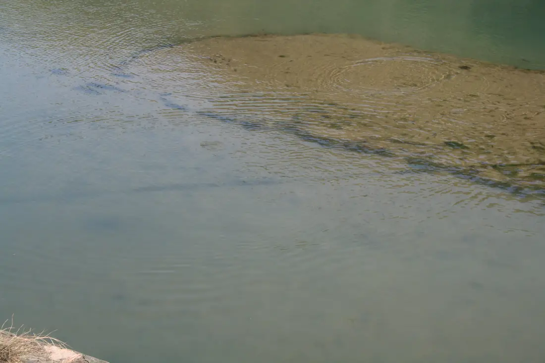
Fish swimming near the island in the island.
Looking at Alabao bay which is closed off except for with a guide.
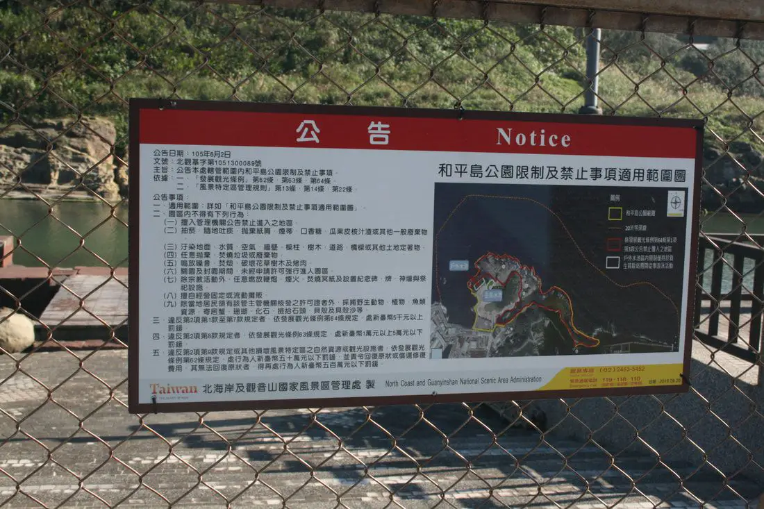
A list of things banned at the park, one of which was not flying a drone at the time. Flying a drone here is now banned.
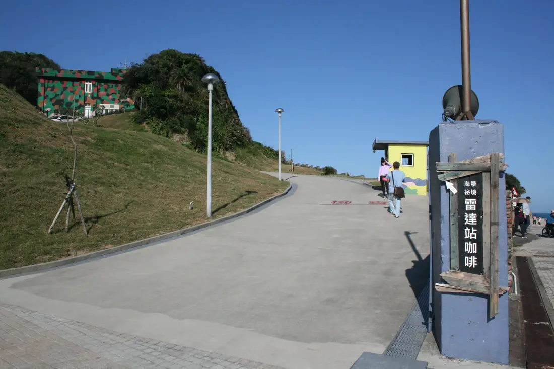
There is also a decommissioned radar station converted into a coffee shop on the backside of the park.
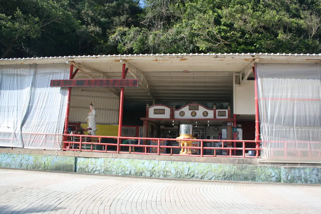
Temple to Wanshan Gong on the back of the park (萬善公).
Another view of the shoreline at the back of the park.
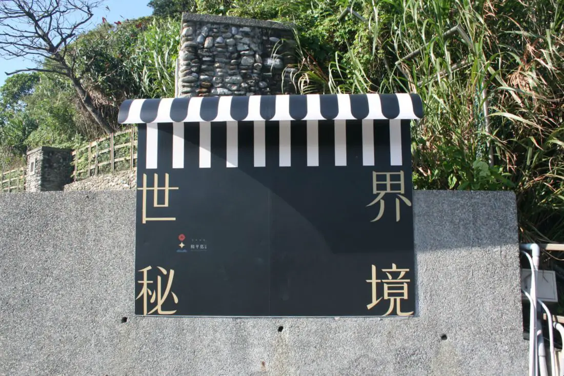
"One of the most secret places in the world"
Grassy hill behind the park.
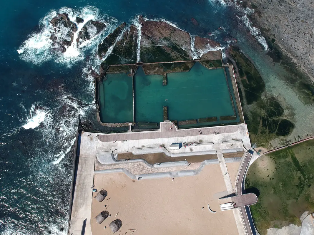
View of the swimming area via drone.
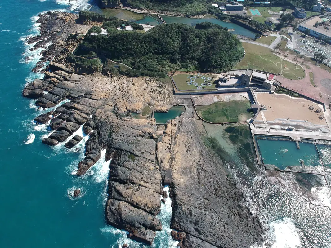
Another view of the park via drone.
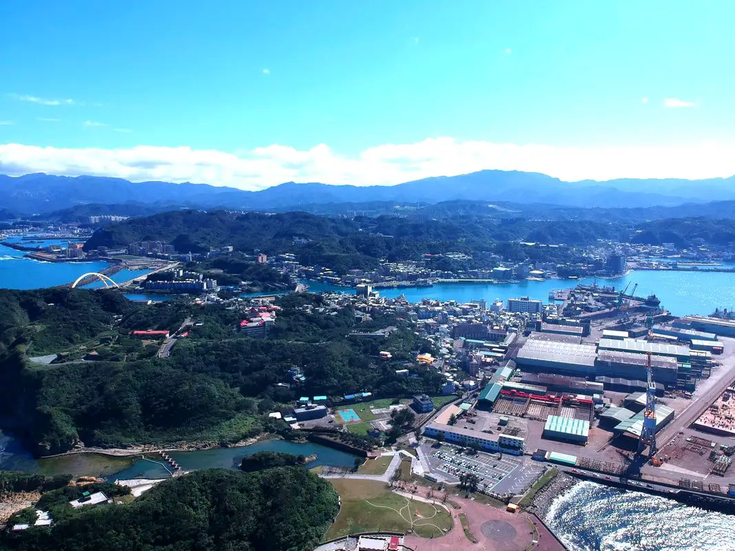
View of Heping Island and Keelung in the background.
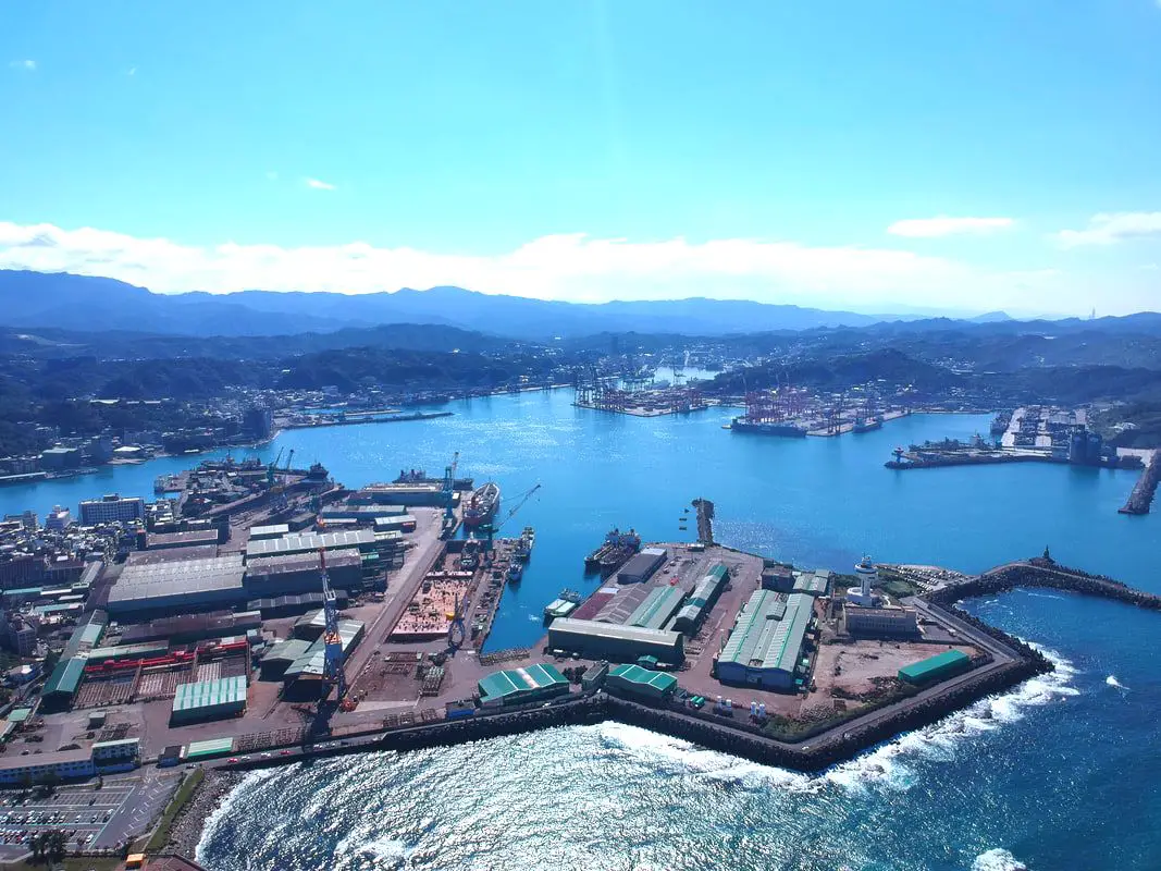
View of Keelung Harbor.
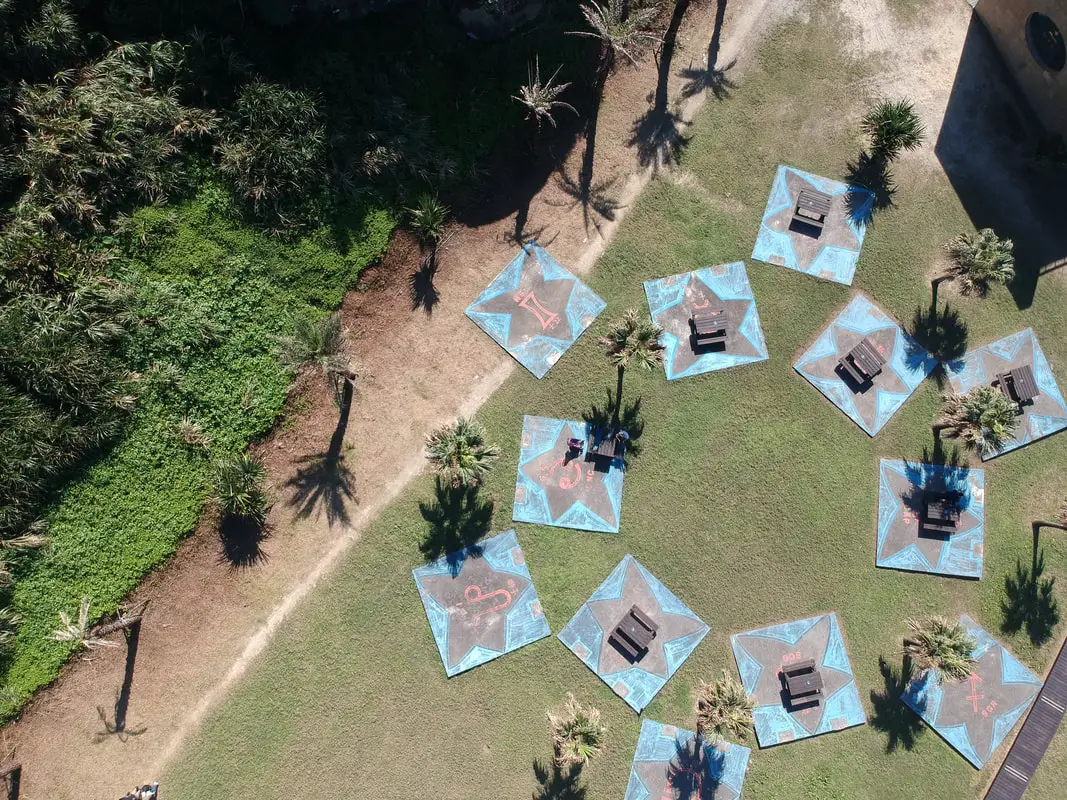
Star shaped picnic areas near the visitor's center.
Map of the visitor's center.
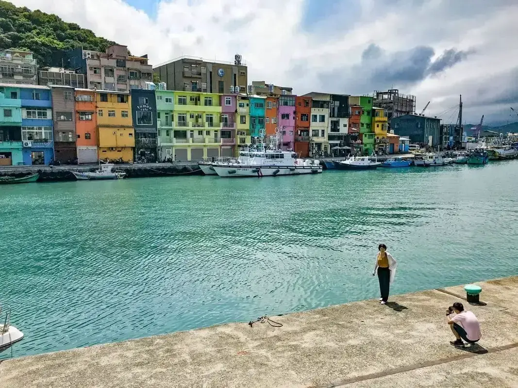
Zhengbin Harbor is a fishing harbor in Keelung that has recently become well-known for its colorfully painted houses. Recently it has become an Instagram selfie spot. There are also many interesting historical sights in the area for you to explore...(read more)
Near the island, you can also check out the ruins of Agenna Shipyard. You can book a walking tour to Zhengbin Harbor and Heping Island on Klook here or KKday here. You can buy a discount entrance ticket to Heping Island Park on Klook here or KKday here. You can also book a tour to Heping Island on TripAdvisor here, Klook here, or KKday here. Check out our guide to the best beaches near Taipei here. Check out our full guide to Taiwan’s Northern Coast here. Check out our guide to Keelung here. You can also check out our full travel guide to Taiwan here.
0 Comments
Your comment will be posted after it is approved.
Leave a Reply. |
Author 作家I am an American expat who has extensive experience living, working, and traveling in Taiwan. In my day, I had to learn many things about Taiwan the hard way. But I have come to learn that Taiwan is one of the best places in the world for Foreigners to live. This blog does not represent the opinions of every foreigner in Taiwan. I am just trying to help others learn more about this beautiful country. Categories
|
 RSS Feed
