

Toucheng Township in Yilan is known for its amazing beaches, but there is much more to do here, such as visit Lanyang Museum, visit Turtle Island, enjoy seafood, traditional fishing harbors, recreational farms, hiking, cycling, surfing lessons, and much more. Here is a short guide to Toucheng, to let you know the variety of activities that you can enjoy here.
Background: Before Chinese settlers came, the area around Toucheng was inhabited by the Ketagalan Aboriginal tribe, whose language is now extinct. The name Toucheng literally means "first town" in Chinese, because it was the first settlement in Yilan, settled in the late 1700s. With the nearby Wushih and Touwei Harbors around the same time, it became the economic focal point of Yilan. However in the late 1800s and early 1900s Wushih Harbor and Touwei Harbor silted in, reducing their function. With the advent of the Japanese built Yilan railway line in the mid-1900's, as well as constant floods and continually silting of the harbors, Toucheng quickly lost its importance economically and fell into decay. After residents of Turtle Island were relocated to Daxi in Toucheng, Daxi Harbor was expanded and has become one of the largest fishing harbors in the area. Due to its close proximity to Taipei, Toucheng has become a major tourist area and may be the most popular surfing location in Taiwan. Tours and Activities: You can purchase tours and tickets for many activities in Yilan such as Su'ao Crayon Castle, Taipingshan, Turtle Island, Lanyang Museum, Toucheng Leisure Farm, Zhang Mei Ama Capybura Farm, Bambi Land, Yinong Ranch, National Center for Traditional Arts, Taxi Museum, Glamping, Camping, ATV / 4-wheeling experience, SUP / paddle boarding, Ximeng Forest Theater, Surfing, Kayaking, Horse Riding, River Tracing, River Rafting, River Tubing, Pack Rafting, Water Biking, Snorkeling, Canoeing, Shrimping and many others through Klook here or KKday here. Accommodation: Looking for a hotel? We recommend booking through Agoda here, which provides the best quality selection of accommodation on the islands. We have stayed at and recommend Ying Shih Guest House, a resort in Datong Township near Taipingshan and Fan Fan Hot Spring (you can book on Agoda here or Booking.com here), and Jiaosi Hotspring Hotel, a hotel with hot springs in each room (you can book on Agoda here, Booking.com here, Hotels.com here, Expedia here, or Trip.com here). We have also stayed at Toucheng Leisure Farm, a recreational farm and experience center in Toucheng (you can book on Agoda here, Booking.com here, Hotels.com here, Expedia here, on Klook here, or on Trip.com here). You can also book Wifi and SIM cards for Taiwan on Gigago here. Need travel insurance? Compare prices on Insubuy here. Just to let you know, if you book using the links above, we get some commission at no cost to you, and you can help support our blog. You can click here to receive $5 USD on your first Klook purchase. How to get there: By TRA: Take the TRA to any of the stations in Toucheng. You can book tickets to travel to Yilan via inter-city bus on Klook here. You can book tickets to Yialn via high speed rail (HSR) on Klook here or KKDay here. Book tickets via the normal train (TRA) on Klook here. Bicycle rental: Cycling is the best way to enjoy Taiwan's landscapes if you have the time and energy. Looking for bicycle rentals in Taiwan? You can search on KKday here and search for tours on Klook here. You can also check out our Taiwan cycling guide here. By Car: From Taipei, take National Freeway 5 to Toucheng. Be careful to note that on Sundays there are highway controls for cars travelling from Yilan to Taipei from 3 PM to 8 PM, so avoid travelling back to Taipei at that time to beat the traffic. Looking for scooter rental in Yilan? You can search Klook here or KKday here to look for options. You can also check out our scooter rental guide here. If you are looking for car rentals in Yilan, you can also search Klook here or KKDay here. You can also check out our car rental guide here. Map: See below for a map of places that are covered in this blog:
0 Comments
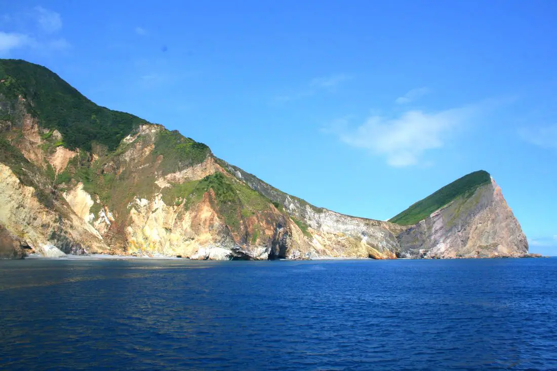
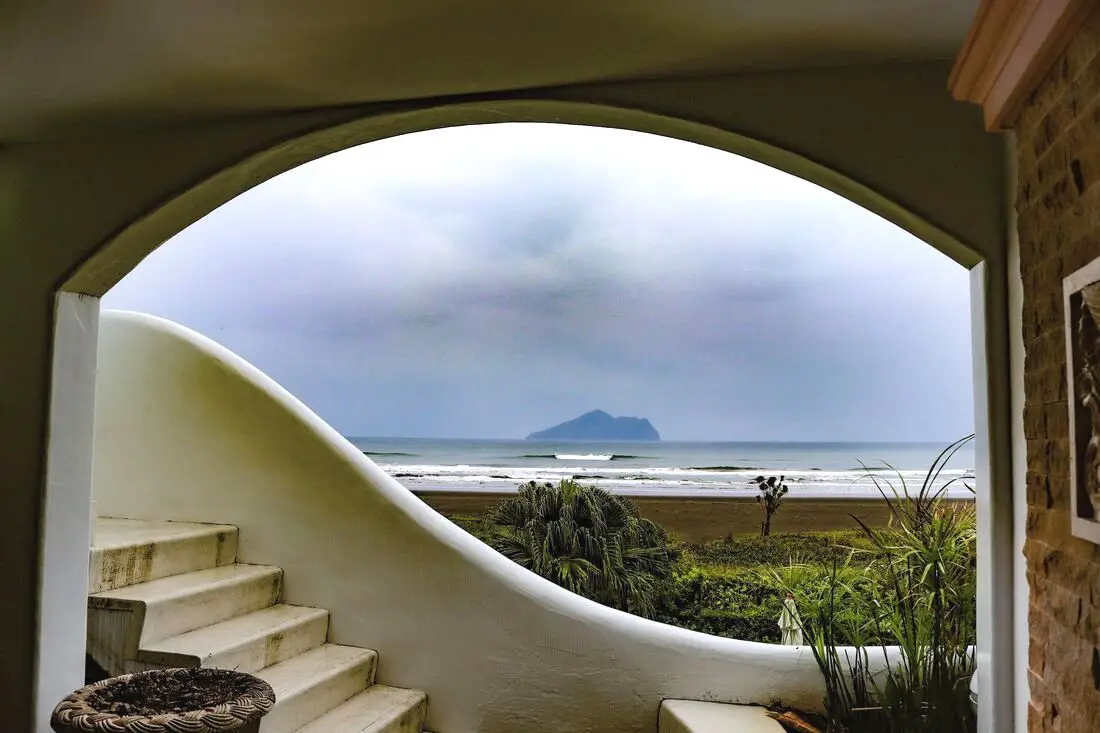
Guishan Island (literally Turtle Mountain Island) is a turtle-shaped island off the coast of Yilan in Eastern Taiwan. Once inhabited by fishermen, it is now a coast guard base but is open for day tours. The island tour includes beautiful sea cliffs, hiking, a lake, an abandoned village, military tunnels, and whale watching just offshore.
Background: Turtle Island has been inhabited since at least the Qing Dynasty. When the ROC took over Taiwan, the island had one elementary school and no hospital. Many people relied simply on religion to cure their sicknesses. During typhoons, the dock would sometimes be destroyed, leaving the island without food for days or weeks. Also, there were way more men on the island than women, and it was hard to convince prospective wives from Taiwan to go live on such a remote island with harsh conditions. As a result, the government relocated everyone living on Turtle Island to the main island of Taiwan in Toucheng township of Yilan in 1977. The people could have chosen to stay, but they went without protest. The ROC then made the island into a restricted military base. In 2000, the Island was opened for tourism, the military aspects of the island were phased down, and it was made into an ecological reserve. Now the island allows Tourists to come during the day, but no one is allowed to stay overnight. Tours and Prices: Whale watching on a boat around the island: 800-1000 NT per person. Once around the island on a boat and 2-hour tour of the island: 800-1000 NT per person. Whale watching and island tour: 1200+ NT Island tour including hiking to the top of the island: 1200+ NT You can book a personalized tour and ferry boat tickets with Klook or KKday. You can purchase tours and tickets for many activities in Yilan such as surfing, kayaking, horse riding, river tracing, river rafting, river tubing, pack rafting, water biking, snorkeling, canoeing, and many others through Klook here or KKday here. Hours: 2-4 hour tours start from 8:00 AM or later and end in the afternoon until about 4:00 PM. When to go: March-November. These tours are generally closed from December to February due to rough seas and cold weather. Accommodation: There are not hotels on Turtle Island and staying overnight is forbidden. Looking for a hotel? We recommend booking through Agoda here, which provides the best quality selection of accommodation on the islands. Find out where to stay in our Taiwan hotels guide or search for the best hotel deals in Taiwan here. We have stayed at and recommend Jiaosi Hotspring Hotel, a hotel with hot springs in each room (you can book on Agoda here, Booking.com here, Hotels.com here, Expedia here, or Trip.com here). We have also stayed at Toucheng Leisure Farm, a recreational farm and experience center in Toucheng (you can book on Agoda here, Booking.com here, Hotels.com here, Expedia here, on Klook here, or on Trip.com here). You can also book Wifi and SIM cards for Taiwan on Gigago here. Need travel insurance? Compare prices on Insubuy here. Just to let you know, if you book using the links above, we get some commission at no cost to you, and you can help support our blog. You can click here to receive $5 USD on your first Klook purchase. How to get there: The only way to get there is by boat from Wushih Harbor in Yilan. To get to Wushih Harbor from Taipei, you can take the TRA train to Toucheng station, and then take a taxi from there. Otherwise, you can drive on National Highway 5 to Toucheng; there is free parking at the harbor (drive to the very end of the harbor). You can purchase a ticket at the harbor or book online in advance via Klook or KKday. Map of Guishan Island: 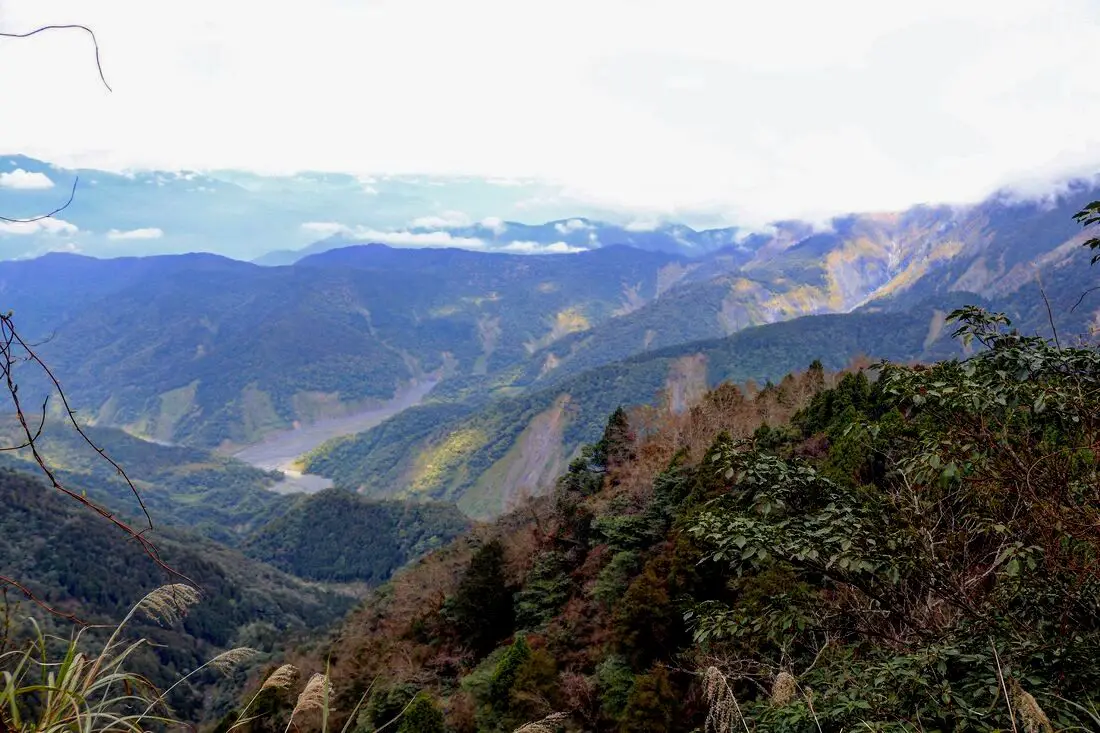
Taipingshan (aka Taipingshan National Forest Recreational Area 太平山國家森林游樂區) is a magical mountain paradise in Datong Township of Yilan County in Taiwan. It has an old Japanese era logging railroad track which has mostly been abandoned, but part of it has been restored with a working train. In addition there are hot springs, Taiwan's largest alpine lake, hikes, wildlife, and endless mountain scenery to explore.
Background: In 1906, the Japanese Indigenous affairs police officers sent a team of men to Fanfan Mountain, where they discovered huge ancient cypress trees. Later the Japanese renamed the area Taipingshan, and began logging the mountain in 1915. The Taipingshan Forest Railway was completed in 1934 and had at least 12 stations, with the grade up the mountain ranging from 2-3%. Loggers relied heavily on wires and pulley systems to haul logs to the railway, which differentiates it from the Alishan Railway. Because of the extensive use of wires or iron donkeys, it was difficult to convert the entire railway to a tourist railway, therefore only a short section at Maosing remains for tourists. The logging industry continued in Taiwan until it was banned in the 1980s, after which the area was converted into a forest recreation area in 1983 and opened to the public. The mountains in Taipingshan range from 500 to 2000 meters high, and is part of the northern central mountain range. The highest peak here is Nanhu Mountain at 3,740 meters high. The terrain generally consists of high mountains and deep valleys, which have been pushed up by the convergence of the Eurasian and Philippine plates, and eroded by torrential rains. Taipingshan is 12,929 hectares, and includes six major areas: Tuchang, Jioujhihze, Jhongjian, Taipingshan, Maosing and Cueifong Lake. Taipingshan holds the record for 24 hour rainfall in Taiwan of 1015 mm, recorded in 2016 during Typhoon Megi. The area is also one of the most accessible places in Taiwan to see snow during winter. The forest recreation area is now a popular place for nature enthusiasts and hikers, and is one of the top three most popular forest recreation areas in Taiwan. Hours: 6 AM to 8 PM (open 4 AM on weekends) Price: 150 NT for non-holidays, 200 NT for holidays Cars: 100 NT Scooters: 20 NT Jioujhize Hot Springs: 250 NT in winter and 150 NT in summer Bong Bong Train: 180 NT You can buy a discount entrance ticket to Taipingshan on KKday here or book a tour on Klook here. Website: https://tps.forest.gov.tw/ Tours and Activities: You can purchase tours and tickets for many activities in Yilan such as Su'ao Crayon Castle, Turtle Island, Lanyang Museum, Toucheng Leisure Farm, Zhang Mei Ama Capybura Farm, Bambi Land, Yinong Ranch, National Center for Traditional Arts, Taxi Museum, Glamping, Camping, ATV / 4-wheeling experience, SUP / paddle boarding, Ximeng Forest Theater, Surfing, Kayaking, Horse Riding, River Tracing, River Rafting, River Tubing, Pack Rafting, Water Biking, Snorkeling, Canoeing, Shrimping and many others through Klook here or KKday here. Accommodation: Looking for a hotel? We recommend booking through Agoda here, which provides the best quality selection of accommodation on the islands. We have stayed at and recommend Ying Shih Guest House, a resort in Datong Township near Taipingshan and Fan Fan Hot Spring (you can book on Agoda here or Booking.com here), and Jiaosi Hotspring Hotel, a hotel with hot springs in each room (you can book on Agoda here, Booking.com here, Hotels.com here, Expedia here, or Trip.com here). We have also stayed at Toucheng Leisure Farm, a recreational farm and experience center in Toucheng (you can book on Agoda here, Booking.com here, Hotels.com here, Expedia here, on Klook here, or on Trip.com here). You can also book Wifi and SIM cards for Taiwan on Gigago here. Need travel insurance? Compare prices on Insubuy here. Just to let you know, if you book using the links above, we get some commission at no cost to you, and you can help support our blog. You can click here to receive $5 USD on your first Klook purchase. How to get there: By Bus: Kuo-kuang departs from Yiland and Luodong at 7:40 and 8 AM, and arrives at Taipingshan at 10:30 AM. The bus then departs Taipingshan at 2:30 PM. You can book tickets to travel to Yilan via inter-city bus on Klook here. You can book tickets to Yialn via high speed rail (HSR) on Klook here or KKDay here. Book tickets via the normal train (TRA) on Klook here. Bicycle rental: Cycling is the best way to enjoy Taiwan's landscapes if you have the time and energy. Looking for bicycle rentals in Taiwan? You can search on KKday here and search for tours on Klook here. You can also check out our Taiwan cycling guide here. By Car/Scooter: From Taipei, take National Freeway 5 to Yilan, then turn southwest on provincial highway 7 until you reach the turnoff to Taipingshan via Yijhuan Route 1. Looking for scooter rental in Yilan? You can search Klook here or KKday here to look for options. You can also check out our scooter rental guide here. If you are looking for car rentals in Yilan, you can also search Klook here or KKDay here. You can also check out our car rental guide here. Map: Please see below of the places covered in this blog: 
Taiwan's northern coast is an amazing, beautiful area with unique geology and rocks, lots of sandy beaches, amazing mountain views and hikes, old streets, night markets, historical sites, and much more to discover. Don't not come here.
Brief Historical Background: The sandstone that forms Northern Taiwan was created between 10 and 20 million years ago and was pushed out of the sea along with northern Taiwan thousands of years ago. Sediment under the ocean millions of years ago was uplifted thanks to the collision of the Eurasian and Philipine plates. The rocks have then been slowly eroded away by wind and water, creating odd shapes that you see today. You can see similar formations at Yehliu Geopark. What is now Keelung and Taipei was once part of Basay aborigine lands. The area around Yilan was inhabited by the Ketagalan Aboriginal tribe, whose language is now extinct. The name Yilan comes from this language. Chinese settlers from Fujian began living in the Taipei Basin during the Dutch rule in the 1600s. Keelung was first settled by the Spanish in 1626, as their first settlement in what became their rule of northern Taiwan until they were defeated by the Dutch and left Taiwan in 1642. The Qing Dynasty then ruled western Taiwan starting from the late 1600s. The capital of Taiwan was moved to Tainan. In 1891, the first train connecting Keelung and Taipei was completed. During this time, the Qing Dynasty built many forts near Keelung in response to the Opium Wars and the Sino-French War. During the Japanese Era, the capital of Taiwan was moved to Taipei and a round-island railway was completed. Currently a High-Speed Rail extension is planned for Yilan, and is expected to be completed by 2036. The northern coast of Taiwan is a popular weekend destination for the nearly 8 million people who live in the greater Taipei area. Basic Taiwan Travel Tips:
When should you go to Taiwan's Northern Coast? In my opinion, the best weather in Taipei is from March-May, and October - November, when the temperatures stay around 26 degrees Celsius and there is not as much rain. Summers are also nice, with the most sunny weather, but also hot and rainy. Winters can be cold (but not below freezing) and usually wet. Overall, there is no wrong answer as to what time of year you should visit Taipei. You will have a great time here at any time of year. Hotels on Taiwan's Northern Coast: We recommend Fullon Hotel which has locations in Tamsui and Fulong near the beach (book on Booking.com here, Tripadvisor here, Agoda here, or Hotels.com here). We have stayed at and recommend Gold Mountain Ranch, which is a horse ranch and glamping destination in Jinshan. You can book a night at Gold Mountain Ranch on Klook here. You can also check out our full blog on the ranch here. We have also stayed at and recommend Hai Xia Your Home which is right in front of Fulong Beach (book on Booking.com here, Tripadvisor here, Agoda here, or Hotels.com here). Looking for a hotel? We recommend booking through Booking.com here, which provides the best quality selection of accommodation in Taiwan. Find out where to stay in our Taiwan hotels guide or search for the best hotel deals in Taiwan here. Tours of Taiwan's Northern Coast: There are many tour itineraries that you can enjoy along Taiwan's Northern Coast that will take you to multiple destinations and arrange transportation. For more information, you can check out Tripadvisor here, KKday here, or Klook here, which are both great tour websites that can connect you with the right tour and tour guide for you. Here are some of the most popular tours of Taipei on Tripadvisor:
You can book a customized tour of Taiwan's North Coast on TripAdvisor here, Klook here, or KKday here. Attractions along Taiwan's Northern Coast: There are many attractions that you can enjoy along Taiwan's Northern Coast such as Yehliu Ocean World, Yehliu Geopark, National Museum of Marine Science and Biology, Heping Island Park, Ju Ming Museum, New Taipei Gold Museum, Futian Leisure Farm, Fort San Domingo, 13 Levels Archaeology Museum, Bat Cave, Candlestick Islet, Activities along Taiwan's Northern Coast: Don't forget that there are many activities available along Taiwan's Northern Coast such as Wakeboarding, Surfing, Speedboat Surfing, SUP / Paddle Boarding, Diving, Snorkeling Kayaking, Canoeing, Water Biking, River Tracing / Canyoneering, ATVing, Horse Riding, Archery, Tree Climbing, Glamping, Motorcycling, Motorbike Tour, Dragon Boat Racing, Shen'ao Rail Bike, and more on Tripadvisor here, Klook here, or KKday here. Just to let you know, if you book using the links above, we get some commission at no cost to you, and you can help support our blog. Some of the Klook links may not work if you are using an Ad blocker. You can click here to receive $5 USD on your first Klook purchase. How to get there: The only way to get to Taiwan is via airplane. Planes leave daily from Taipei's Songshan and Toayuan Airport. Taoyuan Airport: Taoyuan is Taiwan's largest airport and typically has cheaper flights and more flight times to choose from. It's about an hour's journey from Taoyuan Airport to the center of Taipei. You can travel via MRT, HSR, bus, or taxi to get to Taipei. You can get 30% off the Taoyuan Airport VIP lounge on KKday here. Songshan Airport: Songshan is a small airport in Taipei's city center, and can be a convenient option for people traveling within Asia. The airport is right on the Taipei MRT brown line. You can book cheap flights to Taiwan on KKday here, Trip.com here, CheapO Air here, or Kiwi here. How to get around Taiwan's Northern Coast: Northern Taiwan's transportation system is convenient and safe. There are many options you can consider to get around along Taiwan's Northern Coast below: By Train: Gets you to Keelung, Fulong, and Yilan along the north and east parts of the North Coast. Book tickets via the normal train (TRA) on Klook here. By MRT: (Mass Rapid Transit, Metro train, subway) – Easily gets you around Taipei and Tamsui. You can purchase a discount easy card to use on the MRT from Klook here or KKday here. You can also book an MRT travel pass on Klook here. By Bus: Buses run along the entire northeast coast, but they may be slow and there may not be many busses during weekdays. You can also book tickets to travel to Shifen via inter-city bus on Klook here. You can also book a Taipei Sightseeing: Hop On, Hop Off Open Top Bus on TripAdvisor here. By Taxi: You can take short rides for about 150 NT, or hire a Taxi for a day for around 150 USD. You can search for private chartered cars on KKDay here. By Car: If you are looking for car rentals, you can also search Qeeq here, Klook here, or KKday here. You can also check out our car rental guide here. By Scooter: Looking for scooter rental in northern Taiwan? You can search on Klook here or KKday here to search for options. You can also check out our scooter rental guide here. By Bicycle: Cycling is the best way to enjoy Taiwan's landscapes if you have the time and energy. Looking for bicycle rentals in Taiwan? You can use Taiwan's many Youbike sharing stations, or search for rentals on KKday here, and search for tours on Klook here. You can also check out our Taiwan cycling guide here. You can also book a cycling tour on TripAdvisor here. For more information, check out our Taiwan transportation guide here. Here is a map of the locations we will cover in this blog: 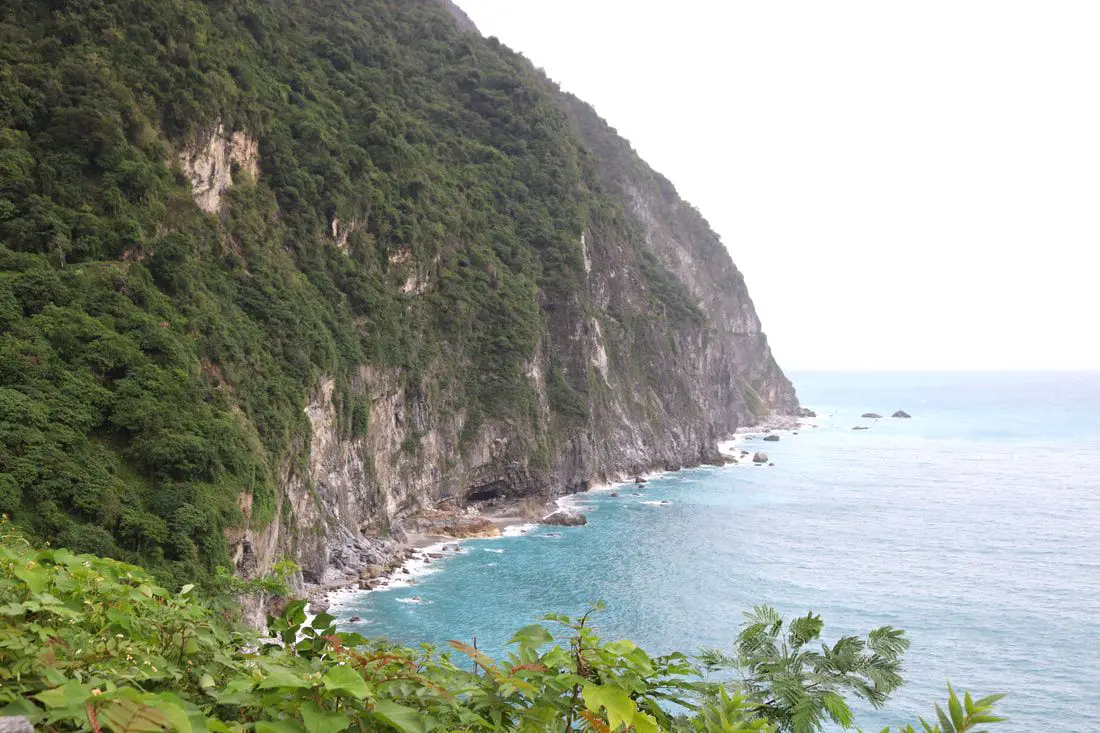
Taiwan's East Coast has the most beautiful scenery in Taiwan. From the deepest marble gorge in the world to outer islands, mountains, rivers, and huge sea cliffs, there are unmissable natural wonders for you to explore. In addition, there are endless outdoor activities and water sports that you can take part in here.
When to go: The best time to go they say is around May when it is not too hot and there are no northeasterly winds or typhoons. The typhoon season lasts from around June to October. The busy season is during summer break from June to August, during which time it can be hard to book a hostel or airplane ticket. Winter is the less crowded season, but the water will be colder, there will be constant wind (which could cancel transportation), and it will rain more often. How to get there: By Plane: Traveling to Taitung or Hualien by plane is the fastest way to get there. The trip only takes one hour from Taipei, and there are planes that leave daily through Mandarin Airlines and Uni Air. From Taitung, where you can switch to Saily Air which will take you the rest of the way to Green Island or Orchid Island. A plane ticket to Taitung takes about one hour and costs about 5000 NT per round trip. You can book discount tickets to Taitung on KKday here. By Train: The train ride from Taipei to Taitung takes 3-4 hours and costs about 800 NT one way. Book tickets via the normal train (TRA) on Klook here. By Bus: Busses leave hourly from Taipei to the East Coast. A bus from Taipei to Hualien now only takes about 2.5 hours. You can book tickets to travel to Taiwan's East Coast via inter-city bus on Klook here. By Bicycle: Cycling is the best way to enjoy Taiwan's landscapes if you have the time and energy. Looking for bicycle rentals in Taiwan? You can search on KKday here and search for tours on Klook here. You can also check out our Taiwan cycling guide here. By Car/Scooter: From Taipei, a car ride to Taitung takes about six hours, and a scooter ride takes about eight hours. You can rent a scooter on Klook or KKday. Scooter rental is about 300 NT per day. You can check out our scooter rental guide here. You can also rent a car for about 1500 NT per day. You can rent a car on Qeeq here or Klook here. You can hire a driver or taxi, and you can charter a car here. You can check out our car rental guide here. Tours: There are many tours and activities available on Taiwan's East Coast such as snorkeling, diving, SUPing, Surfing, Speed Boating, Glamping, River tracing, Paragliding, Kayaking, Canoeing, River Tracing, River Rafting, River Tubing, Pack Rafting, Whale Watching, ATV / 4-wheeling, Paintballing, Water Biking, Glamping, Cycling, Ziplining, Horse Riding, and many others, which you canbook through Klook here or KKday here. Accommodation: Looking for a hotel? We recommend booking through Agoda here, which provides the best quality selection of accommodation on the islands. Yilan: We have stayed at and recommend Ying Shih Guest House, a resort in Datong Township near Taipingshan and Fan Fan Hot Spring, and Jiaosi Hotspring Hotel, a hotel with hot springs in each room. We have also stayed at Toucheng Leisure Farm, a recreational farm and experience center in Toucheng (you can book on Agoda here). Hualien: We also have stayed at and recommend Dream Taiwan Homestay (Agoda / Booking.com), a high quality hostel for the money in downtown Hualien, Farglory Hotel (Agoda / Booking.com), right next to Farglory Ocean Park with amazing views of Hualien, and Goldenflower B&B (Agoda / Booking.com) in Yuli right next to Sixty Stone Mountain. You can find out where to stay in our Taiwan hotels guide or search for the best hotel deals in Taiwan here. Taitung: We have stayed at and recommend the Papago International Resort in Chishang, which is a five star hotel with private villas with pools for each room, and Mountain and Ocean B & B in Taimali, which is a quiet and affordable B&B right next to the beach. Looking for scooter rental in Taiwan? Click here or here to search for options. If you are looking for car rentals, you can also search here. You can also book Wifi and SIM cards for Taiwan on Gigago here. Just to let you know, if you book using the links above, we get some commission at no cost to you, and you can help support our blog. You can click here to receive $5 USD on your first Klook purchase. 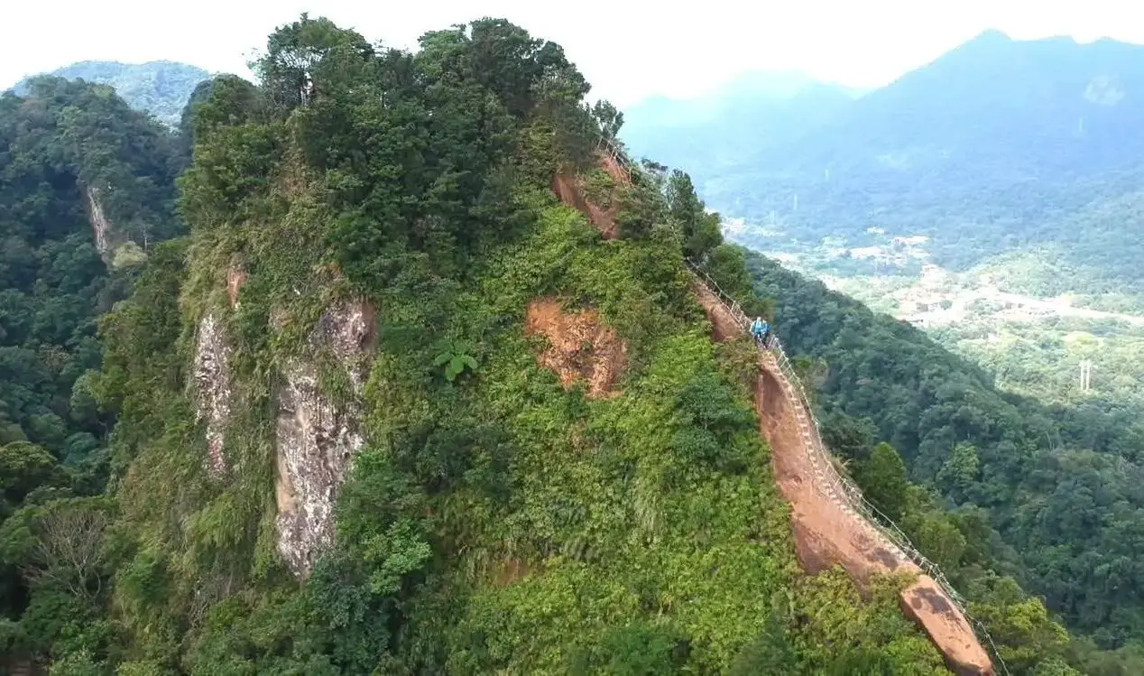
Taipei is full of very accessible hikes right next to the city center. You can find amazing views of Taipei City, as well as make some adrenaline pumping hikes up some very steep peaks in New Taipei and Keelung. We highly recommend checking out what hikes Taipei has to offer. In this guide, we will list out some of the most amazing hikes around Taipei.
Safety Tips When Hiking in Taipei:
Basic Taipei Travel Tips:
When should you go to Taipei? In my opinion, the best weather in Taipei is from March-May, and October - November, when the temperatures stay around 26 degrees Celsius and there is not as much rain. Summers are also nice, with the most sunny weather, but also hot and rainy. Winters can be cold (but not below freezing) and usually wet. Overall, there is no wrong answer as to what time of year you should visit Taipei. You will have a great time here at any time of year. Hotels in Taipei: High end: We have stayed at and recommend the Yuanshan Grand Hotel, once the tallest building in Taiwan and still the most grand (book on Booking.com here, Tripadvisor here, or Agoda here). We have also stayed at and recommend the Grand Hyatt (book on Booking.com here, Tripadvisor here, Agoda here, or Hotels.com here), Marriot (book on Booking.com here, Tripadvisor here, Agoda here, or Hotels.com here), Sheraton (book on Booking.com here, Tripadvisor here, Agoda here, or Hotels.com here), Shangri-la (book on Booking.com here, Tripadvisor here, Agoda here, or Hotels.com here), and Regent (book on Booking.com here, Tripadvisor here, Agoda here, or Hotels.com here), which are all very high quality hotels in the middle of Taipei City. We also recommend Fullon Hotel which has locations in Tamsui and Fulong near the beach (book on Booking.com here, Tripadvisor here, Agoda here, or Hotels.com here). Budget Hotels: We have stayed at and recommend and also Fu Chang Hotel in Ximending, which is within walking distance of Ximending shopping district (book on Booking.com here, Tripadvisor here, or Agoda here). We have also stayed at and recommend Hai Xia Your Home which is right in front of Fulong Beach (book on Booking.com here, Tripadvisor here, Agoda here, or Hotels.com here). Looking for a hotel? We recommend booking through Booking.com here, which provides the best quality selection of accommodation in Taiwan. Find out where to stay in our Taiwan hotels guide or search for the best hotel deals in Taiwan here. Tours in Taipei: There are many tour itineraries that you can enjoy in Taipei that will take you to multiple destinations and arrange transportation. For more information, you can check out Tripadvisor here, KKday here or Klook here, which are both great tour websites that can connect you with the right tour and tour guide for you. Here are some of the post popular tours of Taipei on Tripadvisor:
Attractions in Taipei: There are many attractions that you can enjoy in Taipei such as Taipei 101 Observatory, Taipei 101 460 Skyline Observatory, Taipei Children's Amusement Park, Maokong Gondola, National Palace Museum, Yehliu Ocean World, Yehliu Geopark, National Museum of Marine Science and Biology, i-ride 5D cinema, Astronomical Museum, Miniatures Museum of Taiwan, Double Decker Sightseeing Bus, Miramar Ferris Wheel Ticket, Taipei Zoo, Heping Island Park, Ju Ming Museum, Yuanshan Hotel Secret Road, National Taiwan Museum, New Taipei Gold Museum, Futian Leisure Farm, Chiang Kai-shek Shilin Residence, Chi Po-lin Museaum, Beitou Museum, Tsao Wonderland, Railway Museum, Fort San Domingo, 13 Levels Archaeology Museum, Austin Land, Museum of World Religions, Formosan Aboriginies Museum, ASE Parent-child Park, teamLab Future Park, Yukids Island, VR Experience, Bat Cave, Neidong Waterfall, Candlestick Islet, Jurassic Snow Park, Zhonghe High5 Amusement Park, Longshan Temple, Xingtian Temple, Ningxia Night Market, Yansan Night Market, Meteor Garden, Yingge Old Street, and many more attractions on Tripadvisor here, Klook here, or KKday here. Activities in Taipei: Indoor Skiing, Rock Climbing, Hiking, Wakeboarding, Surfing, Speedboat Surfing, SUP / Paddle Boarding, Diving, Snorkeling Kayaking, Canoeing, Water Biking, River Tracing / Canyoneering, ATVing, Horse Riding, Cooking Class, Archery, Ice Skating, Roller Skating, Tree Climbing, Urban Camping, Glamping, Motorcycling, Motorbike Tour, Dragon Boat Racing, Escape Room, Shen'ao Rail Bike, Laser Gun Experience, Batting Cages, Bowling, Paintball, Flight Simulation Experience, Taipei Tram Driving Experience, Rail Simulation Experience, Taipei 101 Observation Deck activity, Strawberry Picking, Professional Photo Shoot, Body Relaxation SPA, Night Tour, Calligraphy Workshop rand more on Tripadvisor here, Klook here, or KKday here. Just to let you know, if you book using the links above, we get some commission at no cost to you, and you can help support our blog. Some of the Klook links may not work if you are using an Ad blocker. You can click here to receive $5 USD on your first Klook purchase. How to get there: The only way to get to Taiwan is via airplane. Planes leave daily from Taipei's Songshan and Toayuan Airport. Taoyuan Airport: Taoyuan is Taiwan's largest airport and typically has cheaper flights and more flight times to choose from. It's about an hour's journey from Taoyuan Airport to the center of Taipei. You can travel via MRT, HSR, bus, or taxi to get to Taipei. You can get 30% off the Taoyuan Airport VIP lounge on KKday here. Songshan Airport: Songshan is a small airport in Taipei's city center, and can be a convenient option for people traveling within Asia. The airport is right on the Taipei MRT brown line. You can book cheap flights to Taiwan on KKday here, Trip.com here, CheapO Air here, or Kiwi here. How to get around in Taipei: Taipei's transportation system is convenient and safe. There are many options you can consider to get around in Taipei below: By Train: Gets you to the city center of all major cities in Taiwan. It is about 800NT to get from Taipei to Kaohsiung. Roughly half the price of the HSR. Book tickets via the normal train (TRA) on Klook here. By HSR: (High-Speed Rail) – Gets you quickly from north to south. Besides Taipei and Kaohsiung, most of the stations are far from city centers. It costs about 1500NT to get from Taipei to Kaohsiung. You can book tickets to the high-speed rail (HSR) on Klook here or KKDay here. By MRT: (Mass Rapid Transit, Metro train, subway) – Easily gets you around Taipei and Kaohsiung. You can also book an MRT travel pass on Klook here. By Bus: Buses can be tricky. Long-range buses such as Ubus and King Bus are easier to understand and cheaper than the local train. They can take you to the city center of every city throughout Taiwan and to remote tourist destinations such as sun moon lake. A long-range bus from Taipei to Kaohsiung is about 500 NT. You can also book tickets to travel to Shifen via inter-city bus on Klook here. You can also book a Taipei Sightseeing: Hop On, Hop Off Open Top Bus on TripAdvisor here. By Taxi: You can take short rides for about 150 NT, or hire a Taxi for a day for around 150 USD. By Car: If you are looking for car rentals, you can also search Qeeq here, Klook here, or KKday here. You can also check out our car rental guide here. By Scooter: Looking for scooter rental in Taipei? Click here or here to search for options. You can also check out our scooter rental guide here. By Bicycle: Cycling is the best way to enjoy Taiwan's landscapes if you have the time and energy. Looking for bicycle rentals in Taiwan? You can use Taiwan's many Youbike bike sharing stations, or search for rentals on KKday here, and search for tours on Klook here. You can also check out our Taiwan cycling guide here. You can also book a Sunset Riverside Bike Ride and Historical Tour, 4 Hour Cycling in Taipei, Ultimate 8-Hour Cycling City Tour, or Taipei City Bike Tour with Night Market Experience on TripAdvisor here. For more information, check out our Taiwan transportation guide here. Tourist Site Map: Check out our map below of tourist sites in Taiwan, which is constantly updated: 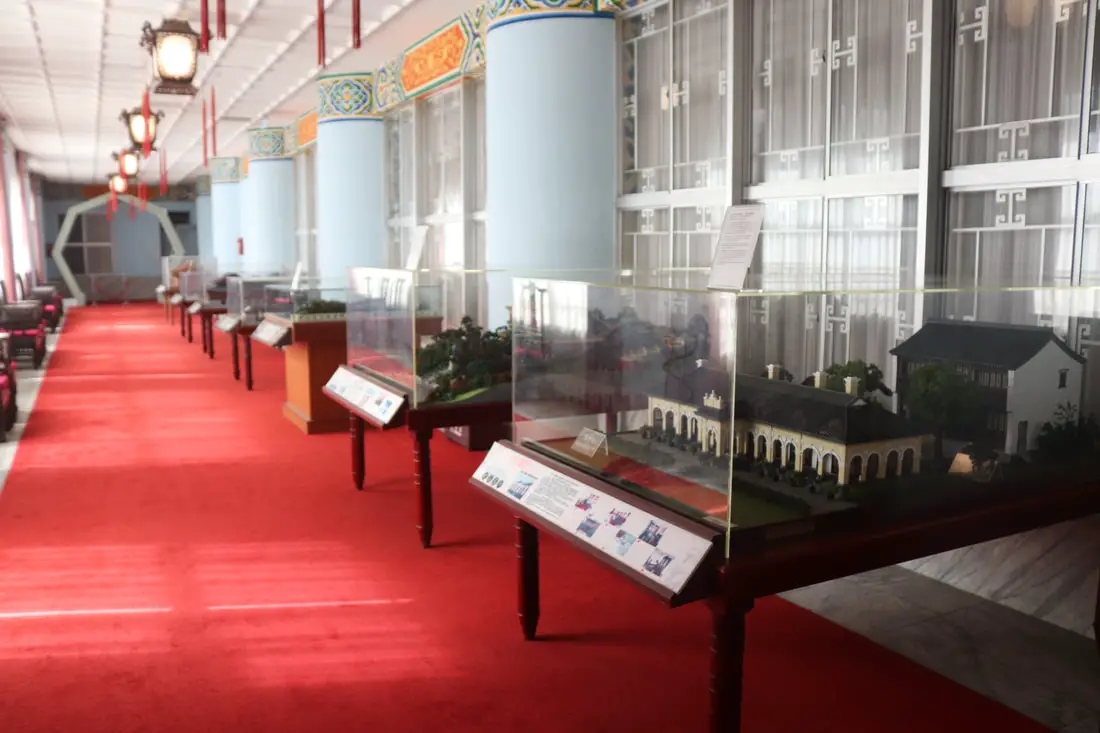
Taipei is full of some of the best museums in Taiwan. Besides the National Palace Museum, there are dozens of museums in Taipei that can provide you deeper insights into Taiwan's unique history and culture.
Brief Historical Background of Taipei: The land on which Taipei now stands on what was once part of Basay tribal land. The Basay people had lived on the land for thousands of years before the first Chinese settlers ever came. Chinese settlers from Fujian began living here during the Dutch rule in the 1600s. The first Chinese settlers came to the area in the mid-1800's during the Qing Dynasty. They created a public area for drying rice and grain, called Dadaocheng (大稻埕) which also became the central market in the area. The earliest trading shops were built in 1851, mainly selling rice, sugar, camphor, and tea. Dihua Street (迪化街) was created around this time, making it the oldest street in Taipei. Most of the buildings were one story and made of red brick in Fujian style, and later western style houses were built. The walls and gates of Taipei were completed in 1884. In 1891, the first train connecting Keelung and Taipei was completed. During the Japanese era, in 1904 the walls of Taipei were destroyed after less than 30 years, and Taipei was re-planned into the capital of Taiwan. After the ROC took control of Taiwan, Taipei continued as the capital city, as well as the financial hub of Taiwan. During the Taiwan miracle, many rural families moved from southern Taiwan to factories and offices in Taipei, making Taipei the most populous urban area in Taiwan. Currently, Taipei is the most advanced and affluent city in Taiwan. It also has Taiwan's most advanced public transportation system, making it easy for millions of commuters to live outside the city where rents are cheaper. Now, most of Taiwan's economic activity is based in this city. Basic Taipei Travel Tips:
When should you go to Taipei? In my opinion, the best weather in Taipei is from March-May, and October - November, when the temperatures stay around 26 degrees Celsius and there is not as much rain. Summers are also nice, with the most sunny weather, but also hot and rainy. Winters can be cold (but not below freezing) and usually wet. Overall, there is no wrong answer as to what time of year you should visit Taipei. You will have a great time here at any time of year. Hotels in Taipei: High end: We have stayed at and recommend the Yuanshan Grand Hotel, once the tallest building in Taiwan and still the most grand (book on Booking.com here, Tripadvisor here, or Agoda here). We have also stayed at and recommend the Grand Hyatt (book on Booking.com here, Tripadvisor here, Agoda here, or Hotels.com here), Marriot (book on Booking.com here, Tripadvisor here, Agoda here, or Hotels.com here), Sheraton (book on Booking.com here, Tripadvisor here, Agoda here, or Hotels.com here), Shangri-la (book on Booking.com here, Tripadvisor here, Agoda here, or Hotels.com here), and Regent (book on Booking.com here, Tripadvisor here, Agoda here, or Hotels.com here), which are all very high quality hotels in the middle of Taipei City. We also recommend Fullon Hotel which has locations in Tamsui and Fulong near the beach (book on Booking.com here, Tripadvisor here, Agoda here, or Hotels.com here). Budget Hotels: We have stayed at and recommend and also Fu Chang Hotel in Ximending, which is within walking distance of Ximending shopping district (book on Booking.com here, Tripadvisor here, or Agoda here). We have also stayed at and recommend Hai Xia Your Home which is right in front of Fulong Beach (book on Booking.com here, Tripadvisor here, Agoda here, or Hotels.com here). Looking for a hotel? We recommend booking through Booking.com here, which provides the best quality selection of accommodation in Taiwan. Find out where to stay in our Taiwan hotels guide or search for the best hotel deals in Taiwan here. Tours in Taipei: There are many tour itineraries that you can enjoy in Taipei that will take you to multiple destinations and arrange transportation. For more information, you can check out Tripadvisor here, KKday here or Klook here, which are both great tour websites that can connect you with the right tour and tour guide for you. Here are some of the post popular tours of Taipei on Tripadvisor:
Attractions in Taipei: There are many attractions that you can enjoy in Taipei such as Taipei 101 Observatory, Taipei 101 460 Skyline Observatory, Taipei Children's Amusement Park, Maokong Gondola, National Palace Museum, Yehliu Ocean World, Yehliu Geopark, National Museum of Marine Science and Biology, i-ride 5D cinema, Astronomical Museum, Miniatures Museum of Taiwan, Double Decker Sightseeing Bus, Miramar Ferris Wheel Ticket, Taipei Zoo, Heping Island Park, Ju Ming Museum, Yuanshan Hotel Secret Road, National Taiwan Museum, New Taipei Gold Museum, Futian Leisure Farm, Chiang Kai-shek Shilin Residence, Chi Po-lin Museaum, Beitou Museum, Tsao Wonderland, Railway Museum, Fort San Domingo, 13 Levels Archaeology Museum, Austin Land, Museum of World Religions, Formosan Aboriginies Museum, ASE Parent-child Park, teamLab Future Park, Yukids Island, VR Experience, Bat Cave, Neidong Waterfall, Candlestick Islet, Jurassic Snow Park, Zhonghe High5 Amusement Park, Longshan Temple, Xingtian Temple, Ningxia Night Market, Yansan Night Market, Meteor Garden, Yingge Old Street, and many more attractions on Tripadvisor here, Klook here, or KKday here. Activities in Taipei: Indoor Skiing, Rock Climbing, Hiking, Wakeboarding, Surfing, Speedboat Surfing, SUP / Paddle Boarding, Diving, Snorkeling Kayaking, Canoeing, Water Biking, River Tracing / Canyoneering, ATVing, Horse Riding, Cooking Class, Archery, Ice Skating, Roller Skating, Tree Climbing, Urban Camping, Glamping, Motorcycling, Motorbike Tour, Dragon Boat Racing, Escape Room, Shen'ao Rail Bike, Laser Gun Experience, Batting Cages, Bowling, Paintball, Flight Simulation Experience, Taipei Tram Driving Experience, Rail Simulation Experience, Taipei 101 Observation Deck activity, Strawberry Picking, Professional Photo Shoot, Body Relaxation SPA, Night Tour, Calligraphy Workshop rand more on Tripadvisor here, Klook here, or KKday here. Just to let you know, if you book using the links above, we get some commission at no cost to you, and you can help support our blog. Some of the Klook links may not work if you are using an Ad blocker. You can click here to receive $5 USD on your first Klook purchase. How to get there: The only way to get to Taiwan is via airplane. Planes leave daily from Taipei's Songshan and Toayuan Airport. Taoyuan Airport: Taoyuan is Taiwan's largest airport and typically has cheaper flights and more flight times to choose from. It's about an hour's journey from Taoyuan Airport to the center of Taipei. You can travel via MRT, HSR, bus, or taxi to get to Taipei. You can get 30% off the Taoyuan Airport VIP lounge on KKday here. Songshan Airport: Songshan is a small airport in Taipei's city center, and can be a convenient option for people traveling within Asia. The airport is right on the Taipei MRT brown line. You can book cheap flights to Taiwan on KKday here, Trip.com here, CheapO Air here, or Kiwi here. How to get around in Taipei: Taipei's transportation system is convenient and safe. There are many options you can consider to get around in Taipei below: By Train: Gets you to the city center of all major cities in Taiwan. It is about 800NT to get from Taipei to Kaohsiung. Roughly half the price of the HSR. Book tickets via the normal train (TRA) on Klook here. By HSR: (High-Speed Rail) – Gets you quickly from north to south. Besides Taipei and Kaohsiung, most of the stations are far from city centers. It costs about 1500NT to get from Taipei to Kaohsiung. You can book tickets to the high-speed rail (HSR) on Klook here or KKDay here. By MRT: (Mass Rapid Transit, Metro train, subway) – Easily gets you around Taipei and Kaohsiung. You can also book an MRT travel pass on Klook here. By Bus: Buses can be tricky. Long-range buses such as Ubus and King Bus are easier to understand and cheaper than the local train. They can take you to the city center of every city throughout Taiwan and to remote tourist destinations such as sun moon lake. A long-range bus from Taipei to Kaohsiung is about 500 NT. You can also book tickets to travel to Shifen via inter-city bus on Klook here. You can also book a Taipei Sightseeing: Hop On, Hop Off Open Top Bus on TripAdvisor here. By Taxi: You can take short rides for about 150 NT, or hire a Taxi for a day for around 150 USD. By Car: If you are looking for car rentals, you can also search Qeeq here, Klook here, or KKday here. You can also check out our car rental guide here. By Scooter: Looking for scooter rental in Taipei? Click here or here to search for options. You can also check out our scooter rental guide here. By Bicycle: Cycling is the best way to enjoy Taiwan's landscapes if you have the time and energy. Looking for bicycle rentals in Taiwan? You can use Taiwan's many Youbike bike sharing stations, or search for rentals on KKday here, and search for tours on Klook here. You can also check out our Taiwan cycling guide here. You can also book a Sunset Riverside Bike Ride and Historical Tour, 4 Hour Cycling in Taipei, Ultimate 8-Hour Cycling City Tour, or Taipei City Bike Tour with Night Market Experience on TripAdvisor here. For more information, check out our Taiwan transportation guide here. Tourist Site Map: Check out our map below of tourist sites in Taiwan, which is constantly updated: 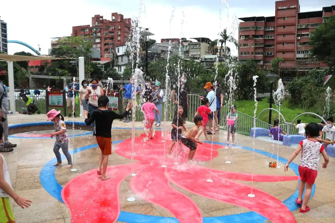
Taipei is full of fund places and activities for kids. In the past few years, more and more fun parks, restaurants, museums, and theme parks have opened. In this blog, we will show you some of the funnest activities and places around Taipei that are fun for kids.
Tips For Travelling in Taipei with Kids:
Basic Taipei Travel Tips:
When should you go to Taipei? In my opinion, the best weather in Taipei is from March-May, and October - November, when the temperatures stay around 26 degrees Celsius and there is not as much rain. Summers are also nice, with the most sunny weather, but also hot and rainy. Winters can be cold (but not below freezing) and usually wet. Overall, there is no wrong answer as to what time of year you should visit Taipei. You will have a great time here at any time of year. Hotels in Taipei: High end: We have stayed at and recommend the Yuanshan Grand Hotel, once the tallest building in Taiwan and still the most grand (book on Booking.com here, Tripadvisor here, or Agoda here). We have also stayed at and recommend the Grand Hyatt (book on Booking.com here, Tripadvisor here, Agoda here, or Hotels.com here), Marriot (book on Booking.com here, Tripadvisor here, Agoda here, or Hotels.com here), Sheraton (book on Booking.com here, Tripadvisor here, Agoda here, or Hotels.com here), Shangri-la (book on Booking.com here, Tripadvisor here, Agoda here, or Hotels.com here), and Regent (book on Booking.com here, Tripadvisor here, Agoda here, or Hotels.com here), which are all very high quality hotels in the middle of Taipei City. We also recommend Fullon Hotel which has locations in Tamsui and Fulong near the beach (book on Booking.com here, Tripadvisor here, Agoda here, or Hotels.com here). Budget Hotels: We have stayed at and recommend and also Fu Chang Hotel in Ximending, which is within walking distance of Ximending shopping district (book on Booking.com here, Tripadvisor here, or Agoda here). We have also stayed at and recommend Hai Xia Your Home which is right in front of Fulong Beach (book on Booking.com here, Tripadvisor here, Agoda here, or Hotels.com here). Looking for a hotel? We recommend booking through Booking.com here, which provides the best quality selection of accommodation in Taiwan. Find out where to stay in our Taiwan hotels guide or search for the best hotel deals in Taiwan here. Tours in Taipei: There are many tour itineraries that you can enjoy in Taipei that will take you to multiple destinations and arrange transportation. For more information, you can check out Tripadvisor here, KKday here or Klook here, which are both great tour websites that can connect you with the right tour and tour guide for you. Here are some of the post popular tours of Taipei on Tripadvisor:
Attractions in Taipei: There are many attractions that you can enjoy in Taipei such as Taipei 101 Observatory, Taipei 101 460 Skyline Observatory, Taipei Children's Amusement Park, Maokong Gondola, National Palace Museum, Yehliu Ocean World, Yehliu Geopark, National Museum of Marine Science and Biology, i-ride 5D cinema, Astronomical Museum, Miniatures Museum of Taiwan, Double Decker Sightseeing Bus, Miramar Ferris Wheel Ticket, Taipei Zoo, Heping Island Park, Ju Ming Museum, Yuanshan Hotel Secret Road, National Taiwan Museum, New Taipei Gold Museum, Futian Leisure Farm, Chiang Kai-shek Shilin Residence, Chi Po-lin Museaum, Beitou Museum, Tsao Wonderland, Railway Museum, Fort San Domingo, 13 Levels Archaeology Museum, Austin Land, Museum of World Religions, Formosan Aboriginies Museum, ASE Parent-child Park, teamLab Future Park, Yukids Island, VR Experience, Bat Cave, Neidong Waterfall, Candlestick Islet, Jurassic Snow Park, Zhonghe High5 Amusement Park, Longshan Temple, Xingtian Temple, Ningxia Night Market, Yansan Night Market, Meteor Garden, Yingge Old Street, and many more attractions on Tripadvisor here, Klook here, or KKday here. Activities in Taipei: Indoor Skiing, Rock Climbing, Hiking, Wakeboarding, Surfing, Speedboat Surfing, SUP / Paddle Boarding, Diving, Snorkeling Kayaking, Canoeing, Water Biking, River Tracing / Canyoneering, ATVing, Horse Riding, Cooking Class, Archery, Ice Skating, Roller Skating, Tree Climbing, Urban Camping, Glamping, Motorcycling, Motorbike Tour, Dragon Boat Racing, Escape Room, Shen'ao Rail Bike, Laser Gun Experience, Batting Cages, Bowling, Paintball, Flight Simulation Experience, Taipei Tram Driving Experience, Rail Simulation Experience, Taipei 101 Observation Deck activity, Strawberry Picking, Professional Photo Shoot, Body Relaxation SPA, Night Tour, Calligraphy Workshop rand more on Tripadvisor here, Klook here, or KKday here. Just to let you know, if you book using the links above, we get some commission at no cost to you, and you can help support our blog. Some of the Klook links may not work if you are using an Ad blocker. You can click here to receive $5 USD on your first Klook purchase. How to get there: The only way to get to Taiwan is via airplane. Planes leave daily from Taipei's Songshan and Toayuan Airport. Taoyuan Airport: Taoyuan is Taiwan's largest airport and typically has cheaper flights and more flight times to choose from. It's about an hour's journey from Taoyuan Airport to the center of Taipei. You can travel via MRT, HSR, bus, or taxi to get to Taipei. You can get 30% off the Taoyuan Airport VIP lounge on KKday here. Songshan Airport: Songshan is a small airport in Taipei's city center, and can be a convenient option for people traveling within Asia. The airport is right on the Taipei MRT brown line. You can book cheap flights to Taiwan on KKday here, Trip.com here, CheapO Air here, or Kiwi here. How to get around in Taipei: Taipei's transportation system is convenient and safe. There are many options you can consider to get around in Taipei below: By Train: Gets you to the city center of all major cities in Taiwan. It is about 800NT to get from Taipei to Kaohsiung. Roughly half the price of the HSR. Book tickets via the normal train (TRA) on Klook here. By HSR: (High-Speed Rail) – Gets you quickly from north to south. Besides Taipei and Kaohsiung, most of the stations are far from city centers. It costs about 1500NT to get from Taipei to Kaohsiung. You can book tickets to the high-speed rail (HSR) on Klook here or KKDay here. By MRT: (Mass Rapid Transit, Metro train, subway) – Easily gets you around Taipei and Kaohsiung. You can also book an MRT travel pass on Klook here. By Bus: Buses can be tricky. Long-range buses such as Ubus and King Bus are easier to understand and cheaper than the local train. They can take you to the city center of every city throughout Taiwan and to remote tourist destinations such as sun moon lake. A long-range bus from Taipei to Kaohsiung is about 500 NT. You can also book tickets to travel to Shifen via inter-city bus on Klook here. You can also book a Taipei Sightseeing: Hop On, Hop Off Open Top Bus on TripAdvisor here. By Taxi: You can take short rides for about 150 NT, or hire a Taxi for a day for around 150 USD. By Car: If you are looking for car rentals, you can also search Qeeq here, Klook here, or KKday here. You can also check out our car rental guide here. By Scooter: Looking for scooter rental in Taipei? Click here or here to search for options. You can also check out our scooter rental guide here. By Bicycle: Cycling is the best way to enjoy Taiwan's landscapes if you have the time and energy. Looking for bicycle rentals in Taiwan? You can use Taiwan's many Youbike bike sharing stations, or search for rentals on KKday here, and search for tours on Klook here. You can also check out our Taiwan cycling guide here. You can also book a Sunset Riverside Bike Ride and Historical Tour, 4 Hour Cycling in Taipei, Ultimate 8-Hour Cycling City Tour, or Taipei City Bike Tour with Night Market Experience on TripAdvisor here. For more information, check out our Taiwan transportation guide here. Tourist Site Map: Check out our map below of tourist sites in Taiwan, which is constantly updated: 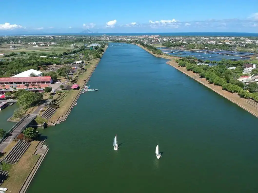
Yilan is a gem on Taiwan's northeast coast. It has rugged mountains, waterfalls, a flat coastal plain, a volcanic island, hot springs, and some of the best beaches in Taiwan. In addition you can find night markets, seafood markets, museums, and much more to explore here. It is definitely worth a stop on your next trip to Taiwan.
Historical Background of Yilan: Before Chinese settlers came, the area around Yilan was inhabited by the Ketagalan Aboriginal tribe, whose language is now extinct. The name Yilan comes from this language. The town Toucheng literally means "first town" in Chinese, because it was the first settlement in Yilan, settled in the late 1700s. With the nearby Wushih and Touwei Harbors around the same time, it became the economic focal point of Yilan. However, in the late 1800s and early 1900s Wushih Harbor and Touwei Harbor silted in, reducing their function. With the advent of the Japanese-built Yilan railway line in the mid-1900's, as well as constant floods and continual silting of the harbors, Toucheng Old Street quickly lost its importance economically and fell into decay. The Japanese also built logging railways up to Taipingshan to harvest lumber. The first path between Yilan and Hualien was a trail built in the Qing Dynasty that was completed in 1876, in order for the Qing to better control aboriginal peoples on the east coast. Later after Japan took control of Taiwan, they widened the path and built 9 bridges and 14 tunnels along the way, making it drivable for cars (one way only) by 1932. Because much of the road was next to cliffs that underwent constant landslides, it was considered one of the most dangerous roads in the world at the time. In the 1980s the ROC government further widened the road, and the two-lane highway was completed in 1990. In 2020, the section of road between Su'ao and Dong'ao was bypassed by a tunnel. Currently Yilan has a population of over 450,000. An High-Speed Rail extension is planned for Yilan, and is expected to be completed by 2036. When to go? The best weather in Yilan lasts from about March-November. During winter months there is constant rain due to the northeasterly winds. How get to Yilan? You can book tickets to travel to Yilan via inter-city bus on Klook here. You can book tickets to Yialn via high speed rail (HSR) on Klook here or KKDay here. Book tickets via the normal train (TRA) on Klook here. How to get around in Yilan? As always, we recommend renting a scooter as the best way to see Taiwan. However, you can also a great deal of Yilan by taking the TRA train, inter-city bus, or local bus. Getting around in a car is also a convenient option as there is plenty of parking pretty much everywhere in this less crowded county. Scooter Rental: Looking for scooter rental in Yilan? You can search Klook here or KKday here to look for options. You can also check out our scooter rental guide here. Car Rental: If you are looking for car rentals in Yilan, you can also search Klook here or KKDay here. You can also check out our car rental guide here. Bicycle Rental: Cycling is the best way to enjoy Taiwan's landscapes if you have the time and energy. Looking for bicycle rentals in Taiwan? You can search on KKday here and search for tours on Klook here. You can also check out our Taiwan cycling guide here. Tours and Activities: You can purchase tours and tickets for many activities in Yilan such as Su'ao Crayon Castle, Taipingshan, Turtle Island, International Children's Festival, Lanyang Museum, Toucheng Leisure Farm, Zhang Mei Ama Capybura Farm, Bambi Land, Yinong Ranch, National Center for Traditional Arts, Taxi Museum, Glamping, Camping, ATV / 4-wheeling experience, SUP / paddle boarding, Ximeng Forest Theater, Surfing, Kayaking, Horse Riding, River Tracing, River Rafting, River Tubing, Pack Rafting, Water Biking, Snorkeling, Canoeing, Shrimping and many others through Klook here or KKday here. Accommodation: We have stayed at and recommend Ying Shih Guest House, a resort in Datong Township near Taipingshan and Fan Fan Hot Spring (you can book on Agoda here or Booking.com here), and Jiaosi Hotspring Hotel, a hotel with hot springs in each room (you can book on Agoda here, Booking.com here, Hotels.com here, Expedia here, or Trip.com here). We have also stayed at Toucheng Leisure Farm, a recreational farm and experience center in Toucheng (you can book on Agoda here, Booking.com here, Hotels.com here, Expedia here, on Klook here, or on Trip.com here). We recommend booking through Agoda here, which provides the best quality selection of accommodation on the islands. Find out where to stay in our Taiwan hotels guide or search for the best hotel deals in Taiwan here. You can also book Wifi and SIM cards for Taiwan on Gigago here. Need travel insurance? Compare prices on Insubuy here. Just to let you know, if you book using the links above, we get some commission at no cost to you, and you can help support our blog. You can click here to receive $5 USD on your first Klook purchase. Map: You can find a map of places we will cover in this blog below: 
Taipei is home to some of Taiwan's most magnificent waterfalls, and most of them are just a short trip away. Here we have compiled a list of the most easily accessible waterfalls around Taipei.
Please note this is not an exhaustive list. There are many more waterfalls in Taipei than are listed in this blog. Get out there and discover Taipei's waterfalls for yourself! Safety Tips When Visiting Waterfalls:
Basic Taipei Travel Tips:
When should you go to Taipei? In my opinion, the best weather in Taipei is from March-May, and October - November, when the temperatures stay around 26 degrees Celsius and there is not as much rain. Summers are also nice, with the most sunny weather, but also hot and rainy. Winters can be cold (but not below freezing) and usually wet. Overall, there is no wrong answer as to what time of year you should visit Taipei. You will have a great time here at any time of year. Hotels in Taipei: We have stayed at and recommend the Yuanshan Grand Hotel, once the tallest building in Taiwan and still the most grand (book on Booking.com here, Agoda here, or Kayak here). We also recommend Fullon Hotel which has locations in Tamsui and Fulong near the beach (book on Booking.com here, Agoda here, or Kayak here). Budget Hotels: We have stayed at and also recommend Fu Chang Hotel in Ximending, which is within walking distance of Ximending shopping district (book on Booking.com here, Agoda here, or Kayak here). We have also stayed at and recommend Hai Xia Your Home which is right in front of Fulong Beach (book on Booking.com here, Agoda here, or Kayak here). Looking for a hotel? We recommend booking through Booking.com here, which provides the best quality selection of accommodation in Taiwan. Find out where to stay in our Taiwan hotels guide or search for the best hotel deals in Taiwan here. Tours in Taipei: There are many tour itineraries that you can enjoy in Taipei that will take you to multiple destinations and arrange transportation. For more information, you can check out KKday here or Klook here. Attractions in Taipei: There are many attractions that you can enjoy in Taipei such as Taipei 101 Observatory, Taipei 101 460 Skyline Observatory, Taipei Children's Amusement Park, Maokong Gondola, National Palace Museum and many more attractions on Klook here or KKday here. Activities in Taipei: You can also look for more activities in Taipei such as Rock Climbing, Surfing, Speedboat Surfing, Diving, Snorkeling, Cooking Class, Glamping, Motorcycling, and more on Klook here or KKday here. Just to let you know, if you book using the links above, we get some commission at no cost to you, and you can help support our blog. Some of the Klook links may not work if you are using an Ad blocker. You can click here to receive $5 USD on your first Klook purchase. How to get there: The only way to get to Taiwan is via airplane. Planes leave daily from Taipei's Songshan and Toayuan Airport. Taoyuan Airport: Taoyuan is Taiwan's largest airport and typically has cheaper flights and more flight times to choose from. It's about an hour's journey from Taoyuan Airport to the center of Taipei. You can travel via MRT, HSR, bus, or taxi to get to Taipei. You can get 30% off the Taoyuan Airport VIP lounge on KKday here. Songshan Airport: Songshan is a small airport in Taipei's city center, and can be a convenient option for people traveling within Asia. The airport is right on the Taipei MRT brown line. You can book cheap flights to Taiwan on KKday here, Trip.com here, CheapO Air here, or Kiwi here. How to get around in Taipei: Taipei's transportation system is convenient and safe. There are many options you can consider to get around in Taipei below: By Train: Gets you to the city center of all major cities in Taiwan. It is about 800NT to get from Taipei to Kaohsiung. Roughly half the price of the HSR. Book tickets via the normal train (TRA) on Klook here. By HSR: (High-Speed Rail) – Gets you quickly from north to south. Besides Taipei and Kaohsiung, most of the stations are far from city centers. It costs about 1500NT to get from Taipei to Kaohsiung. You can book tickets to the high-speed rail (HSR) on Klook here or KKDay here. By MRT: (Mass Rapid Transit, Metro train, subway) – Easily gets you around Taipei and Kaohsiung. You can also book an MRT travel pass on Klook here. By Bus: Buses can be tricky. Long-range buses such as Ubus and King Bus are easier to understand and cheaper than the local train. They can take you to the city center of every city throughout Taiwan and to remote tourist destinations such as sun moon lake. A long-range bus from Taipei to Kaohsiung is about 500 NT. You can also book tickets to travel to Shifen via inter-city bus on Klook here. By Taxi: You can take short rides for about 150 NT, or hire a Taxi for a day for around 150 USD. By Car: If you are looking for car rentals, you can also search Qeeq here, Klook here, or KKday here. You can also check out our car rental guide here. By Scooter: Looking for scooter rental in Taipei? Click here or here to search for options. You can also check out our scooter rental guide here. By Bicycle: Cycling is the best way to enjoy Taiwan's landscapes if you have the time and energy. Looking for bicycle rentals in Taiwan? You can use Taiwan's many Youbike bike sharing stations, or search for rentals on KKday here, and search for tours on Klook here. You can also check out our Taiwan cycling guide here. For more information, check out our Taiwan transportation guide here. Tourist Site Map: Check out our map below of tourist sites in Taiwan, which is constantly updated: 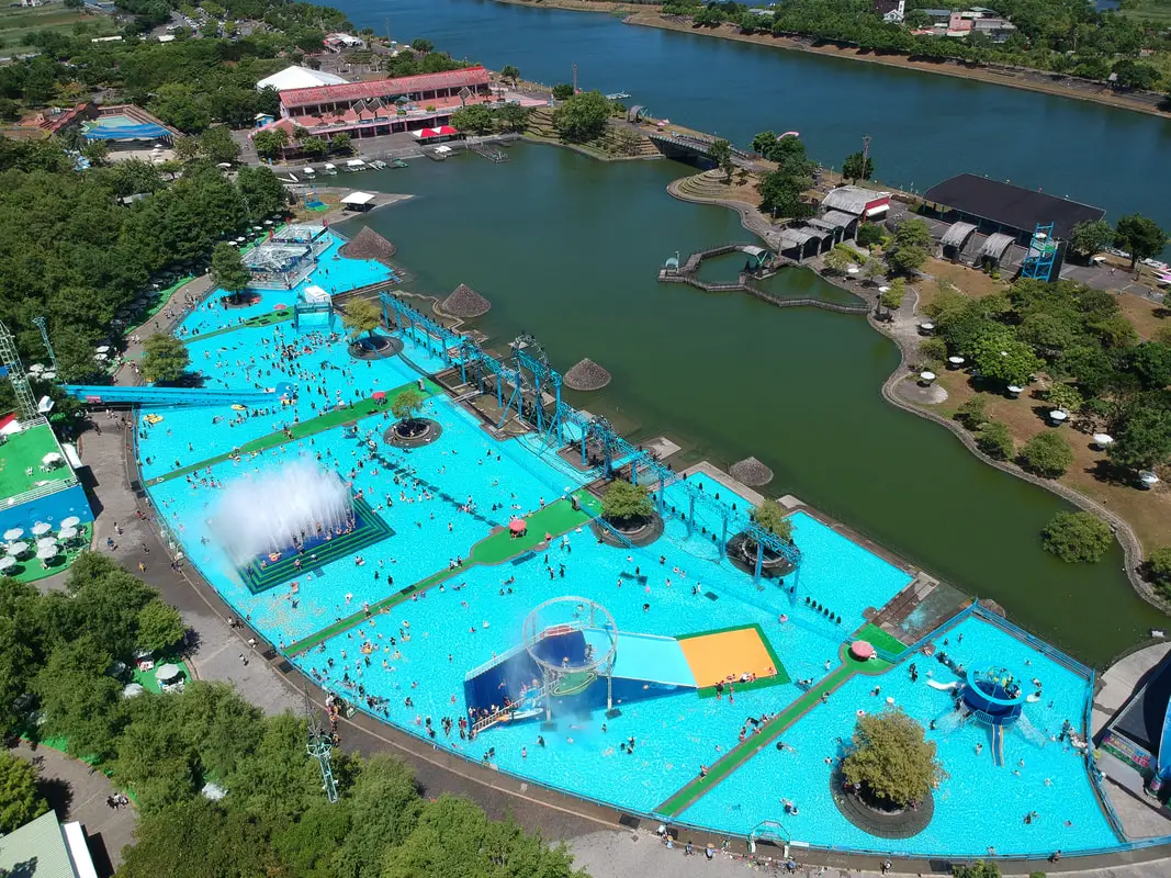
Yilan International Children's Folklore and Folkgame Festival (宜蘭國際童玩藝術節) is one of the largest children's festivals in Taiwan, occurring every year during summer break along the Dongshan River in Yilan. It features a large outdoor waterpark as well as musical performances, exhibitions, games, and cultural events. It has become a yearly tradition for many families in northern Taiwan.
Background: The festival first began in 1996 and has continued every year, except for 2008-2009 due to lack of funds, in 2003 because of SARS, and in 2020 due to COVID. The completion of the Hsueshan Tunnel in 2006 made it much easier for large amounts of people to travel quickly from Taipei to Yilan. The large event attracts many visitors from Taipei. During summer weekdays and weekends the venue can be expected to be totally packed with visitors. Hours: 10 AM to 9 PM (pool area closes at 6 PM), starting from the beginning of July to mid-August every summer. In 2024 the festival runs from July 6th to August 18th. Price: 350 NT on weekends and 250 NT on weekdays 50 NT parking fee for cars 20 NT parking fee for scooters You can book tickets for a discount on Klook here or book a day tour on KKday here. Website: https://www.yicfff.tw/index.php?lang=5tKpKqHPsMZQ82iPyZj4TQ Tours and Activities: You can purchase tours and tickets for many activities in Yilan such as Su'ao Crayon Castle, Taipingshan, Turtle Island, Lanyang Museum, Toucheng Leisure Farm, Zhang Mei Ama Capybura Farm, Bambi Land, Yinong Ranch, National Center for Traditional Arts, Taxi Museum, Glamping, Camping, ATV / 4-wheeling experience, SUP / paddle boarding, Ximeng Forest Theater, Surfing, Kayaking, Horse Riding, River Tracing, River Rafting, River Tubing, Pack Rafting, Water Biking, Snorkeling, Canoeing, Shrimping and many others through Klook here or KKday here. Accommodation: Looking for a hotel? We recommend booking through Agoda here, which provides the best quality selection of accommodation on the islands. We have stayed at and recommend Ying Shih Guest House, a resort in Datong Township near Taipingshan and Fan Fan Hot Spring (you can book on Agoda here or Booking.com here), and Jiaosi Hotspring Hotel, a hotel with hot springs in each room (you can book on Agoda here or Booking.com here). We have also stayed at Toucheng Leisure Farm, a recreational farm and experience center in Toucheng (you can book on Agoda here, Booking.com here, or on Klook here). How to get there: By car/scooter: From National Highway 5 in Yilan, take provincial highway 7 east to Dongshan River Water Park. Looking for scooter rental in Yilan? You can search Klook here or KKday here to look for options. You can also check out our scooter rental guide here. If you are looking for car rentals in Yilan, you can also search Klook here or KKDay here. You can also check out our car rental guide here. By bus: From Luodong TRA station, take bus GR21 to Dongshan River Water Park. You can book tickets to travel to Yilan via inter-city bus on Klook here. You can book tickets to Yialn via high speed rail (HSR) on Klook here or KKDay here. Book tickets via the normal train (TRA) on Klook here. Bicycle rental: Cycling is the best way to enjoy Taiwan's landscapes if you have the time and energy. Looking for bicycle rentals in Taiwan? You can search on KKday here and search for tours on Klook here. You can also check out our Taiwan cycling guide here. Map: Please see below: 
This month marks the 10th anniversary of this blog, so to celebrate I am making a blog tracing back our first round-island trip lasting 14 days and 13 nights made in 2014. During this journey we rented a car in Taipei, and circled Taiwan clockwise, visiting Taroko Gorge, Kenting, Xiaoliuqiu, Alishan, Sun Moon Lake, and many more places along the way. I am the kind of guy who likes to bask in nostalgia, but also I hope that laying out this experience in the open as well as the lessons we learned about travel in Taiwan along the way (and what I know now in 2024) will be helpful to other foreigners coming to Taiwan.
Some background on why this trip happened: This was not our first trip to Taiwan. Scott and I had been Latter-day Saint missionaries in Taiwan from 2011 to 2012 in the Taichung Mission, which covers Taichung to Pingtung but nothing north or east of that. We still had a lot of friends in Taiwan that we missed, we missed Taiwanese food, and there were the entire north and east parts of the island for us to explore. We decided it would be a once-in-a-lifetime opportunity to tour Taiwan now because later on in our lives we would likely have work and family obligations that would not allow us to take a 14-day trip around Taiwan. Being poor college students at the time, we had a very limited budget (for reference, I was making 700 USD a month as a janitor and I could only save about half of that after rent and food). Originally another friend planned to come with us, but he backed out because he got married. Scott's brother Matt decided to come along too. Just so you know, Scott and I know Chinese, but Matt doesn't. It makes traveling easier to know the language but you can still get by in Taiwan without it. The Plane Ride: We took the cheapest flight available on Shenzhen Airlines, which had many flights for cheap to the US at the time. For 700 USD we bought a round trip from LA to Beijing to Taipei and back. Renting a car in Taiwan: Before we began our trip, we planned on rounding the island by Scooter. This can be a fun way to explore Taiwan. As a side note, you can book a Motorcycling experience on Klook here, or a half-day Motorbike Tour on KKday here. If you are looking for a multi-day, in-depth tour of Taiwan via motorbike, we recommend contacting [email protected] who schedules regular 10-day motorbike tours of Taiwan. The tour guide is a long-term expat in Taiwan who has been giving riding tours of Taiwan for 16 years now. You can also check out our scooter rental guide here. After crunching the numbers, we figured that we could rent a car for just as cheap as three scooters, and we wouldn't have to worry about rain or luggage. A scooter would be 300 NT per day, and for three people 900 NT per day, but we found a car rental place that would rent us a small Nissan March for 700 NT a day (that car company was called Good Cars 固得汽車 in Zhonghe, you can find their information in our Taiwan Car Rental Guide here). After arriving at Taoyuan International Airport, we took a bus to Taipei and made our way to Zhonghe at a friend's house and picked up the rental car. At the end of the trip, we found the price was a few thousand NT more than we expected because of highway tolls (about 1.5 NT per kilometer). SIM Card: I bought a pre-paid SIM card from Taiwan Mobile for 500 TWD that lasted the whole trip. I think it was only a few GB of data, but I had a crappy phone and was not using much data. Map: Check out a map of places we visited on this trip below: 
Toucheng Farm is not just a farm but also a leisure area, hotel, restaurant, and activity area. Here we also fed water buffalo, learned sustainable farming, the ancient art of sweet potato baking, lime juice fermentation, and painted T-shirts. Overall it was a fun time that the whole family can enjoy.
Background: Before Chinese settlers came, the area around Toucheng was inhabited by the Ketagalan Aboriginal tribe, whose language is now extinct. The name Toucheng literally means "first town" in Chinese, because it was the first settlement in Yilan, settled in the late 1700s. With the nearby Wushih and Touwei Harbors around the same time, it became the economic focal point of Yilan. However in the late 1800s and early 1900s Wushih Harbor and Touwei Harbor silted in, reducing their function. With the advent of the Japanese built Yilan railway line in the mid-1900's, as well as constant floods and continually silting of the harbors, Toucheng quickly lost its importance economically and fell into decay. After residents of Turtle Island were relocated to Daxi in Toucheng, Daxi Harbor was expanded and has become one of the largest fishing harbors in the area. Due to its close proximity to Taipei, Toucheng has become a major tourist area and may be the most popular surfing location in Taiwan. Website: https://www.tcfarm.com.tw/en/ Facebook: https://www.facebook.com/tcfarmeng/ Twitter: https://twitter.com/toucheng_farm Tours and Activities: You can book tickets to Toucheng Leisure Farm on Klook here or on KKday here. You can also book a room there on Klook here, Agoda here, Booking.com here, Hotels.com here, Expedia here, or Trip.com here. Accommodation: We have stayed at and recommend Toucheng Leisure Farm. You can also book a room there on Klook here, Agoda here, Booking.com here, Hotels.com here, Expedia here, or Trip.com here. Looking for a hotel? We recommend booking through Agoda here, which provides the best quality selection of accommodation in Taiwan. Find out where to stay in our Taiwan hotels guide or search for the best hotel deals in Taiwan here. How to get there: By TRA: Take the TRA to any of the stations in Toucheng. You can book tickets to travel to Yilan via inter-city bus on Klook here. You can book tickets to Yialn via high speed rail (HSR) on Klook here or KKDay here. Book tickets via the normal train (TRA) on Klook here. Bicycle rental: Cycling is the best way to enjoy Taiwan's landscapes if you have the time and energy. Looking for bicycle rentals in Taiwan? You can search on KKday here and search for tours on Klook here. You can also check out our Taiwan cycling guide here. By Car: From Taipei, take National Freeway 5 to Toucheng. Be careful to note that on Sundays there are highway controls for cars travelling from Yilan to Taipei from 3 PM to 8 PM, so avoid travelling back to Taipei at that time to beat the traffic. Looking for scooter rental in Yilan? You can search Klook here or KKday here to look for options. You can also check out our scooter rental guide here. If you are looking for car rentals in Yilan, you can also search Klook here or KKDay here. You can also check out our car rental guide here. Map: Please see below: 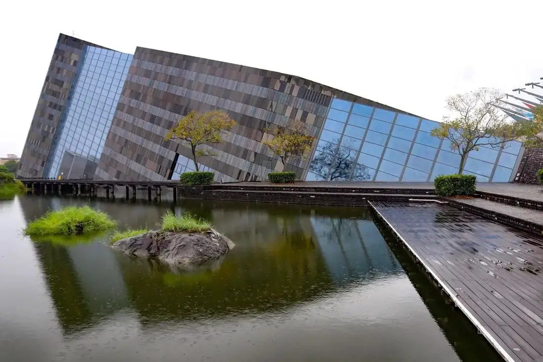
The Lanyang Museum focuses on Toucheng's history and artifacts. If you want to learn about the history of Toucheng, this is the place to visit. It is also a beautiful building, designed in the shape of Cuestas, or slanted rocks that appear commonly along Toucheng's coastline.
Background: Before Chinese settlers came, the area around Toucheng was inhabited by the Ketagalan Aboriginal tribe, whose language is now extinct. The name Toucheng literally means "first town" in Chinese, because it was the first settlement in Yilan, settled in the late 1700s. With the nearby Wushih and Touwei Harbors around the same time, it became the economic focal point of Yilan. However in the late 1800s and early 1900s Wushih Harbor and Touwei Harbor silted in, reducing their function. With the advent of the Japanese built Yilan railway line in the mid-1900's, as well as constant floods and continually silting of the harbors, Toucheng quickly lost its importance economically and fell into decay. After residents of Turtle Island were relocated to Daxi in Toucheng, Daxi Harbor was expanded and has become one of the largest fishing harbors in the area. Due to its close proximity to Taipei, Toucheng has become a major tourist area and may be the most popular surfing location in Taiwan. Price: 100 NT You can book discount exhibition tickets to the museum on KKday here or book a tour through Klook here. Hours: 9 AM to 5 PM every day except Wednesdays. Tours and Activities: You can purchase tours and tickets for many activities in Yilan such as Su'ao Crayon Castle, Taipingshan, Turtle Island, Lanyang Museum, Toucheng Leisure Farm, Zhang Mei Ama Capybura Farm, Bambi Land, Yinong Ranch, National Center for Traditional Arts, Taxi Museum, Glamping, Camping, ATV / 4-wheeling experience, SUP / paddle boarding, Ximeng Forest Theater, Surfing, Kayaking, Horse Riding, River Tracing, River Rafting, River Tubing, Pack Rafting, Water Biking, Snorkeling, Canoeing, Shrimping and many others through Klook here or KKday here. Accommodation: We have stayed at and recommend Toucheng Leisure Farm. You can also book a room there on Klook here, Agoda here, Booking.com here, Hotels.com here, Expedia here, or Trip.com here. Looking for a hotel? We recommend booking through Agoda here, which provides the best quality selection of accommodation in Taiwan. Find out where to stay in our Taiwan hotels guide or search for the best hotel deals in Taiwan here. How to get there: By TRA: Take the TRA to any of the stations in Toucheng. You can book tickets to travel to Yilan via inter-city bus on Klook here. You can book tickets to Yialn via high speed rail (HSR) on Klook here or KKDay here. Book tickets via the normal train (TRA) on Klook here. Bicycle rental: Cycling is the best way to enjoy Taiwan's landscapes if you have the time and energy. Looking for bicycle rentals in Taiwan? You can search on KKday here and search for tours on Klook here. You can also check out our Taiwan cycling guide here. By Car: From Taipei, take National Freeway 5 to Toucheng. Be careful to note that on Sundays there are highway controls for cars travelling from Yilan to Taipei from 3 PM to 8 PM, so avoid travelling back to Taipei at that time to beat the traffic. Looking for scooter rental in Yilan? You can search Klook here or KKday here to look for options. You can also check out our scooter rental guide here. If you are looking for car rentals in Yilan, you can also search Klook here or KKDay here. You can also check out our car rental guide here. Map: 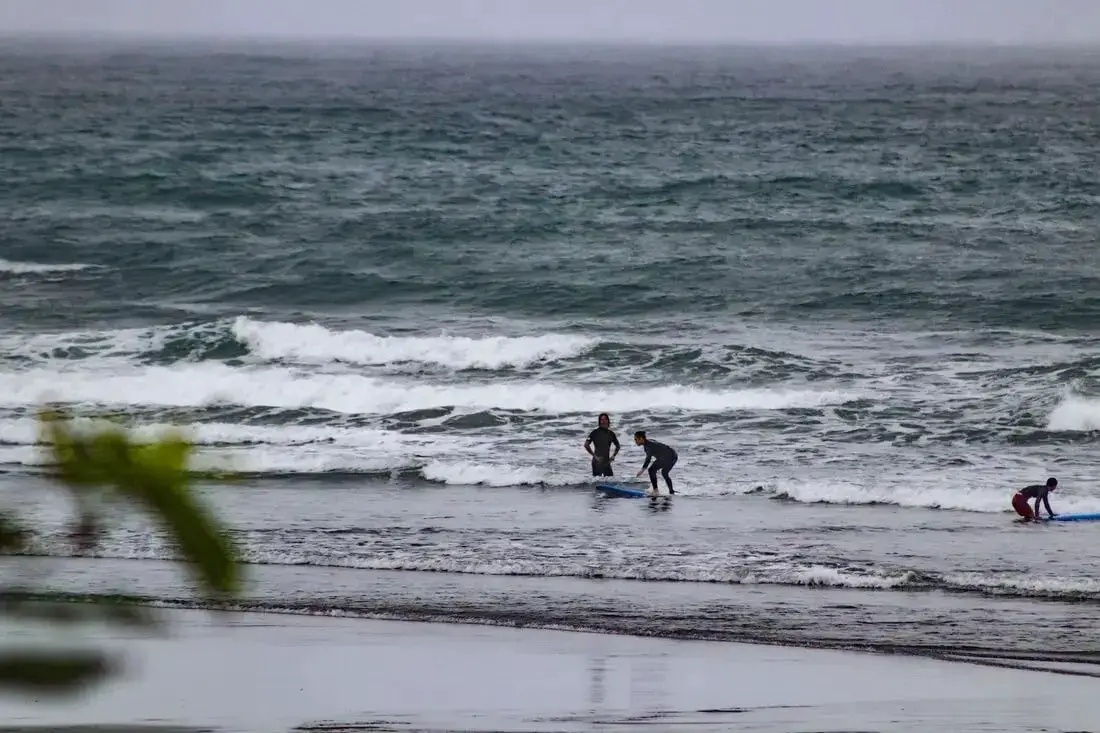
Double Lion Beach is a quiet surfing beach in Yilan County. There are fewer people here and awesome waves. The reason it is called Double Lion Beach is because of the two lions in front of the temple that looks over the beach. It is definitely worth a stop on your next trip to Yilan.
Background: Before Chinese settlers came, the area around Toucheng was inhabited by the Ketagalan Aboriginal tribe, whose language is now extinct. The name Toucheng literally means "first town" in Chinese, because it was the first settlement in Yilan, settled in the late 1700s. With the nearby Wushih and Touwei Harbors around the same time, it became the economic focal point of Yilan. However in the late 1800s and early 1900s Wushih Harbor and Touwei Harbor silted in, reducing their function. With the advent of the Japanese built Yilan railway line in the mid-1900's, as well as constant floods and continually silting of the harbors, Toucheng quickly lost its importance economically and fell into decay. After residents of Turtle Island were relocated to Daxi in Toucheng, Daxi Harbor was expanded and has become one of the largest fishing harbors in the area. Due to its close proximity to Taipei, Toucheng has become a major tourist area and may be the most popular surfing location in Taiwan. Tours and Activities: You can book a surfing lesson at Double Lion Beach on KKday here. Accommodation: We have stayed at and recommend Toucheng Leisure Farm. You can also book a room there on Klook here, Agoda here, Booking.com here, Hotels.com here, Expedia here, or Trip.com here. Looking for a hotel? We recommend booking through Agoda here, which provides the best quality selection of accommodation in Taiwan. Find out where to stay in our Taiwan hotels guide or search for the best hotel deals in Taiwan here. How to get there: By TRA: Take the TRA to any of the stations in Toucheng. You can book tickets to travel to Yilan via inter-city bus on Klook here. You can book tickets to Yialn via high speed rail (HSR) on Klook here or KKDay here. Book tickets via the normal train (TRA) on Klook here. Bicycle rental: Cycling is the best way to enjoy Taiwan's landscapes if you have the time and energy. Looking for bicycle rentals in Taiwan? You can search on KKday here and search for tours on Klook here. You can also check out our Taiwan cycling guide here. By Car: From Taipei, take National Freeway 5 to Toucheng. Be careful to note that on Sundays there are highway controls for cars travelling from Yilan to Taipei from 3 PM to 8 PM, so avoid travelling back to Taipei at that time to beat the traffic. Looking for scooter rental in Yilan? You can search Klook here or KKday here to look for options. You can also check out our scooter rental guide here. If you are looking for car rentals in Yilan, you can also search Klook here or KKDay here. You can also check out our car rental guide here. Map: Please see below: 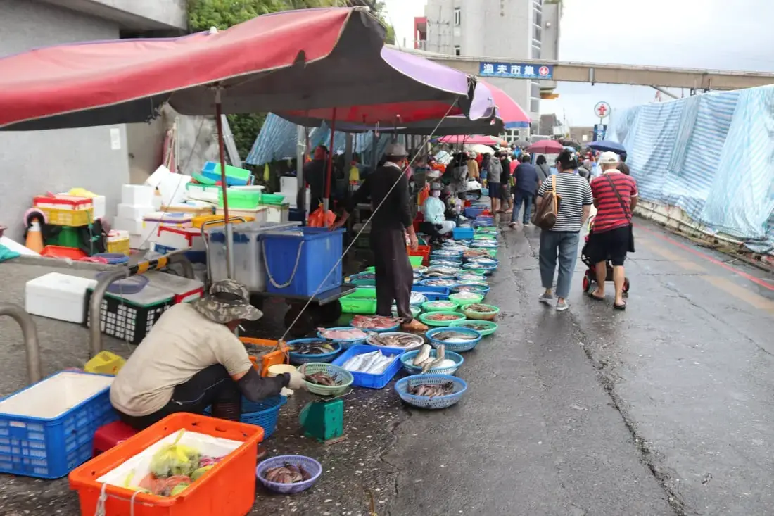
Daxi Fishing Harbor (aka Ta-Hsi Fishing Harbor) in Toucheng Township, Yilan County has one of the biggest seafood markets in the area. Originally it was smaller, but when the residents of Turtle Island were moved here, they expanded the harbor so that more boats could fit. This is where you can get some of the freshest seafood there is, every day at 2:30 PM.
Background: Before Chinese settlers came, the area around Toucheng was inhabited by the Ketagalan Aboriginal tribe, whose language is now extinct. The name Toucheng literally means "first town" in Chinese, because it was the first settlement in Yilan, settled in the late 1700s. With the nearby Wushih and Touwei Harbors around the same time, it became the economic focal point of Yilan. However in the late 1800s and early 1900s Wushih Harbor and Touwei Harbor silted in, reducing their function. With the advent of the Japanese built Yilan railway line in the mid-1900's, as well as constant floods and continually silting of the harbors, Toucheng quickly lost its importance economically and fell into decay. After residents of Turtle Island were relocated to Daxi in Toucheng, Daxi Harbor was expanded and has become one of the largest fishing harbors in the area. Due to its close proximity to Taipei, Toucheng has become a major tourist area and may be the most popular surfing location in Taiwan. Tours and Activities: You can purchase tours and tickets for many activities in Yilan such as Su'ao Crayon Castle, Taipingshan, Turtle Island, Lanyang Museum, Toucheng Leisure Farm, Zhang Mei Ama Capybura Farm, Bambi Land, Yinong Ranch, National Center for Traditional Arts, Taxi Museum, Glamping, Camping, ATV / 4-wheeling experience, SUP / paddle boarding, Ximeng Forest Theater, Surfing, Kayaking, Horse Riding, River Tracing, River Rafting, River Tubing, Pack Rafting, Water Biking, Snorkeling, Canoeing, Shrimping and many others through Klook here or KKday here. Accommodation: We have stayed at and recommend Toucheng Leisure Farm. You can also book a room there on Klook here, Agoda here, Booking.com here, Hotels.com here, Expedia here, or Trip.com here. Looking for a hotel? We recommend booking through Agoda here, which provides the best quality selection of accommodation in Taiwan. Find out where to stay in our Taiwan hotels guide or search for the best hotel deals in Taiwan here. How to get there: By TRA: Take the TRA to any of the stations in Toucheng. You can book tickets to travel to Yilan via inter-city bus on Klook here. You can book tickets to Yialn via high speed rail (HSR) on Klook here or KKDay here. Book tickets via the normal train (TRA) on Klook here. Bicycle rental: Cycling is the best way to enjoy Taiwan's landscapes if you have the time and energy. Looking for bicycle rentals in Taiwan? You can search on KKday here and search for tours on Klook here. You can also check out our Taiwan cycling guide here. By Car: From Taipei, take National Freeway 5 to Toucheng. Be careful to note that on Sundays there are highway controls for cars travelling from Yilan to Taipei from 3 PM to 8 PM, so avoid travelling back to Taipei at that time to beat the traffic. Looking for scooter rental in Yilan? You can search Klook here or KKday here to look for options. You can also check out our scooter rental guide here. If you are looking for car rentals in Yilan, you can also search Klook here or KKDay here. You can also check out our car rental guide here. Map: 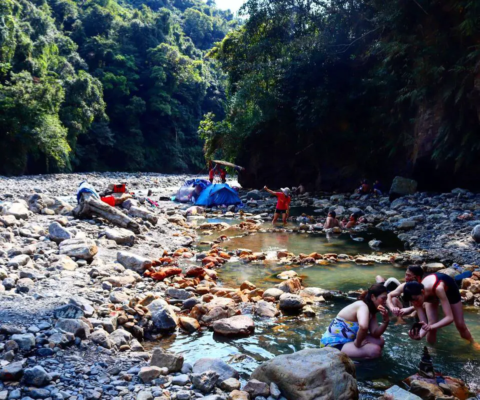
Fanfan Hot Spring is a popular hot spring in Yingshi Village, Datong Township, Yilan County. It is one of the most easily accessible wild hot springs in Taiwan, so it sees many visitors year round. If you are in the area, you should consider taking a dip here.
Background: The area around Fanfan Hot Spring has been inhabited by the Atayal tribe for thousands of years. Originally the river where the hot springs lay was called Bonbon by the local indigenous people, but later the spelling was changed to "Fanfan" because of Han Chinese people in the area who misheard the name. Fanfan Hot Springs is part of the Xueshan Mountain Range, which was pushed up from the collision of the Eurasian and Philippine plate. The hot springs come from heated water caused from metamorphic rocks under pressure deep within the earth. Hours: 24/7 Tours and Activities: You can purchase tours and tickets for many activities in Yilan such as Su'ao Crayon Castle, Taipingshan, Turtle Island, Lanyang Museum, Toucheng Leisure Farm, Zhang Mei Ama Capybura Farm, Bambi Land, Yinong Ranch, National Center for Traditional Arts, Taxi Museum, Glamping, Camping, ATV / 4-wheeling experience, SUP / paddle boarding, Ximeng Forest Theater, Surfing, Kayaking, Horse Riding, River Tracing, River Rafting, River Tubing, Pack Rafting, Water Biking, Snorkeling, Canoeing, Shrimping and many others through Klook here or KKday here. Accommodation: Looking for a hotel? We recommend booking through Agoda here, which provides the best quality selection of accommodation on the islands. We have stayed at and recommend Ying Shih Guest House, a resort in Datong Township near Taipingshan and Fan Fan Hot Spring (you can book on Agoda here or Booking.com here), and Jiaosi Hotspring Hotel, a hotel with hot springs in each room (you can book on Agoda here, Booking.com here, Hotels.com here, Expedia here, or Trip.com here). You can also book Wifi and SIM cards for Taiwan on Gigago here. Need travel insurance? Compare prices on Insubuy here. Just to let you know, if you book using the links above, we get some commission at no cost to you, and you can help support our blog. You can click here to receive $5 USD on your first Klook purchase. How to get there: By Bus: From Yilan Bus Station, take bus 1744 about one hour to Fanfan Station. The hot springs are about a 20 minute walk away. You can book tickets to travel to Yilan via inter-city bus on Klook here. You can book tickets to Yialn via high speed rail (HSR) on Klook here or KKDay here. Book tickets via the normal train (TRA) on Klook here. Bicycle rental: Cycling is the best way to enjoy Taiwan's landscapes if you have the time and energy. Looking for bicycle rentals in Taiwan? You can search on KKday here and search for tours on Klook here. You can also check out our Taiwan cycling guide here. By Car/Scooter: From downtown Yilan, take provincial higway 7 southwest to Siji Elementary School Yingshi Branch, in Yingshi village. There is parking at the elementary school. The hot springs are about a 15 minute walk away. Looking for scooter rental in Yilan? You can search Klook here or KKday here to look for options. You can also check out our scooter rental guide here. If you are looking for car rentals in Yilan, you can also search Klook here or KKDay here. You can also check out our car rental guide here. Map: Please see below: 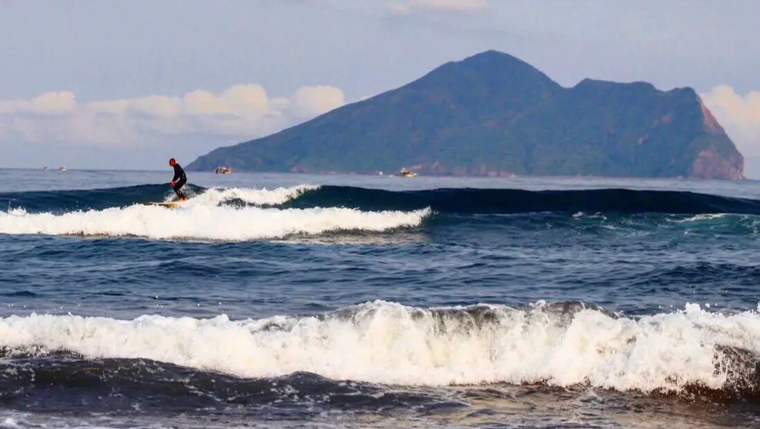
Wai'ao Beach (aka Gangao Beach 港澳沙灘, or Wai'ao Ocean Recreation Area 外澳海水浴場) in Toucheng township of Yilan County is one of the most popular surfing destinations in Taiwan. It features a long flat sandy beach and constant waves. It is also a special beach in Taiwan because you have a constant view of another island in the distance, Turtle Island. It is definitely a great beach worth visiting.
Background: The name Wai'ao Beach comes from "Wai (meaning outside)" of the "Ao (meaning harbor)," because the beach is just past Wushi Harbor. The beach has constant waves and many surf shops and showers nearby. The beach is usually kept pretty clean and there are umbrellas that you can rent. The sand is a darker color which means it can get hot in the sun. Due to the convenient transportation to the beach, it has become one of the most popular beach destinations in northern Taiwan. Hours: 24/7 Price: Free: You can book surfing lessons in Yilan on Klook here. Tours and Activities: You can purchase tours and tickets for many activities in Yilan such as Su'ao Crayon Castle, Taipingshan, Turtle Island, Lanyang Museum, Toucheng Leisure Farm, Zhang Mei Ama Capybura Farm, Bambi Land, Yinong Ranch, National Center for Traditional Arts, Taxi Museum, Glamping, Camping, ATV / 4-wheeling experience, SUP / paddle boarding, Ximeng Forest Theater, Surfing, Kayaking, Horse Riding, River Tracing, River Rafting, River Tubing, Pack Rafting, Water Biking, Snorkeling, Canoeing, Shrimping and many others through Klook here or KKday here. Accommodation: Looking for a hotel? We recommend booking through Agoda here, which provides the best quality selection of accommodation on the islands. We have stayed at and recommend Ying Shih Guest House, a resort in Datong Township near Taipingshan and Fan Fan Hot Spring (you can book on Agoda here or Booking.com here), and Jiaosi Hotspring Hotel, a hotel with hot springs in each room (you can book on Agoda here, Booking.com here, Hotels.com here, Expedia here, or Trip.com here). We have also stayed at Toucheng Leisure Farm, a recreational farm and experience center in Toucheng (you can book on Agoda here, Booking.com here, Hotels.com here, Expedia here, on Klook here, or on Trip.com here). You can also book Wifi and SIM cards for Taiwan on Gigago here. Need travel insurance? Compare prices on Insubuy here. Just to let you know, if you book using the links above, we get some commission at no cost to you, and you can help support our blog. You can click here to receive $5 USD on your first Klook purchase. How to get there: By Car: Take national highway 5 east to Yilan and then turn north to Toucheng. There is free parking near the community development center (頭城鎮港口社區發展協會), and the beach is just a short walk from there. You can search Klook here or KKday here to look for options. You can also check out our scooter rental guide here. If you are looking for car rentals in Yilan, you can also search Klook here or KKDay here. You can also check out our car rental guide here. By Train: Take the TRA to Wai'ao train station. It's about an hour ride from Taipei. From Wai'ao station, the beach is literally just a few steps away. You can book tickets to travel to Yilan via inter-city bus on Klook here. You can book tickets to Yialn via high speed rail (HSR) on Klook here or KKDay here. Book tickets via the normal train (TRA) on Klook here. Bicycle rental: Cycling is the best way to enjoy Taiwan's landscapes if you have the time and energy. Looking for bicycle rentals in Taiwan? You can search on KKday here and search for tours on Klook here. You can also check out our Taiwan cycling guide here. Map: See below: 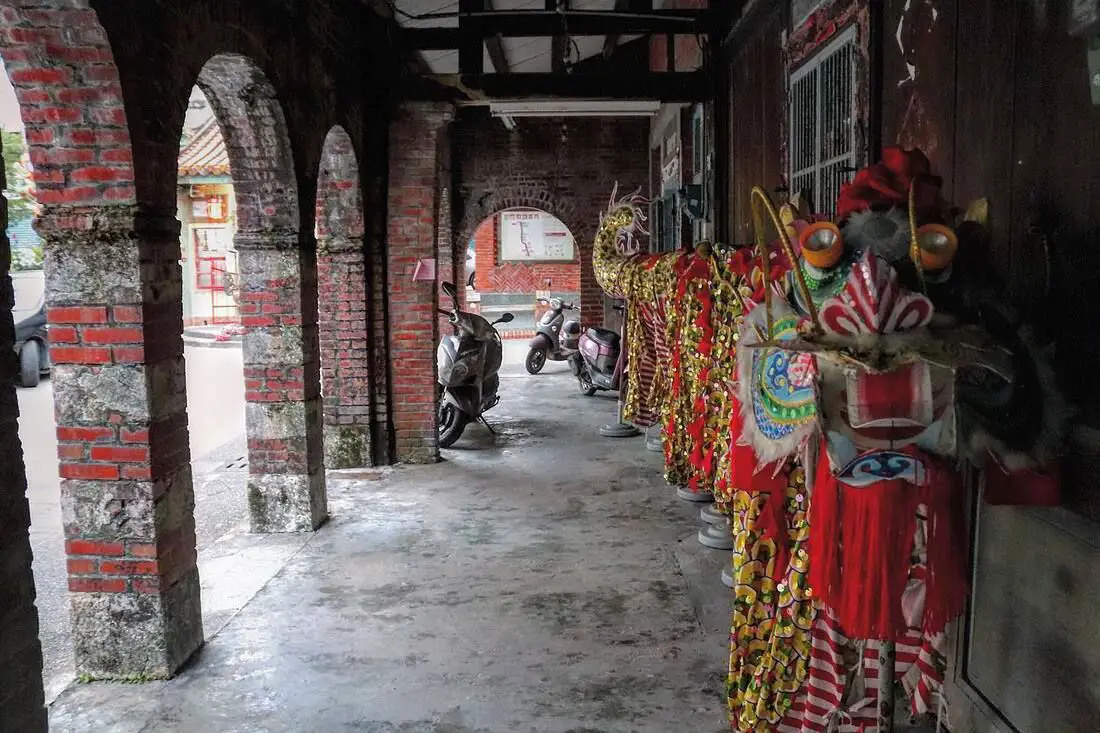
Toucheng Old Street (officially Heping Street 和平街) is the oldest street in Yilan, dating back to the Qing Dynasty. It was once the economic center of Yilan, but it's importance was later replaced. Now it sits as a monument to the past, with few changes as compared to its former glory. It's definitely worth a stop on your trip through Yilan.
Background: Before Chinese settlers came, the area around Toucheng was inhabited by the Ketagalan Aboriginal tribe, whose language is now extinct. The name Toucheng literally means "first town" in Chinese, because it was the first settlement in Yilan, settled in the late 1700s. With the nearby Wushih and Touwei Harbors around the same time, it became the economic focal point of Yilan. However in the late 1800s and early 1900s Wushih Harbor and Touwei Harbor silted in, reducing their function. With the advent of the Japanese built Yilan railway line in the mid-1900's, as well as constant floods and continually silting of the harbors, Toucheng Old Street quickly lost its importance economically and fell into decay. The old street has two temples, the major one being Toucheng Qingyuan Temple (頭城慶元宮) which dates back to 1796. Currently the old street is a moderately popular tourist attraction with only a few shops. Hours: 24/7 Price: Free Tours and Activities: You can purchase tours and tickets for many activities in Yilan such as Su'ao Crayon Castle, Taipingshan, Turtle Island, Lanyang Museum, Toucheng Leisure Farm, Zhang Mei Ama Capybura Farm, Bambi Land, Yinong Ranch, National Center for Traditional Arts, Taxi Museum, Glamping, Camping, ATV / 4-wheeling experience, SUP / paddle boarding, Ximeng Forest Theater, Surfing, Kayaking, Horse Riding, River Tracing, River Rafting, River Tubing, Pack Rafting, Water Biking, Snorkeling, Canoeing, Shrimping and many others through Klook here or KKday here. Accommodation: Looking for a hotel? We recommend booking through Agoda here, which provides the best quality selection of accommodation on the islands. We have stayed at and recommend Ying Shih Guest House, a resort in Datong Township near Taipingshan and Fan Fan Hot Spring (you can book on Agoda here or Booking.com here), and Jiaosi Hotspring Hotel, a hotel with hot springs in each room (you can book on Agoda here, Booking.com here, Hotels.com here, Expedia here, or Trip.com here). We have also stayed at Toucheng Leisure Farm, a recreational farm and experience center in Toucheng (you can book on Agoda here, Booking.com here, Hotels.com here, Expedia here, on Klook here, or on Trip.com here). You can also book Wifi and SIM cards for Taiwan on Gigago here. Need travel insurance? Compare prices on Insubuy here. Just to let you know, if you book using the links above, we get some commission at no cost to you, and you can help support our blog. You can click here to receive $5 USD on your first Klook purchase. How to get there: By Car/Scooter: Take national highway 5 east to Yilan and then turn north to Toucheng. There is free parking near the community development center (頭城鎮港口社區發展協會), and the beach is just a short walk from there. Looking for scooter rental in Yilan? You can search Klook here or KKday here to look for options. You can also check out our scooter rental guide here. If you are looking for car rentals in Yilan, you can also search Klook here or KKDay here. You can also check out our car rental guide here. By Train: Take the TRA to Wai'ao train station. It's about an hour ride from Taipei. From Wai'ao station, the beach is literally just a few steps away. You can book tickets to travel to Yilan via inter-city bus on Klook here. You can book tickets to Yialn via high speed rail (HSR) on Klook here or KKDay here. Book tickets via the normal train (TRA) on Klook here. Bicycle rental: Cycling is the best way to enjoy Taiwan's landscapes if you have the time and energy. Looking for bicycle rentals in Taiwan? You can search on KKday here and search for tours on Klook here. You can also check out our Taiwan cycling guide here. Map: Please see below: 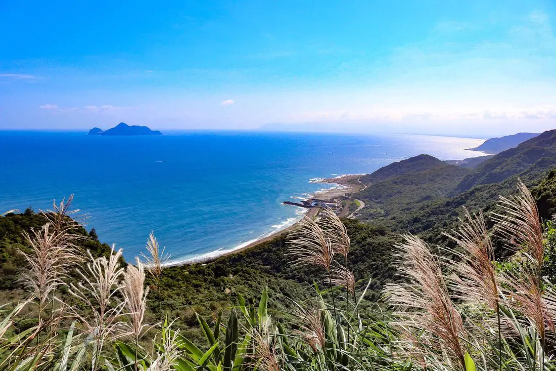
The Caoling Old Trail (aka Caoling Historic Trail) is a section of the Danlan Old Trail connecting Gongliao District of New Taipei to Dali District of Toucheng Township in Yilan. In the past it was an important shipping route for goods from Yilan to Tamsui. Now it is a popular and family friendly hiking route due to its convenient public transportation, slow elevation gain, grassy mountain hills, and great views of the surrounding area.
Background: The name Caoling comes from the mang grass (silver Miscanthus flowers 芒草) that grows on the top of the ridge on the east border of Yilan and New Taipei where there are almost no trees. The trail is said to first be made by the Plains Aboriginies to connect their tribes in the mountains of New Taipei. During the Qing Dynasty, the Caoling Old trail was an important part of the Danlan Old Trail (淡蘭古道 which means the road between Tamsui and Yilan), which was split into three paths, and the Caoling Old Trail was on the Northern Path. The Northern Path was the first path created between Yilan and Tamsui, and winded from Mengjia Old Street to Nuannuan, then to Ruifang, and onto Jiufen and Houtong. From Houtong, the road then went to Mudan and then Shuangxi, then went over the Caoling pass to Yilan. During this time, most of the things traded were tea leaves and agricultural goods. Also, it was the main route for Han Chinese immigrants to come to Yilan. In 1867 Liu Mingdeng, the commander general of Taiwan at the time, walked along the Caoling Old Trail and ran into thick fog and evil spirits. Therefore he made two stone tablets: the "tiger" tablet and the Xiongzhenbianyan Tablet to ward off evil sprits and bring good luck. Before the old Caoling Railway tunnel was completed, the last train along the Yilan Railway line stopped at Fulong, and people then walked along the Caoling Old Trail to Yilan. This is part of the reason why the trail is still preserved today. However after the tunnel was completed, people were able to travel to Yilan by train and the trail lost its importance. Later on, provincial highway 2. Now the trail see a fair amount of tourists, especially during mang grass season (from September to November). Hours: 24/7 Price: Free Difficulty: Easy but long. Length: 9.5 KM Elevation Gain: 500 meters Time Needed: Roughly 4-6 hour round trip When to go: If you don't mind the crowds, the best time to go is in Autumn during the Mang Grass season from September to November. Spring will also have nice temperatures but fewer people and no Mang Grass. Other than that, in the summer it can get really hot because there is little shade on the grassy mountain top, and in the winter it can get really cold and windy. Tours and Activities: You can purchase tours and tickets for many activities in Yilan such as Su'ao Crayon Castle, Taipingshan, Turtle Island, Lanyang Museum, Toucheng Leisure Farm, Zhang Mei Ama Capybura Farm, Bambi Land, Yinong Ranch, National Center for Traditional Arts, Taxi Museum, Glamping, Camping, ATV / 4-wheeling experience, SUP / paddle boarding, Ximeng Forest Theater, Surfing, Kayaking, Horse Riding, River Tracing, River Rafting, River Tubing, Pack Rafting, Water Biking, Snorkeling, Canoeing, Shrimping and many others through Klook here or KKday here. Accommodation: Looking for a hotel? We recommend booking through Agoda here, which provides the best quality selection of accommodation on the islands. We have stayed at and recommend Fullon Hotel, which has a location right on the beach in Fulong (you can book on Agoda here, Booking.com here, or Klook here). We have also stayed at Toucheng Leisure Farm, a recreational farm and experience center in Toucheng (you can book on Agoda here, Booking.com here, Hotels.com here, Expedia here, on Klook here, or on Trip.com here). You can also book Wifi and SIM cards for Taiwan on Gigago here. Need travel insurance? Compare prices on Insubuy here. Just to let you know, if you book using the links above, we get some commission at no cost to you, and you can help support our blog. You can click here to receive $5 USD on your first Klook purchase. How to get there: By Train: Take the TRA to Fulong Station (or Dali Station), the old trail starts from each station. You can book tickets to travel to Yilan via inter-city bus on Klook here. You can book tickets to Yialn via high speed rail (HSR) on Klook here or KKDay here. Book tickets via the normal train (TRA) on Klook here. Bicycle rental: Cycling is the best way to enjoy Taiwan's landscapes if you have the time and energy. Looking for bicycle rentals in Taiwan? You can search on KKday here and search for tours on Klook here. You can also check out our Taiwan cycling guide here. By Car/Scooter: From Taipei, on provincial highway 5 until you reach Keelung, then take provincial highway 2B to Gongliao. If you want to shorten the hike, you can park at Yuanwangkeng Park (遠望坑親水公園), but you will have to turn around once you reach the top. If you start from either of the train stations, you can walk the full 9.5 KM loop and get back to where you started by train. Looking for scooter rental in Yilan? You can search Klook here or KKday here to look for options. You can also check out our scooter rental guide here. If you are looking for car rentals in Yilan, you can also search Klook here or KKDay here. You can also check out our car rental guide here. Map: Please see below (the trail is the path on the left): 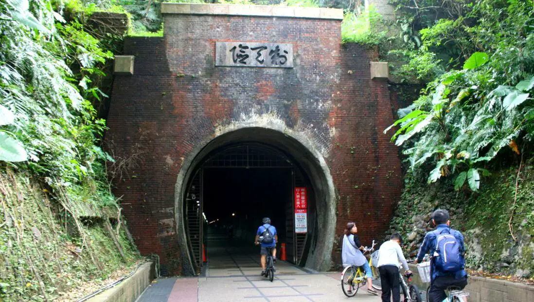
The Fulong-Coaling-Sandiao Cape- bike route is one of the most biker friendly routes in Taiwan, the roughly 2 hour loop is something that the whole family can enjoy. It includes a 2KM ride through the Old Coaling Railroad Tunnel, as well as a ride along the Sandiao Cape coast on an enclosed bike path, where one can enjoy great views of the ocean, Turtle Island, wavy geological features on the coastline, and historical stone villages along the way. This bike route is highly recommended for people of all ages.
Background: The area around Fulong was originally inhabited by the Basay indigenous tribe who has a village and hunting grounds there. In 1626, the Spanish landed near Fulong and renamed the location Santiago (transliterated from Taiwanese as Sandiao 三貂, as in Sandiao Cape). After the Qing colonized Taiwan, many Fujianese fisherman relocated to the area and began to build the iconic stone houses you can see today. The Old Caoling Tunnel was built in 1924 during the Japanese occupation of Taiwan, and is 2,167 meters long. At the time it was built, it was the longest tunnel in Taiwan. The tunnel took 3 years to build due to delays from Malaria, remoteness of the location, and digging accidents killing 11 people and injuring over 300. The tunnel was only one lane wide, too narrow for electric trains, and so was decommissioned in 1985 and lay waste for 22 years. The tunnel was reopened when the Coaling Bicycle Loop was created in 2007, using the old Caoling Tunnel as its main looping point. Also, along the northeast coast are some old fishing villages that have been around since the Qing Dynasty, including traditional stone houses. One of these historical villages called Magang (馬崗) is in threat of destruction to make way for a resort. however as Li Yongping out it "The thing that attracts modern travelers most is not 5 star hotels, but history and culture!" Save the Magang Stone Houses! Besides these historical sites, there is amazing scenery along the bike ride, such as views of Turtle Island and long flat sections of layered rock (see below to know what I am talking about). Price: Bicycle Rental: 100-500 NT depending on the bike Electric Bicycle Rental: 300-400 NT You can search for bike rentals on KKday here and search for tours on Klook here. You can also check out our Taiwan cycling guide here. Riding Time: The whole bike route is about 20 KM and takes 1-2 hours to complete. We were going really slow with many pit stops and it took us 2 hours. Hours: The Old Caoling Tunnel is open from 8:30 AM - 5:00 PM. It is okay to walk through the tunnel on weekdays, but on weekends only bike traffic is allowed for safety reasons. When to go: May to October when the weather is nice and the water is warm. Winter on the northeast coast is cold and windy. Tours and Activities: You can purchase tours and tickets for many activities in Yilan such as Su'ao Crayon Castle, Taipingshan, Turtle Island, Lanyang Museum, Toucheng Leisure Farm, Zhang Mei Ama Capybura Farm, Bambi Land, Yinong Ranch, National Center for Traditional Arts, Taxi Museum, Glamping, Camping, ATV / 4-wheeling experience, SUP / paddle boarding, Ximeng Forest Theater, Surfing, Kayaking, Horse Riding, River Tracing, River Rafting, River Tubing, Pack Rafting, Water Biking, Snorkeling, Canoeing, Shrimping and many others through Klook here or KKday here. Accommodation: Looking for a hotel? We recommend booking through Agoda here, which provides the best quality selection of accommodation on the islands. We have stayed at and recommend Fullon Hotel, which has a location right on the beach in Fulong (you can book on Agoda here, Booking.com here, or Klook here). We have also stayed at Toucheng Leisure Farm, a recreational farm and experience center in Toucheng (you can book on Agoda here, Booking.com here, Hotels.com here, Expedia here, on Klook here, or on Trip.com here). You can also book Wifi and SIM cards for Taiwan on Gigago here. Need travel insurance? Compare prices on Insubuy here. Just to let you know, if you book using the links above, we get some commission at no cost to you, and you can help support our blog. You can click here to receive $5 USD on your first Klook purchase. How to get there: By Train: Take the TRA train to Fulong Station. Walk straight from the station and you will see tons of bike rental shops. You can book tickets to travel to Yilan via inter-city bus on Klook here. You can book tickets to Yialn via high speed rail (HSR) on Klook here or KKDay here. Book tickets via the normal train (TRA) on Klook here. Bicycle rental: Cycling is the best way to enjoy Taiwan's landscapes if you have the time and energy. Looking for bicycle rentals in Taiwan? You can search on KKday here and search for tours on Klook here. You can also check out our Taiwan cycling guide here. By Car/Scooter: Take provincial highway 2 from Qidu in Keelung through the mountains past Shifen and Shuangxi until you reach Gongliao on the coast. The beach is right in front of the train station, and there is free parking in front of Dongxing Temple. From there you can walk to the train station where there are bike rentals everywhere. Looking for scooter rental in Yilan? You can search Klook here or KKday here to look for options. You can also check out our scooter rental guide here. If you are looking for car rentals in Yilan, you can also search Klook here or KKDay here. You can also check out our car rental guide here. Map: Please see below: 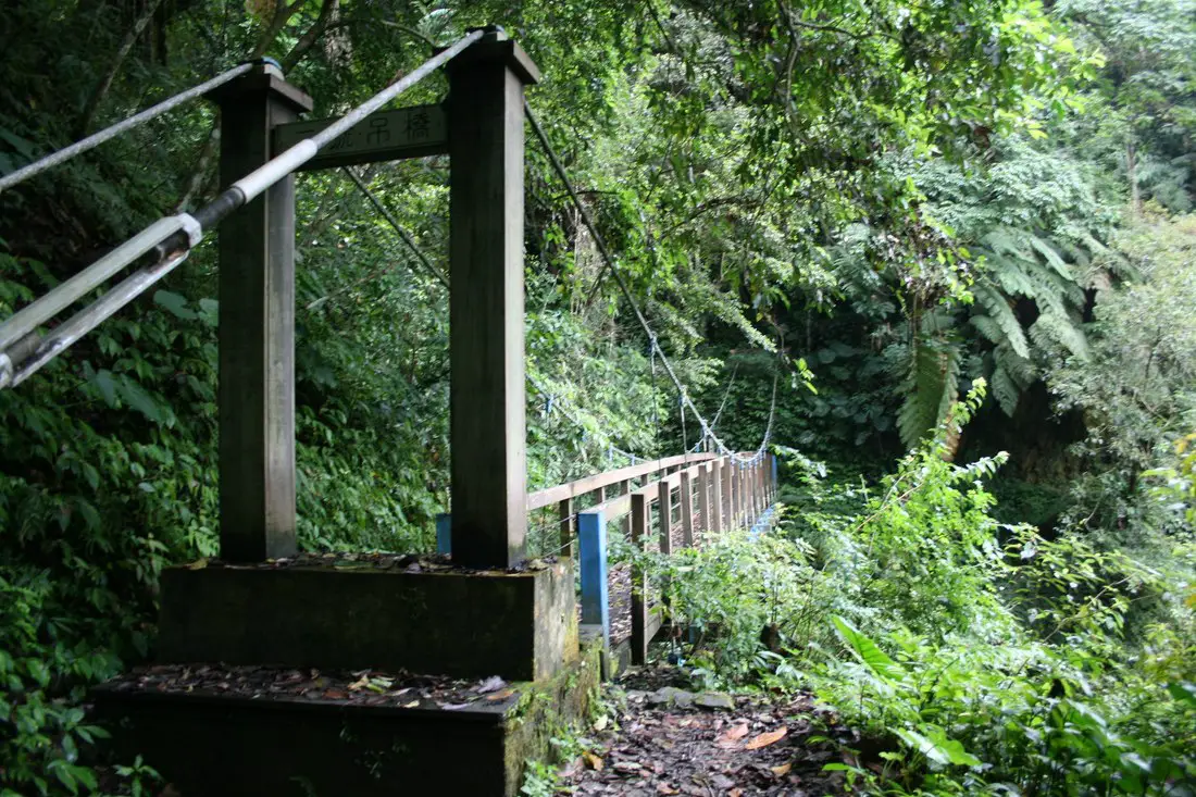
Nanao Old Trail (aka Nanao Historic Trail or Nanao Old Raod) is a historic hiking trail in Yilan County, Taiwan. It was once a major route for the Ayatal aboriginal tribe, and was improved by during the Japanese colonial era. Now you can hike only a small section of the original trail, but you can still see beautiful mountainous scenes, rivers, and wildlife, as well as appreciate the history here.
Background: Nanao Old trail was an important trail built by the Ayatal Indigenous Tribe in Taiwan to connect villages in the mountains of Yilan. In 1874, the Qing Dynasty blasted a road through Ayatal lands from Yilan to Hualien, but after a few years they were unable to maintain it due to constant attacks from the Ayatal tribesmen. Therefore the road was soon abandoned. During the Japaneses era in the early 1900s, the Japanese pacified the local people, and improved the Nanao Old Trail and set up police stations and checkpoints along the road to better control the native population and obtain resources in the area. The road stretched 27.5KM from Nanao to Datong Township. After the ROC took control of Taiwan, the trail was opened for recreational purposes. In 2012, most of the trail was closed due to damage from Typhoon Saola (蘇拉), and has never been fully repaired. Now only 3 kilometers of the original trail remain open to the public. Hours: 24/7 Price: Free Length: 3KM one way, about 3 hours Tours and Activities: You can purchase tours and tickets for many activities in Yilan such as Su'ao Crayon Castle, Taipingshan, Turtle Island, Lanyang Museum, Toucheng Leisure Farm, Zhang Mei Ama Capybura Farm, Bambi Land, Yinong Ranch, National Center for Traditional Arts, Taxi Museum, Glamping, Camping, ATV / 4-wheeling experience, SUP / paddle boarding, Ximeng Forest Theater, Surfing, Kayaking, Horse Riding, River Tracing, River Rafting, River Tubing, Pack Rafting, Water Biking, Snorkeling, Canoeing, Shrimping and many others through Klook here or KKday here. Accommodation: Looking for a hotel? We recommend booking through Agoda here, which provides the best quality selection of accommodation on the islands. We have stayed at and recommend Ying Shih Guest House, a resort in Datong Township near Taipingshan and Fan Fan Hot Spring (you can book on Agoda here or Booking.com here), and Jiaosi Hotspring Hotel, a hotel with hot springs in each room (you can book on Agoda here, Booking.com here, Hotels.com here, Expedia here, or Trip.com here). We have also stayed at Toucheng Leisure Farm, a recreational farm and experience center in Toucheng (you can book on Agoda here, Booking.com here, Hotels.com here, Expedia here, on Klook here, or on Trip.com here). You can also book Wifi and SIM cards for Taiwan on Gigago here. Need travel insurance? Compare prices on Insubuy here. Just to let you know, if you book using the links above, we get some commission at no cost to you, and you can help support our blog. You can click here to receive $5 USD on your first Klook purchase. How to get there: By Car/Scooter: Take the Suhua Highway to Wuta, the turn west on Wutabuluo Communication Raod (武塔部落聯絡道), and keep going up the mountain valley until you reach the very end of the road. The trail starts there. Looking for scooter rental in Yilan? You can search Klook here or KKday here to look for options. You can also check out our scooter rental guide here. If you are looking for car rentals in Yilan, you can also search Klook here or KKDay here. You can also check out our car rental guide here. By Train: You can take a train to Wuta Station, and then walk or take a taxi 11 KM to the trailhead. But then you need to think how you will get back. You can book tickets to travel to Yilan via inter-city bus on Klook here. You can book tickets to Yialn via high speed rail (HSR) on Klook here or KKDay here. Book tickets via the normal train (TRA) on Klook here. Bicycle rental: Cycling is the best way to enjoy Taiwan's landscapes if you have the time and energy. Looking for bicycle rentals in Taiwan? You can search on KKday here and search for tours on Klook here. You can also check out our Taiwan cycling guide here. Map: Please see below: 
Su'ao's Crayon Castle (officially Luck Arts Crayon Factory) is a crayon factory castle in Su'Ao township in Yilan County, that has been specifically designed as a DIY experience center for kids where they can make their own arts and crafts, as well as their own set of markers, and crayon in the shape of Taiwan! The DIY activities include making markers and crayons, face painting, painting porcelain, making chalk, and water coloring. Basically, it is a paradise for young children.
Background: The Lucky Art corporation started in Yilan in 1990, and has four factories worldwide, two in Taiwan, and one in Shanghai and Vietnam. The factory in Yilan produces over 1.5 million crayons per day. In 2008, the Lucky Art corporation opened its tourist crayon factory, which now sees more than 200,000 visitors per year. In 2017, the crayon castle was expanded to double its size, and added a parking lot that can accommodate over 200 cars. Price: General DIY (4 activities and 100 NT coupon): 250 NT per person Chalk DIY: 150 NT per person Watercolor DIY: 350 NT per person Paint Porcelain: 160 NT per person Price for children under 90 CM: free Parking: Free You can buy tickets for a discount onKlook here. Tours and Activities: You can purchase tours and tickets for many activities in Yilan such as Taipingshan, Turtle Island, Lanyang Museum, Toucheng Leisure Farm, Zhang Mei Ama Capybura Farm, Bambi Land, Yinong Ranch, National Center for Traditional Arts, Taxi Museum, Glamping, Camping, ATV / 4-wheeling experience, SUP / paddle boarding, Ximeng Forest Theater, Surfing, Kayaking, Horse Riding, River Tracing, River Rafting, River Tubing, Pack Rafting, Water Biking, Snorkeling, Canoeing, Shrimping and many others through Klook here or KKday here. Accommodation: Looking for a hotel? We recommend booking through Agoda here, which provides the best quality selection of accommodation on the islands. We have stayed at and recommend Ying Shih Guest House, a resort in Datong Township near Taipingshan and Fan Fan Hot Spring (you can book on Agoda here or Booking.com here), and Jiaosi Hotspring Hotel, a hotel with hot springs in each room (you can book on Agoda here, Booking.com here, Hotels.com here, Expedia here, or Trip.com here). We have also stayed at Toucheng Leisure Farm, a recreational farm and experience center in Toucheng (you can book on Agoda here, Booking.com here, Hotels.com here, Expedia here, on Klook here, or on Trip.com here). You can also book Wifi and SIM cards for Taiwan on Gigago here. Need travel insurance? Compare prices on Insubuy here. Just to let you know, if you book using the links above, we get some commission at no cost to you, and you can help support our blog. You can click here to receive $5 USD on your first Klook purchase. Hours: 8:30 AM to 6PM (Tickets not sold after 4 PM. Sessions every half hour.) How to get there: By Car/Scooter: Take National Freeway 5 south until it ends. You will see the Crayon Factory on your right as the road becomes the Haishan West Road. Looking for scooter rental in Yilan? You can search Klook here or KKday here to look for options. You can also check out our scooter rental guide here. If you are looking for car rentals in Yilan, you can also search Klook here or KKDay here. You can also check out our car rental guide here. By Train: Take the TRA to Xinma Station (新馬站) and then walk or take a taxi the remaining 500 meters to the crayon factory. You can book tickets to travel to Yilan via inter-city bus on Klook here. You can book tickets to Yialn via high speed rail (HSR) on Klook here or KKDay here. Book tickets via the normal train (TRA) on Klook here. Bicycle: Cycling is the best way to enjoy Taiwan's landscapes if you have the time and energy. Looking for bicycle rentals in Taiwan? You can search on KKday here and search for tours on Klook here. You can also check out our Taiwan cycling guide here. Map: Please see below: 
Nanfang'ao is the third-largest fishing harbor in Taiwan and is an important part of the local economy. Just above the harbor along the Suhua highway is an amazing lookout that gives a 180-degree view of southern Yilan, Su'ao, and the surrounding area. It is definitely worth a stop on your next trip to the east coast of Taiwan.
Background: The first path between Su'ao and Hualien was a trail built in the Qing Dynasty that was completed in 1876, for the Qing to better control aboriginal peoples on the east coast. Later after Japan took control of Taiwan, they widened the path and built 9 bridges and 14 tunnels along the way, making it drivable for cars (one way only) by 1932. Because much of the road was next to cliffs that underwent constant landslides, it was considered one of the most dangerous roads in the world at the time. In the 1980s the ROC government further widened the road, and the two-lane highway was completed in 1990. In 2020, the section of road between Su'ao and Dong'ao was bypassed by a tunnel. Nanfang'ao is the third-largest fishing harbor in Taiwan and is an important part of the local economy. There is a popular fish and seafood market there that is open from 3 PM to 5 PM every day at the harbor if you a fan of fresh seafood. Price: Free Hours: 24/7 Tours and Activities: You can purchase tours and tickets for many activities in Yilan such as Su'ao Crayon Castle, Taipingshan, Turtle Island, Lanyang Museum, Toucheng Leisure Farm, Zhang Mei Ama Capybura Farm, Bambi Land, Yinong Ranch, National Center for Traditional Arts, Taxi Museum, Glamping, Camping, ATV / 4-wheeling experience, SUP / paddle boarding, Ximeng Forest Theater, Surfing, Kayaking, Horse Riding, River Tracing, River Rafting, River Tubing, Pack Rafting, Water Biking, Snorkeling, Canoeing, Shrimping and many others through Klook here or KKday here. Accommodation: Looking for a hotel? We recommend booking through Agoda here, which provides the best quality selection of accommodation on the islands. We have stayed at and recommend Ying Shih Guest House, a resort in Datong Township near Taipingshan and Fan Fan Hot Spring (you can book on Agoda here or Booking.com here), and Jiaosi Hotspring Hotel, a hotel with hot springs in each room (you can book on Agoda here, Booking.com here, Hotels.com here, Expedia here, or Trip.com here). We have also stayed at Toucheng Leisure Farm, a recreational farm and experience center in Toucheng (you can book on Agoda here, Booking.com here, Hotels.com here, Expedia here, or Trip.com here). You can also book Wifi and SIM cards for Taiwan on Gigago here. Need travel insurance? Compare prices on Insubuy here. Just to let you know, if you book using the links above, we get some commission at no cost to you, and you can help support our blog. You can click here to receive $5 USD on your first Klook purchase. How to get there: By Car/Scooter: From Su'ao or Dong'ao, take Highway 9 east along the coast. You will have to take a dangerous U-turn or left turn across double yellow lines if you come from Su'ao, so it is better to come from Dong'ao. Looking for scooter rental in Yilan? You can search Klook here or KKday here to look for options. You can also check out our scooter rental guide here. If you are looking for car rentals in Yilan, you can also search Klook here or KKDay here. You can also check out our car rental guide here. By Bus: Take the Nanfang'ao Blue line to Nanjian Shopping Center (南建購物中心) then walk up the Nanfang'ao Lookout trail about 15 minutes to the lookout. You can book tickets to travel to Yilan via inter-city bus on Klook here. You can book tickets to Yialn via high speed rail (HSR) on Klook here or KKDay here. Book tickets via the normal train (TRA) on Klook here. Bicycle rental: Cycling is the best way to enjoy Taiwan's landscapes if you have the time and energy. Looking for bicycle rentals in Taiwan? You can search on KKday here and search for tours on Klook here. You can also check out our Taiwan cycling guide here. Map: Please see below: 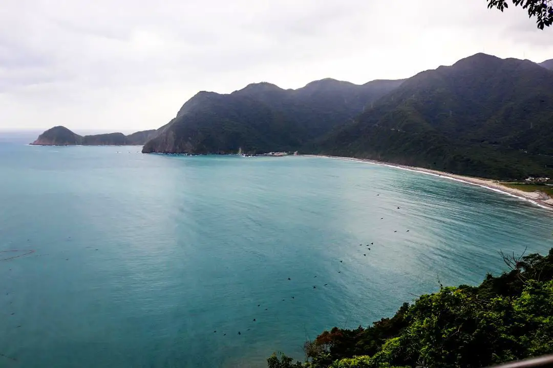
The Suhua Highway Monument (蘇花公路安魂碑) and nearby Kailu Xianfengye Temple (開路先鋒爺廟) commemorate the 13 workers who died building the road from Su'ao to Hualien from 1932 to the present. It sits on one of the most scenic viewpoints of the highway between Su'ao and Dong'ao, overlooking Dong'ao Bay. It is definitely worth a stop on your next trip to the east coast of Taiwan.
Background: The first path between Su'ao and Hualien was a trail built in the Qing Dynasty that was completed in 1876, in order for the Qing to better control aboriginal peoples on the east coast. Later after Japan took control of Taiwan, they widened the path and built 9 bridges and 14 tunnels along the way, making it drivable for cars (one way only) by 1932. Because much of the road was next to cliffs that underwent constant landslides, it was considered one of the most dangerous roads in the world at the time. In the 1980s the ROC government further widened the road, and the two-lane highway was completed in 1990. In 2020, the section of road between Su'ao and Dong'ao was bypassed by a tunnel. Kailu Xianfengye Temple was erected in 1994 near the Suhua Highway Monument to honor the thirteen lives that were lost during the construction of the Su'hua highway (two during the Japanese era and 11 during the ROC era). It is believed that the ghosts of these men had protected further construction along the highway. Price: Free Hours: 24/7 Tours and Activities: You can purchase tours and tickets for many activities in Yilan such as Zhang Mei Ama Capybura Farm, Bambi Land, Yinong Ranch, National Center for Traditional Arts, Taxi Museum, Glamping, Camping, ATV / 4-wheeling experience, SUP / paddle boarding, Ximeng Forest Theater, Surfing, Kayaking, Horse Riding, River Tracing, River Rafting, River Tubing, Pack Rafting, Water Biking, Snorkeling, Canoeing, Shrimping and many others through Klook here or KKday here. Accommodation: Looking for a hotel? We recommend booking through Agoda here, which provides the best quality selection of accommodation on the islands. We have stayed at and recommend Ying Shih Guest House, a resort in Datong Township near Taipingshan and Fan Fan Hot Spring (you can book on Agoda here or Booking.com here), and Jiaosi Hotspring Hotel, a hotel with hot springs in each room (you can book on Agoda here, Booking.com here, Hotels.com here, Expedia here, or Trip.com here). We have also stayed at Toucheng Leisure Farm, a recreational farm and experience center in Toucheng (you can book on Agoda here, Booking.com here, Hotels.com here, Expedia here, or Trip.com here). You can also book Wifi and SIM cards for Taiwan on Gigago here. Need travel insurance? Compare prices on Insubuy here. Just to let you know, if you book using the links above, we get some commission at no cost to you, and you can help support our blog. You can click here to receive $5 USD on your first Klook purchase. How to get there: By Car/Scooter: From Su'ao or Dong'ao, take Highway 9 east along the coast. You will have to take a dangerous U-turn or left turn across double yellow lines if you come from Su'ao, so it is better to come from Dong'ao. Looking for scooter rental in Yilan? You can search Klook here or KKday here to look for options. You can also check out our scooter rental guide here. If you are looking for car rentals in Yilan, you can also search Klook here or KKDay here. You can also check out our car rental guide here. By Bus: No way to get there by public transport! You can book tickets to travel to Yilan via inter-city bus on Klook here. You can book tickets to Yialn via high speed rail (HSR) on Klook here or KKDay here. Book tickets via the normal train (TRA) on Klook here. Bicycle rental: Cycling is the best way to enjoy Taiwan's landscapes if you have the time and energy. Looking for bicycle rentals in Taiwan? You can search on KKday here and search for tours on Klook here. You can also check out our Taiwan cycling guide here. Map: Please see below: |
Author 作家I am an American expat who has extensive experience living, working, and traveling in Taiwan. In my day, I had to learn many things about Taiwan the hard way. But I have come to learn that Taiwan is one of the best places in the world for Foreigners to live. This blog does not represent the opinions of every foreigner in Taiwan. I am just trying to help others learn more about this beautiful country. Categories
|
 RSS Feed
