

Datunshan in Yangmingshan National Park (aka Datun Mountain) is considered the only active volcanic peak in Taiwan, and the island's only stratovolcano. This along with Turtle Island are the two known active volcanos in Taiwan. The area is also an important ecological area with protected species. Currently access to Datunshan is closed to motor vehicles, but you can cycle or hike to the top. There is a large viewing platform that has great views of the Taipei Basin and the sunset.
Background: The area known as Yangmingshan now was formed by volcanoes about 700,000 years ago, forming many mountains about 1000 meters or less in northwestern Taiwan. The park still features active volcanoes, vents, and hot springs. The original name of the area was Caoshan (grass mountain 草山). During the Qing Dynasty, the area was used to harvest sulfur, and many of the hills were burned to help catch sulfur thieves. In 1927 during the Japanese era, Yangmingshan was made as the first national park in Taiwan, then known as Datunshan National Park Association. In 1950 after the ROC took Taiwan Chiang Kai-shek renamed the park after the philosopher Wang Yangming, and called the area Yangmingshan. In 1985, after resolving many land disputes, Yangmingshan National Park was officially designated as a national park in the ROC era. Datunshan is1092 meters tall, and is known as the only strata volcano in Taiwan. It is also known to snow in the area. Datunshan lies in Beitou District of New Taipei City. It is a popular stop in Yangmingshan and has two parking lots and visitor's center at Erziping. There is a paved road that goes to the top of the mountain. The tip of the mountain is off limits to the public and contains a weather station, but there is a large viewing platform that has great views of the Taipei Basin and the sunset. Hours: 24/7 Price: Free (parking 30 NT) You can book tours to Yangmingshan on TripAdvisor here, Klook here, or KKday here or here. Tours: You can check out tours to Yangmingshan such as a One-day Yangmingshan NP Beitou Hot Spring Park and Tamsui Tour Package, Beitou and Yangmingshan Day Tour from Taipei, One Day Hike around Yangmingshan, or Private Yangmingshan Volcano Tour and more on TripAdvisor here, Klook here, or KKday here. Difficulty: Easy: 247 meter elevation gain, 45 minutes to the top and 45 minutes back (1.5 hours round trip). There is a flat paved road to the top from Erziping, or a steeper trail from Anbu. Hotels in Taipei: High end: We have stayed at and recommend the Yuanshan Grand Hotel, once the tallest building in Taiwan and still the most grand (book on Booking.com here, Tripadvisor here, or Agoda here). We also recommend Fullon Hotel which has locations in Tamsui and Fulong near the beach (book on Booking.com here, Tripadvisor here, Agoda here, or Hotels.com here). Budget Hotels: We have stayed at and also recommend Fu Chang Hotel in Ximending, which is within walking distance of Ximending shopping district (book on Booking.com here, Tripadvisor here, or Agoda here). We have also stayed at and recommend Hai Xia Your Home which is right in front of Fulong Beach (book on Booking.com here, Tripadvisor here, Agoda here, or Hotels.com here). Looking for a hotel? We recommend booking through Booking.com here, which provides the best quality selection of accommodation in Taiwan. Find out where to stay in our Taiwan hotels guide or search for the best hotel deals in Taiwan here. How to get there: By Car/Scooter: From Taipei, take provincial highway 2A north to the Zhuzihu Lookout. Turn left at the fork to Datunshan, and keep going until you reach the first parking lot or second parking lot at Erziping. Car parking is limited on weekends and the number of cars allowed up the mountain is also limited. There is also paid scooter parking. I recommend coming up from the Anbu Trailhead to the east because there is less distance walking, but it is steeper. Looking for scooter rental in Taipei? Check out Qeeq here, Klook here, or KKday here to search for options. You can also check out our scooter rental guide here. If you are looking for car rentals, you can also search Qeeq here, Klook here, or KKday here. You can also check out our car rental guide here. By Bus: From Shilin MRT Station, Take Bus 1717 to Bailaka Highway Entrance Station (百拉卡公路入口). From there the trail entrance is about 1 KM away. You can book tickets to travel to Taipei via inter-city bus on Klook here. By Bicycle: Cycling is the best way to enjoy Taiwan's landscapes if you have the time and energy. Looking for bicycle rentals in Taiwan? You can use Taiwan's many Youbike sharing stations, or search for rentals on KKday here, and search for tours on Klook here. You can also check out our Taiwan cycling guide here. You can also book a Sunset Riverside Bike Ride and Historical Tour, 4 Hour Cycling in Taipei, Ultimate 8-Hour Cycling City Tour, or Taipei City Bike Tour with Night Market Experience on TripAdvisor here. Map: Please see below: Our Journey: I have attempted Datunshan three times and have only been up once. The reason I failed the first two times was because it was my last stop on Yangmingshan and it was just too late to start the hike. I waited many weekends for good weather, however when I went there was pretty much amazing weather all weekend except for the two hours that I was on the mountain. Originally I though you could drive to the top, and you could before, but now it seems to road is closed to motor traffic permanently (except government vehicles) to protect the endangered insect species on the mountain that are found no where else in the world.
Check out our drone video above for an overview of the area.
Or check out the 360 degree spherical panorama above from the top of the mountain.
Also here is a 360 degree spherical panorama from the side of the mountain showing the two paths up.
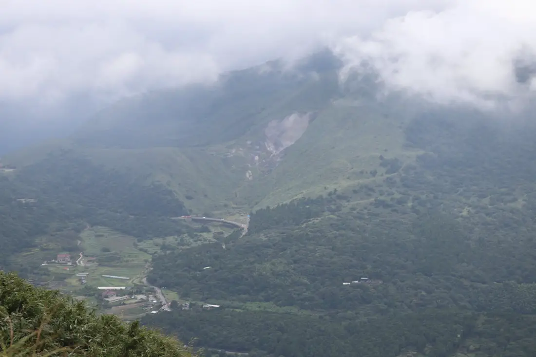
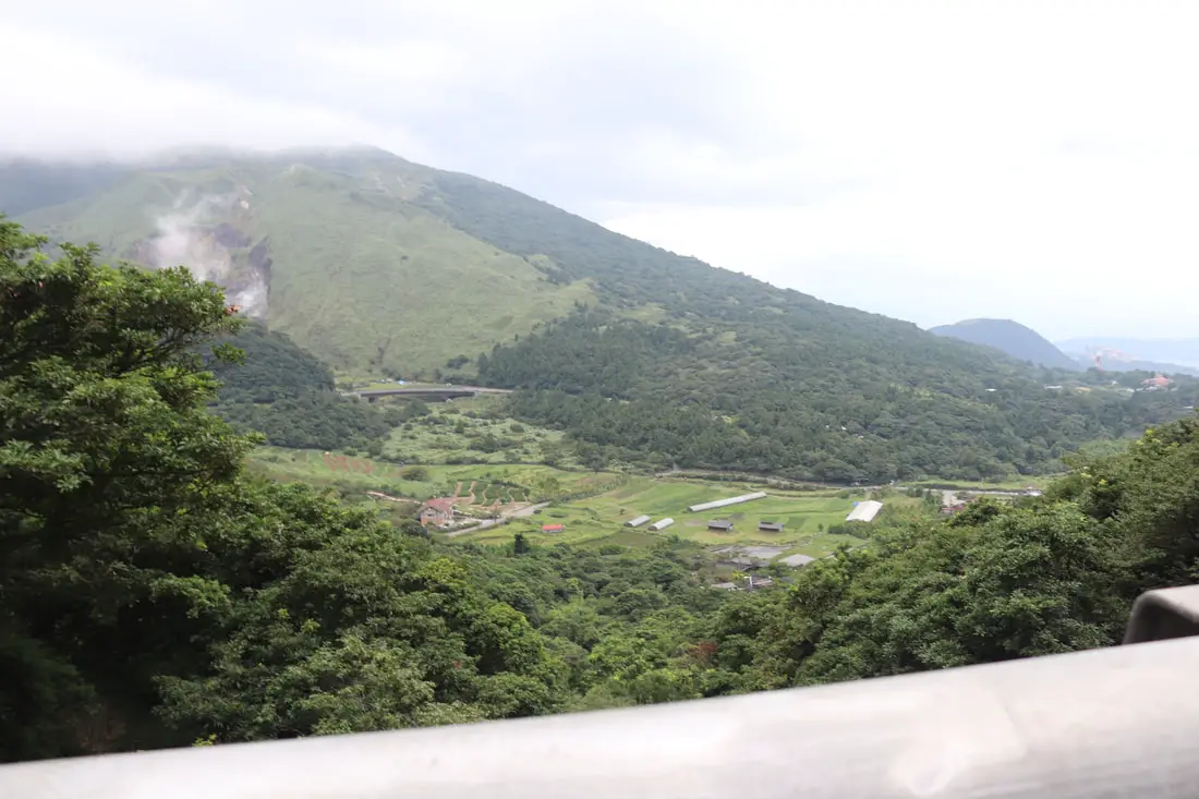
On the road up to Datunshan, you will pass other beautiful places like Zhuzihu, Dayoukeng, and Qixing Mountain.
There are also amazing views from the Bailaka on the road up to Datunshan.
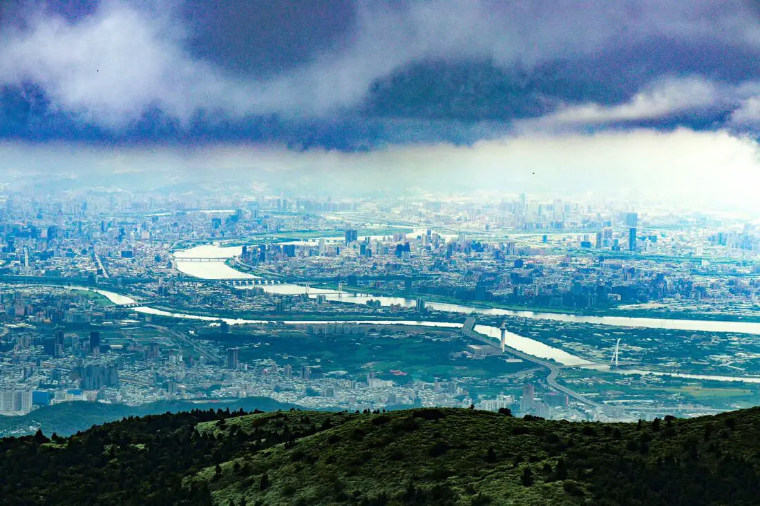
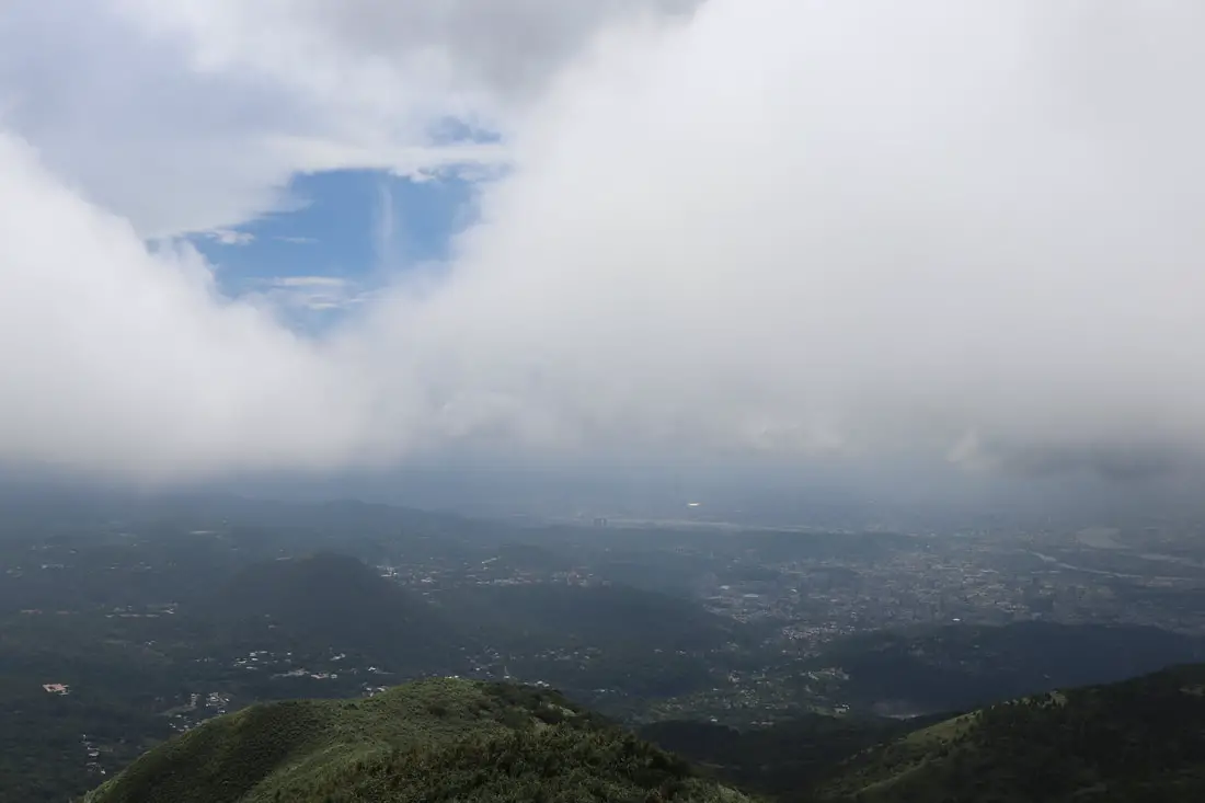
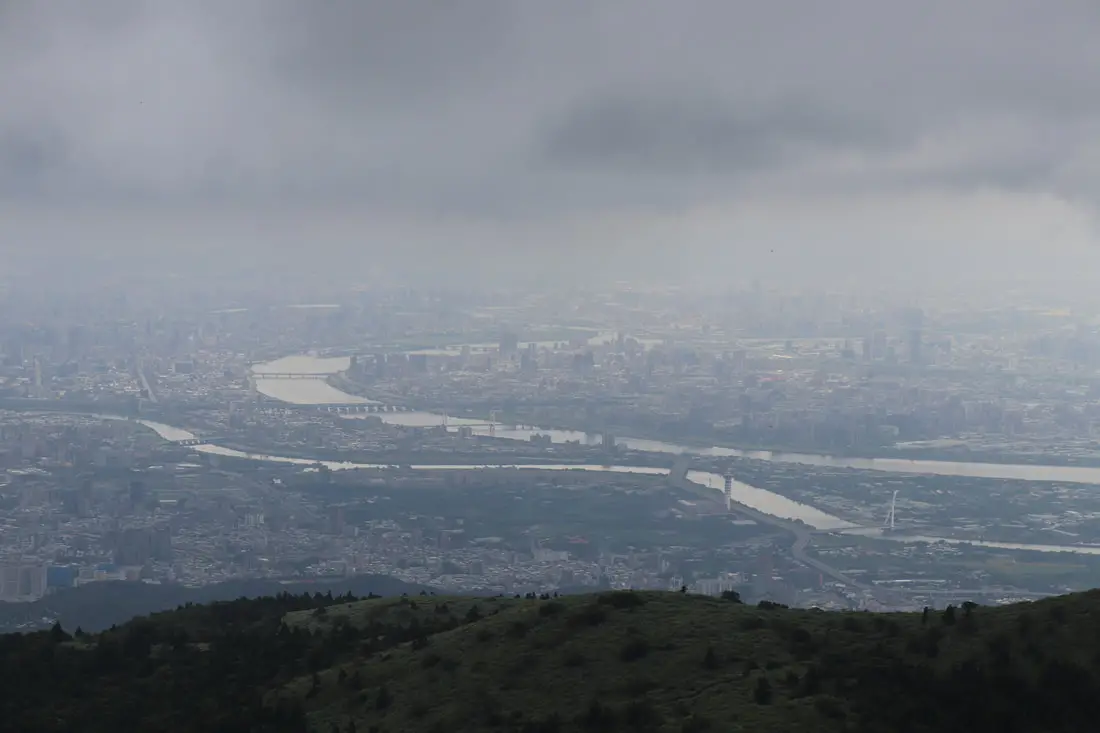
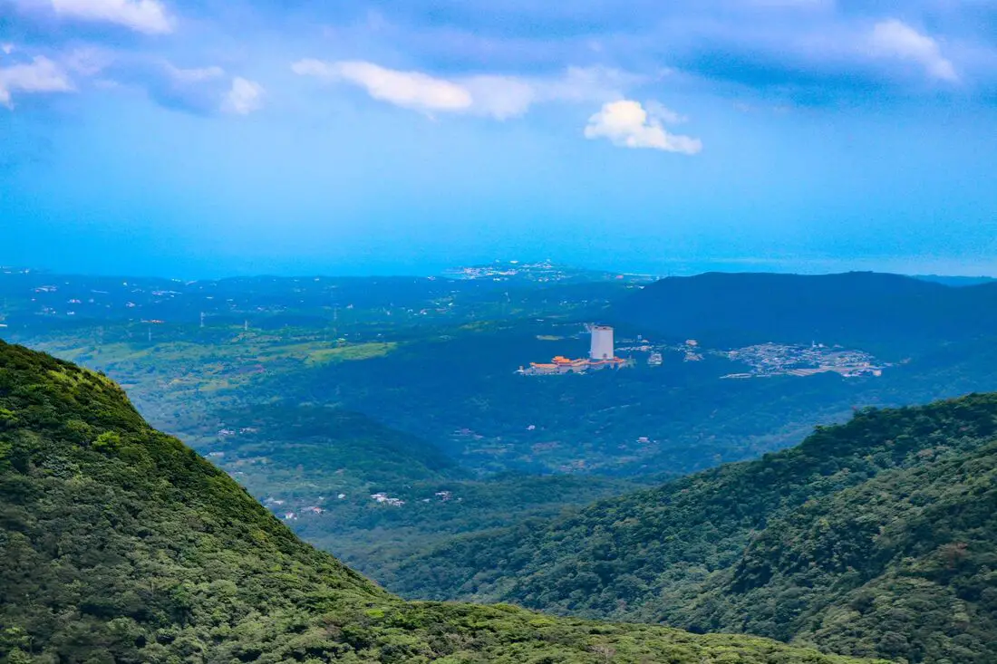
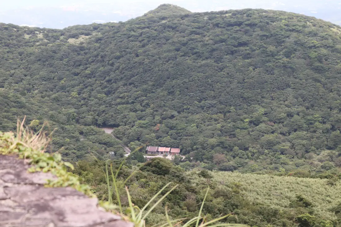
Closer view of Taipei on a clear day.
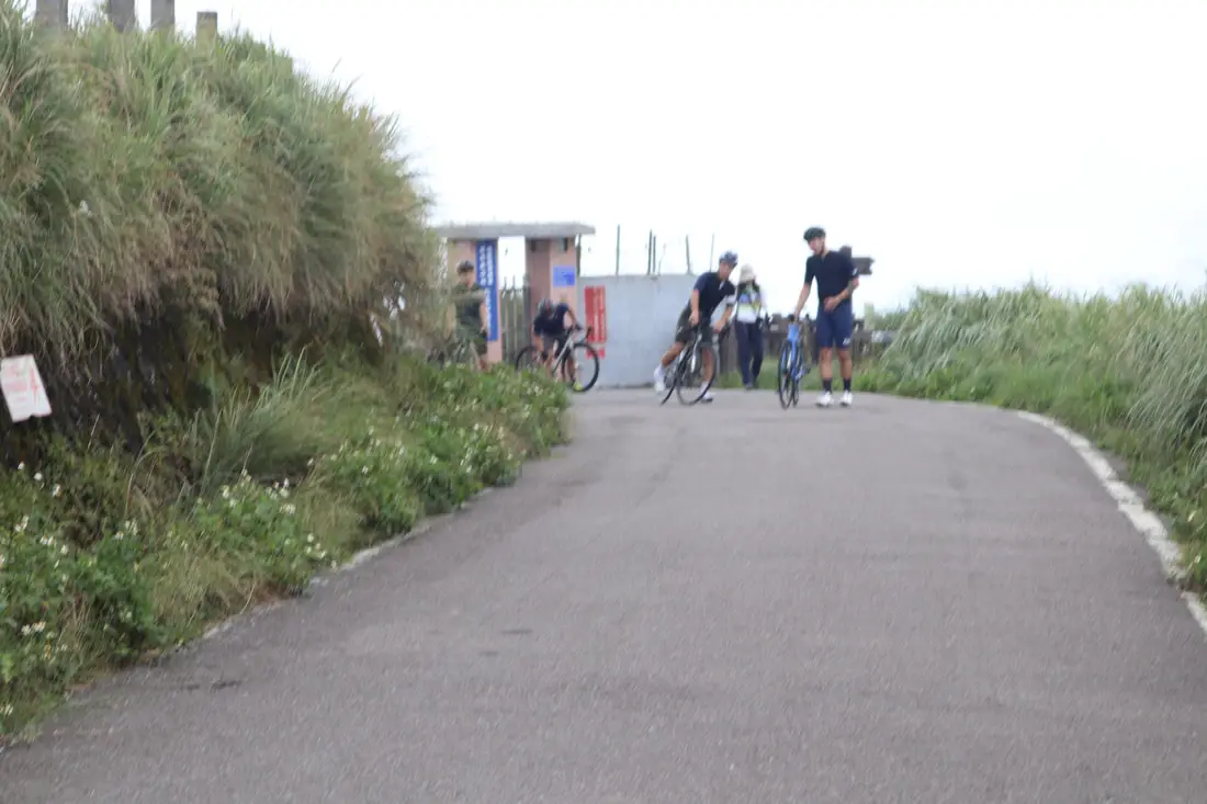
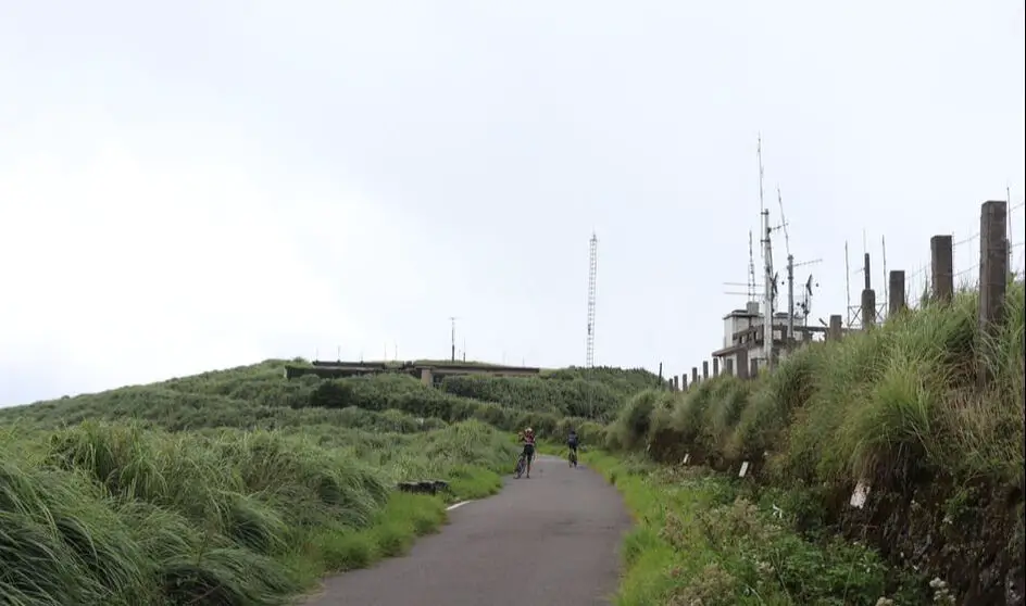
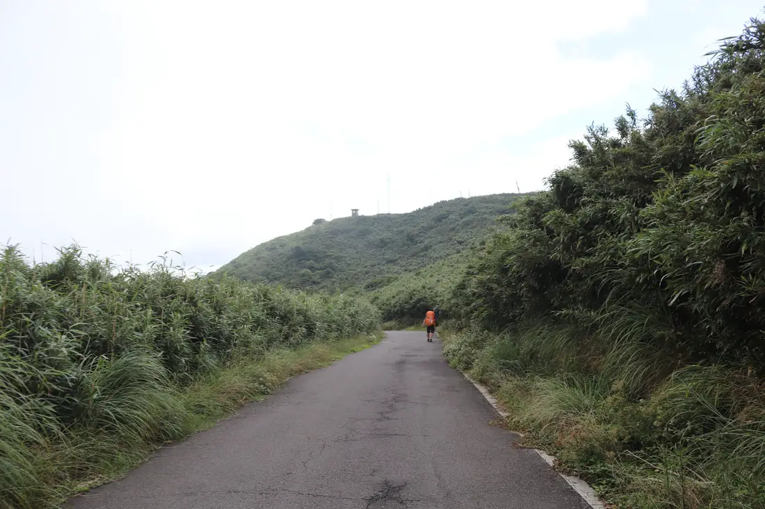
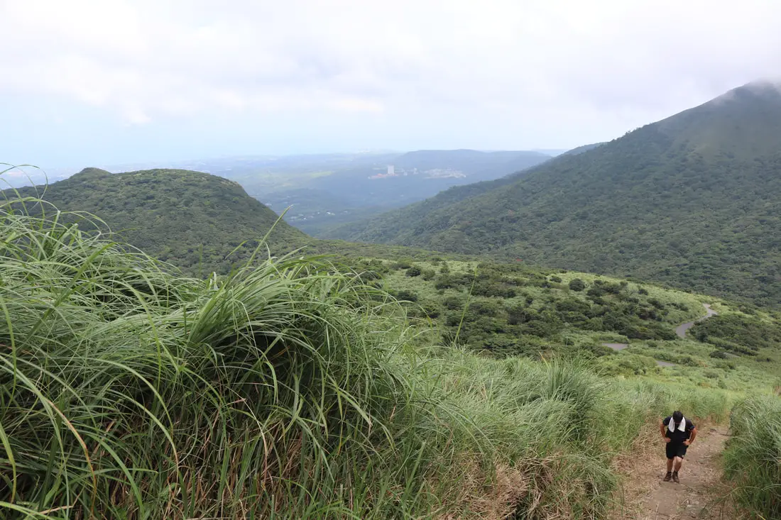
9:43 AM, we make it to the trail entrance on the southern side. You you go to the northern side you can walk up a flatter paved road to the top, but it takes longer.
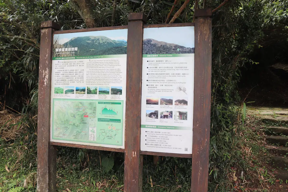
"Strolling Along the Peaks" "The Mount Datun Multi-Peak Tail runs from he Anbu Trail entrance on the Bailaka Highway (County Highway 101A) over Mt. Datun Main Peak, South Peak, and West Peak, on through Miantianping to Qingtian Temple. This is a challenging trail that is 5.8 kilometers long and takes about 4.5 hours to walk. This trail primarily follows the Mt. Datun ridgeline and offers lovely scenery all the way. Hikers can see the famous grasslands of the Yangmingshan National Park and the cityscapes of the Taipei Basin in the distance, enjoy the majestic landforms of the Datun Volcano group, and observe the historic sites along the way. If you hike the trail during the May-July butterfly watching season, you can see butterflies of many species fitting about. So we suggest that you leave yourself some extra time, prepare yourself mentally to get intimate with nature, and use your feet instead of wheels to enjoy a leisurely walk amongst the beauties of the trail." 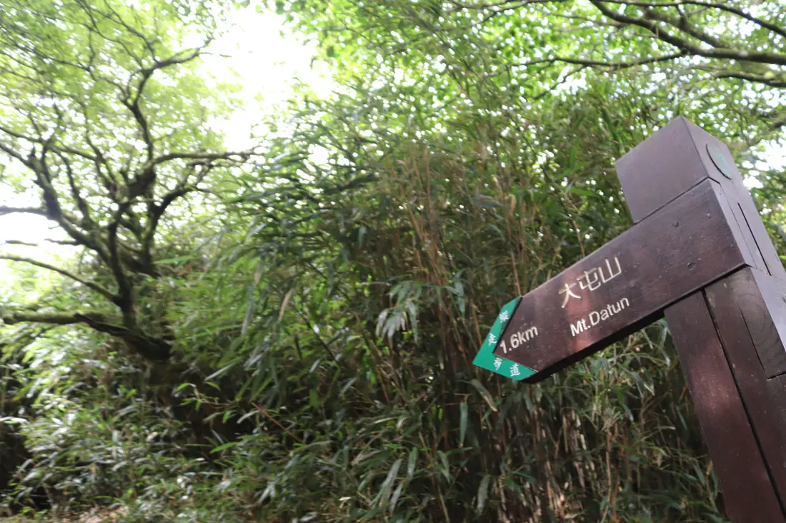
1.6 KM to the top, with about 300 meters of elevation gain.
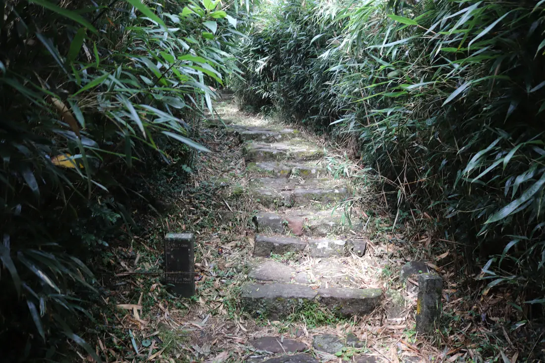
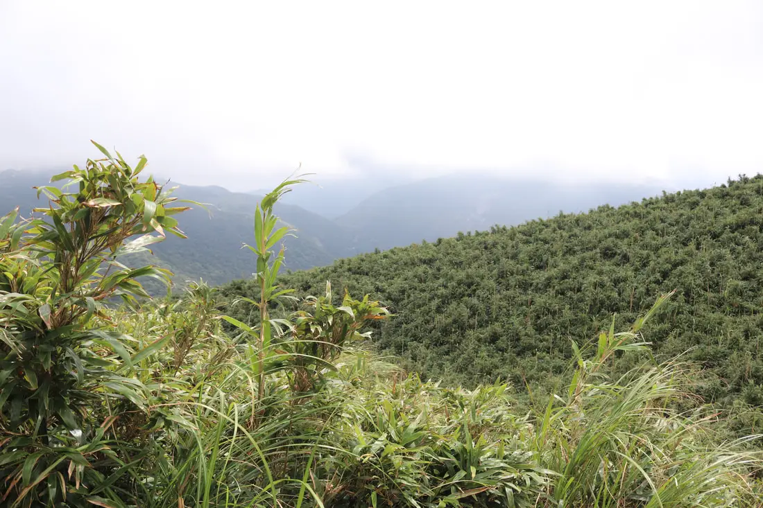
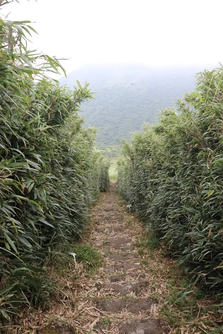
The first part of the trail is covered in bamboo.
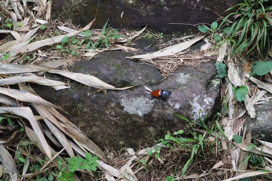
10:09 AM, we see our first bug, a large beetle. The whole mountain is an insect sancuary.
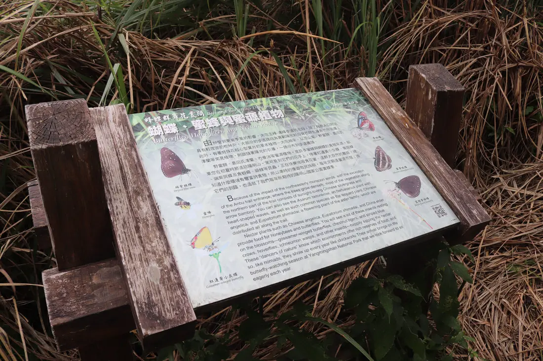
"Butterflies, honeybees, and nectar plants"
"Because of the impact of the northeasterly monsoon winds, with the exception of the Anbu trail entrance, where the trees grow densely, most of the vegetation along the northern party of the trail consists of sunlight loving Chinese silvergrass and arrow bamboo. You can also see the Asarum Taitoneses, an herbaceous plant with hearth shaped leaves, as well as such common specifies as the leopard plant. Chinese angelica, and Eupatorium shimadai, a flowering plant of the aster family, which are distributed all along the trail. Nectar plants such as Chinese angelica, Eupartirum shimadai, and China elder provide food for honeybees and butterflies. You will see a lot of these insects resting on the blossoms, goasamer winged butterflies, chestnut tigers and striped blue magpies, hoverflies, inchenuem wasps, and other insects, happily sipping the nectar. These "dancers of nature" know which environments offer rick reserves of food, and so, like nomads, they show up ever year like clockwork. Their arrival brings on the butterfly watching season at Yangminshan National Park that we look forward to so much each year." 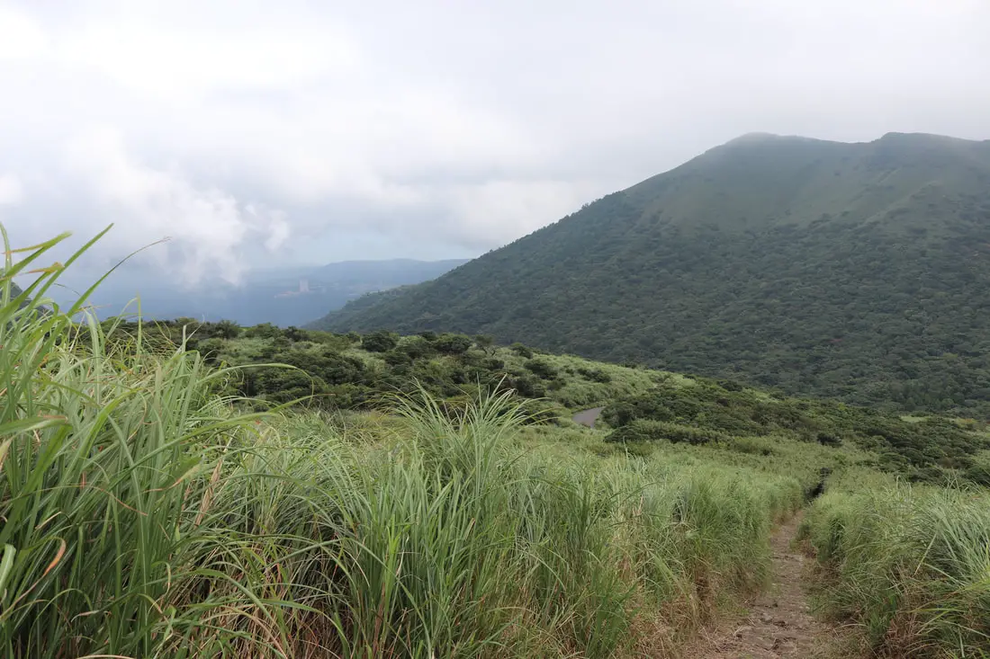
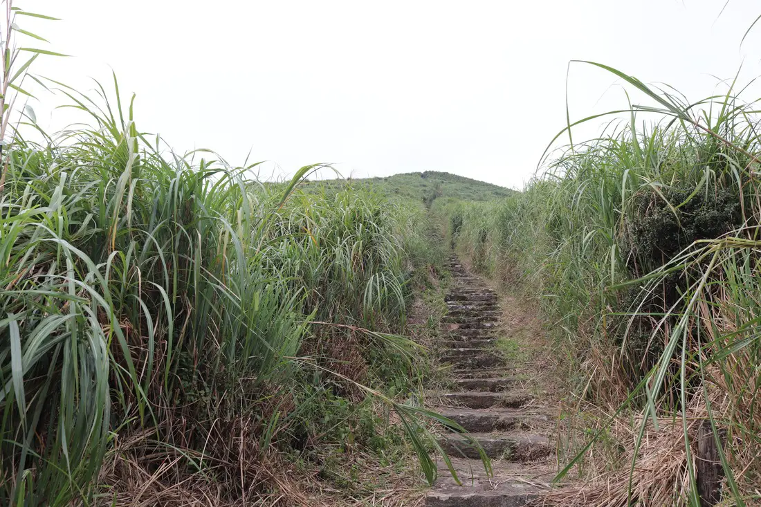
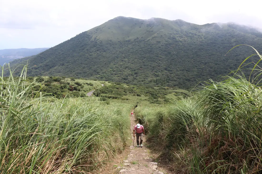
Soon the trail leaves the bamboo and you get onto the silvergrass.
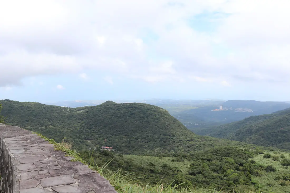
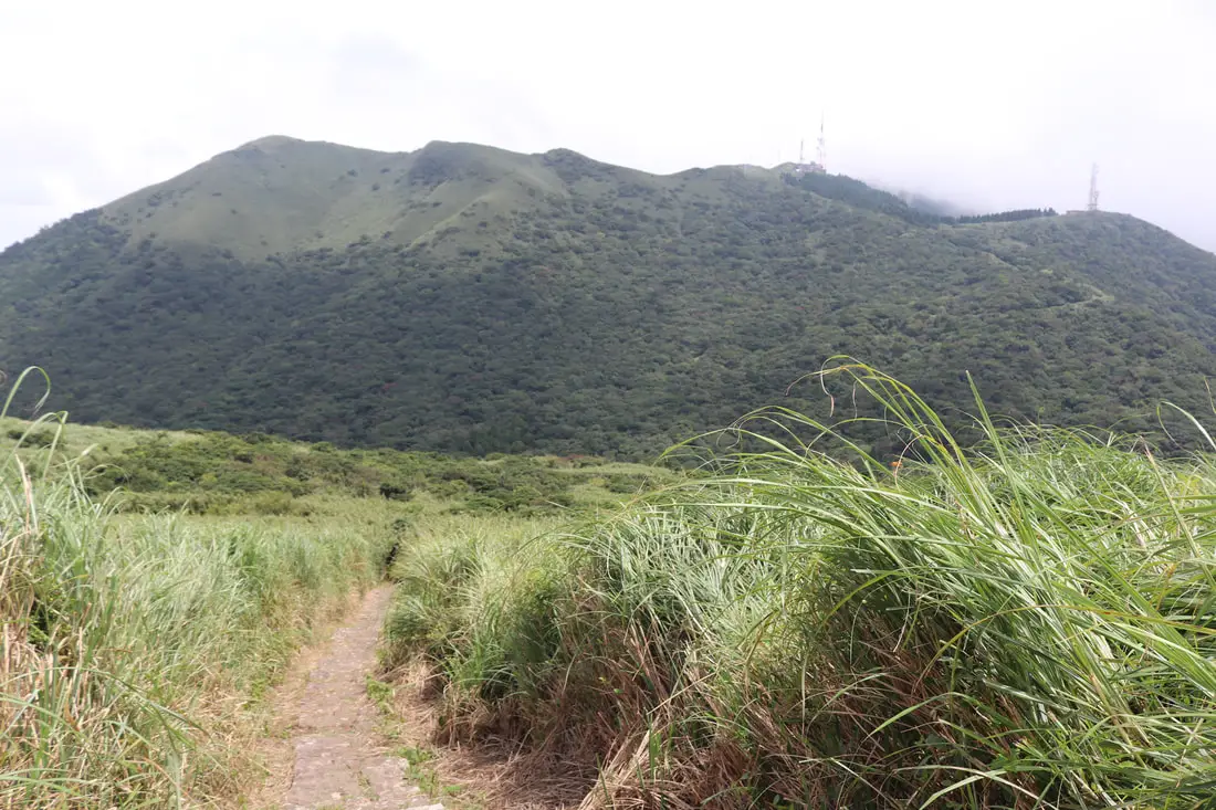
View of Little Guanyinshan from the trail.
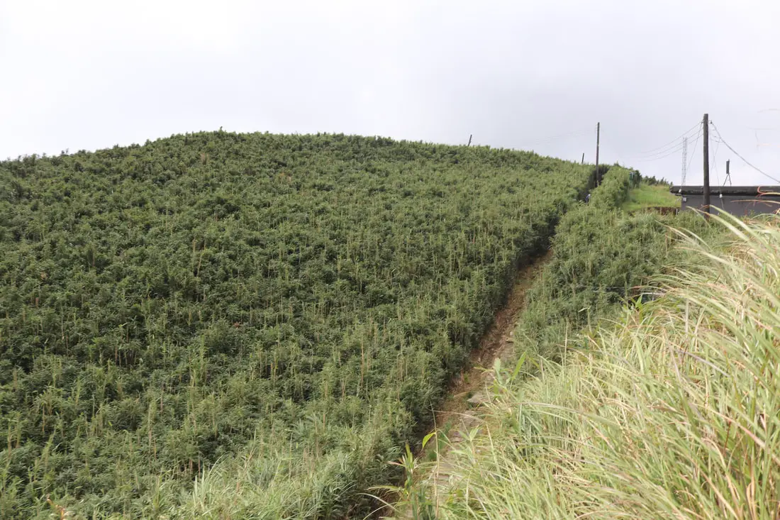
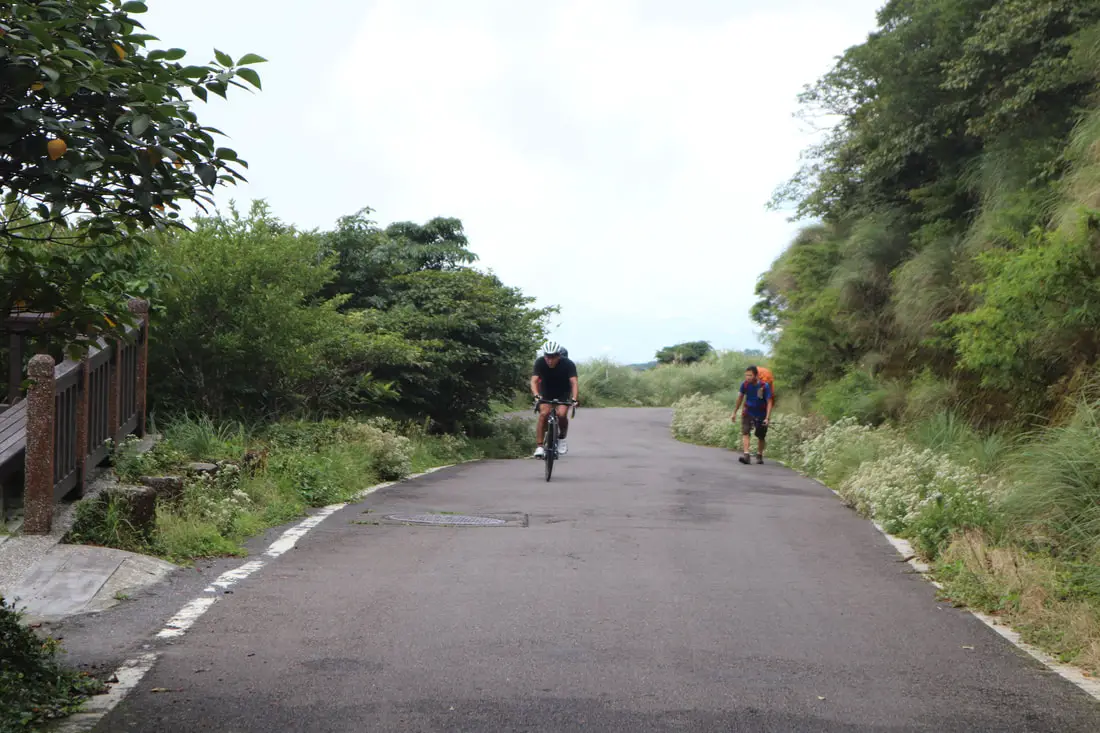
At the middle of the trail, the paved road connects with the trail. You can take the paved road here for a less gradual ascent.
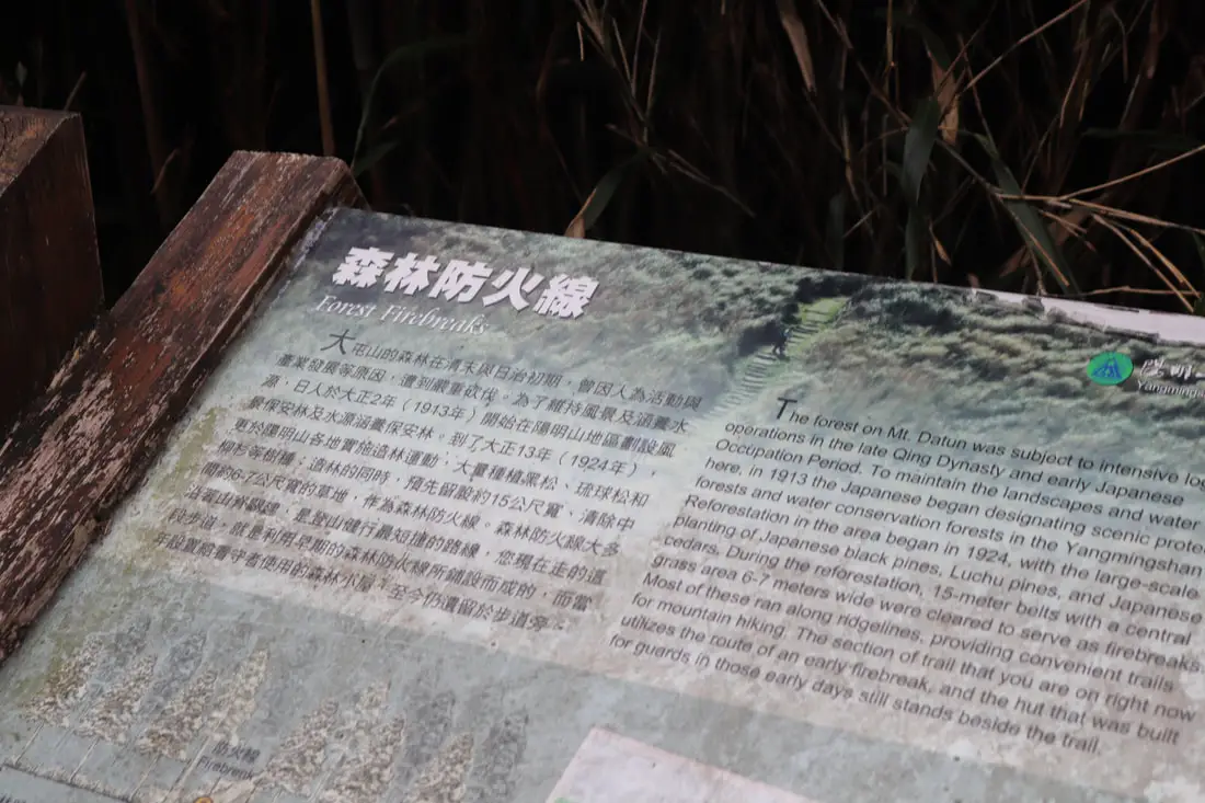
"Forest Firebreaks"
"The forest on Mt. Datun was subject to intensive logging operations in the late Qing Dynasty and early Japanese Occupation Period. To maintain the landscapes and water here, in 1913 the Japanese began designating scenic protected forests and water conservation forests in the Yangmingshan. Reforestation in the area began in 1924, with the large-scale planting of Japanese black pines, Luchu pines, and Japanese cedars. During the reforestation, 15 meter belts with a central grass area 6-7 meters wide were cleared to serve as fire breaks. Most of these ran along ridgelines, providing convenient trails for mountain hiking. The section of trail that you are on right now utilizes the route of an early firebreak, and the hut that was built for guards in those days still stands beside the trail." 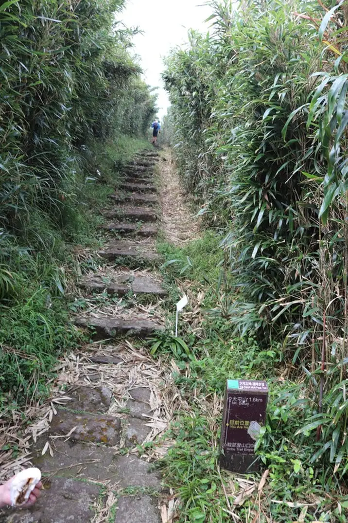
Walking up near the top of the mountain.
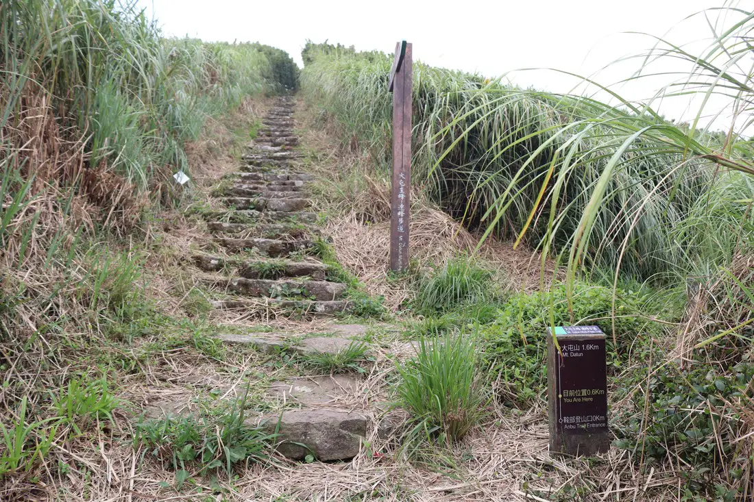
Only at .6 KM, but most of the elevation is already gained.
More walking through silvergrass.
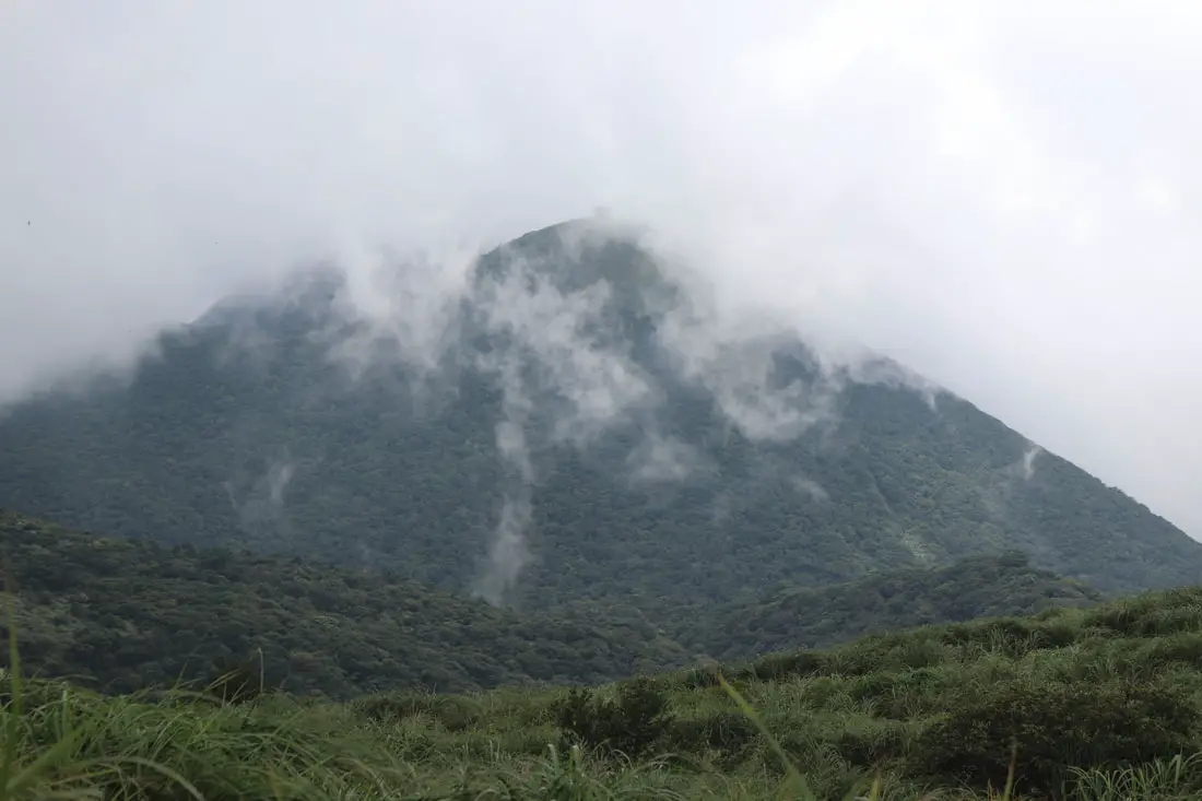
10: 17 AM, made it to the near the top of the mountain, more bamboo and clouds.
The top of the mountain is off limits. There is a fence in the way.
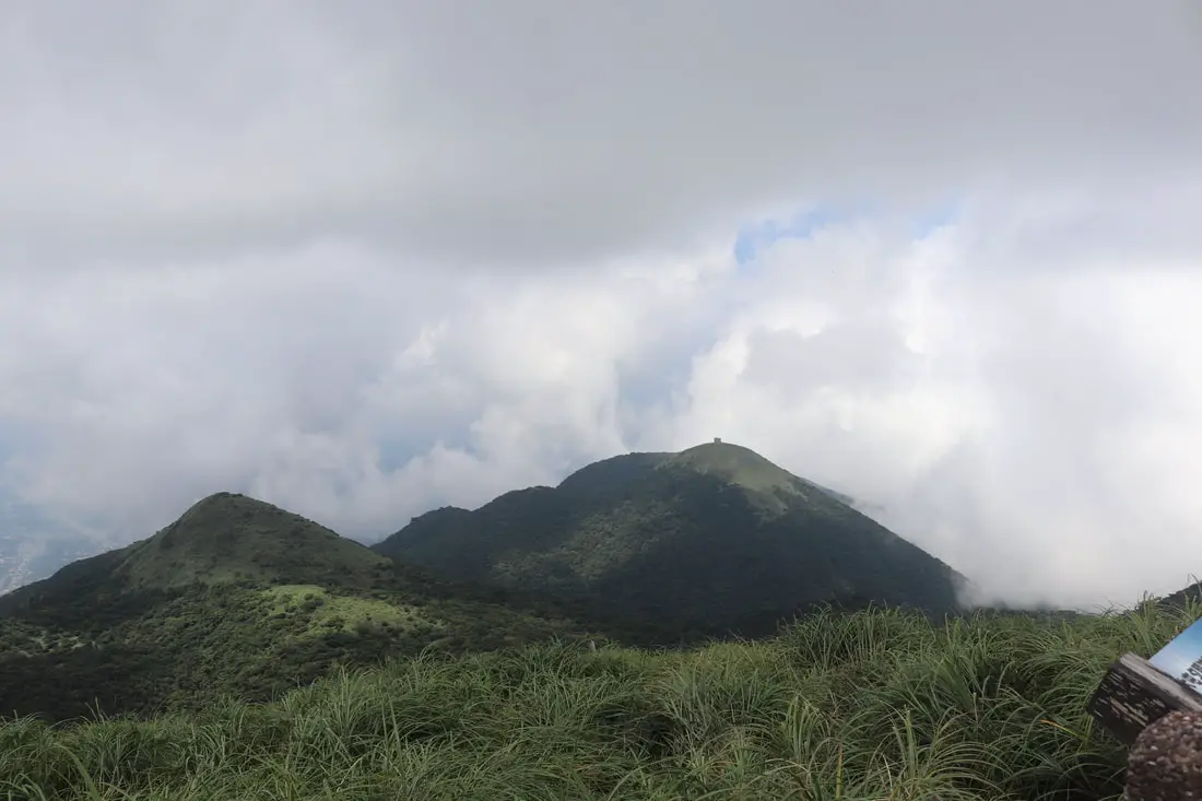
View from near the top.
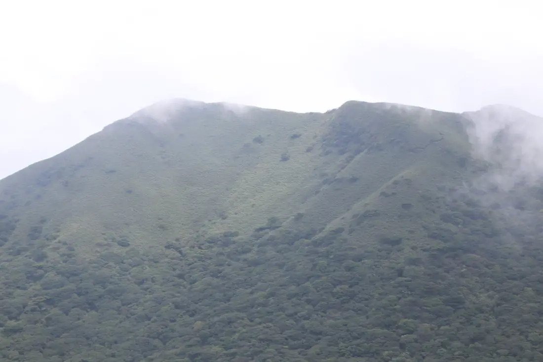
Another cloudy view from the road.
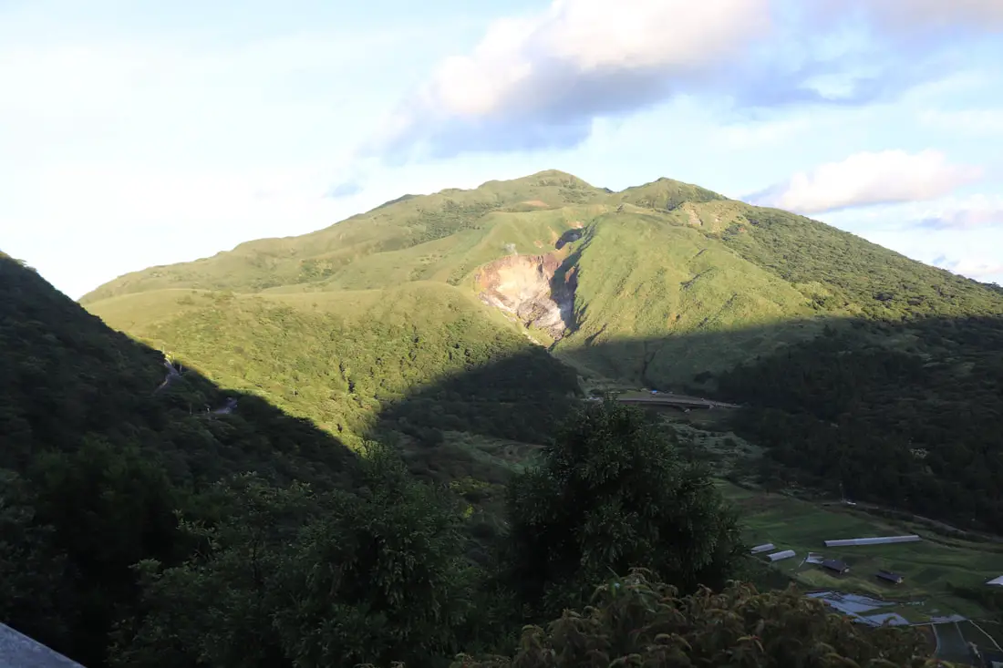
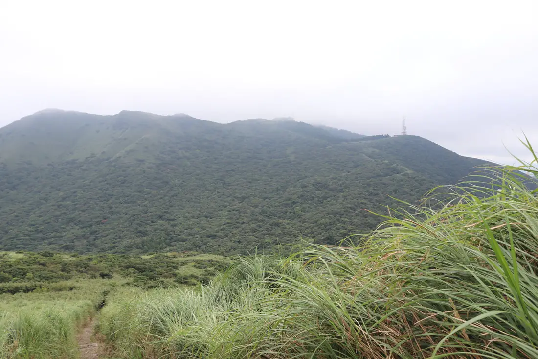
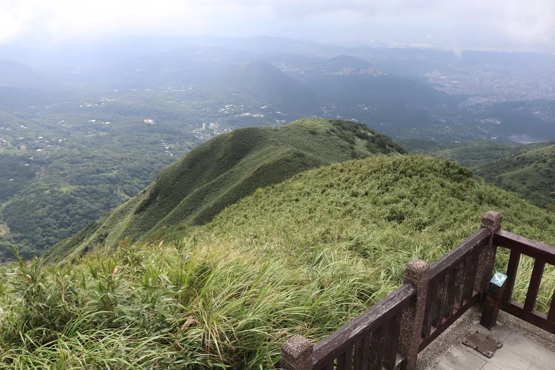
View of Miantianshan 面天山.
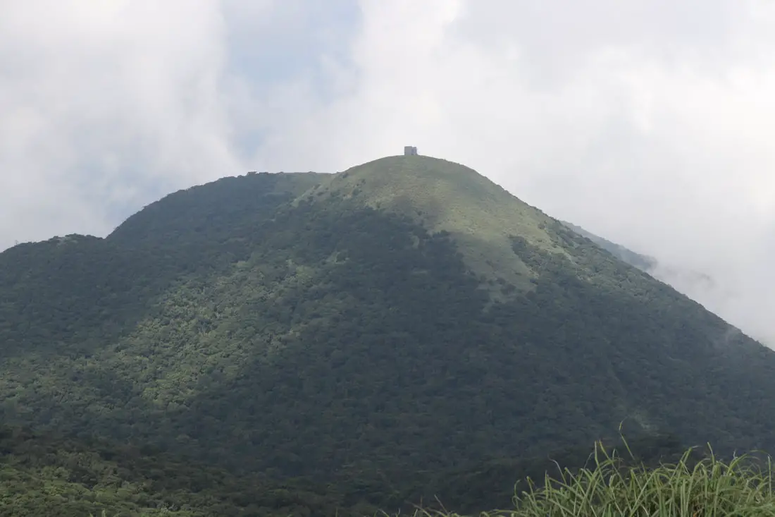
Closer view of Miantianshan.
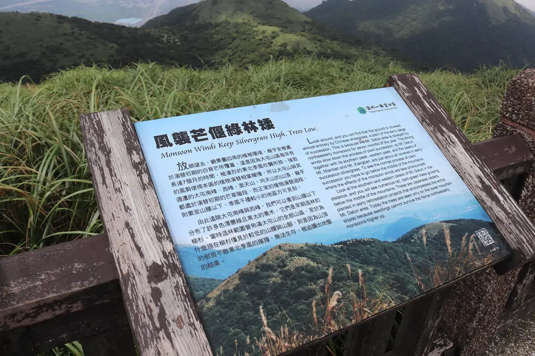
"Monsoon winds keep silvergrass high, trees low"
"Look around, and you will find that the ground is covered almost entirely but Chinese silvergrass, a plant of the early stage of succession. This is because the Mt. Datun area is ravaged y northeasterly monsoons for seven months of the year. The strong winds slow down the process of the plant succession, so Mt. Datun, together with its southern peak, and the peaks of Mt. Minatian and Mt. Xiangtian are just about all covered in early succession silvergrass. To see the normal process of the plan succession you have to go below the middle of the mountains, where the effects of the monsoon winds are less pronounced. Look at the southern and western peaks of Mt. Datun in the distance, and you will see numerous tall, dark green trees growing below the middle of the mountains. These are Japanese cedars, planted in early reforestation projects that encompassed the entire Mt. Datun area. Today the trees are seen only on the lower mountain slopes because seedlings cannot survive the fierce northeasterly monsoons higher up." 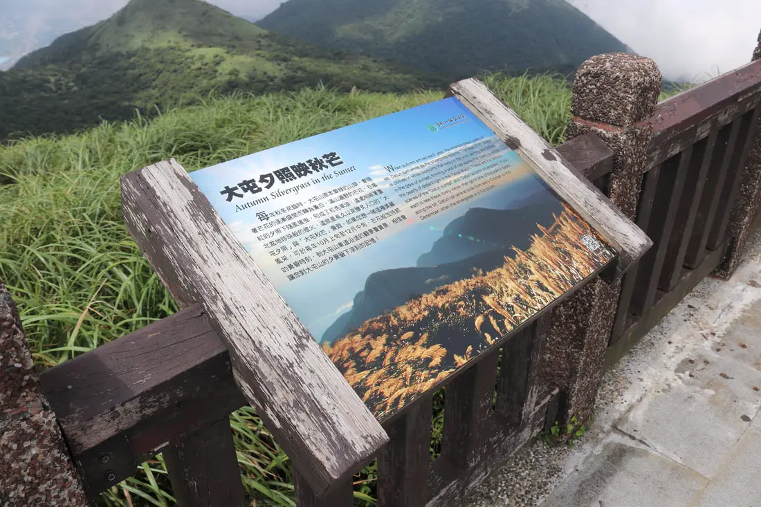
"Autumn silvergrass in the sunset."
"When Autumn arrives each year, the emerald green peaks of Mt. Datun turn white as the silvergrass blooms, The peak of Mt. Datun is clothed in white blossoms that sway in the wind as the are bathed in the glow of sunset, forming a sea of red waves that seem to reflect the pearls of distant light to the Taipei Basin. These are the famous scenes of the Datun sunset and Datun Autmun silvergrass. If you want to see these lovely views, then go to one of the scenic decks along the MT. Datun car lane at dusk from early October to mid-December, when the silvergrass is in full bloom." 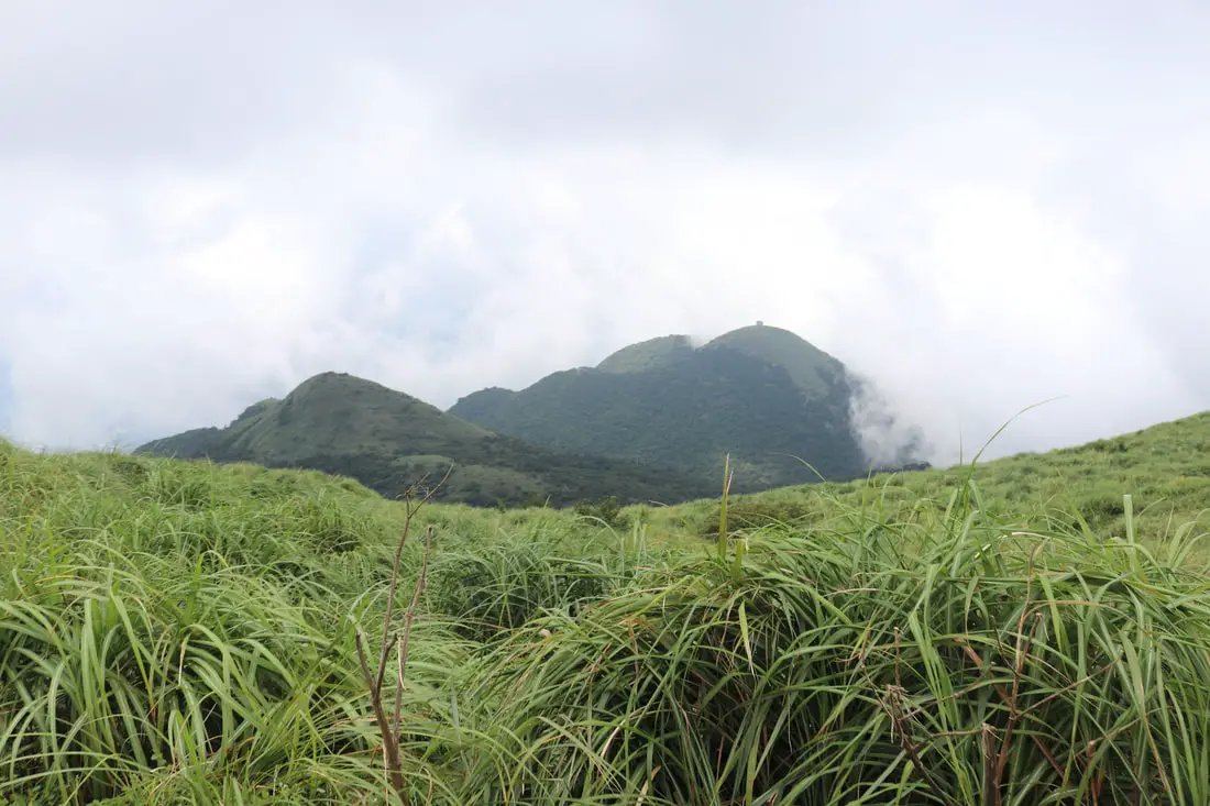
Another view of Miantianshan.
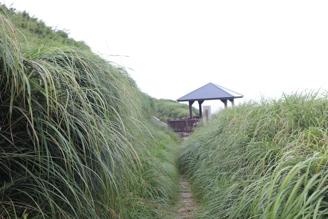
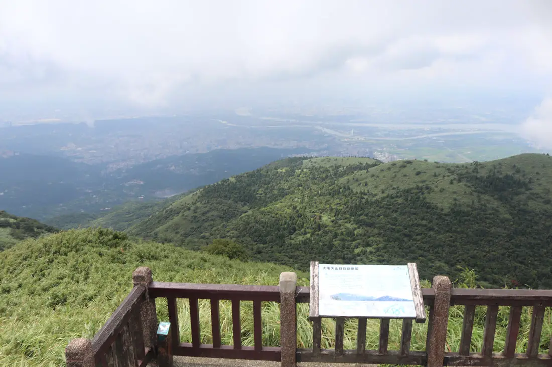
10:26 AM, we make it to the viewing platform where there are some hikers waiting.
Check out the video above for a view from the viewing platform on top of Datunshan.
There were a few breaks in the clouds but not many.
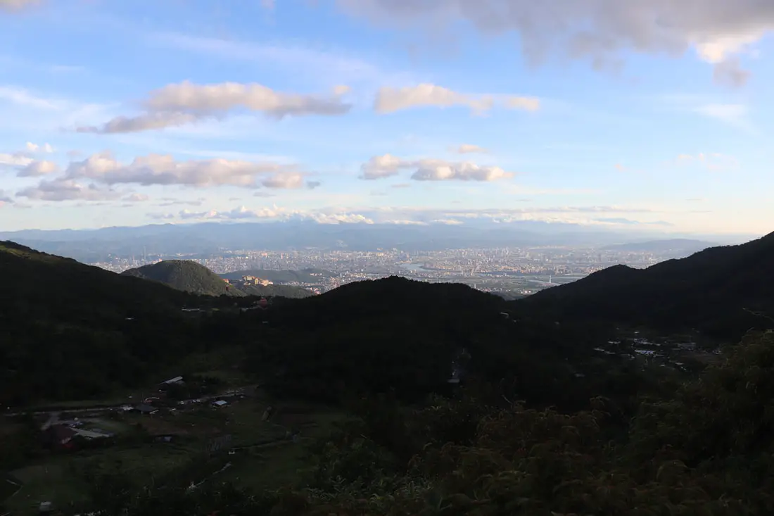
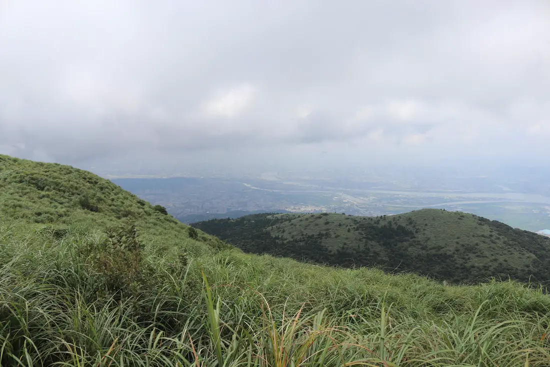
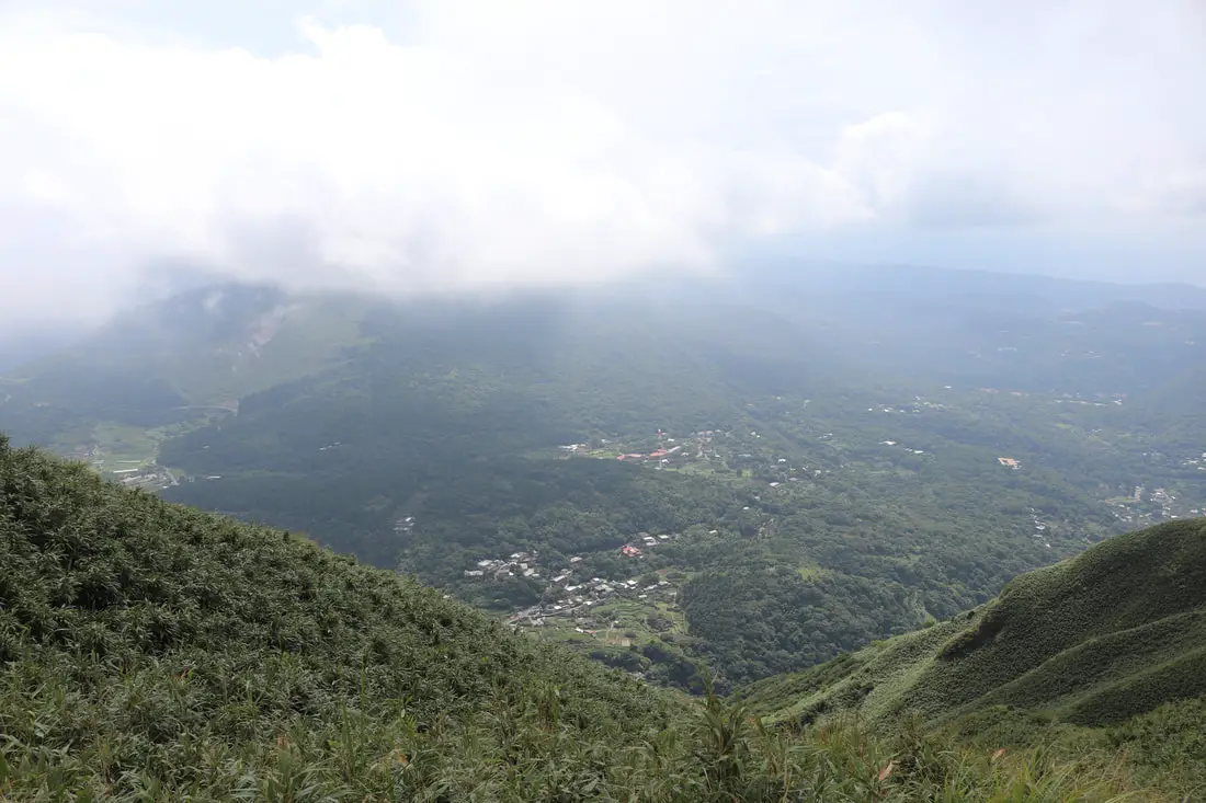
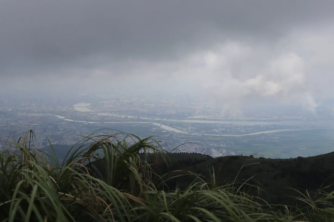
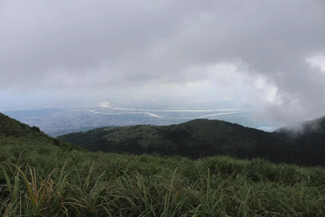
Another view of the Taipei Basin.
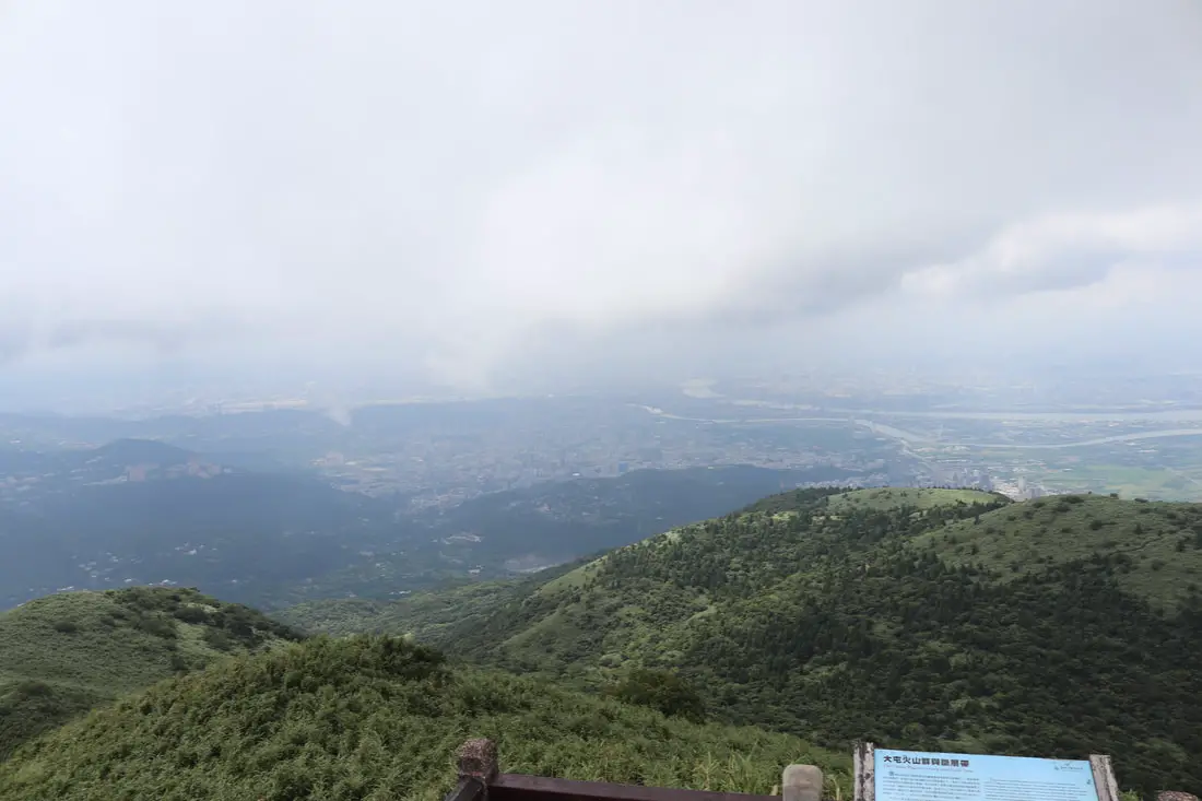
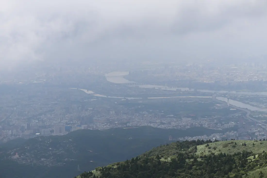
Taipei Basin covered in clouds.
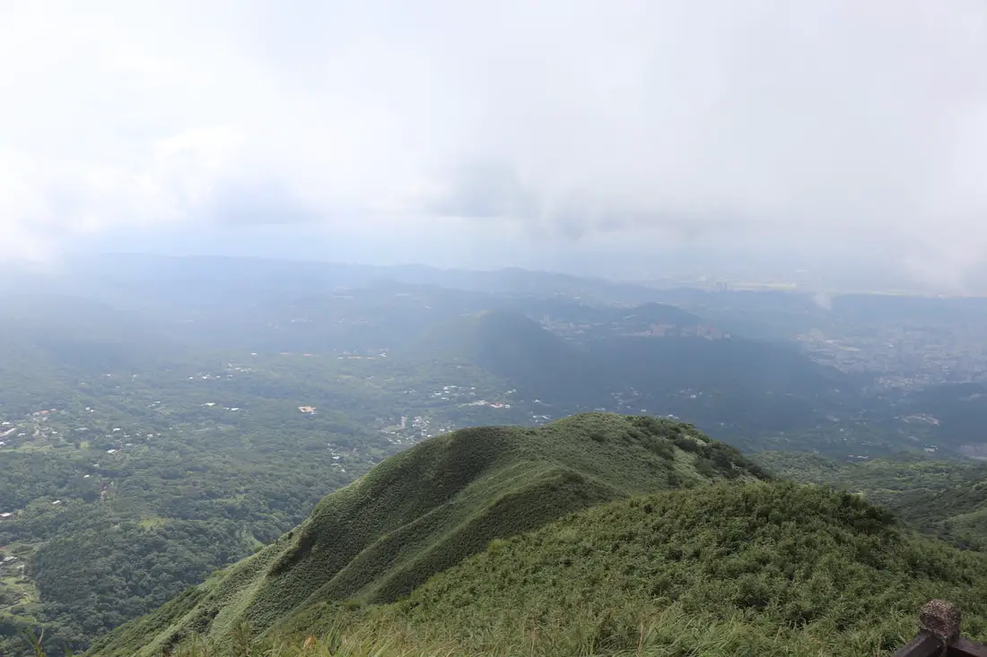
View looking south.
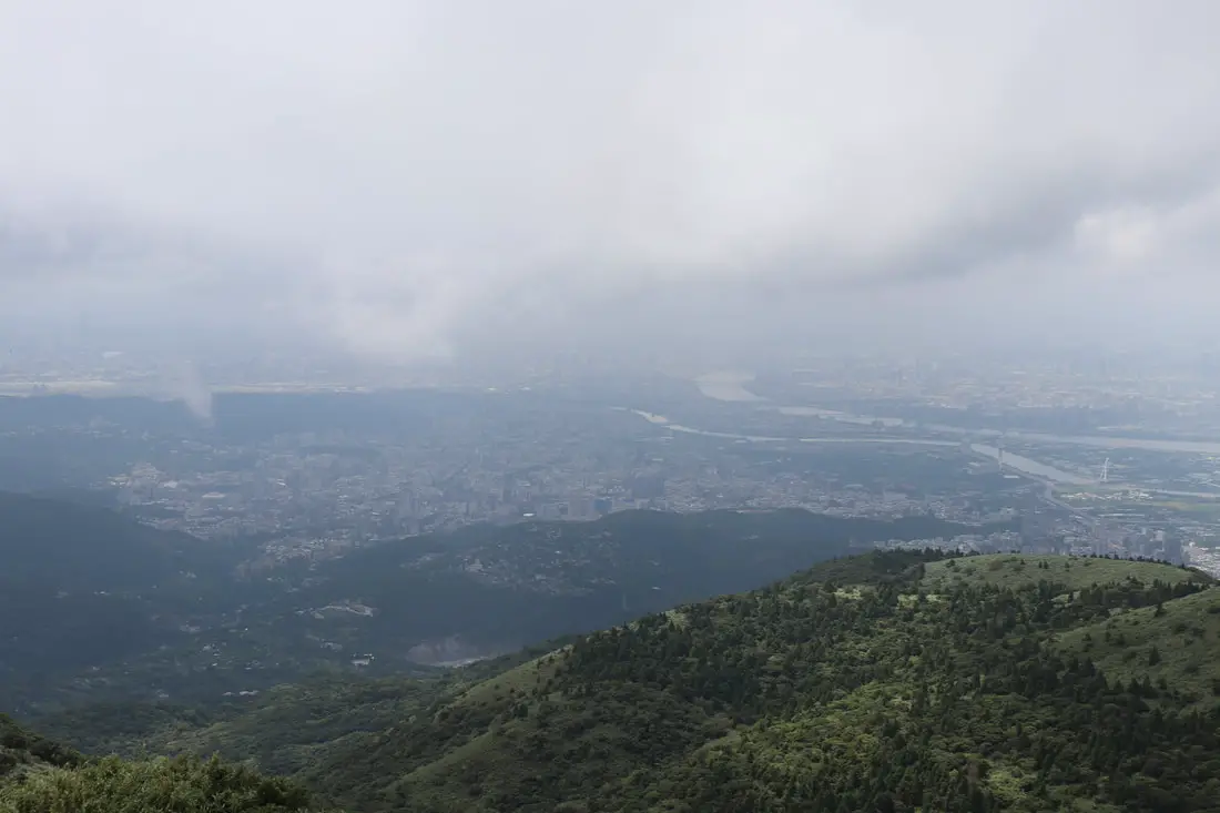
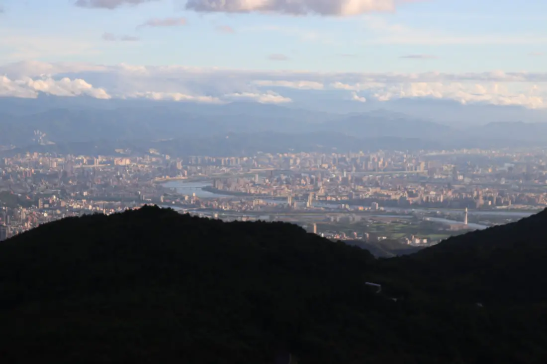
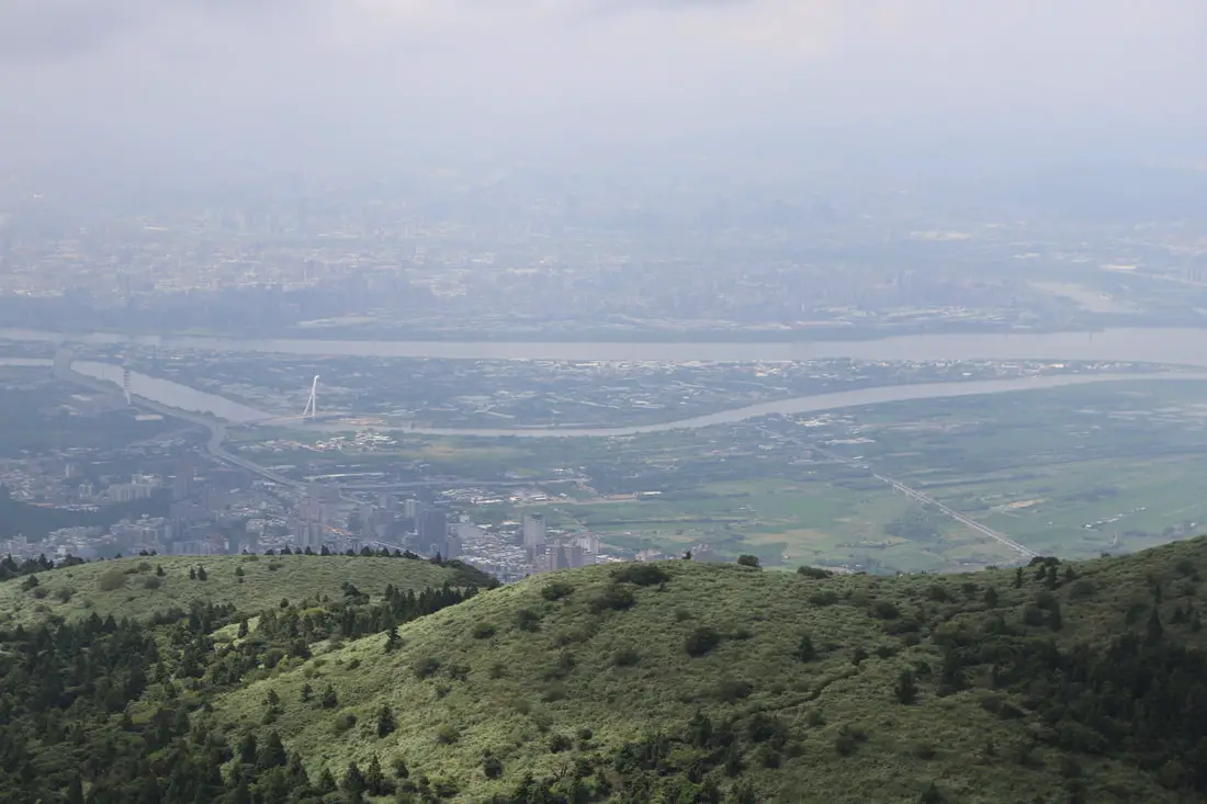
Closeup on the Taipei Basin.
Another view from the viewing platform.
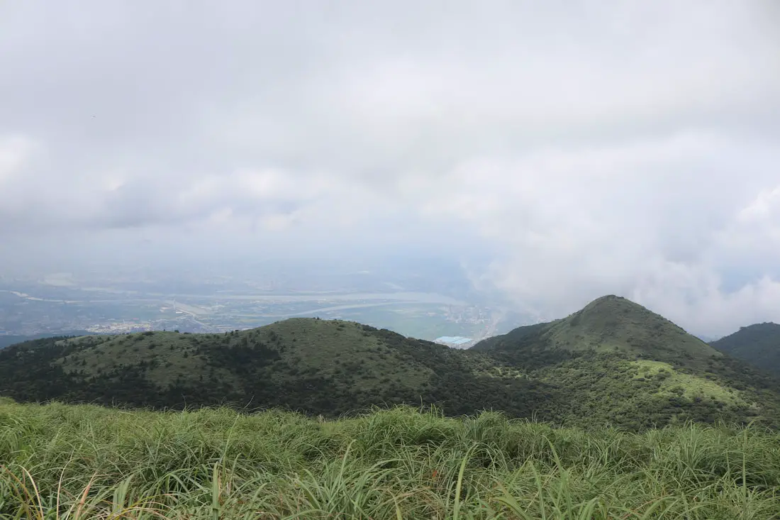
Wider view looking south.
Closeup on Shilin and Luzhou.
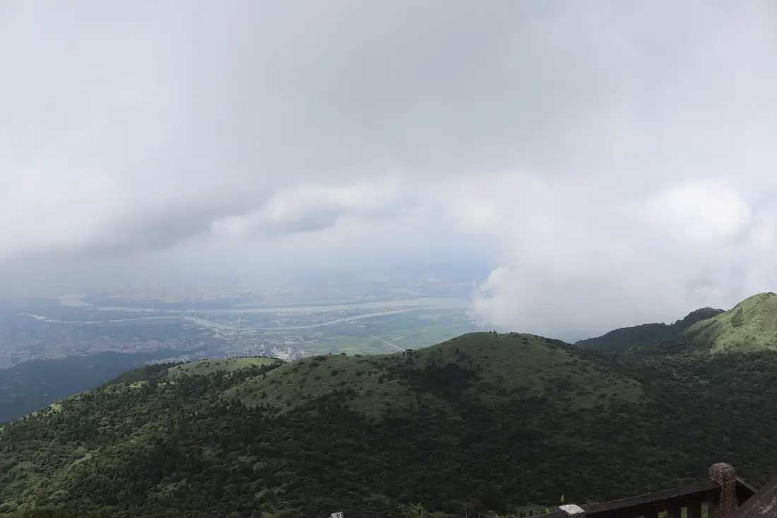
Another view of the Keelung and Tamsui Rivers.
Clouds covering Qixingshan.
A small patch of blue sky appears.
Clouds uncover Qixingshan for a short time.
Another view of the basin.
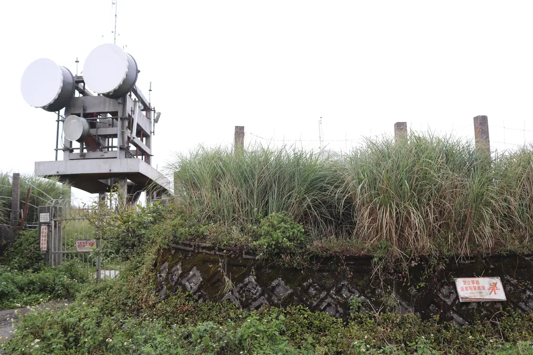
11:04 AM, after half an hour of taking phots and flying the drone, we were ready to head down the mountain. The top of the mountain as seen here is covered in weather monitoring equipment and is off limits.
Paved road at the top of the mountain.
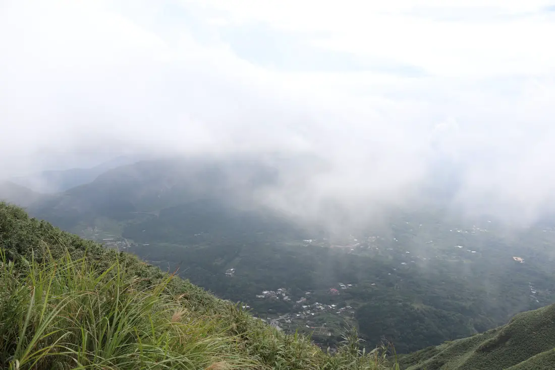
Miantianshan covered in clouds.
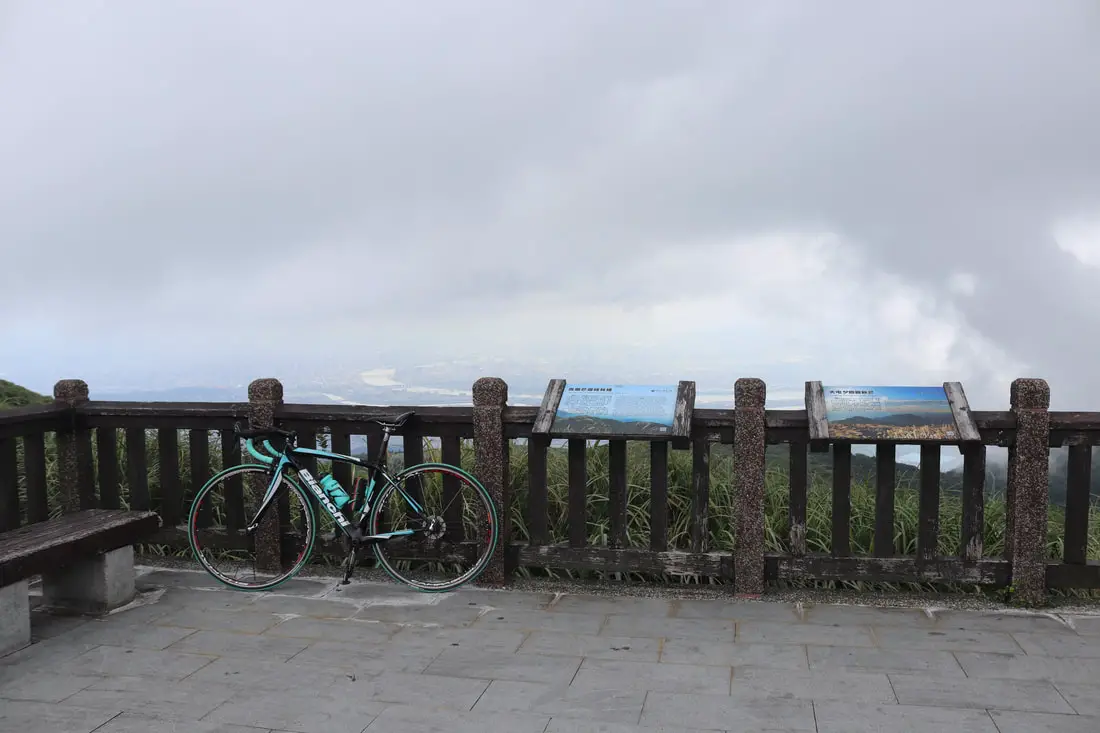
The other lookout that you can ride your bike straight onto.
Last view of the Taipei Basin.
Closeup of the basin seen the last time.
After we left the top, the weather started getting better and better.
We decided to take the paved path down because it was easier on our legs.
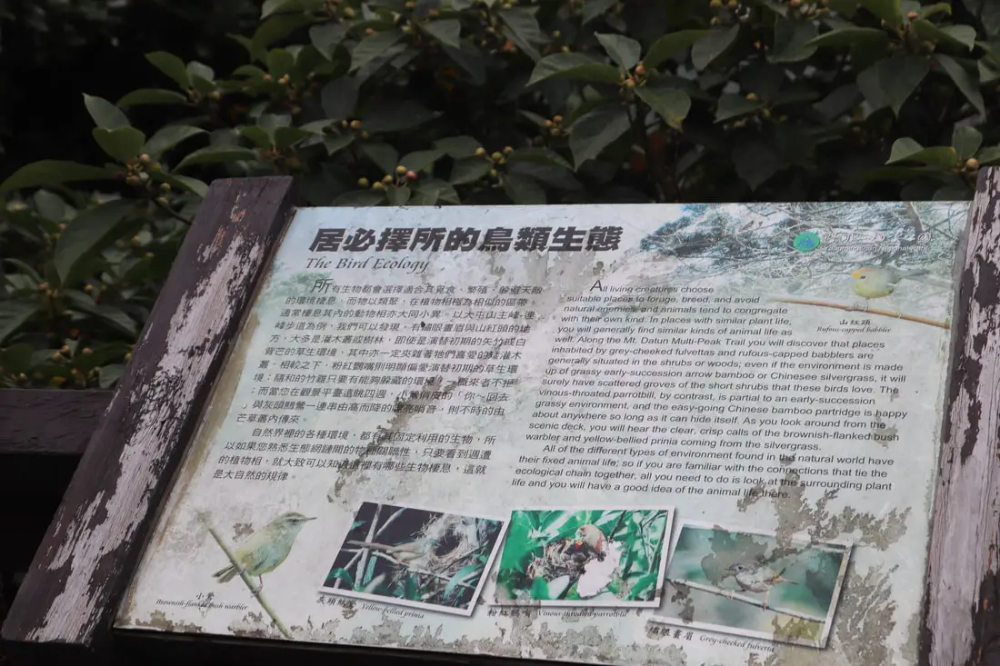
"Bird Ecology"
"All living creatures choose suitable places to forage, breed, and avoid natural enemies, and animals tend to congregate with their own kind. In places with similar plant life, you will general find similar kinds of animal life as well. Along the Mt Datun Multi=Peak trail you will discover that places inhabited by grey-cheeked fulvettas and rufous capped babblers are generally suited in the shurbs or woods; even if the environment is made up of grassy early-succession arrow bamboo or Chinese silvergrass, it will surely have scattered groves of the short shrubs that these birds love. The vinous-throated parrotbill, by contrast, is partial to an early succession grassy environment nd the easy going Chinese bamboo partridge is happy about anywhere so long as it can hide itself. As you look around the groom the scenic deck, you will hear the clear, crisp calls of the brownish-flanked bush warbler and yellow bellied prinia coming from the silvergrass. All of the different types of environment found in the natural world have their fixed animal life, so if you are familiar with the connections that tie the ecological chain together, all you need to do is look at the surrounding plant life and you will have a good idea of the animal life there." 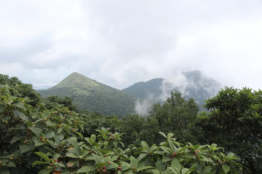
View of Miantainshan again.
11:20 AM we reach the central pavilion and decide to walk down the trail through the bamboo. The skies are getting clearer, and we can see the ocean now.
Better view of the northwest coast and the ocean.
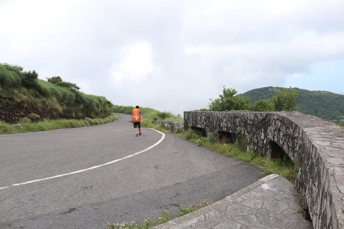
A hiker chooses to take the winding paved path down.
View of the Erziping parking lot below.
Hiking back down the silvergrass.
View of the top of Lesser Mount Guanyinshan.
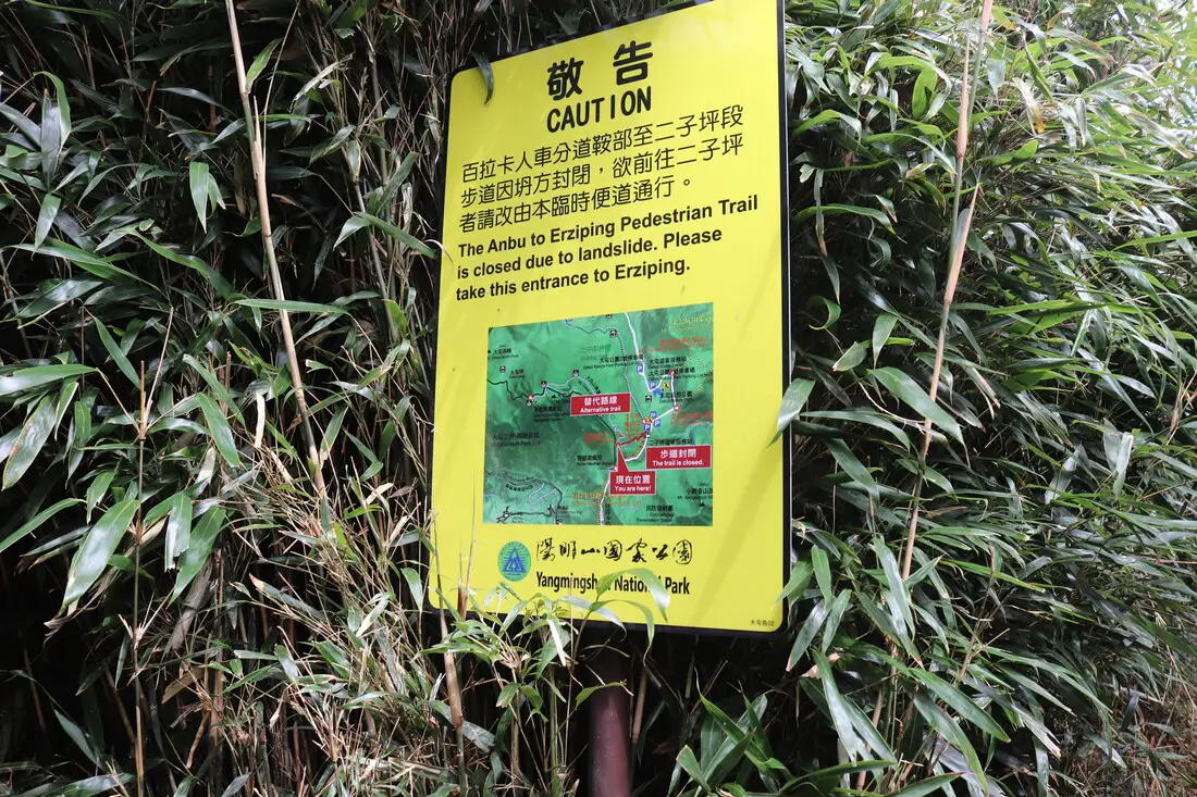
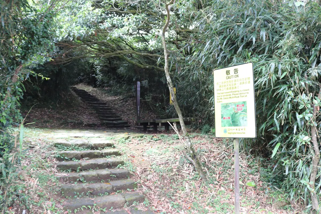
An old trail closed due to landslide.
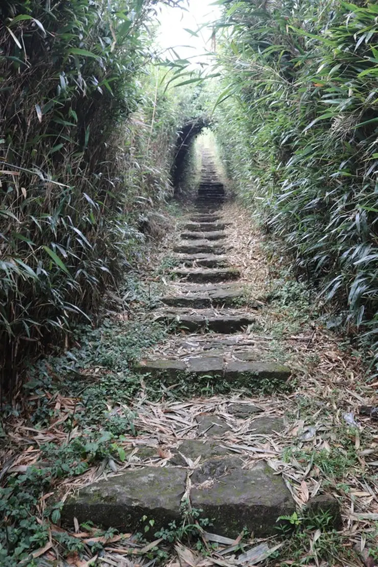
Bamboo tunnel.

Skink found on the trail.
Another view of the trail.
Walking through bamboo, close to the bottom.
11:50, we make it back to the Anbu Trailhead.
12:00 PM, we drive down the mountain. The weather had cleared up pretty much.
The whole trip took us about 2 hours total, 40 minutes of which was flying a drone and taking photos, so about 1 hour 20 minutes total of pure hiking. You can book tours to Yangmingshan on TripAdvisor here, Klook here, or KKday here or here. You can check out tours to Yangmingshan such as a One-day Yangmingshan NP Beitou Hot Spring Park and Tamsui Tour Package, Beitou and Yangmingshan Day Tour from Taipei, One Day Hike around Yangmingshan, or Private Yangmingshan Volcano Tour and more on TripAdvisor here, Klook here, or KKday here. We will be sure to update this blog in the future. Thanks for reading and be sure to check out more of our guides to Taiwan coming soon! Check out our full guide to Yangmingshan National Park here. Check out our Taipei hiking and trails guide here. Check out our guide to the best day trips from Taipei here. Also be sure to check out our guide to Taipei here. You can also check out our full travel guide to Taiwan here.
0 Comments
Your comment will be posted after it is approved.
Leave a Reply. |
Author 作家I am an American expat who has extensive experience living, working, and traveling in Taiwan. In my day, I had to learn many things about Taiwan the hard way. But I have come to learn that Taiwan is one of the best places in the world for Foreigners to live. This blog does not represent the opinions of every foreigner in Taiwan. I am just trying to help others learn more about this beautiful country. Categories
|
 RSS Feed
