

Maobitou Park is a coral and limestone cliff area with viewing platform that offers amazing panoramic views of the Hengchun Peninsula. There are also many interesting rock formations such as a rock that looks like a cat, as well as plants and wildlife. You should definitely stop by on your next trip to Kenting.
Background: Maobitou is the dividing line between the Taiwan Strait and the Bashi Channel in the Pacific Ocean. There is one prominent rock here that looked like a cat to local residents, hence the name of the area Maobitou 貓鼻頭, literally meaning cat rock. After uplift of the Eurasian Plate due to Collision with the Pacific plate, the rocks here have been thrust up from the sea over thousands of years. Now that they are exposed to wind and rain, the rocks here have taken on odd shapes and made giant holes and crevices. The water between Maobitou and Houshanbi Harbor is clear and full of sea life, and is one of the most diverse environments in Taiwan. Kenting was first settled by Chinese during the Qing Dynasty. The word Kenting comes from two words that mean cultivate (ken3 墾) and strong man (丁 ding1). During that time, a group of strong men (or Zhuang Ding 壯丁) came from Guangdong, who were basically Chinese pioneers of the area to cultivate the land, hence the area was named Kenting for them. The area was considered to be made into a park during the Japanese occupation due to it being the only tropical location in the Japanese Empire, but was never officially created. Kenting National Park was established in 1984 as the first national park in Taiwan after WWII. Kenting became a major vacation spot, becoming a center for hostels and hotels for travelers. Kenting is considered by many to have the best beaches in Taiwan. This is because of its fine white sand and year-round warm temperatures and sunshine (it is in the tropical part of Taiwan after all). Hours: 8 AM to 5 PM Price: 30 NT per person Parking: 40 NT for cars or 10 NT for scooters. When to go: Summer! It's when the water is warmest and the sun is hottest. However there will be more people in summer, and there could be Typhoons. Spring and Fall are also good times to go, as there will be less visitors and cooler temperatures. Winter is an okay time to go as well, it will be warmer than the rest of Taiwan and the water will still be warm enough to swim in. How to get there: By Car/Scooter: Take provincial highway 1 south to the bottom of Taiwan until it becomes provincial highway 26. After that turn right on highway 153 and keep left until you see the signs to Maobutou. Looking for scooter rental in Kenting? Click here or here to search for options. You can also check out our Taiwan scooter rental guide here. If you are looking for car rentals, you can also search here. You can also check out our car rental guide here. By Bus: Busses leave daily to Kenting from Zuoying HSR station, Kaohsiung Station, and Pingtung. From Hengchun Bus Station, you can take shuttle bus 102 to Maobitou Bus Stop. You can book tickets to Pingtung via high speed rail (HSR) on Klook here or KKDay here, or book tickets via the normal train (TRA) on Klook here. You can book tickets to travel to Pingtung via inter-city bus on Klook here. Accommodation: I have stayed at many hostels and hotels in Kenting, and even almost bought a house here. Some places that I have stayed at and can recommend are Nanwan Kiki (book on Agoda here, Booking.com here), a B&B next to Nanwan Bay, Kenting's most popular Beach. There are also a few decent hotels near Kenting Street Night Market like Kenting Star Inn 888 (book on Agoda here, Klook here, Hotels.com here, Expedia here, or Booking.com here), or Kenting Dajianshan Hotel (book on Agoda here, Booking.com here, Hotels.com here, or Expedia here). You will notice that none of these hotels are five star resorts (I do not come to Kenting to waste my time at a resort, but you can still search Agoda, Booking.com, Hotels.com, or Expedia for those) but they are in my opinion the above have the best value for the money. Looking for a hotel? Find out where to stay in our Taiwan hotels guide or search for the best hotel deals in Taiwan here. We recommend booking through Agoda here, which provides the best quality selection of accommodation in Taiwan. You can also book Wifi and SIM cards for Taiwan on Gigago here. Need travel insurance? Compare prices on Insubuy here. Tours and Activities in Kenting: There are many activities available such as snorkeling, diving, SUPing, surfing, submarine riding, and river tracing. You can find more tours of Kenting on Klook here or KKday here. Just to let you know, if you book using the links above, we get some commission at no cost to you, and you can help support our blog. You can click here to receive $5 USD on your first Klook purchase. Map: Please see below: Our Journey: I have been to Maobitou Park once and it was hot. Be prepared to sweat and hike. It is kind of a steep climb to the top but it is worth it. 
The parking lot here is quite large but there is no shade.
There are also multiple bathroom locations, and the whole place is very wheelchair friendly.
After paying 30 NT, you can finally enjoy this view.
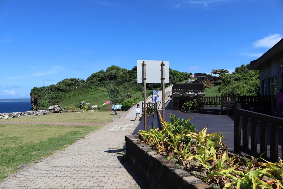
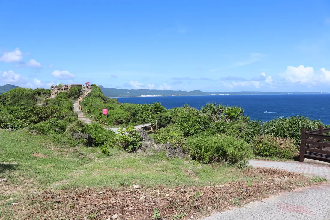
There is also a wheelchair and stroller friendly ramp up the hill here.
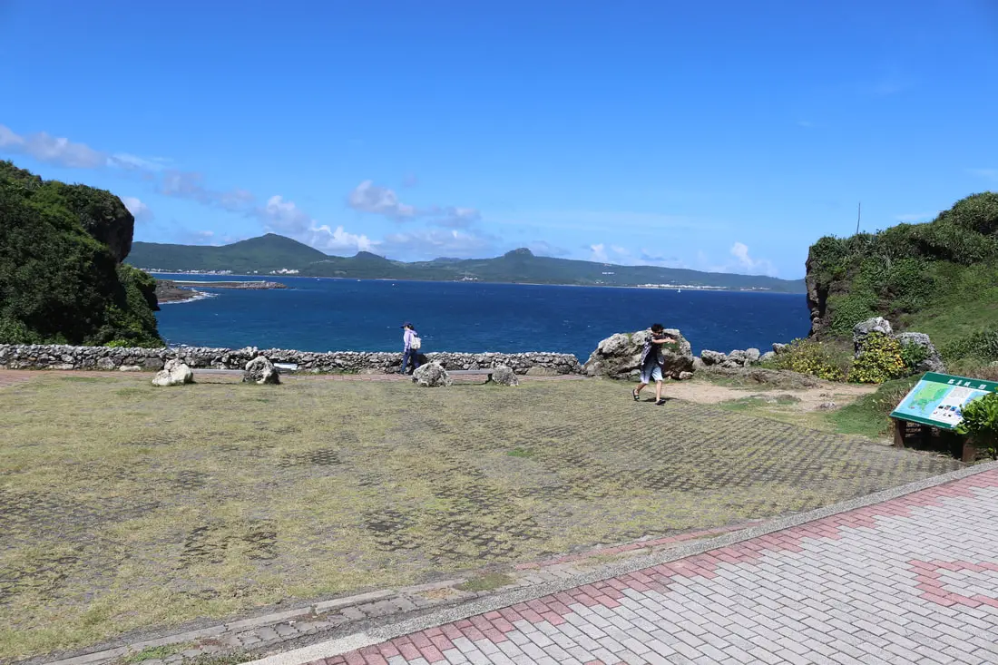
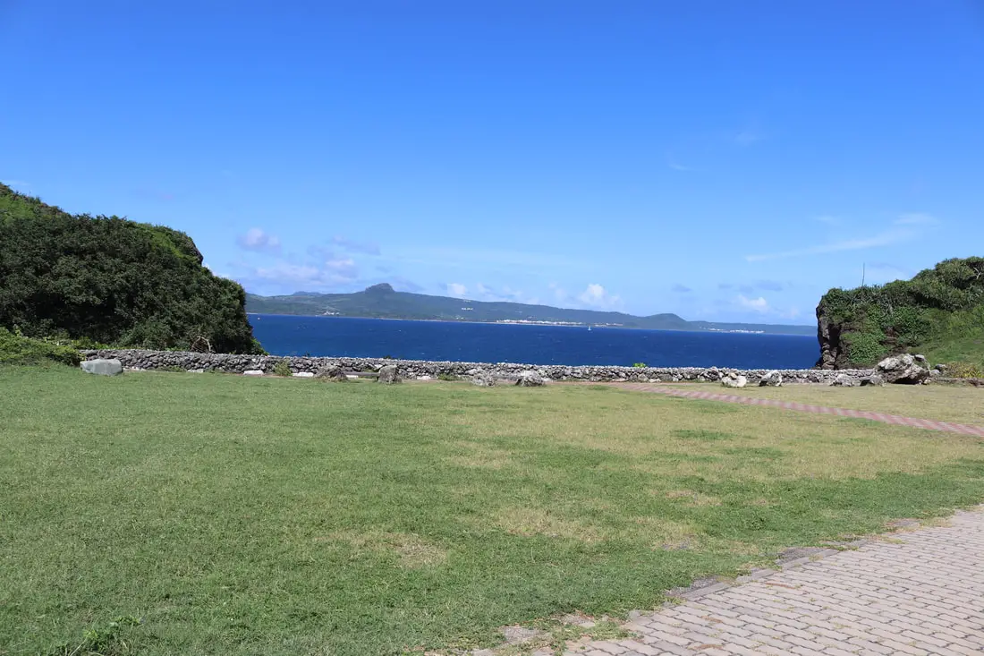
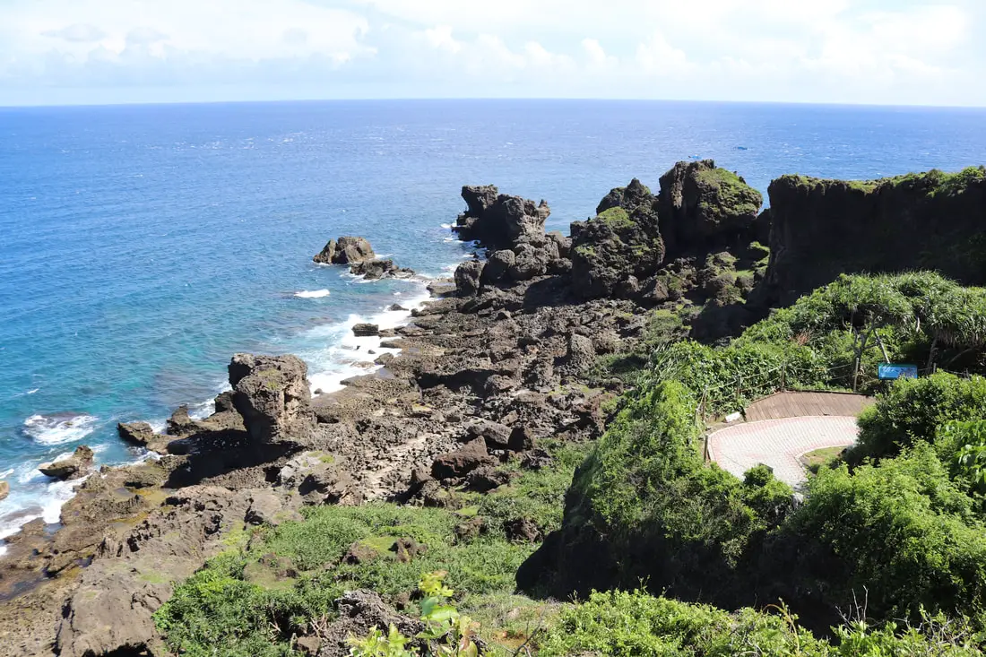
You can also enjoy views from the cliff here.
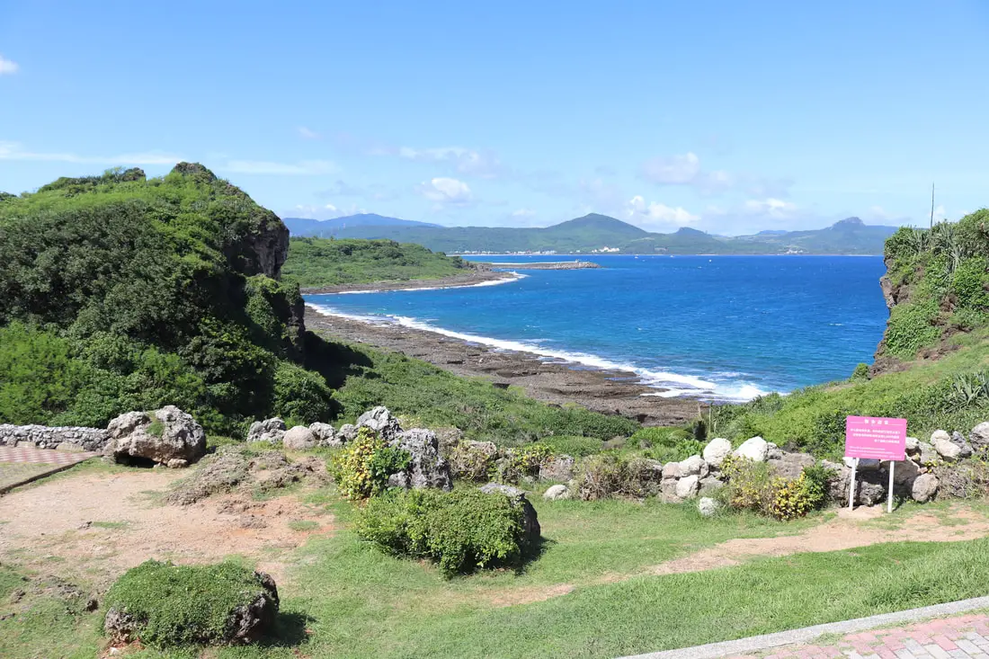
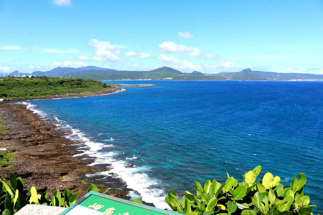
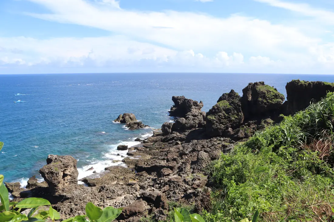
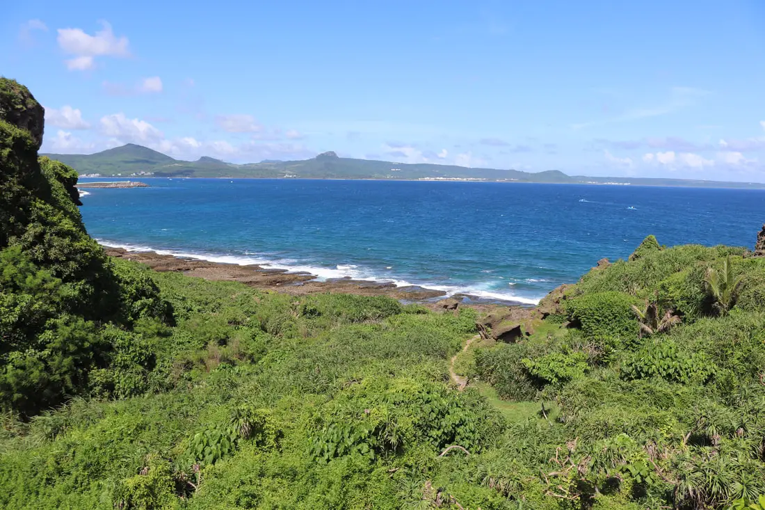
This is one of the most pristine coral coastlines in the world.
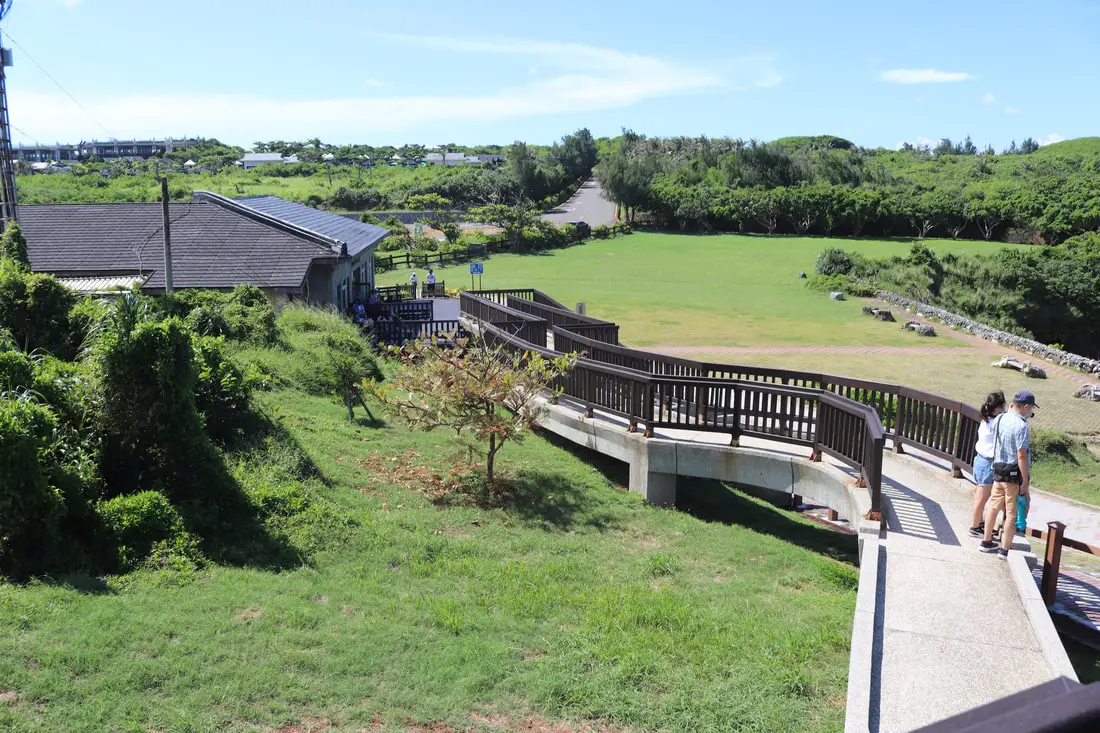
Looking back down from the wheelchair ramp.
The strange rocks at Maobiti.
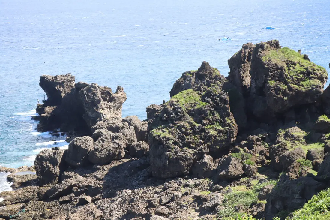
The rock on the far left there is the one that looks like a cat.
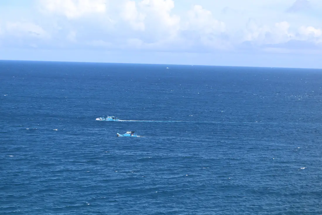
Fishing ships heading back to harbor.
Another view of this beautiful coastline.
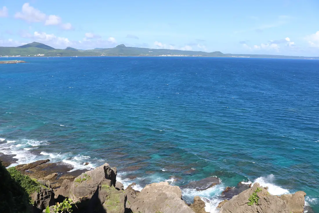
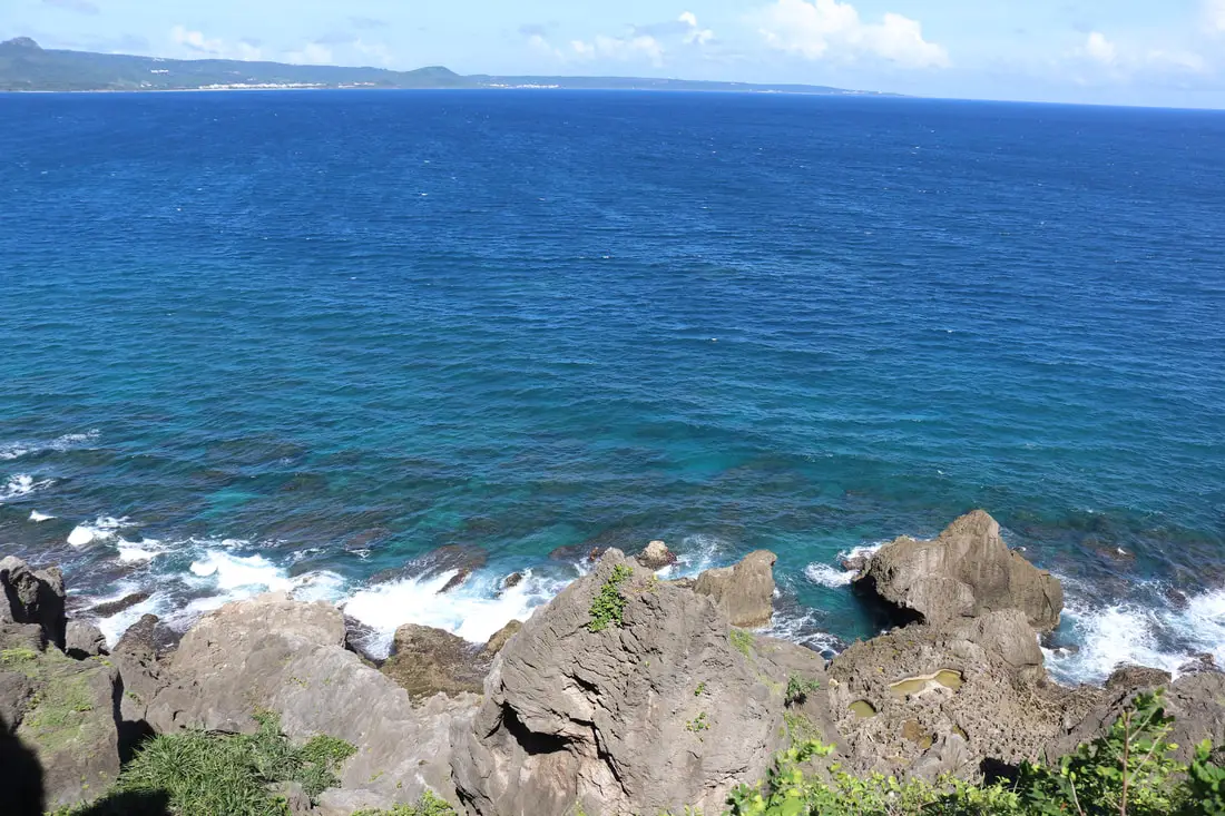
View southeast.

View East.
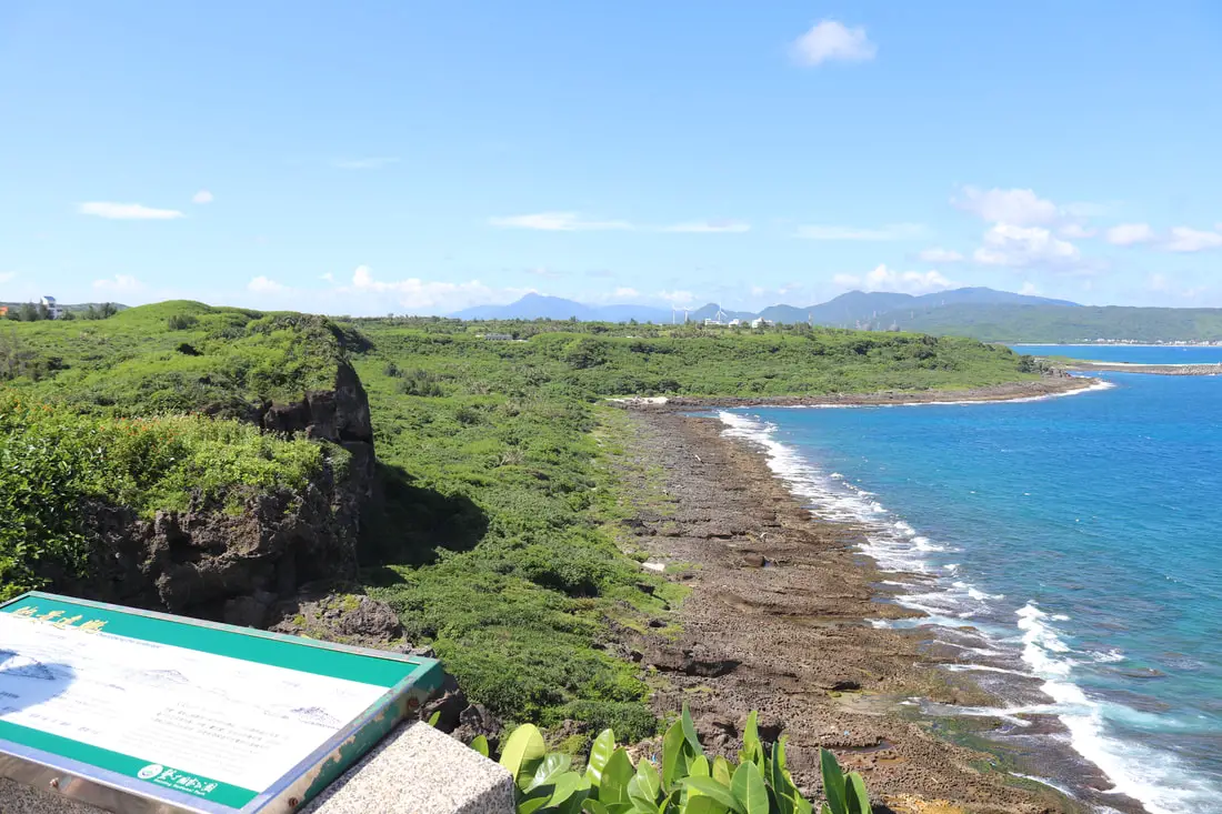
Another view of the Maobitou coastline and cliffs.
Vertical view.
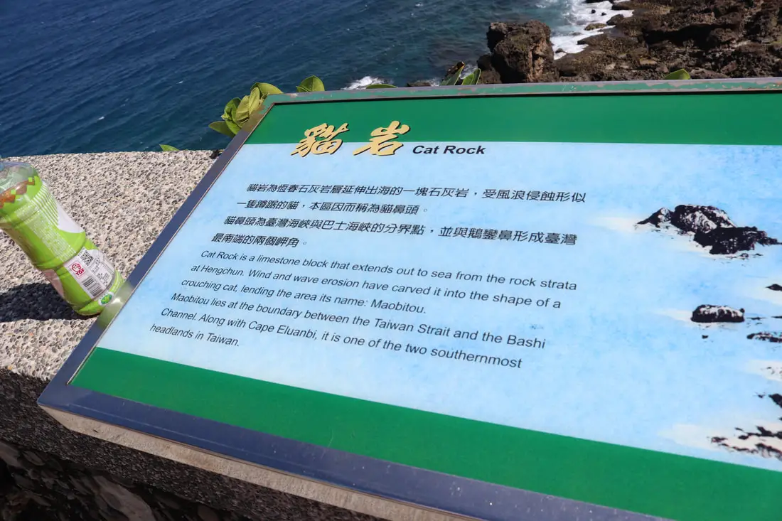
"Cat Rock"
"Cat Rock is a limestone block that extends out to sea from the rock strata at Hengchun. Wind and wave erosion have carved it into the shape of a crouching cat, lending the area its name, Maobitou. Maobitou lies at the boundary between the Taiwan Strait and the Bashi Channel. Along with Cape Eluanbi, it is one of the two southernmost headlands in Taiwan. 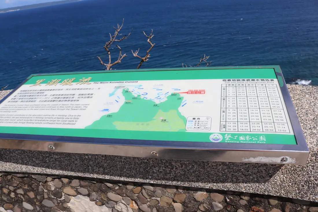
"The Warm Kuroshio Current"
"The Kuroshio Current flows southward along the coasts of Taiwan. The main current passes buy on the east coast of the island and continues to low north to Japan. The branching current passes by on the west coast ad flows through the Taiwan Strait heading north. The current contributes to the abundant marine life in Kenting. Due to the current, the sea temperature in Kenting remains at Twenty one to thirty degrees Celsius year round, which is perfect for coral reefs to flourish and also brings floating seeds northward from the southeast." 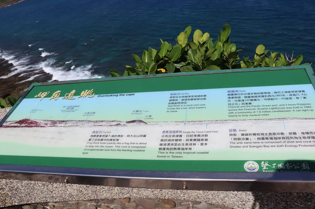
Map of the natural sights in Kenting, like Frog Rock, Sail Rock, and Eluanbi.
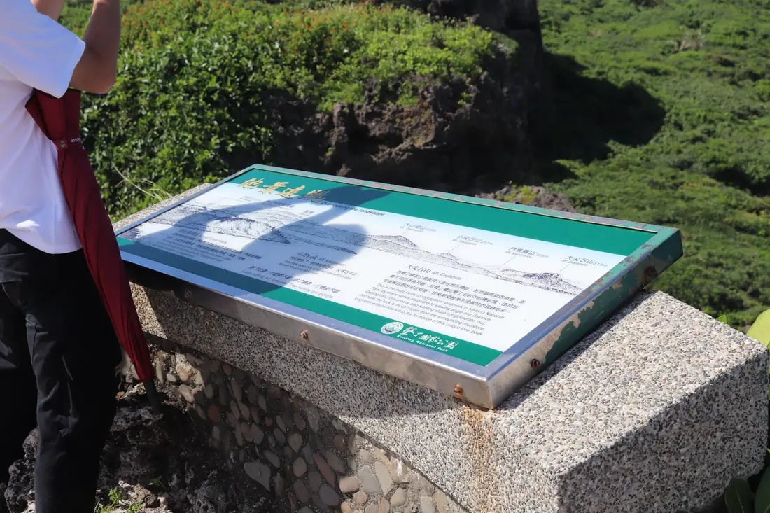
More descriptions of sights in Kenting such as Mt. Dajianshi and Mt. Dashanmu.
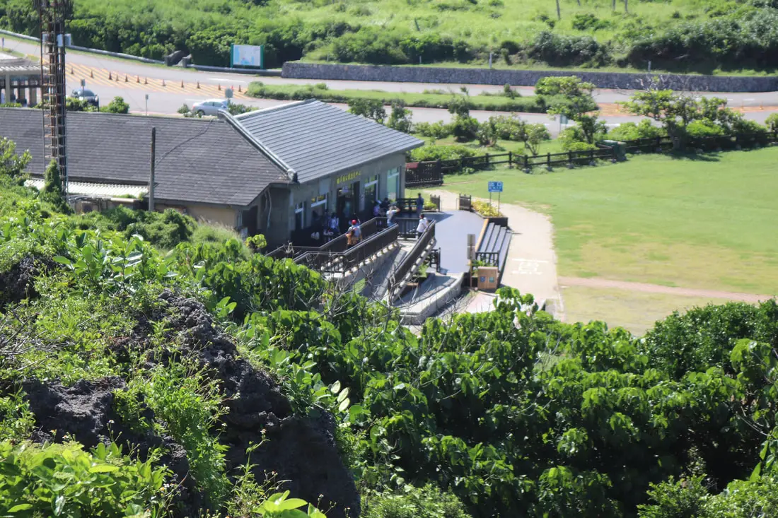
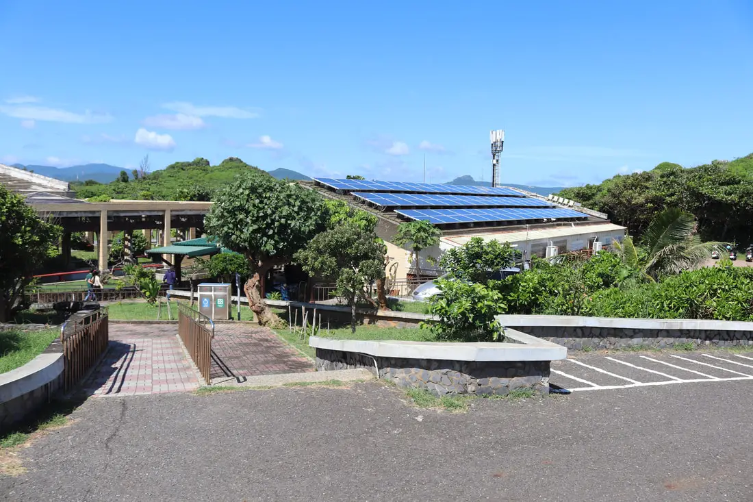
View looking back at the visitor center from the top of the mountain.
Another view of the cat rocks from the top of the hill.
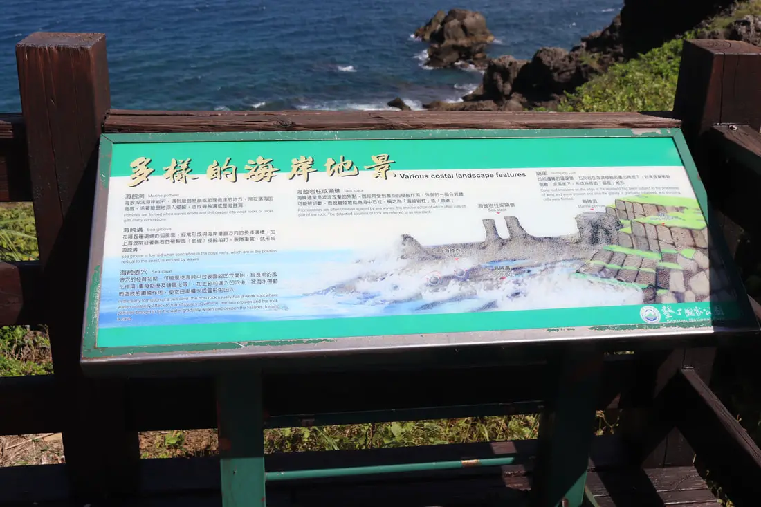
Explanation of various coastal landscape features.
Marine potholes formed by waves erode into rocks.
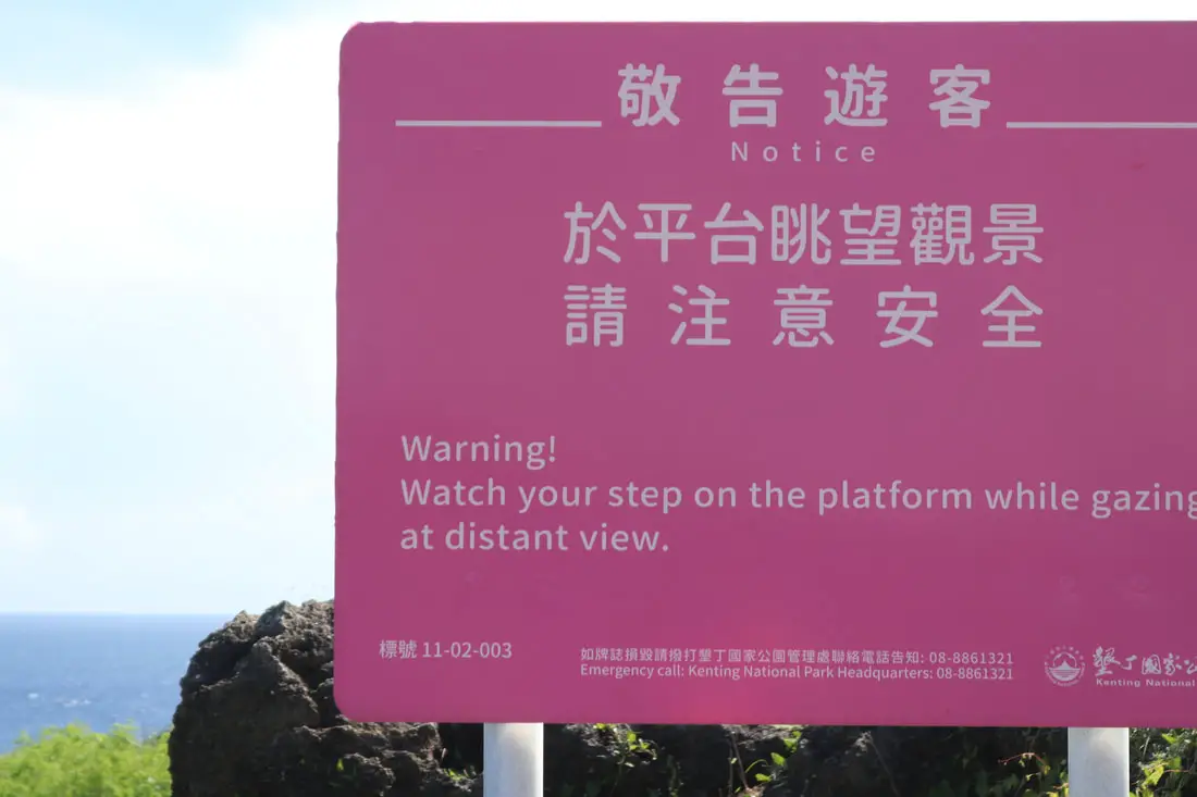
You better watch your step here.
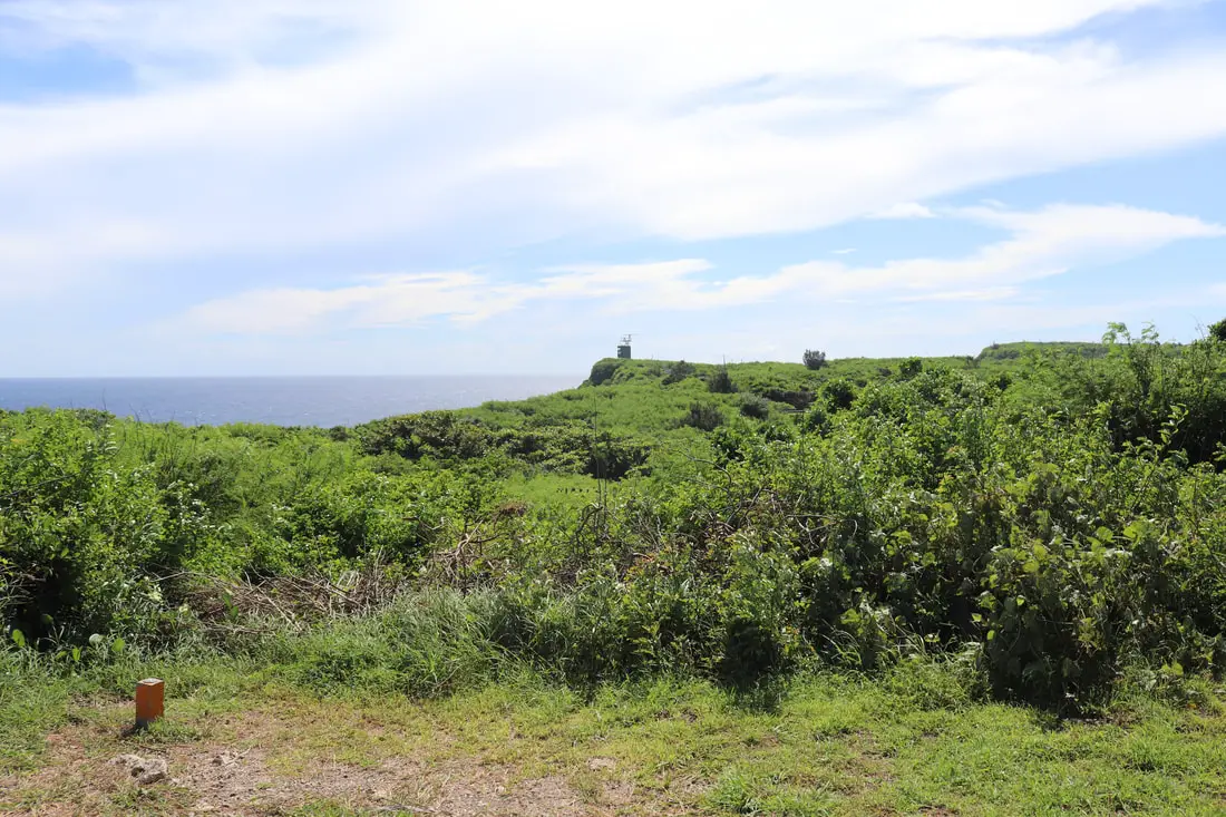
A coast guard tower in the distance.
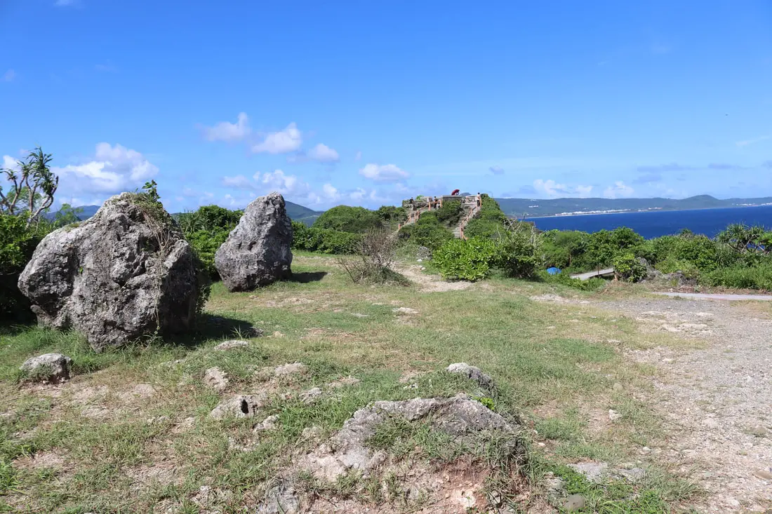
Giant boulders on top of the mountain.
View towards the ocean.
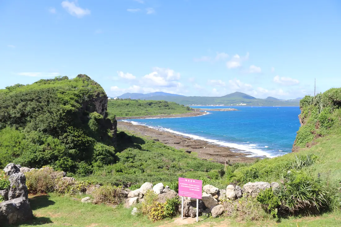
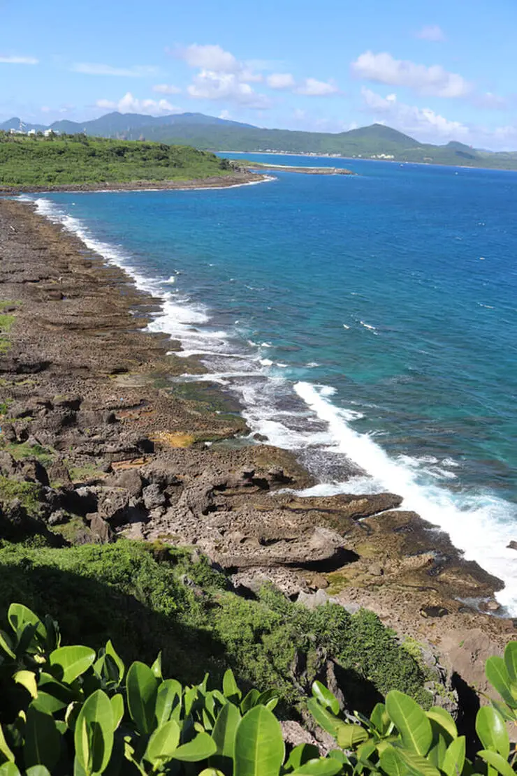
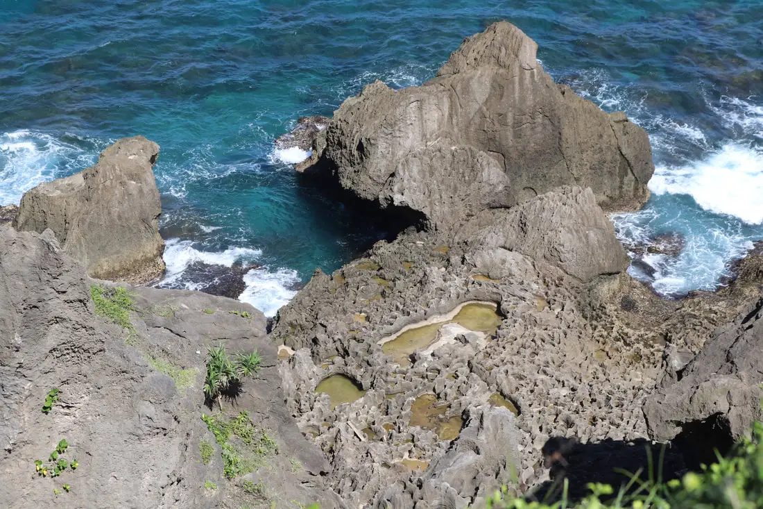
Another view of the coral coastline.
There appears to be a trail down there.
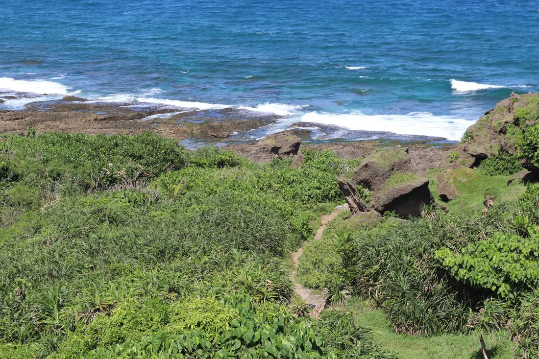
I am not sure how you would get down there, but it looks like a nice walk.
Check out more photos of the area in the photo gallery above.
There are many activities available such as snorkeling, diving, SUPing, surfing, submarine riding, and river tracing. You can find more tours of Kenting on Klook here or KKday here. Check out our full guide to Kenting here. You can also check out our full guide to Pingtung here, and can also check out our full travel guide to Taiwan here.
0 Comments
Your comment will be posted after it is approved.
Leave a Reply. |
Author 作家I am an American expat who has extensive experience living, working, and traveling in Taiwan. In my day, I had to learn many things about Taiwan the hard way. But I have come to learn that Taiwan is one of the best places in the world for Foreigners to live. This blog does not represent the opinions of every foreigner in Taiwan. I am just trying to help others learn more about this beautiful country. Categories
|
 RSS Feed
