

Qixingshan in Yangmingshan National Park (aka Qixing Mountain, Cising Mountain, Chising Mountain, or Seven Star Mountain) is considered the highest dormant volcanic peak in Taiwan, and the highest point in Taipei City. The area is also an important ecological area with protected species. There are a few paths to the top with varying difficulty, and it offers great views of the Taipei Basin and the sunset.
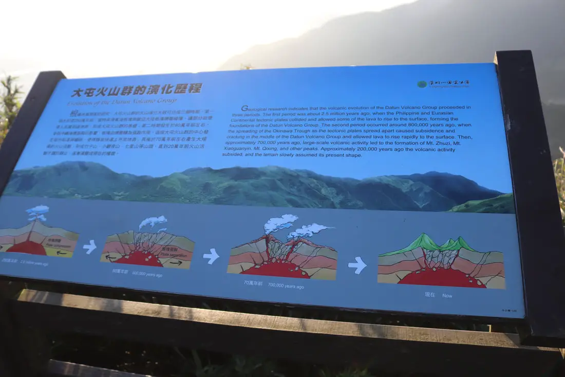
Background: The area known as Yangmingshan now was formed by volcanoes more than 700,000 years ago, forming many mountains about 1000 meters or less in northwestern Taiwan. The park still features active volcanoes, vents, and hot springs. The original name of the area was Caoshan (grass mountain 草山). During the Qing Dynasty, the area was used to harvest sulfur, and many of the hills were burned to help catch sulfur thieves. In 1927 during the Japanese era, Yangmingshan was made as the first national park in Taiwan, then known as Datunshan National Park Association. In 1950 after the ROC took Taiwan Chiang Kai-shek renamed the park after the philosopher Wang Yangming, and called the area Yangmingshan. In 1985, after resolving many land disputes, Yangmingshan National Park was officially designated as a national park in the ROC era. Qixingshan is 1120 meters tall, and is known as the highest dormant volcano in Taiwan. The last eruption here was about 700,000 years ago. Originally the peak had a crater but it slowly eroded into seven peaks, which is how it got its name. It is also known to snow in the area. Qixingshan lies in Beitou District of New Taipei City. It is a popular stop in Yangmingshan and has three main trails up to the top. There is a large viewing platform that has great views of the Taipei Basin and the sunset. Hours: 24/7 Price: Free (parking 30 NT) You can book tours to Yangmingshan on TripAdvisor here, Klook here, or KKday here or here. Tours: You can check out tours to Yangmingshan such as a One-day Yangmingshan NP Beitou Hot Spring Park and Tamsui Tour Package, Beitou and Yangmingshan Day Tour from Taipei, One Day Hike around Yangmingshan, or Private Yangmingshan Volcano Tour and more on TripAdvisor here, Klook here, or KKday here. Difficulty: There are three trails that you can take to the top. Here is a dissections of each trail: From Miaopu: Moderate: : 700 meter elevation gain, 2.4 KM of walking one way, 2 hours to the top and 2 hours back (4 hours round trip). This is the most difficult way up. From Xiaoyoukeng: Easy: 400 meter elevation gain, 1.6 KM walk one way, 40 minutes to the top and 40 minutes back (1.5 hours round trip). This is the easiest way up. From Lengshuikeng/Menghuan Pond: Easy: 450 meter elevation gain, 2.1 KM walk one way, 45 minutes to the top and 45 minutes back (1.5 hours round trip). For a more detailed comparison of the three trails, check out this blog by Josh Ellis. Hotels in Taipei: High end: We have stayed at and recommend the Yuanshan Grand Hotel, once the tallest building in Taiwan and still the most grand (book on Booking.com here, Tripadvisor here, or Agoda here). We also recommend Fullon Hotel which has locations in Tamsui and Fulong near the beach (book on Booking.com here, Tripadvisor here, Agoda here, or Hotels.com here). Budget Hotels: We have stayed at and also recommend Fu Chang Hotel in Ximending, which is within walking distance of Ximending shopping district (book on Booking.com here, Tripadvisor here, or Agoda here). We have also stayed at and recommend Hai Xia Your Home which is right in front of Fulong Beach (book on Booking.com here, Tripadvisor here, Agoda here, or Hotels.com here). Looking for a hotel? We recommend booking through Booking.com here, which provides the best quality selection of accommodation in Taiwan. Find out where to stay in our Taiwan hotels guide or search for the best hotel deals in Taiwan here. How to get there: By Car/Scooter: From Taipei, take provincial highway 2A north to Yangmingshan. There are three trails to the top: from Xiaoyoukeng 小油坑, Lengshuikeng 冷水坑, and Miaopu 苗圃. Looking for scooter rental in Taipei? Check out Qeeq here, Klook here, or KKday here to search for options. If you are looking for car rentals, you can also search Qeeq here, Klook here, or KKday here. You can also check out our car rental guide here. By Bus: From Shilin MRT Station, Take Bus 1717 to Xiaoyoukeng 小油坑, Lengshuikeng 冷水坑, Menghuan Pond 夢幻胡 or Miaopu 苗圃 parking lots. You can book tickets to travel to Taipei via inter-city bus on Klook here. By Bicycle: Cycling is the best way to enjoy Taiwan's landscapes if you have the time and energy. Looking for bicycle rentals in Taiwan? You can search on KKday here and search for tours on Klook here. You can also check out our Taiwan cycling guide here. Map: Please see below: Our Journey: I have attempted Qixing mountain twice and only finished once. The first time I went we did not know what we were doing and ended up hiking from Miaopu. The hike from Miaopu is really difficult and we only made it to Seven Star Park before we gave up. I really regret going that way because I brought my parents, and now they will probably never get a chance to climb to the top of Qixingshan and enjoy the views there. The time I did finish though, we had perfect weather and some of the best photos I've ever taken on a hike in Taiwan. The hike from Xiaoyoukeng is easiest and it took us just over an hour from start to finish. Just see the photos below, it was absolutely gorgeous. It was also my first trip using my new Canon 800D. Of the three trailheads, I highly recommend starting and finishing at Xiaoyoukeng if you bring your own vehicle, because it is fastest and easiest. If you come by public transportation, then I suggest starting from Xiaoyoukeng and finishing at Lengshuikeng. 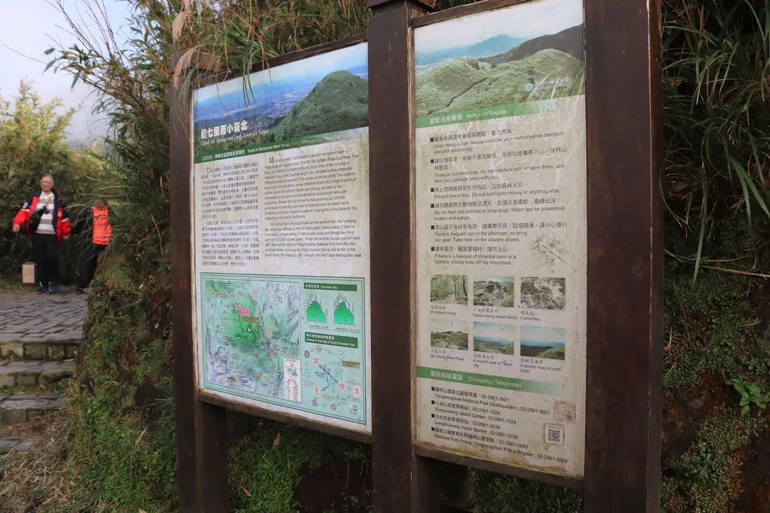
3:59 PM, we arrive at Xiaoyoukeng.
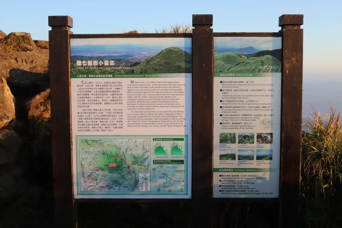
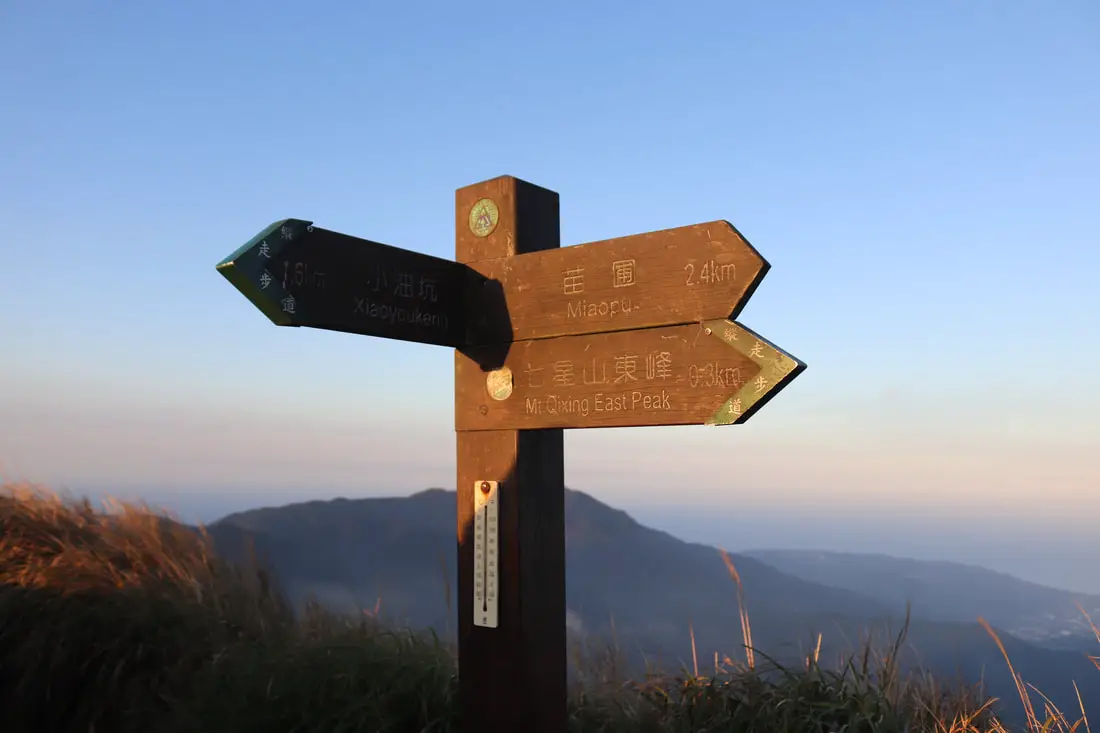
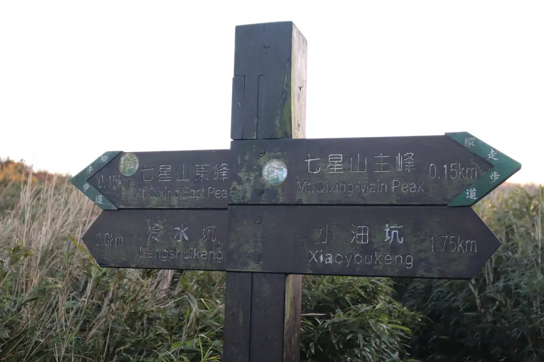
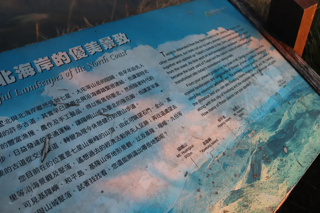
The easiest way to get to the top is from Xiaoyoukeng Parking lot. From there it is only about a half hour hike to the top. "Climb Mt. Qixing and Look Down on Taipei" "Mt. Qixing rises 1,120 meters making it the highest peak in Yangmingshan National Park. The Mt. Qixing Main Peak-East Peak Trail takes you from the northern to the southern ends of the mountain's ridgeline; if you walk its entire length, you will observe the completely different ecological aspects of the slopes at the two ends. The southern slopes are covered with a dense broadleaf forest and a high diversity of wildlife, while the northern slopes are strongly affected buy the northeasterly monsoons and are therefore covered primarily with grasslands. Beside the trail at the nearby Xiaoyoukeng you will find landscapes formed by post-volcanic features such as steam vents, fumaroles, and sulfur crystal formations, making this a fine place foe the observation of volcanic landforms. Mt. Qixing Main and East Peak can be reached from the following four entrances: Miaopu (2.4 km to the main peak) Xiaoyoukeng (1.6 KM to the main peak) Lengshuikeng (2.1 KM to the east peak) and Menghuan Pond parking lot (2.2 KM to the east peak), When the weather is clear you will have 360 degree views of the whole Yangmingshan National Park from the Main and East Peaks, including the Datun Volcano Group, the terrain of the North Coast, Mt. Huangzui, Mt. Guanyin, and the Taipei Metropolitan Area." 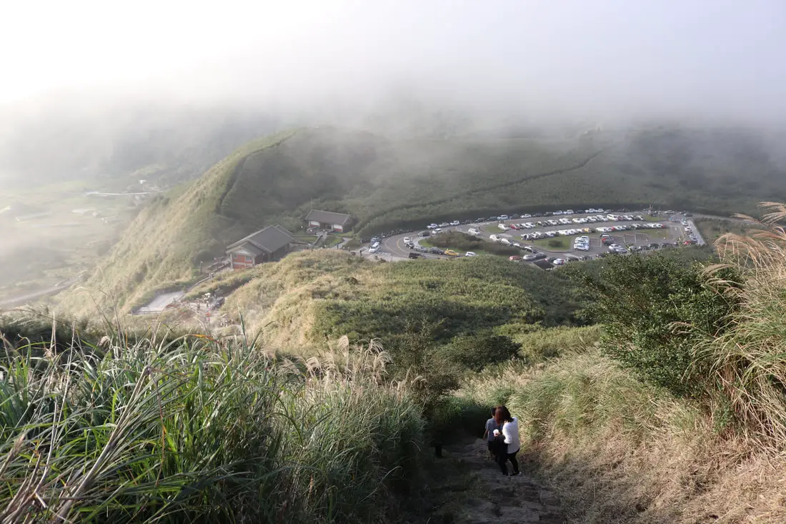
4:05 PM. The steepest part is the trail the goes right next to the Xiaoyoukeng crater. Below you can see the Xiaoyoukeng parking lot and visitor's center.
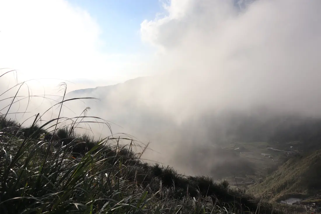
4:05 PM. Fog rolling in over Zhizihu.
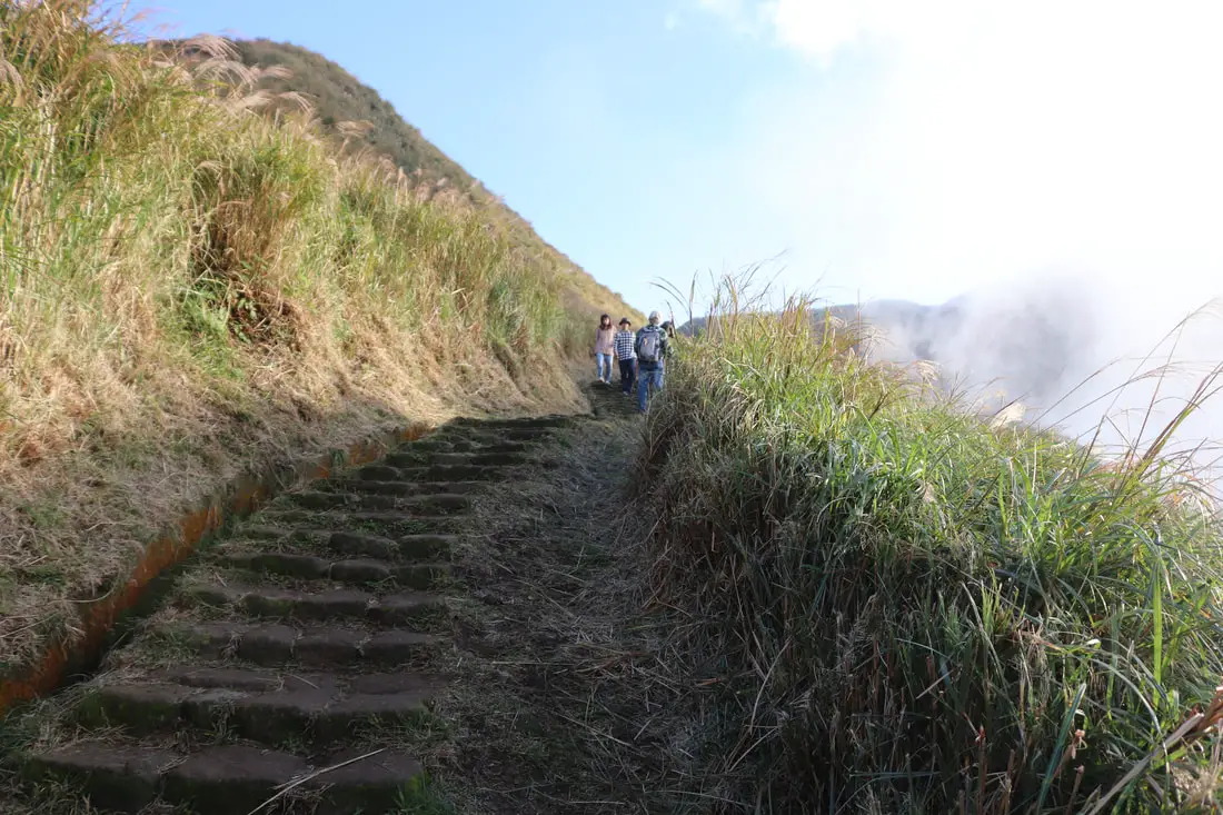
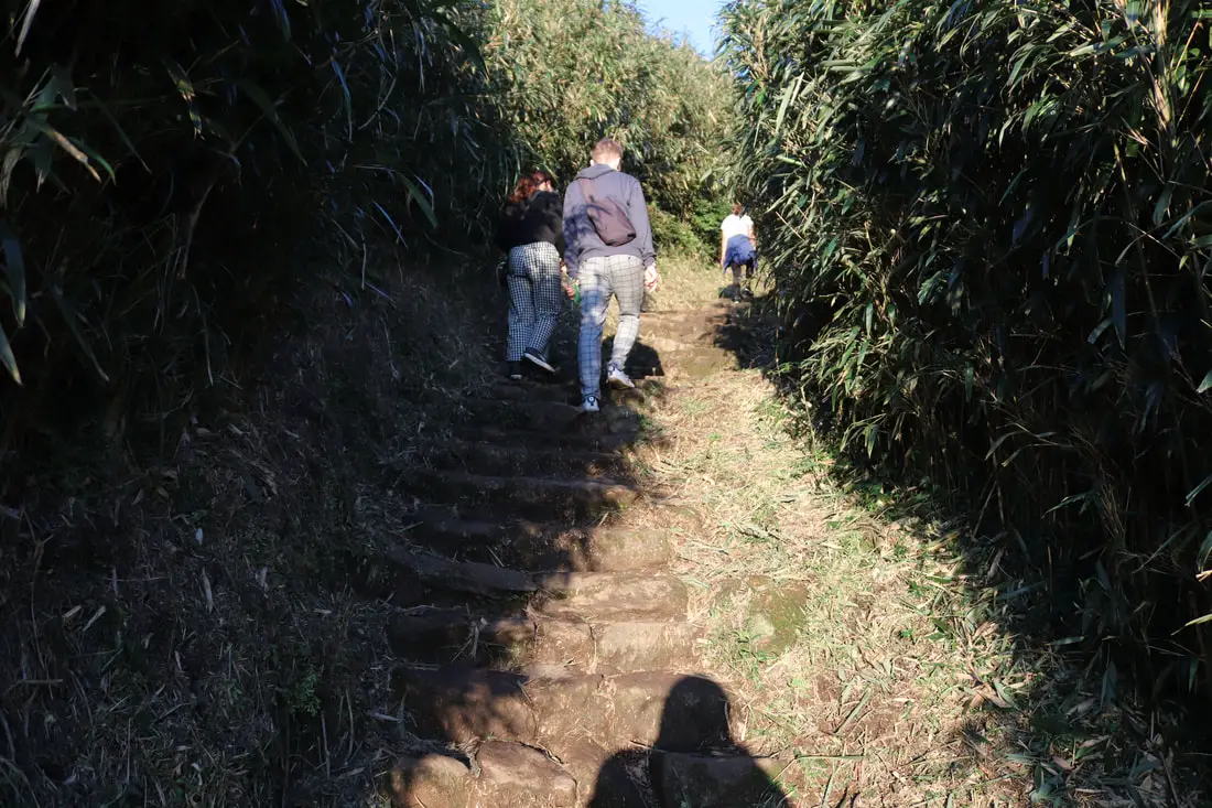
4:05 PM. More of the trail above Xiaoyoukeng.
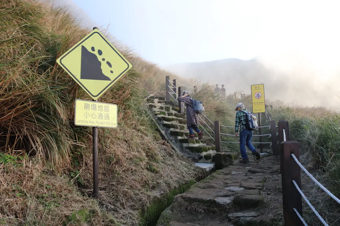
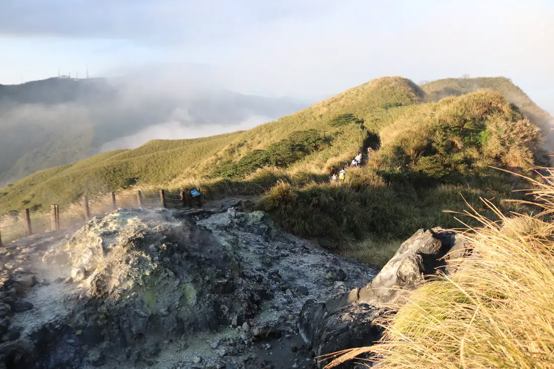
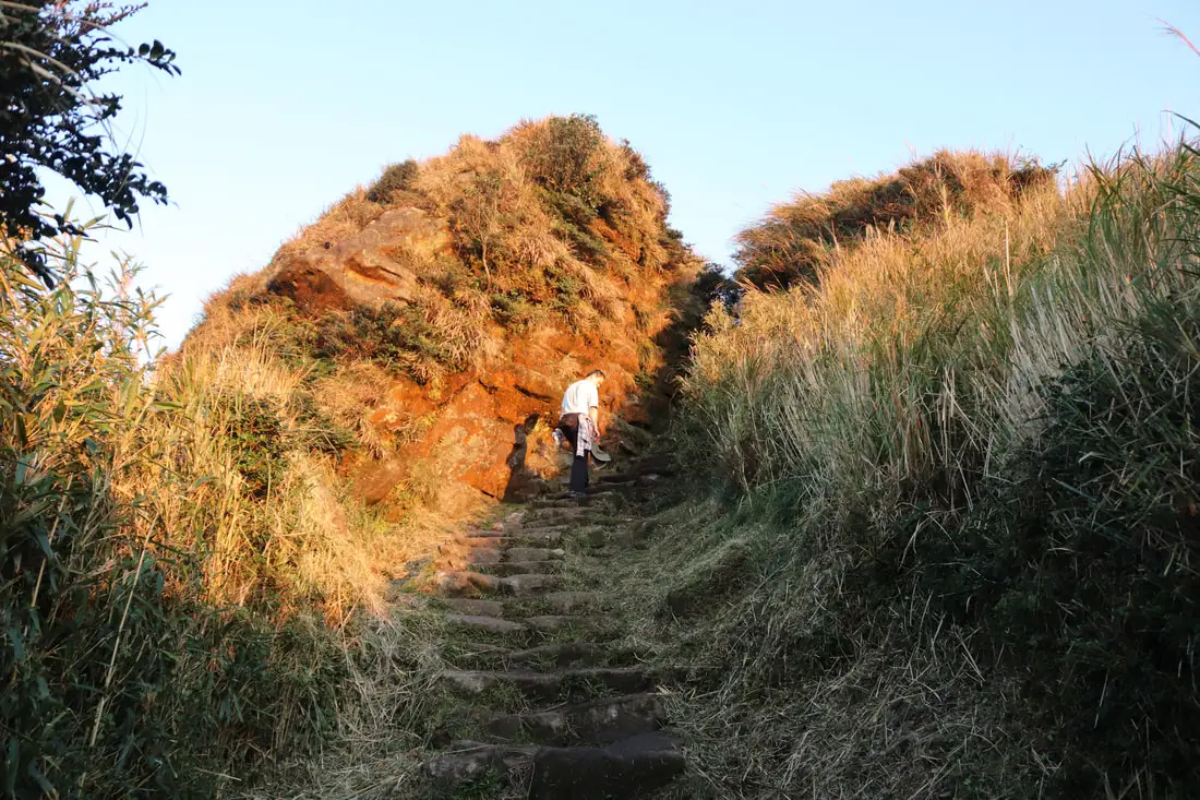
4:06 PM. Climbing stairs at the lip of Xiaoyoukeng crater.
4:06 PM. Fog and steam coming from the crater.
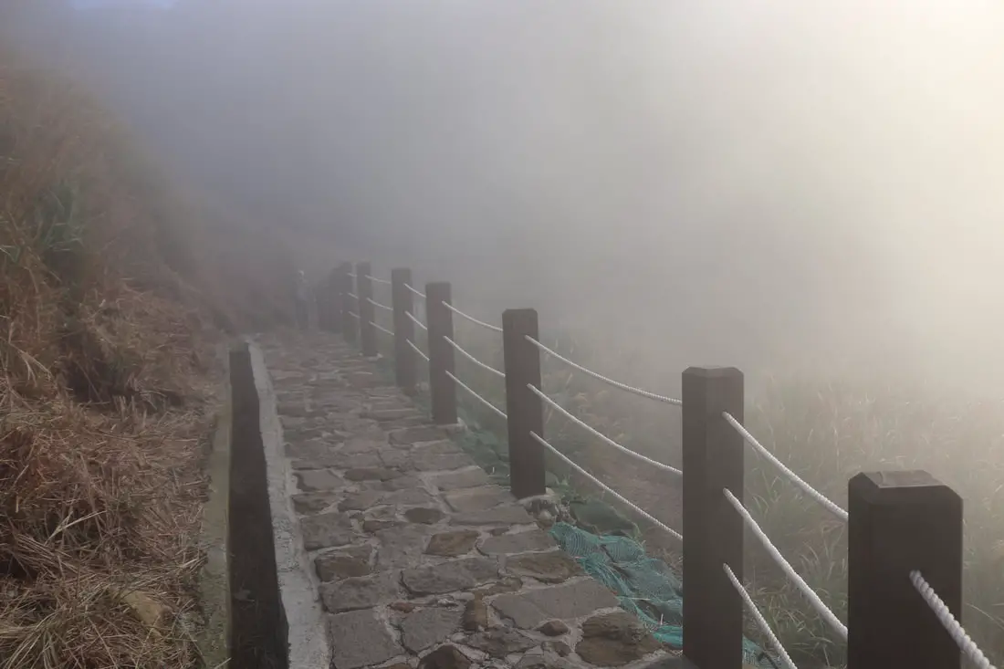
4:07 PM View of the edge of Xiaoyoukeng Crater.
4:08 PM.
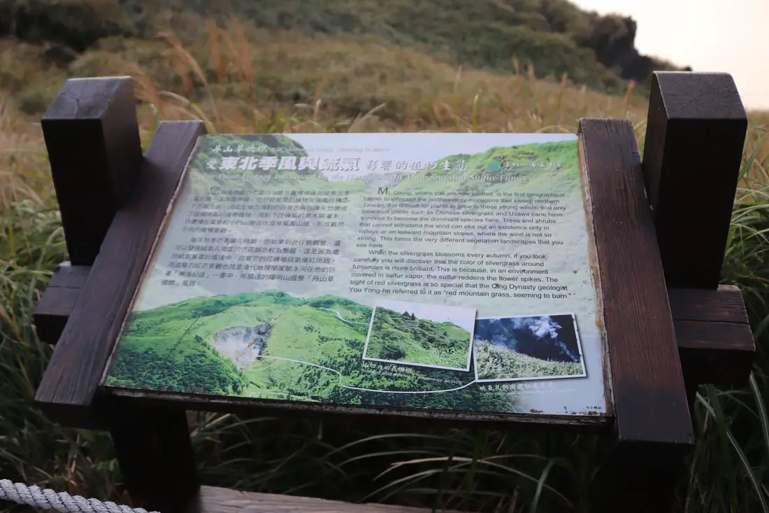
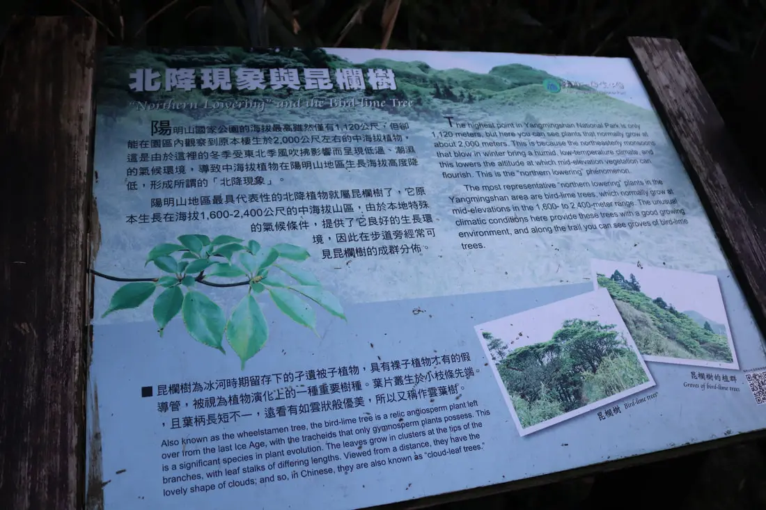
"The plant ecology influenced by the northeasterly monsoons and sulfur fumes" "MT Qixing, where you are now located, is the first geological barrier to intercept the northeasterly monsoons that sweep northern Taiwan. It is difficult for the plants to grow in these strong winds, and only tenacious plants such as Chinese silvergrass and Usawa cane have survived to become the dominant species here. Trees and shrubs that cannot withstand the wind can eke out an existence only in valleys or on leeward mountain slopes, where the wind is not so strong. This forms the very different vegetation landscapes that you see here. When the silvergrass blossoms every autumn, if you look carefully you will discover that the color of the silvergrass around fumaroles is more brilliant. This is because, in an environment covered in sulfur vapor, the sulfur reddens the flower spikes. The sight of red silvergrass is so special that the Qing Dynasty geologist You Yong-he referred to it as "red mountain grass, seeming to burn." 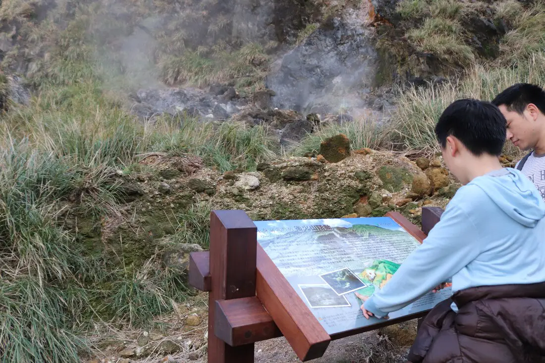
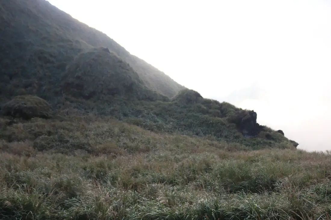
4:10 PM.
"Quietly intense volcanic activity" "As we walk past the fumaroles along the trail, we can see the best that is welling out the the earth and the smell a unique odor. These are indications of the intense post-volcanic activity that is taking place deep beneath your feet. Post volcanic activity takes place because the hear that is contained in the magma chamber following a volcanic eruption raises the temperature of underground water, turning it into steam that emerges from the earth's surface in fumaroles, steam vents and hot springs. The yellow crystals that you see around many of the steam cents form when the sulfur-containing high temperatures gas from deep in the earth spews from the surface, comes in contact with the air, cools down, and creates spine-shaped crystals. The gas also contains sulfur dioxide and other toxic gases, so you don't want to get too close for too long." 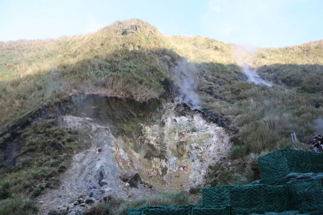
4:10 PM. Above Xiaoyoukeng Crater, there are many sulfur deposits and steam vents in the valley the goes toward the top of the mountain.
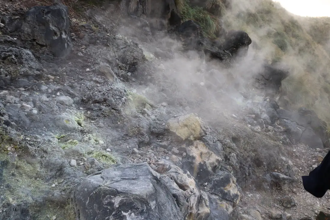
4:14 PM. A closeup on the sulfur vents.
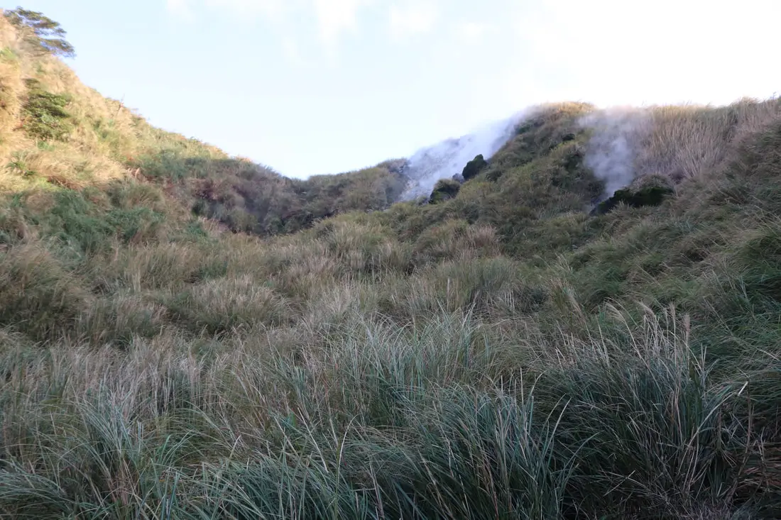
4:15 PM. Quite a few places are spewing steam.
4:16 PM. Once you get out of the steam vent valley, you get to see some pretty amazing views.
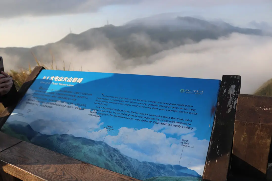
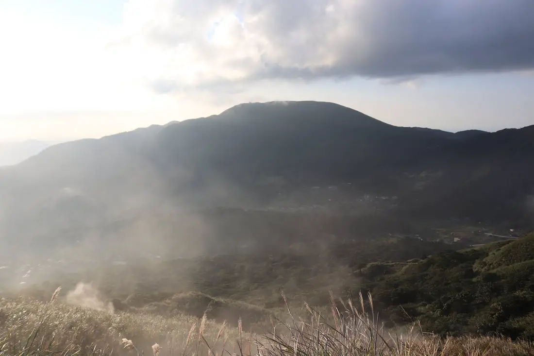
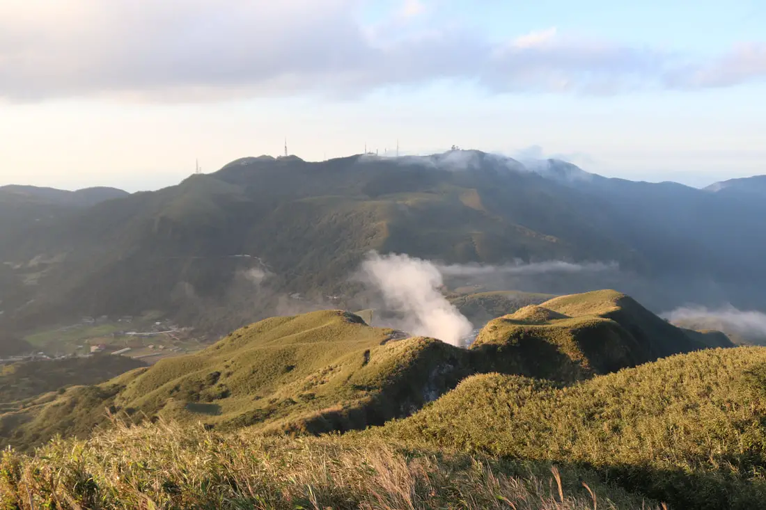
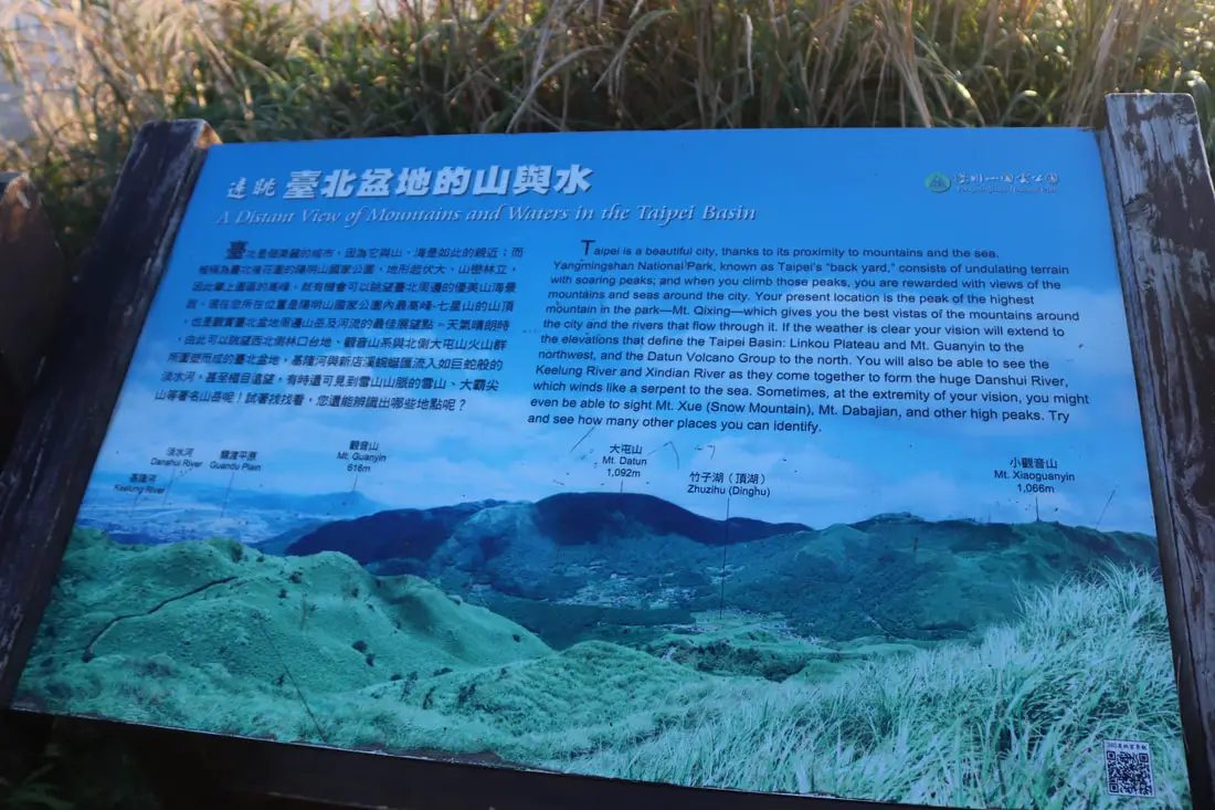
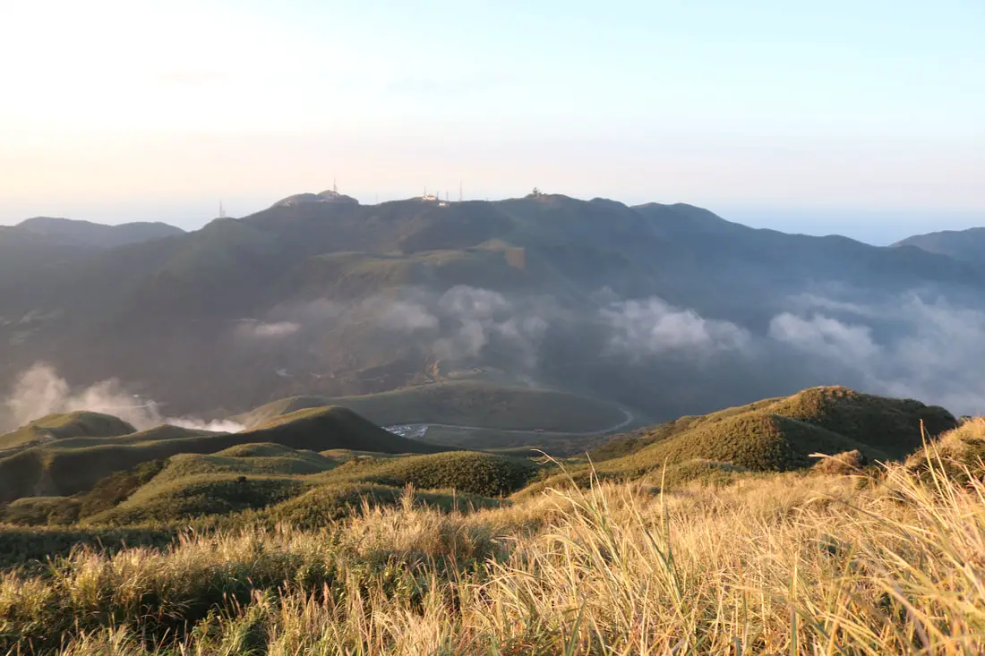
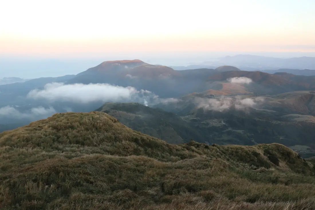
"Views of the Datun Volcano Group" "The Datun Volcano Group that you see before you is made up of many peaks resulting from major eruptions 2.5 million years and 700,000 years ago, gradually forming the terrain we see today., We can still see remnants of this volcanic activity in the many steam vents, fumaroles, and hot springs that dot the area. Look at the peaks of the Datun Group. The flat mountain on the left is Datun Mountain Peak, with a navigation station of top. The mountain with the flat cone shape and the TV and radio antennas on top is Mt. Xiaoguanyinshan. The impressive mountain on the right is Mt. Zhuzi, which is currently a military controlled area." 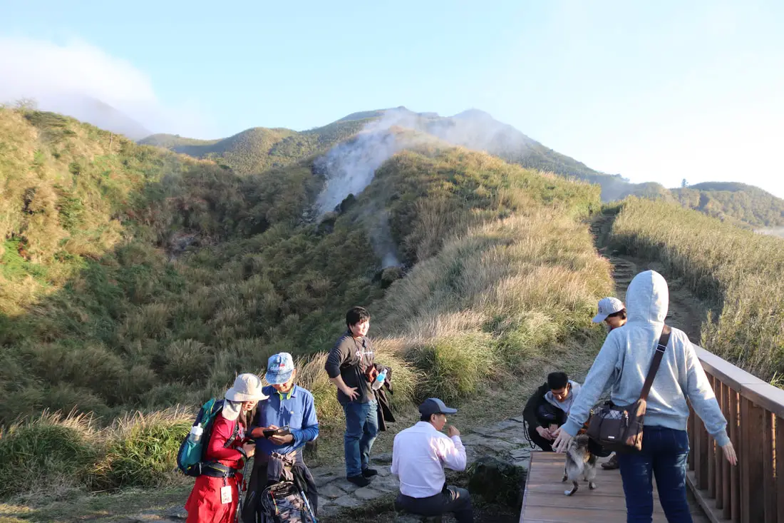
4:16 PM. More steam coming from the Datunshan Viewing platform.
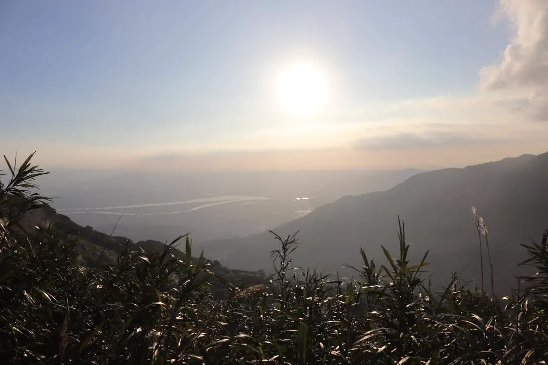
4:18 PM. First view of the Taipei Basin on the trail.
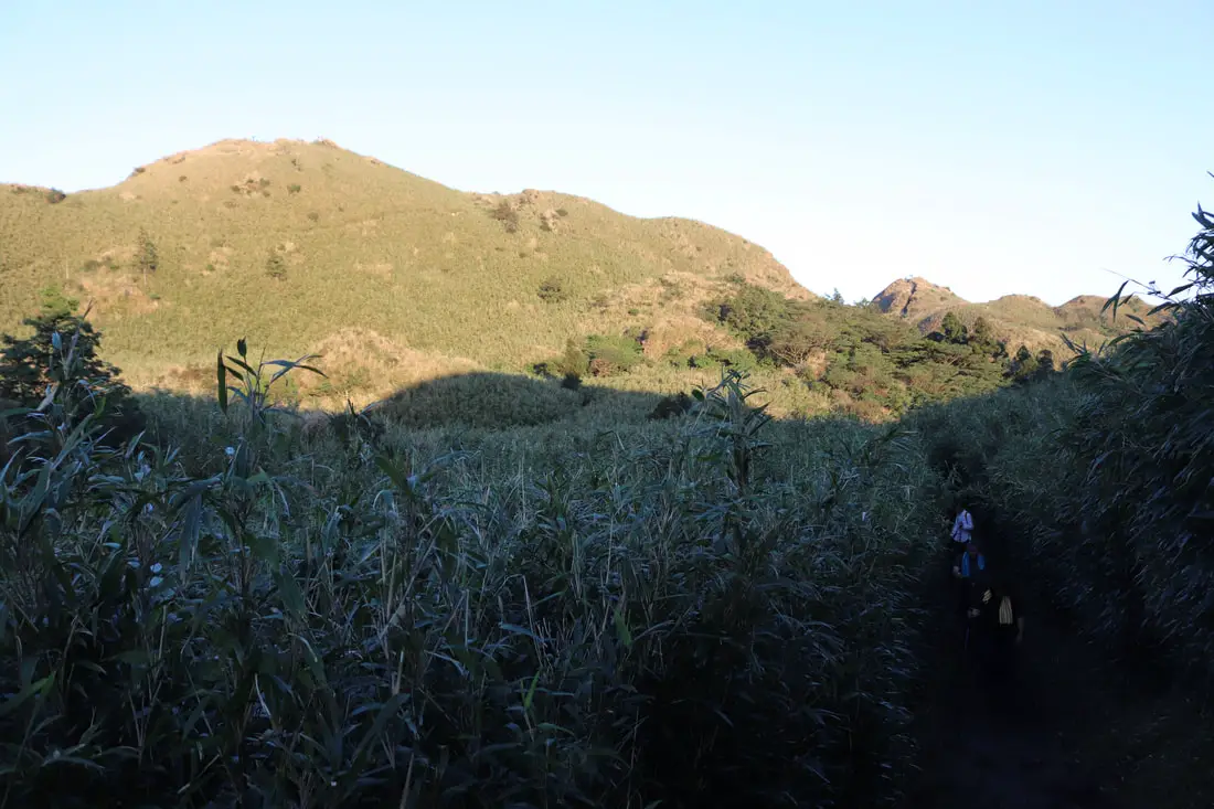
4:20 PM.
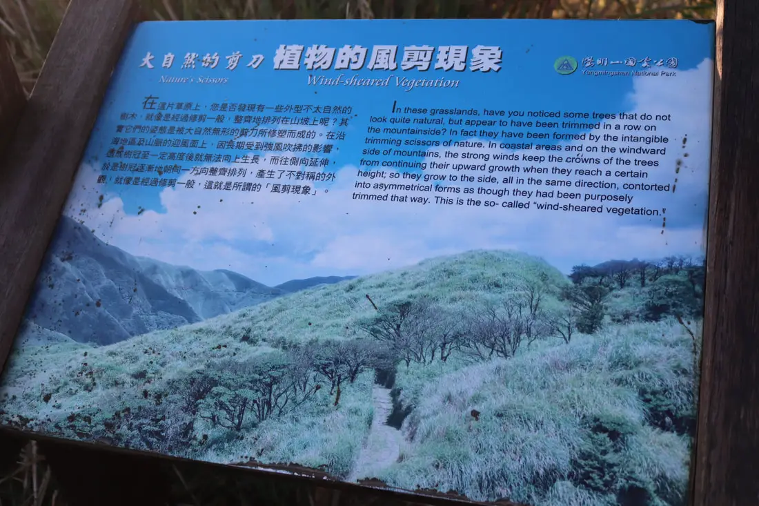
"Wind sheared vegetation" "In these grasslands, have you noticed some trees that do not look quite natural, but appear to have been trimmed in a row on the mountainside? In fact they have been formed by the intangible trimming scissors of nature. In coastal areas and on the windward side of mountains, the strong winds keep the crowns of the trees from continuing their upward growth when they reach a certain height, so they grow to the side, all in the same direction, contorted into asymmetrical forms as though they had bee purposely trimmed that way, This is the so called wind sheared vegetation. 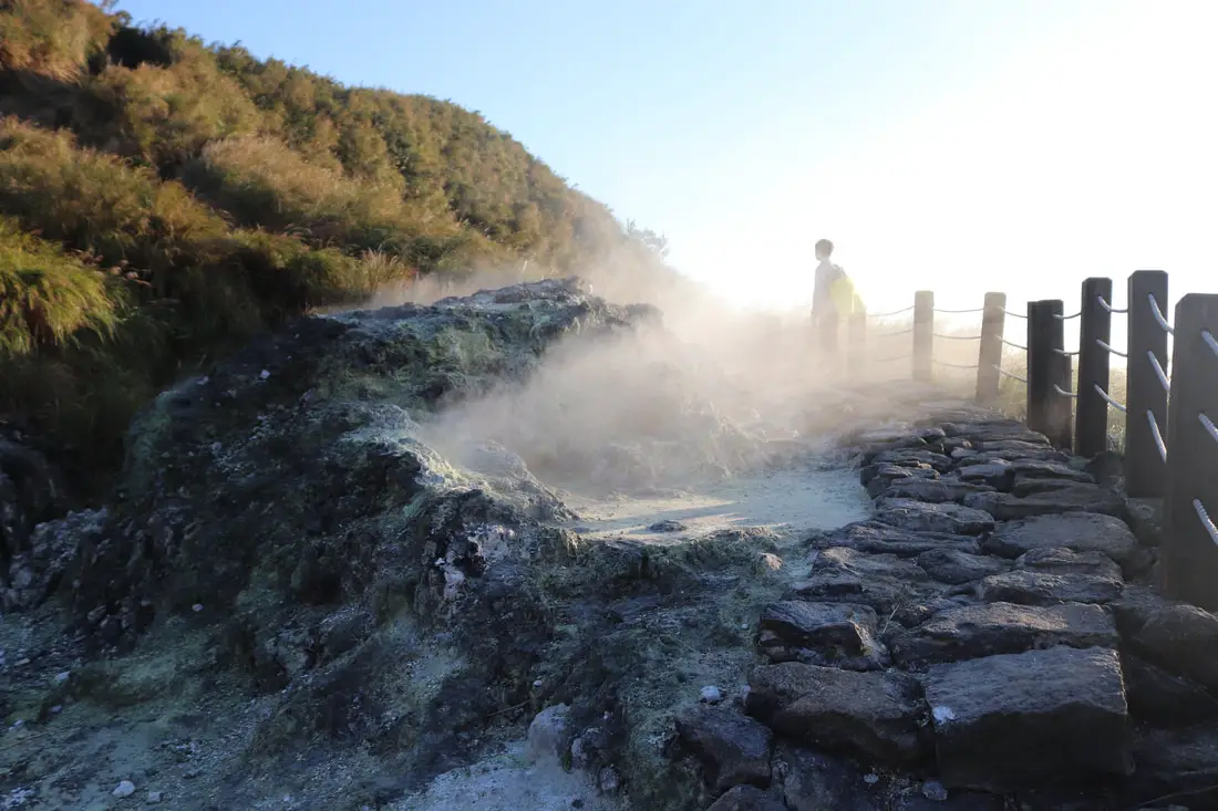
4:20 PM. Getting really close to a hot spring on the trail.
4:20 PM. View of Datunshan.
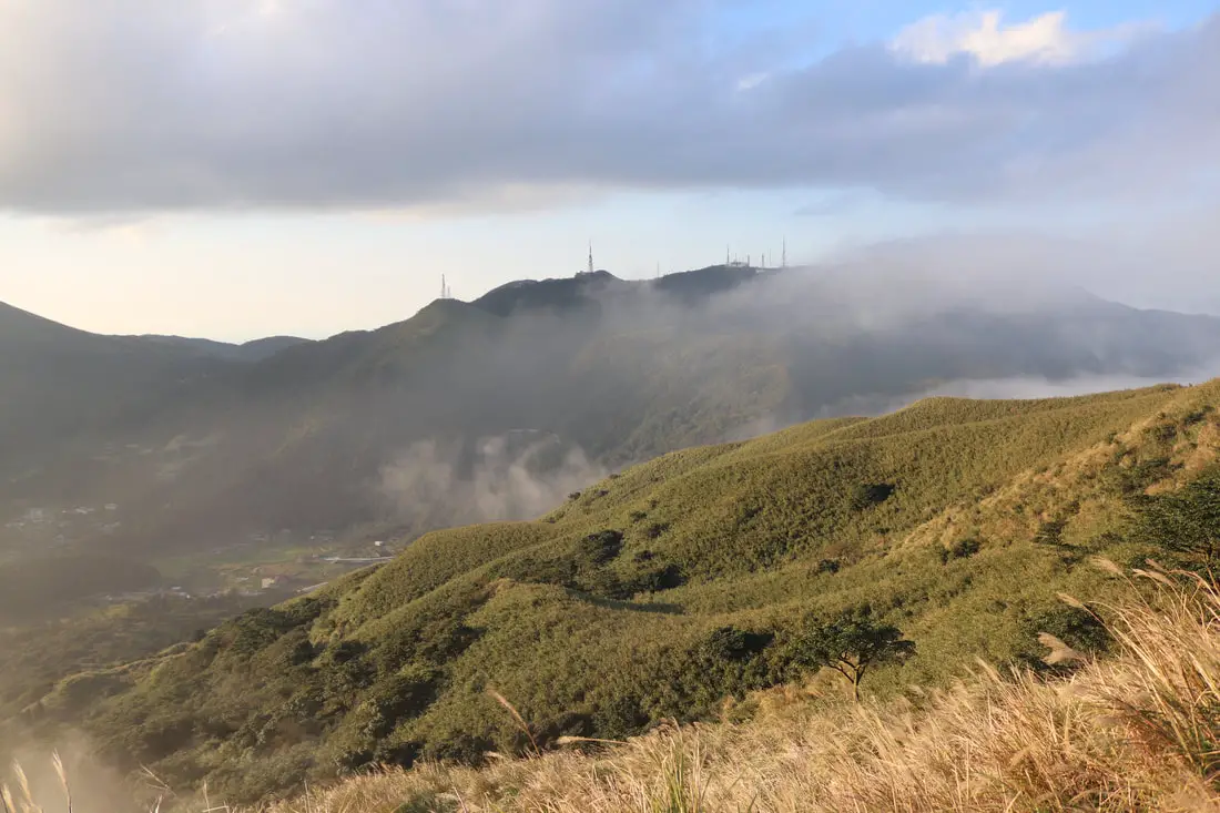
4:20 PM. Another view toward Xiaoyoukeng and Zhuzihu.
4:20 PM. Looking back at the steam vent.
4:28 PM. Steam coming from Xiaoyoukeng.
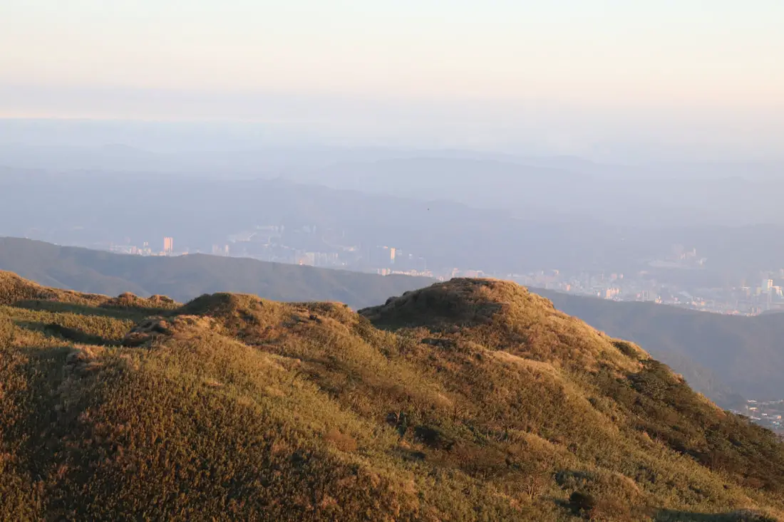
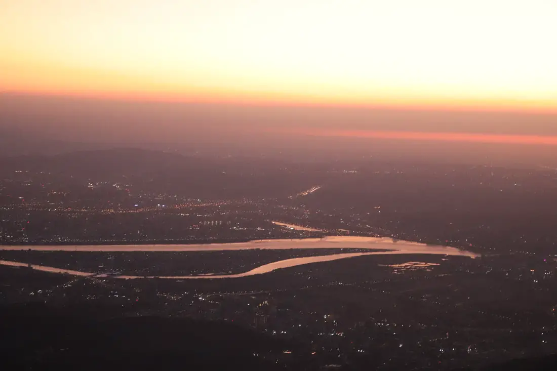
4:28 PM. Misty view of the Taipei Basin.
4:28 PM.
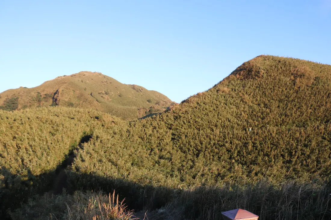
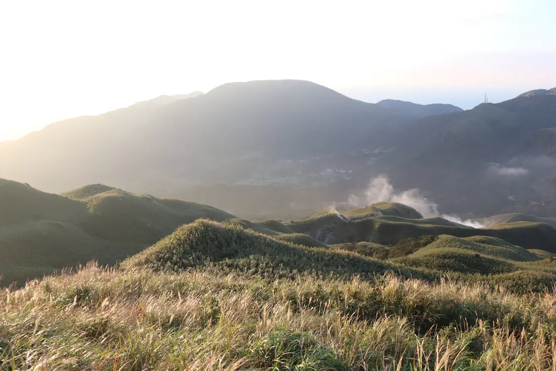
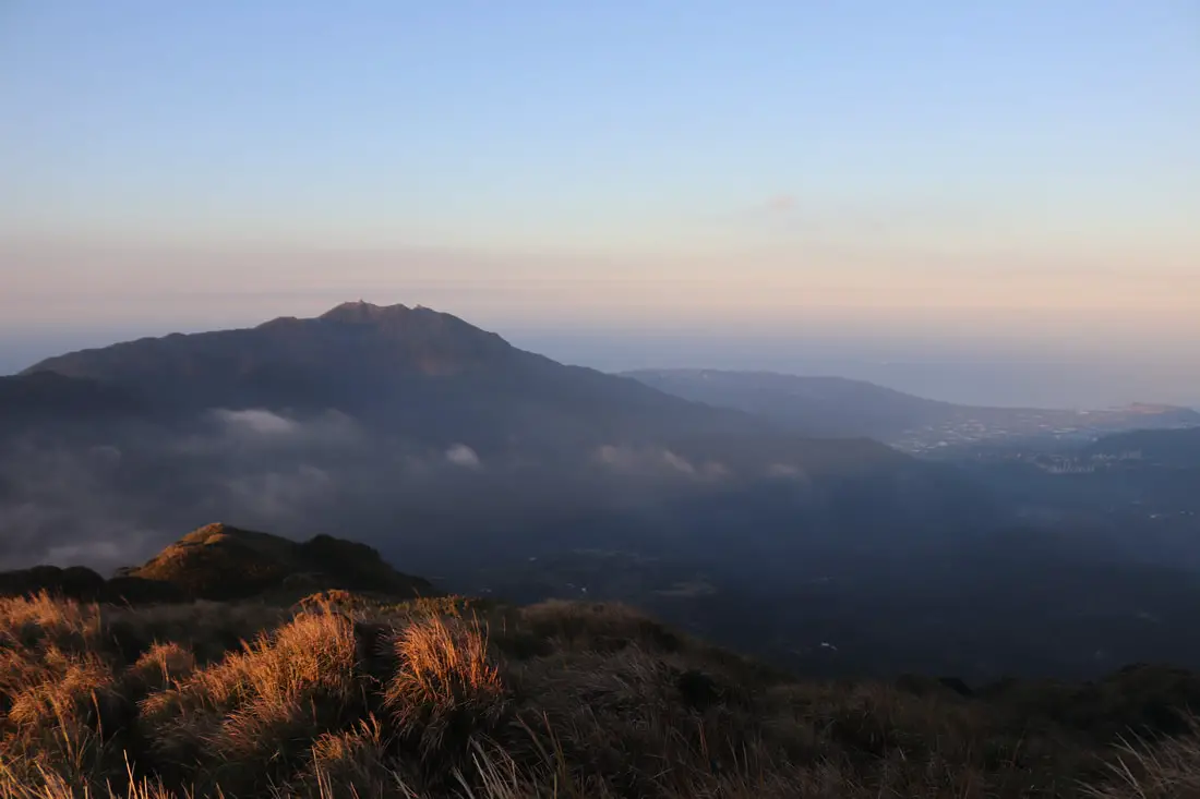
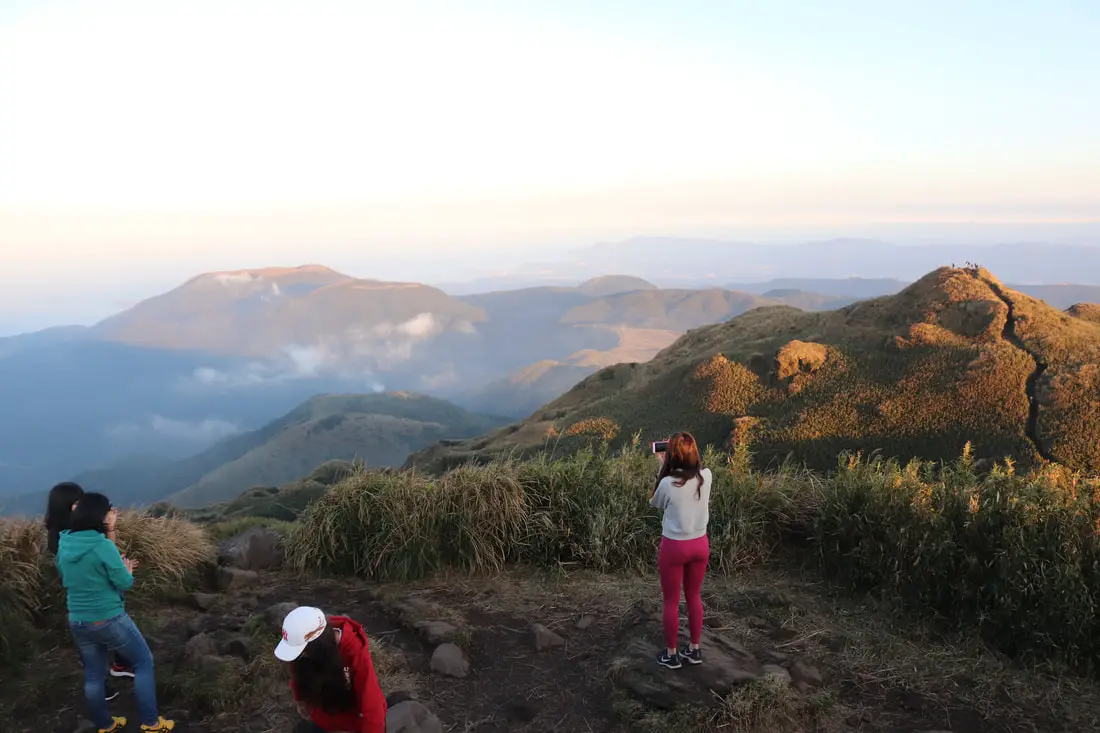
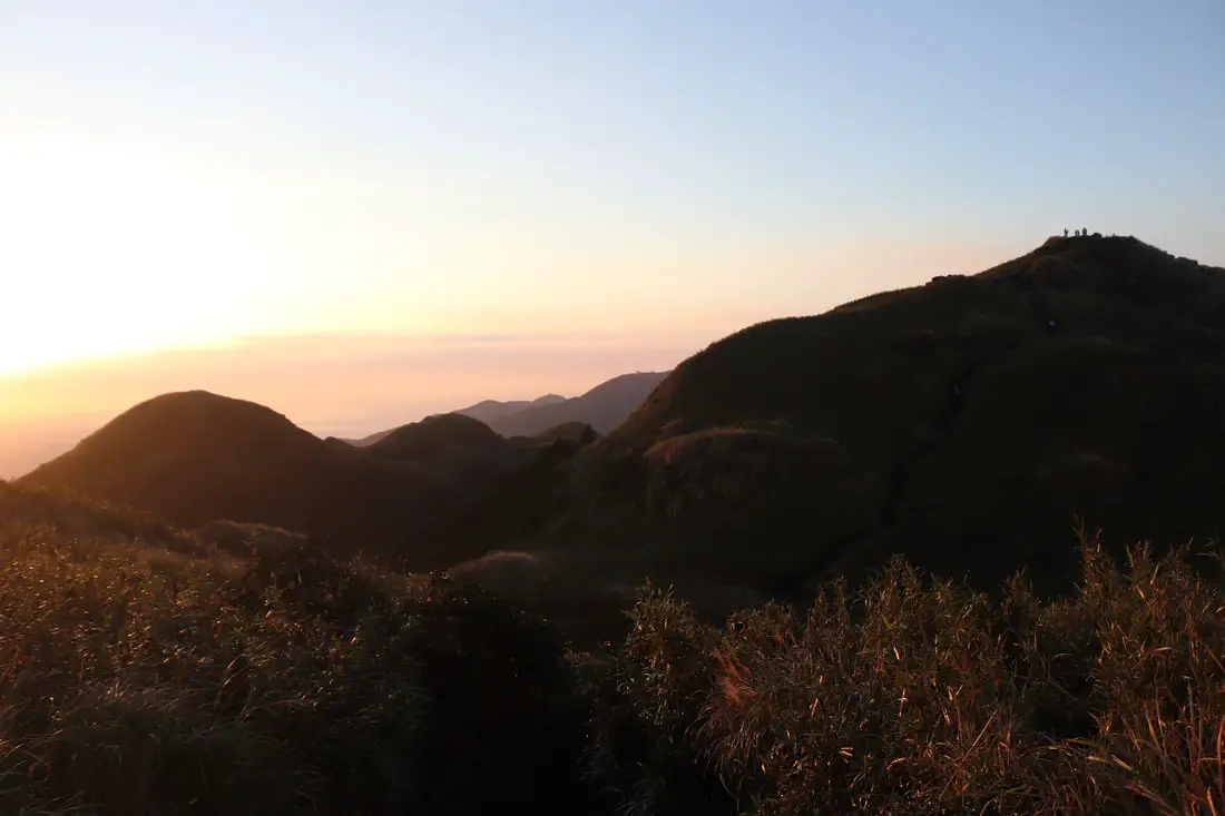
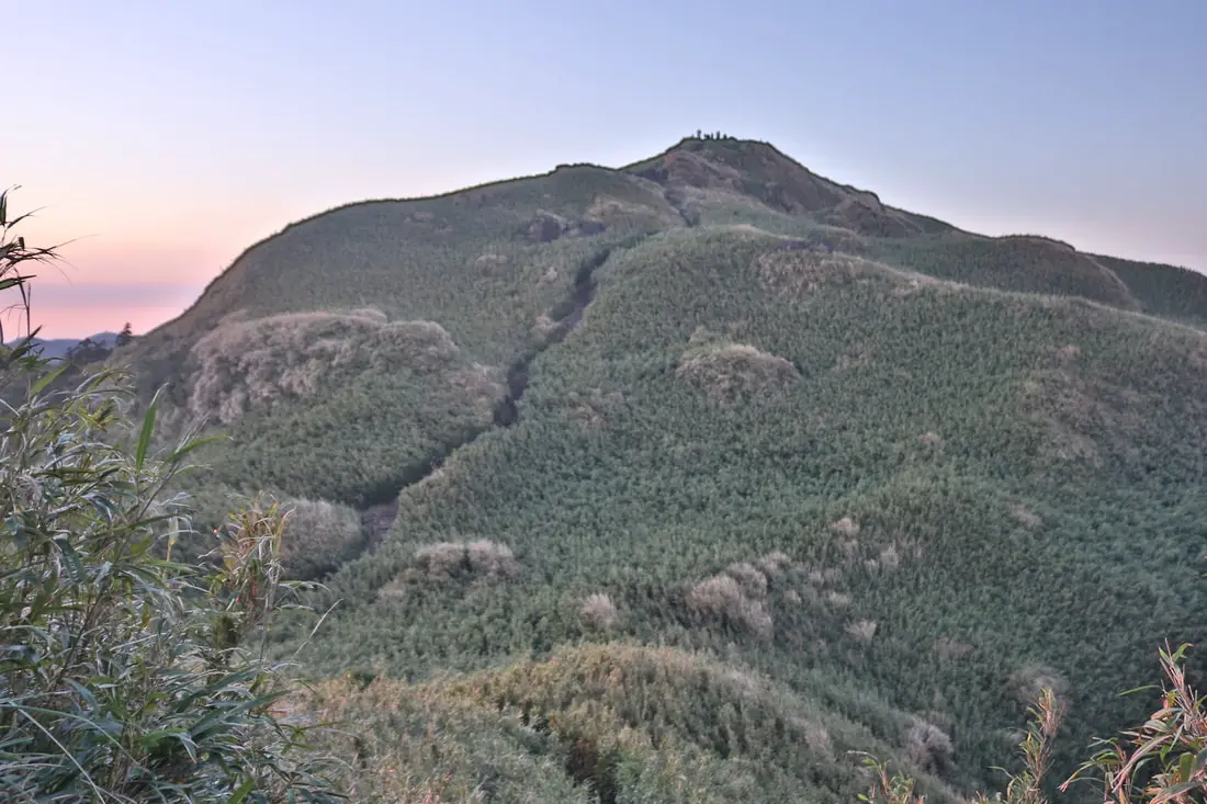
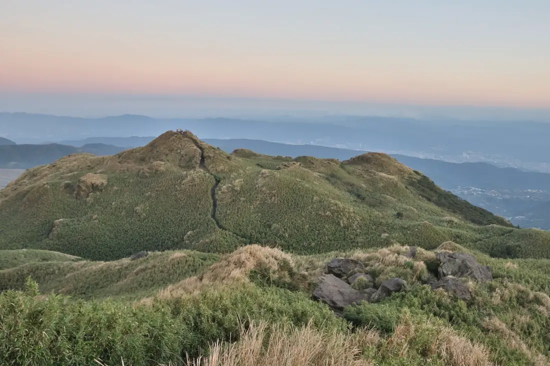
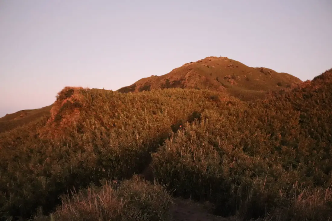
4:28 PM. Now we can see the top of the mountain. The mountain top is pretty flat before the main peak and is covered in bamboo.
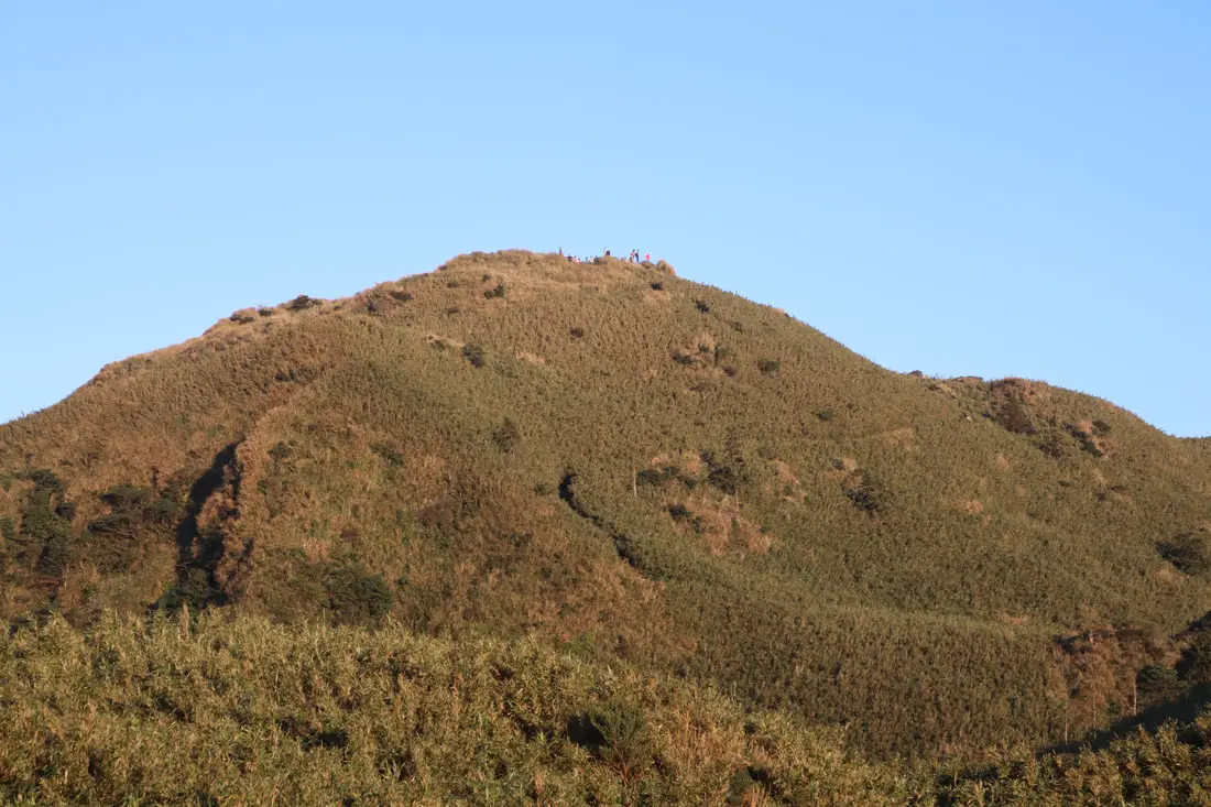
4:28 PM. You can see people at the top of the mountain.
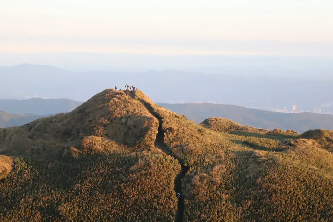
4:29 PM. Hiking in the shadows toward the top. This part of the mountain used to be a crater but has since eroded into seven peaks around a flat valley.
4:33 PM.
4:36 PM. Hiking through the bamboo.
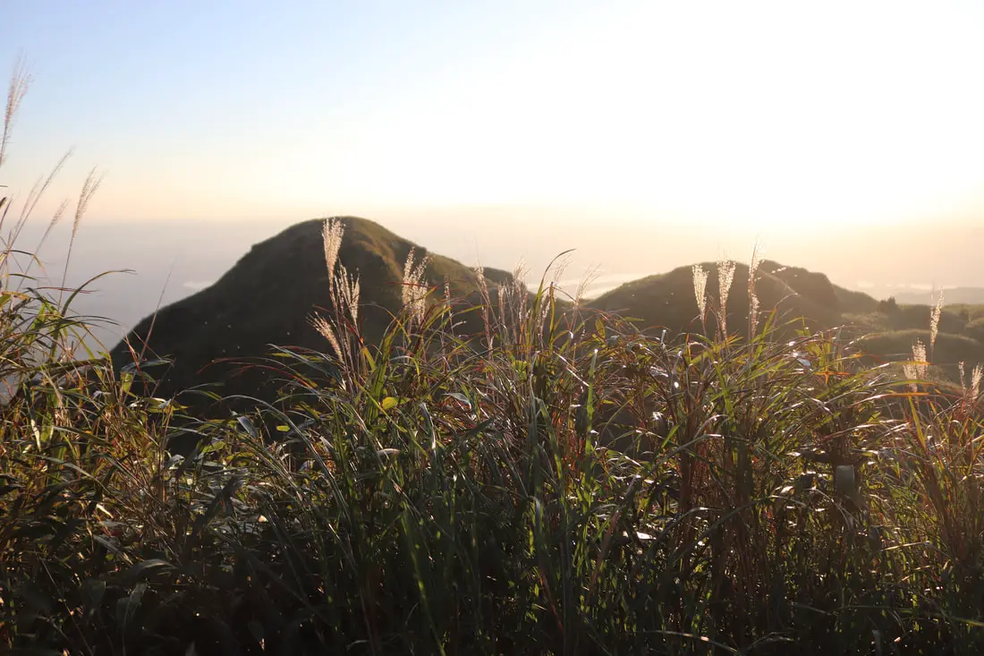
4:38 PM. Silvergrass covering the other peaks.
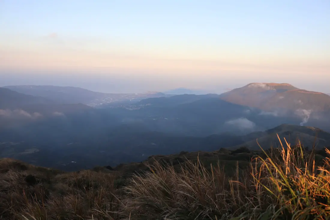
4:41 PM. Another view of Datunshan.
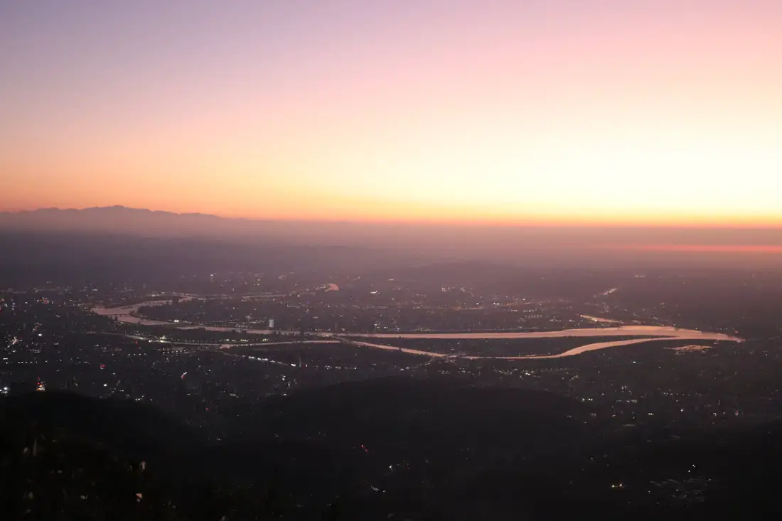
4:41 PM. View of the Taipei Basin from the top.
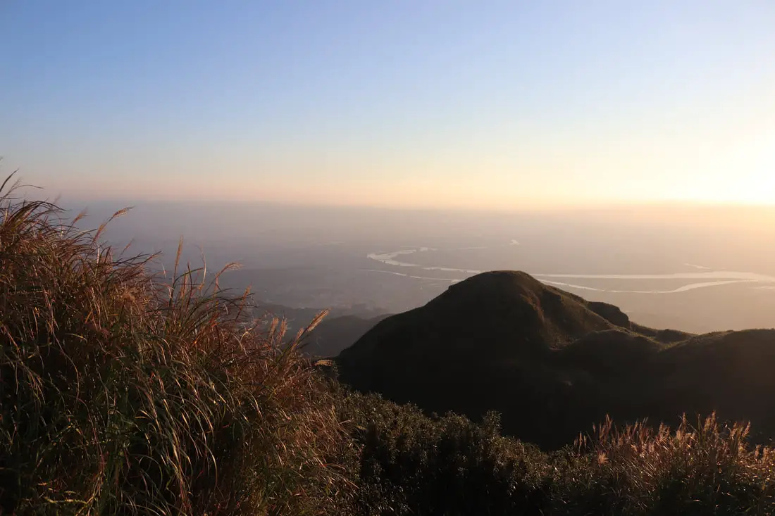
4:41 PM. View looking east.
4:41 PM.
4:41 PM.
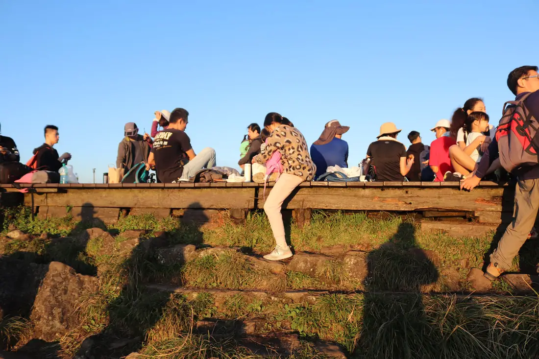
4:42 PM. People enjoying views at the top of the mountain.
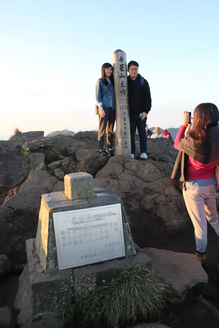
4:42 PM. Photo opportunity at the very top of the main peak.
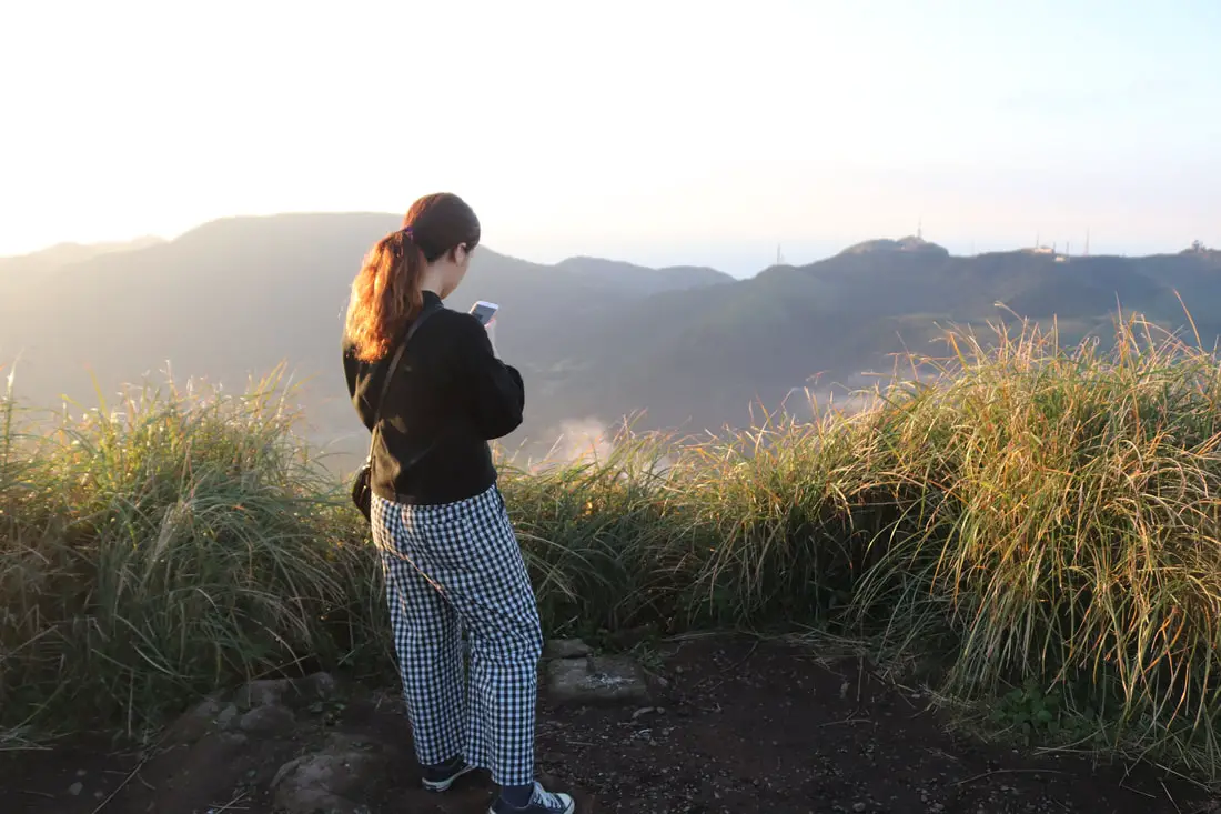
4:42 PM. A woman enjoys the view looking toward Xiaoyoukeng Crater.
4:42 PM. Better view toward Xiaoyoukeng.
4:42 PM. View toward Little Guanyinshan.
4:42 PM. View of Xiaoguanyinshan and Jinshan below.
4:42 PM. The shadow of Mt. Qixing over Jinshan. I have not seen a shadow like this since hiking volcanic peaks in the US northwest.
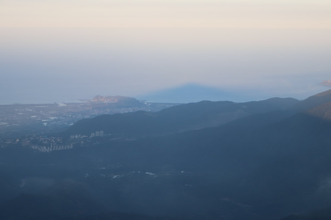
4:42 PM. Cloaseup on the shadow. You can aslo see Yehliu and Wanli.
4:42 PM. View looking toward Keelung, with Qingtiangang grassland on the mountain.
4:43 PM. Signs pointing to different trails down the mountain.
4:43 PM. View of the east peak and Keelung.
Cloaser view of the east peak.
View of east Taipei in the background.
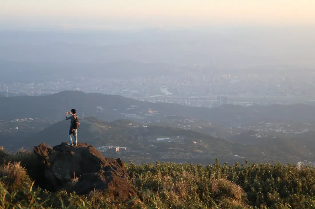
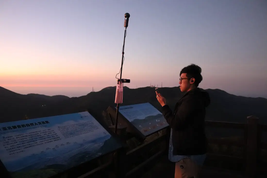
A man takes photos with central Taipei in the background.
Check out more photos of the area in the photo gallery above.
Last few steps to the east peak.
View of the main peak from the east peak.
Clearer view of Qingtiangang looking north.
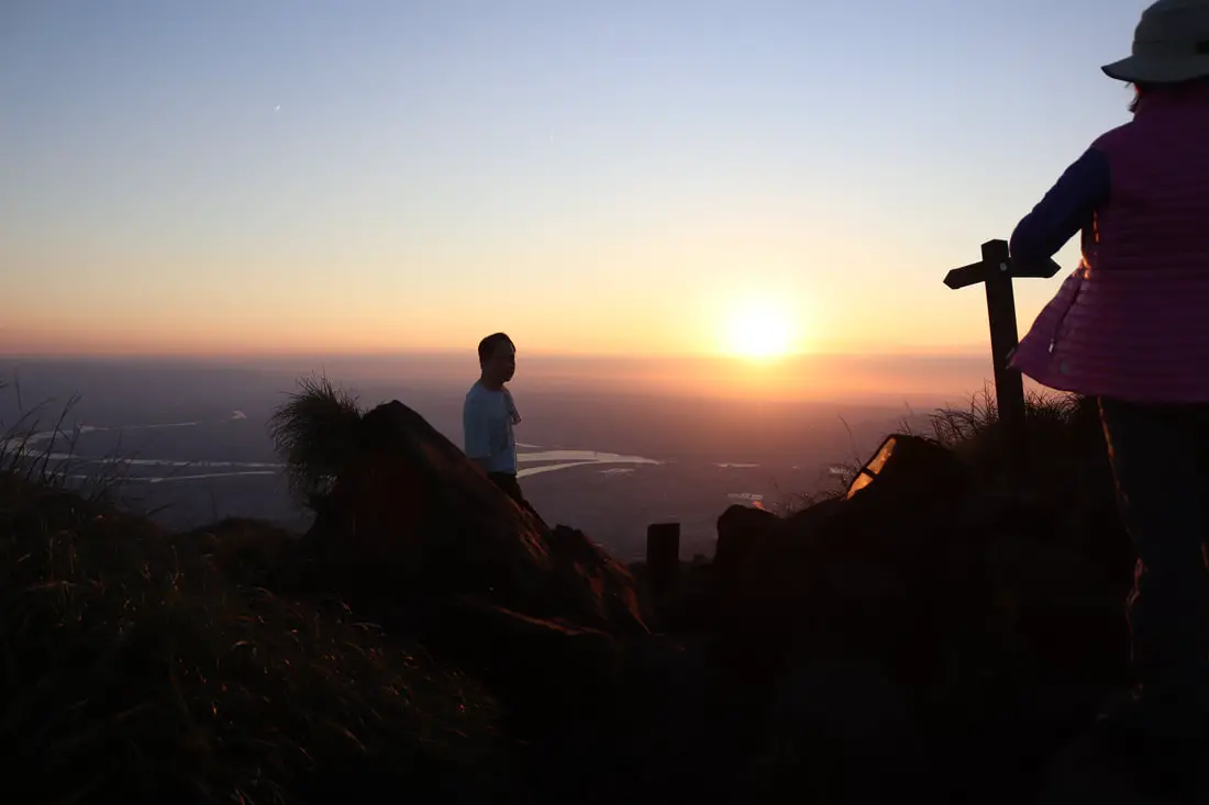
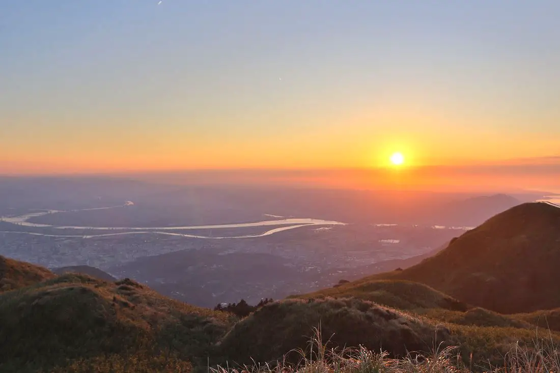
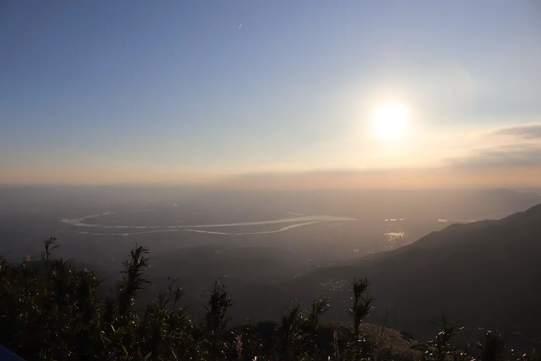
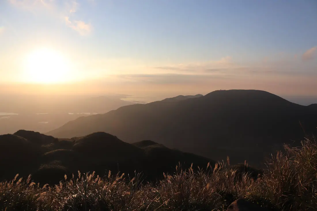
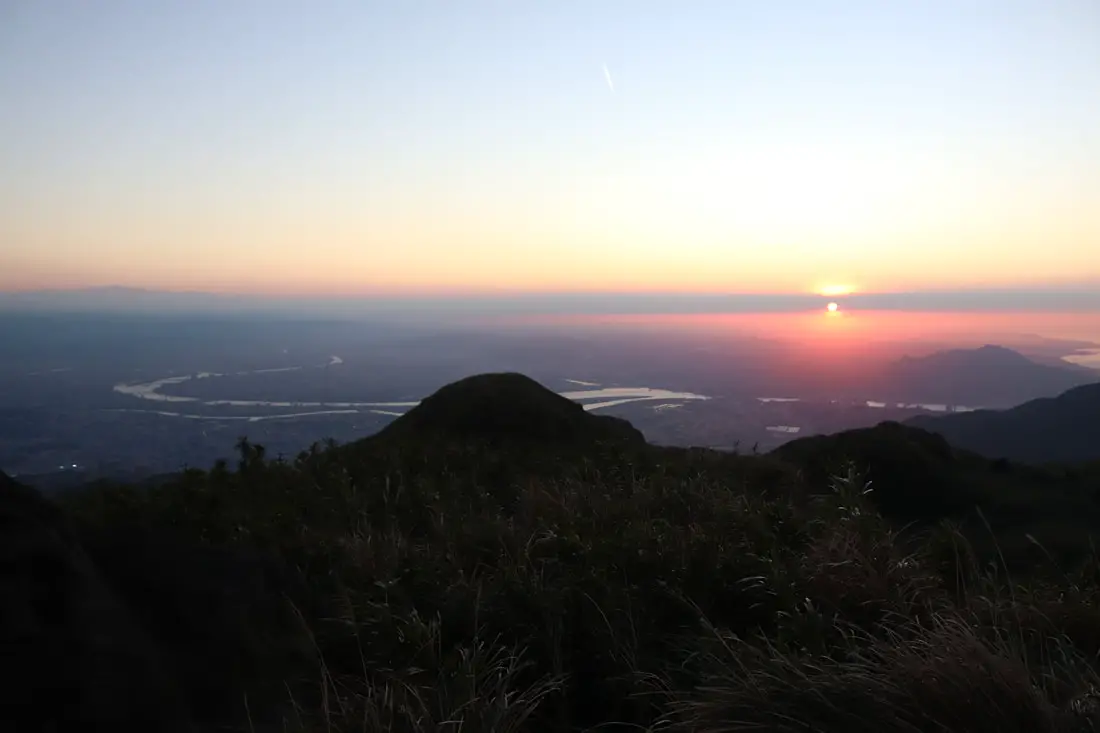
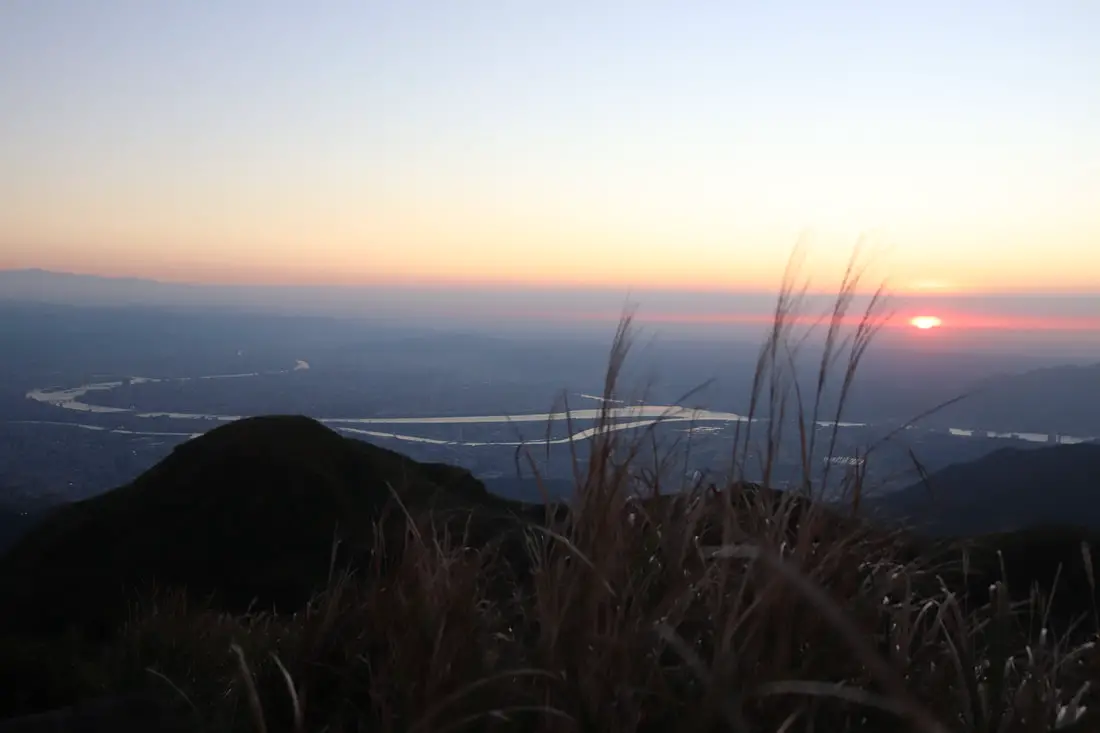
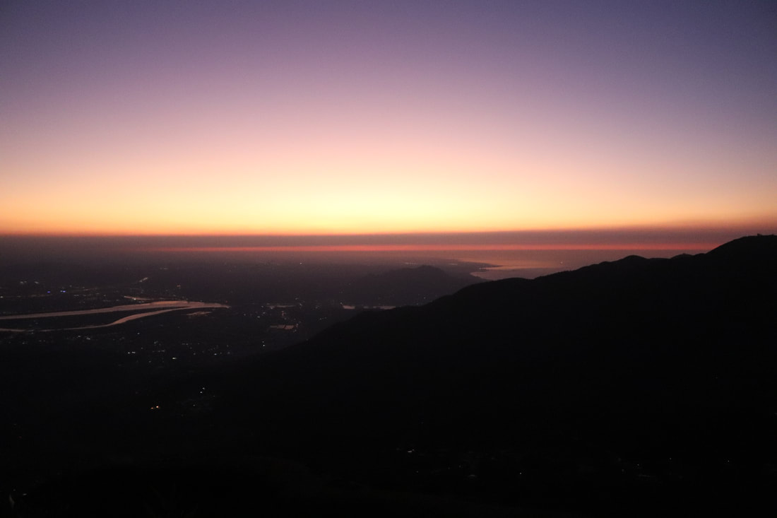
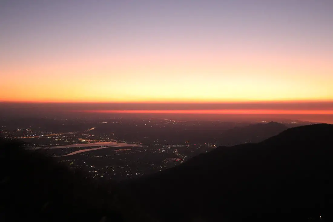
4:55 PM. View of the sunset from the top of the east peak.
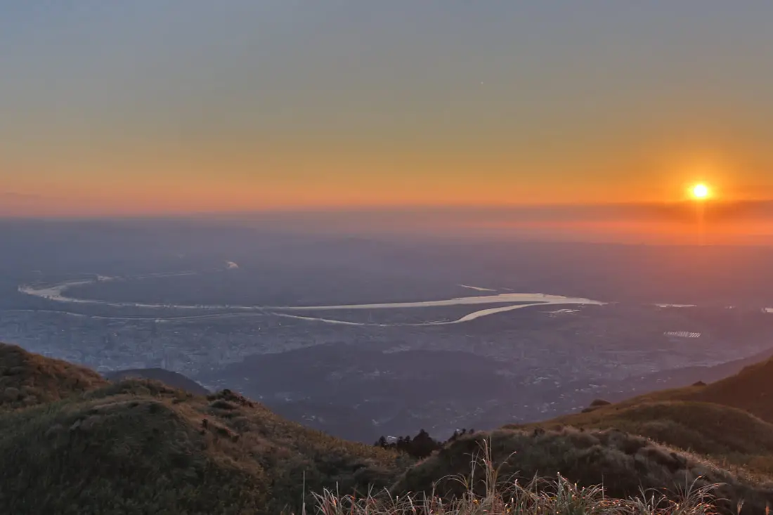
Amazing sunset over Taipei.
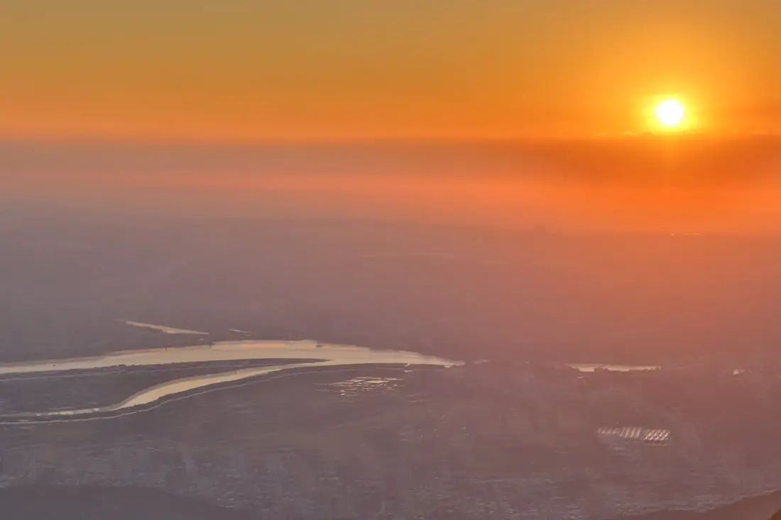
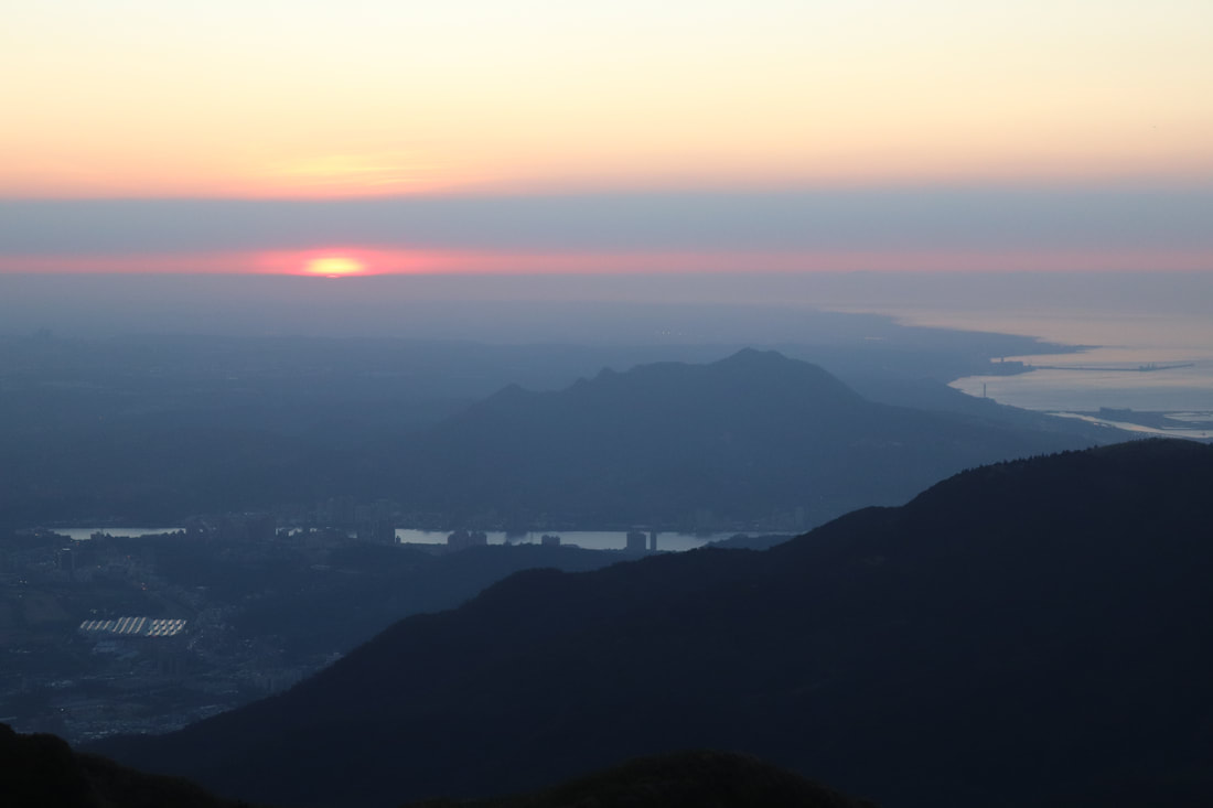
Closer view of the sun. My HDR setting made the river look weird, first time using it.
Another view of the Tamsui and Keelung rivers.
Looking toward cetnral Taipei.
Check out more photos of the sun set in the photo gallery above.
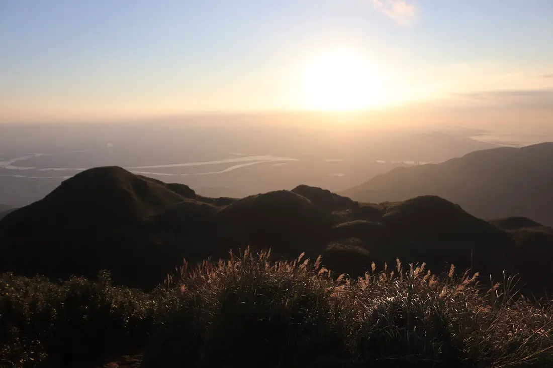
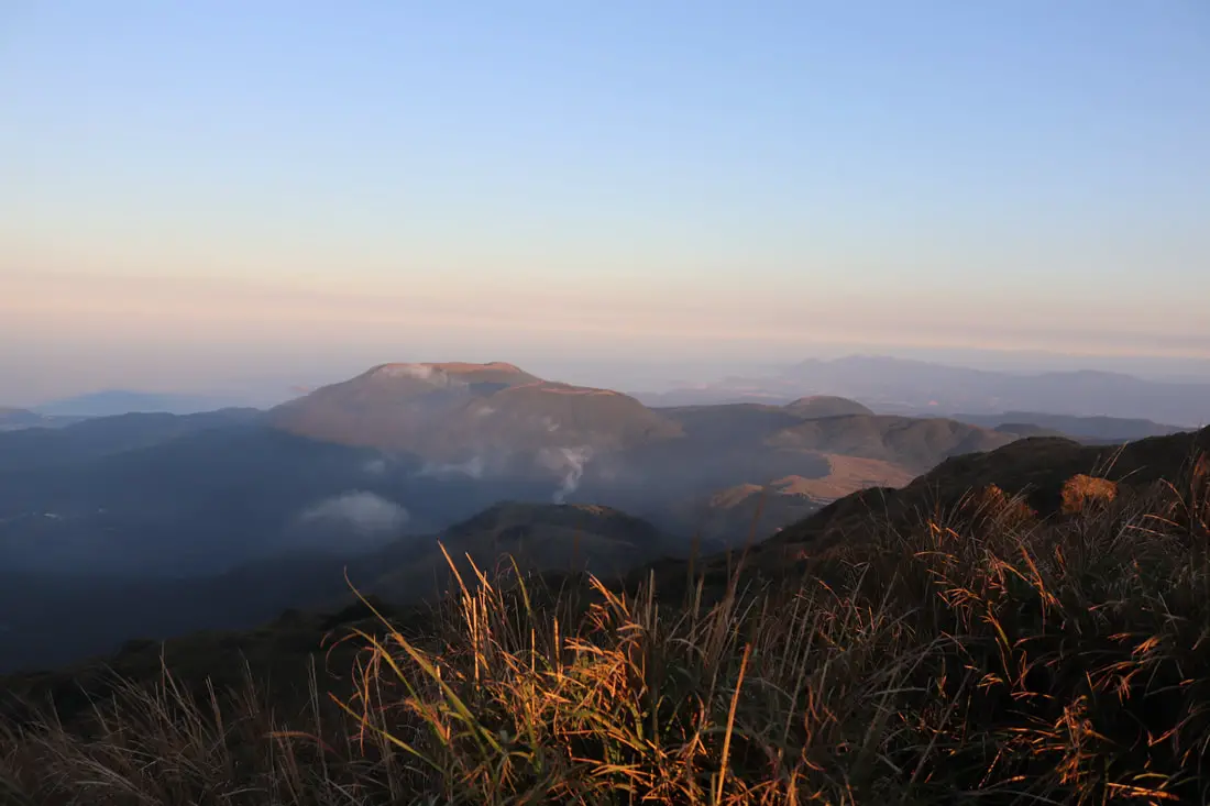
Another view of the main peak.
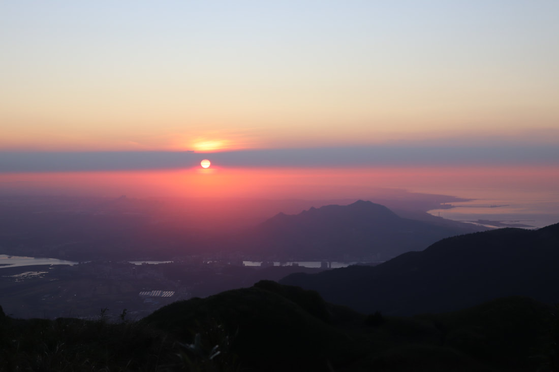
Amazing sunet from the main peak.
Looking back at the east peak again.
The very last bit of sun over Guanyinshan.
Another view of the sun breaking through clouds.
5:07 PM. Silvergrass in the sunset.
Check out more photos of the sun set in this area in the photo gallery above.
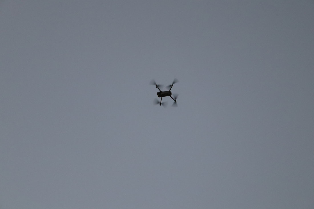
There was a guy flying a drone there, wish I would have brought my drone too. You can fly here if you first apply for a permit from the park seven days in advance.
5:22 PM. We begin our way down. Beautiful sky as we hiked back though the bamboo.
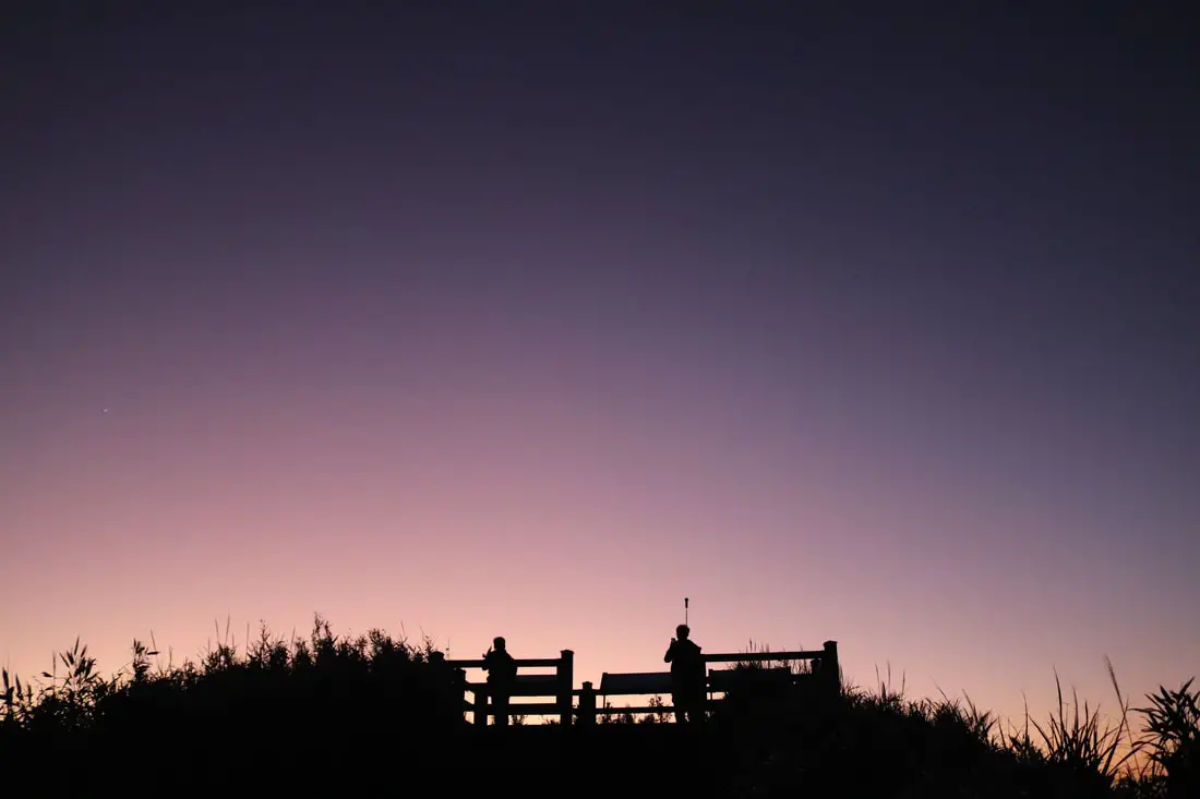
5:26 PM. More amazing sky as we got to the main viewing platform below,
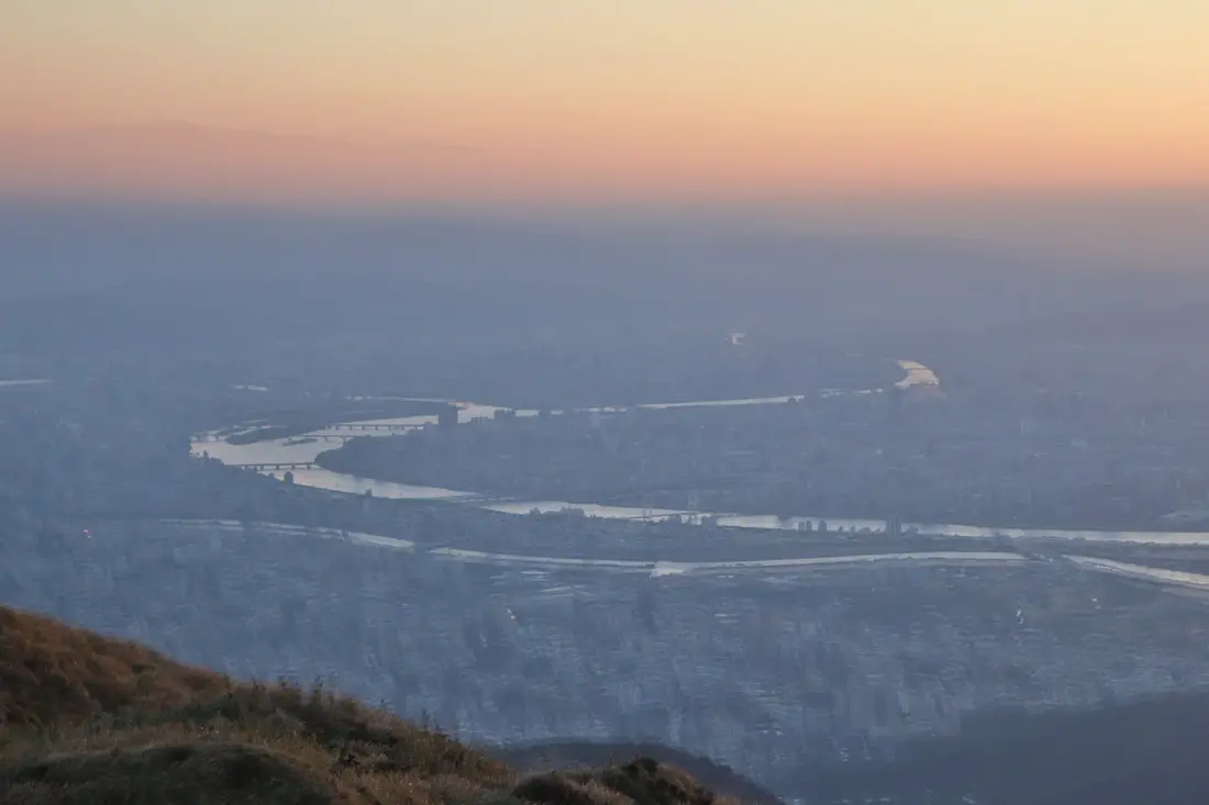
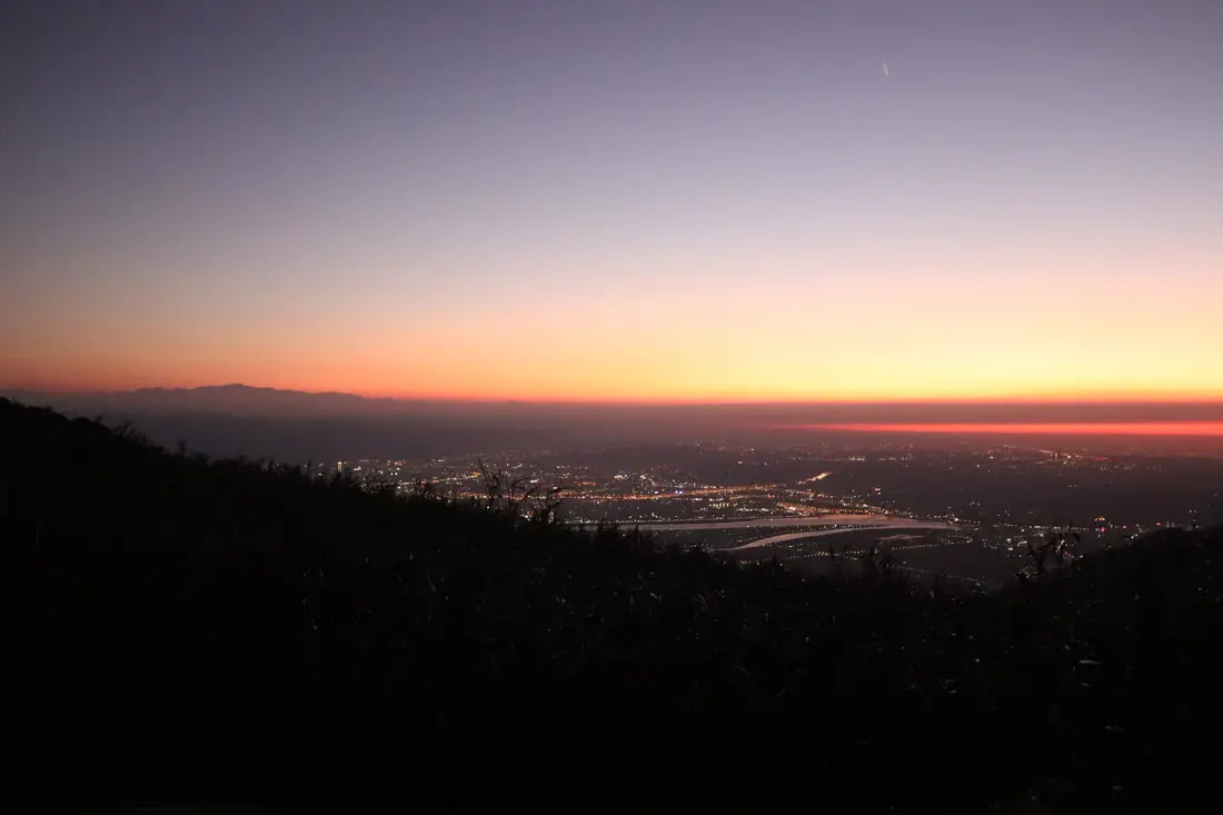
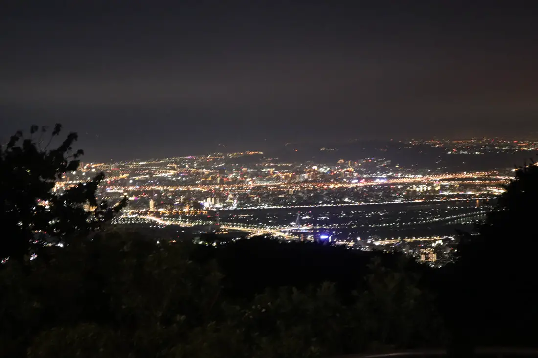
Amazing twlight viewq of Taipei.
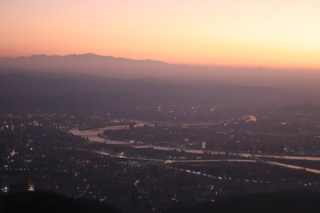
Closer view of Sanchong.
View of converging rivers.
Another view toward Bali and the ocean.
You must take as many photos as you can while up here.
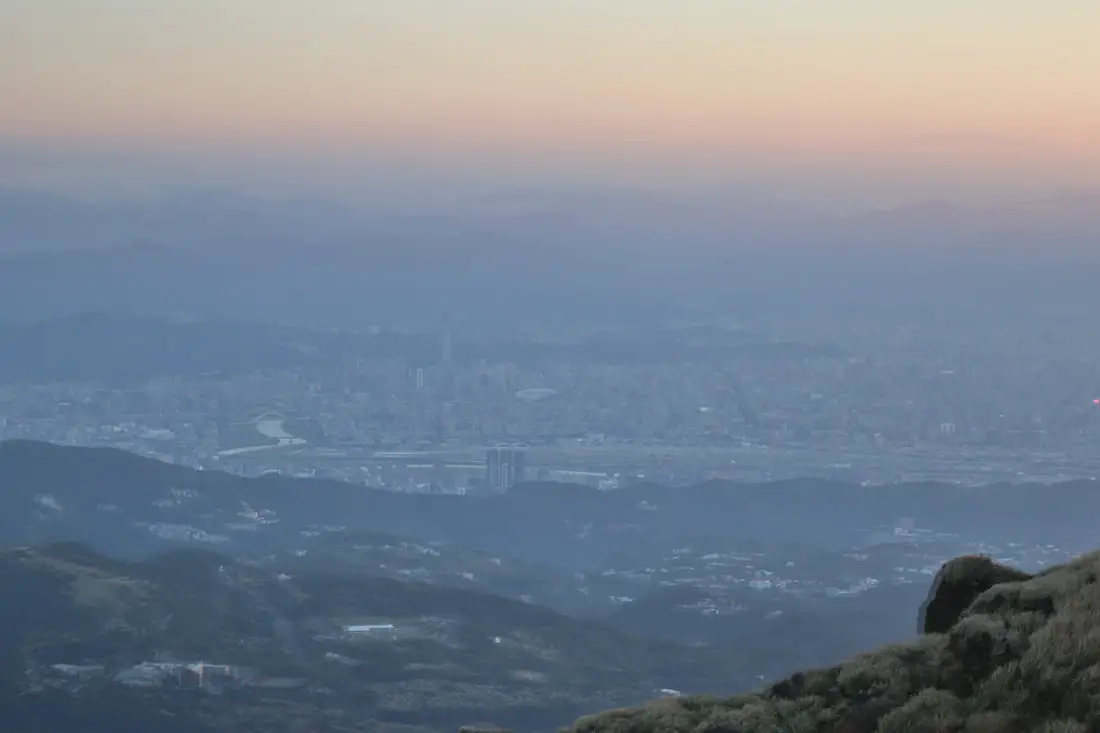
5:28 PM. Last bits of lingerling light on the top of the mountain.
Another view looking toward Linkou.
Last view of the Taipei Basin.
Walking in the dark to Xiaoyoukeng with the aid of cell phone flashlight.
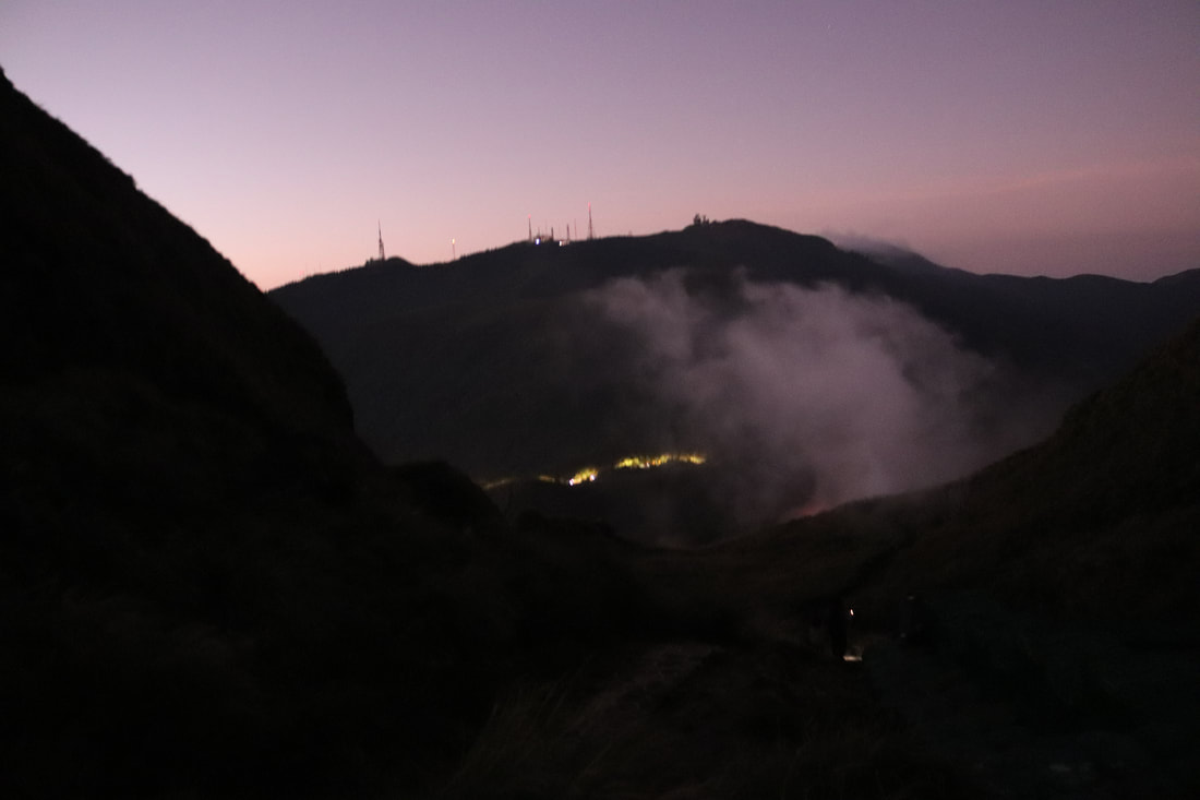
Night photo of Datunshan.
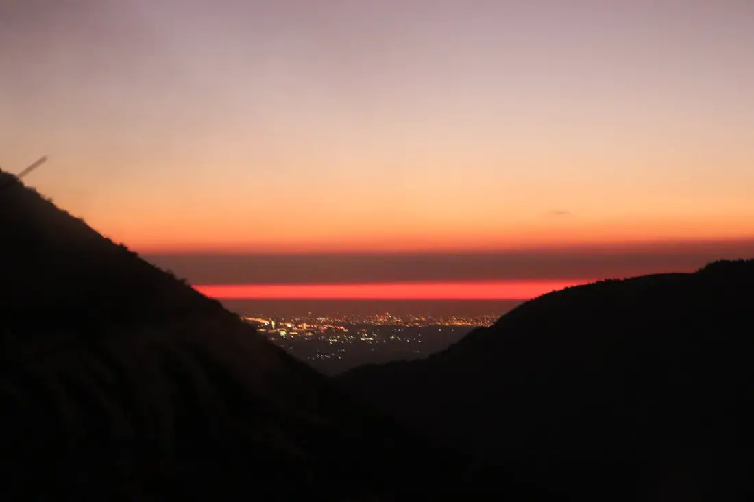
5:46 PM. Speak peak of Taipei.
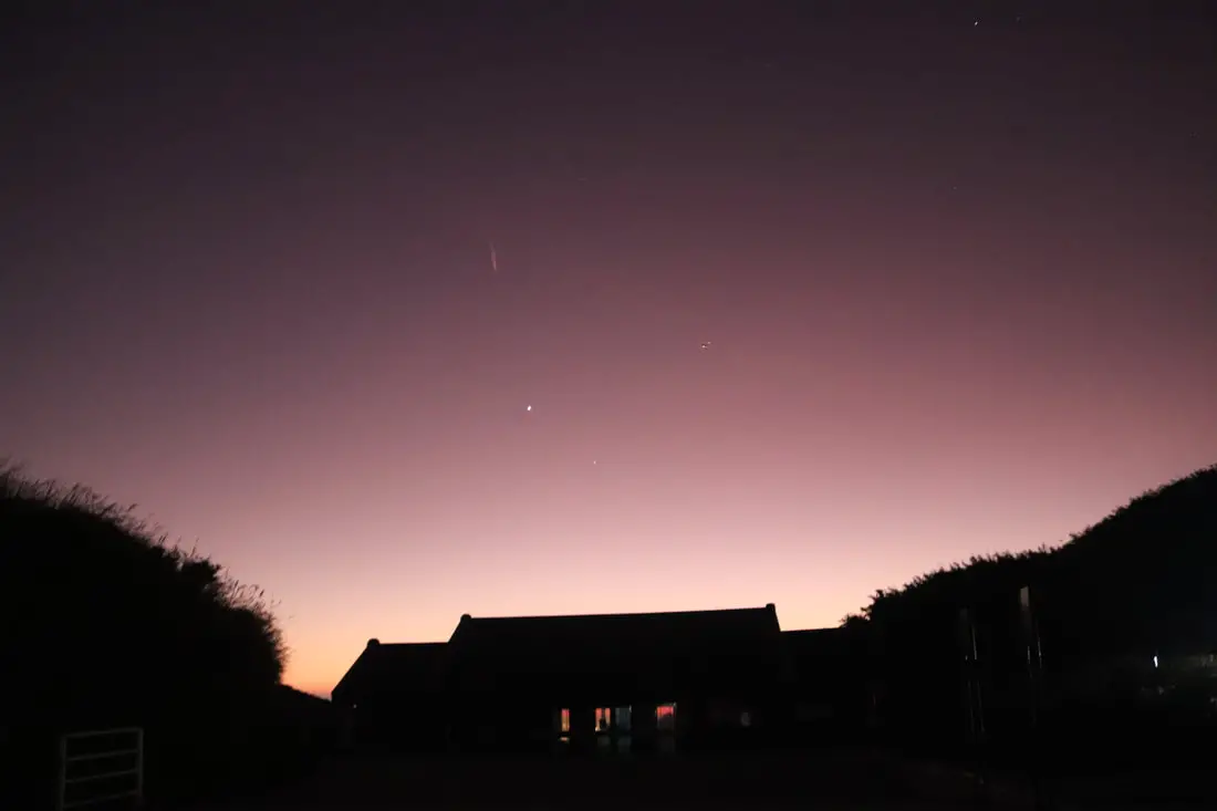
5:52 PM. Shooting star over the Xiaoyukeng visitor's center!
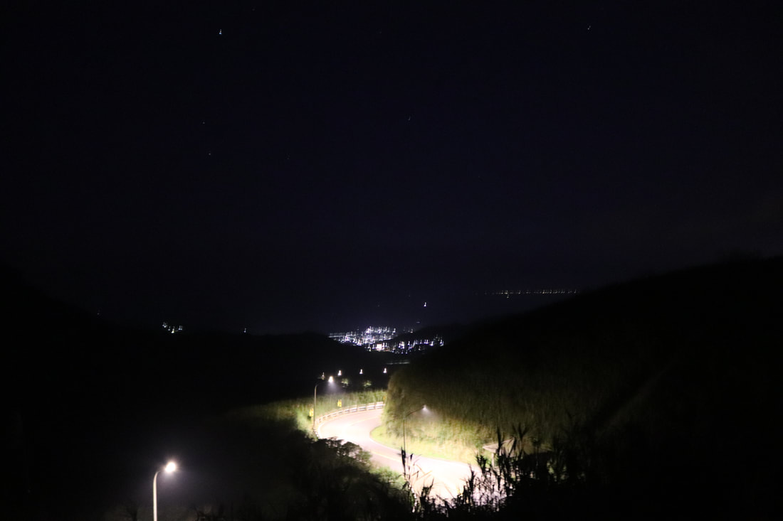
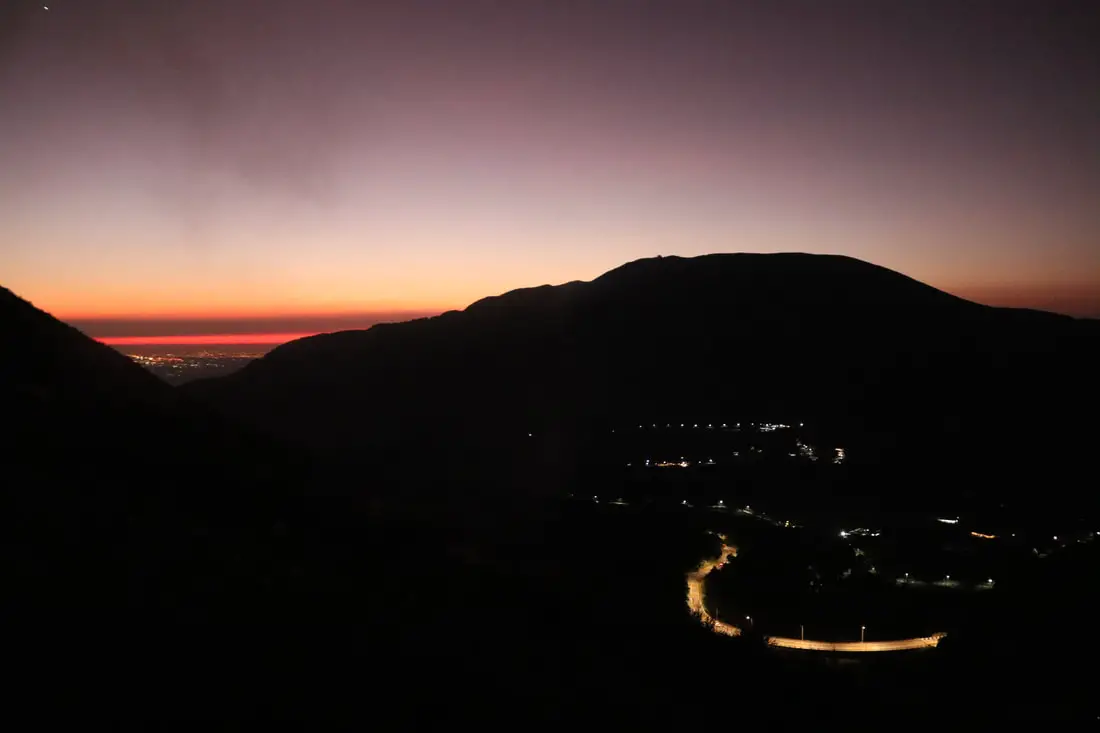
Blurry photo of the road down.
6:07 PM. Last view of Taipei on the drive down Yangmingshan.
You can book tours to Yangmingshan on TripAdvisor here, Klook here, or KKday here or here. You can check out tours to Yangmingshan such as a One-day Yangmingshan NP Beitou Hot Spring Park and Tamsui Tour Package, Beitou and Yangmingshan Day Tour from Taipei, One Day Hike around Yangmingshan, or Private Yangmingshan Volcano Tour and more on TripAdvisor here, Klook here, or KKday here. We will be sure to update this blog in the future. Thanks for reading and be sure to check out more of our guides to Taiwan coming soon! Check out our full guide to Yangmingshan National Park here. Check out our Taipei hiking and trails guide here. Check out our guide to the best day trips from Taipei here. Check out our list of the best views of Taipei here. Also be sure to check out our guide to Taipei here. You can also check out our full travel guide to Taiwan here.
0 Comments
Your comment will be posted after it is approved.
Leave a Reply. |
Author 作家I am an American expat who has extensive experience living, working, and traveling in Taiwan. In my day, I had to learn many things about Taiwan the hard way. But I have come to learn that Taiwan is one of the best places in the world for Foreigners to live. This blog does not represent the opinions of every foreigner in Taiwan. I am just trying to help others learn more about this beautiful country. Categories
|
 RSS Feed
