

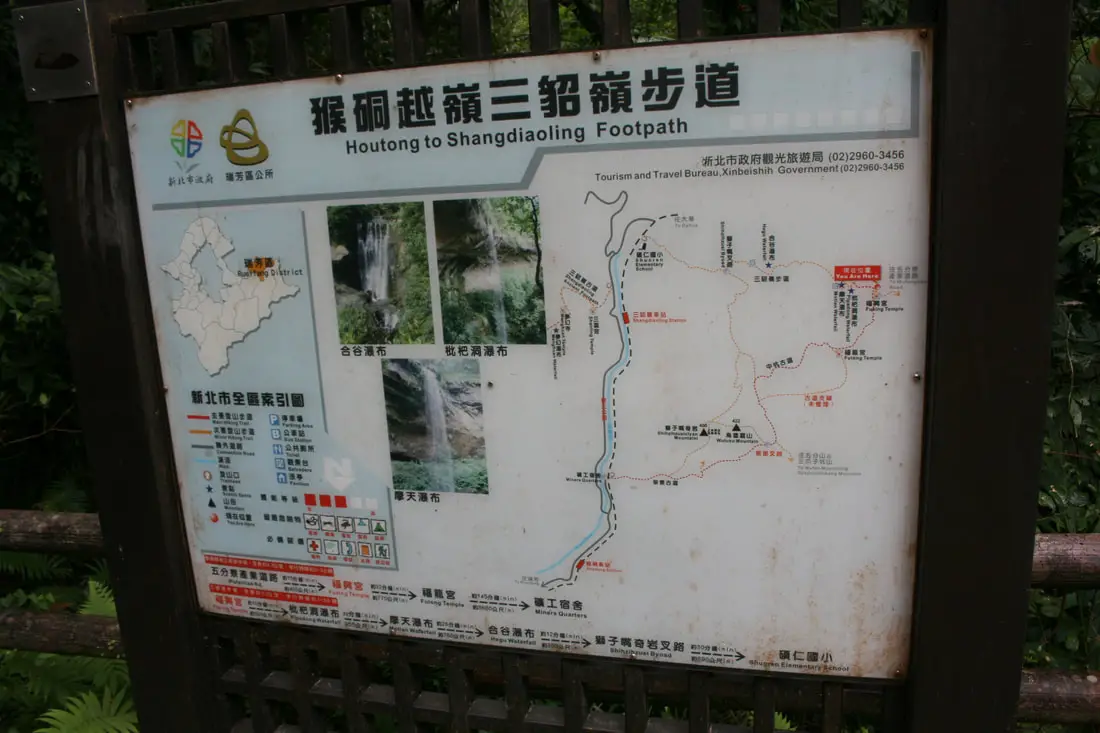
In an area full of majestic waterfalls, Sandiaoling's Three Tiered Waterfall Trail near Sandiaoling Station could be the most spectacular, with three large waterfalls over 30 meters tall in a row next to each other.
Background: There are many waterfalls along the Keelung River valley which runs through Pingxi and Ruifang; this is due to easily eroding sedimentary rock that makes up the terrain, which also makes for odd shapes and holes along rivers. The Sandiaoling waterfalls lie on a tributary of the Keelung River, in a mountain valley above the former mining village of Sandiaoling. Coming from Sandiaoling, the first waterfall you will see on the trail is Hegu Waterfall (合谷瀑布) which consists of two falls, the higher falls are 25 meters high and 9 meters wide, and the lower falls are 15 meters high and 6 meters wide. The second or middle waterfall is Motian Waterfall (摩天瀑布) which is 41 meters tall and 7 meters wide; it perhaps the tallest waterfall along the Pingxi Railway. The third or highest waterfall along the trail is Pipa Waterfall (aka Pipadong Waterfall 枇杷洞瀑布), and is about 31 meters high. Difficulty: This hike is moderately challenging; the whole hike take about an hour or two but there are ropes, chains, and ladders along the way, making for some gnarly climbs near the the top two waterfalls. Hours: 24/7 Price: Free Tours of Pingxi: You can book a tour to Pingxi on TripAdvisor here, Klook here, or KKday here. There are many tour itineraries that you can enjoy in Shifen that will take you to multiple destinations and arrange transportation. Activities Around Pingxi: Don't forget that there are many activities available around Pingxi such as Rock Climbing, Hiking, kayaking, canoeing, snorkeling, SUP / paddle boarding, water biking, Diving, River Tracing / Canyoneering, ATVing, Horse Riding, Cooking Class, photo shoot, Jingtong Sky Lantern Police Station, Shifen Sky Lantern Experience, Waterfall Zipline, Waterfall Diving, and more on Tripadvisor here, Klook here, or KKday here. Hotels Near Pingxi: We recommend Fullon Hotel which has locations in Tamsui and Fulong near the beach (book on Booking.com here, Tripadvisor here, Agoda here, or Hotels.com here). We have stayed at and recommend Gold Mountain Ranch, which is a horse ranch and glamping destination in Jinshan. You can book a night at Gold Mountain Ranch on Klook here. You can also check out our full blog on the ranch here. We have also stayed at and recommend Hai Xia Your Home which is right in front of Fulong Beach (book on Booking.com here, Tripadvisor here, Agoda here, or Hotels.com here). Looking for a hotel? We recommend booking through Booking.com here, which provides the best quality selection of accommodation in Taiwan. Find out where to stay in our Taiwan hotels guide or search for the best hotel deals in Taiwan here. How to get there: By Train: Take the TRA to Ruifang Station, and then switch to the Pingxi Railway line. Get off at Sandiaoling Station, then walk along the tracks to Shuoren Elementary School (碩仁國小); the trail starts at the entrance of the school. Book tickets via the normal train (TRA) on Klook here. You can purchase a discount easy card to use on Pingxi Railway Line on Klook here or KKday here. You can also book a travel pass on Klook here. By Car/Scooter: Take provincial highway 2 east toward Pinglin, then get off the main highway once you reach Shifen. Then take highway 106 to Wufenliao (五分寮), and take the road down to the trail head, where there is plenty of free parking. From here the first waterfall you will come across is Pipadong Waterfall (coming down from above). You can also drive to Sandiaoling Station and use the directions above. If you are looking for car rentals, you can also search Qeeq here, Klook here, or KKday here. You can also check out our car rental guide here. Looking for scooter rental in Taipei? You can search on Klook here or KKday here to search for options. You can also check out our scooter rental guide here. By Taxi: You can take short rides for about 150 NT, or hire a Taxi for a day for around 150 USD on Klook here. By Bus: You can also book tickets to travel to Shifen via inter-city bus on Klook here. You can also book a Taipei Sightseeing: Hop On, Hop Off Open Top Bus on TripAdvisor here. By Bicycle: Cycling is the best way to enjoy Taiwan's landscapes if you have the time and energy. Looking for bicycle rentals in Taiwan? You can use Taiwan's many Youbike sharing stations, or search for rentals on KKday here, and search for tours on Klook here. You can also check out our Taiwan cycling guide here. You can also book a Sunset Riverside Bike Ride and Historical Tour, 4 Hour Cycling in Taipei, Ultimate 8-Hour Cycling City Tour, or Taipei City Bike Tour with Night Market Experience on TripAdvisor here. For more information, check out our Taiwan transportation guide here. Map: Please see below: Our Journey: I have been to the Sandiaoling Trail twice, once from the back (top) and once from the front (bottom). Check out our drone footage below for an overview of the waterfall trail:
The views from the air are pretty amazing. Now lets take a look from the ground.
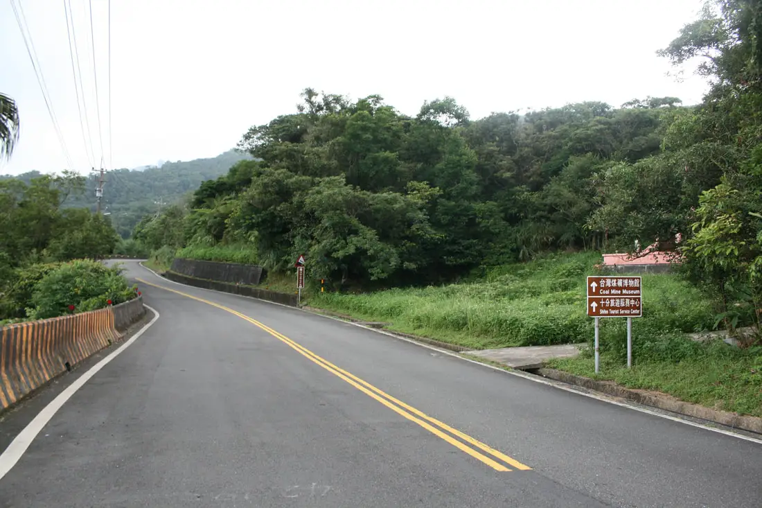
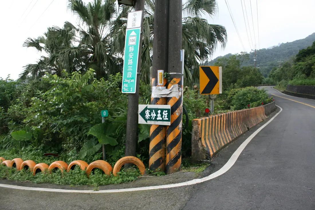
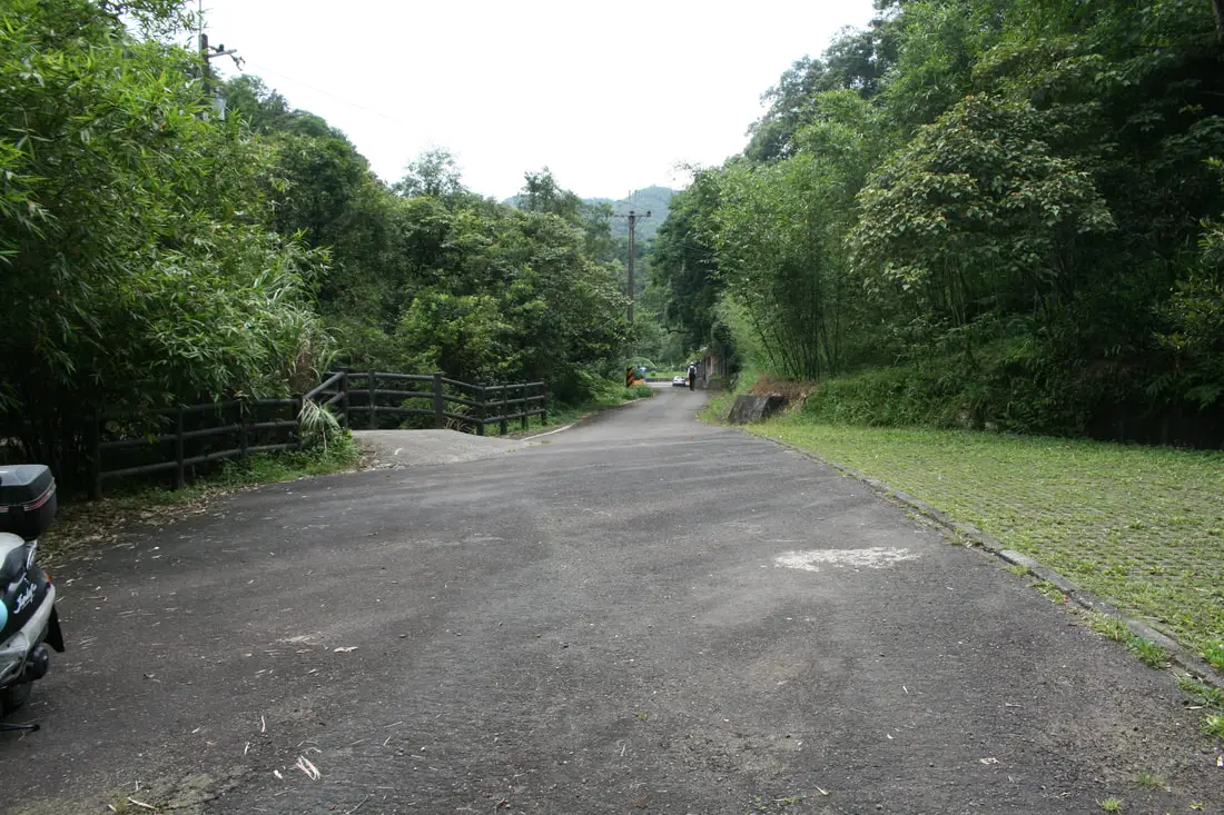
If you are travelling by car, I recommend going up highway 106 to the Wufenliao Turnoff. However you can also come up from Sandiaoling Village on the other side of the valley.
From Wufenliao, the trail will be going downhill with Pipadong Waterfall coming first.
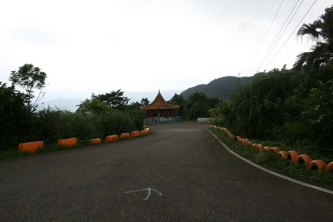
AT the turnoff there is a pavilion and some white arrows on the road.
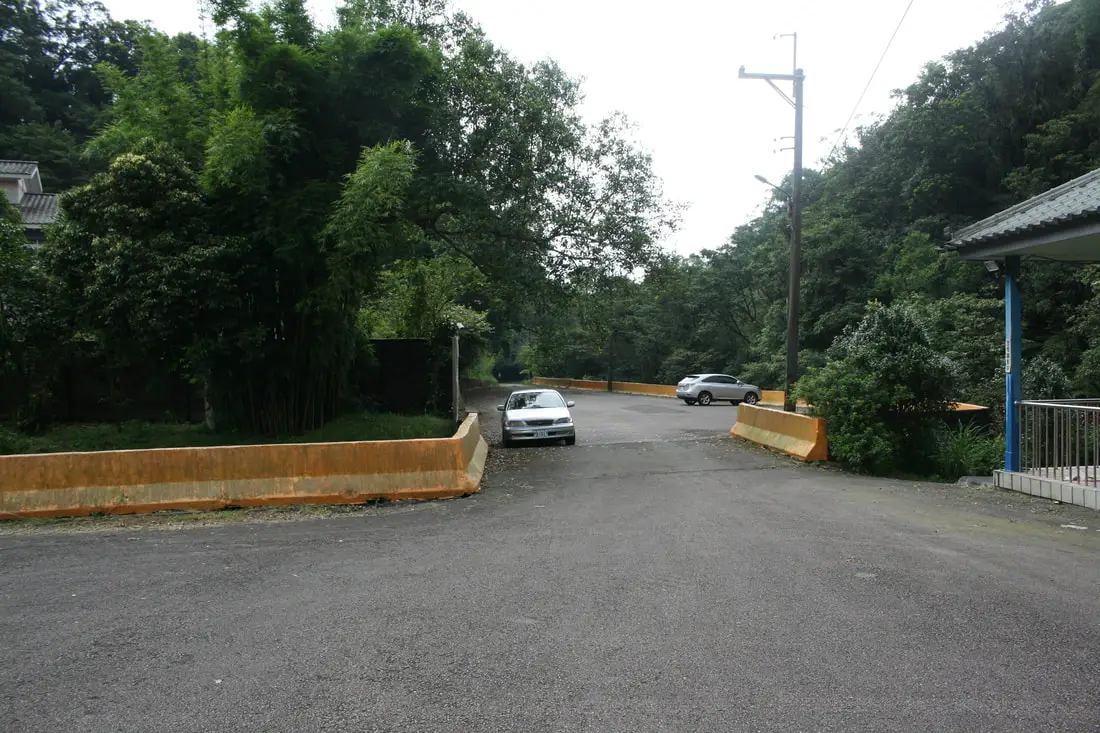
At the trailhead (which is at the very end of the road), there is plenty of parking.
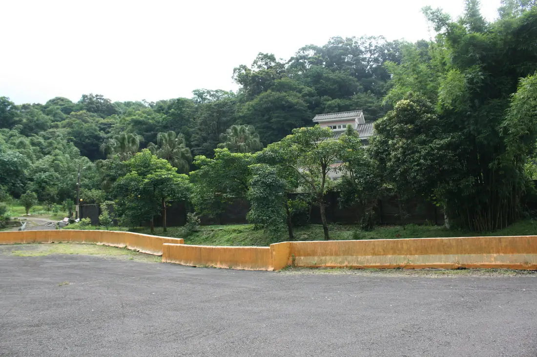
There is a mansion here at the trail entrance that some rich lucky person owns.
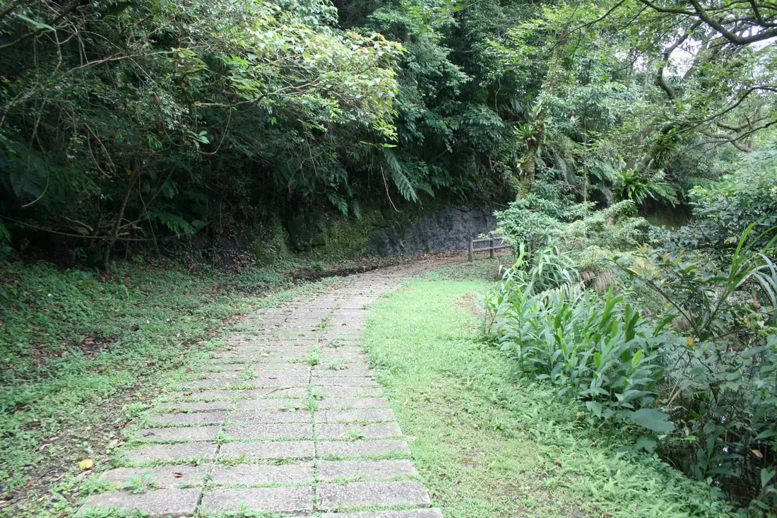
The trail then follows an asphalt path that becomes stone steps.
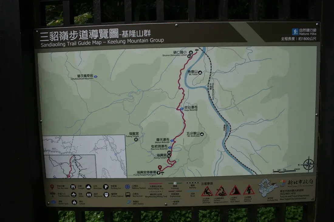
Map of the Sandiaoling Trail.
The stone stepped trail heading to Pipidong Waterfall.
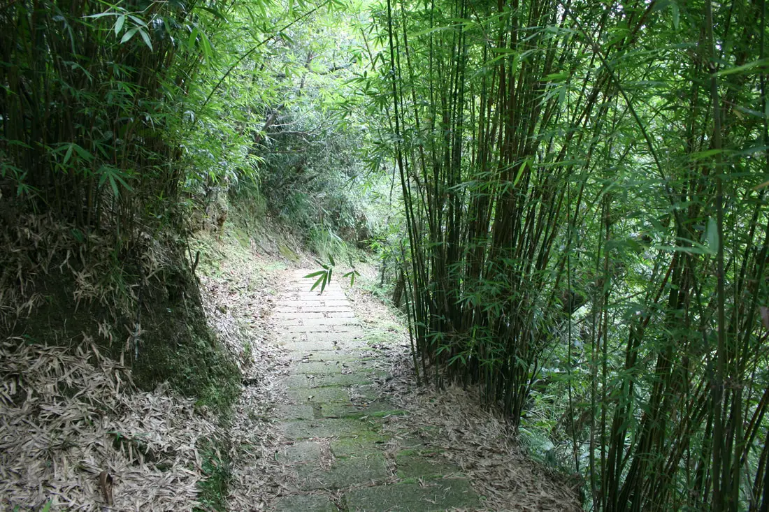
Some bamboo forest along the way.
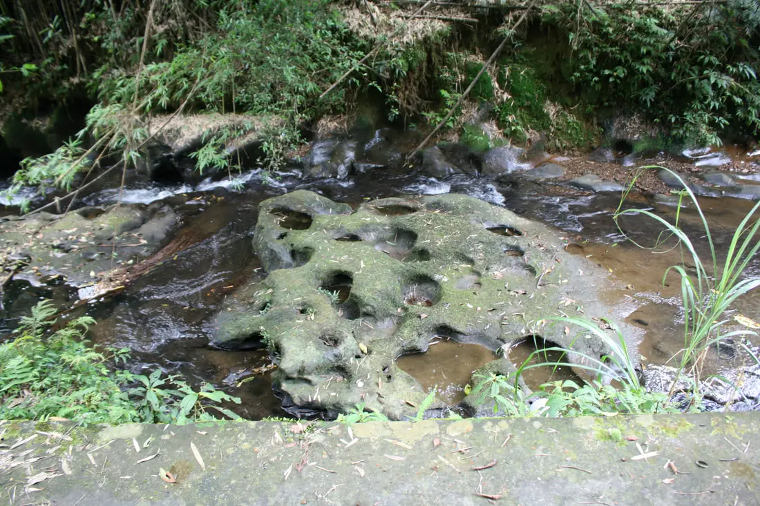
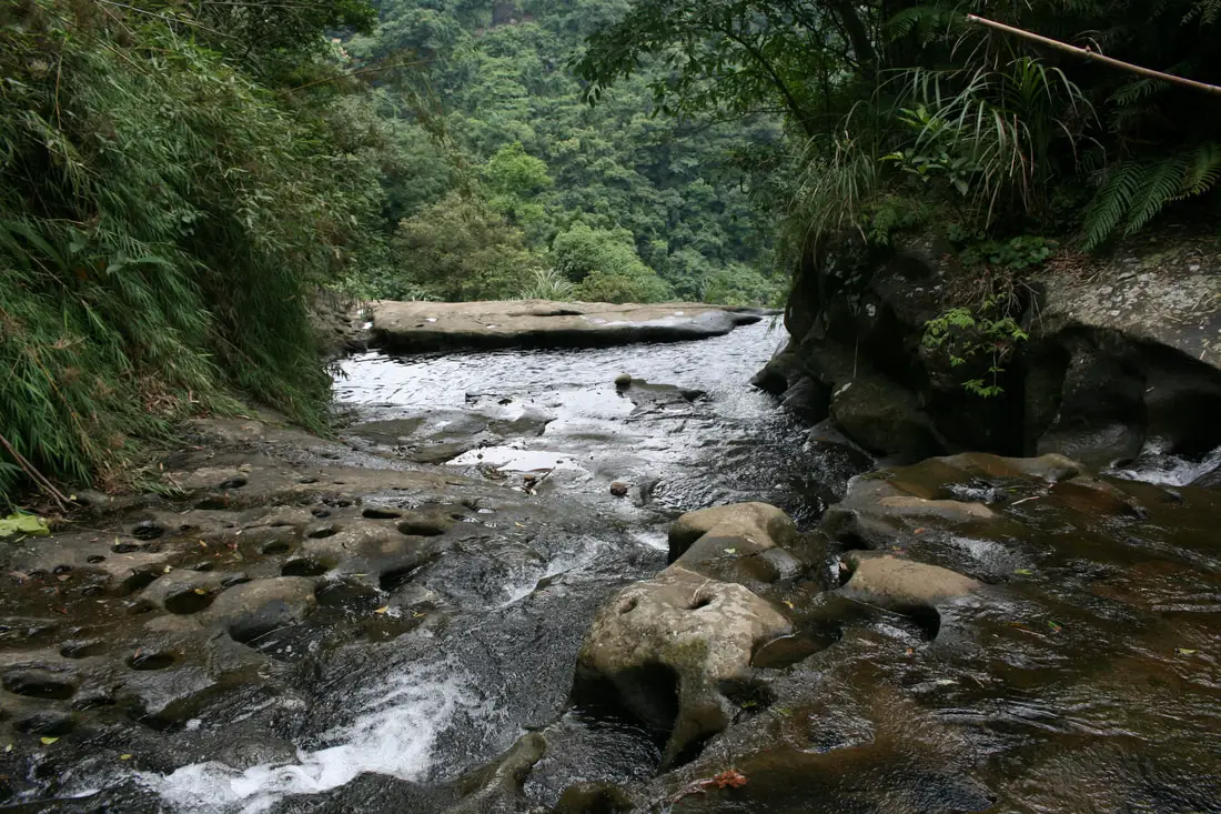
Potholes in the rocks near Pipadong Waterfall due to erosion.
I came in the late morining; by that time there were already plenty of elderly hikers on their way out. After Pipadong Waterfall, the trail loops around the back side of the mountain back to Sandiaoling Village.
The path also hooks up to Houtong, the next station along the Pingxi Railway.
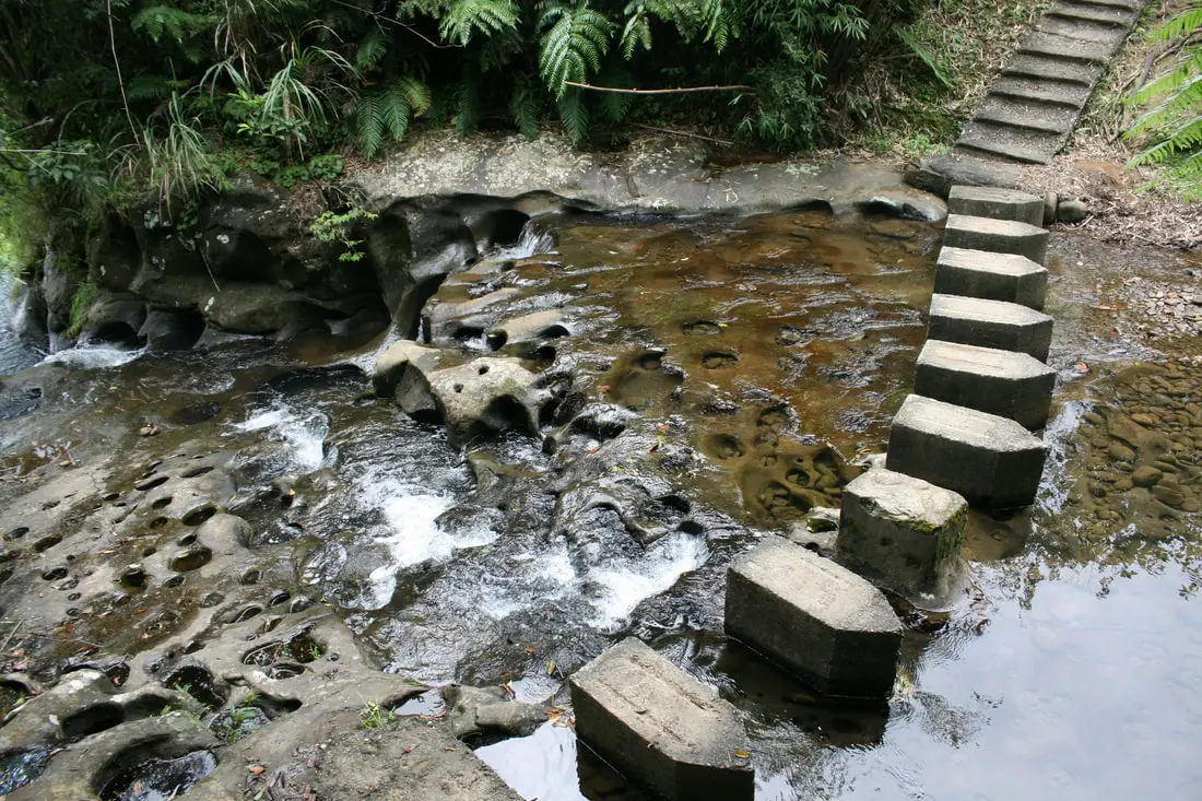
More pothole covered rock right before Pipdadong Waterfall.
This water falls off a 30 meter ledge. Be very careful if you decide to climb down.
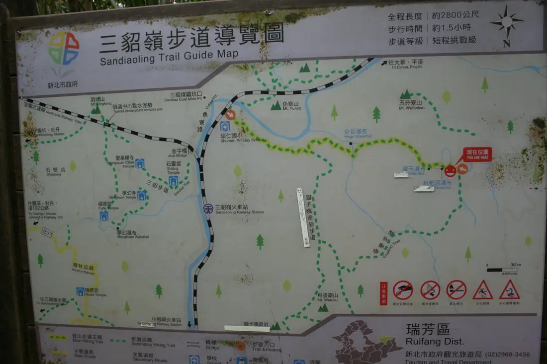
Another map of the trail system.
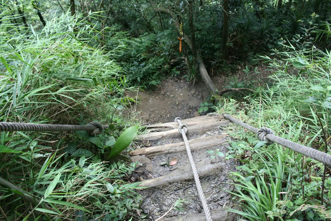
The preferred route down is via this rope and wooden beam bridge. When I went, there was a very long wait, with 2 hiking groups of about 30 people each. If this one is clogged up, there is another metal ladder to the right.
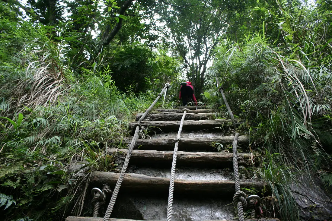
The climb down is kind of scary.
Pipadong Waterfall 枇杷洞瀑布 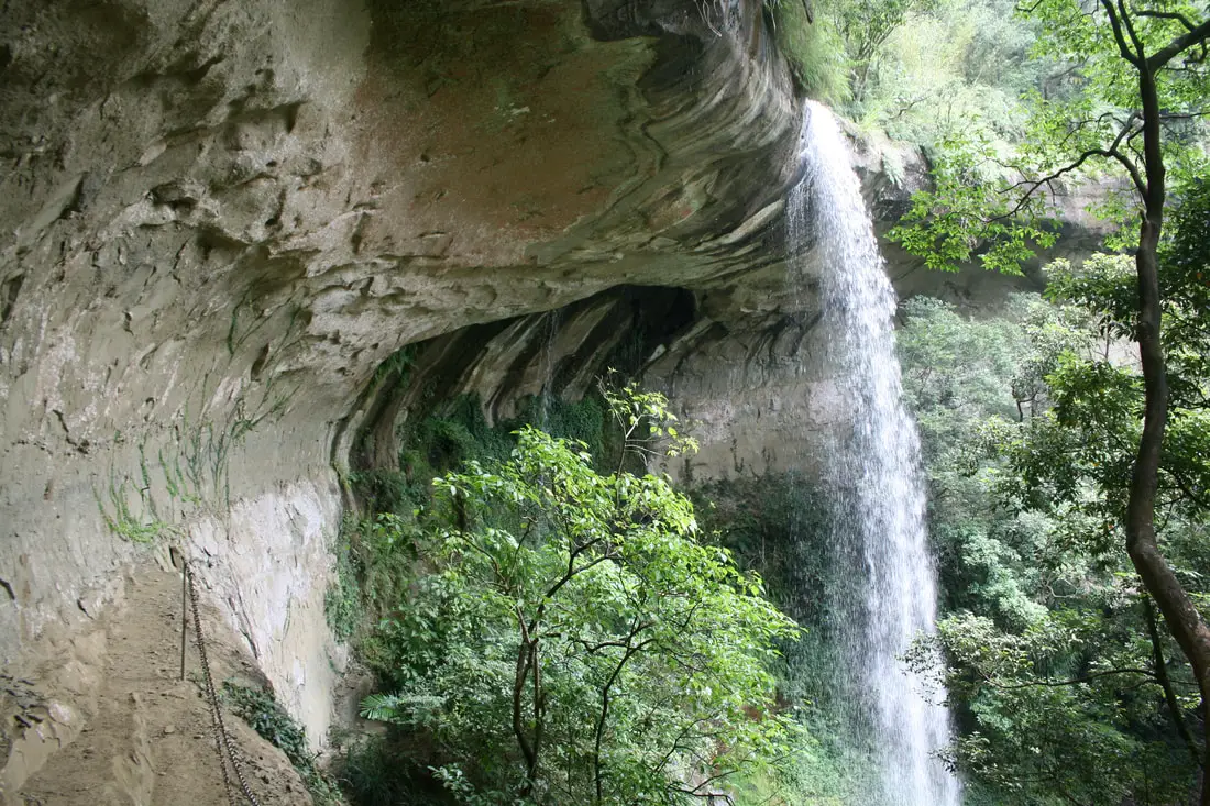
First view of Pipadong Waterfall from below.
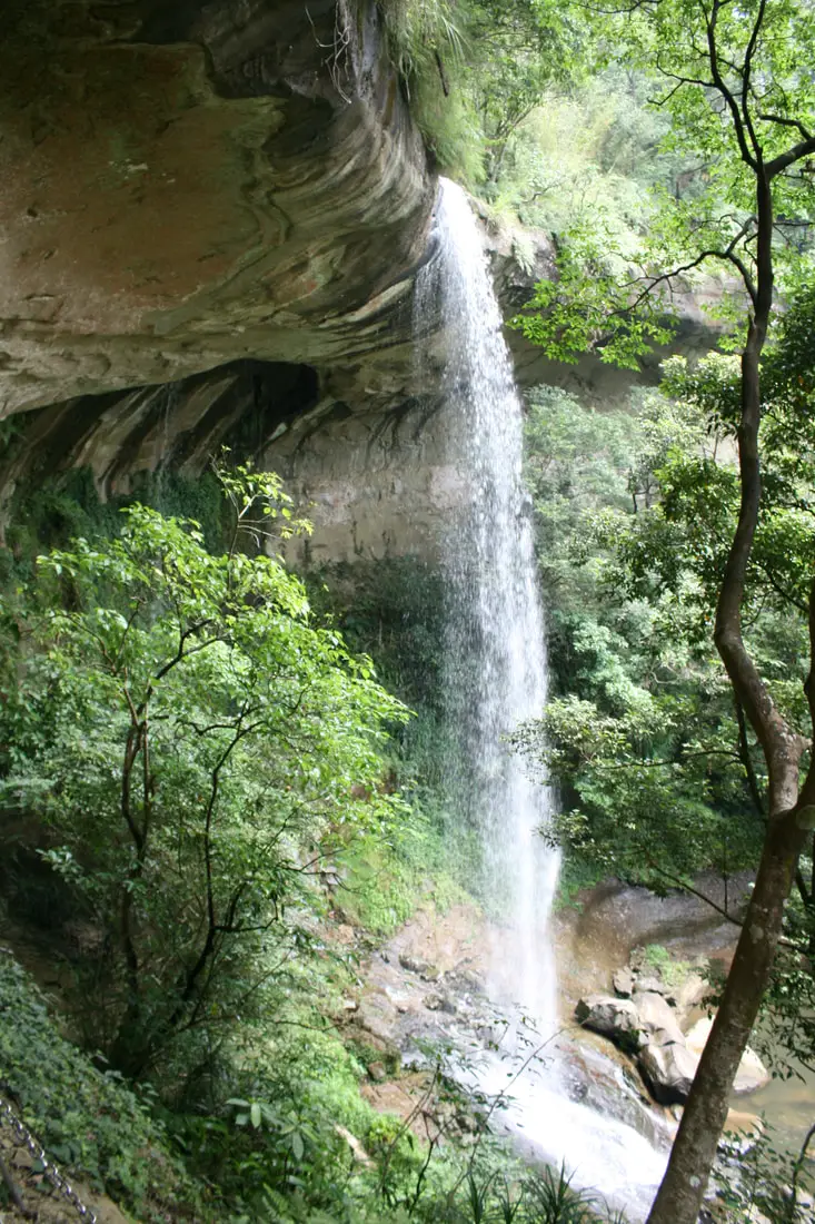
Another full view of the waterfall.
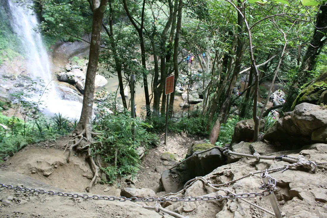
There is another gnarly climb down to the water below, with some rock scrambling with help of ropes and chains.
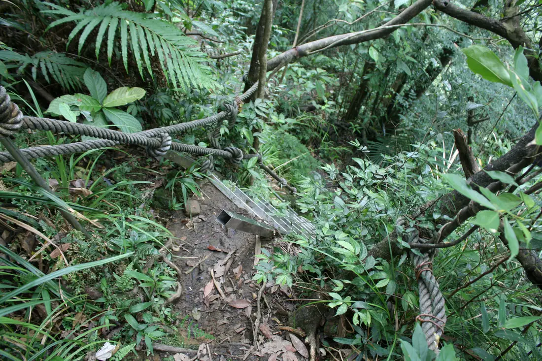
The climb down to Motian Waterfall is also gnarly.
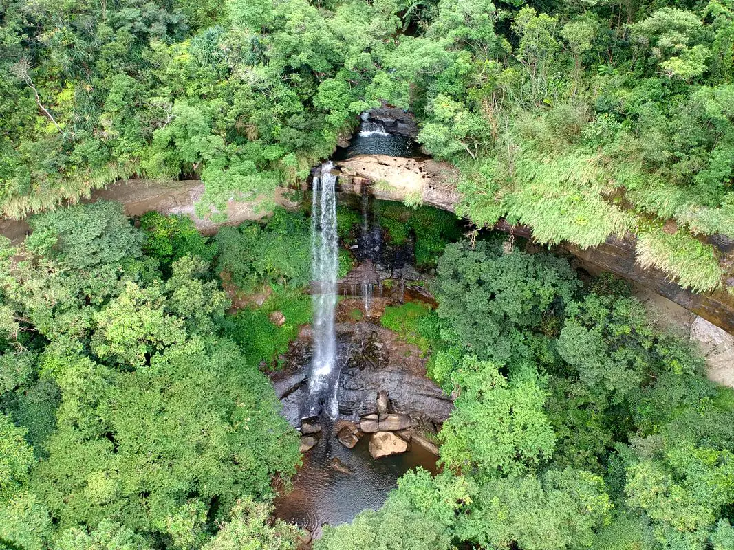
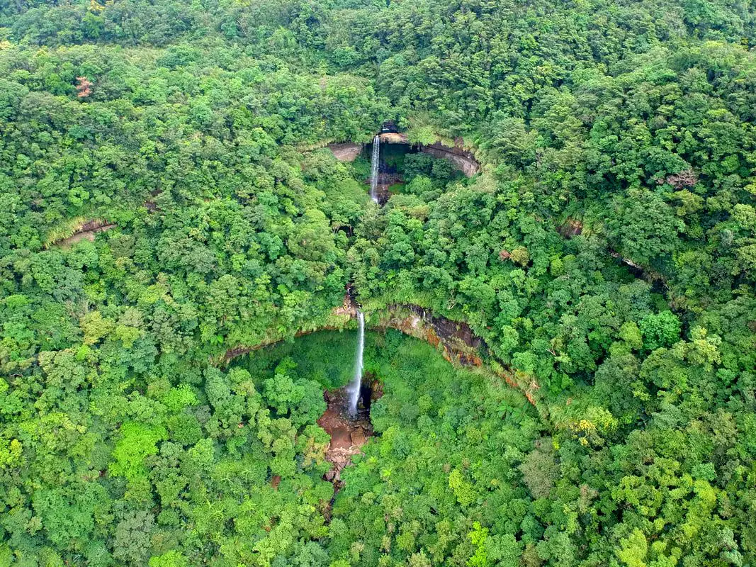
View of Pipadong Waterfall from the air.
Motian Waterfall 摩天瀑布 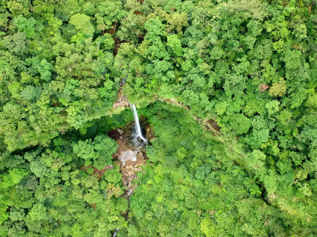
The second waterfall on the trail is Motian Waterfall, which looks similar to Pipadong Waterfall except it is about 10 meters taller.
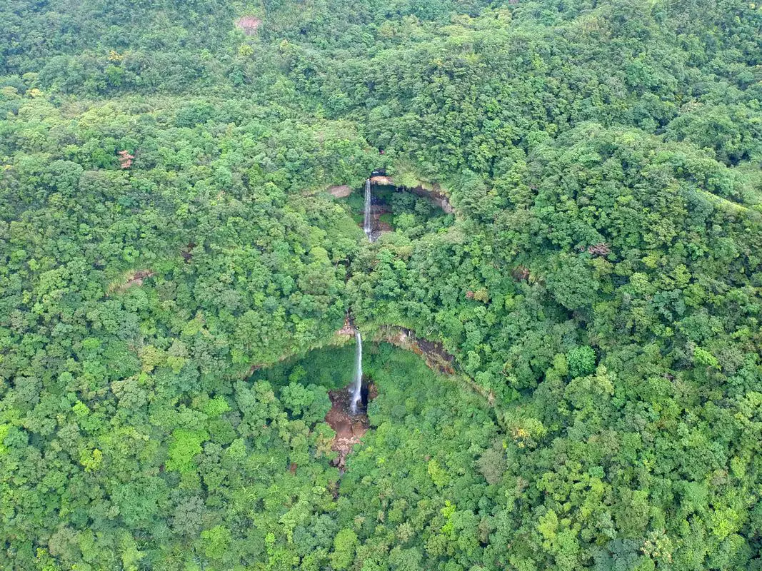
View of Pipdadong Waterfall above and Motian Waterfall below.
Hegu Waterfall 合谷瀑布 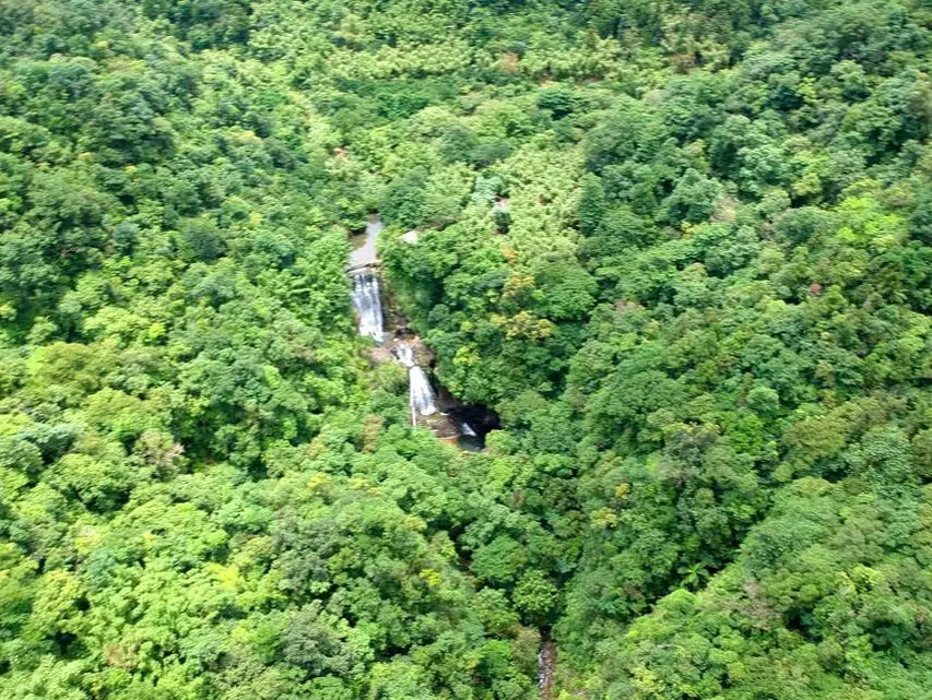
The third and final waterfall along the trail is Hegu Waterfall, which consists of two parts, and a weir at the top. There is no way to walk down to the waterfall except to rover trace up.
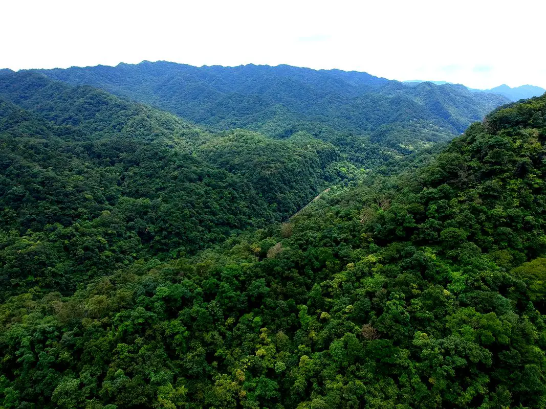
View of the vast wilderness between Sandiaoling and Dahua Station.
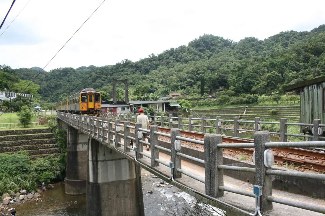
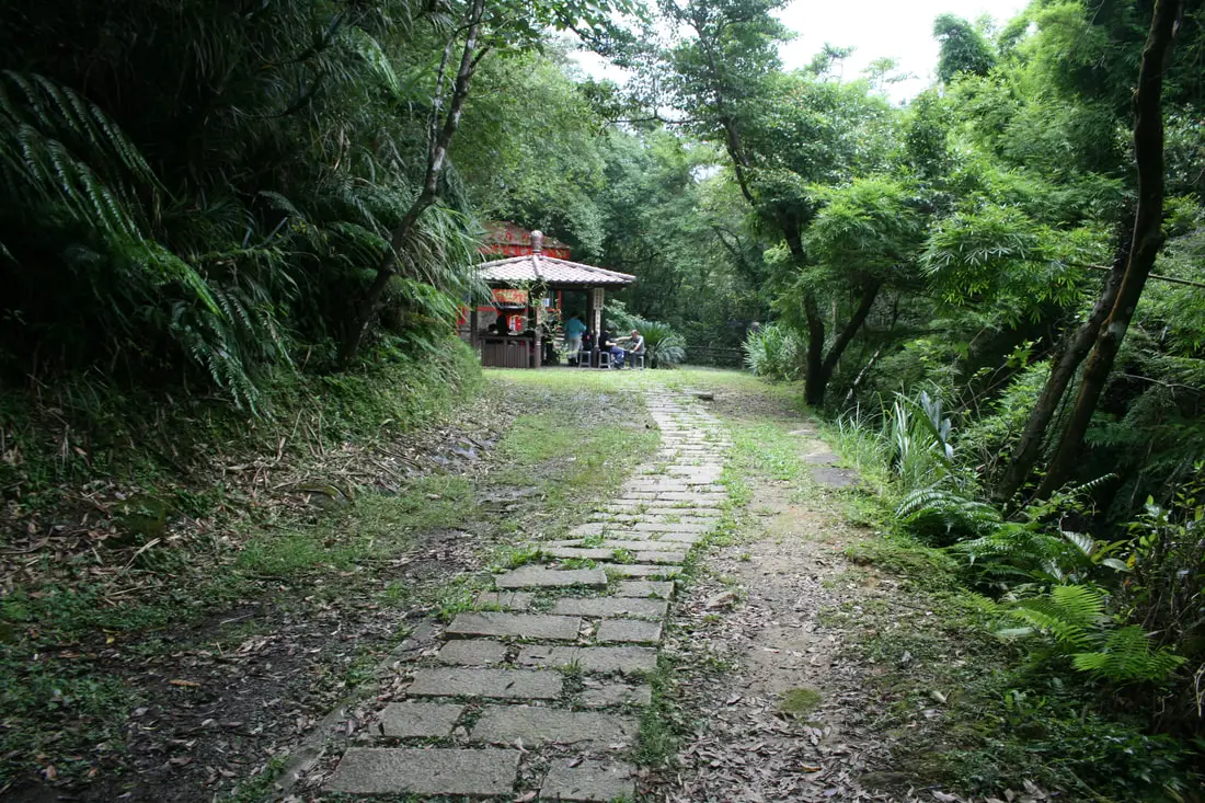
Once you are down the mountain, you can enjoy a nice meal or drink at a cafe in Sandiaoling before you make your way back up.
For other blogs in English on the Sandiaoling Trail, check out this blog by Follow Xiaogfei, this blog by Taiwan Everything, or this blog by Josh Ellis. Don't forget that there are many activities available around Pingxi such as Rock Climbing, Hiking, kayaking, canoeing, snorkeling, SUP / paddle boarding, water biking, Diving, River Tracing / Canyoneering, ATVing, Horse Riding, Cooking Class, photo shoot, Jingtong Sky Lantern Police Station, Shifen Sky Lantern Experience, Waterfall Zipline, Waterfall Diving, and more on Tripadvisor here, Klook here, or KKday here. Thanks for reading! For our full guide to the Pingxi Railway, click here. Check out our guide to Taipei’s Waterfalls here. Check out our Taipei hiking and trails guide here. Check out our guide to the best day trips from Taipei here. Check out our full guide to Taiwan’s Northern Coast here. Also be sure to check out our guide to Taipei here. You can also check out our full travel guide to Taiwan here.
0 Comments
Your comment will be posted after it is approved.
Leave a Reply. |
Author 作家I am an American expat who has extensive experience living, working, and traveling in Taiwan. In my day, I had to learn many things about Taiwan the hard way. But I have come to learn that Taiwan is one of the best places in the world for Foreigners to live. This blog does not represent the opinions of every foreigner in Taiwan. I am just trying to help others learn more about this beautiful country. Categories
|
 RSS Feed
