

Guishan Island (literally Turtle Mountain Island) is a turtle-shaped island off the coast of Yilan in Eastern Taiwan. Once inhabited by fishermen, it is now a coast guard base but is open for day tours. The island tour includes beautiful sea cliffs, hiking, a lake, an abandoned village, military tunnels, and whale watching just offshore.
Background: Turtle Island has been inhabited since at least the Qing Dynasty. When the ROC took over Taiwan, the island had one elementary school and no hospital. Many people relied simply on religion to cure their sicknesses. During typhoons, the dock would sometimes be destroyed, leaving the island without food for days or weeks. Also, there were way more men on the island than women, and it was hard to convince prospective wives from Taiwan to go live on such a remote island with harsh conditions. As a result, the government relocated everyone living on Turtle Island to the main island of Taiwan in Toucheng township of Yilan in 1977. The people could have chosen to stay, but they went without protest. The ROC then made the island into a restricted military base. In 2000, the Island was opened for tourism, the military aspects of the island were phased down, and it was made into an ecological reserve. Now the island allows Tourists to come during the day, but no one is allowed to stay overnight. Tours and Prices: Whale watching on a boat around the island: 800-1000 NT per person. Once around the island on a boat and 2-hour tour of the island: 800-1000 NT per person. Whale watching and island tour: 1200+ NT Island tour including hiking to the top of the island: 1200+ NT You can book a personalized tour and ferry boat tickets with Klook or KKday. You can purchase tours and tickets for many activities in Yilan such as surfing, kayaking, horse riding, river tracing, river rafting, river tubing, pack rafting, water biking, snorkeling, canoeing, and many others through Klook here or KKday here. Hours: 2-4 hour tours start from 8:00 AM or later and end in the afternoon until about 4:00 PM. When to go: March-November. These tours are generally closed from December to February due to rough seas and cold weather. Accommodation: There are not hotels on Turtle Island and staying overnight is forbidden. Looking for a hotel? We recommend booking through Agoda here, which provides the best quality selection of accommodation on the islands. Find out where to stay in our Taiwan hotels guide or search for the best hotel deals in Taiwan here. We have stayed at and recommend Jiaosi Hotspring Hotel, a hotel with hot springs in each room (you can book on Agoda here, Booking.com here, Hotels.com here, Expedia here, or Trip.com here). We have also stayed at Toucheng Leisure Farm, a recreational farm and experience center in Toucheng (you can book on Agoda here, Booking.com here, Hotels.com here, Expedia here, on Klook here, or on Trip.com here). You can also book Wifi and SIM cards for Taiwan on Gigago here. Need travel insurance? Compare prices on Insubuy here. Just to let you know, if you book using the links above, we get some commission at no cost to you, and you can help support our blog. You can click here to receive $5 USD on your first Klook purchase. How to get there: The only way to get there is by boat from Wushih Harbor in Yilan. To get to Wushih Harbor from Taipei, you can take the TRA train to Toucheng station, and then take a taxi from there. Otherwise, you can drive on National Highway 5 to Toucheng; there is free parking at the harbor (drive to the very end of the harbor). You can purchase a ticket at the harbor or book online in advance via Klook or KKday. Map of Guishan Island:
Map of how to get to Wushih Harbor:
Our Journey:
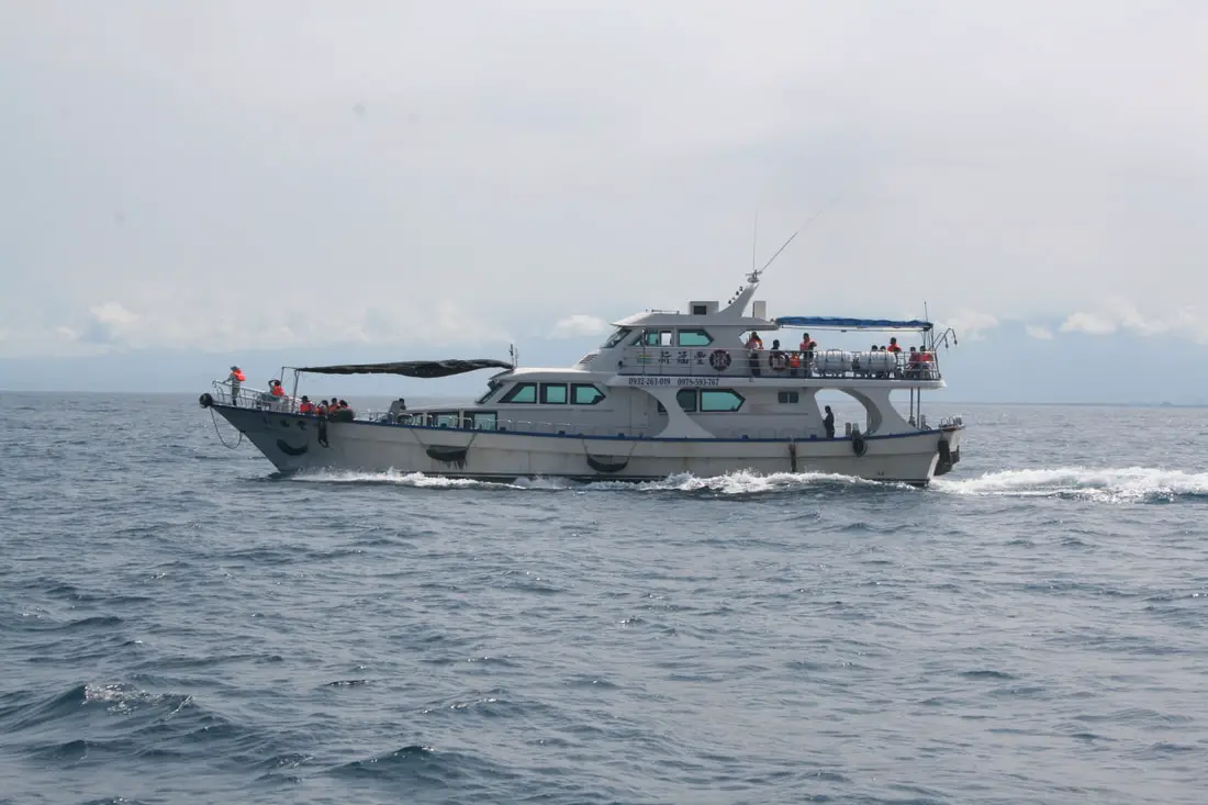
We booked our ferry tickets using Klook and arrived at Wushih harbor on a Saturday morning. Parking at the front of the harbor was packed, but we found some free parking at the end of the road closest to the sea wall. For lunch, we had McDonald's drive through which was just down the street. The day before, we had called our guide beforehand to make sure we knew where to find him. We lined up in front of his stand when the time came and boarded the boat. Life vests were mandatory.
(Sorry my camera sensor had some dust on it and I am too lazy to Photoshop it out for every photo) The Eight Scenes of Turtle Island The boat tour always says that they will take you around the island to see the "eight scenes." It's totally a tourist gimmick but whatever. So what are the eight scenes? See below (not necessarily in this order): Scene 1: Turtle God Wearing a Hat 神龜戴帽 Scene 2: Turtle Cliff Wall 龜巖巉壁 Scene 3: Turtle Island Sulfur 龜島磺煙 Scene 4: Eye Cave Stalactites 眼鏡洞鐘乳石 Scene 5: Undersea Hot Spring Flowing Up 海底溫泉湧上流 Scene 6: Turtle Looking Toward the Sun 龜山朝日 Scene 7: The Turtle God's Tail 神龜擺尾 Scene 8: Turtle Egg Wonder 龜卵奇觀 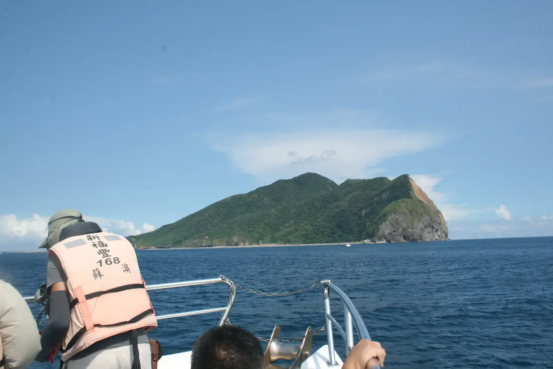
Scene 1: Turtle God Wearing a Hat 神龜戴帽
The first scene we saw was "Turtle God Wearing a Hat" which is basically a cloud above the top of the island. The islanders noticed this weather phenomenon meant a change in the weather, usually to more humid and wet. The most coveted picture taking spot is at the front of the boat. Be careful not to get in the way of other people taking selfies though. I was yelled at by the man at the front of the boat for being in his way for too long. 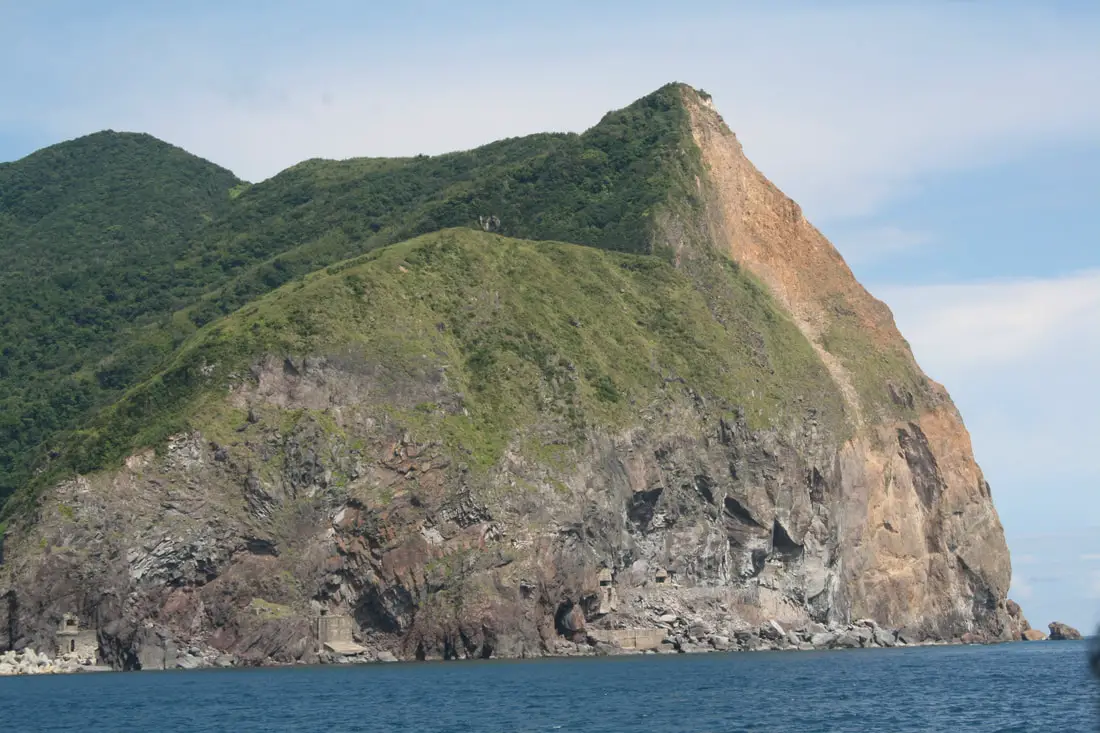
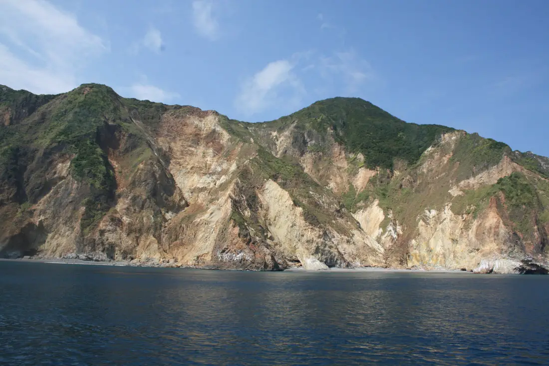
Scene 2: Turtle Cliff Wall 龜巖巉壁
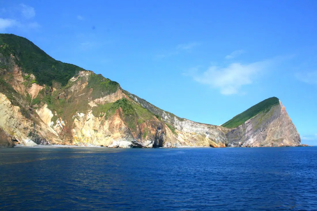
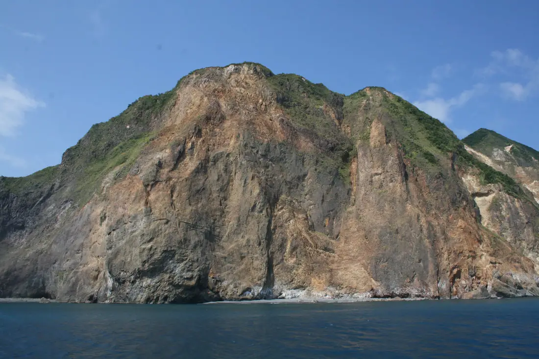
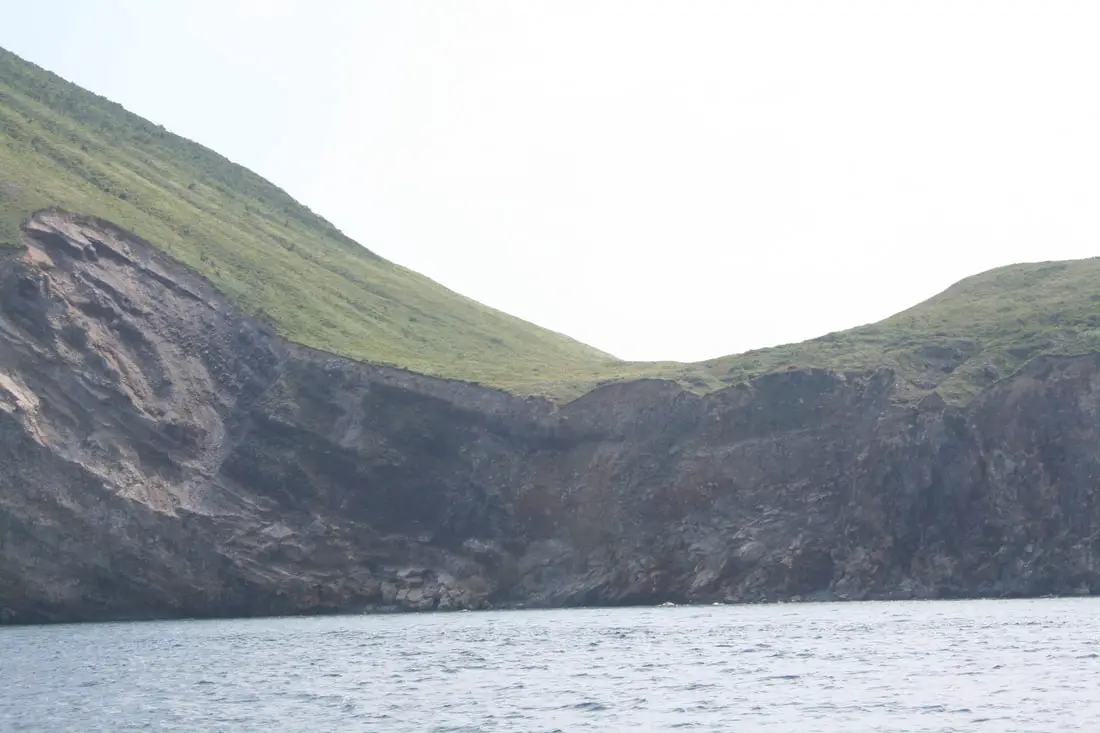
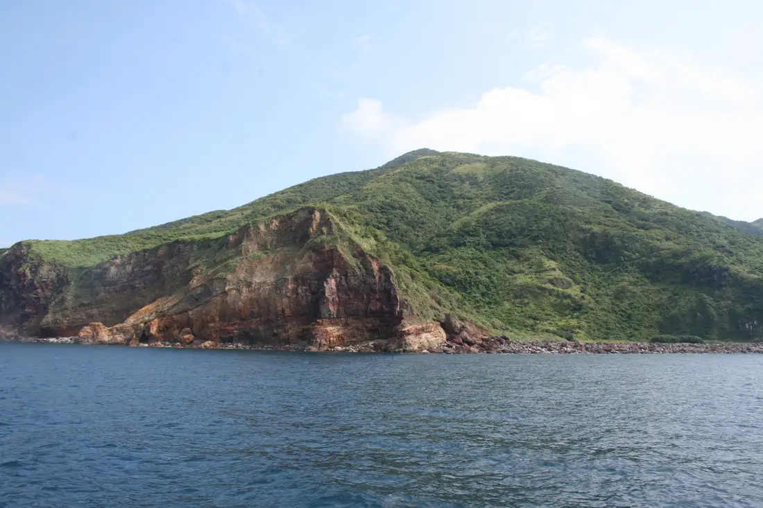
The sea cliffs on the southwestern part of the island were formed due to the weak sulfuric rock being eaten away by the sea. If you look closely you can see military caves, which we will explore further down in this blog. 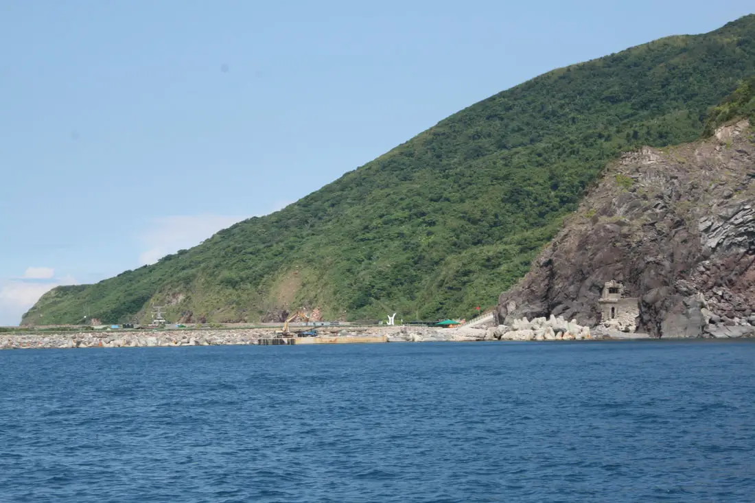
Our guide told us that after every Typhoon the seventh scene, the "Turtle's Tail" (a sand tail near the harbor) gets washed out after every typhoon, so they have to re-excavate the rocks on the beach.
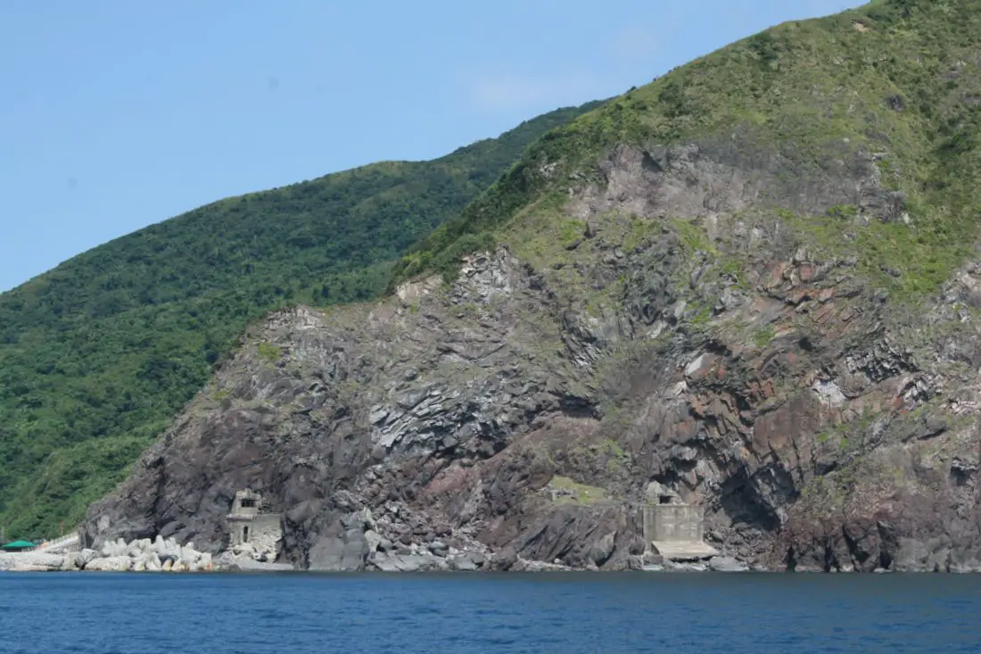
Another view of the bunkers and sea cliffs.
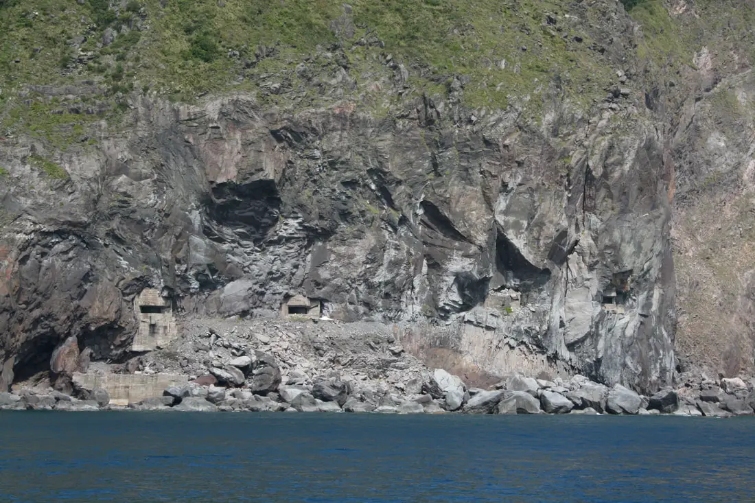
More bunkers carved into the sea cliffs. I wonder if the ROC even thought for one second about the environmental impact they were having on this island.
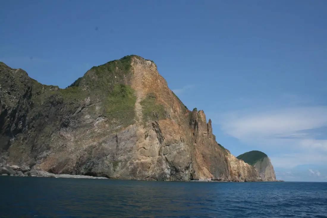
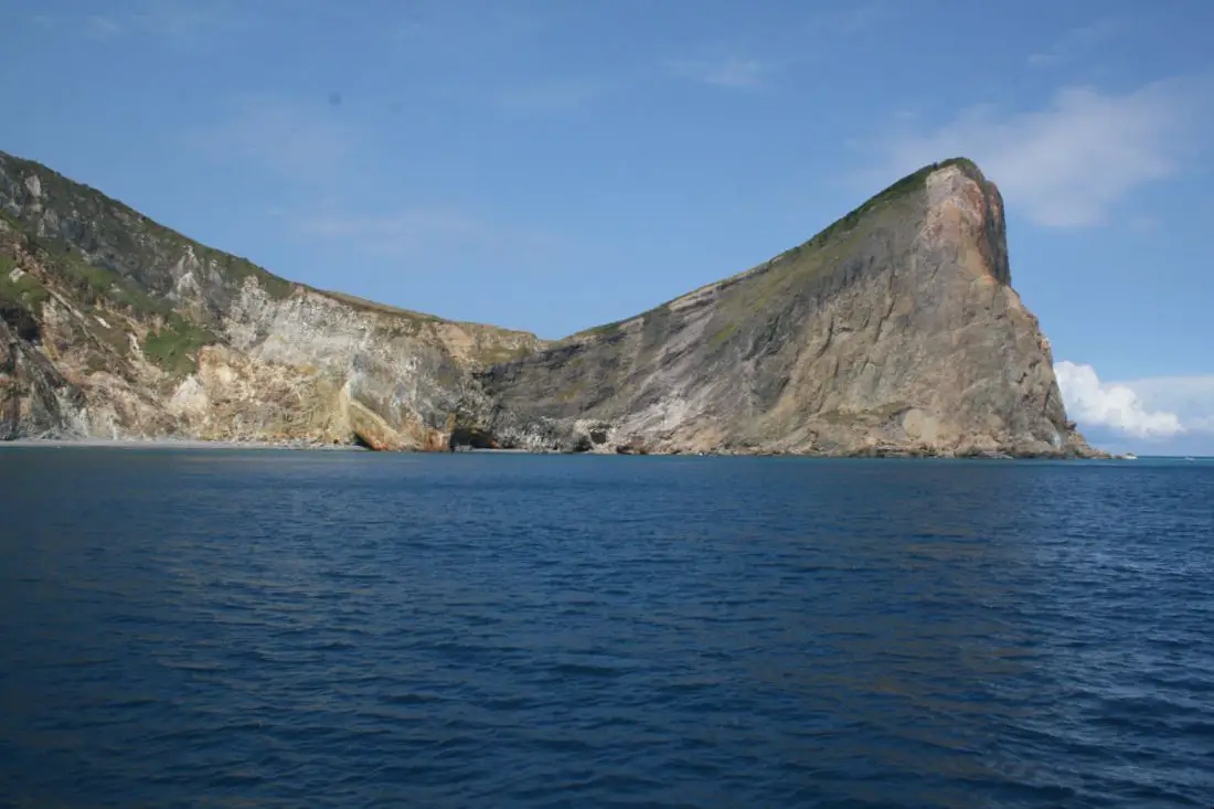
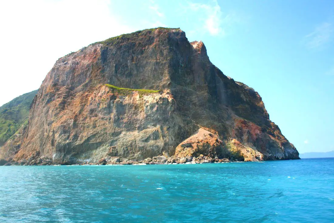
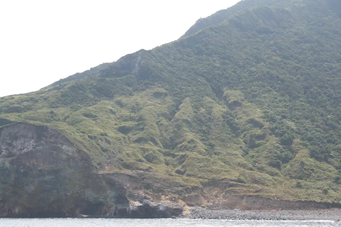
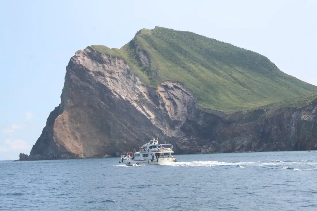
Looking toward the turtle shell and turtle head as we round the island.
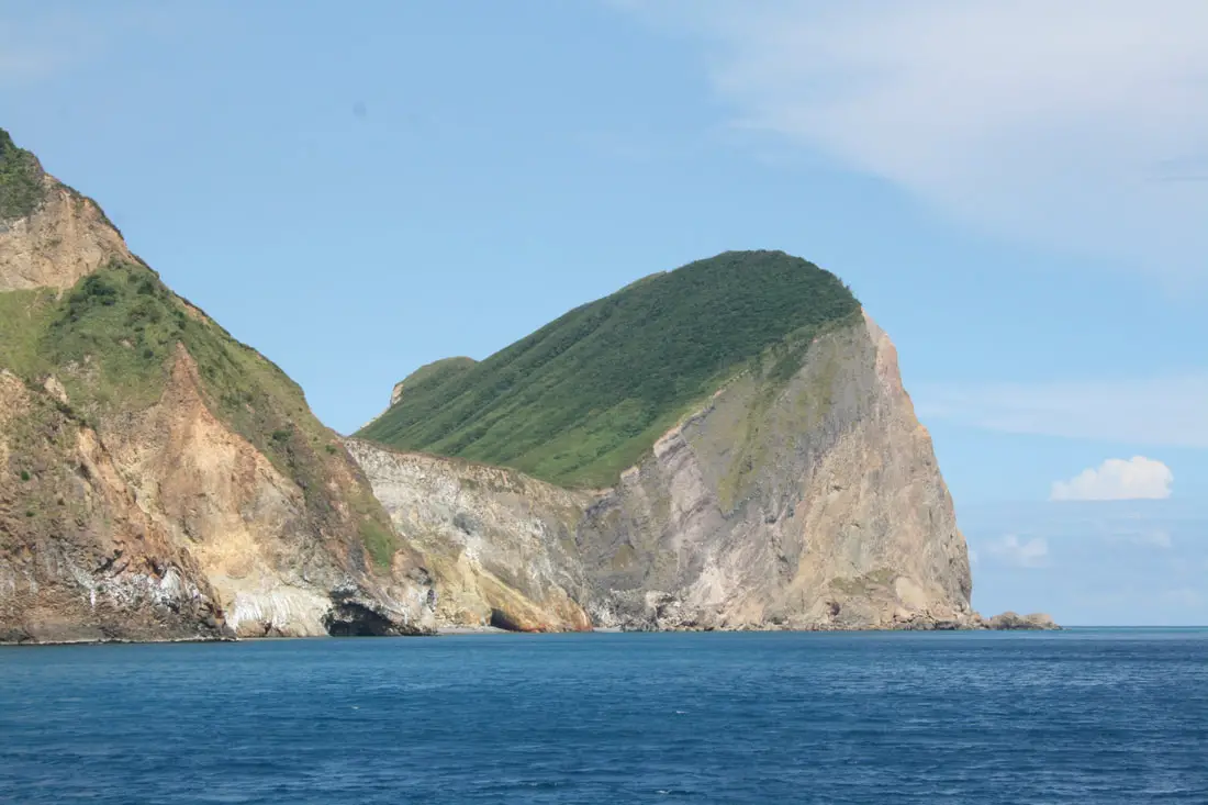
View of the turtle head from the south.
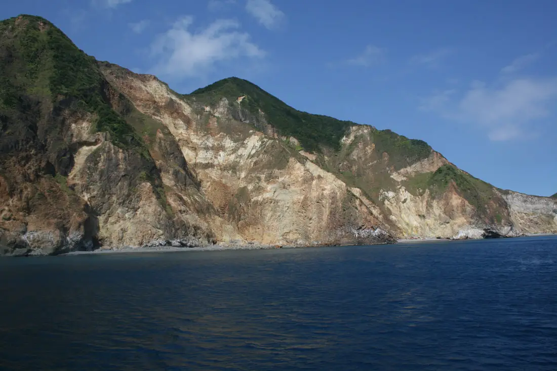
Huge sea cliffs coming off the south of the island.
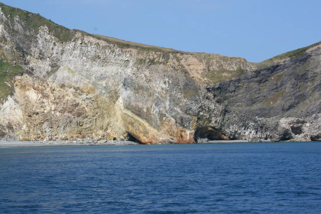
Scene 3: Turtle Island Sulfur 龜島磺煙
Here we can see cliffs made with lighter colored rocks and sulfur. At this point we could smell that rotten egg sulfur smell. Guishan Island is a volcano, and it's active! In fact, Guishan Island is the only active volcano in Taiwan! 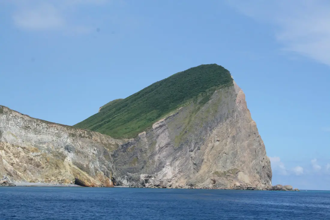
Another angle of the Turtle's head.
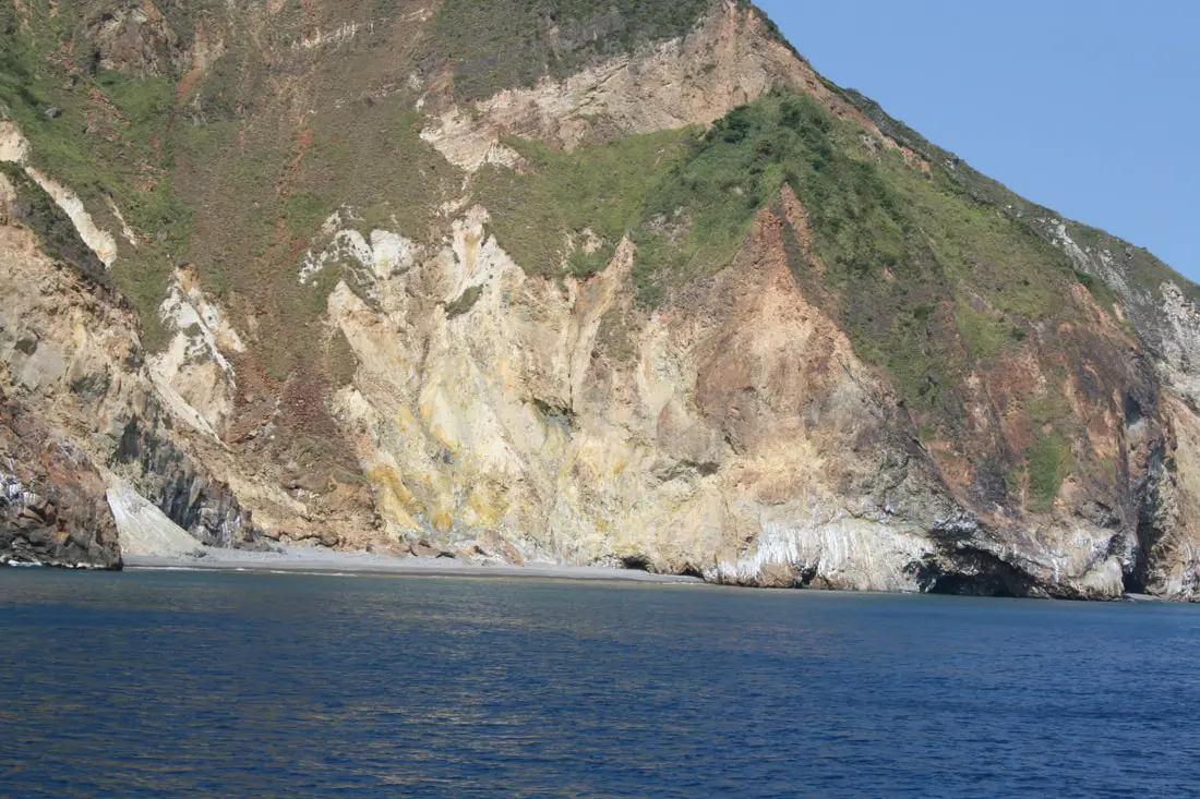
More sulfur cliffs.
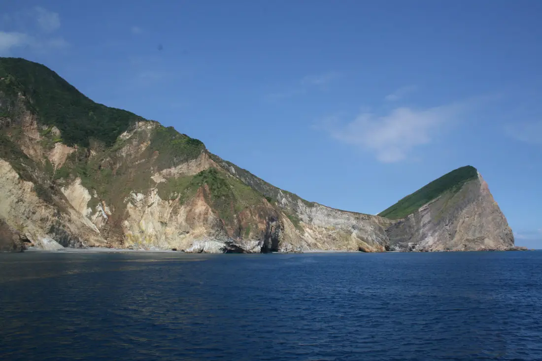
Here is where you can really see the turtle shape on the island.
Sulfur cliffs that look like they could erode away at any time.
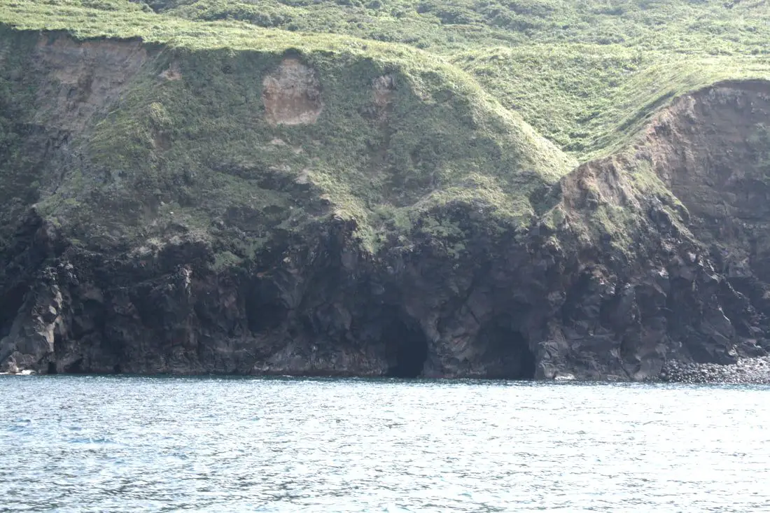
What appears to be many natural sea caves at the bottom of the sulfur cliffs.
The turtle head from the side.
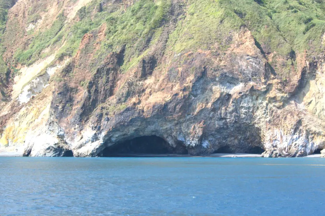
Scene 4: Eye Cave Stalactites 眼鏡洞鐘乳石
If you look closer at the sea caves, you'll notice one with stalactites (eye cave, pictured above)! You can kind of see one, I guess, from this angle. 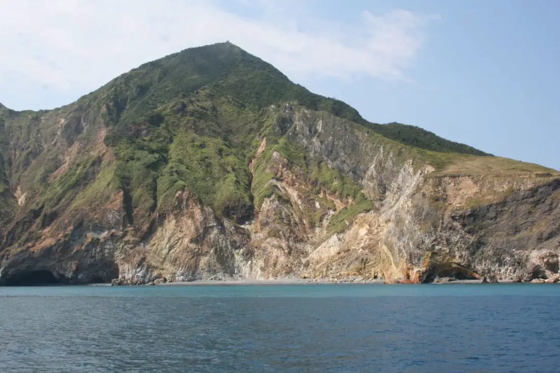
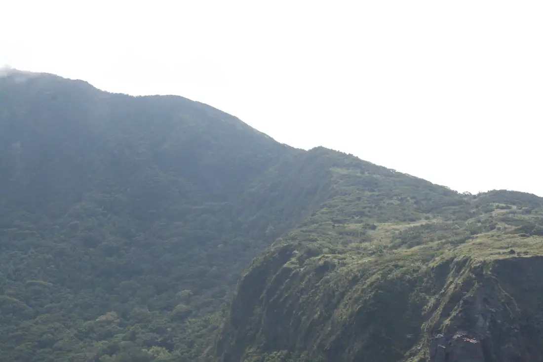
From here you can see the mountain that sits on top of Guishan Island.
Scene 5: Undersea Hot Spring Flowing Up 海底溫泉湧上流
At the front of the turtle's head the water is a beautiful turquoise color because of an undersea hot spring spewing sulfur into the ocean. You can actually see the bubbling hot spring from the boat, but I missed it. 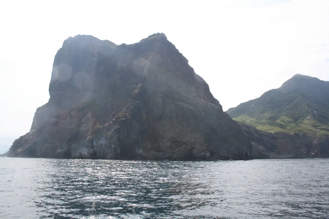
Scene 6: Turtle Looking Toward the Sun 龜山朝日
Normally this scene can be seen from Yilan, you don't even need to get on a boat. Just watch the sun rise over Turtle Island. But because we were on an afternoon tour, I got the next best thing: the back side of the turtle head facing the sun. Breaking all basic rules of photography here. 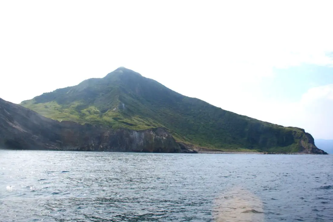
The back (east) side of the island.
Close up of the turtle's neck.
Closeup of the back side of the island.
More of the island's back side.
Another ship circling around the back side of the island.
On the north side of the island are a few man made caves used to protect ROC boats from bomb raids. Guishan Island was never actually attacked.
Wider view of the island's north side.
After rounding out the north side of the island, half of us left the boat and started touring the island. The other half of the people stayed on the boat to look at whales, including "Mr. get out of the way of my selfie" which I was happy about.
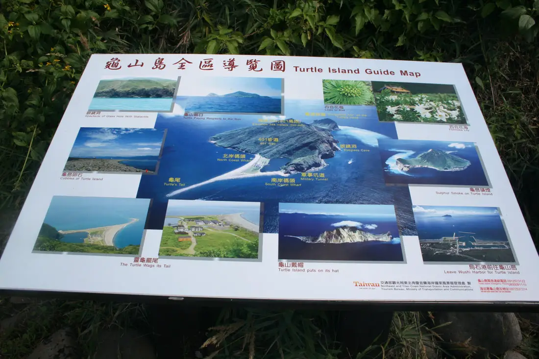
Turtle Island Guide Map.
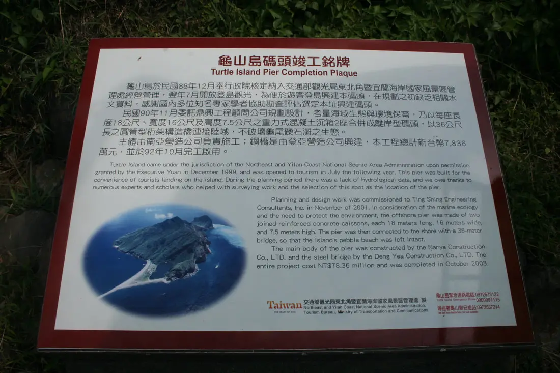
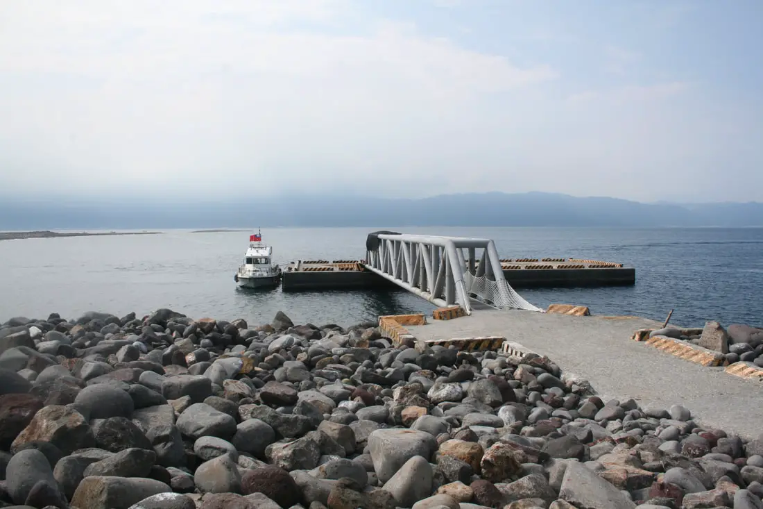
Turtle Island Pier Completion Plaque:
"Turtle Island came under the jurisdiction of the Northeast and Yilan Coast National Scenic Area Administration upon permission granted by the Executive Yuan in December 1999, and was opened to tourism in July the following year. This pier was built for the convenience of tourists on the island. During the planning period there was a lack of hydrological data, and we owe thanks to numerous experts and scholars who helped with surveying work and the selection of this spot as the location of the pier." "Planning and design work was commissioned to Ting Shing Engineering Consultants Inc. in November 2001. In consideration of the marine ecology and the need to protect the environment, the offshore pier was made of two joined reinforced concrete caissons, each 18 meters wide, and 7.5 meters high. The pier was then connected to the shore with a 36 meter bridge, so that the island's pebble beach was left intact. The main body of the pier was constructed by the Nanya Construction Co., LTC and the steel bridge by the Deng Yea Construction Co., LTD. The entire project cost NT $78.36 million and was completed in October 2003." 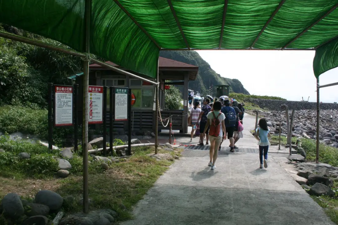
Entering the island costs 100 NT per person. We bought these with KK Day, and we gave our receipts to the guard in the shack above.
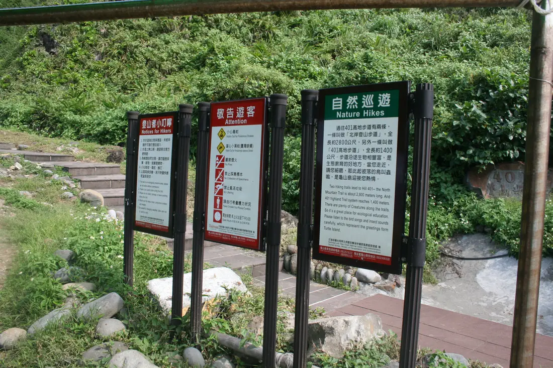
From here you can start hiking to the top of the island, but our our was too short. Besides, we had already seen the whole island from the boat so we gave it a pass.
Scene 7: The Turtle God's Tail 神龜擺尾
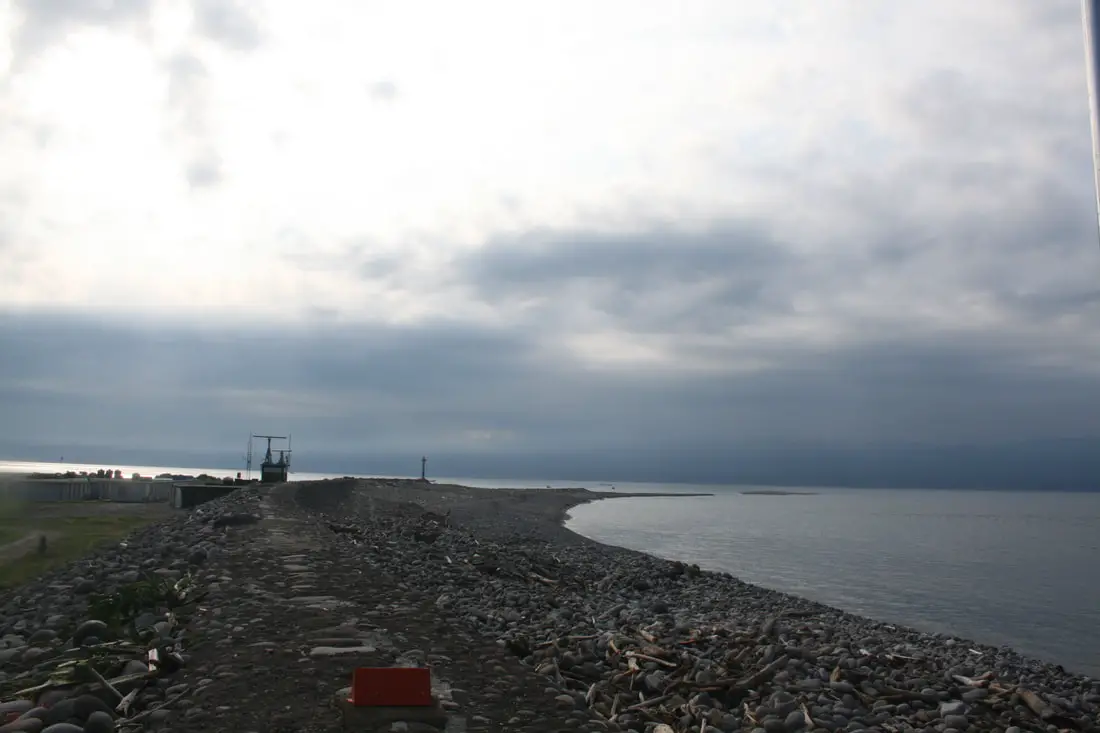
Here is the sand bar that looks like a turtle's tail on the north side of the island. 
Scene 8: Turtle Egg Wonder 龜卵奇觀
Next we entered the visitor's center which had "turtle eggs on display." Apparently the beach here on the turtle's tail is full of these turtle egg sized rocks. For more info, you can check out My Taiwan Tour's blog on the island here. That's all the scenes, we found them all (kind of)! 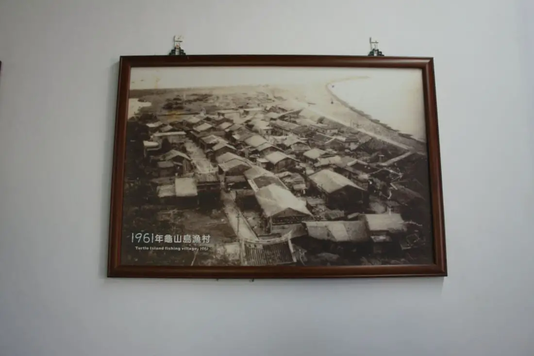
Guishan Island in 1961.
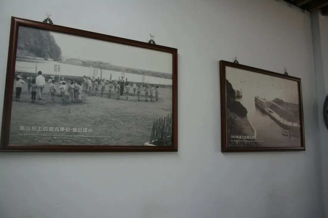
The elementary school and harbor.
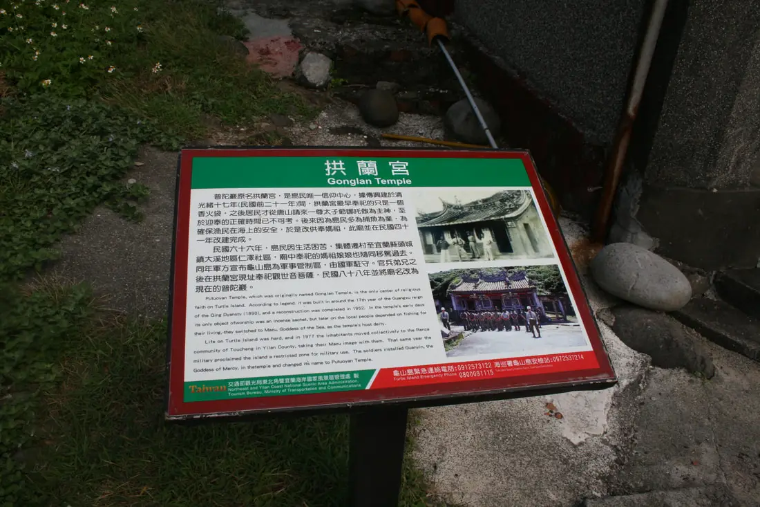
Gonglan Temple:
"Putoyan Temple, which was originally named Gonglan Temple, is the only center of religious faith on Turtle Island. According to legend, it was built around the 17th year of the Guangxu reign of the Qing Dynasty (1890), and a reconstruction was completed in 1952. In the temple's early days its only object of worship was an incense sachet, but later on the local people depended on fishing for their living, they switched to Mazu, Goddess of the Sea, as the temple's host deity." "Life on Turtle Island was hard, and in 1977 the inhabitants moved collectively to the Renze community of Toucheng in Yilan County, taking their Mazu image with them. That same year the military proclaimed the island a restricted zone for military use. The soldiers installed Guanyin, the Goddess of Mercy, in the temple and changed its name to Putuoyan Temple." 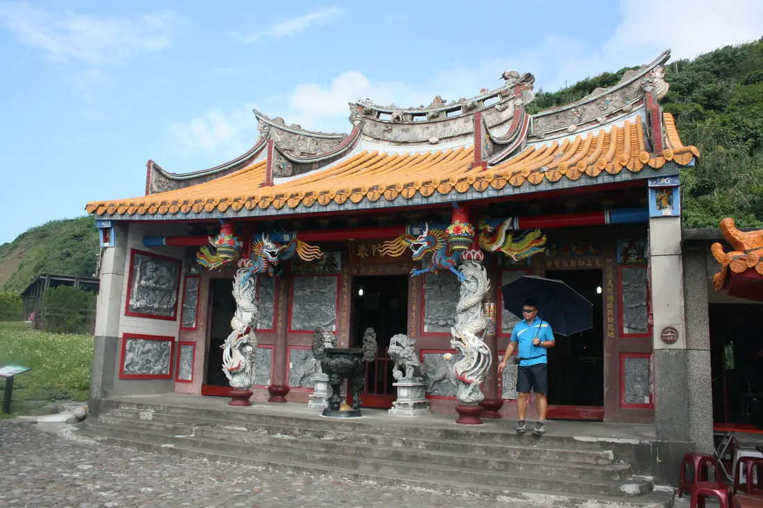
Our handsome tour guide basically explaining exactly what that sign just said.
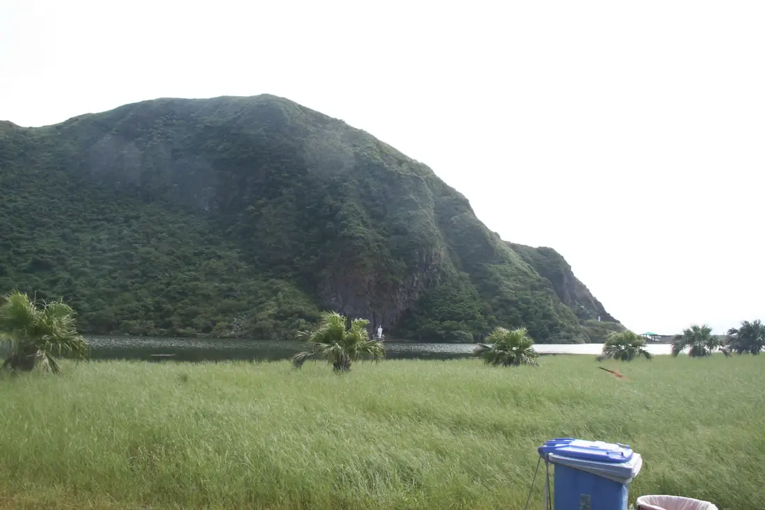
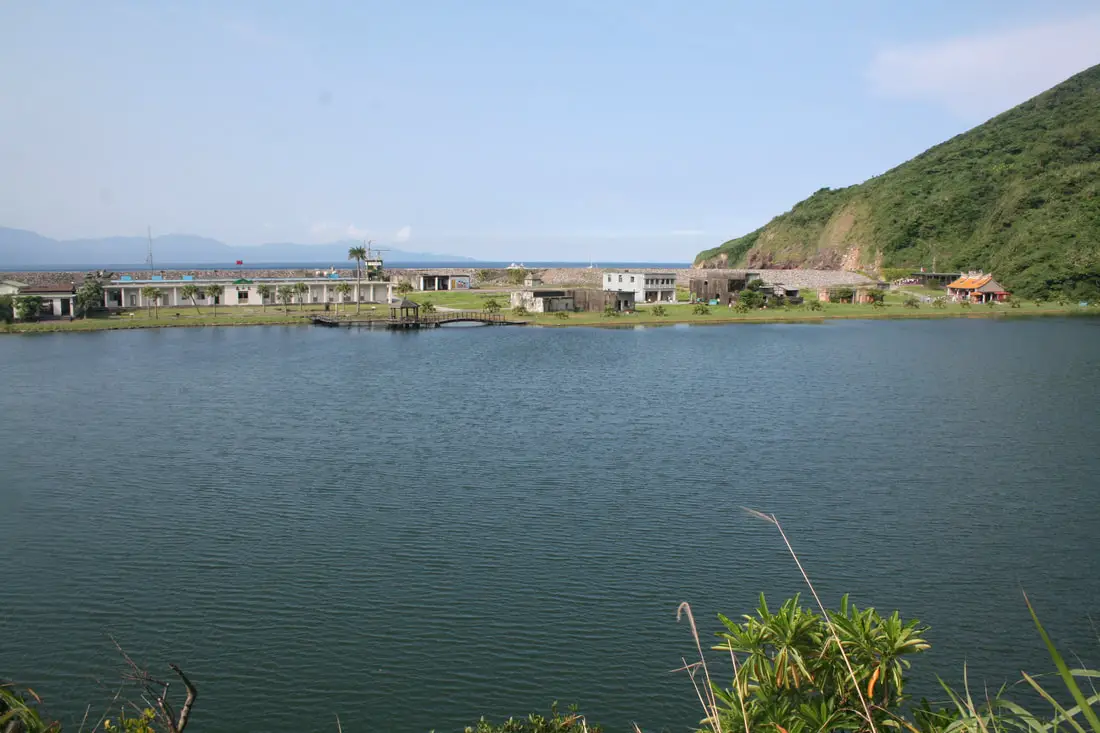
View of Guiwei Lake (literally turtle tail lake 龜尾湖). This was originally a natural lagoon or somewhat salty lake. Later on the citizens tried to make it into a harbor, but after every typhoon the entrance would block up and it would become a fresh water lake again. Nowadays they've built a dam and made the lake permanent.
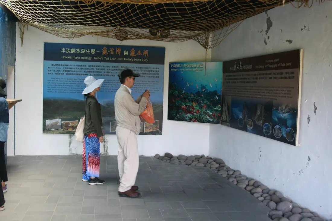
Exhibition next inside of the abandoned buildings.
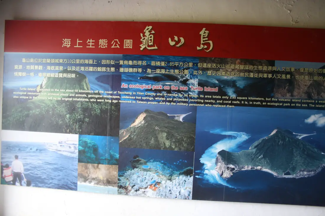
An Ecological Park on Turtle Island:
"Turtle Island is situated in the sea about 10 kilometers off the coast of Toucheng in Yilan County and is named for its shape. Its area totals only 2.85 square kilometers, but this volcanic island contains a wealth of ecological resources with primeval plants and animals, geological landscapes, underseas hot springs, whales and porpoises cavorting nearby, and coral reefs. It is, in truth, an ecological park on the sea. The island is also unique in the history left by its original inhabitants, who were long ago removed to Taiwan proper, and by the military personnel who replaced them." 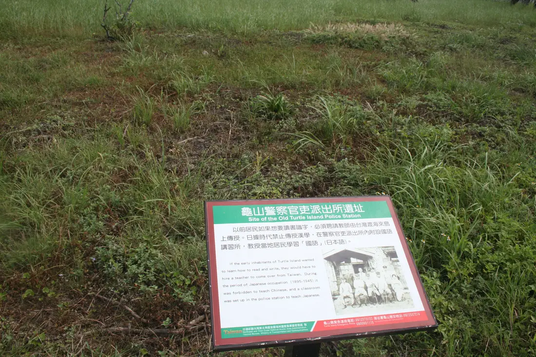
Site of the old Turtle Island Police Station:
"If the early inhabitants of Turtle Island wanted to learn how to read and write, they would have to hire a teacher to come over from Taiwan. During the period of Japanese occupation (1895-1945) it was forbidden to teach Chinese, and a classroom was set up in the police station to teach Japanese." 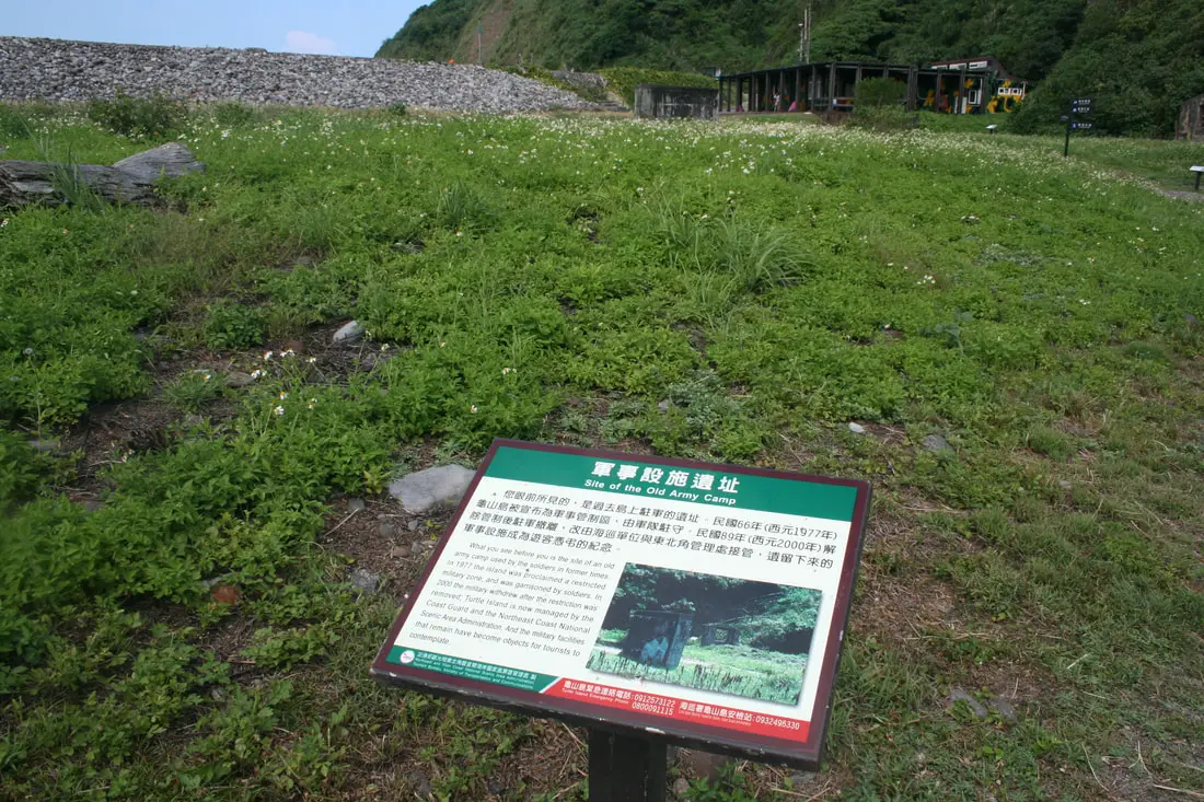
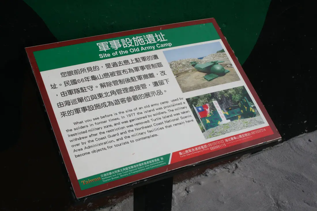
Site of the old Army Camp
"What you see before you is the site of an old army camp used by the soldiers in former times. In 1977 the island was proclaimed a restricted military zone, and was garrisoned by soldiers. In 2000 the military withdrew after the restriction was removed; turtle Island is now managed by the Coast Guard and the Northeast Coast national Scenic Area Administration, and the military facilities that remain have become objects for tourists to contemplate." 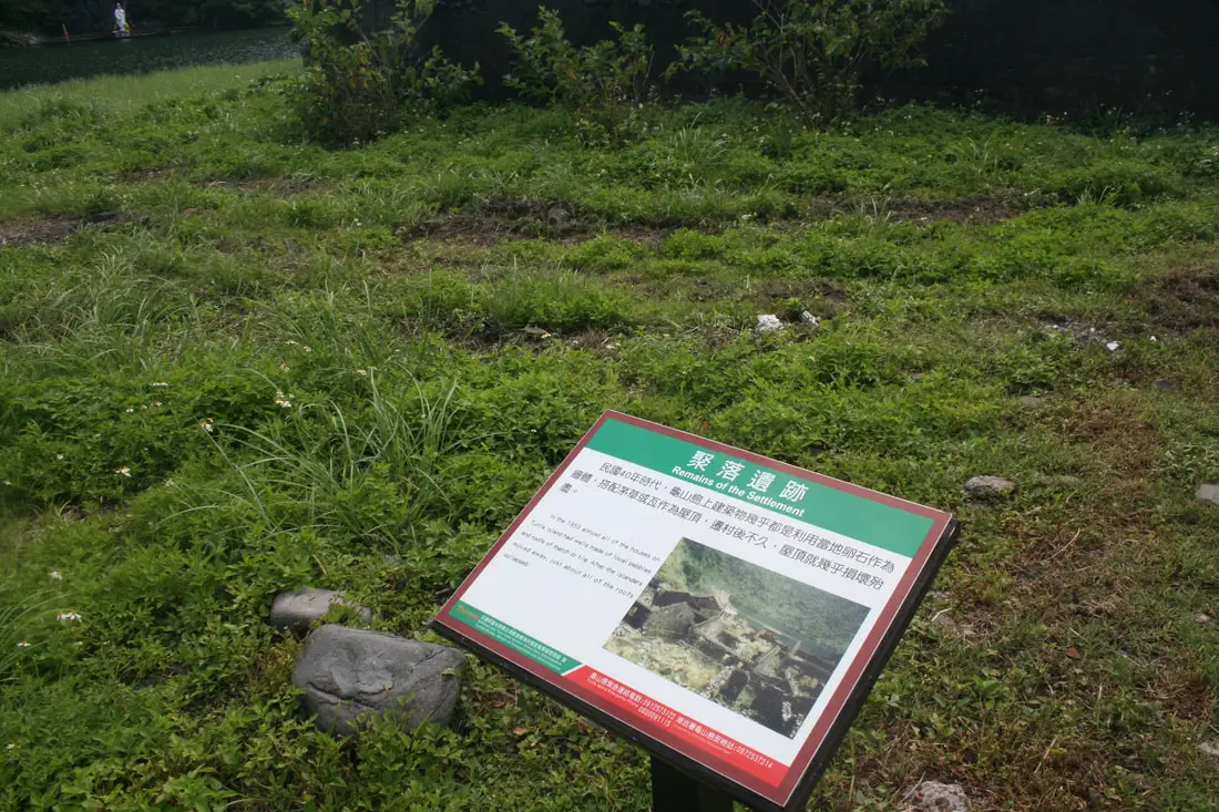
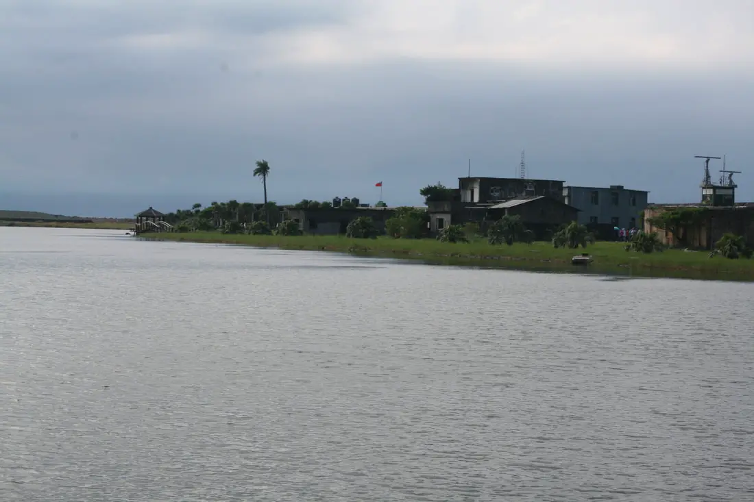
Remains of the Settlement:
"In 1950 almost all of the houses on Turtle Island had walls made of local pebbles and roofs of thatch or tile. After the islanders moved away, just about all of the roofs collapsed." 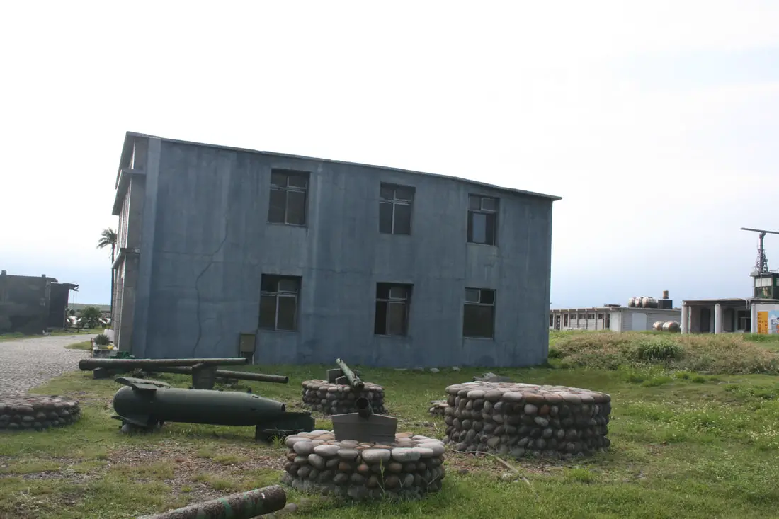
The abandoned village along with some old military hardware.
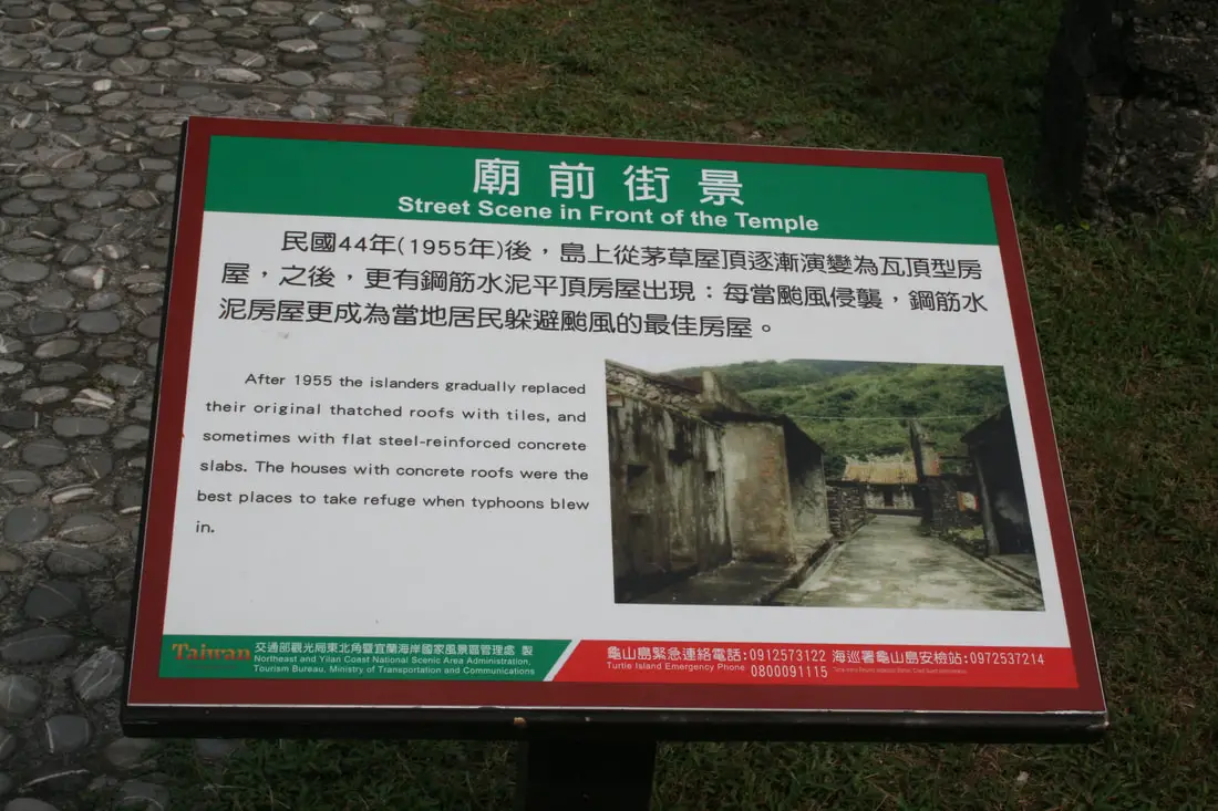
Street Scene in Front of the Temple:
"After 1955 the islanders gradually replaced their original thatched roofs with tiles, and sometimes with flat steel-reinforced concrete slabs. The houses with concrete roofs were the best placed to take refuge when typhoons blew in. 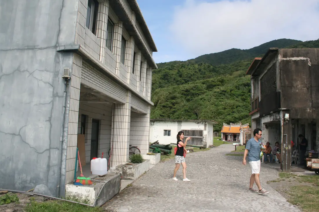
A view of the main street in town.
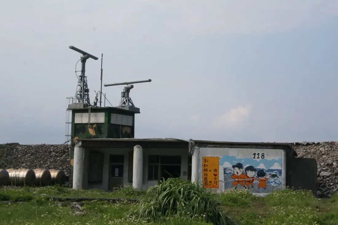
Old military structures and radar now used by the coast guard.
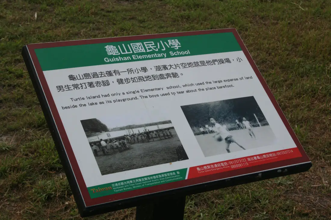
Guishan Elementary School:
"Turtle Island had only a single Elementary school, which used the large expanse of land beside the lake as its playground. The boys used to tear about the place barefoot. 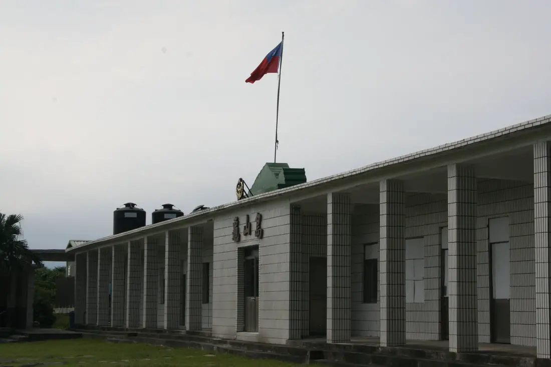
Guishan Elementary School (later used as a military barracks).
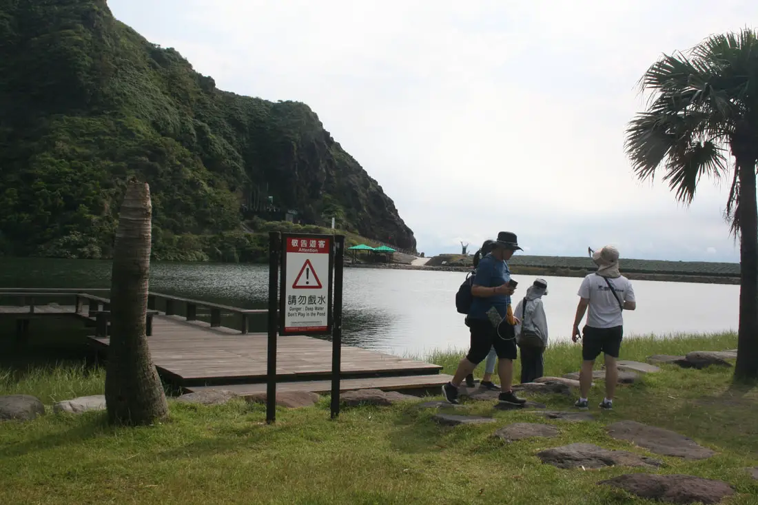
another view of Guiwei Lake.
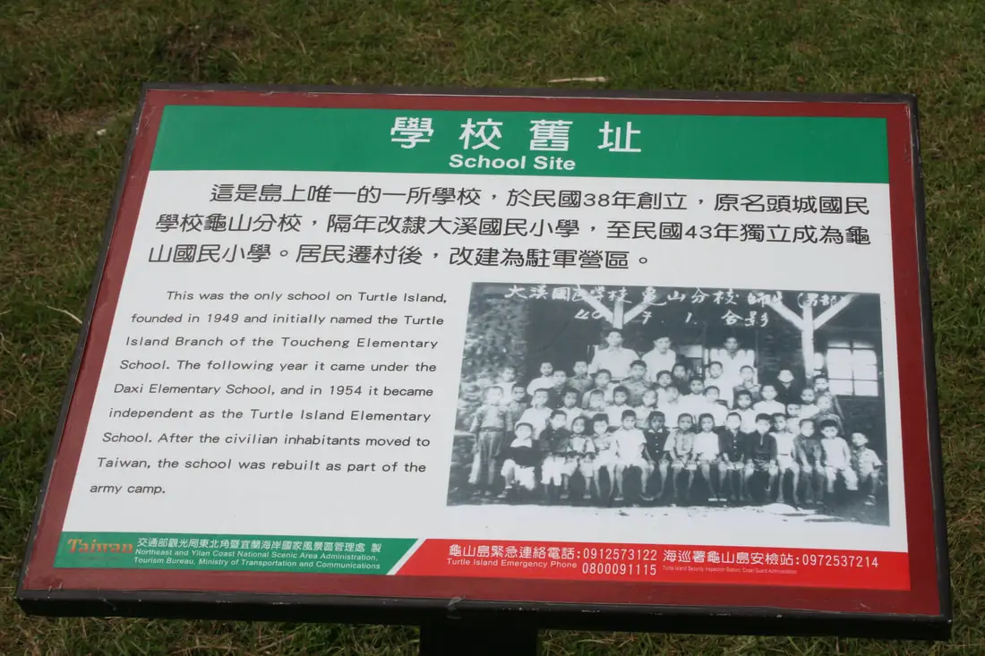
School Site:
"This was the only school on Turtle Island, founded in 1949 and initially named the Turtle Island Branch of the Toucheng Elementary School. The following year it came under the Daxi Elementary School, and in 1954 it became independent as the Turtle Island Elementary School. After the civilian inhabitants moved to Taiwan, the school was rebuilt as part of the army camp." 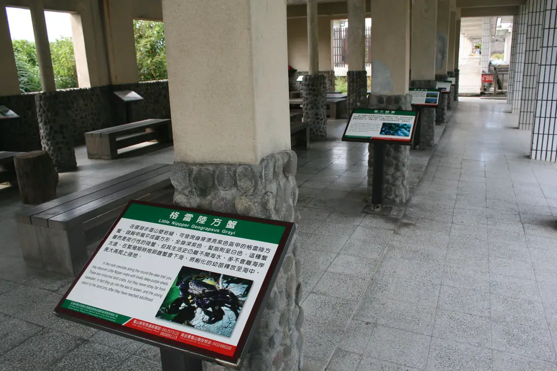
More signs about the wildlife of Guishan Island in the elementary school.
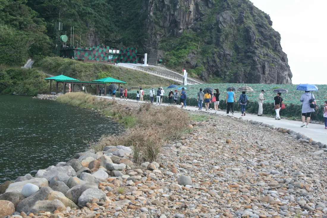
From there, the tour took us around Guiwei Lake to the military tunnels. Look at all those turtle eggs!
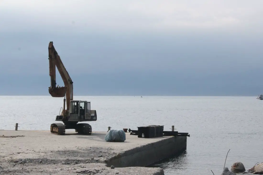
Idle excavator on the dock.
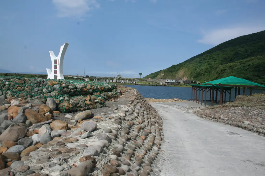
Another view looking back. This used to be the connection from the lake to the ocean. And more turtle eggs!
Site of the Old Army Camp
"What you see before you is the site of an old army camp used by the soldiers in former times. In 1977 the island was proclaimed a restricted military zone, and was garrisoned by soldiers. The military withdrew after the restriction was removed; Turtle Island was taken over by the Coast Guard and the Northeast Coast national Scenic Area Administration, and the military facilities that remain have become objects for tourists to contemplated." Wow this is the exact same wording as before! Nice recycling! 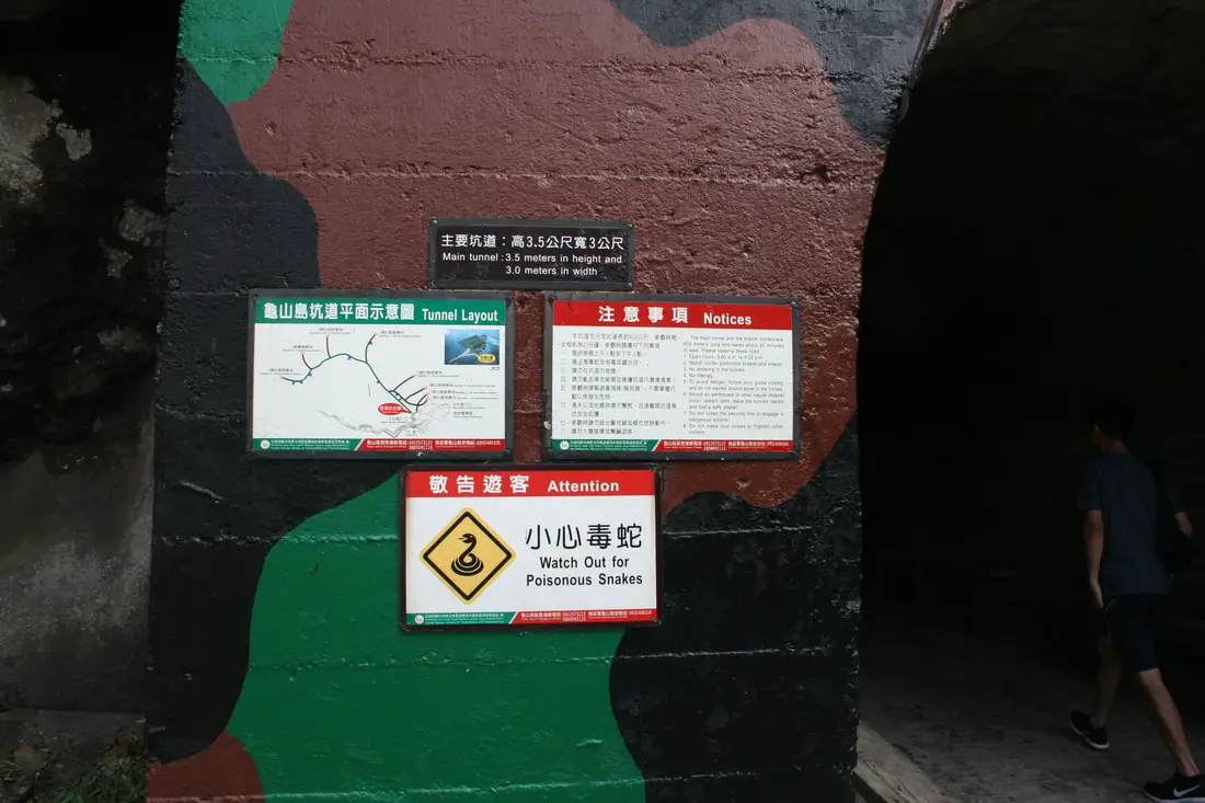
Entrance to the military tunnels. Watch for poisonous snakes! (we saw none)
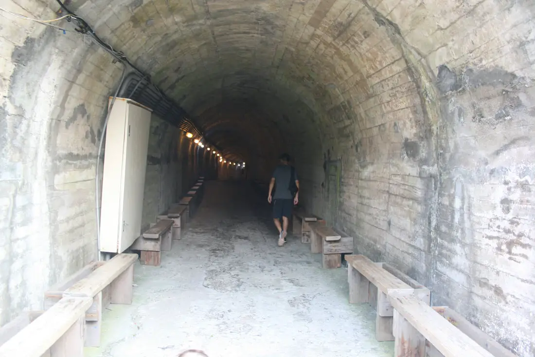
Lots of spots to rest along the tunnel.
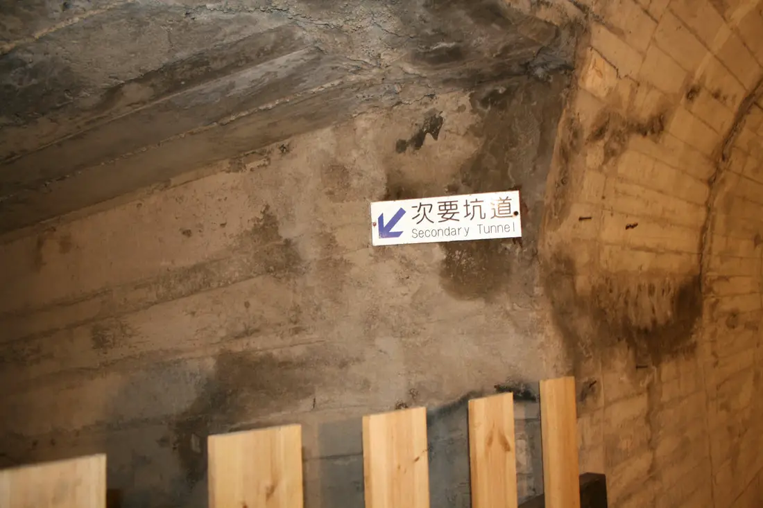
A secondary tunnel, closed off to the public. Probably they were afraid of tourists getting lost.
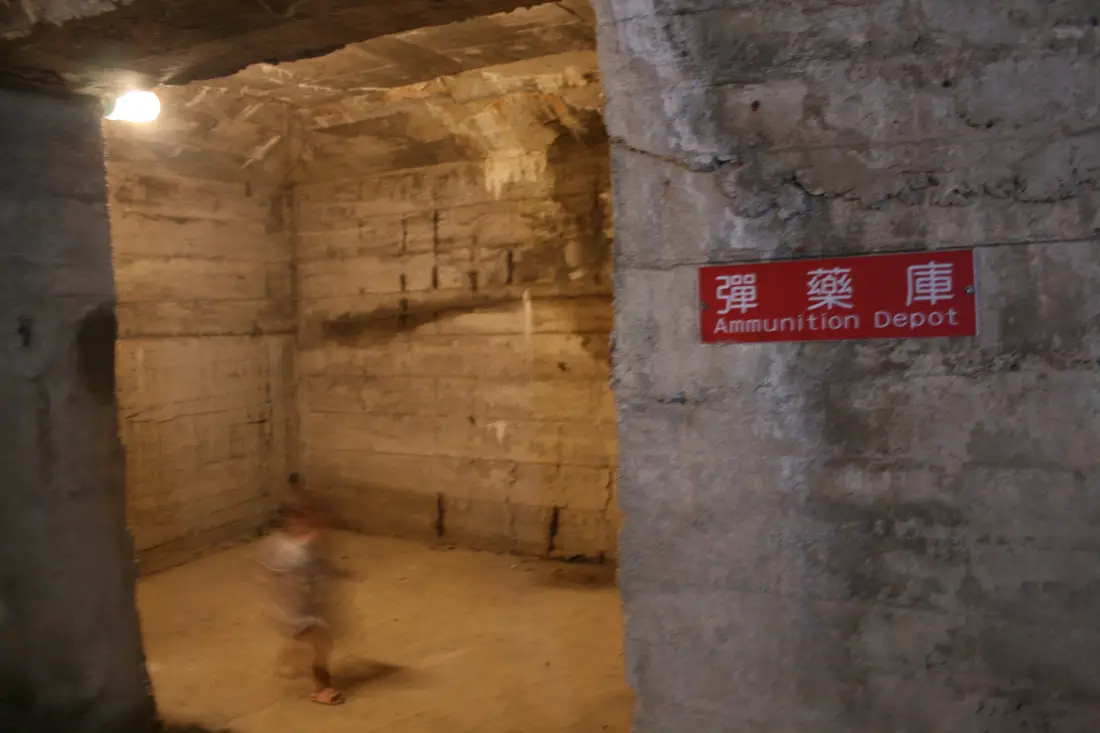
A ghost in the ammunition depot.
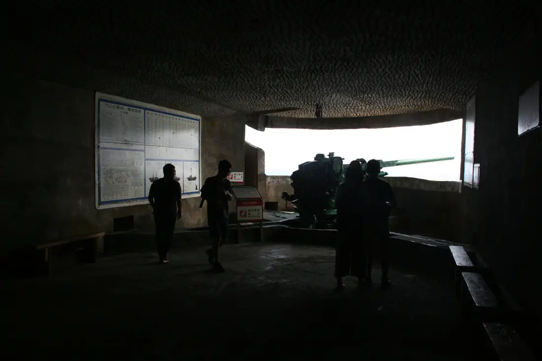
The main cannon on display.
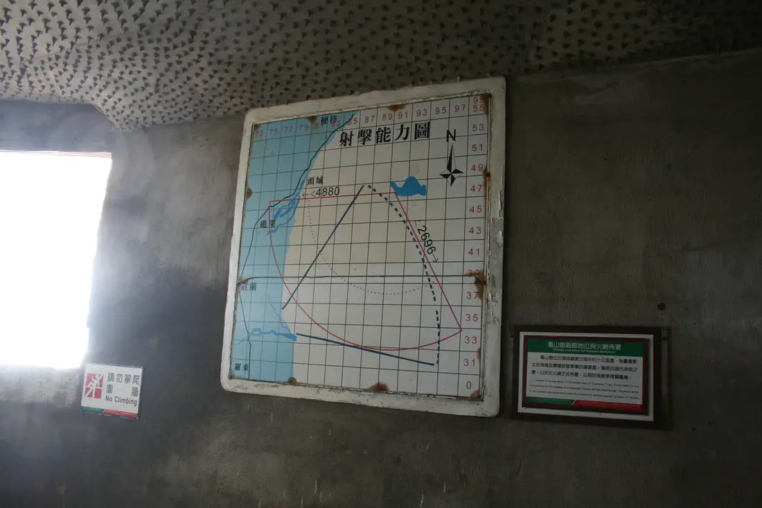
The range of the cannon is 2696 meters to the south and 4880 meters to the west.
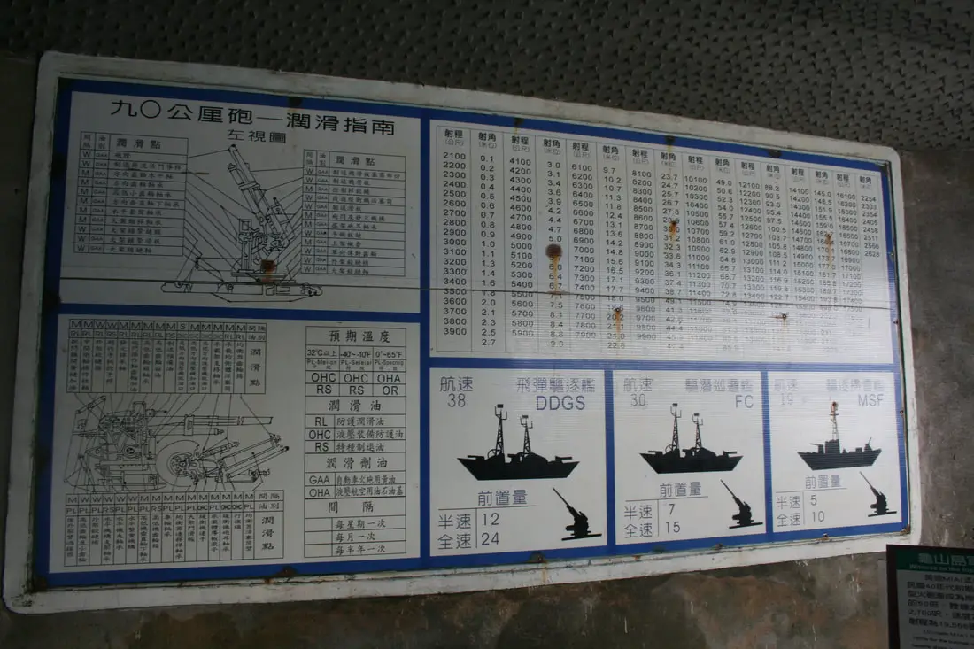
List of ships and cannons as well as their specifications.
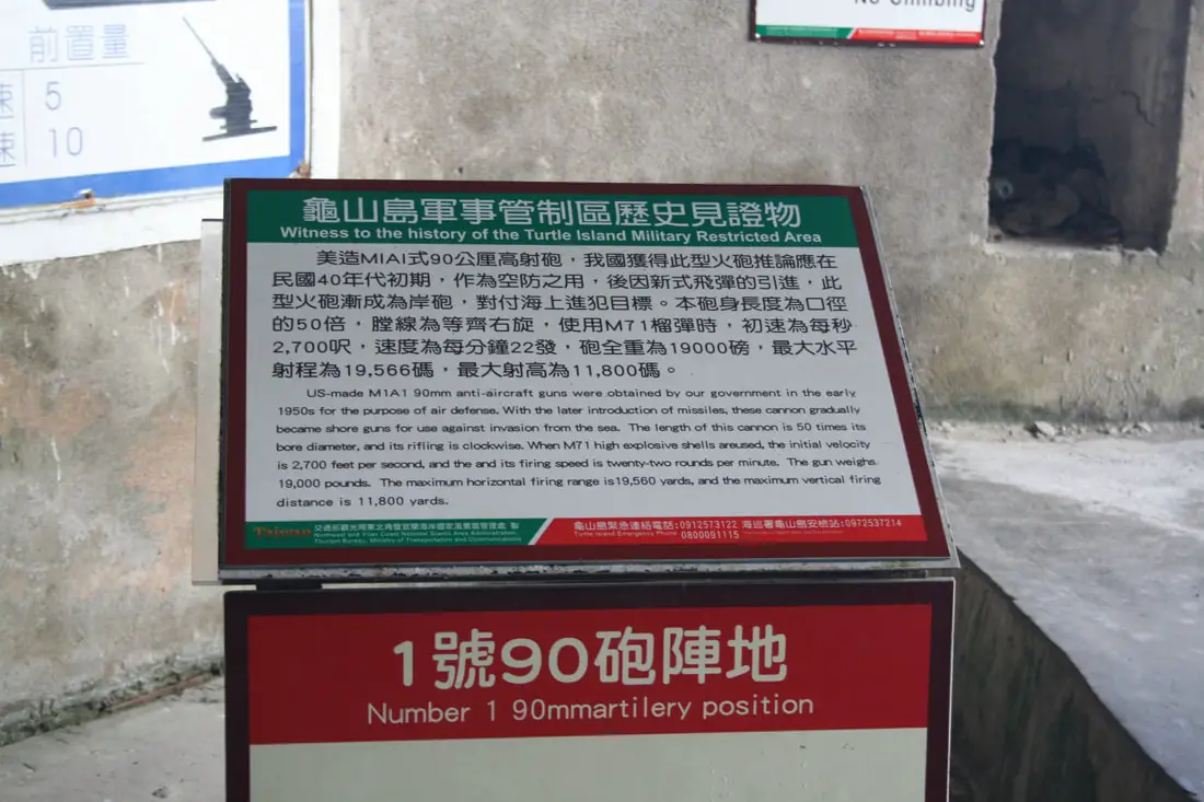
Witness to the history of the Turtle Island Military Restricted Area:
"Us-made M1A1 90mm anti-aircraft guns were obtained by our government in the early 1950s for the purpose of air defense. With the later introduction of missiles, these cannons gradually became shore guns for use against invasion from the sea. The length of this cannon is 50 times its bore diameter, and its rifling is clockwise. When M71 high explosive shells are used, the initial velocity is 2,700 feet per second, and its firing speed is 22 rounds per minute. The gun weighs 19,000 pounds. The maximum horizontal firing range is 19,560 yards, and the maximum vertical firing distance is 11,800 yards. 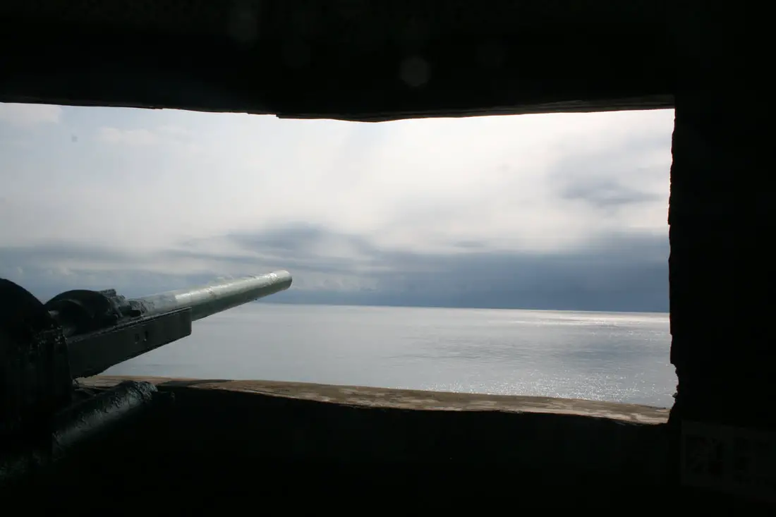
View of the cannon overlooking the sea.
Rocks left over from boring out the tunnels and bunker.
After the tunnels, the tour guide took us on a hike around the back side of the lake.
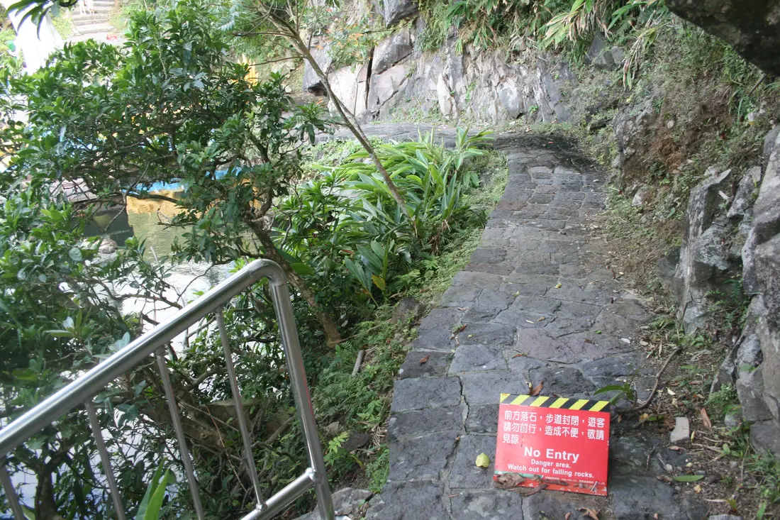
Part of the trail closed because of falling rocks.
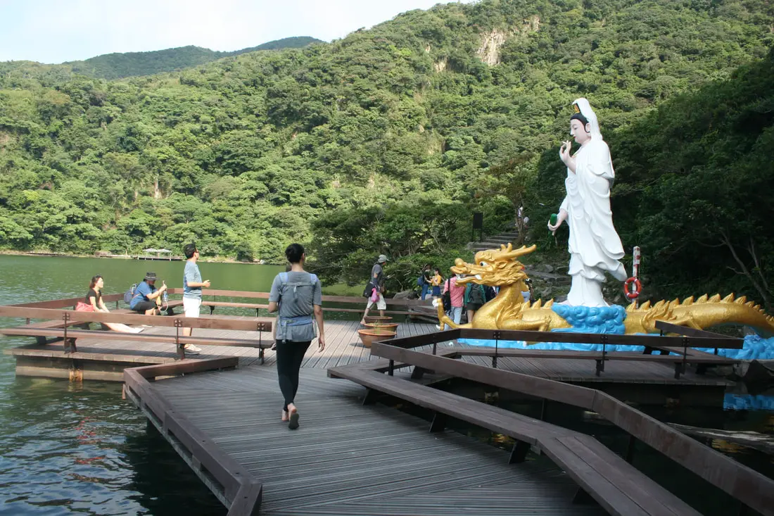
Statue of Guanyin Pusa on the other side of the lake.
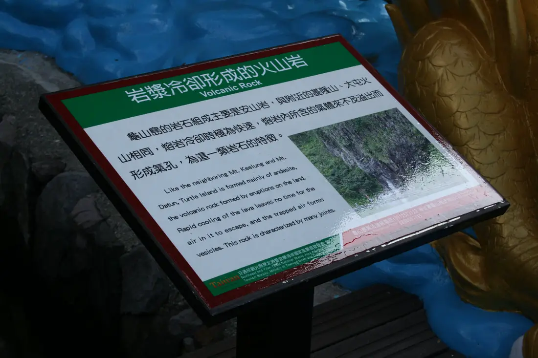
Volcanic Rock:
"Like the neighboring Mt. Keelung and Mt. Datun, Turtle Island is formed mainly of andesite, the volcanic rock formed by eruptions on the land. Rapid cooling of the lava leaves no time for the air in it to escape, and the trapped air forms vesicles. This rock is characterized by many joints." If only I knew what that even means. 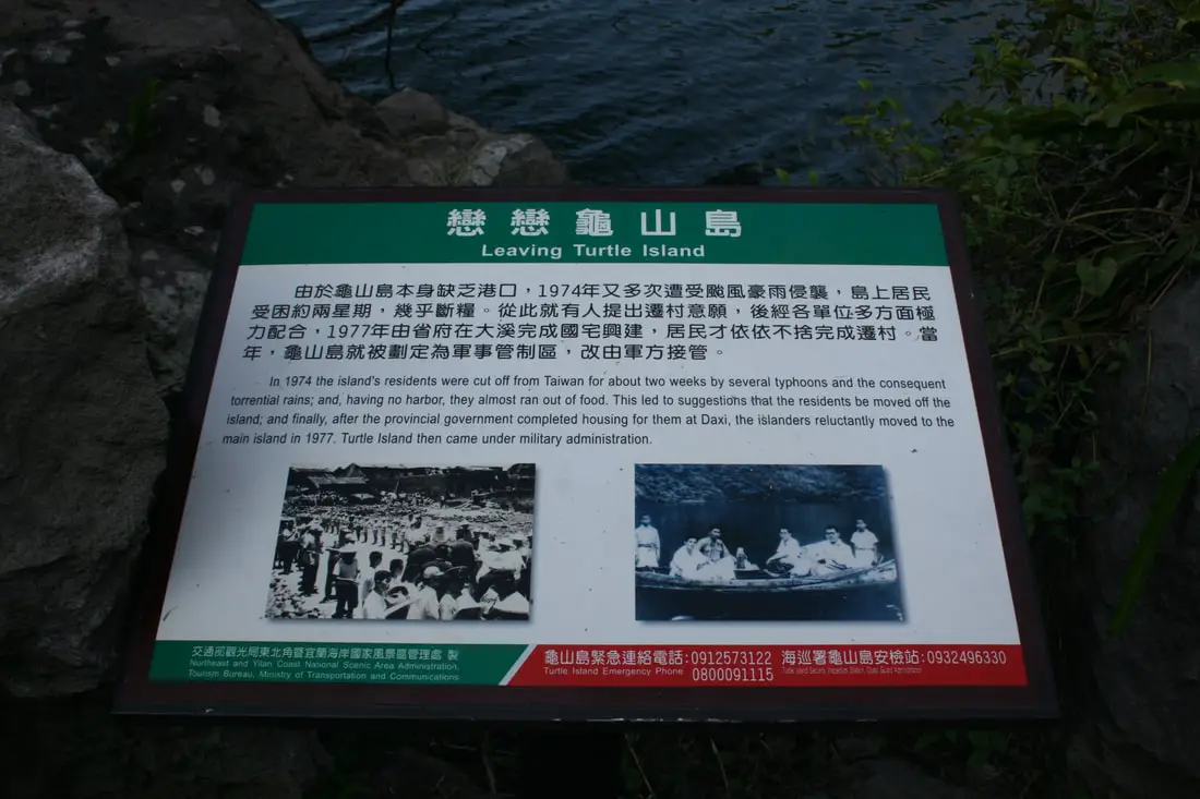
Leaving Turtle Island:
"In 1974 the island's residents were cut off from Taiwan for about two weeks by several typhoons and the consequent torrential rains; and having no harbor, they almost ran out of food. This led to suggestions that the residents be moved off the island and finally, after the provincial government completed housing for them at Daxi, the islanders reluctantly moved to the main island in 1977. Turtle Island then came under military administration." 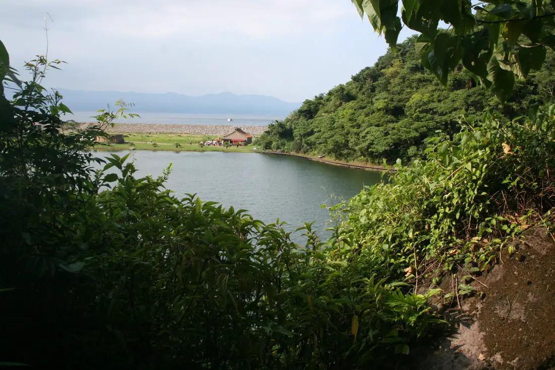
View of the temple from the trail behind the lake.
Another view of the abandoned settlement.
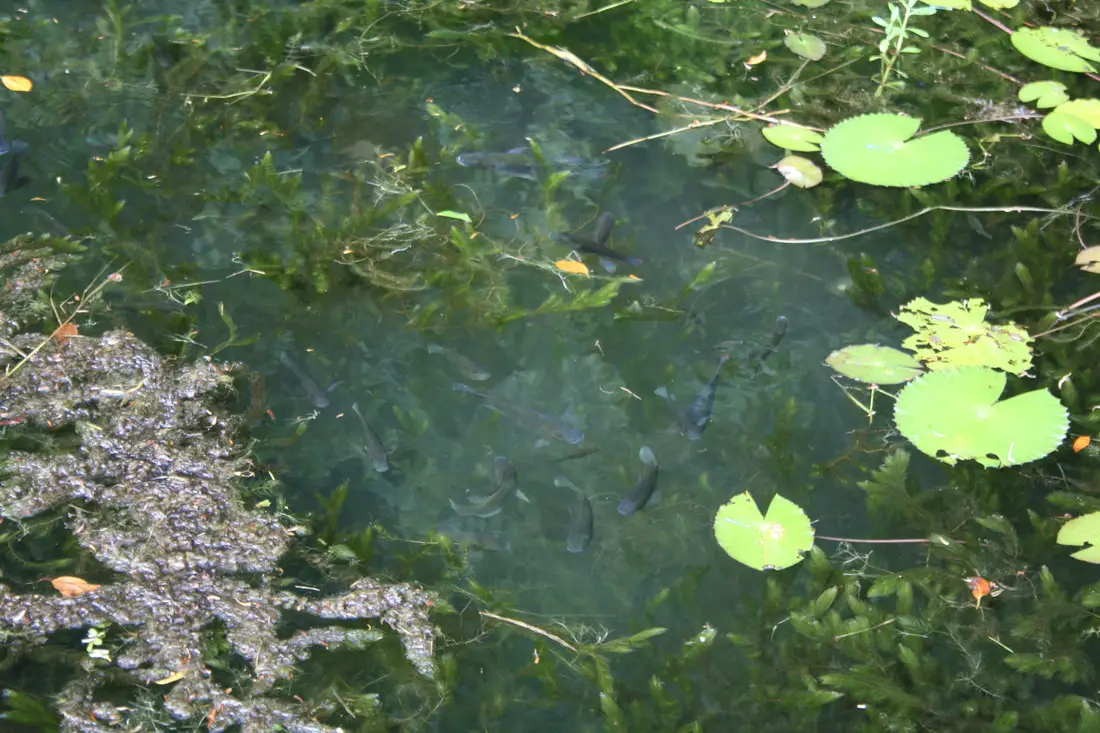
Some fish swimming in the cold water spring.
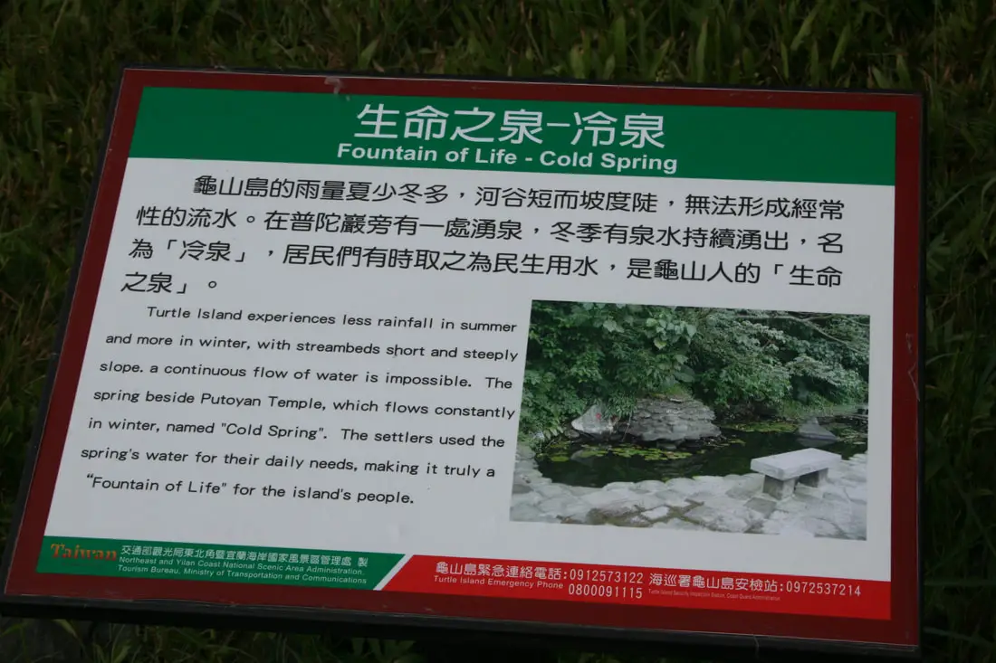
Fountain of Life - Cold Spring:
"Turtle Island experiences less rainfall in summer and more in winter, with streambeds short and steeply slope, a continuous flow of water is impossible. The spring beside Putoyan Temple, which flows constantly in winter, named "Cold Spring." The settlers used the spring's water for their daily needs, truly making it a "fountain of life" for the island's people." 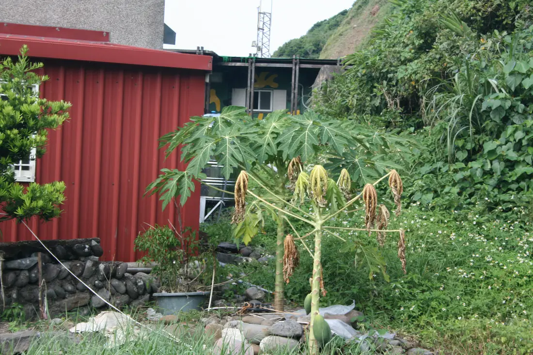
The cold spring hooks up to a water tank behind the visitor center. And someone is secretly growing papaya in an ecological reserve.
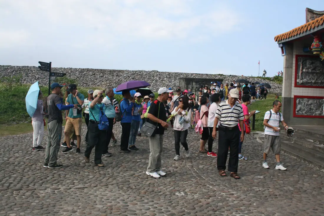
As we were about to leave, a bunch of other tourists arrived.
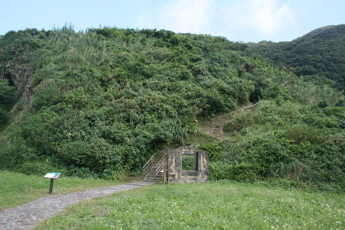
Trail to the Lord Taiwan Ebony.
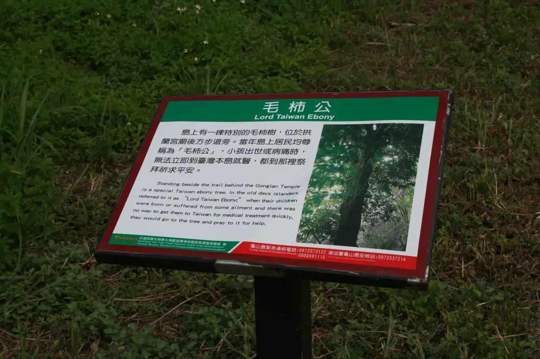
Lord Taiwan Ebony:
"Standing beside the trail behind the Gonglan Temple is a special Taiwan ebony tree. In the old days islanders referred to is as "Lord Taiwan Ebony" when their children were born or suffered from some ailment and there was no way to get them to Taiwan for medical treatment quickly, they would go to the tree and pray to it for help." 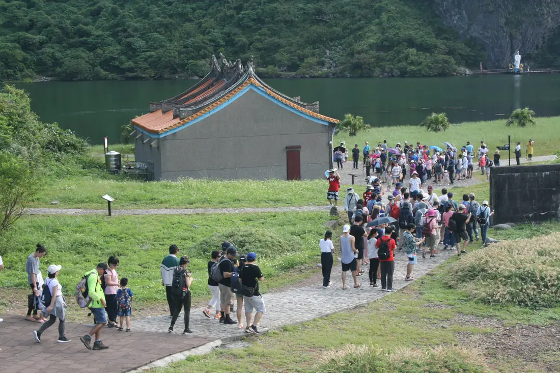
Another batch of tourists entering the island as we were leaving.
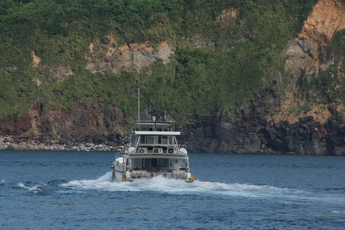
Time was up, and we got on our boat back to the main island of Taiwan.
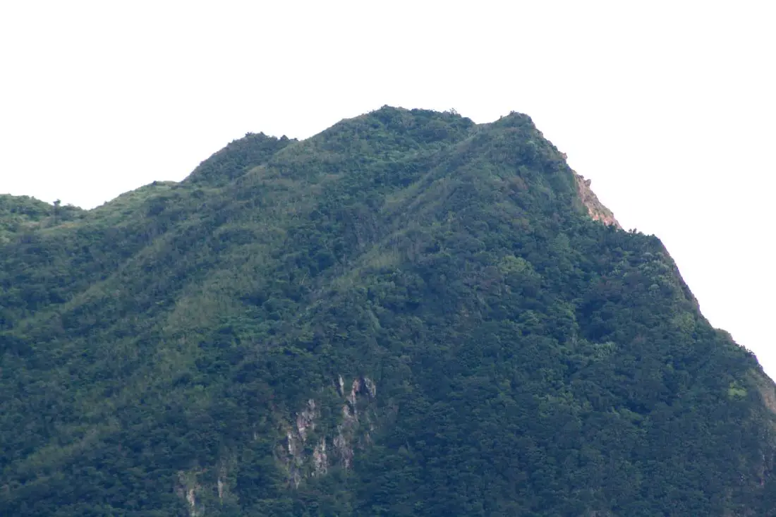
View of the Island mountains looking from the west.
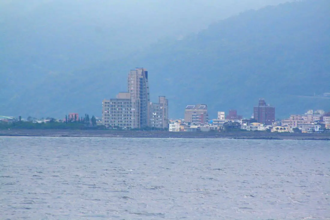
Jiaoxi as seen from our boat.
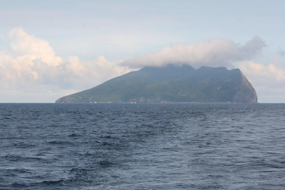
Last view of turtle island (and the Turtle God's hat) before we made it back to Wushih Harbor.
Please like and follow to see more of our adventures in Taiwan! You can book a personalized tour of Turtle Island, ferry boat tickets, and more with Klook here or KKday here. You can also purchase tours and tickets for many activities in Yilan such as surfing, kayaking, horse riding, river tracing, river rafting, river tubing, pack rafting, water biking, snorkeling, canoeing, and many others through Klook here or KKday here. You can also check out our full guide to all of Taiwan's outer islands here. Check out our full guide to Yilan here, our full guide to Taiwan's Northern Coast here, and our full guide Taiwan's East Coast here. You can also check out our full travel guide to Taiwan here.
0 Comments
Your comment will be posted after it is approved.
Leave a Reply. |
Author 作家I am an American expat who has extensive experience living, working, and traveling in Taiwan. In my day, I had to learn many things about Taiwan the hard way. But I have come to learn that Taiwan is one of the best places in the world for Foreigners to live. This blog does not represent the opinions of every foreigner in Taiwan. I am just trying to help others learn more about this beautiful country. Categories
|
 RSS Feed
