

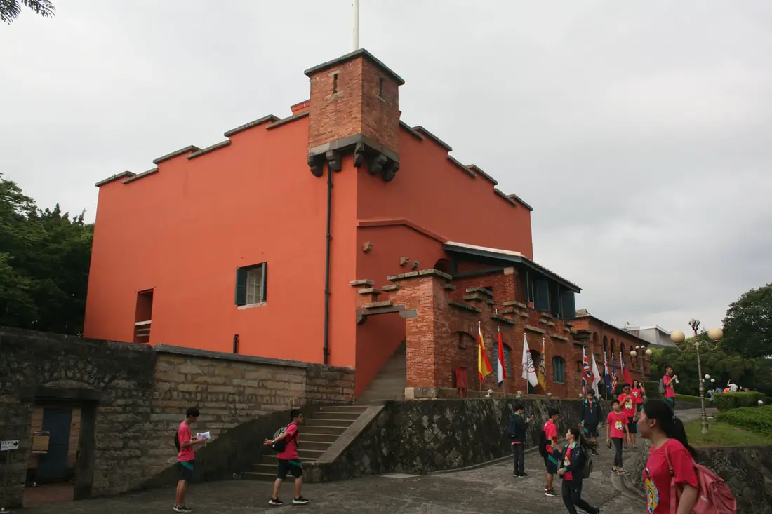
Fort San Domingo (aka 紅毛城 Hongmaocheng, “City of Red Hair") is one of the oldest buildings in Taiwan, with a nearly 400 year history. Originally built by the Spanish, it was handed over to nine different nations including the Dutch, Qing, Japan, British, Australia, USA, and the ROC. Now it is a popular tourist destination in Tamsui.
Background: Fort San Domingo was originally a wooden fort built by the Spanish who were vying for control of Taiwan in 1628. Later the fort came into Dutch control in 1642, and the Spanish were driven from Taiwan. In the process, the Spanish razed the fort to the ground. The fort was rebuilt in brick by the Dutch. The Dutch were expelled from Taiwan thanks to Konxinga and his Ming loyalists. After the Qing dynasty took Taiwan from the Ming loyalists, they repaired the fort in 1724. The local Han Chinese at the time called the fort "Red Hair Fort 紅毛城" as a racial slur to the Dutch. Later, the fort was leased to the British government, who continued to keep a presence there until 1972, and later it was given for a short time to Australia and the USA, and then given to the ROC government in 1980. Now the government maintains the fort as a tourist attraction. Hours: 9:30 AM to 5 PM Price: 80 NT per person (includes passage to the British Consulate, Hobe Fort, and the Little White House). You can book tickets to this fort and nearby historic sites on Klook here or KKday here. Hotels in Tamsui: We have stayed at and recommend Fullon Hotel which has locations in Tamsui and Fulong near the beach (book on Booking.com here, Tripadvisor here, Agoda here, Klook here, Trip.com, Kayak here, or Hotels.com here). We have also stayed at and recommend the Yuanshan Grand Hotel, once the tallest building in Taiwan and still the most grand (book on Booking.com here, Tripadvisor here, Agoda here, Trip.com here, or Kayak here). Looking for a hotel? We recommend booking through Booking.com here, which provides the best quality selection of accommodation in Taiwan. Find out where to stay in our Taiwan hotels guide or search for the best hotel deals in Taiwan here. How to get there: By Car/Scooter: Take provincial highway 2 north from Taipei until you reach Tamsui. The fort is past Tamsui Old Street on highway 2. Parking can be hard to find, but there should be plentiful parking at Tamsui Elementary School and other places further away. Looking for scooter rental in Tamsui? You can search on Klook here or KKday here to search for options. You can also check out our scooter rental guide here. If you are looking for car rentals, you can also search Qeeq here, Klook here, or KKday here. You can also check out our car rental guide here. By MRT: Take the red line MRT north to Tamsui station and walk 1 KM north or take a bus to the fort. You can purchase a discount easy card to use on the MRT from Klook here or KKday here. You can also book an MRT travel pass on Klook here. By Bicycle: Cycling is the best way to enjoy Taiwan's landscapes if you have the time and energy. Looking for bicycle rentals in Taiwan? You can use Taiwan's many Youbike sharing stations, or search for rentals on KKday here, and search for tours on Klook here. You can also check out our Taiwan cycling guide here. Map: Please see below:
0 Comments
Keelung is a small city in the northern part of Taiwan, known for its deep harbor. Here you can find interesting historical sites dating back to the Dutch, Spanish, Qing, and Japanese colonization of Taiwan. Now the town is a bustling urban area with tons of food options, amazing coastline, waterfalls, mountains, and much more to explore. It should definitely be on your bucket list of places to visit in Taiwan.
Brief Historical Background of Keelung: Keelung was formed as sediment under the ocean millions of years ago and was then uplifted thanks to the collision of the Eurasian and Phillipine plates. The rocks have then been slowly eroded away by wind and water, creating odd shapes that you see today. You can see similar formations at Yehliu Geopark. What is now Keelung was once part of Basay aborigine lands. Keelung was first settled by the Spanish in 1626 because of the deep-watered Keelung Harbor. Their first settlement in what became their rule of northern Taiwan until they were defeated by the Dutch and left Taiwan in 1642 was on Heping Island. They built Fort San Salvador (聖薩爾瓦多城), which was destroyed and abandoned by the Dutch in 1668. The ruins of the fort were not confirmed to be found on the island until excavations in 2019. In 1891, the first train connecting Keelung and Taipei was completed. During this time, the Qing Dynasty built many forts near Keelung in response to the Opium Wars and the Sino-French War. During the Japanese Era, the capital of Taiwan was moved to Taipei and a round-island railway was completed. After WWII, as part of the White Terror Movement, on March 8th, 1947 KMT soldiers kidnapped and shot some of about 30 civilians on Sheliao island who were suspected enemy conspirators, known as the Sheliao Incident "社寮事件." After this, the people on the island decided to change to island's name to "Peace Island" or Heping Island in Chinese. Keelung is now a popular daytime and weekend destination for many Taiwanese. Basic Keelung Travel Tips:
When should you go to Keelung? In my opinion, the best weather in Keelung is from March-May, and October - November, when the temperatures stay around 26 degrees Celsius and there is not as much rain. Summers are also nice, with the most sunny weather, but also hot and rainy. Winters can be cold (but not below freezing) and usually wet. Overall, there is no wrong answer as to what time of year you should visit Keelung. You will have a great time here at any time of year. Hotels in Keelung: We recommend Just Live Inn-Keelung and Yung Feng Hotel, which are two great quality hotels for a reasonable price in Keelung's City Center. You can book Just Live Inn-Keelung on Booking.com here, Agoda here, Klook here, Hotels.com here, Trip.com here, or Kayak here. You can book Yung Feng Hotel on Booking.com here, Agoda here, Hotels.com here, Trip.com here, Klook here, or Kayak here. Looking for a hotel? We recommend booking through Booking.com here, which provides the best quality selection of accommodation in Taiwan. Find out where to stay in our Taiwan hotels guide or search for the best hotel deals in Taiwan here. Tours near Keelung: There are many tour itineraries that you can enjoy in Keelung that will take you to multiple destinations and arrange transportation. For more information, you can check out Tripadvisor here, KKday here or Klook here, which are both great tour websites that can connect you with the right tour and tour guide for you. Here are some of the most popular tours of Taipei on Tripadvisor:
Attractions around Keelung: There are many attractions that you can enjoy in Keelung such as Heping Island Park, Miaokou Night Market, Chaojing Smart Aquarium, Kanziding Fish Market, National Museum of Marine Science and Biology, Yehliu Ocean World, Yehliu Geopark, Jiufen, Elephant Trunk Rock, Ju Ming Museum, New Taipei Gold Museum, Bat Cave, Candlestick Islet, and many more attractions on Tripadvisor here, Klook here, or KKday here. Activities in Keelung: Don't forget that there are many activities available in Keelung such as Yachting, Fishing, Surfing, SUP / Paddle Boarding, Diving, Snorkeling Kayaking, Canoeing, Water Biking, River Tracing / Canyoneering, Glamping, Motorcycling, Motorbike Tour, Shen'ao Rail Bike, Night Fishing, Instagram Tour, Metaverse VR experience, Seaside Picnic, and more on Tripadvisor here, Klook here, or KKday here. Just to let you know, if you book using the links above, we get some commission at no cost to you, and you can help support our blog. Some of the Klook links may not work if you are using an Ad blocker. You can click here to receive $5 USD on your first Klook purchase. How to get there: The only way to get to Taiwan is via airplane. Planes leave daily from Taipei's Songshan and Toayuan Airport. Taoyuan Airport: Taoyuan is Taiwan's largest airport and typically has cheaper flights and more flight times to choose from. It's about an hour's journey from Taoyuan Airport to the center of Taipei. You can travel via MRT, HSR, bus, or taxi to get to Taipei. You can get 30% off the Taoyuan Airport VIP lounge on KKday here. Songshan Airport: Songshan is a small airport in Taipei's city center, and can be a convenient option for people traveling within Asia. The airport is right on the Taipei MRT brown line. You can book cheap flights to Taiwan on KKday here, Trip.com here, CheapO Air here, or Kiwi here. How to get around in Keelung: Taipei's transportation system is convenient and safe. There are many options you can consider to get around in Taipei below: By Train: Gets you to the city center of all major cities in Taiwan. It is about 800NT to get from Taipei to Kaohsiung. Roughly half the price of the HSR. Book tickets via the normal train (TRA) on Klook here. By Bus: Long-range buses such as Ubus and King Bus are easier to understand and cheaper than the local train. You can book tickets to travel to Keelung via inter-city bus on Klook here. By Taxi: You can take short rides for about 150 NT, or hire a Taxi for a day for around 150 USD. You can search for private chartered cars on KKDay here. By Car: If you are looking for car rentals, you can also search Qeeq here, Klook here, or KKday here. You can also check out our car rental guide here. By Scooter: Looking for scooter rental in Taipei? Search KKday here for options. You can also check out our scooter rental guide here. By Bicycle: Cycling is the best way to enjoy Taiwan's landscapes if you have the time and energy. Looking for bicycle rentals in Taiwan? You can use Taiwan's many Youbike bike sharing stations, or search for rentals on KKday here, and search for tours on Klook here. You can also check out our Taiwan cycling guide here. For more information, check out our Taiwan transportation guide here. Tourist Site Map: Check out our map below of tourist sites in Taiwan, which is constantly updated: 
Tamsui District of New Taipei is famous for its delicious food and historical atmosphere. It is one of the most popular and well known areas in all of Taiwan. Some local delicacies here include A-gei, iron eggs, fried squid, and other seafood. Historical places near here include Fort San Domingo, Hobe Fort, Tamsui Old Street, Bali Old Street, and the Shihsanhang archaeological site. There is plenty here to see and do for almost every kind of traveler.
Historical Background of Tamsui: Tamsui Harbor was opened in 1860 during the Qing Dynasty as part of the Treaty of Tientsin which ended the Second Opium War. It was one of only eight ports in the entire Qing empire that was open to trade with the West. As a result, it became a focal point for trade in Taiwan. It was also the western terminus of the Danlan Old Trail, which was a network of roads and trails that sent tea and other goods from Yilan to Tamsui. It remained an important port until it started to silt in during the 1900s, and after the construction of Keelung Harbor. There are also a number of important historical buildings in Tamsui such as Fort San Domingo, Hobe Fort, and others. Recently there have been projects from the local government to improve tourism, such as widening roads and making a riverside walkway. With the completion of the Red Line MRT with its terminus in 1997 right at the edge of Tamsui Old Street, Tamsui became an extremely popular destination for residents in greater Taipei and remains to be so today. When should you visit Tamsui? In my opinion, the best weather in Tamsui is from March-May, and October - November, when the temperatures stay around 26 degrees Celsius and there is not as much rain. Summers are also nice, with the most sunny weather, but also hot and rainy. Winters can be cold (but not below freezing) and usually wet. Overall, there is no wrong answer as to what time of year you should visit Tamsui. You will have a great time here at any time of year. Hotels in Tamsui: We have stayed at and recommend Fullon Hotel which has locations in Tamsui and Fulong near the beach (book on Booking.com here, Tripadvisor here, Agoda here, Klook here, Trip.com, Kayak here, or Hotels.com here). We have also stayed at and recommend the Yuanshan Grand Hotel, once the tallest building in Taiwan and still the most grand (book on Booking.com here, Tripadvisor here, Agoda here, Trip.com here, or Kayak here). Looking for a hotel? We recommend booking through Booking.com here, which provides the best quality selection of accommodation in Taiwan. Find out where to stay in our Taiwan hotels guide or search for the best hotel deals in Taiwan here. Tours: You can book a tour of Tamsui on TripAdvisor here, KKday here, or Klook here. You can book a tour of Taiwan's North Coast on TripAdvisor here, Klook here, or KKday here. Activities: There are many activities available around Tamsui such as SUPing, Sand Bar Digging, Horse Riding, Lover's Tower, Sailing, Yachting, Happy Island Parent Child Gymnasium, Chi Po Lin Museum and more on TripAdvisor here, KKday here, or Klook here. How to get around in Tamsui: Taipei's transportation system is convenient and safe. There are many options you can consider to get around in Taipei below: By MRT/Danhai Light Rail: (Mass Rapid Transit, Metro train, subway) – Easily gets you around Taimsui. New stations will be added to the Danhai Rail line soon. You can purchase a discount easy card to use on the MRT from Klook here or KKday here. You can also book an MRT travel pass on Klook here. By Bus: Buses can be tricky. Long-range buses such as Ubus and King Bus are easier to understand and cheaper than the local train. They can take you to the city center of every city throughout Taiwan and to remote tourist destinations. A long-range bus from Taipei to Kaohsiung is about 500 NT. You can also book tickets to travel to Shifen via inter-city bus on Klook here. You can also book a Taipei Sightseeing: Hop On, Hop Off Open Top Bus on TripAdvisor here. By Taxi: You can take short rides for about 150 NT, or hire a Taxi for a day for around 150 USD. You can also get a private charted car on Klook here. By Car: If you are looking for car rentals, you can also search Qeeq here, Klook here, or KKday here. You can also check out our car rental guide here. By Scooter: Looking for scooter rental in Taipei? You can search on Klook here or KKday here to search for options. You can also check out our scooter rental guide here. By Bicycle: Cycling is the best way to enjoy Taiwan's landscapes if you have the time and energy. Looking for bicycle rentals in Taiwan? You can use Taiwan's many Youbike sharing stations, or search for rentals on KKday here, and search for tours on Klook here. You can also check out our Taiwan cycling guide here. You can also book a Sunset Riverside Bike Ride and Historical Tour, 4 Hour Cycling in Taipei, Ultimate 8-Hour Cycling City Tour, or Taipei City Bike Tour with Night Market Experience on TripAdvisor here. For more information, check out our Taiwan transportation guide here. Below we have created a list of what we think are the best places to see near Tamsui. Map: Please see a map below of the places we will visit in this blog: 
Shimen Ancient Battlefield (aka Shimen Historic Battlefield Macacukes 石門古戰場) in Mudan Township of Pingtung is where local Paiwan indigenous people fought a Japanese invading force in the aftermath of the Mudan Incident. Here the Paiwan people were able to stall the Japanese advance but were ultimately defeated and agreed to stop attacking shipwrecked ships. This spot along the river played an important part in Taiwan's history and is also important for the local Paiwan people who still live there. Now you can enjoy the natural scenery, historical markers, and hiking trails nearby.
Background: In 1871, a ship from the Ryukyuan Kingdom was shipwrecked near Mudan Village, and 54 Ryukyu men were massacred by the local Paiwan aboriginals. Even though the Ryukyuan kingdom was independent, it asked for help from the Qing Dynasty, its main trading partner, to pacify the Taiwanese aboriginals. Later in 1872, Japan dethroned the King of the Ryukyuan Kingdom and asked that the Qing Dynasty be held responsible for the massacre. The Qing denied having control over that region of Taiwan, so Japan sent soldiers to avenge those massacred as part of the 1874 invasion of Taiwan. A war ensued, and Japan entered Taiwan at Sheliao (near Guishan) on the Hengchun Peninsula and was stopped for a while at Shimen. Shimen literally means stone gate, referring to the narrow canyon that the Sichong River runs through here. The Japanese army was eventually successful at moving past Shimen and burned all nearby Paiwan Villages. The villagers promised to stop attacking shipwrecked sailors and began flying the Japanese flag which they saw as a sign of peace, and which the Japanese saw as a claim of jurisdiction. In the end, 561 Japanese soldiers died from disease while only 12 were killed in battle. 89 Paiwan aboriginals were killed in battle. Japan then negotiated with China with the help of American and British advisors, and China recognized Japanese control of the Ryukyu Islands and made payment to Japan for peacekeeping in the area. The Japanese finally withdrew from Taiwan in December 1875. In the end, the battle helped Japan solidify its influence on Taiwan and the Ryukyu Islands, emboldening it later to take over Taiwan. Hours: 24/7 Price: Free Tours and Activities in Pingtung: There are many activities available in Pingtung, such as snorkeling, diving, SUPing, surfing, submarine riding, and river tracing. You can find more tours of Kenting on Klook here or KKday here. Accommodation: Looking for a hotel? Find out where to stay in our Taiwan hotels guide or search for the best hotel deals in Taiwan here. We recommend booking through Agoda here, which provides the best quality selection of accommodation in Taiwan. I have stayed at many hostels and hotels in Kenting, and even almost bought a house here. Some places that I have stayed at and can recommend are Nanwan Kiki (book on Agoda here, Booking.com here), a B&B next to Nanwan Bay, Kenting's most popular Beach. There are also a few decent hotels near Kenting Street Night Market like Kenting Star Inn 888 (book on Agoda here, Klook here, Hotels.com here, Expedia here, or Booking.com here), or Kenting Dajianshan Hotel (book on Agoda here, Booking.com here, Hotels.com here, or Expedia here). You will notice that none of these hotels are five star resorts (I do not come to Kenting to waste my time at a resort, but you can still search Agoda, Booking.com, Hotels.com, or Expedia for those) but they are in my opinion the above have the best value for the money. How to get there: By Car/Scooter: Take Provincial Highway 1 south to the bottom of Taiwan until it Checheng. Then travel east toward Mudan Township until you reach the Shimen Historic Battlefield memorial marker. Looking for scooter rental in Pingtung? Click here or here to search for options. You can also check out our scooter rental guide here. If you are looking for car rentals, you can also search Qeeq here, Klook here, or KKday here. You can also check out our car rental guide here. By Bus: You can reach Mudan from Pingtung Bus 1773 or 302, but it will take over three hours. You can book tickets to Kaohsiung via high speed rail (HSR) on Klook here or KKDay here, or book tickets via the normal train (TRA) on Klook here. You can book tickets to travel to Pingtung via inter-city bus on Klook here. By Bicycle: Cycling is the best way to enjoy Taiwan's landscapes if you have the time and energy. Looking for bicycle rentals in Taiwan? You can search on KKday here and search for tours on Klook here. You can also check out our Taiwan cycling guide here. Map: Please see below: 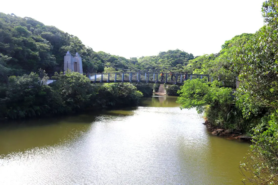
Lovers Lake is a small lake a recreation area in Anle District of Keelung City. It has some easy trails, bridges, and a tower that looks over the area. The lake trails also connect to Dawulun Fort. Overall it is a nice scenic spot for a day trip in Northern Taiwan.
Background: The name "Lovers Lake" comes from the fact that there are actually two lakes, one larger and one smaller, so they are a like a couple in love. The sandstone that forms the area was created between 10 and 20 million years ago, and was pushed out of the sea along with northern Taiwan thousands of years ago. In the past the area was run by a private company, which went out of business. Recently the Keelung City government has taken over control, and has installed a trail that circles the lake. There is also a suspension bridge, windmill, and stone tower overlooking the lake. Nearby you can hike to Dawulun Fort or Eagle Rock that provide great views of the north coast. Currently the lake is popular with hikers and intagrammers, as well as wedding photographers. On the weekends it can get quite busy and parking can be hard to find. Hours: 24/7 Price: Free Tours: You can book a hiking tour of Lover's Lake on KKday here. Activities: Don't forget that there are many activities available along Taiwan's Northern Coast such as Yachting, Fishing, Surfing, SUP / Paddle Boarding, Diving, Snorkeling Kayaking, Canoeing, Water Biking, River Tracing / Canyoneering, Glamping, Motorcycling, Motorbike Tour, Shen'ao Rail Bike, Night Fishing, Instagram Tour, Metaverse VR experience, Seaside Picnic, and more on Tripadvisor here, Klook here, or KKday here. Hotels in Keelung: We recommend Just Live Inn-Keelung and Yung Feng Hotel, which are two great quality hotels for a reasonable price in Keelung's City Center. You can book Just Live Inn-Keelung on Booking.com here, Agoda here, Klook here, Hotels.com here, Trip.com here, or Kayak here. You can book Yung Feng Hotel on Booking.com here, Agoda here, Hotels.com here, Trip.com here, Klook here, or Kayak here, How to get there: By car/scooter: Take provincial highway northwest out of Keelung, and take a right on Jijin First Road toward Keelung Chang Kung Hospital. The Lover's lake parking lot is at the top of the hill before the road turns into one lane. There is limited parking, and you may have to park further away. The trail is not wheelchair or stroller friendly. However there is always plenty of scooter parking. If you are looking for car rentals, you can also search Qeeq here, Klook here, or KKday here. You can also check out our car rental guide here. Looking for scooter rental in northern Taiwan? You can search on Klook here or KKday here to search for options. You can also check out our scooter rental guide here. By Bicycle: Cycling is the best way to enjoy Taiwan's landscapes if you have the time and energy. Looking for bicycle rentals in Taiwan? You can use Taiwan's many Youbike sharing stations, or search for rentals on KKday here, and search for tours on Klook here. You can also check out our Taiwan cycling guide here. You can also book a cycling tour on TripAdvisor here. For more information, check out our Taiwan transportation guide here. By Bus: Unfortunately there are no buses that directly get there, so you will have to walk from provincial highway 2, or take a taxi. You can purchase a discount easy card to use on the MRT and buses from Klook here or KKday here. You can also book an MRT travel pass on Klook here. Map: Please see below: 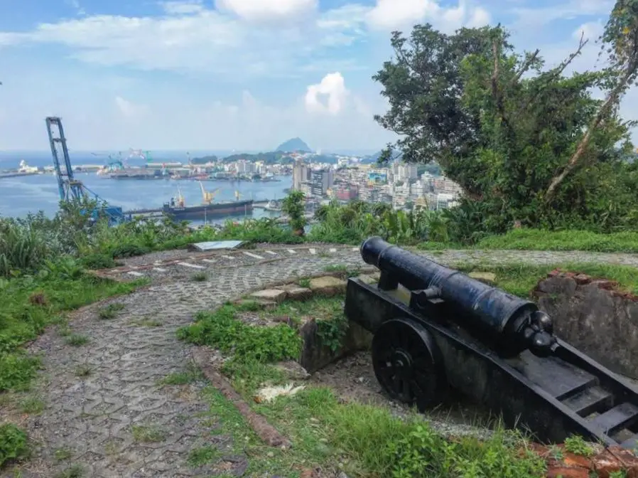
Ershawan Fort (aka Ershawan battery or Tenable Gate of the Sea 海門天險), is a Qing Dynasty era fort that once guarded Keelung Harbor among a network of other forts. For a brief time was taken over by the French during the Sino-French War. Now it stands as a wonderfully preserved monument to the past, with great views of Keelung Harbor.
Background: Ershawan Fort started as a seaside fortification in 1840 as a response to the First Opium War. During the war, a British ship called the Nerbudda fired on the fort, destroying one of the soldier dorm rooms. The ship later bottomed out on a coral reef and the sailors were imprisoned. In August of 1884, 5 French ships under direction of general S. N. J. Lespes attacked the forts at Keelung, attacking from the side. Because the cannons in Ershawan Fort could not rotate, they were useless against the ships. Most of the canons and gunpowder were destroyed or exploded. The next day the French Forces invaded Keelung with a force of about 500 men. They made a cemetery nearby for their men, which was later moved to Ershawan Fort were it still remains to this day. After the war, in an effort to protect the coal reserves near Keelung from the French, the then Imperial Inspector on Military Affairs Liu Mingchuan decided to improve fortifications in Keelung by relocating the Ershawan fortress to the nearby hillside. The new fortress was built in western style with the help of German technicians. The new fortress was completed in 1888 and included two 6 inch Armstrong guns and one 8 inch Armstrong gun. Liu Mingchuan also installed new revolving bases for the cannons, and created a camp below with the "Tenable Gate of the Sea." After the Japanese took Taiwan, the fort was barely used and fell into decay. The fort was declared a national historic monument in 1997. The fort and pathways were further restored in 2018. Now it is a popular attraction in the area especially because of the great view of Keelung Harbor that can be seen from the fort. Hours: 24/7 Price: Free Tours: You can book a tour to Taiwan's North Coast on TripAdvisor here, Klook here, or KKday here. Activities: Don't forget that there are many activities available along Taiwan's Northern Coast such as Yachting, Fishing, Surfing, SUP / Paddle Boarding, Diving, Snorkeling Kayaking, Canoeing, Water Biking, River Tracing / Canyoneering, Glamping, Motorcycling, Motorbike Tour, Shen'ao Rail Bike, Night Fishing, Instagram Tour, Metaverse VR experience, Seaside Picnic, and more on Tripadvisor here, Klook here, or KKday here. Hotels in Keelung: We recommend Just Live Inn-Keelung and Yung Feng Hotel, which are two great quality hotels for a reasonable price in Keelung's City Center. You can book Just Live Inn-Keelung on Booking.com here, Agoda here, Klook here, Hotels.com here, Trip.com here, or Kayak here. You can book Yung Feng Hotel on Booking.com here, Agoda here, Hotels.com here, Trip.com here, Klook here, or Kayak here. How to get there: By Car/Scooter: From central Keelung, take Shoushan Road up the hill on the east part of the city and the fort is at the very top of the hill. There is limited free parking near the top. If you are looking for car rentals, you can also search Qeeq here, Klook here, or KKday here. You can also check out our car rental guide here. Looking for scooter rental in northern Taiwan? You can search on Klook here or KKday here to search for options. You can also check out our scooter rental guide here. By Bicycle: Cycling is the best way to enjoy Taiwan's landscapes if you have the time and energy. Looking for bicycle rentals in Taiwan? You can use Taiwan's many Youbike sharing stations, or search for rentals on KKday here, and search for tours on Klook here. You can also check out our Taiwan cycling guide here. You can also book a cycling tour on TripAdvisor here. For more information, check out our Taiwan transportation guide here. By Bus: There is no direct way to get there by bus, but you can take the 204 bus from Keelung Station to Keeling Stadium station and then walk up the hill about 1 KM to the fort. I think you can reach the fort from the harbor side, but I'm not sure where the entrance to the trail is. You can purchase a discount easy card to use on the MRT and buses from Klook here or KKday here. You can also book an MRT travel pass on Klook here. Map: Please see below: 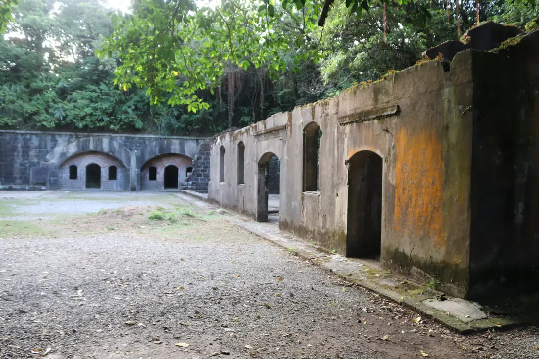
Dawulun Fort is a Qing Dynasty era fort that once guarded the coast along Wanli, Jinshan, and Keelung, among a network of other forts. Now it stands as a wonderfully preserved monument to the past, with great views of Keelung Harbor and Wanli District.
Background: Dawulun Fort started as a seaside fortification in 1875 in order to protect Dawulun Harbor, Keelung Harbor, and the road from Tamsui to Keelung which goes through Jinshan. Soldiers began being stationed on the hill at Dawulun as early as 1840. The fort was an important piece of defense during the Opium Wars and the Sino-French War. A total of 10 Canons were placed at the fort at one time. After the Japanese took Taiwan, the fort was not used after 1935 and fell into decay. When the ROC took Taiwan, they took down all the remaining canons. The fort was declared a national historic monument in 1985. Since the early 2000's some people have illegally dug around the site looking for buried treasure, even though a study in 2003 found that there was no treasure buried in this site. Now it is a popular attraction in the area especially because of the great view of Keelung and Wanli that can be seen from the fort. Hours: 24/7 Price: Free Tours: You can book a tour to Dawulun Fort on KKday here. Activities: Don't forget that there are many activities available along Taiwan's Northern Coast such as Yachting, Fishing, Surfing, SUP / Paddle Boarding, Diving, Snorkeling Kayaking, Canoeing, Water Biking, River Tracing / Canyoneering, Glamping, Motorcycling, Motorbike Tour, Shen'ao Rail Bike, Night Fishing, Instagram Tour, Metaverse VR experience, Seaside Picnic, and more on Tripadvisor here, Klook here, or KKday here. Hotels on Taiwan's Northern Coast: We recommend Fullon Hotel which has locations in Tamsui and Fulong near the beach (book on Booking.com here, Tripadvisor here, Agoda here, or Hotels.com here). We have also stayed at and recommend Hai Xia Your Home which is right in front of Fulong Beach (book on Booking.com here, Tripadvisor here, Agoda here, or Hotels.com here). Looking for a hotel? We recommend booking through Booking.com here, which provides the best quality selection of accommodation in Taiwan. Find out where to stay in our Taiwan hotels guide or search for the best hotel deals in Taiwan here. How to get there: By car/scooter: Take provincial highway northwest out of Keelung, and take a right on Jijin First Road toward Keelung Chang Kung Hospital. The Dawulun Fort parking lot is at the top of the hill after the road turns into one lane. There is lots of parking. The trail is not wheelchair or stroller friendly. If you are looking for car rentals, you can also search Qeeq here, Klook here, or KKday here. You can also check out our car rental guide here. Looking for scooter rental in northern Taiwan? You can search on Klook here or KKday here to search for options. You can also check out our scooter rental guide here. By Bicycle: Cycling is the best way to enjoy Taiwan's landscapes if you have the time and energy. Looking for bicycle rentals in Taiwan? You can use Taiwan's many Youbike sharing stations, or search for rentals on KKday here, and search for tours on Klook here. You can also check out our Taiwan cycling guide here. You can also book a cycling tour on TripAdvisor here. For more information, check out our Taiwan transportation guide here. By Bus: Unfortunately there are no buses that directly get there, so you will have to walk from provincial highway 2, or take a taxi. You can purchase a discount easy card to use on the MRT and buses from Klook here or KKday here. You can also book an MRT travel pass on Klook here. Map: Please see below: 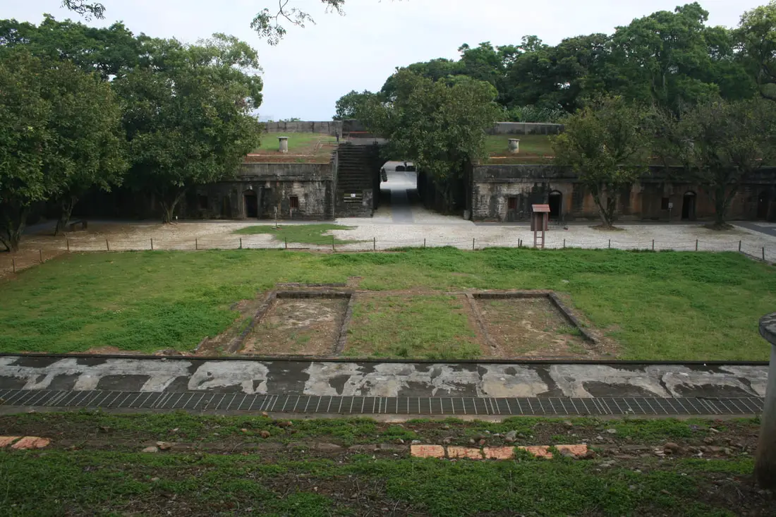
Hobe Fort (Aka Huwei Fort) is a Qing Dynasty era fortress in Tamsui, New Taipei that once has massive guns that protected the waterways nearby. The fort is included in a historical monument ticket that allows you to see other historical buildings in the area. It is also one of the best preserved historical fortresses in Taiwan.
Background: After the Sino French War in which the French threatened Tamsui and Keelung, the Qing Dynasty decided to fortify their coastline in Taiwan, building forts at Keelung, Tamsui, Penghu, Tainan, and what is now Kaohsiung. Hobe fort in Tamsui was completed in 1888 and designed by Liu Mingchuan. The fort never saw any military action, which has helped preserve the fort. After the Japanese took over Taiwan, they took out the canons and turned the fort into a practice ground for troops. After the ROC took over Taiwan, they placed troops at the fort for a while, before turing the fort over to the central government, who have opened it to the public. The walls of the fort are 4.2 meters thick and 7 meters high. There is also an outer earth wall. The fort only has one gate facing north. Hours: 9:30 AM to 5 PM Price: 80 NT per person (includes entrance toFort San Domingo and the Little White House) You can book tickets to this fort and nearby historic sites on Klook here or KKday here. Hotels in Tamsui: We have stayed at and recommend Fullon Hotel which has locations in Tamsui and Fulong near the beach (book on Booking.com here, Tripadvisor here, Agoda here, Klook here, Trip.com, Kayak here, or Hotels.com here). We have also stayed at and recommend the Yuanshan Grand Hotel, once the tallest building in Taiwan and still the most grand (book on Booking.com here, Tripadvisor here, Agoda here, Trip.com here, or Kayak here). Looking for a hotel? We recommend booking through Booking.com here, which provides the best quality selection of accommodation in Taiwan. Find out where to stay in our Taiwan hotels guide or search for the best hotel deals in Taiwan here. How to get there: By Car/Scooter: Take provincial highway 2 north from Taipei until you reach Tamsui. The fort is near Heping Park off highway 2. Parking can be found in front of the fort. Looking for scooter rental in Tamsui? You can search on Klook here or KKday here to search for options. You can also check out our scooter rental guide here. If you are looking for car rentals, you can also search Qeeq here, Klook here, or KKday here. You can also check out our car rental guide here. By MRT: Take the red line MRT north to Tamsui station and walk 1 KM north or take a bus/taxi to the fort. You can purchase a discount easy card to use on the MRT from Klook here or KKday here. You can also book an MRT travel pass on Klook here. By Bicycle: Cycling is the best way to enjoy Taiwan's landscapes if you have the time and energy. Looking for bicycle rentals in Taiwan? You can use Taiwan's many Youbike sharing stations, or search for rentals on KKday here, and search for tours on Klook here. You can also check out our Taiwan cycling guide here. Map: Please see below: 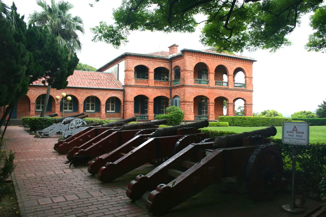
The former British Consulate in Tamsui is over 100 years old, spanning a long and complex history in Taiwan. Originally built by the British, it was handed over to Australia, the USA, and then the ROC. Now it is a popular tourist destination in Tamsui.
Background: The spot where the consular residents lies is right next to Fort San Domingo, which was originally a wooden fort built by the Spanish who were vying for control of Taiwan in 1628. Later the fort came into Dutch control in 1642, and the Spanish were driven from Taiwan. In the process, the Spanish razed the fort to the ground. The fort was rebuilt in brick by the Dutch. The Dutch were expelled from Taiwan thanks to Konxinga and his Ming loyalists. The local Han Chinese at the time called the fort "Red Hair Fort 紅毛城" as a racial slur to the Dutch. Later, the fort was leased to the British government. The British built the consular residence in 1891, and continued to keep a presence there until 1972, and later it was given for a short time to Australia and the USA, and then given to the ROC government in 1980. Now the government maintains the fort as a tourist attraction. Hours: 9:30 AM to 5 PM Price: 80 NT per person (includes passage to the Fort San Domingo, Hobe Fort, and the Little White House). You can book tickets to this fort and nearby historic sites on Klook here or KKday here. Hotels in Tamsui: We have stayed at and recommend Fullon Hotel which has locations in Tamsui and Fulong near the beach (book on Booking.com here, Tripadvisor here, Agoda here, Klook here, Trip.com, Kayak here, or Hotels.com here). We have also stayed at and recommend the Yuanshan Grand Hotel, once the tallest building in Taiwan and still the most grand (book on Booking.com here, Tripadvisor here, Agoda here, Trip.com here, or Kayak here). Looking for a hotel? We recommend booking through Booking.com here, which provides the best quality selection of accommodation in Taiwan. Find out where to stay in our Taiwan hotels guide or search for the best hotel deals in Taiwan here. How to get there: By Car/Scooter: Take provincial highway 2 north from Taipei until you reach Tamsui. The former consulate is past Tamsui Old Street on highway 2. Parking can be hard to find, but there should be plentiful parking at Tamsui Elementary School and other places further away. Looking for scooter rental in Tamsui? You can search on Klook here or KKday here to search for options. You can also check out our scooter rental guide here. If you are looking for car rentals, you can also search Qeeq here, Klook here, or KKday here. You can also check out our car rental guide here. By MRT: Take the red line MRT north to Tamsui station and walk 1 KM north or take a bus to the fort. You can purchase a discount easy card to use on the MRT from Klook here or KKday here. You can also book an MRT travel pass on Klook here. By Bicycle: Cycling is the best way to enjoy Taiwan's landscapes if you have the time and energy. Looking for bicycle rentals in Taiwan? You can use Taiwan's many Youbike sharing stations, or search for rentals on KKday here, and search for tours on Klook here. You can also check out our Taiwan cycling guide here. Map: Please see below: 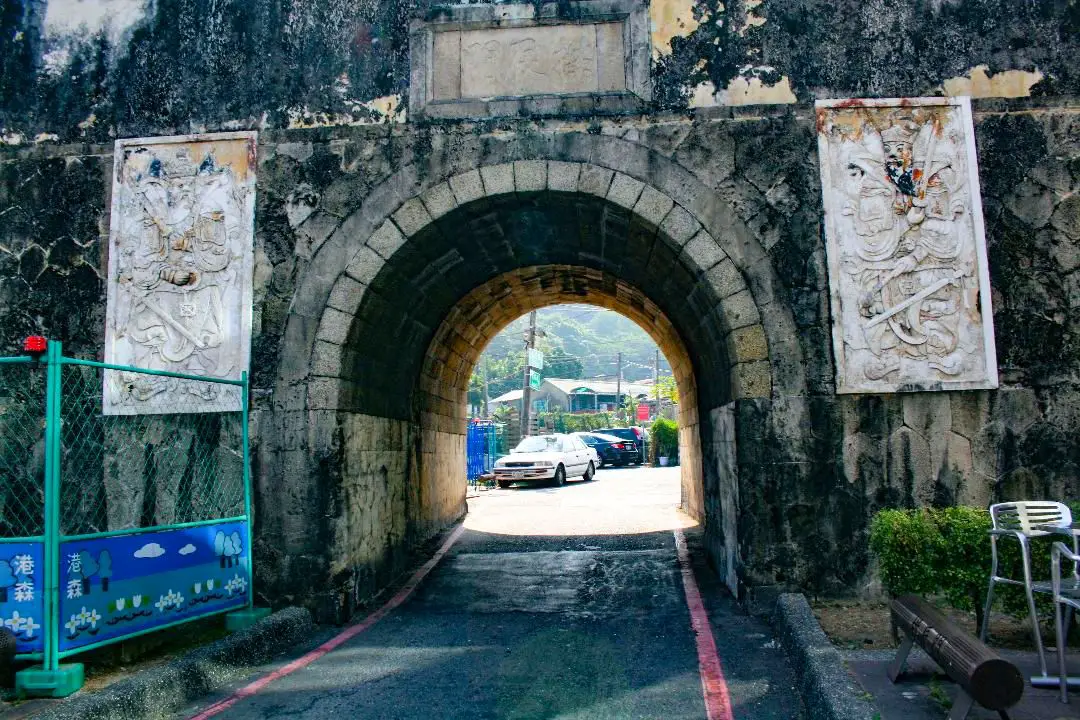
The Old City of Fengshan in Zuoying is the oldest walled city on the island of Taiwan. It has survived rebellions, raids, and changes of power, and now stands as a well preserved monument to the past, from when the Qing Dynasty ruled western Taiwan. It is definitley worth a visit on your trip to Kaohsiung.
Historical Background: After the capture of Taiwan by the Qing Dynasty, they quickly set up a settlement in Zuoying in 1684 because of its strategic location between hills and mountains. The walls of the Old City of Fengshan first started as earthen walls wiht a moat in 1721. Before this, the construction of city walls was forbidden by the Qing government to prevent rebellions, but after a rebellion by Chu Yi-kuei (朱一貴) in which he ruined the government buildings there with no protection, the Qing allowed walls to be built. The uprising by 17 year old Zhu Yigui was successful in exiling the provincial government out of Taiwan after heavy taxation and a bad earthquake had left the people destitute. The Qing took back the capital of Tainan about a month later and Zhu Yigui was executed. In 1787 another rebellion by Lin shuang-wen (林爽文) ruined the city, and afterward the local government relocated to the current Fengshan district of Kaohsiung and created a new Fengshan City. However the government was still attacked continuously. In 1826, the government rebuilt the Old Fengshan City walls and improved them, building them with concrete and granite stone, and at the time it was the most advanced city wall in Taiwan. However the city remained mainly unused because it was considered unlucky. During the Japanese Era of Taiwan, the Japanese made Zuoying a naval port and changed the area into a military zone. Zuoying continued as a military zone during the ROC era, but the old walled city of Fengshan was designated as a national monument. Major renovations of the walls and gates occured in 1991 and renovations are still ongoing. Originally there were four gates: the North (also Gongcheng Gate 拱辰門), South (Ciwen Gate 啟文門), East (Fongyi Gate 鳳儀門), and West Gate (Dianhai Gate 奠海門, no longer exists). Hours: 24/7 Price: Free How to Get There: By Car/Scooter: From central Kaohsiung, go north on provincial highway 17 and then turn north on Xinzhuang 1st Road. Looking for scooter rental in Kaohsiung? You can check out Klook here or KKday here to search for options. You can check also out our scooter rental guide here. If you are looking for car rentals, you can search Qeeq here, KKday here, or Klook here. You can also check out our car rental guide here. By Train: From the north you can walk to the pond from Zuoying HSR station, or from the south you can walk there from Zuoying Jiucheng TRA Station. You can book tickets to travel to Kaohsiung via inter-city bus on Klook here. You can book tickets to Kaohsiung via high speed rail (HSR) on Klook here or KKDay here. Book tickets via the normal train (TRA) on Klook here. You can also book a Kaohsiung Travel pass here. Accommodation We have stayed at and recommend Chao She Hotel (you can book on Agoda here, Booking.com here, Hotels.com here, or Expedia here) IHI Sanduo Travel Hotel (you can book on Agoda here, Booking.com here, Hotels.com here, or Expedia here), and Mingli Hotel (you can book on Agoda here, Klook here, or Hotels.com here) which are three inexpensive and high quality choices in downtown Kaohsiung. I also have stayed at and recommend Kaohsiung Meinong Rabbit Paul Homestay B&B (you can book on Agoda here, Booking.com here, or Trip.com here), a quiet B&B in rural Meinong, and Chengching Lakeside Resort (you can book on Agoda here, Booking.com or Trip.com here)and the Grand Hotel Kaohsiung (you can book on Agoda here, Booking.com here, Hotels.com here, or Expedia here) which both offer breakfast buffet and free entrance into Chenqing Lake Park. I have also stayed at the 85 sky tower which offers great views of the city; you can search for rooms in the 85 sky tower on Agoda here, Booking.com here, Hotels.com here, Expedia here, or Trip.com here). Find out more about where to stay in our Taiwan hotels guide or search for the best hotel deals in Taiwan here. We recommend booking through Agoda here, which provides the best quality selection of accommodation on the islands. You can also book Wifi and SIM cards for Taiwan on Gigago here. Need travel insurance? Compare prices on Insubuy here. Tours: You can book water sport activities at the Lotus Pond such as wake boarding, water skiing, SUP paddle boarding, and more on Klook here or KKday here. Just to let you know, if you book using the links above, we get some commission at no cost to you, and you can help support our blog. You can click here to receive $5 USD on your first Klook purchase. Map: Please see the existing city gates marked with red castle icons below: 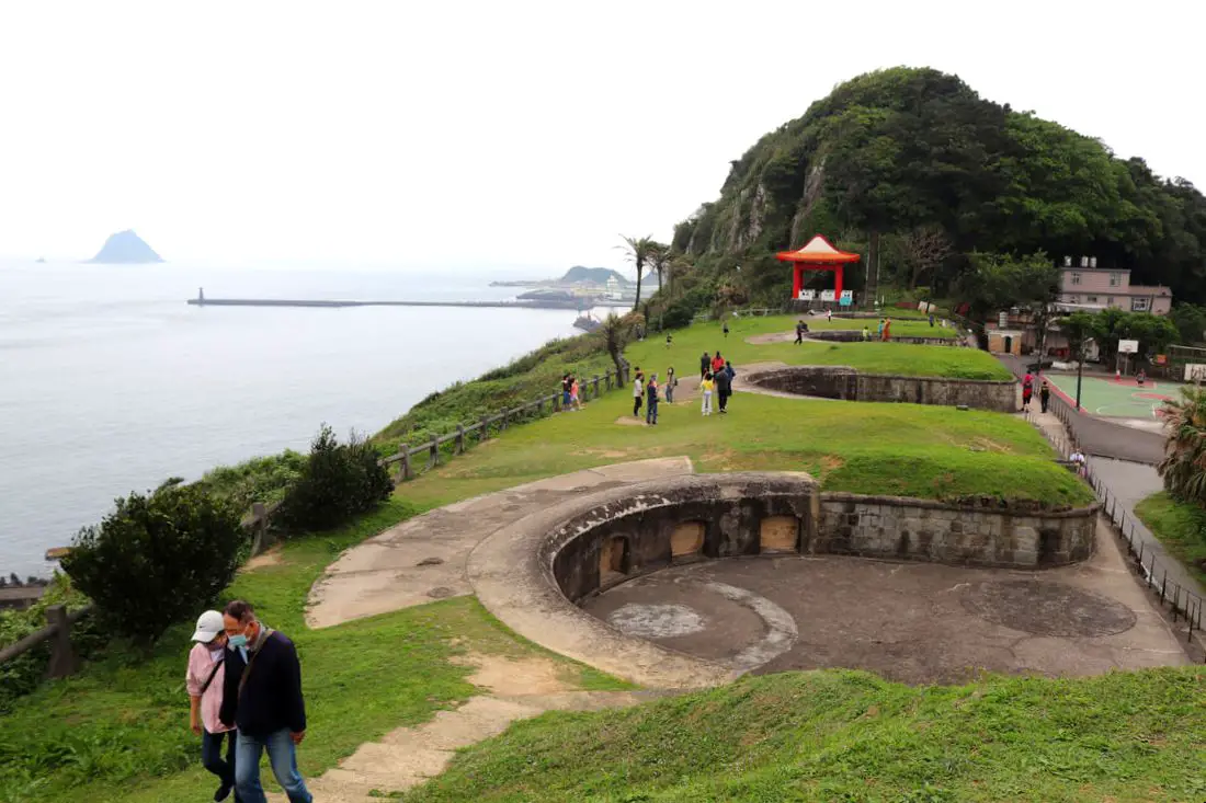
Baimiweng Fort is an abandoned fort in Keelung that is now open to the public, dating back to the Dutch colonization of Taiwan. Here you can learn more about Taiwan's colonial history, and enjoy amazing panoramic views of Keelung and the surrounding area. Keelung Lighthouse is also within walking distance.
Background: Baimiweng Fort is thought to have been built over the ruins of either Milaen Fort or Fort Clement, which were Dutch Forts built in the 1600s, seen on maps at the time. It was later used by the Qing forces, and was occupied briefly by French forces during the Sino-French war. The current fort that you see today was built during the Japanese era in Taiwan in 1900 to defend against Russia, in response to the Russio-Japanese War. It had some of the first artillery emplacements in Keelung and acted as a first line of defense. During the Japanese era, the fort was occupied and renovated in 1927 and expanded in 1931. After the ROC took control of Taiwan, the fort no longer stationed troops and was abandoned, and used as a public restroom for local residents. The fort then underwent restoration work in 1980, and a later restoration was completed in 2021 including hiking trails to connect with Keelung Lighthouse. Keelung Lighthouse was built during the Qing Dynasty in 1900 and refurbished in 1962. It is still an important lighthouse for ships in the area. The Fort is a popular location for tourists especially on weekends and holidays. Hours: 7 AM to 7 PM every day Price: Free Tours near Keelung: There are many tour itineraries that you can enjoy in Keelung that will take you to multiple destinations and arrange transportation. For more information, you can check out Tripadvisor here, KKday here or Klook here, which are both great tour websites that can connect you with the right tour and tour guide for you. Here are some of the post popular tours of Taipei on Tripadvisor:
Attractions around Keelung: There are many attractions that you can enjoy in Keelung such as Heping Island Park, Miaokou Night Market, Chaojing Smart Aquarium, Kanziding Fish Market, National Museum of Marine Science and Biology, Yehliu Ocean World, Yehliu Geopark, Jiufen, Elephant Trunk Rock, Ju Ming Museum, New Taipei Gold Museum, Bat Cave, Candlestick Islet, and many more attractions on Tripadvisor here, Klook here, or KKday here. Activities in Keelung: Yachting, Fishing, Surfing, SUP / Paddle Boarding, Diving, Snorkeling Kayaking, Canoeing, Water Biking, River Tracing / Canyoneering, Glamping, Motorcycling, Motorbike Tour, Shen'ao Rail Bike, Night Fishing, Instagram Tour, Metaverse VR experience, Seaside Picnic, and more on Tripadvisor here, Klook here, or KKday here. Just to let you know, if you book using the links above, we get some commission at no cost to you, and you can help support our blog. Some of the Klook links may not work if you are using an Ad blocker. You can click here to receive $5 USD on your first Klook purchase. Hotels in Keelung: We recommend Just Live Inn-Keelung and Yung Feng Hotel, which are two great quality hotels for a reasonable price in Keelung's City Center. You can book Just Live Inn-Keelung on Booking.com here, Agoda here, Klook here, Hotels.com here, Trip.com here, or Kayak here. You can book Yung Feng Hotel on Booking.com here, Agoda here, Hotels.com here, Trip.com here, Klook here, or Kayak here, How to get there: By Car/scooter: From Keelung Station, take Zhongshan First Road to Guanghua Road Lane 37, and then go up the hill to the fort. The hill may be hard to drive a car up, and there is limited parking at the top. If you are looking for car rentals, you can also search Qeeq here, Klook here, or KKday here. You can also check out our car rental guide here. Looking for scooter rental in northern Taiwan? You can search on Klook here or KKday here to search for options. You can also check out our scooter rental guide here. By Bus: From Keelung TRA Station, you can take bus 301 to Taibaizhuang Station, from which the fort is about a 10 minute walk. You can purchase a discount easy card to use on the MRT and buses from Klook here or KKday here. You can also book an MRT travel pass on Klook here. By Bicycle: Cycling is the best way to enjoy Taiwan's landscapes if you have the time and energy. Looking for bicycle rentals in Taiwan? You can use Taiwan's many Youbike sharing stations, or search for rentals on KKday here, and search for tours on Klook here. You can also check out our Taiwan cycling guide here. You can also book a cycling tour on TripAdvisor here. For more information, check out our Taiwan transportation guide here. Map: 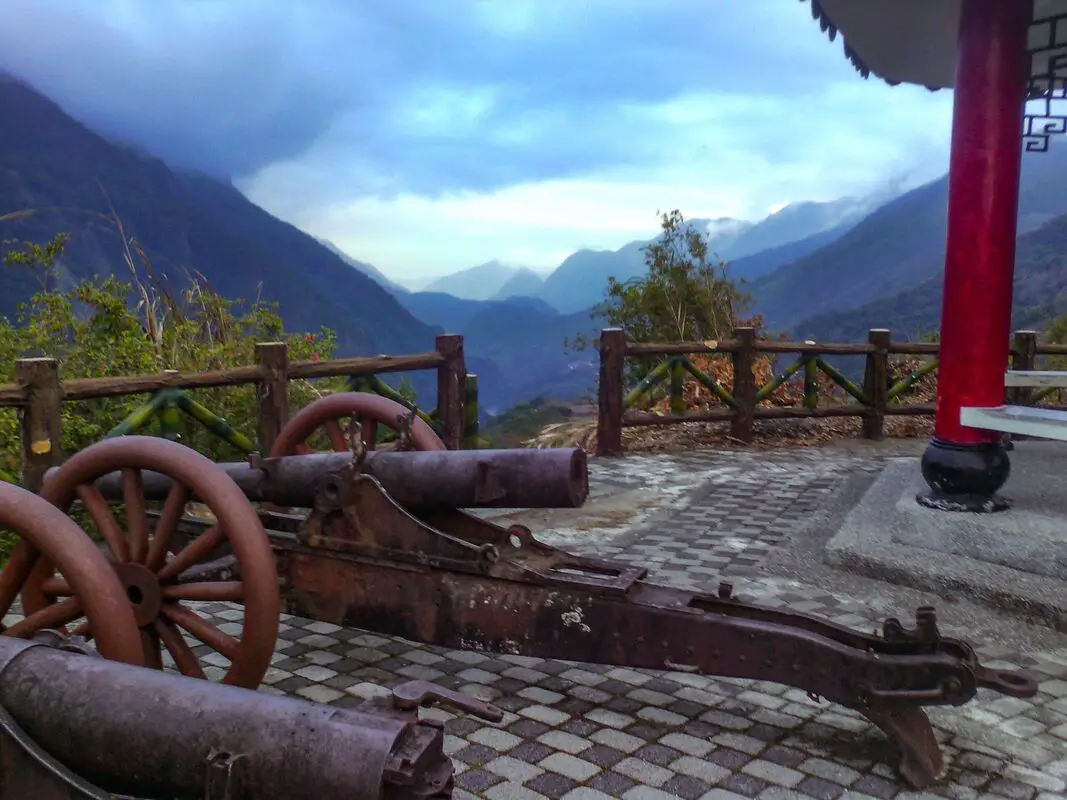
Wulu Fort in Haiduan Township of Taitung County was originally made by the Japanese to suppress an uprising by the Bunun indigenous tribe. Now it stands as a monument to Taiwan's colonial past. The area also has great views of the Wulu Gorge and Wulu Village along Taiwan's South Cross-Island Highway.
Historical Background: As per the sign on sight, the history of Wulu Fort is as follows: "Wulu Battery was constructed in 1927 when the Japanese were building the Guanshan Cross-Ridge TRail (now the South Cross-Island Highway) from Xinwu to Wulu. This cannon, manufactured by the Russians in 1903, was captured by the Japanese during the Russio-Japanese War and shipped to Taiwan for the Japanese Police to use in the suppression of an uprising of the aboriginal Bunun tribe. Batteries were also built in neighboring Saku (Dalun) and Madiangulu (Motian); but Wulu Battery is the only one that has survived, a witness to the bloody and tragic history of the Japanese occupation." Usually, this area is not crowded. If you visit, it is likely you will be the only person there. Price: Free Hours: 24/7 How to get there: By Car/Scooter: From Taitung, take provincial highway 9 north until you reach provincial highway 20 (South Cross-Island Highway) then turn west up into the mountains. Turn off at Wulu Village. The fort is just above the elementary school. Looking for scooter rental in Taitung? You can search Klook here or KKday here to search for options. You can also check out our scooter rental guide here. If you are looking for car rentals, you can also search KKday here or Klook here. You can check out our car rental guide here. By Bus: From Guanshan TRA station, you can take bus 8178 to Wulu. The Fort is about a 25 minute walk from the bus station. You can book tickets to travel to Taitung via inter-city bus on Klook here. Book tickets via the normal train (TRA) on Klook here. Accommodation: Booking accommodation in the Taitung can be difficult in the summer months and on weekends when rooms can be fully booked for months in advance. We suggest a better quality selection on Agoda.com. We have stayed at and recommend the Papago International Resort in Chishang (you can book on Agoda here, Booking.com here, Hotels.com here, or Expedia here), which is a five star hotel with private villas with pools for each room, and Mountain and Ocean B & B in Taimali (you can book on Agoda here, Booking.com here, Hotels.com here, or Expedia here), which is a quiet and affordable B&B right next to the beach. Find out where to stay in our Taiwan hotels guide or search for the best hotel deals in Taiwan here. You can also book Wifi and SIM cards for Taiwan on Gigago here. Need travel insurance? Compare prices on Insubuy here. Tours: There are many tours and activities such as snorkeling, diving, SUPing, Surfing, Speed Boating, Glamping, River tracing and more in Taitung. You can find more tours of Taitung on Klook here or KKday here. Just to let you know, if you book using the links above, we get some commission at no cost to you, and you can help support our blog. You can click here to receive $5 USD on your first Klook purchase. Map: 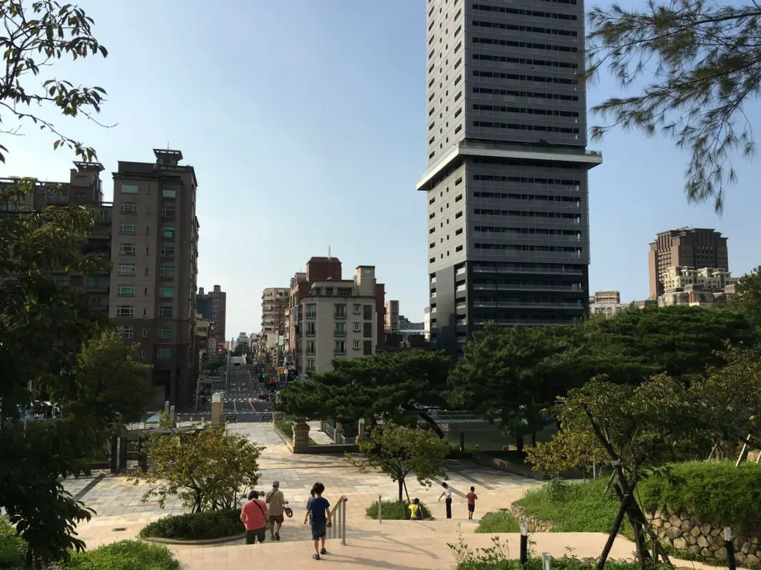
Hsinchu Park is full of historical and modern areas to explore. Here you can find a restored Japanese restaurant (which was also formerly an ROC dependents village), the Hsinchu Glass Museum, Hsinchu Confucius Temple, Qing Dynasty Fort, Hsinchu Zoo, and Hsinchu Flower Market. It is also the largest park in Hsinchu. If you don't know what to do in Hsinchu, you can literally stay the entire day in this park.
Background: The Area around Hsinchu Park was originally a hill called "Zhentou Shan" literally meaning "pillow hill," which is 55 meters above sea level. The Japanese formed the area into a park in 1925, the first public park in the area. They also built a martial arts hall here. The original Qing Dynasty Hsinchu Train station was built in the park where the current glass museum stands. The four existing wooden Japanese buildings currently in the park were built in about 1931 as a fine dining restaruant, and after WWII were converted to be part of the Air Force 11th Village (空軍十一村), built for ROC Air Force officers and their dependents, who likely worked at the nearby Hsinchu Airbase. The four buildings have now been converted into a restaurant, a gift shop, and two cafes. There were renovated in 2017. The building that houses the Hsinchu Glass museum was built in 1936 to house the Japanese royal family and government officials. The building is designed in European brick architectural style. It was converted into the glass museum in 1999. In the 1930s, the Hsinchu Zoo was also established. The Five Chinese Cannons are left over from the Opium Wars in 1840 and were planted on the hill to ward off British Ships. After WWII, the park was renamed "Zhongshan Park," and the part of the park with the pond was known as Lichi Park "麗池公園." The park originally included a radio tower, and a physical science school until it moved to Taichung in 1980. The sports stadium was originally created in 1959, and the Confucius temple was moved here in 1958. The park also includes Hsinchu Confucius Temple Hsinchu Zoo, Hsinchu Flower Market, Taiwan Insect Museum, a music hall, a gymnasium, and a sports stadium. Hours: 24/7 Price: Free Tours: You can find more tours and activities in Hsinchu such as You can find more tours and activities in Hsinchu such as river tracing, wild hot springs, white water kayaking, backpack rafting, Little Ding Dong Theme Park, Leofoo Village Theme Park, Window on China Theme Park, glamping, camping, stone spa, horse riding, Yukids Island, Tom and Bei Bei Parent Child Paradise, bee keeping experience, cycling, dried persimmons experience, Jump Wave Trampoline Park and more on Klook here or KKday here. Where to stay: Most of the accommodation you will find is near the city center. If you will only visit downtown, you can consider a day trip from Taipei. We have stayed at and recommend the Golden Motel a high quality motel near Green Grass Lake (you can book on Agoda here, Booking.com here, Hotels.com here, Expedia here, or Trip.com here), and CD Motel, another high quality motel in downtown Hsinchu (you can book on Agoda here, Booking.com here, or Trip.com here). Unfortunately I cannot recommend any further hotels that I have stayed at in Hsinchu because usually we stay at my wife's uncle's house. You can find out where to stay in our Taiwan hotels guide or search for the best hotel deals in Taiwan here. You can also book Wifi and SIM cards for Taiwan on Gigago here. Need travel insurance? Compare prices on Insubuy here. Just to let you know, if you book using the links above, we get some commission at no cost to you, and you can help support our blog. You can click here to receive $5 USD on your first Klook purchase. How to get there: By car/scooter: From central Hsinchu, turn on to Shipin Road, and park near the south side of Hsinchu Park. There is an underground parking lot and paid parking on the side of the road. If you are looking for car rentals in Hsinchu, you can also search Qeeq here, Klook here, or KKDay here. You can also check out our car rental guide here. Looking for scooter rental in Hsinchu? You can search Klook here or KKday here to look for options. You can also check out our scooter rental guide here. By TRA: Hsinchu Park is only a ten minute walk south from Hsinchu TRA station. You can book tickets to travel to Hsinchu via inter-city bus on Klook here. You can book tickets to Hsinchu via high speed rail (HSR) on Klook here or KKDay here. Book tickets via the normal train (TRA) on Klook here. By Bicycle: Cycling is the best way to enjoy Taiwan's landscapes if you have the time and energy. Looking for bicycle rentals in Taiwan? You can search on KKday here and Klook here. You can also check out our Taiwan cycling guide here. Map: Please see below: |
Author 作家I am an American expat who has extensive experience living, working, and traveling in Taiwan. In my day, I had to learn many things about Taiwan the hard way. But I have come to learn that Taiwan is one of the best places in the world for Foreigners to live. This blog does not represent the opinions of every foreigner in Taiwan. I am just trying to help others learn more about this beautiful country. Categories
|
 RSS Feed
