

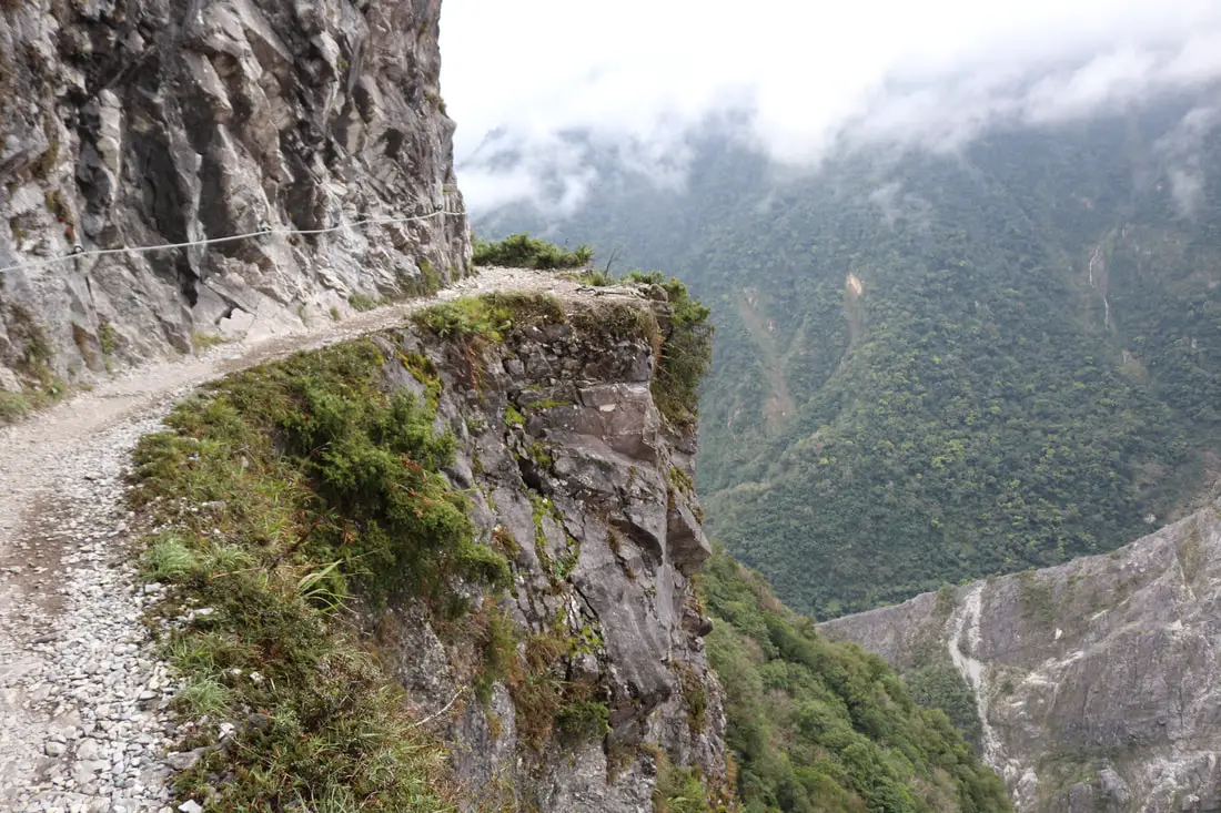
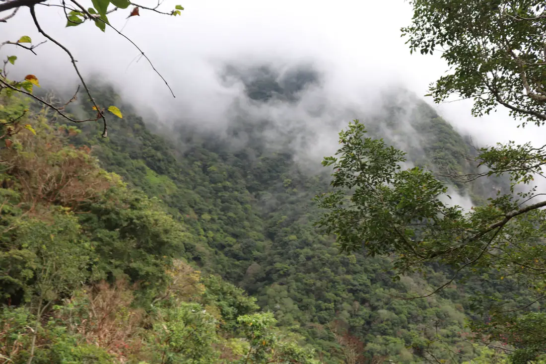
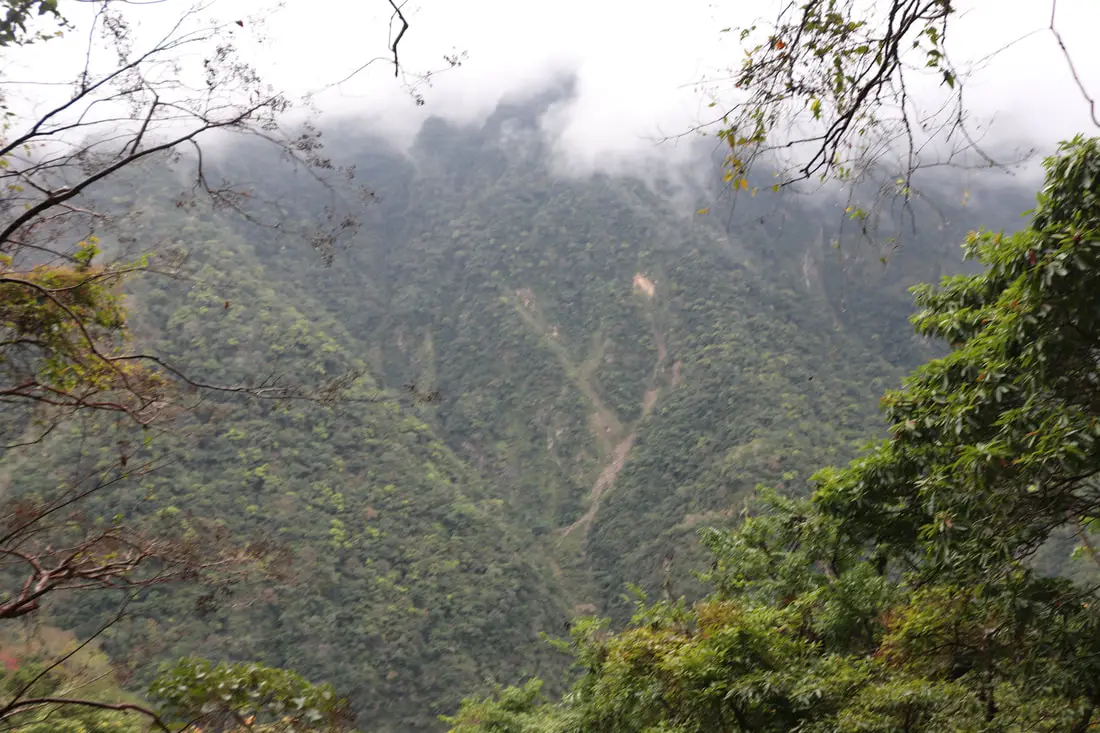
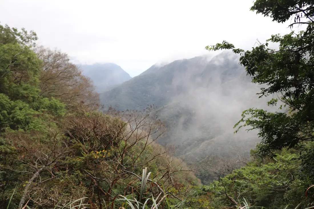
Zhuilu Old Trail (aka Jhueilu/Zhuilu Old Road) is known as "the best day hike in Taiwan" and has a trail on "the No. 1 cliff in east Asia." It is for sure one of the most beautiful and exciting hiking trails in Taiwan. It features a vertical cliff section with amazing views 500 meters above the world's deepest marble gorge (Taroko Gorge).
History: The Zhuilu Old Trail was created hundreds of years ago by the Truku indigenous people to connect their villages in Taroko Gorge and the central mountain range. Originally the cliff sections of the trail were just 30 cm wide! These indigenous people remained basically autonomous and undisturbed until the Japanese occupation of Taiwan. However after conflicts such as the Xincheng incident in 1896 and the Weili Incident in 1906, where combined more than 50 Japanese people were killed by indigenous warriors, the Japanese decided to tighten control of the mountain aborigines and natural resources in the area, and started the Truku War. The war lasted from May-August 1914, and in the process the Japanese forced indigenous men to widen the Zhuilu Trail to 1.5 meters so that they could transport artillery through the mountainous terrain. 37 people died during this widening process during and after the war, which included using dynamite to blast open the rock while only using ropes. The Truku lost the war, which included 3,000-5,000 indigenous warriors with modern weapons pitted against a Japanese fighting force of over 10,000. The Japanese lost over 300 men in the fight. After the war, the Japanese tried to dismantle their culture by scattering the people, preventing them from hunting, and forcing the children to attend Japanese schools. The Japanese then built the Old Cross-Hehuan Mountain Road which stretched 145 KM from Taroko Gorge to Wushe in Nantou from 1914 to 1933, with the Zhuilu Old Trail as part of it. They set up police stations/outposts along the trail as well, including Badagang Village which had a school, hospital, and inns for travelers. After the ROC took control of Taiwan, the trail was disused except for some expert hikers, and the Japanese police outposts were abandoned. After the 921 earthquake in 1999, the trail was closed for nine years until 2008. At around 2016 (probably after a typhoon), the 7KM after the Zhuilu Cliffs were closed off, so now the only walk-able part of the trail is 3.1 KM long from Swallow Grotto to the Zhuilu Cliff Outpost. It doesn't seem like this part of the trail will reopen soon. The cliff section of the trail is 750 meters above sea level, and nearly 500 meters above the valley floor. The distance between these cliffs and the cliffs on the opposite side of the gorge is only about 200 meters. The mountain that the cliffs are part of rises 1600 meters above sea level, and over 1000 meters above the valley floor, and is made completely of marble. Hours: Currently the trail is closed due to damage from the April 3rd, 2024 earthquake. Must enter between 7 AM and 10 AM the day of the permit (unless the gorge is closed due to typhoon/natural disaster) Permits Required: Only a park access permit is required. You can apply for a permit in English here. Only 96 people are allowed on weekdays and 156 people on weekends and holidays. Police permits are no longer required for this trail. Drones: Please note that if you want to fly a drone in Taroko National Park, you need to apply for a permit at least seven days in advance. You can apply to fly a drone (Chinese only) here. Price: 200 NT per person Duration: 6.2 Km round trip 500 meter elevation gain About 6 hours The trail is 3.1 KM one way to the Zhuilu Cliff Outpost, and gains 500 meters in elevation. It took me (one person with only one 30 minute break to fly a drone) three hours there and back (I was told this is a very fast pace). Some people say that it takes an average of six hours there and back. If you are taking people that are not in shape, expect to take most of the day hiking. When to go: On a sunny dry day. The rocks can get slippery and a fall on some of the trails could kill you. But if you are careful and bring proper hiking boots and gear, hiking on a wet day should be fine. Avoid typhoons and heavy rains at all costs. There gorge will close during typhoons anyway. Typhoon season lasts from May to October. Other than that, this hike is great year round. Need travel insurance? Compare prices on Insubuy here. Where to stay? Most of the accommodation you will find is near the city center. If you only want to visit Hualien City and Taroko Gorge, you can consider booking a hotel near downtown, walking or cycling around the city, and taking a bus to Taroko Gorge. We have stayed at and recommend Dream Taiwan Homestay (Agoda / Booking.com / Expedia / Hotels.com), a high quality hostel for the money in downtown Hualien, Farglory Hotel (Agoda / Booking.com / Expedia / Hotels.com), right next to Farglory Ocean Park with amazing views of Hualien, and Goldenflower B&B (Agoda / Booking.com) in Yuli right next to Sixty Stone Mountain. You can find out where to stay in our Taiwan hotels guide or search for the best hotel deals in Taiwan here. You can also book Wifi and SIM cards for Taiwan on Gigago here. How to get there: By Train/Bus: Take the TRA to Hualien Station, and then switch to the Hualien Bus 1133A. Get off at Swallow Grotto (Yanzikou 燕子口). Also you can take the TRA to Xincheng Station and take Taroko Bus 302. You can book tickets to travel to Hualien via inter-city bus on Klook here. Book tickets via the normal train (TRA) on Klook here. By Car/Scooter: Go west on the Central Cross Island Highway until you reach swallow grotto after Xipan Tunnel. There is only parking near Jinheng Park (靳珩公園) 500 meters down the road from the trail entrance. Looking for a scooter rental in Hualien? You can search KKday here or Klook here to look for options. You can also check out our scooter rental guide here. If you are looking for car rentals in Hualien, you can also search Klook here or KKDay here. You can also check out our car rental guide here. Tours: You can book a tour of Zhuilu Old Trail on Klook here or KKday here. Map: For the location of the start of the trail, please see below: Applying for a park entry permit: 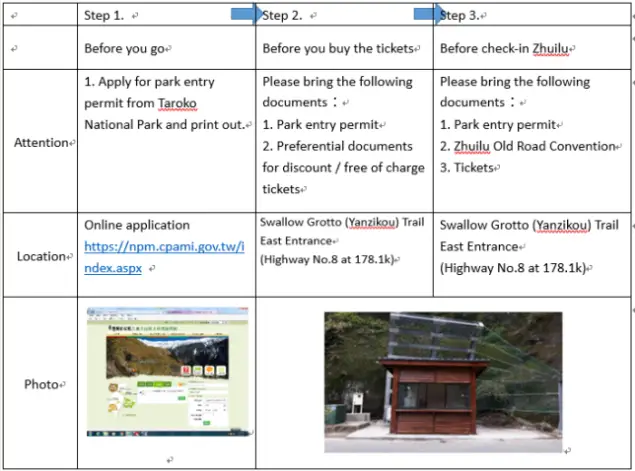
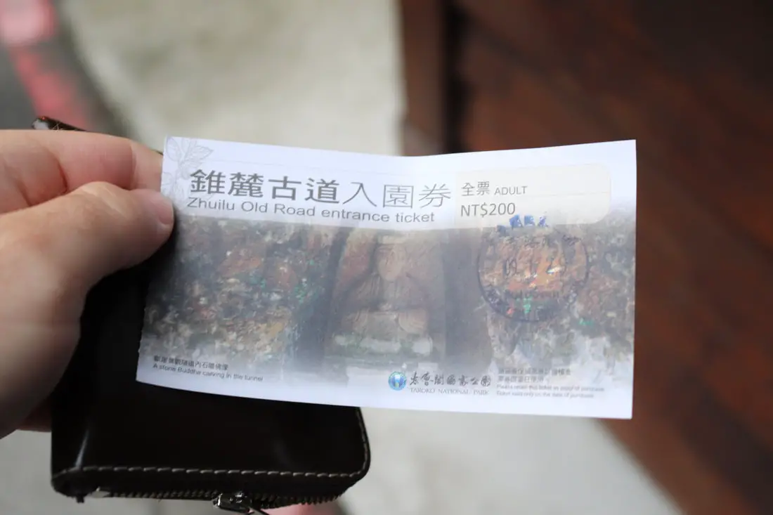
Before you go, you should appy for a permit here. There is special priority given to foreigners that apply for the advance application 35 days to four months beforehand. (photo above taken from https://npm.cpami.gov.tw/en/news_1main.aspx?ID=1855)
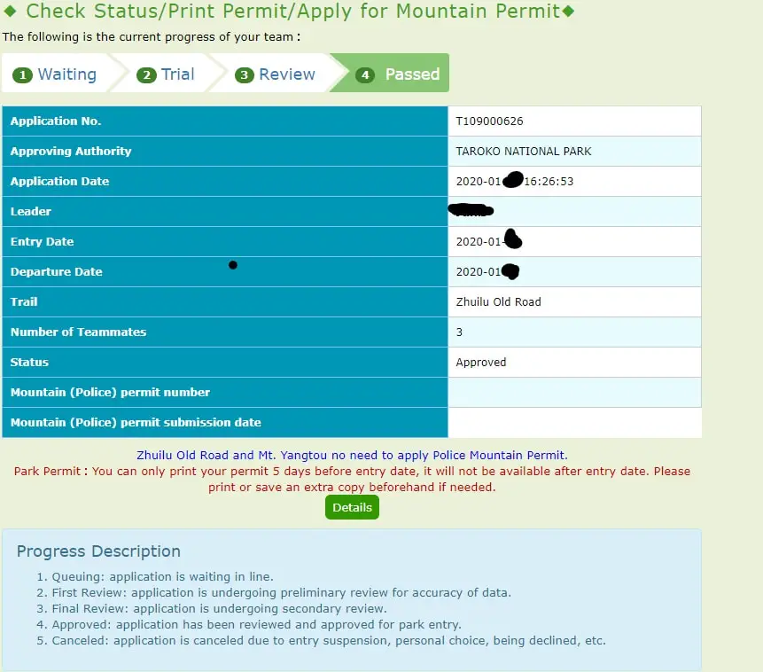
Be sure to go online after you receive your confirmation email and print out the PDF park entry permit (only available 5 days beforehand), you will need this to purchase tickets to the trail at the kiosk (along with your passport or ARC).
Drone Footage:
To start off, enjoy the drone footage I took of the trail above.

If you are also interested in flying a drone in Taroko National Park, you need to apply at least seven days in advance. This involves telling the park your flight plans and areas you plan to fly; I picked about 5 areas over a time period of three days. The park will then send a physical paper permit to fly to your address provided (as per the above photo). Permission is pretty much always granted, but you should follow the safety rules that you agreed to to get the permit.
Our Journey: 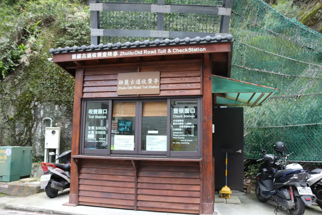
I have hiked on the Zhuilu Trail only once in January 2020. I knew I needed to get there and leave early because I wanted to get back to my hotel in Hualien so I could shower and charge batteries before checkout time. I got up at 5:40 AM and rode my scooter 40 minutes over to Swallow Grotto.
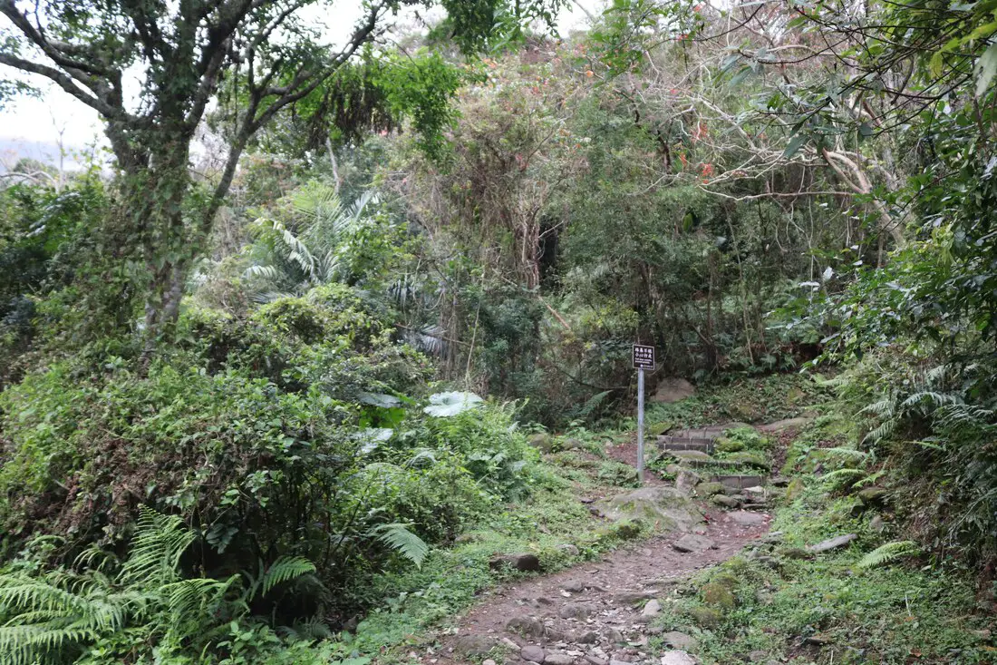
6:45 AM: I parked my scooter. There is only parking near Jinheng Park (靳珩公園) 500 meters down the road from the trail entrance.
I took some time to enjoy the park before I started off.
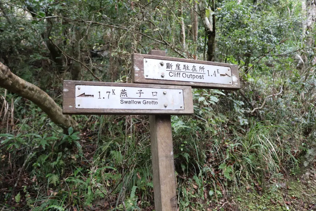
The views at Jinheng Park and Swallow Grotto are amazing, so it is no sacrifice to walk the extra 500 meters to get there.
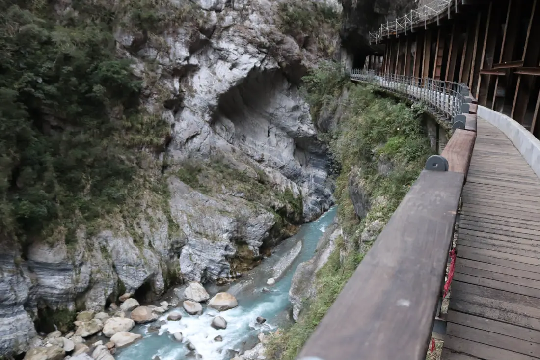
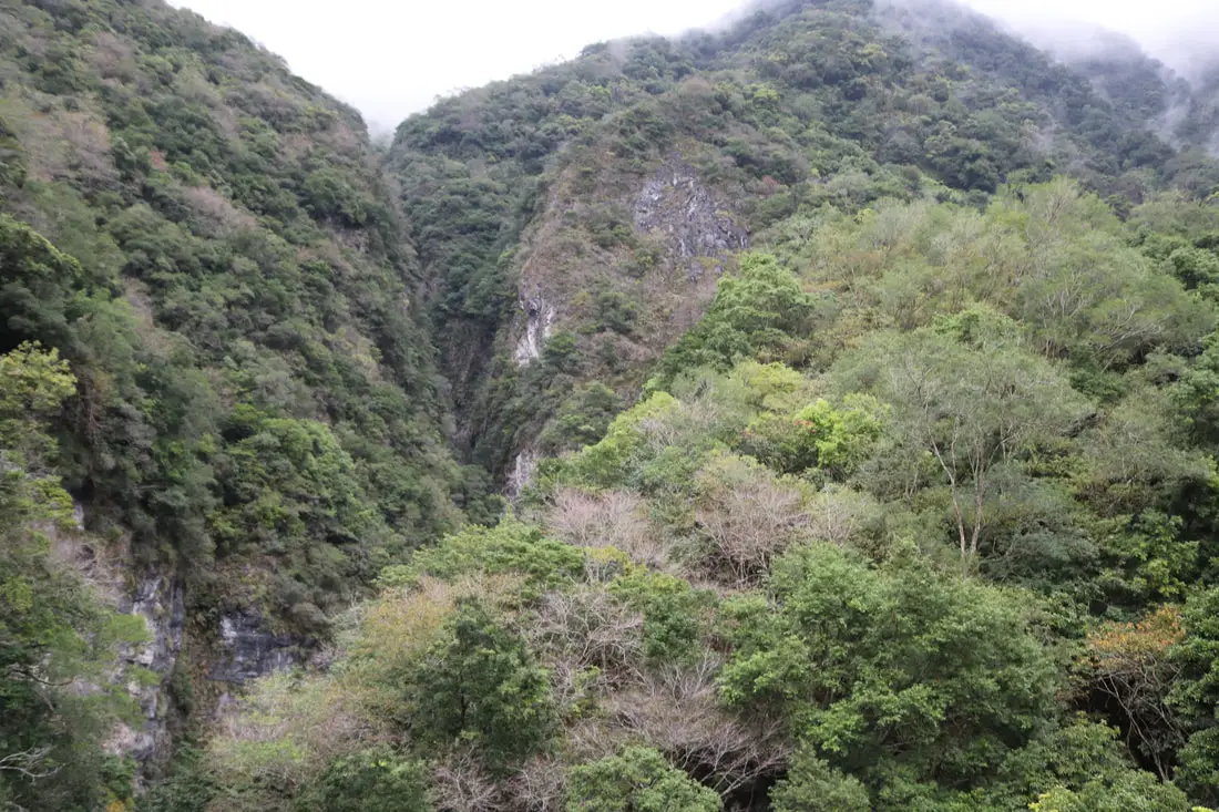
View of the gorge and canyon below. This stretch is the most narrow part of the gorge.
Looking up at the canyon from Swallow Grotto.
A small canyon I spotted, it looks like it would be fun and dangerous to river trace up.
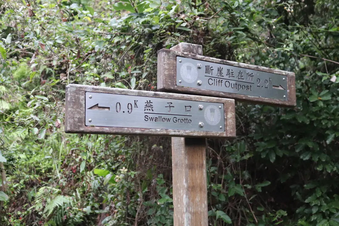
The swallow grotto trail.
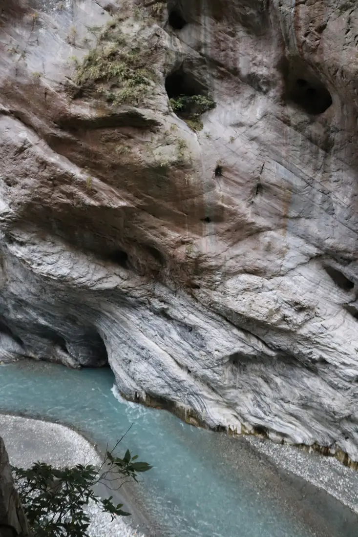
The beautiful marble canyon inside swallow grotto.
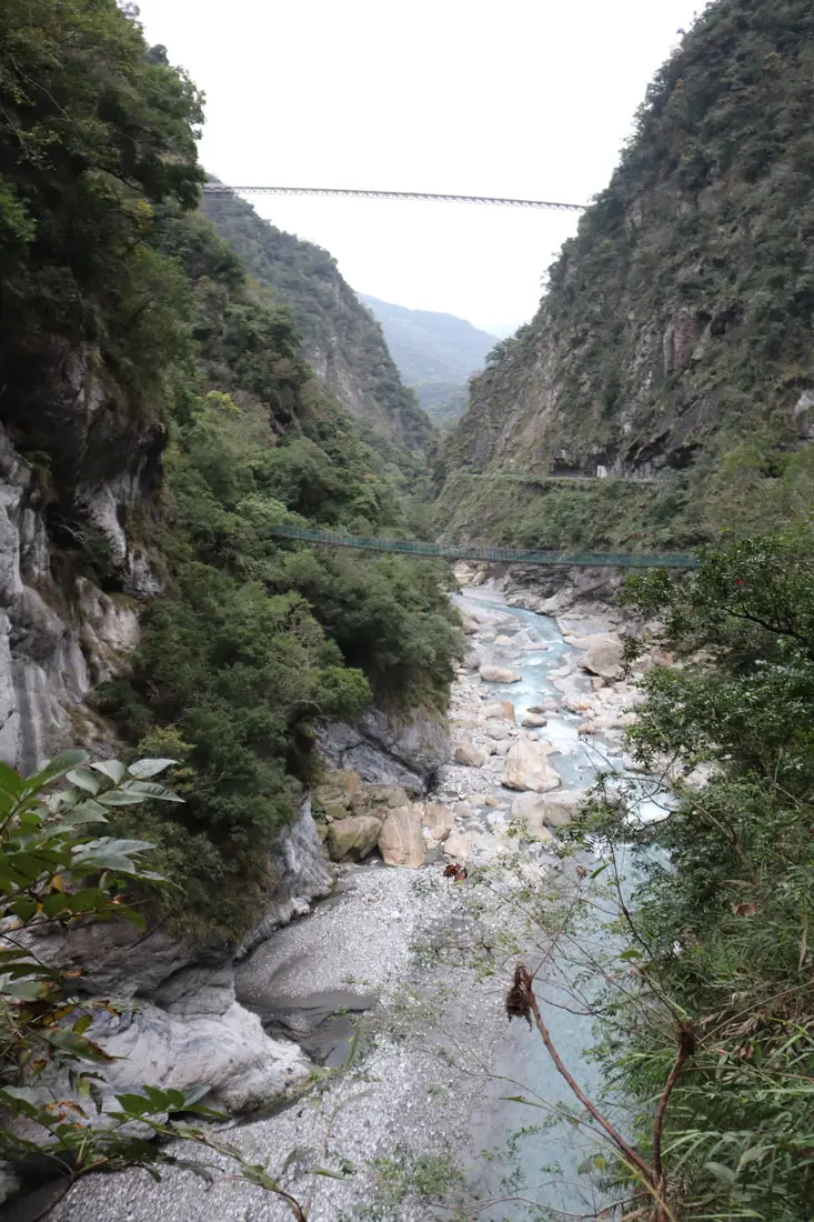
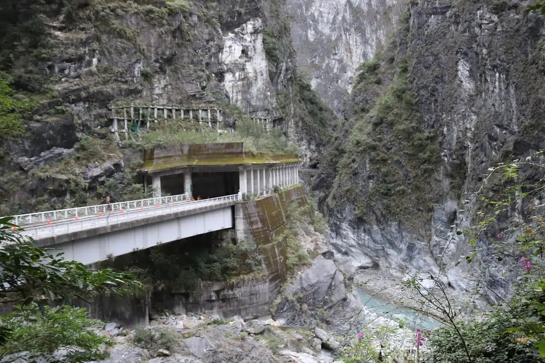
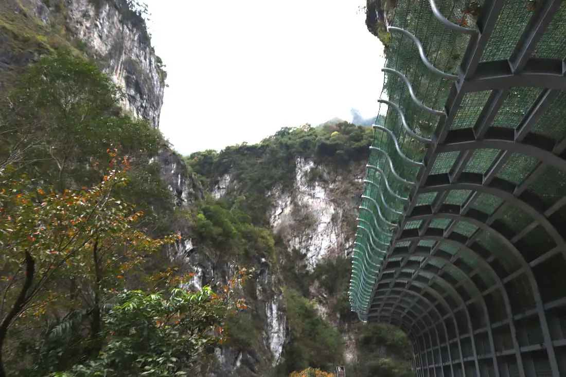
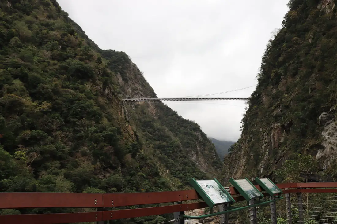
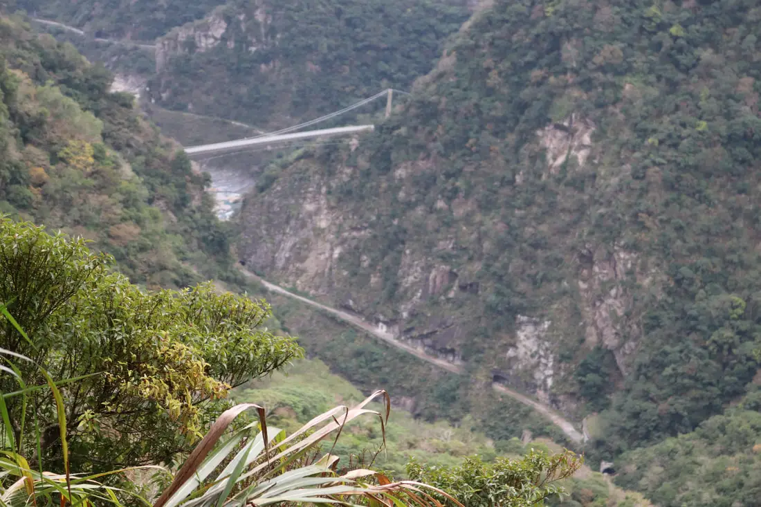
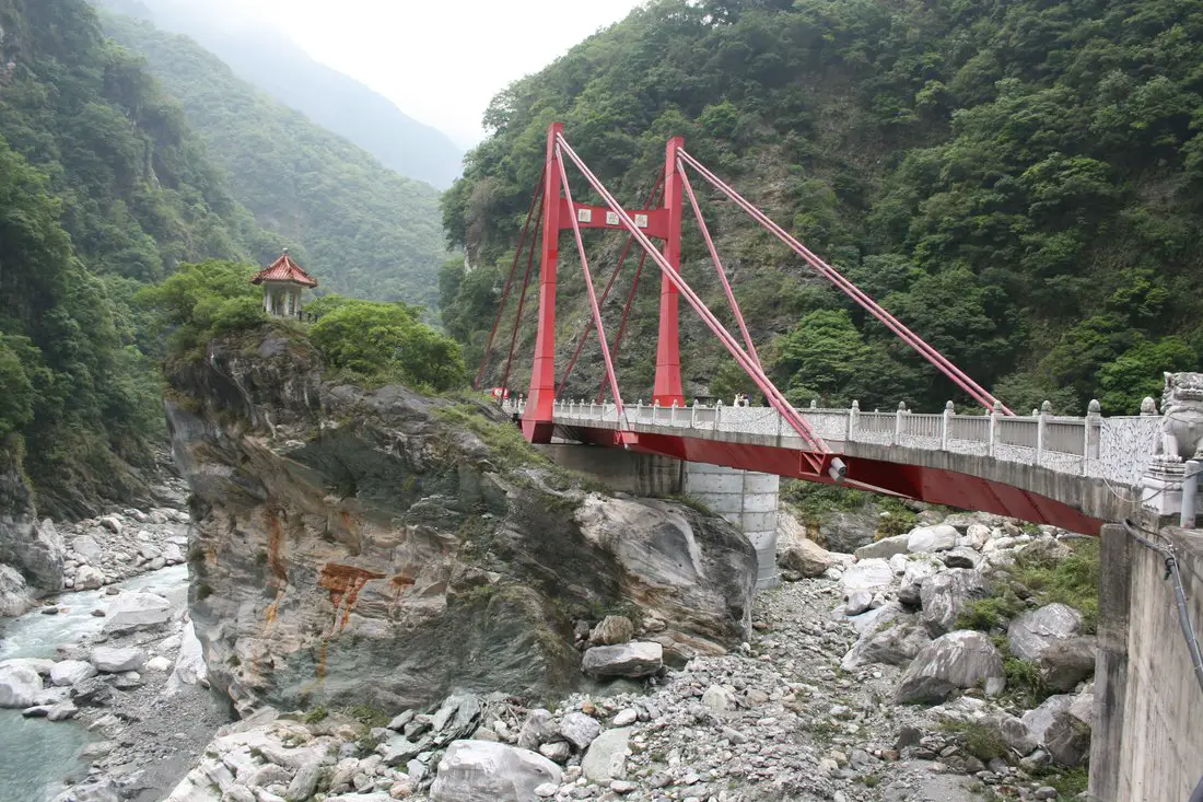
Here you can see both the Zhuilu Suspension Bridge and the new Buluowan Suspension Bridge above that is not yet open, but for sure will be a major tourist attraction in the future.
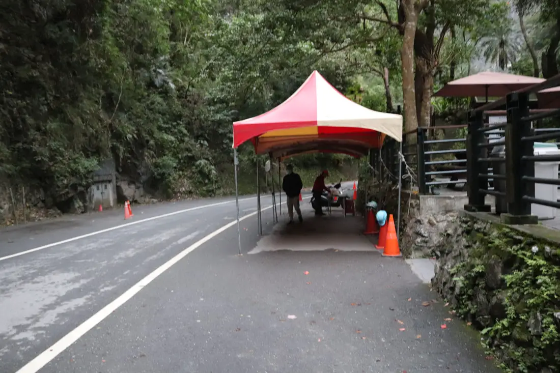
6:56 AM: I got to the wooden kiosk pictured above and the lady told me it was too early. But it took some time to sign in. I showed her my printed out permit and ARC card. Then she said I had to cancel the permit applications of the other two people that were originally going to go with me (that decided to sleep in instead). That took about five minutes.
I was then able to purchase an entrance ticket from her for 200 NT right at 7:00 AM. 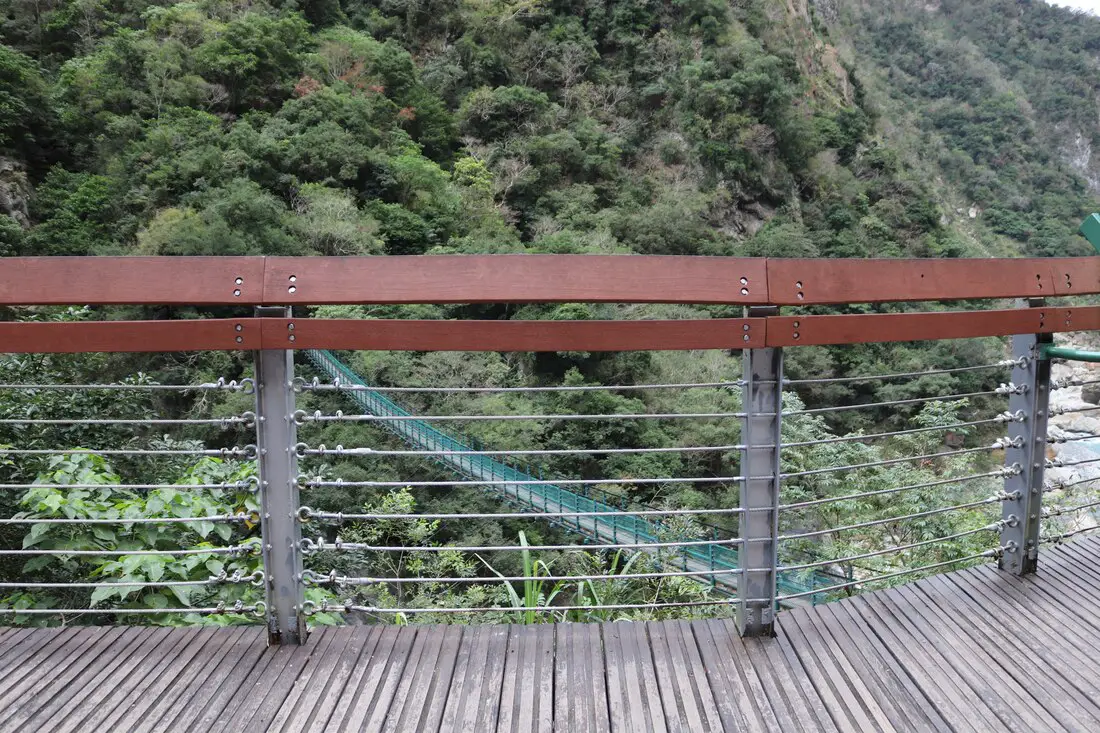
View of the Zhuilu Suspension bridge, didn't really get a good photo here.
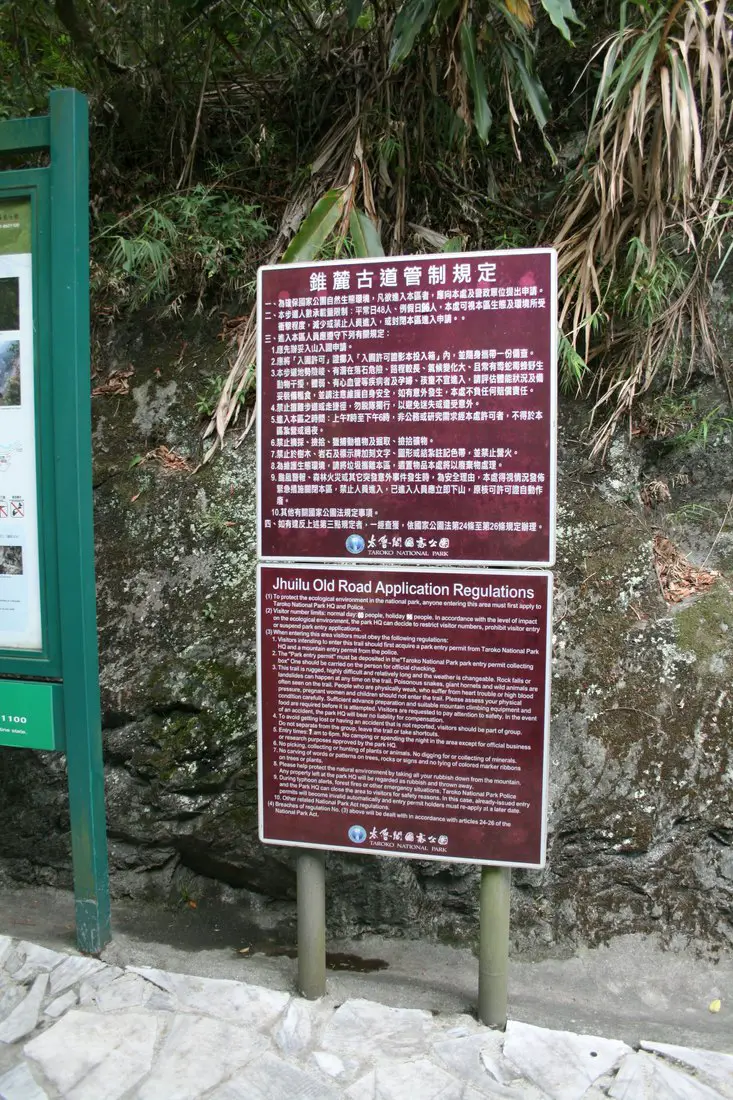
Didn't get to read those signs either, I was in a rush.
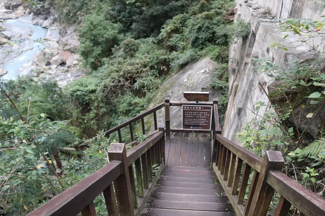
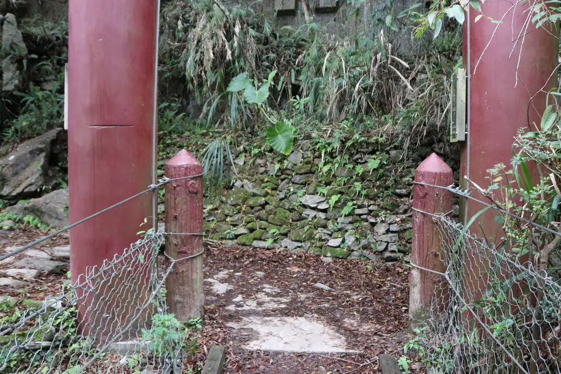
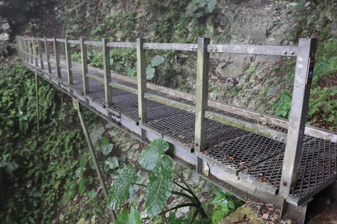
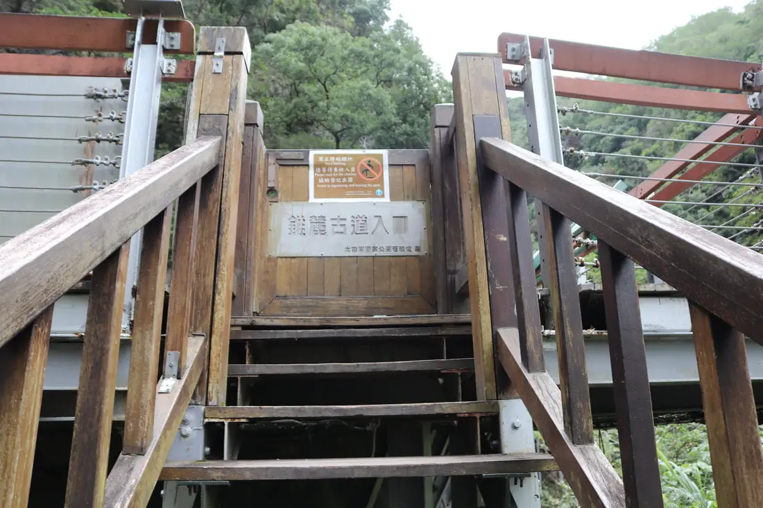
7:07: made it onto the trail. The door to the suspension bridge is locked, and you need to guard to open it after you show them your permit and pay the 200 NT entrance fee.
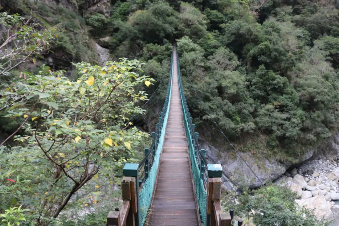
Zhuilu suspension bridge.
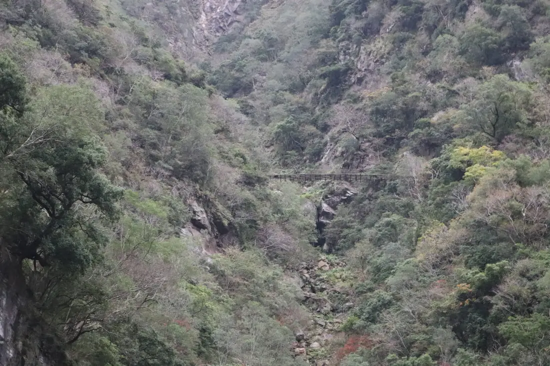
A broken and disused suspension bridge in the valley above, probably as part of the Japanese Old Cross-Hehuan Mountain Road.
Looking up to Swallow Grotto.
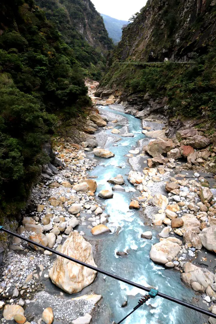
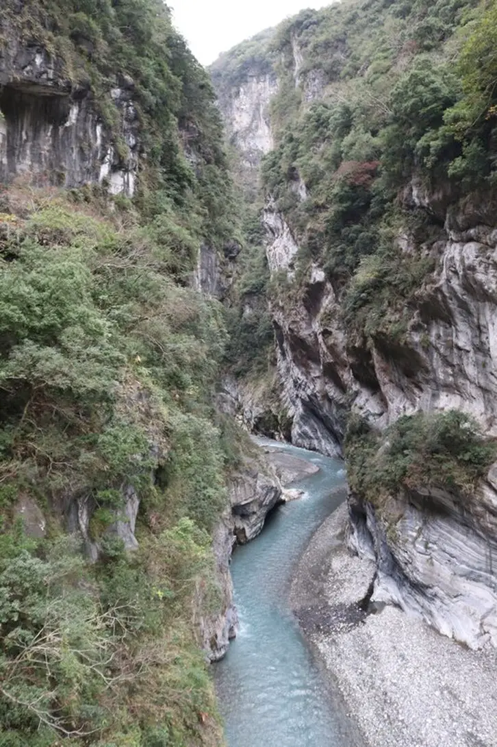
Looking down the river from the suspension bridge.
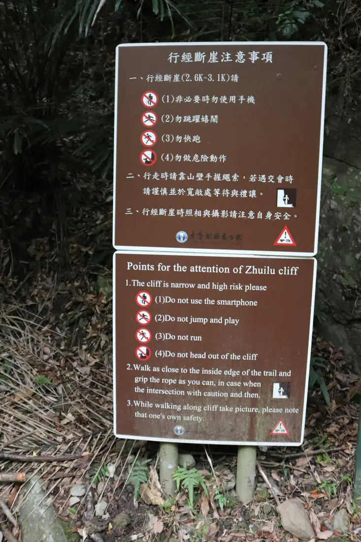
Do not use smartphone, run, jump, or head off the cliff. I think I broke just one of these rules.
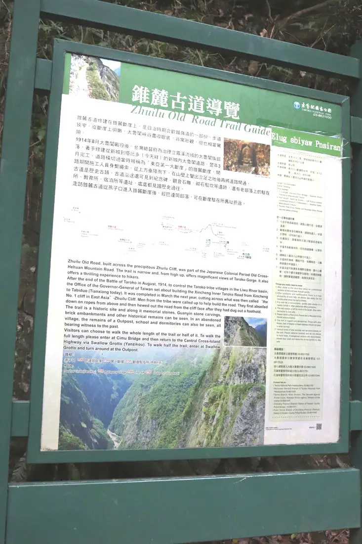
"Zhuilu Old Road Trail Guide"
"Zhuilu Old Road, built across the precipitous Zhuilu Cliff, was part of the Japanese Colonial Period Hehuan Mountain Road. The trail is narrow, and from high up, offers magnificent view of Taroko Gorge. It also offers a thrilling experience to hikers. After the end of the Battle of Taroko in Agust, 1914, to control the Taroko tribe villages in the Liwu River basin. the Office of the Governer General of Taiwan set about building the Xincheng Inner Taroko Road from Xincheng to Tabiduo (Tianxiang today), Ut was completed in March the next year, cutting across what was then called the "No. 1 Cliff in East Asia" -Zhuilu Cliff. Men from the tribe were called up the help build the road, They first abseiled down on ropes from above and then hewed out the road from the cliff face after they had dug out a foothold. The trail is a historic site and along it memorial stones. Guanyin stone carvings, brick embankments, and other historical remains can be seem. In an abandoned village, the remains of a Outpost, school, and dormitories can also be seen, all bearing witness to the past. Visitors can choose to walk the whole length of the trail or half of it, To walk the full length, please enter at the Cimu Bridge and then return to the Central Cross-Island Highway via Swallow Grotto and turn around at the Outpost." 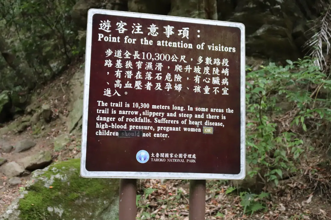
"The trail is 10,300 meters long. In some areas the trail is narrow, slippery and steep and there is danger of rockfalls. Sufferers of heart disease, high-blood pressure, pregnant women or children should not enter."
Good thing I left my child and pregnant wife at home. Well, they didn't want to come anyway. 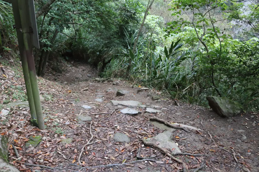
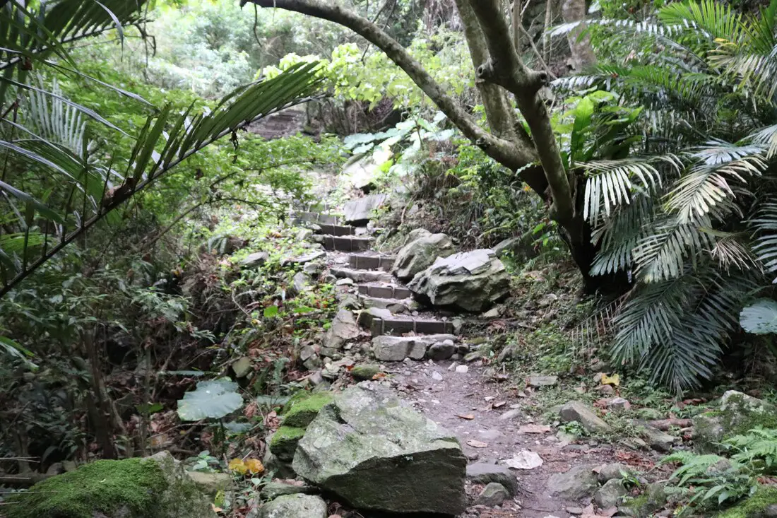
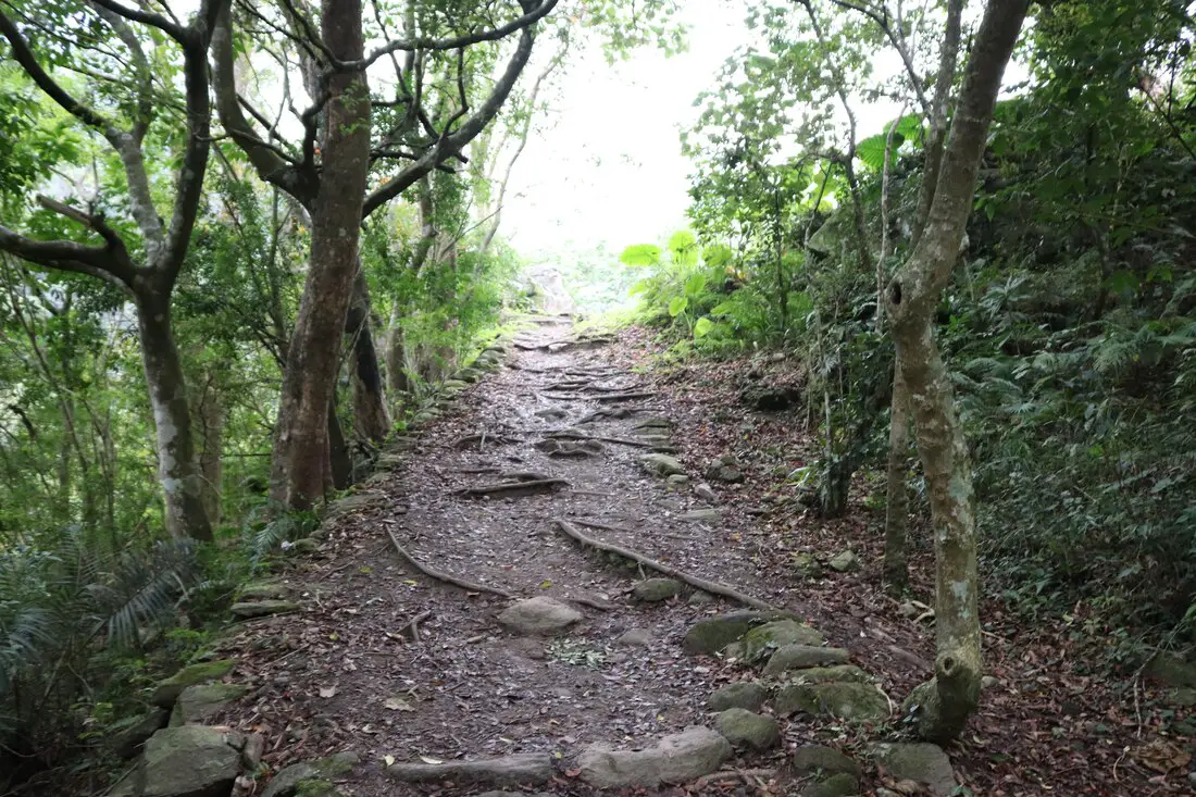
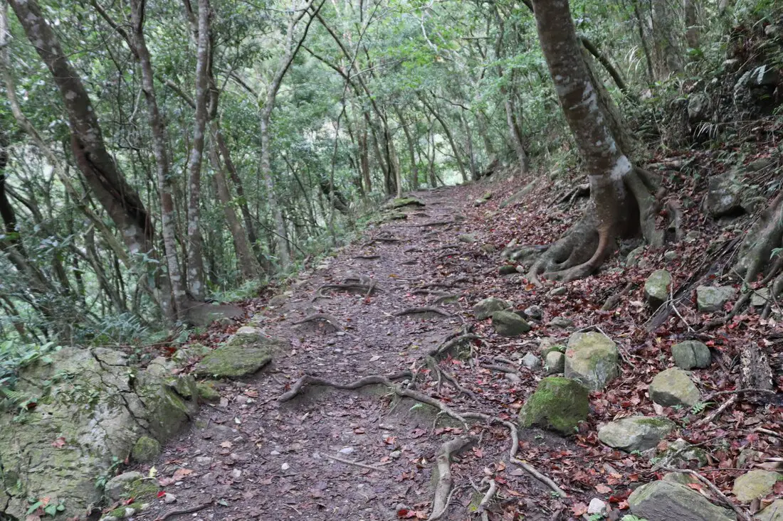
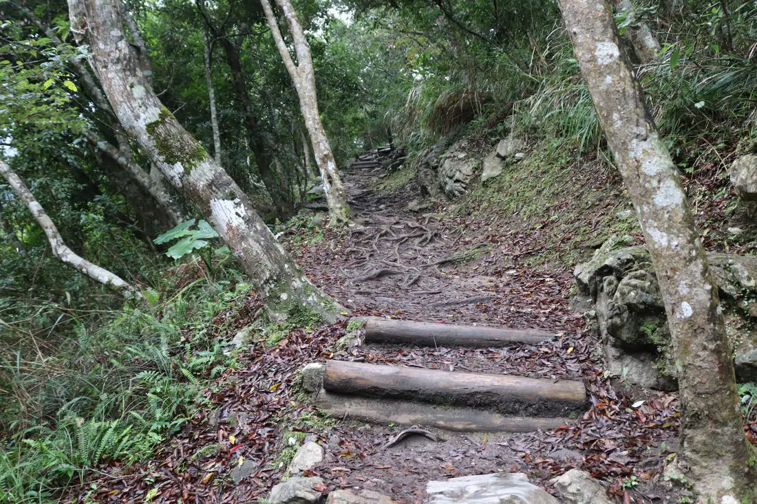
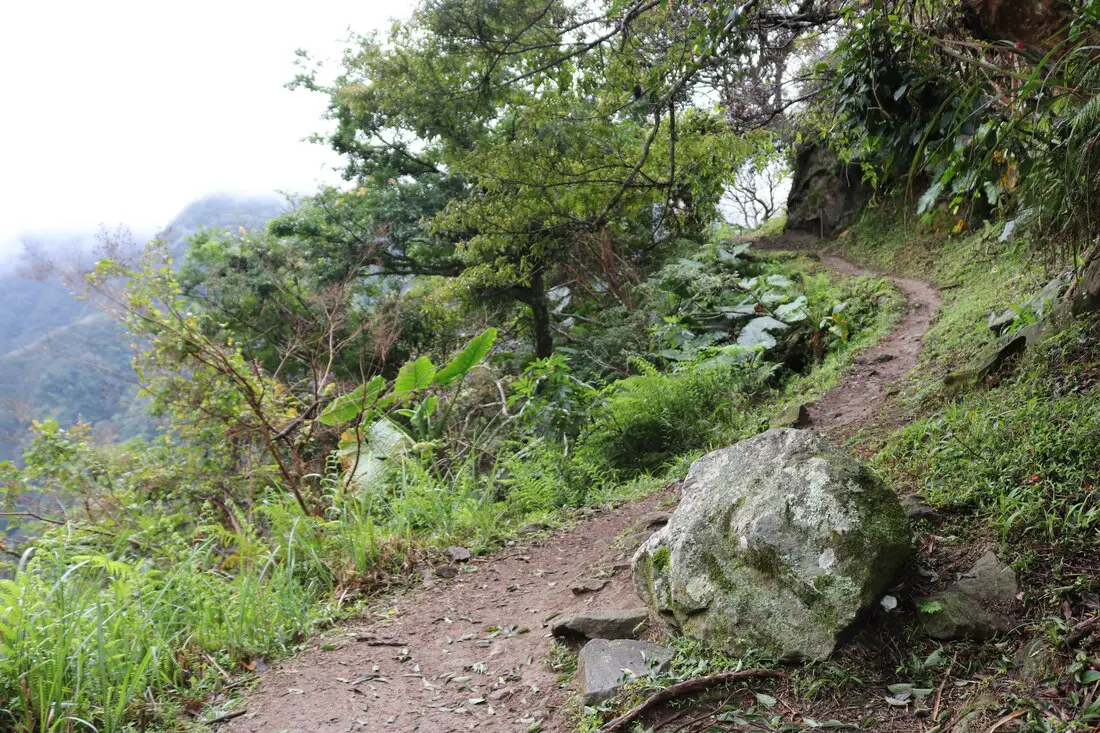
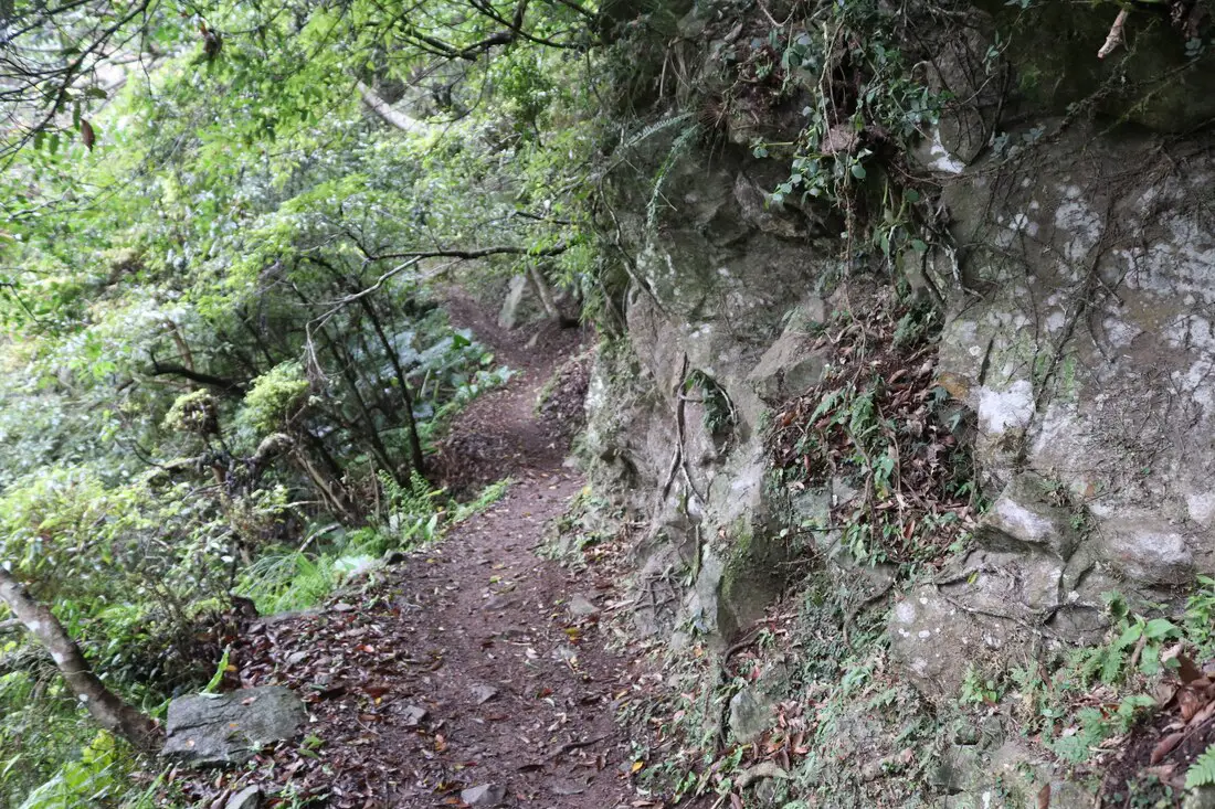
The trail through the first part is steep switchbacks through the forest.
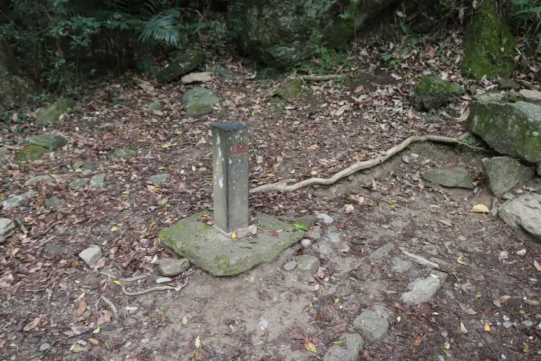
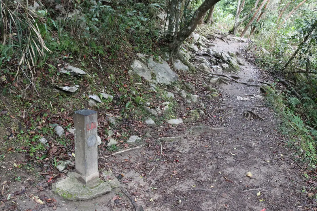
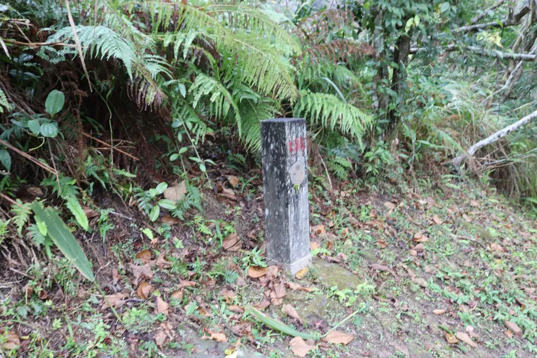
7:17 AM: made it to the .6K marker. There are also markers at every tenth of a mile so you know how far you have gone. I think these markers are a little short near the beginning, that's just me.
An abandoned path leading into the forest.
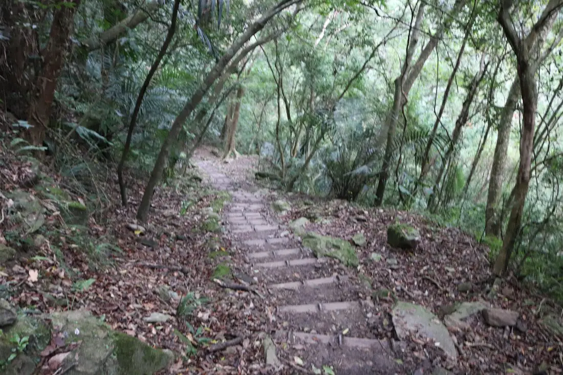
Further up the trail is made of wooden beams secured with re-bar.
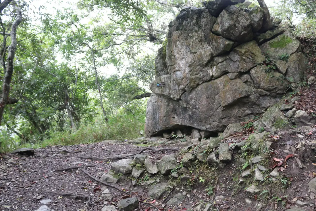
7:21 AM: made it to the .8K marker. There is a giant rock which is where most people stop to rest, but not me.
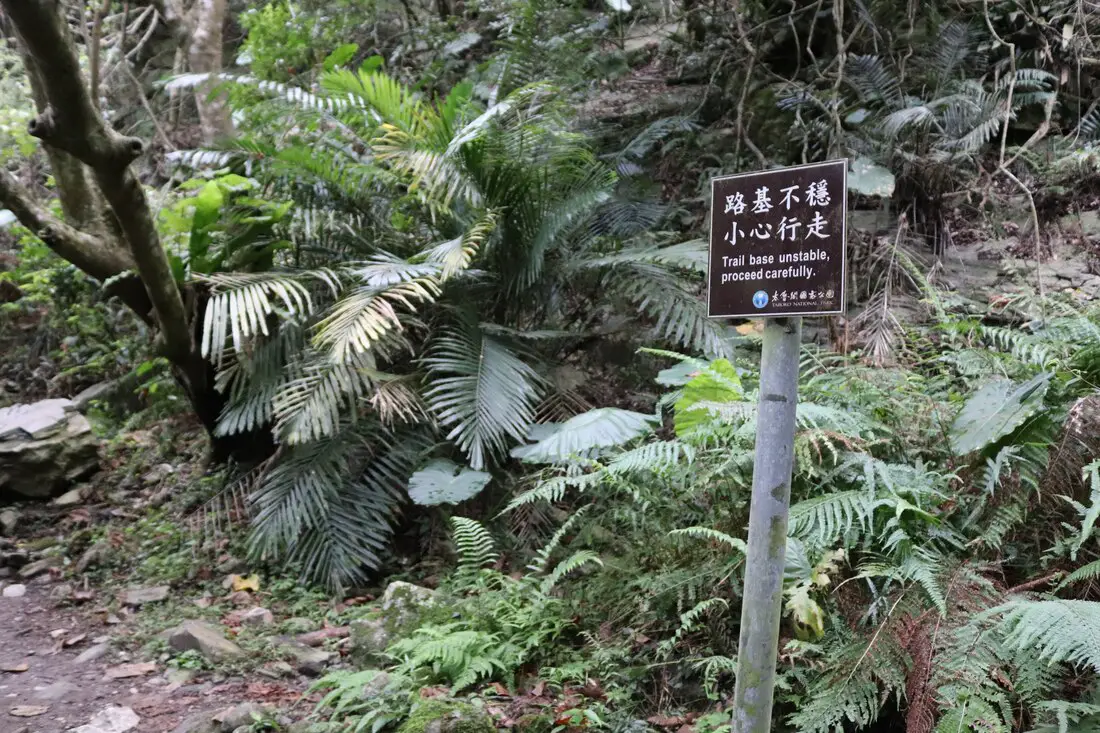
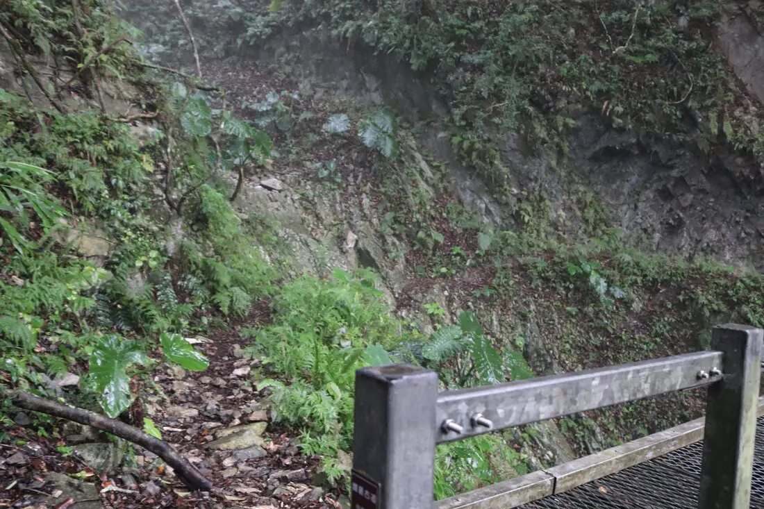
"Trail base unstable, proceed carefully" ...that is comforting.
Now I proceed up the trail expecting it to fall out from under me at any moment.
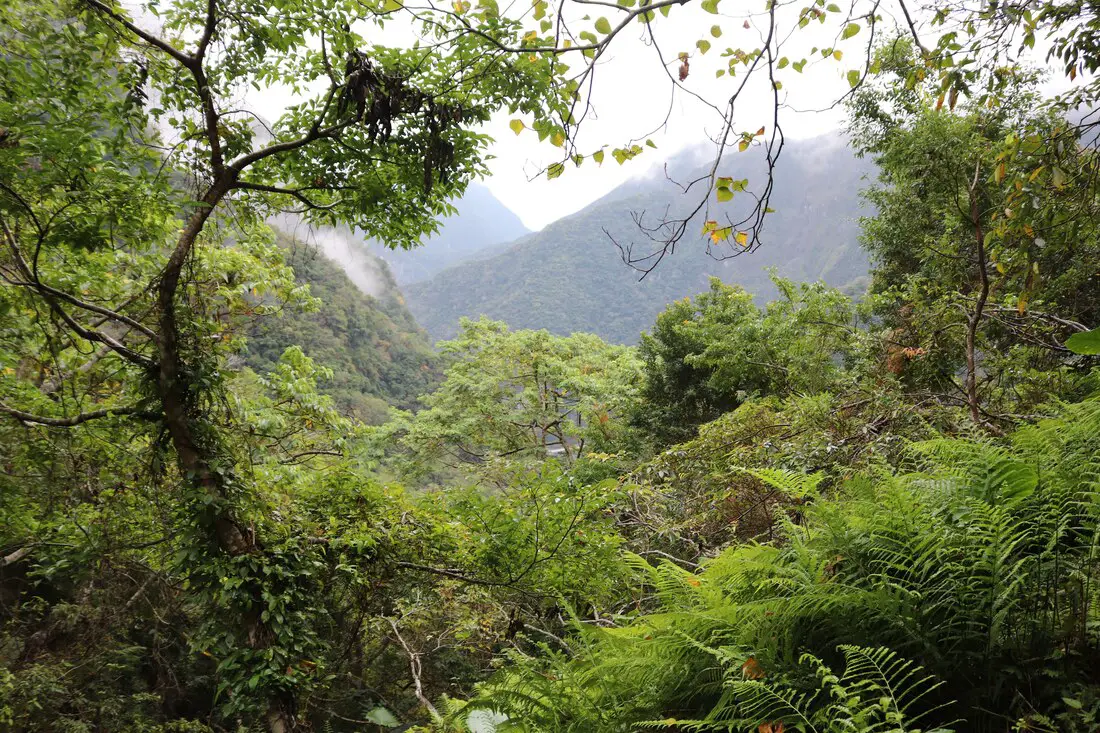
The first real good view of the as the forest opens up.
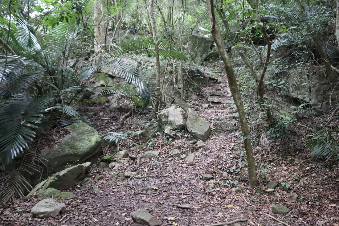
But, there are a lot more switch backs through the forest.
7:27 AM: 2.2 KM more to go. When do I get to see the cliffs?
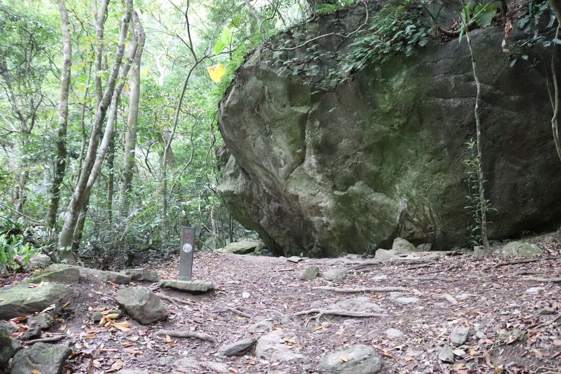
The first sign of the old trail comes here, right before Badagang Village.
The trail comes out of the forest briefly near Badagang Village.
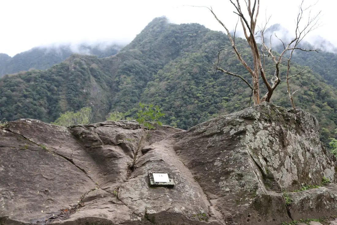
7:29 AM: The 1K marker on a stone right before Badagang Village.
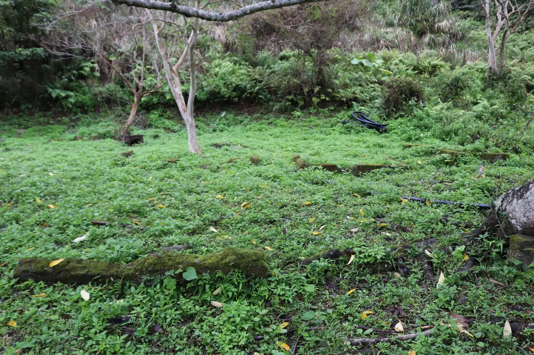
Badagang Village 巴達岡村 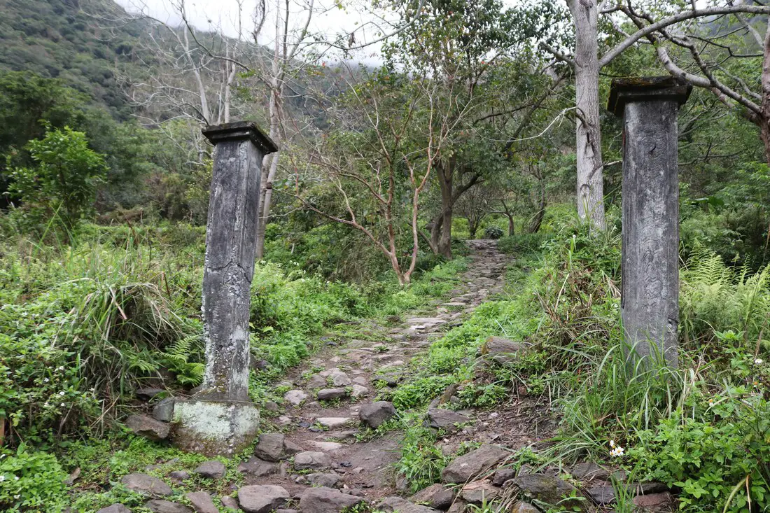
The only structures left standing at Badagang Village are two cement posts, that seemed to have been stripped of an outer stone that once covered them.
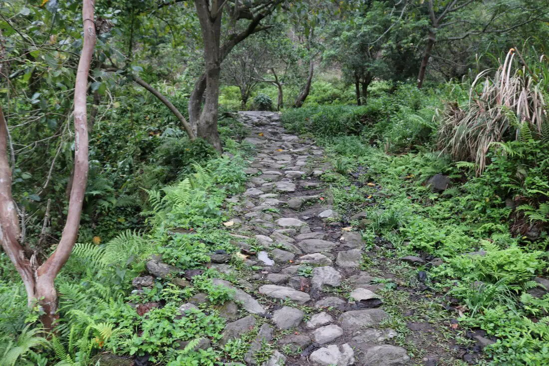
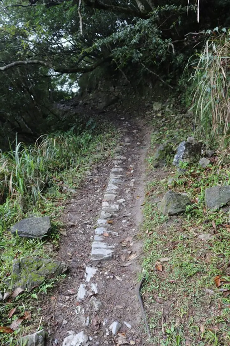
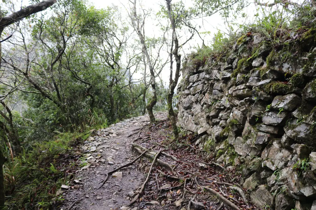
The old trail here is very wide and you can tell that it was well made.
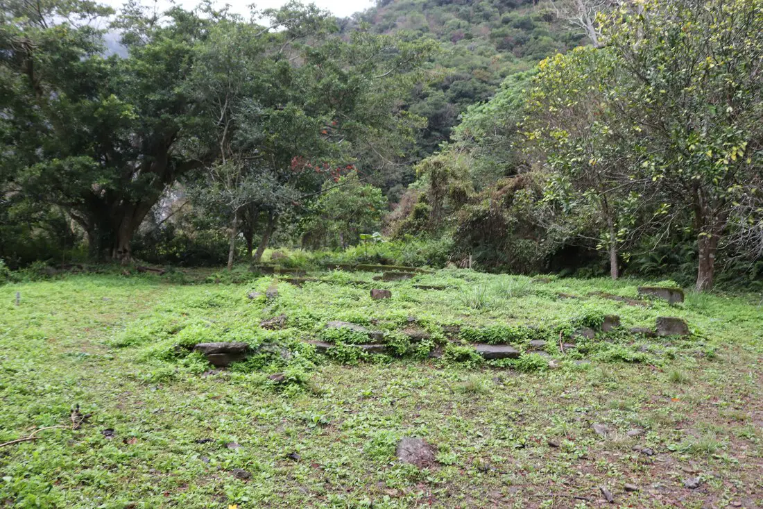
Here are two levels of flat land where buildings used to stand. There was a police station, clinic, school, inns, and dormitories here.
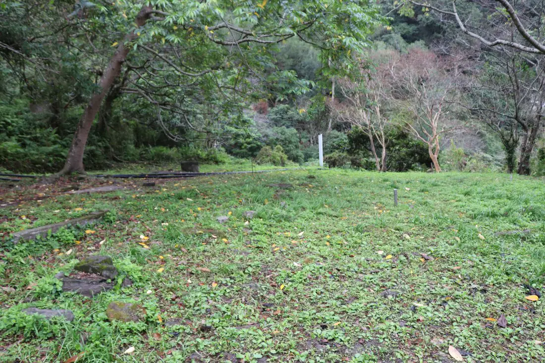
View of the foundation remnants on the right side of the trail going up.
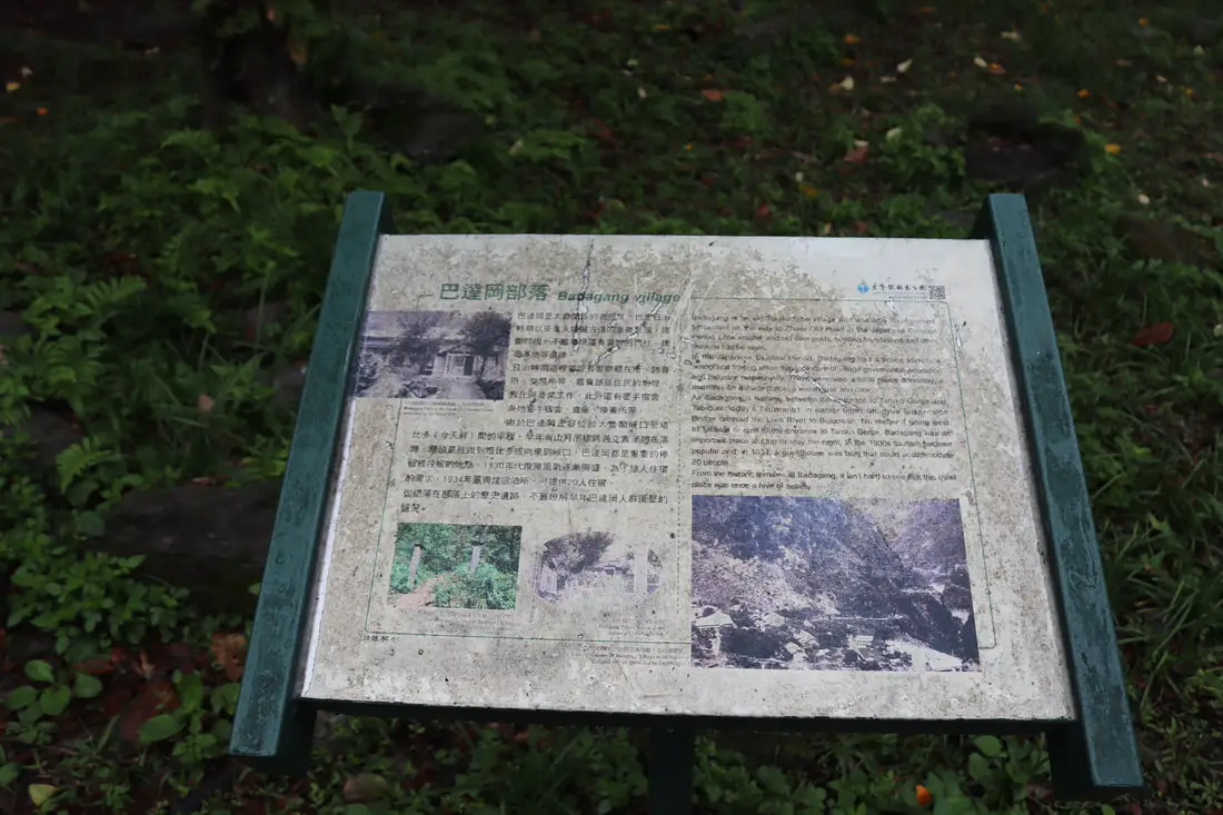
"Badagang Village"
"Badagang is an old Taroko tribe village and was also an important settlement on the way to Zhuilu Old Road in the Japanese Colonial Period. Look around, and old door posts, building foundations, and other remains can be seen. In the Japanese Colonial Period, Badagang had a police station, a school and trading office that took care of village governance, education and industry, respectively. There were also a local police dormitory, a dormitory for outside police, a warehouse, and a clinic. As Badagang is halfway between the entrance to Taroko Gorgfe and Tabiduo (today's Tianxiang), in earlier times Shanyue Suspension Bridge crossed the Liwu River to Buluowan. No matter if going west to Tabiduo or east to the entrance to Taroko Gorge, Badagang was an important place to stop or stay the night. In the 1930s tourism became popular and in 1934 a guesthouse was built that could accommodate 20 people. From historic remains at Badagang, it isn't hard to see that this quiet place was once a hive of activity." 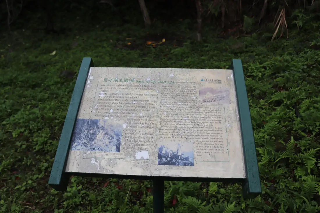
"Battle of 100 years ago"
"Zhuilu Old Road cuts across Zhuilu Cliff from the trail, stunning bird's eye views of Taroko Gorge can be enjoyed. Why was this precipitous trail actually built? The reason is a battle that was fought a century ago. During the Japanese Colonial Period in 1910 Governor-General of Taiwan Sajuma Samata put forward the 5 year Barbarian Pacification Plan, part of which involved launching a military campaign to suppress the Taroko tribe. After intense planning, in May, 1914, Japanese army and police launched a pincer movement from east and west. From the east, the police force attacked up the Liuwu River while the force in the east split up, one group of infantry crossing the south peak of Mt. Qilai from Wushe and entering the Mugua River basin, another force grouped on Mt. Hehuan and then attacked from above along the Liwwu River from Mt. Bulu, Mt. Pingfung, Mt Hehuan, and the north peak of Mt. Qilai. The army was first to reach To-bo-ko on the middle reaches of the Liwu River, taking village after village and met up with the police force near Buluowan at the end of June. The end of the battle was announced in Mid-August and the Taroko people were forced to accept Japanese rule. After the end of the battle, Karenk (Hualien Harbor) Prefecture set about building the Xincheng-Tabiduo (Tianxiang) Xincheng Inner Taroko Road. The section that crossed Zhuilu Cliff is today's Zhuilu Old Road." 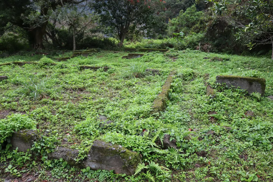
Foundations of other buildings on the left of the trail coming up.

Flat area to the right of the trail going up.
More foundations on the second level.
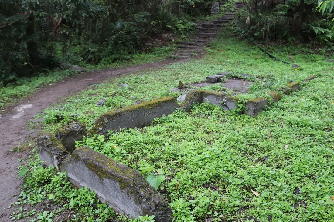
A more complete concrete foundation.
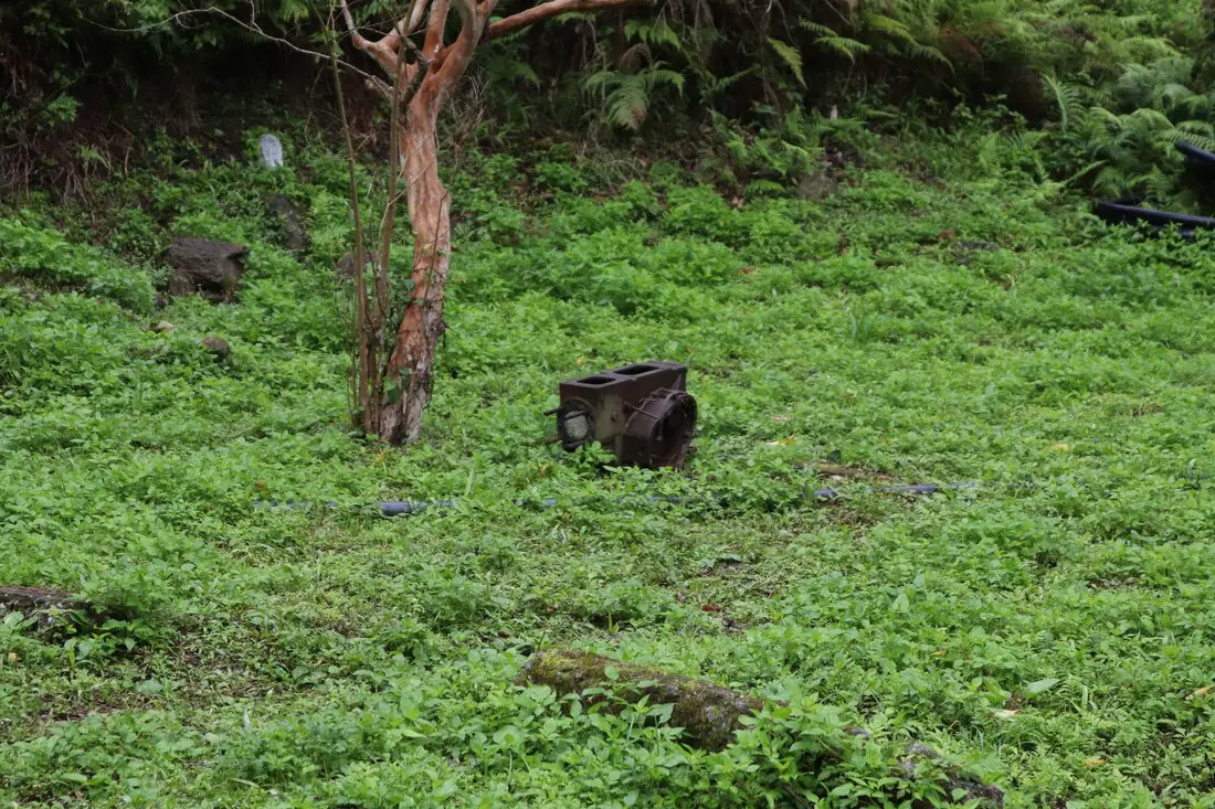
Some rusting metal machine type object in the grass.
A look back on the trail as it passes Badagang Village.
Above you can see a 360 view of the area around Badagang Village, taken via drone.
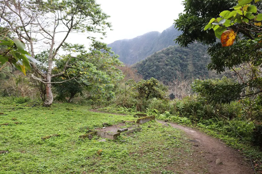
After Badagang, the trail goes back into the woods but is not quite as steep as the beginning.
Badagang Bridge No. 2 巴達岡二號橋 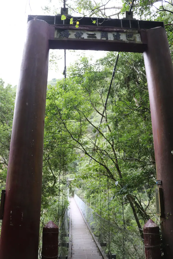
7:35 AM: I reached Badagang Bridge No. 2. This was built in about 2008 to improve the trail. Before this bridge was built, it involved a difficult climb through the gully.
Before the bridge was built, you had to climb up and down this steep gully below.
A look to the left of the bridge coming up.
Looking at the gully towards the mountains.
A look towards the gorge.
On the other side of the bridge you can see some stonework that is probably modern.
7:44 AM: 1.6K, halfway there!
7:45 AM: 1.7K, still in the woods.
The trail was not as steep here, but still no cliffs to be seen.
Here the forest started to clear up a little.
7:49 AM: 1.8K, still no cliffs.
Another break in the trees.
This part of the trail starts to look kind of like cliffs.
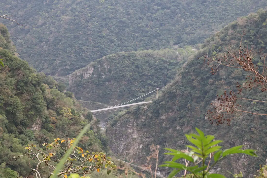
Looking back at the Buluowan Suspension bridge. In the olden days, the Zhuilu trail connected with that bridge and went to Buluowan Village, and then out of the gorge.
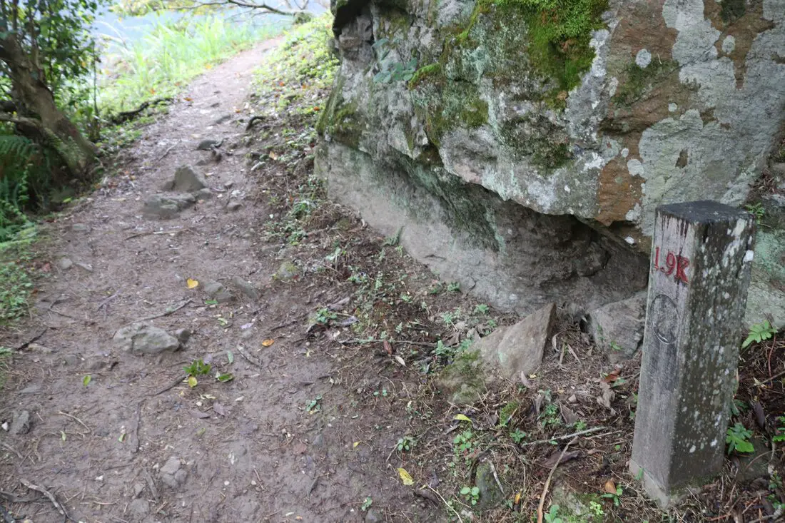
7:52 AM: 1.9K, I can smell cliffs.
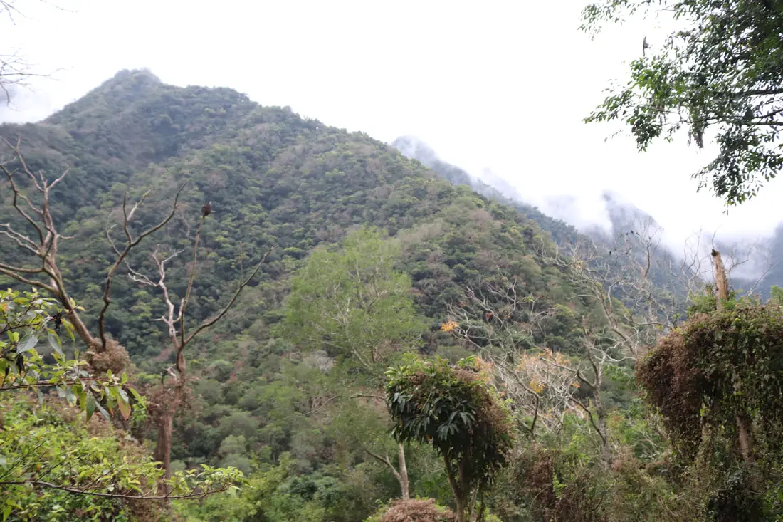
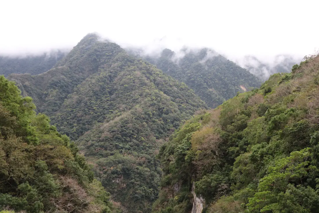
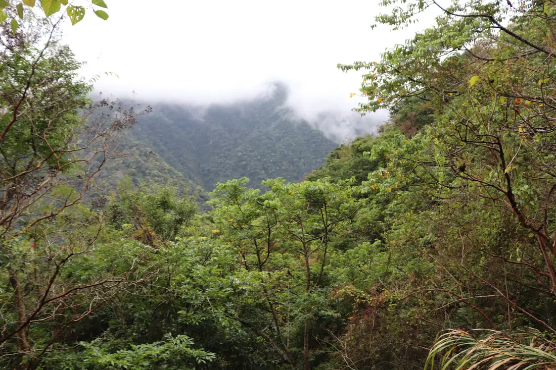
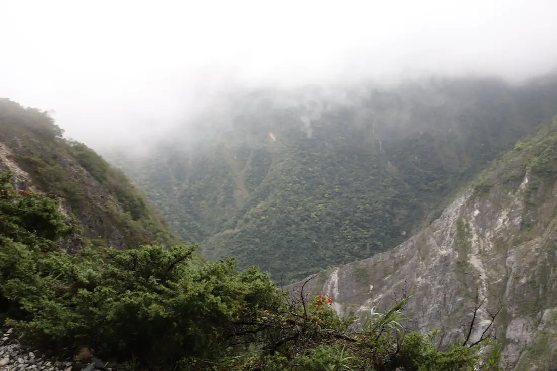
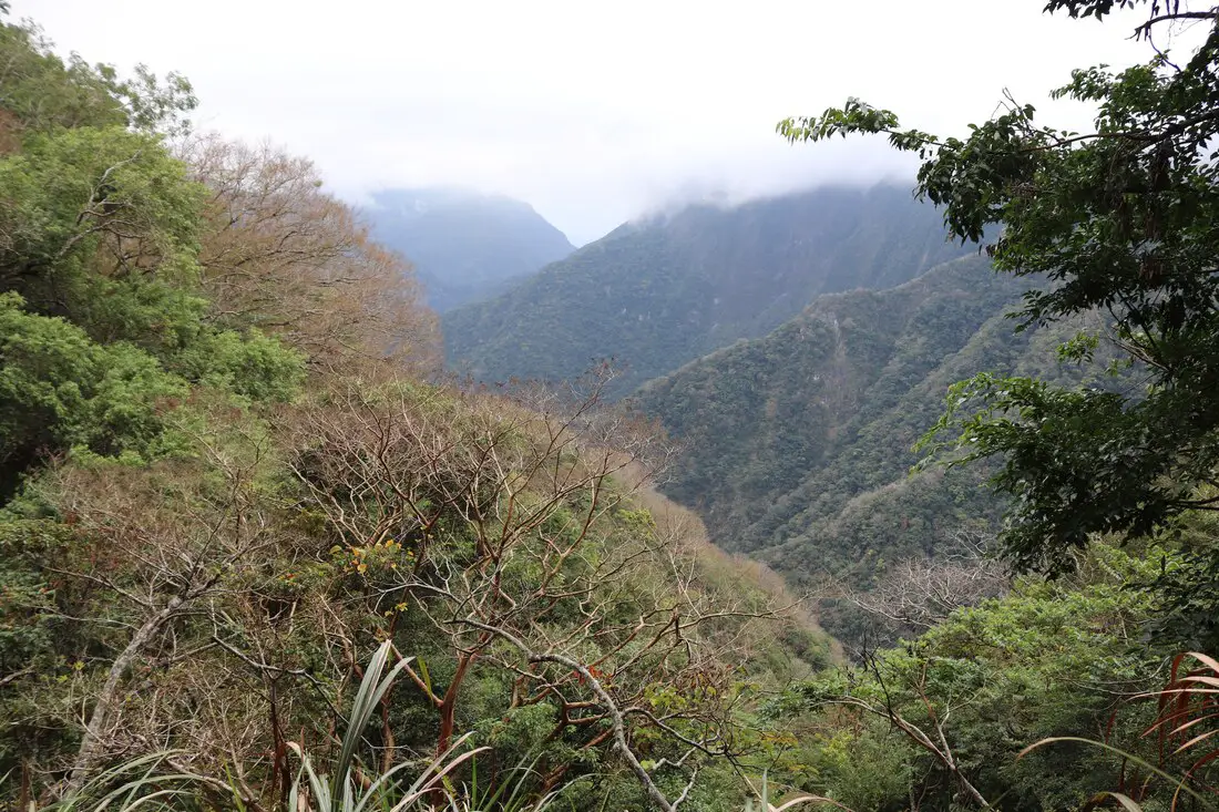
Getting closer to the cloud barrier as I move higher in elevation.
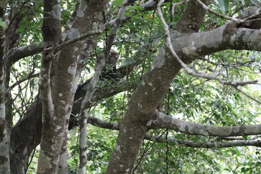
On this hike, I heard many calls from birds and monkey screeches, but didn't see much wildlife except this Formosan Macaque.
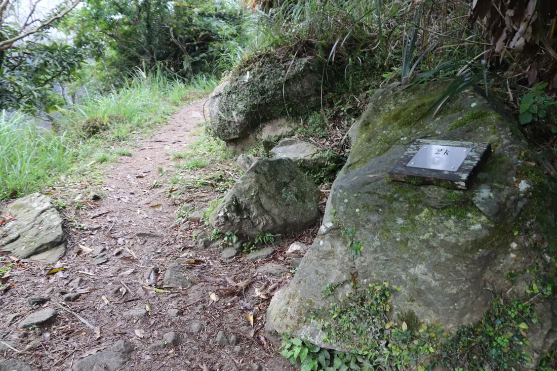
7:54 AM: 2K, still no cliffs. At this point I had not taken any breaks and had basically already risen 500 meters. It was a cold cloudy day, so I wan't losing much moisture and it was still early morning and I was not that hungry either.
More jungle paths.
A break in the trees.
The first real cliffs on the trail.
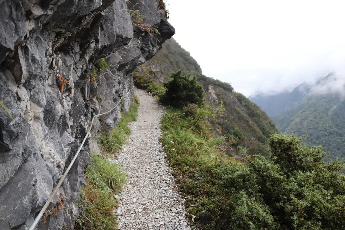
The first roped section on the trail.
What I assume is the original Zhuilu stone path.
Clouds rolling in.
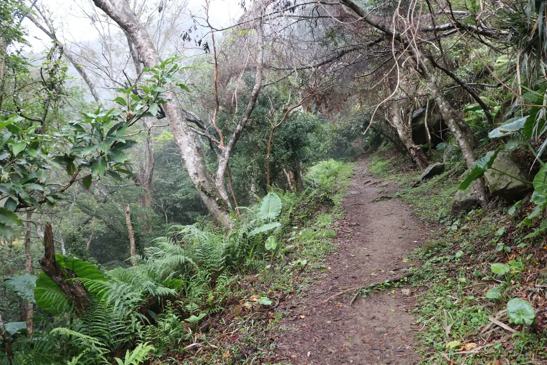
More switchbacks through the forest! Still no cliff.
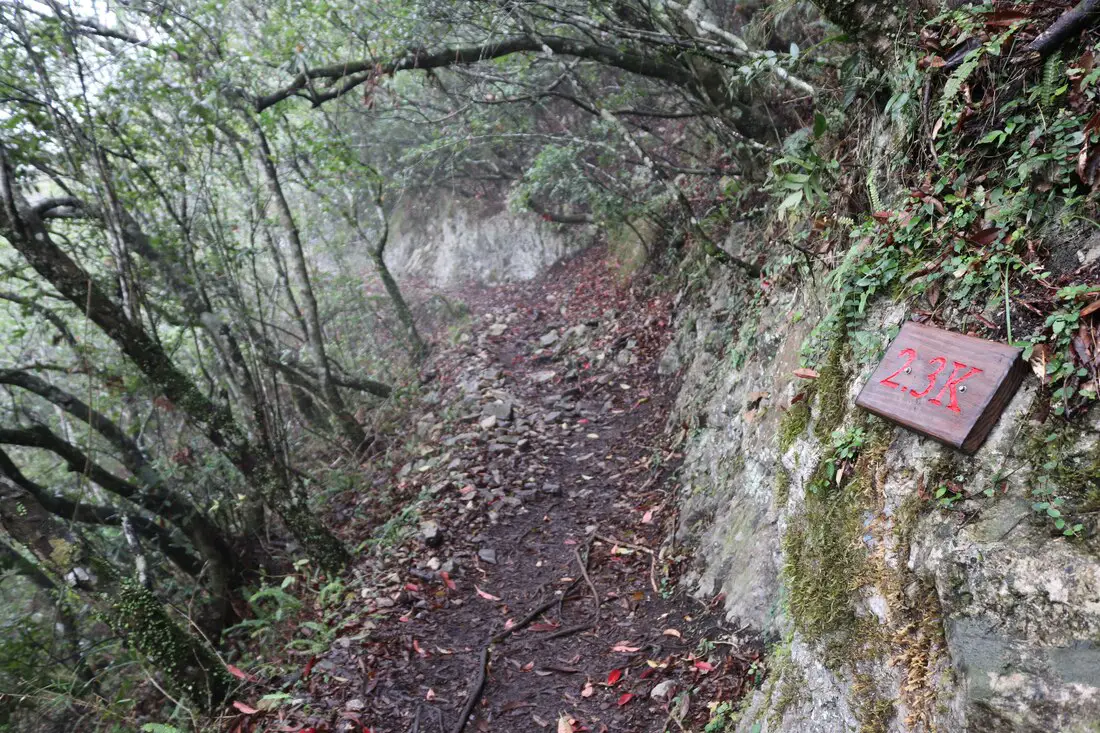
8:05 AM: 2.3K, still walking through the foggy forest.
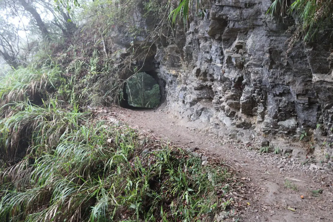
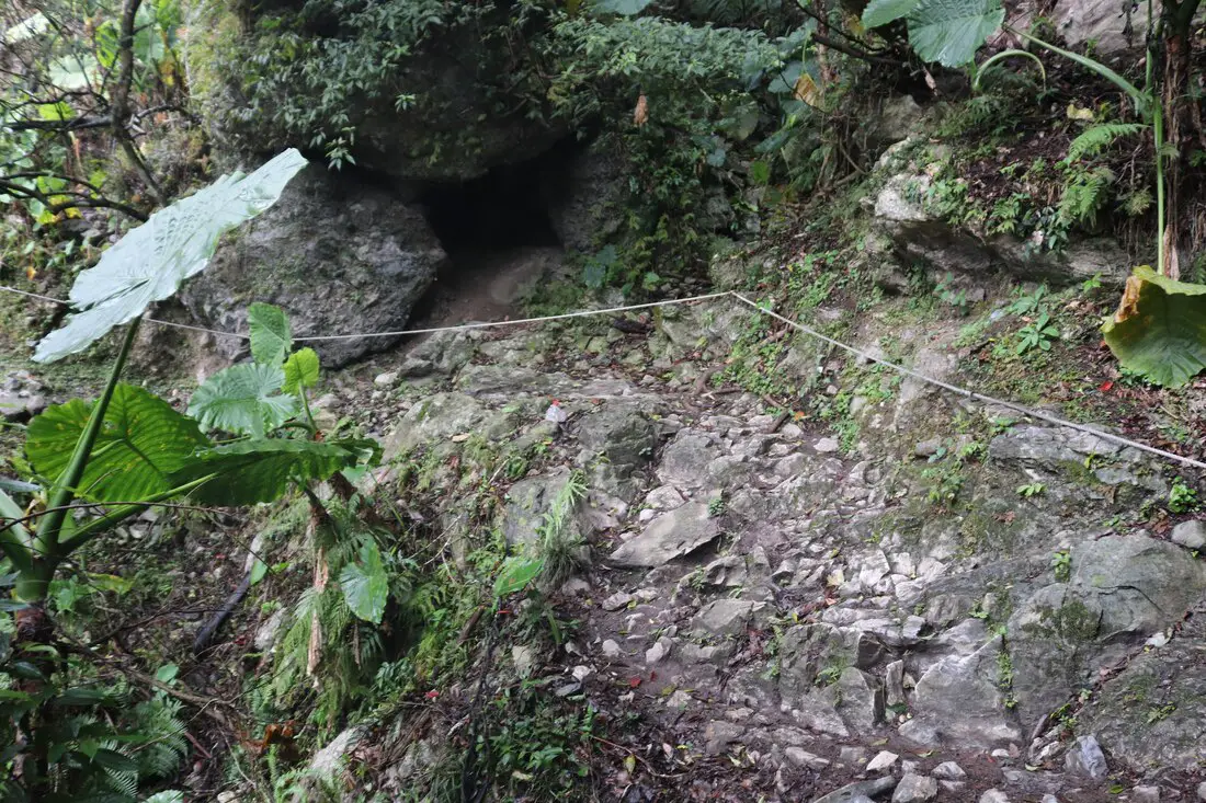
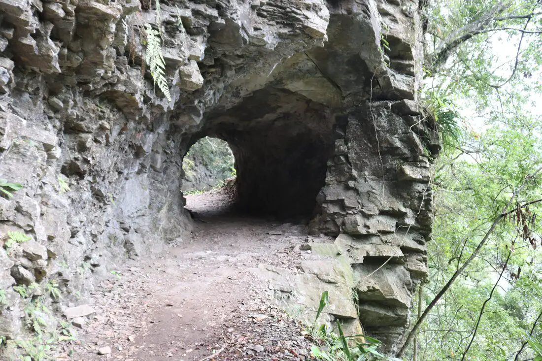
8:07 AM: The first stone tunnel through a rock precipice.
8:08 AM: The second bridge on the trail, still in the forest. This one looks modern, but it was super scary and wobbly.
You can see where the original trail passed by next to the bridge, I guess the brige is safer.
What look like very old rock walls after the bridge.
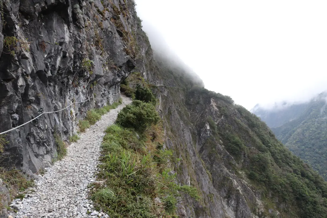
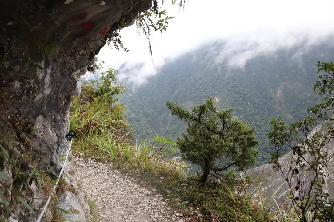
8:09 AM: A rope appears next to a cliffy section.
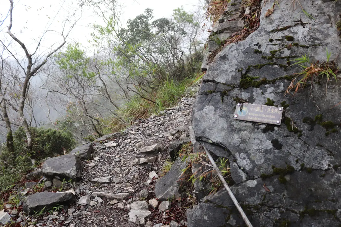
"Watch out for the precipice. Be careful not to trip over rocks." Zhuilu Cliff 錐麓斷崖 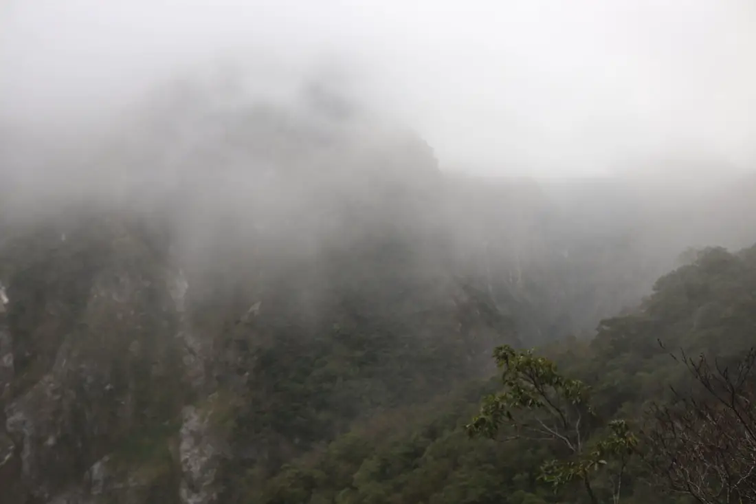
And we made it to the cliffs! At this point I was scared all I would see is fog and there would be no scenery.
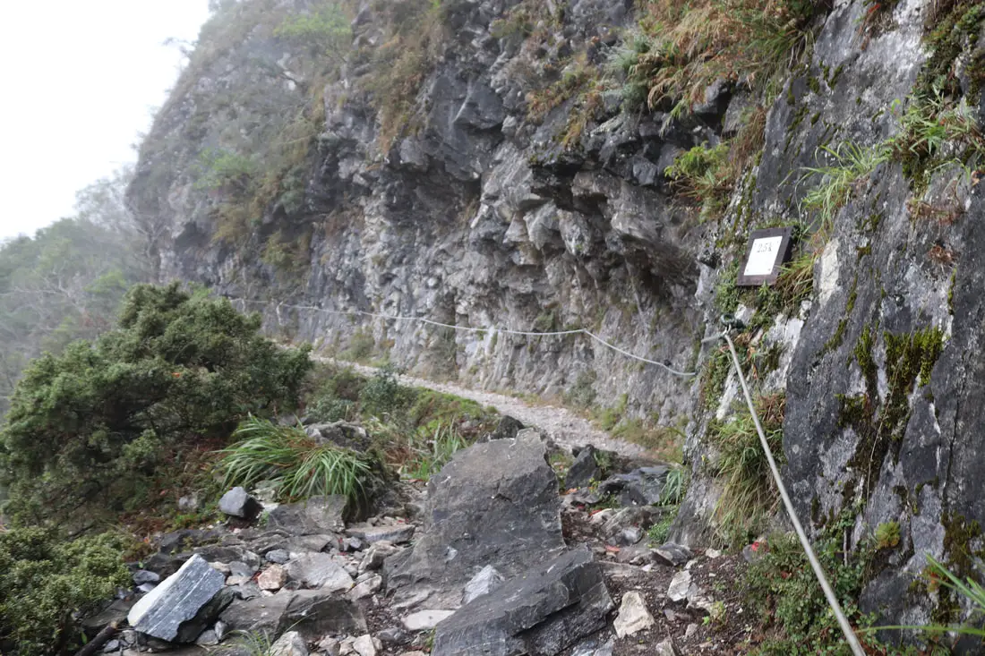
8:10 AM: 2.5K, First real section of the Zhuilu Cliff.
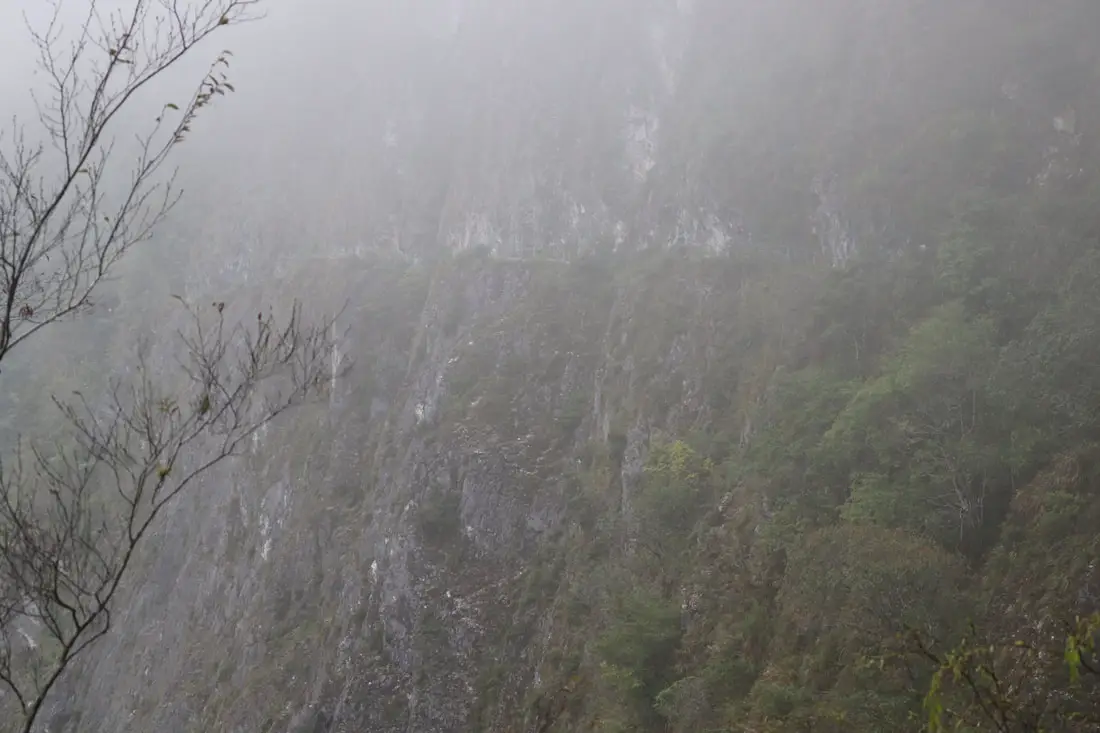
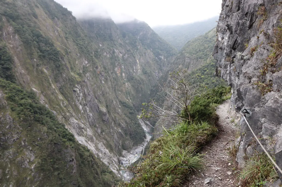
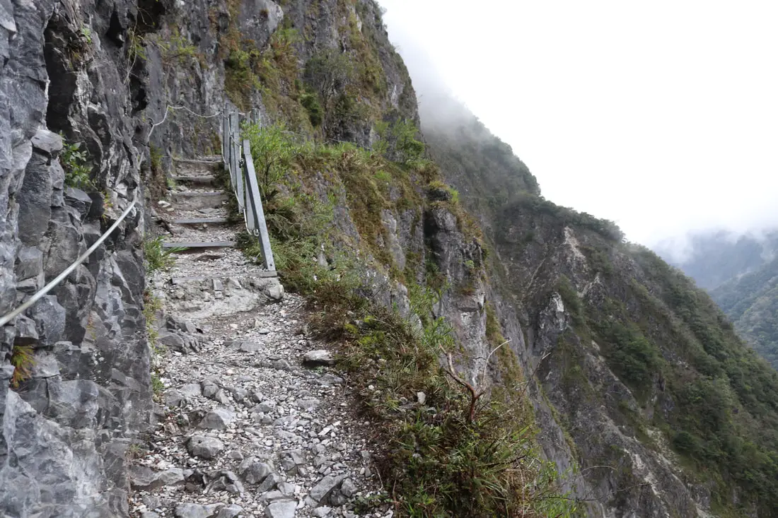
Foggy view of the Zhuilu cliff trail.
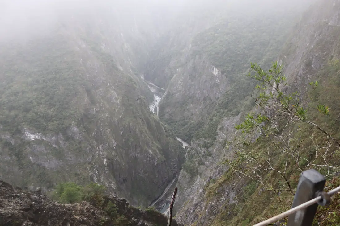
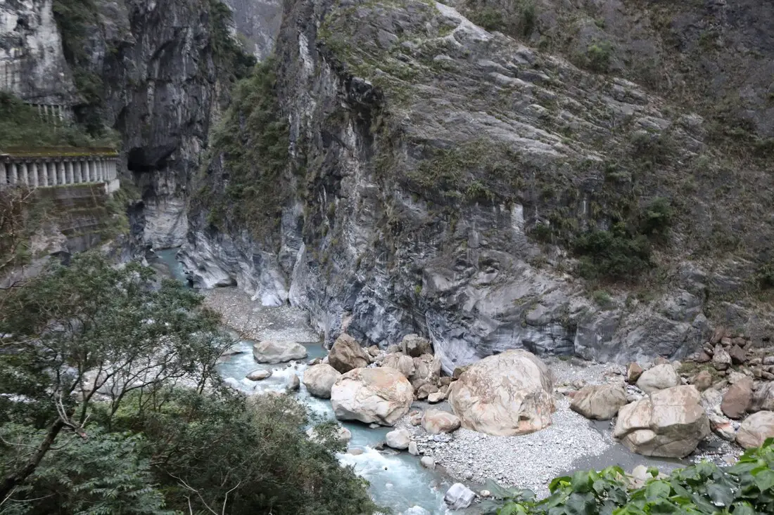
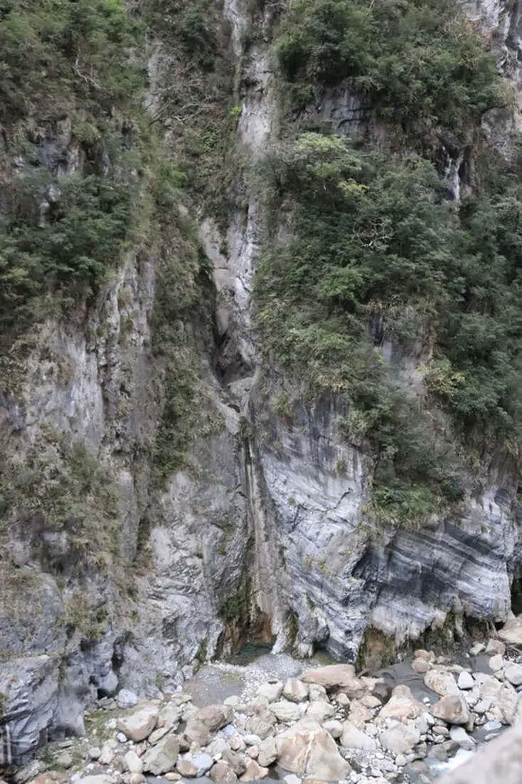
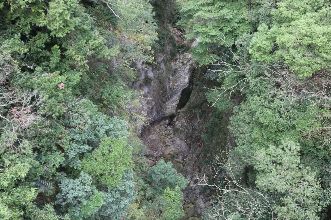
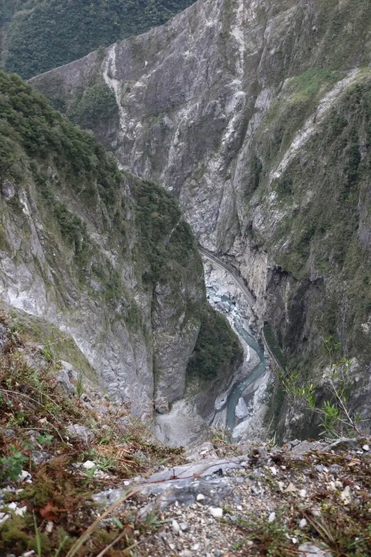
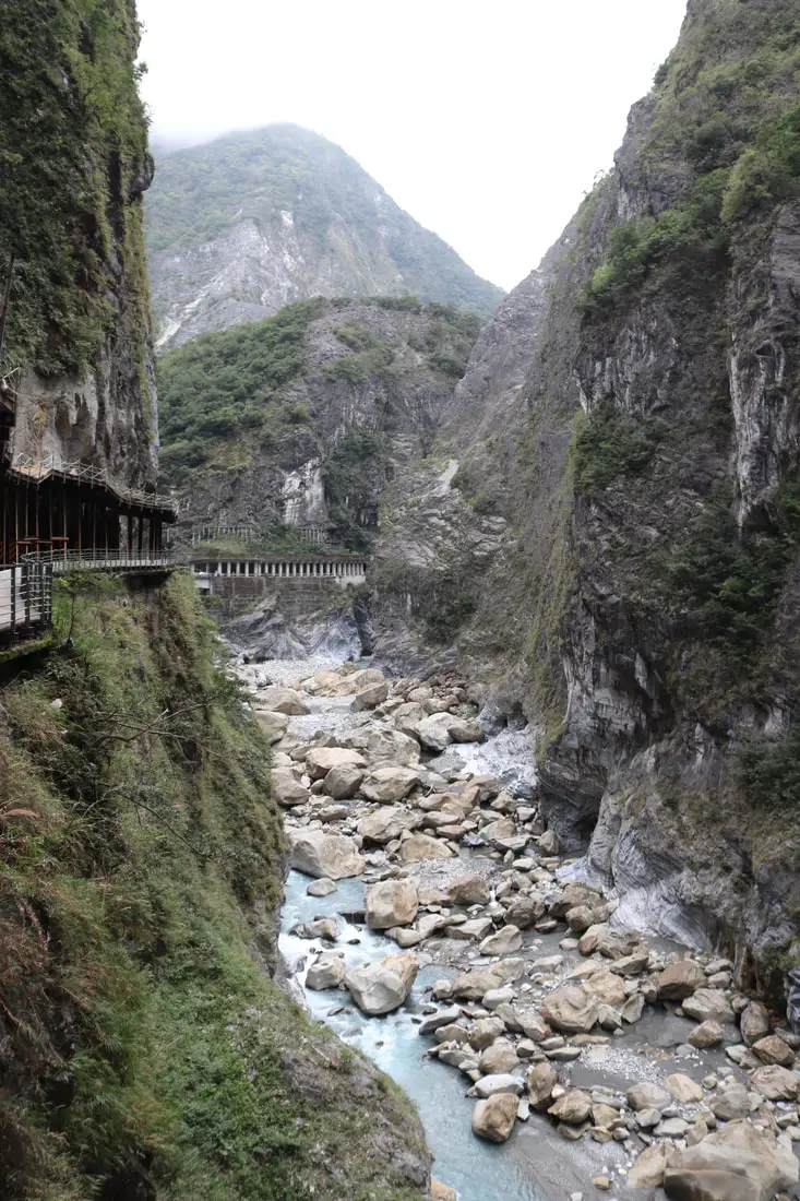
Looking down into the gorge below.
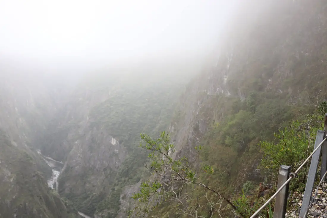
Different angle with both gorge and cliff.
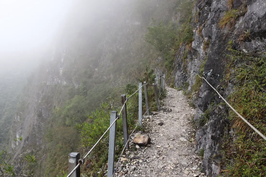
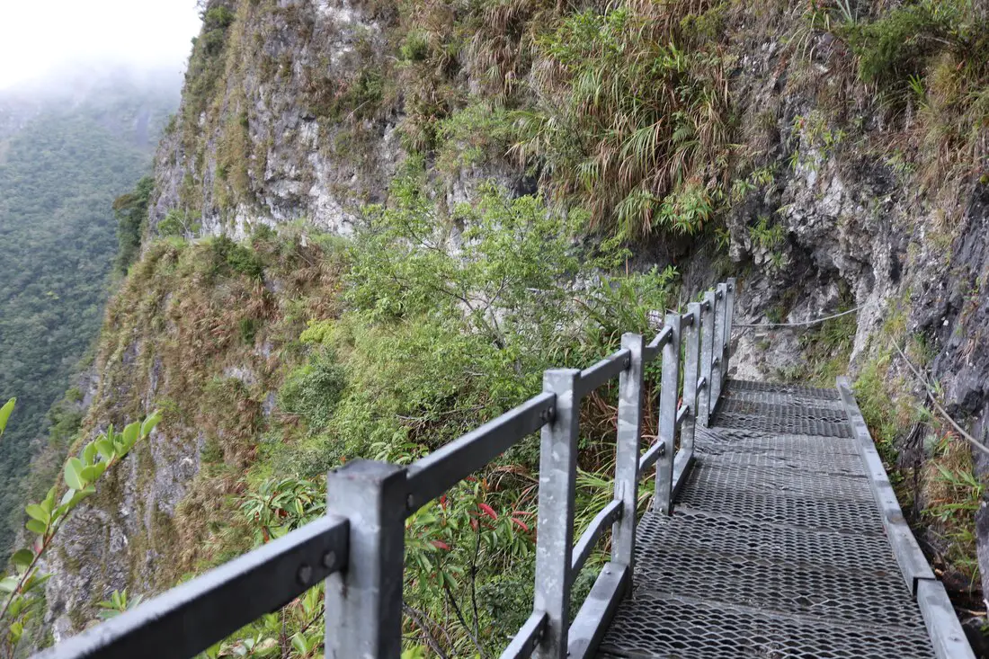
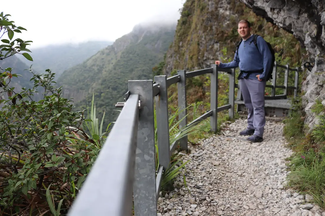
Here there is a nice guardrail so you don't feel as scared.
And here the guardrail ends.
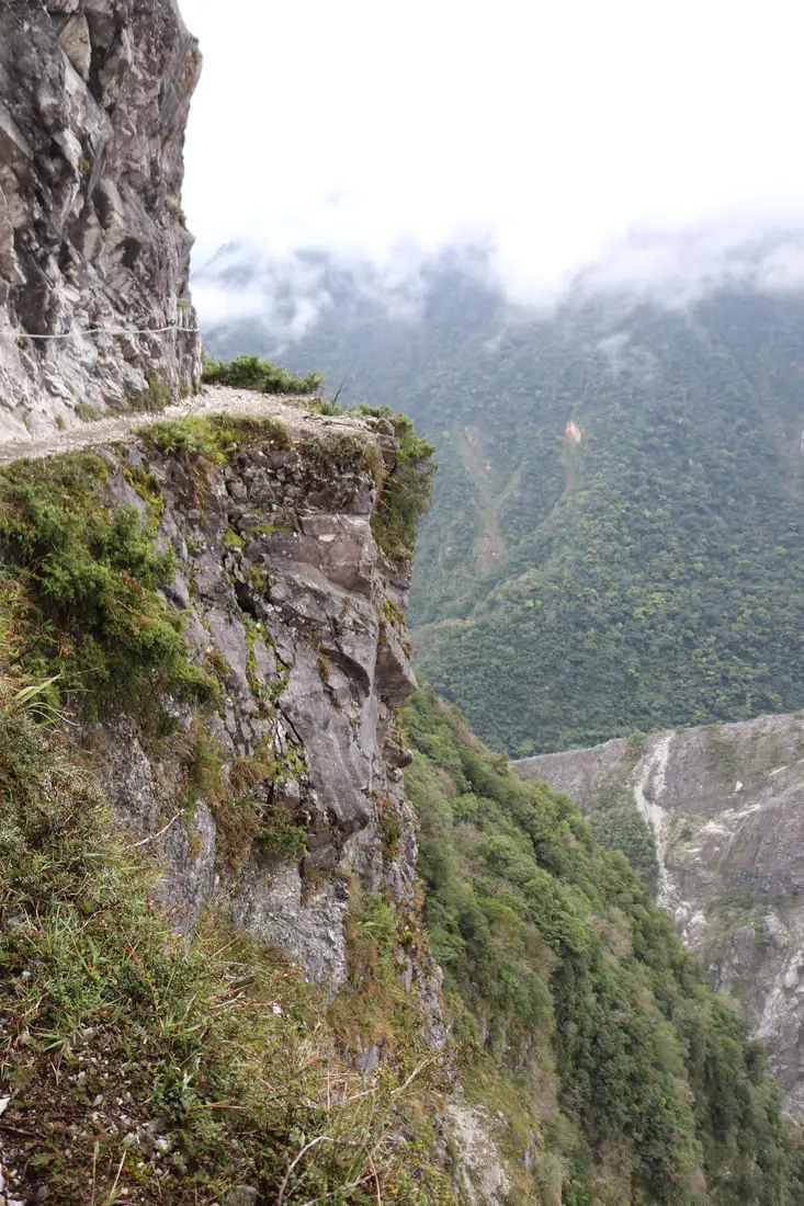
Things are pretty scary from here on out, but very beautiful and exciting.
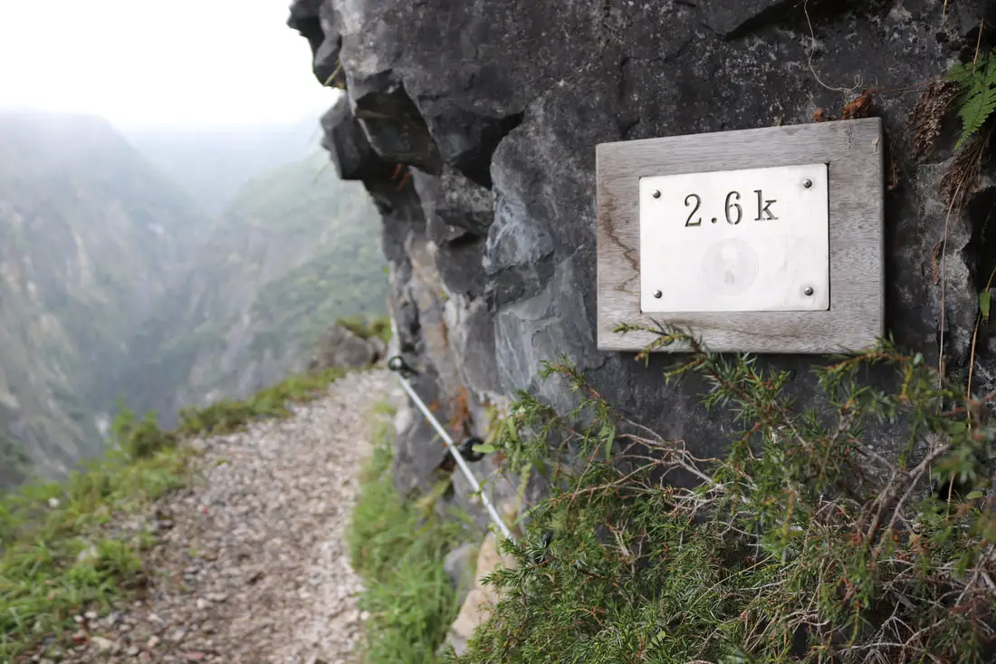
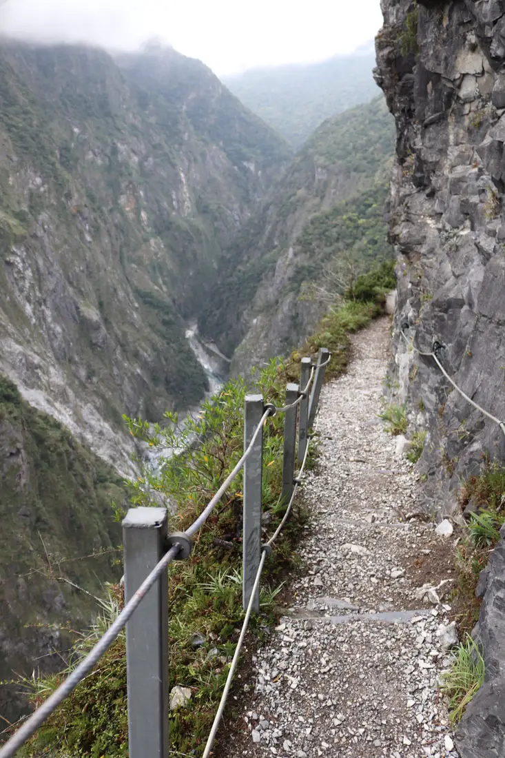
8:13 AM: 2.6K, at the far end of the Zhuilu cliffs.
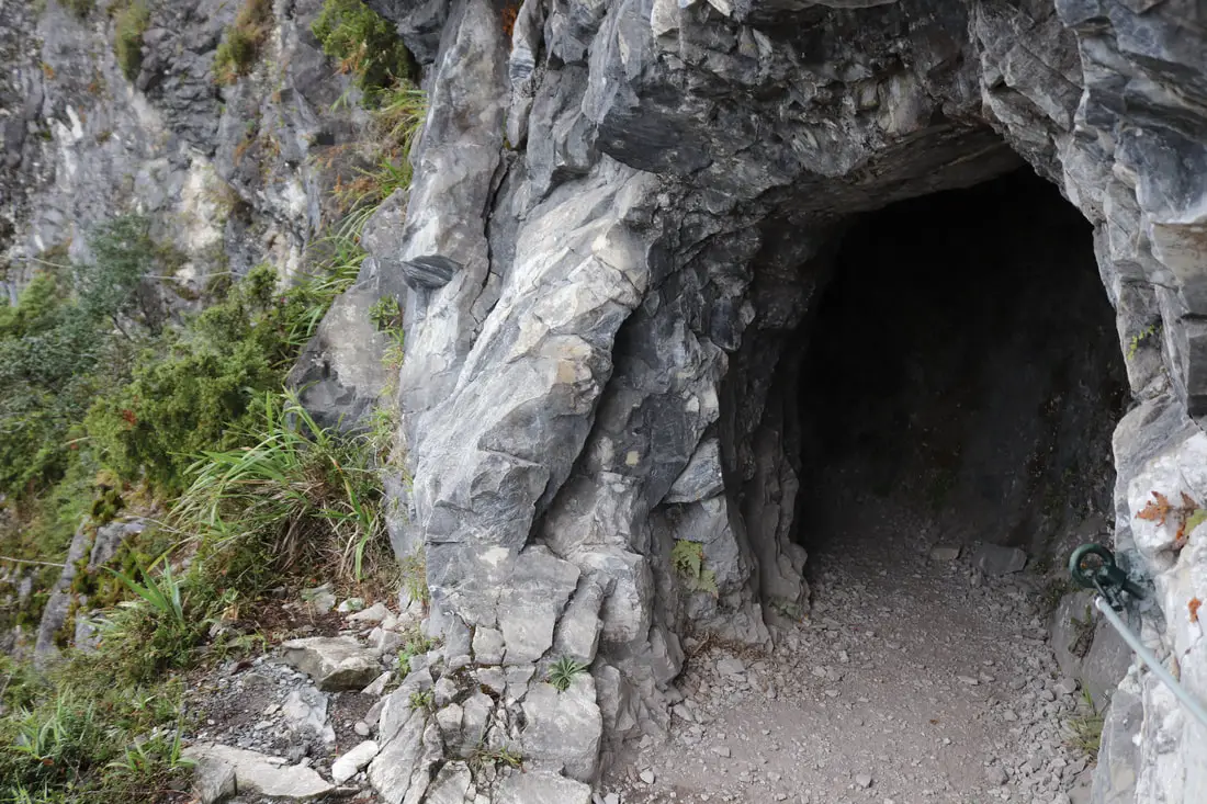
8:14 AM: second tunnel on the trail, right in the middle of the Zhuilu Cliffs.
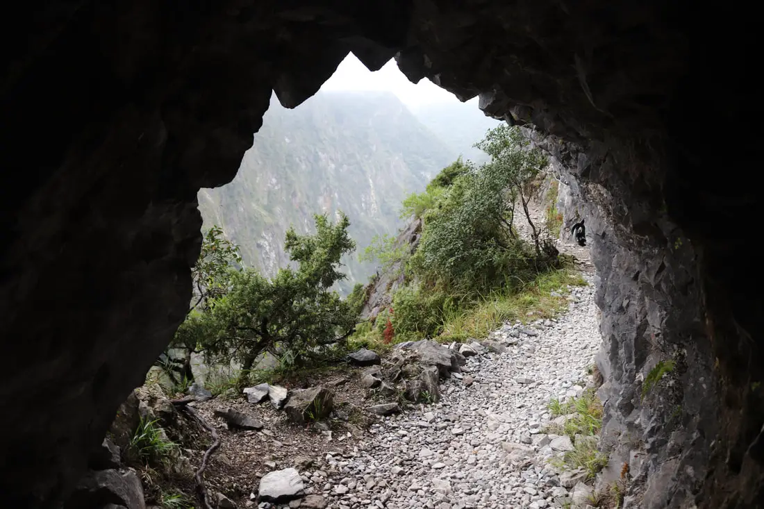
View out the tunnel of the trail.
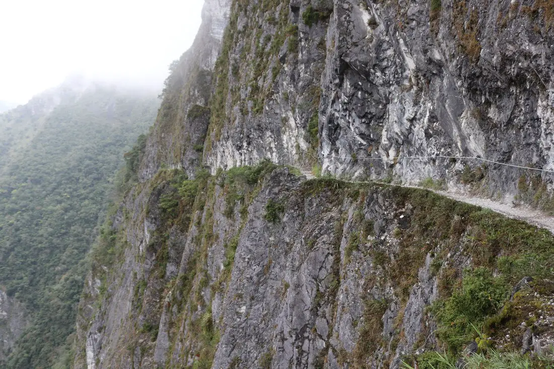
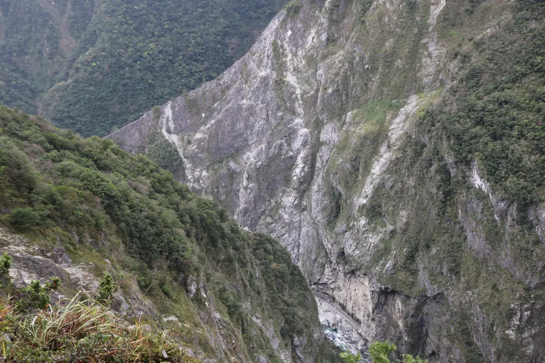
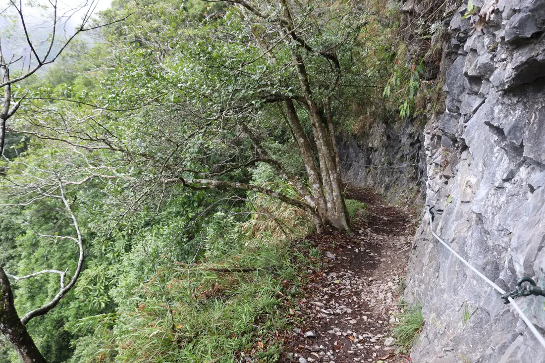
View of the crazy trail carved into a marble cliff.
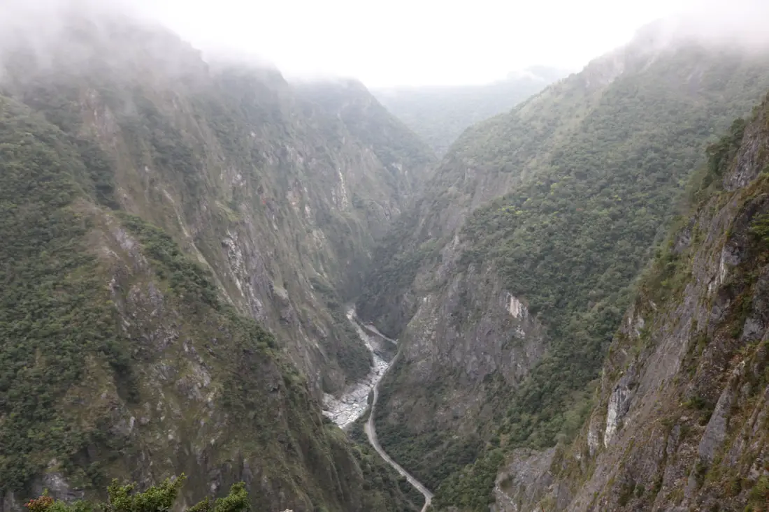
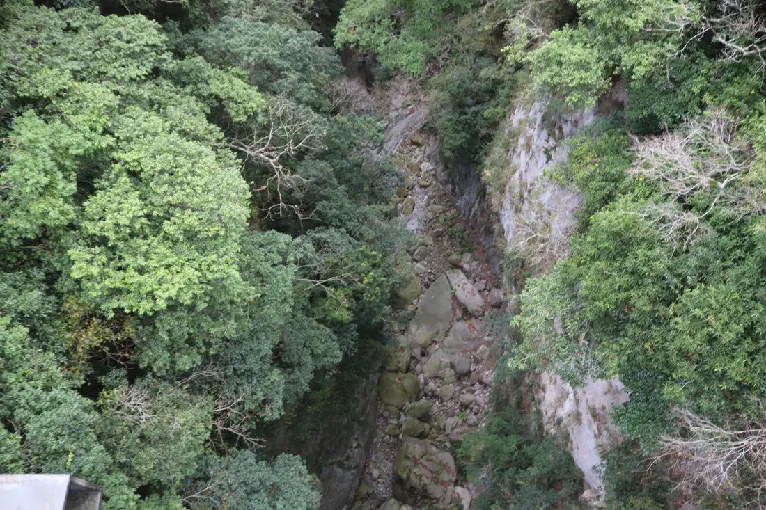
View into the gorge.
View to the left.
View down into the gorge.
another view looking up the gorge.
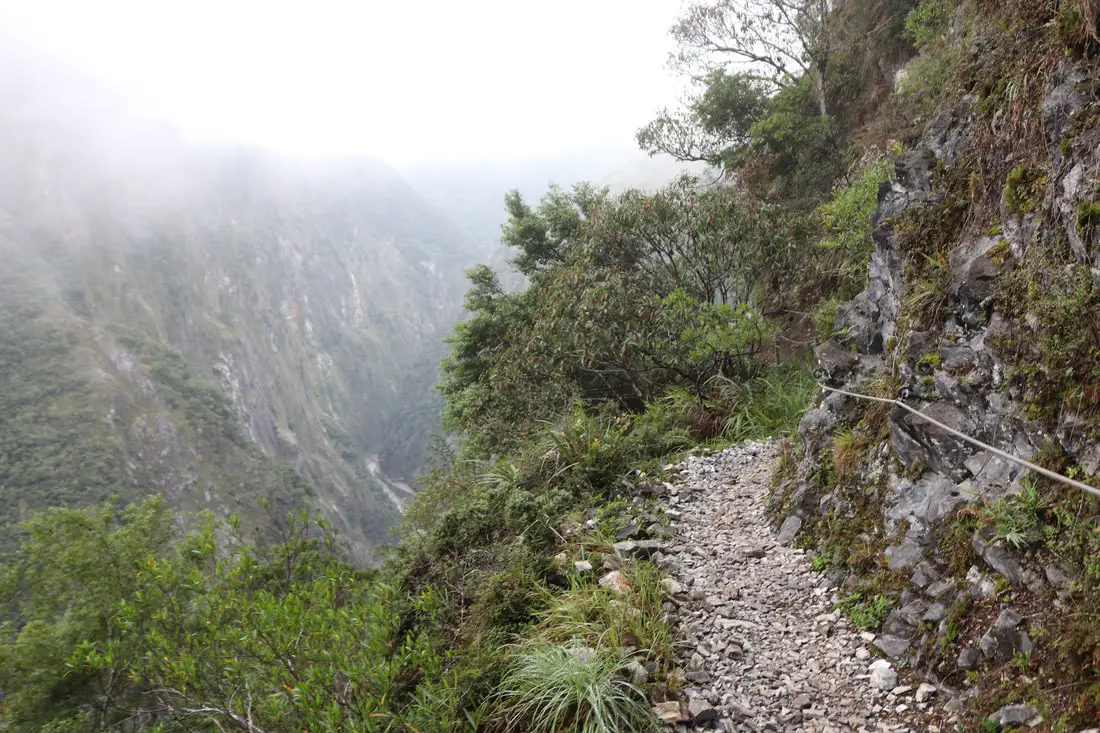
8:26 AM: After a failed attempt to fly the drone, I reached bridge number three on the Zhuilu Cliffs. I guess this is a washed out section of the trail.
Another view further down the trail.
8:28 AM: reached the end of the trail. I think this is at about 3K. I didn't go any further than this because I didn't want to do more forest hiking, and most of the rest of the trail is blocked off anyway. I came to see the Zhuilu Cliffs.
I missed seeing the Zhuilu Cliff Outpost, so if you want to know what it looks like, you should go yourself! 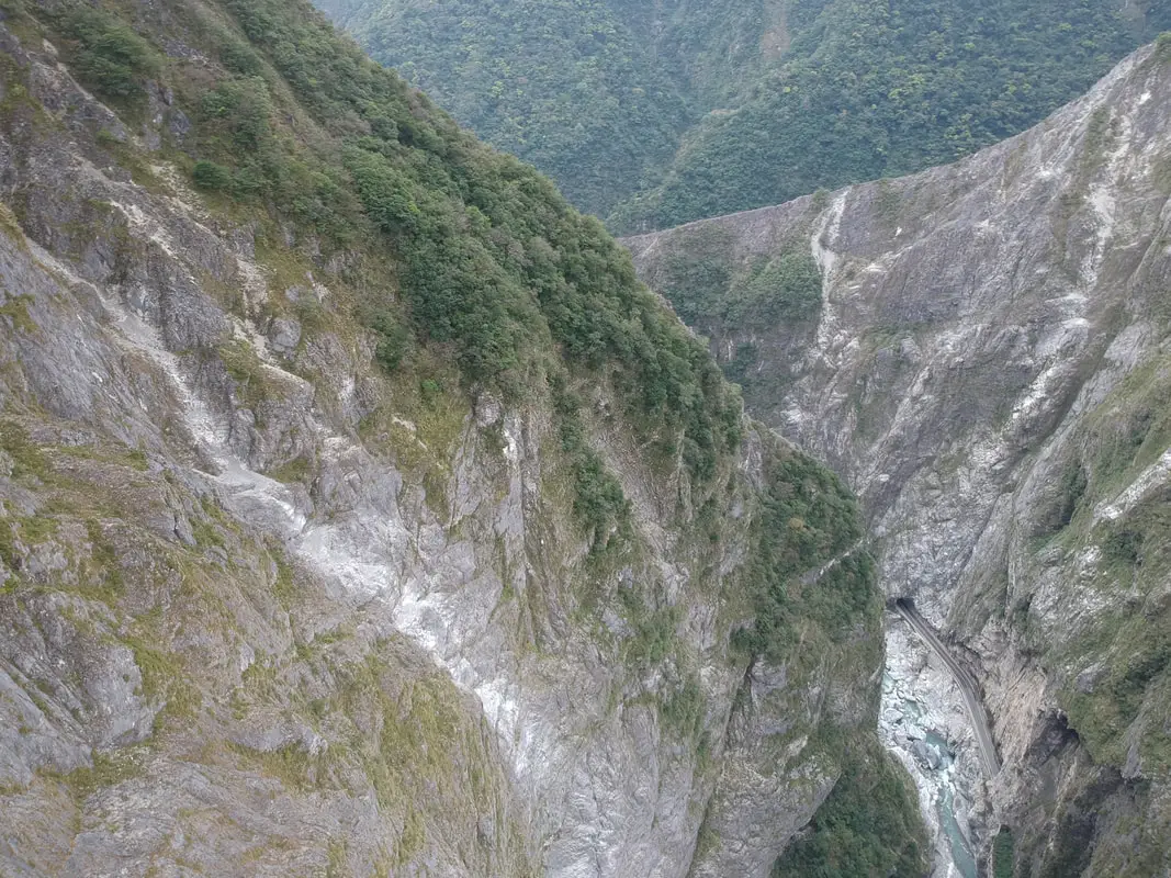
Looking at the cliffs via drone. It is here at the end of the cliff that I started flying. I didn't have a good signal, and I learned it was because I had my blue tooth on my phone turned on. So there was major lag, but I got some decent shots even if they were not the best.
Pro tip: if you want a strong drone signal, put your phone in airplane mode and just turn on Wifi. 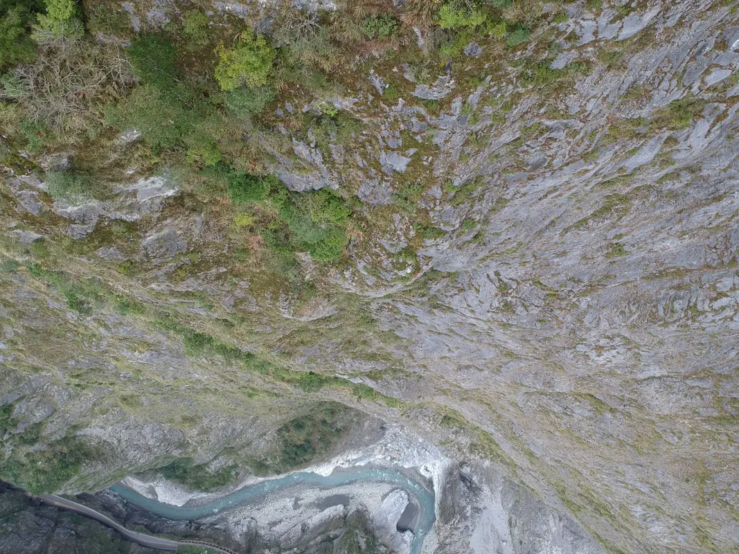
Another view looking down the cliff via drone.
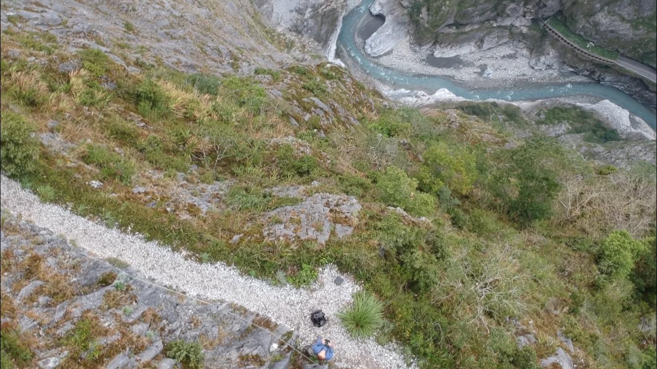
View of me on the trail via drone.
Above you can see a 360 view of the Zhuilu Old Trail in the context of Taroko Gorge. This is the pinnacle of my trip, by far the best photo. I'm glad it turned out; there was no rain, basically no fog, and enough signal to pull this one off.
Hiking Back
8:46 AM: starting the way back down. Walking back on the same trail is not that bad because you get to see amazing views again from a different angle.
View of the trail coming back.
This section of the trail has part of the cliff overhanging.
View of the gorge from right near the edge. A fall here would kill you.
Coming back with a big ledge overhanging.
You have read the blog this far, so here is a Easter egg profile of my person, which I rarely share because the focus of this blog is Taiwan, not any one foreigner in Taiwan. I took some selfies with my phone, and one with my camera here, but there was no one else on the cliffs the whole time I was there, so no one could take a photo for me. That's the price of coming early.
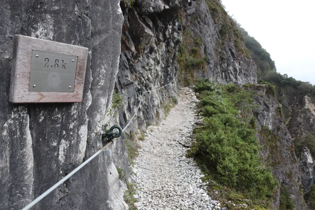
8:49 AM: 2.8K. Can't see this sign on the way there because it is at the wrong angle.
Here is the perfect photo spot, if you have someone else that can take your pictire :,(.
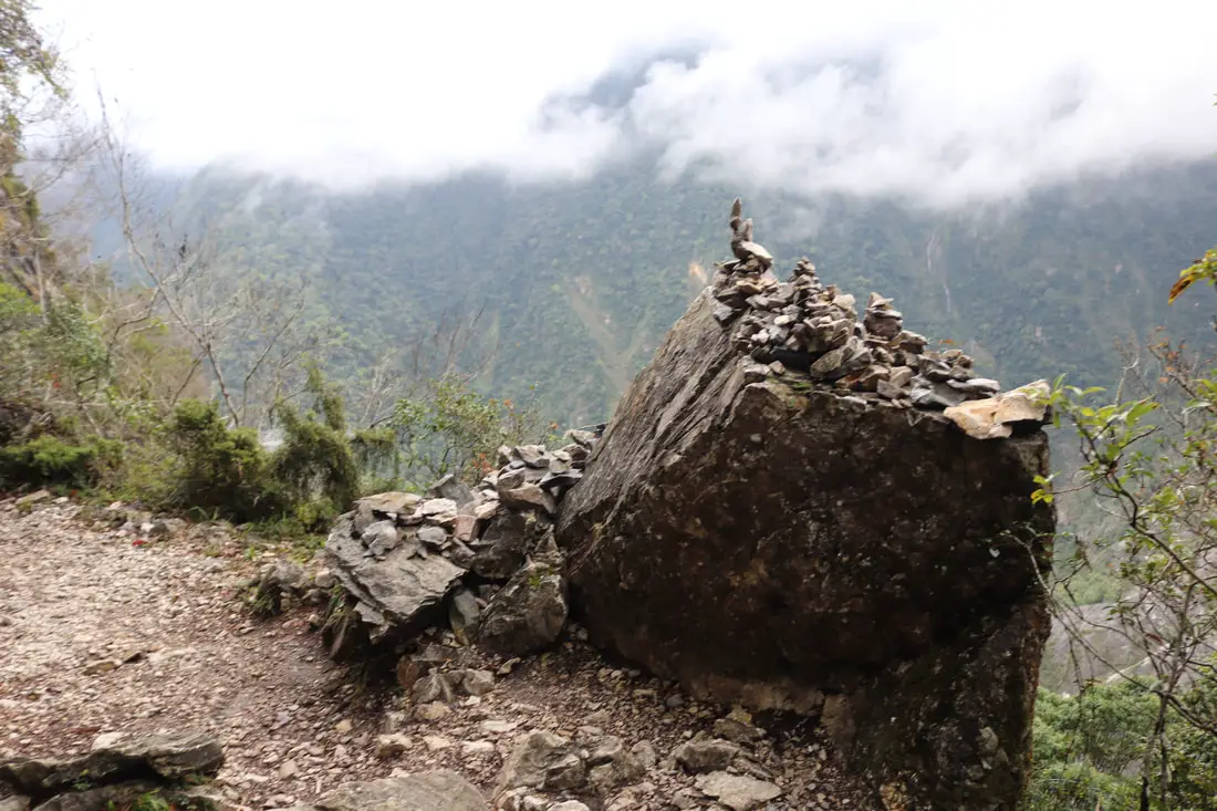
Some stones piled up near the cliff edge.
Last view of the cliffs before I go back in the forest.
9:00 AM: view of the first rock tunnel coming back the other way.
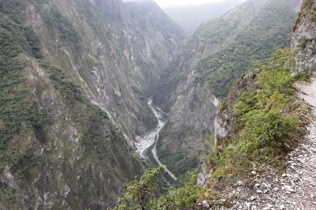
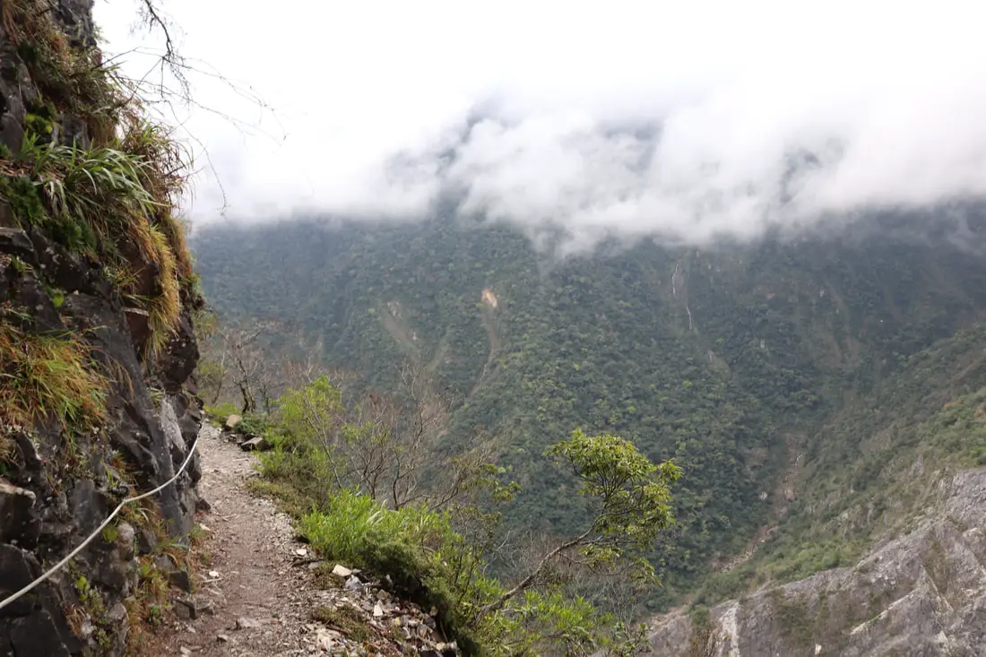
View of the gorge from the forest coming back.
9:11 AM: another view of the gorge near Badagang, my camera chose to focus on the foreground.
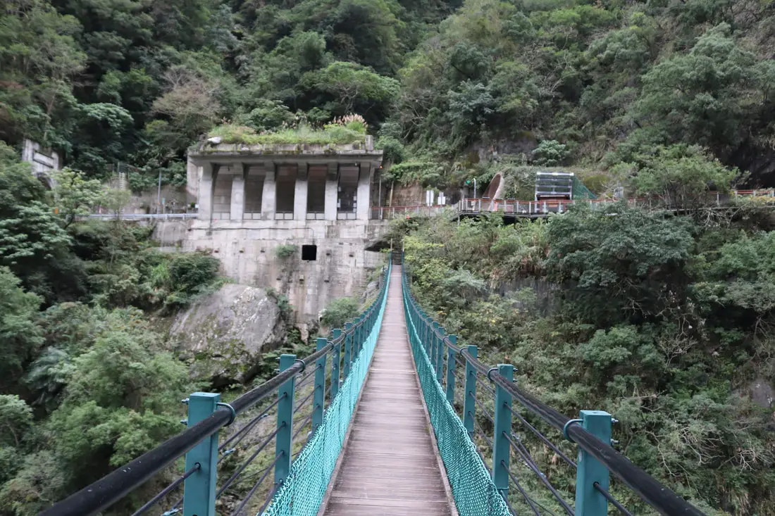
9:50 AM: back to the Zhuilu Suspension Bridge.
9:53 AM: back to the trail entrance. When I got back up to the gate, it was locked. There was a bunch of other people rushing to check in before 10 AM, so I had to wait for the lady to finish with me before she unlocked the gate and let me out.
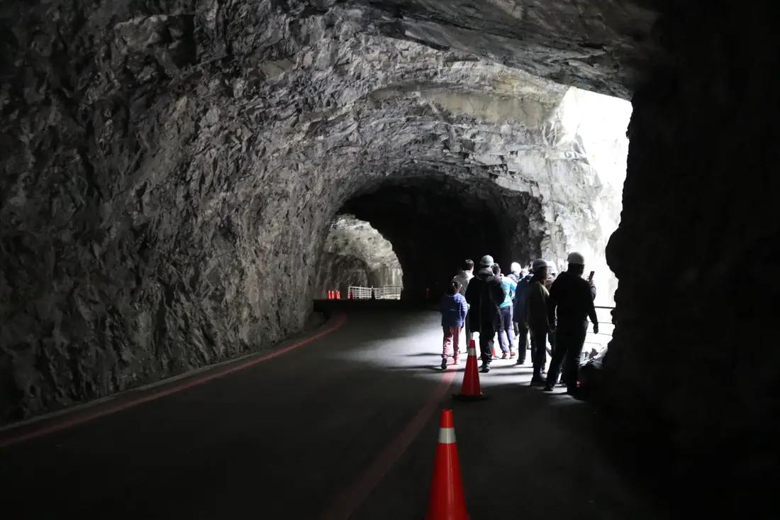
9:55 AM: Swallow Grotto tunnel coming back.
Another view of Swallow Grotto.
The full section of the Zhuilu Old Trail ends here near the Cimu Bridge (慈母橋).
There is still a sign for the Zhuilu Trail here but it is blocked off. Maybe one day when the whole 10K is open again I will go back. The other 7K involved some boulder scrambling with the help of ropes and more cliff sections.
To see what the full trail was like before part of it was closed, check outthis blog by Luomujie. After getting back to my scooter I finally drank the first water of the day, and three cold Gongzheng pork buns, my first food of the day. Yeah I carried 1.5 liters of water and 10 pork buns up the mountain for nothing. I booked it back to my hotel in Hualien and got there at about 10:40 AM. I took a shower, charged my drone, and we checked out right on time at 11:30 AM that day. After hiking this trail, I have a much deeper appreciation for Taroko Gorge. It truly is one of the most beautiful places in Taiwan. I love it almost as much as Maolin, my favorite place in Taiwan, which is also a mountain area. You can book a tour of Zhuilu Old Trail on Klook here or KKday here. You can also check out our full guide to Hualien here, our full guide to Taroko Gorge here, and our full guide to Taroko National Park here. You can also check out our full travel guide to Taiwan here.
2 Comments
Evan
9/18/2023 03:05:28 am
This was amazing! Thanks so much for sharing. I'm planning on doing this hike and this was very informative!
Justin
12/9/2023 11:47:18 pm
Thank you for this informational blog post on the Zhuliu Old Trail, the photos are very helpful. Your comment will be posted after it is approved.
Leave a Reply. |
Author 作家I am an American expat who has extensive experience living, working, and traveling in Taiwan. In my day, I had to learn many things about Taiwan the hard way. But I have come to learn that Taiwan is one of the best places in the world for Foreigners to live. This blog does not represent the opinions of every foreigner in Taiwan. I am just trying to help others learn more about this beautiful country. Categories
|
 RSS Feed
