

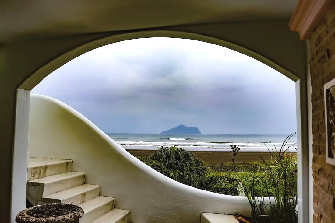
Toucheng Township in Yilan is known for its amazing beaches, but there is much more to do here, such as visit Lanyang Museum, visit Turtle Island, enjoy seafood, traditional fishing harbors, recreational farms, hiking, cycling, surfing lessons, and much more. Here is a short guide to Toucheng, to let you know the variety of activities that you can enjoy here.
Background: Before Chinese settlers came, the area around Toucheng was inhabited by the Ketagalan Aboriginal tribe, whose language is now extinct. The name Toucheng literally means "first town" in Chinese, because it was the first settlement in Yilan, settled in the late 1700s. With the nearby Wushih and Touwei Harbors around the same time, it became the economic focal point of Yilan. However in the late 1800s and early 1900s Wushih Harbor and Touwei Harbor silted in, reducing their function. With the advent of the Japanese built Yilan railway line in the mid-1900's, as well as constant floods and continually silting of the harbors, Toucheng quickly lost its importance economically and fell into decay. After residents of Turtle Island were relocated to Daxi in Toucheng, Daxi Harbor was expanded and has become one of the largest fishing harbors in the area. Due to its close proximity to Taipei, Toucheng has become a major tourist area and may be the most popular surfing location in Taiwan. Tours and Activities: You can purchase tours and tickets for many activities in Yilan such as Su'ao Crayon Castle, Taipingshan, Turtle Island, Lanyang Museum, Toucheng Leisure Farm, Zhang Mei Ama Capybura Farm, Bambi Land, Yinong Ranch, National Center for Traditional Arts, Taxi Museum, Glamping, Camping, ATV / 4-wheeling experience, SUP / paddle boarding, Ximeng Forest Theater, Surfing, Kayaking, Horse Riding, River Tracing, River Rafting, River Tubing, Pack Rafting, Water Biking, Snorkeling, Canoeing, Shrimping and many others through Klook here or KKday here. Accommodation: Looking for a hotel? We recommend booking through Agoda here, which provides the best quality selection of accommodation on the islands. We have stayed at and recommend Ying Shih Guest House, a resort in Datong Township near Taipingshan and Fan Fan Hot Spring (you can book on Agoda here or Booking.com here), and Jiaosi Hotspring Hotel, a hotel with hot springs in each room (you can book on Agoda here, Booking.com here, Hotels.com here, Expedia here, or Trip.com here). We have also stayed at Toucheng Leisure Farm, a recreational farm and experience center in Toucheng (you can book on Agoda here, Booking.com here, Hotels.com here, Expedia here, on Klook here, or on Trip.com here). You can also book Wifi and SIM cards for Taiwan on Gigago here. Need travel insurance? Compare prices on Insubuy here. Just to let you know, if you book using the links above, we get some commission at no cost to you, and you can help support our blog. You can click here to receive $5 USD on your first Klook purchase. How to get there: By TRA: Take the TRA to any of the stations in Toucheng. You can book tickets to travel to Yilan via inter-city bus on Klook here. You can book tickets to Yialn via high speed rail (HSR) on Klook here or KKDay here. Book tickets via the normal train (TRA) on Klook here. Bicycle rental: Cycling is the best way to enjoy Taiwan's landscapes if you have the time and energy. Looking for bicycle rentals in Taiwan? You can search on KKday here and search for tours on Klook here. You can also check out our Taiwan cycling guide here. By Car: From Taipei, take National Freeway 5 to Toucheng. Be careful to note that on Sundays there are highway controls for cars travelling from Yilan to Taipei from 3 PM to 8 PM, so avoid travelling back to Taipei at that time to beat the traffic. Looking for scooter rental in Yilan? You can search Klook here or KKday here to look for options. You can also check out our scooter rental guide here. If you are looking for car rentals in Yilan, you can also search Klook here or KKDay here. You can also check out our car rental guide here. Map: See below for a map of places that are covered in this blog:
0 Comments
Qijin Island (aka Cijin Island or Chijin Island) has one of the most accessible sandy beaches to any urban area in Taiwan. Besides the nearly 10 Km stretch of sandy shores, the island also has an old street with tasty snacks, a seafood market, a lighthouse, an ancient fort, a star tunnel, a shell museum, and much more. It is one of the most popular destinations in Kaohsiung and definitely worth a trip.
Background: Qijin Island was first settled by a Chinese fisherman named Hsu Ah-hua (徐阿華) in the 1600's, discovered after he took shelter there during a typhoon. He brought many families with him from Fujian to settle there. They created the first Mazu temple there, Chi Jin Mazu Temple in 1673. The lighthouse dates from 1883 and was built in the English style. The fort on the hill to the north of the Island was completed in 1875 during the Qing dynasty. After WWII, Qijin was made a district of Kaohsiung City. In 1979, Taiping Island and Dongsha Island were added under the district's administration. Qijin Island used to be a sandbar peninsula, but was separated from mainland Taiwan at its southern tip to make a second entrance into Kaohsiung Harbor in 1967. There were plans for a cross harbor gondola but they were scrapped due to the height needed to cover the harbor. Price: Passenger ferry crossing: 40 NT Bicycle ferry crossing: 50 NT Motorcycle ferry crossing: 80 NT Showers: Free! Hours: 24/7 Tours: You can find more tours and activities in Kaohsiung such as Pier 2, Meinong Hakka Museum, Hamasen Railway Museum, Suzuka Circuit Park, i-Ride Kaohsiung Visual 5D Flying Theater, National Science and Technology Museum , Senya Village Restaruant, Austin Land, Ski School Indoor Ski Slope, and many more on Klook here or KKday here. Just to let you know, if you book using the links above, we get some commission at no cost to you, and you can help support our blog. You can click here to receive $5 USD on your first Klook purchase. Accommodation We have stayed at and recommend Chao She Hotel (you can book on Agoda here, Booking.com here, Hotels.com here, or Expedia here) IHI Sanduo Travel Hotel (you can book on Agoda here, Booking.com here, Hotels.com here, or Expedia here), and Mingli Hotel (you can book on Agoda here, Klook here, or Hotels.com here) which are three inexpensive and high quality choices in downtown Kaohsiung. I also have stayed at and recommend Kaohsiung Meinong Rabbit Paul Homestay B&B (you can book on Agoda here, Booking.com here, or Trip.com here), a quiet B&B in rural Meinong, and Chengching Lakeside Resort (you can book on Agoda here, Booking.com or Trip.com here)and the Grand Hotel Kaohsiung (you can book on Agoda here, Booking.com here, Hotels.com here, or Expedia here) which both offer breakfast buffet and free entrance into Chenqing Lake Park. I have also stayed at the 85 sky tower which offers great views of the city; you can search for rooms in the 85 sky tower on Agoda here, Booking.com here, Hotels.com here, Expedia here, or Trip.com here). Find out more about where to stay in our Taiwan hotels guide or search for the best hotel deals in Taiwan here. We recommend booking through Agoda here, which provides the best quality selection of accommodation on the islands. You can also book Wifi and SIM cards for Taiwan on Gigago here. Need travel insurance? Compare prices on Insubuy here. How to get there: By Passenger Ferry: Ferry's leave from Gushan near Xiziwan MRT station about every 10 minutes 24/7 (every half hour at after midnight). Or there is also another passenger ferry in Qianzhen that connects with Zhong Zhou Ferry Terminal. The gates are only open in the early morning and in the afternoon as noted above. You can book tickets to travel to Kaohsiung via inter-city bus on Klook here. You can book tickets to Kaohsiung via high speed rail (HSR) on Klook here or KKDay here. Book tickets via the normal train (TRA) on Klook here. You can also book a Kaohsiung Travel pass here. By Car/Scooter: Take the underwater tunnel on the south side of the island. Scooters can cross, but not bicycles. Looking for scooter rental in Kaohsiung? You can check out Klook here or KKday here to search for options. You can check also out our scooter rental guide here. If you are looking for car rentals, you can search Qeeq here, KKday here, or Klook here. You can also check out our car rental guide here. Map: Please see below for the places we will cover in this blog: 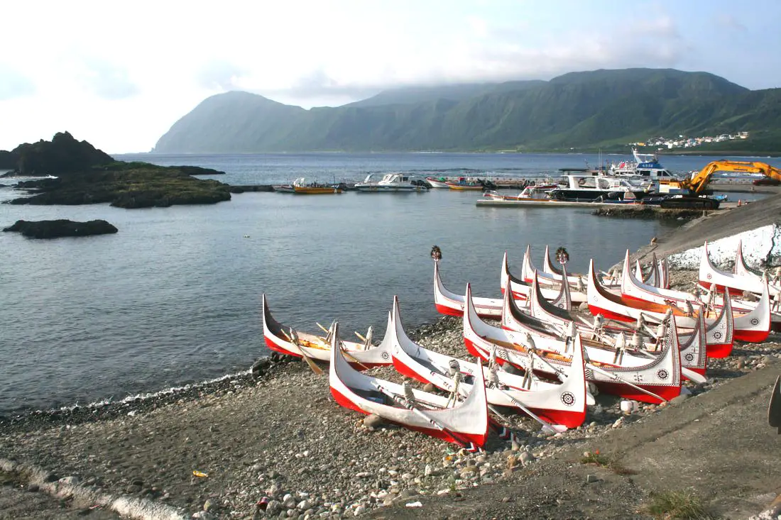
Orchid Island (not to be confused with the Fijian Island of the same name), known in the local Tao language as Ponso No Tao (Island of the people), and in Chinese as Lanyu (蘭嶼) is a secret indigenous people's paradise off the southeastern coast of Taiwan. It is different than any other place in Taiwan, and has the best preserved indigenous culture anywhere in the country. If Taiwan's best tourist activity is experiencing the culture of Taiwan's indigenous peoples, then Lanyu has the best tourist experience anywhere in Taiwan.
Background: History: Orchid Island became inhabited about 800 years ago by the Tao indigenous people (達悟族) (aka Yami people 雅美族, which is a name coined by the Japanese, but the native people prefer Tao), which are thought to have traveled from the Batanes Islands in the Philippines, which are a little less than 200 KM away, cut off by the Bashi Channel. However, Orchid Island is very different than the Philippines. Beginning in1644, some Dutch Sailors were sent to investigate the island, and some settled there among the natives. Because of this, the Island was known as Red Head Island (紅頭嶼) by the Chinese and the Japanese. After the Dutch were defeated in Taiwan, Lanyu was claimed but not controlled by the Qing Dynasty. The Japanese claimed the Island shortly after the Sino-Japanese War in 1895, but protected it as an "ethnological research site" and forbid outsiders from entering. After the Republic of China took over Taiwan following the end of WWII, they continued to ban visitors to the island until 1967, after which tourists were allowed to enter and public schools were built there. Christian missionaries began preaching and living on the island starting in the 1950s, and now basically all native people on the island are Christian (mixed with traditional beliefs). However Christianity was introduced much earlier starting with the Dutch in the 1600s although to a lesser extent. In 1982 a nuclear waste storage plant was built on the south side of the Island without the islanders' consent, causing protests from the inhabitants. Also because of this, the Island inhabitants receive free electricity. The island is volcanic in nature, with the last major eruption being over 5 million years ago. The highest mountain is 552 meters (1,811 feet). Currently there are 2,400 people permanently living on the island, 90% of them being of native Tao descent. Tao Culture: The Tao people number about 2,000 living on Orchid Island, with about another 2,000 living on the Taiwan mainland. The Tao people rely on the sea for survival, and much of their traditions and lifestyle are centered on fishing. The Tao people are mostly Christian but also still practice many of their traditional beliefs. However their ancestral religion included a pantheon of Gods. Traditional roles for men are fishing while roles for women include harvesting taro and sweet potato and weaving. The men usually fish at night or early morning and rest on traditional wooden platforms during the day. Boats are made from planks of wood and are painted red, white, and black. The boat usually has human figures, waves, and the traditional sun image (red and black circles and sun rays) which is said to warn off evil spirits. Boats are considered sacred and the ultimate human creation. There is also a launching ceremony for new boats in which traditional clothes and headgear (such as silver helmets for men and wooden hats for women) are worn, pigs are slaughtered, and the boat is lifted into the air multiple times before being set in the water. Traditional clothes include loin cloths and vests for men, and aprons and vests for women. Young people on the street usually do not wear traditional dress. Flying Fish Festival: There are three basic seasons on Lanyu: one is the flying fish season when flying fish can be easily caught and used and lasts from February to May. The other seasons are from May to October and October to February, when flying fish cannot be caught for ceremonial use. There are many taboos during flying fish season which are discussed below. The Flying Fish Festival lasts from aboutMarch to October when flying fish are caught. During this time many ceremonies take place such as for the beginning of the festival, plentiful harvest, etc. During the festival, there are multiple migrations of flying fish species near Lanyu. There are many taboos during this time, especially when it comes to catching and eating flying fish which are the main life source of the Tao people. Weather and Climate: The island has a tropical rainforest climate, with average high temperatures between 20 and 30 degrees year round. The rainy months are in summer, especially due to Typhoons, but the most sunny days are also in summer (expect a lot of sun), and the most rainy days are in winter. Summer is the tourist season, but spring and fall are also popular times to visit. Winters are said to be dreary, cold, and have constant northeastern winds that can stop airplanes and ferries from departing to the island. When to go: The best time to go they say is around May when it is not too hot and there are no northeasterly winds or typhoons which can cancel your transportation to the island. Typhoon season lasts from around June to October. The busy season is during summer break from June to August, during which time it can be hard to book a hostel or airplane ticket. Winter is the less crowded season, but the water will be cold, there will be constant wind (which could cancel transportation), and it will rain more often. Taboos: General Taboos:
How to get there: By Plane: You can book discount air tickets from Taipei to Taitung on KKday here. The only planes to and from Orchid Island come from Taitung. Flight times: As of the time of this blog, there were six flights per day byDaily Air Corporation from about8 AM to 4 PM (Please note their website is only in Chinese). The flight from Taitung to Lanyu takes about 25 minutes. Please note that the aircraft are small and flights can be cancelled due to high winds or unfavorable weather. Costs: NT 1428 to Lanyu and NT 1360 from Lanyu. You can purchase plane tickets through a tour agency such as Klook or a similar website. By Boat: There are two places that offer ferry rides to Lanyu: Houbihu Harbor (恆春後壁湖漁港) in Pingtung and Fugang Harbor in Taitung (臺東富岡漁港). There are also two ferry companies that operate at both harbors. Both companies leave from both harbors at the same time and arrive at the same time for the same price (2300 NT per person round trip/1150 NT per single trip). Ferry Boat costs: 2300 NT per person round trip (1150 NT per single trip)from both Taitung and Pingtung. Both ferry companies have the same price. Ferry Boat Times: 7:30/7:00 AM departure, 9:30 AM arrival to Lanyu. 12:00/12:30 PM departure, 3:00 PM arrival to Lanyu. 9:30 AM departure from Lanyu, 11:30 arrival to Taitung or Pingtung. 3:00 PM departure from Lanyu, 5:00 PM arrival to Taitung or Pingtung. Both ferry companies depart and arrive at the same time to both locations. You can purchase ferryboat tickets for a discount on Klook here or KKday here. Getting around the island: Rent a scooter! The island is small so you should not need to rent a car. You can rent bicycles but you will not be able to travel as fast. You can also hire a driver to take you on tours. Ask your hostel for more rental information. They can help you book a rental in advance. Tours: You can book multiple tours and activities such as a Tribal Tour, Underground House Tour, day hiking, night hiking, snorkeling, scuba Diving, SUPing / Paddle Boarding, and Freediving. You can search for more tours through Klook here or KKday here. Scooter Rental: Price: expect 500 NT per day. You can book a scooter through Klook here or KKday here. Be sure to book your rental in advance, especially during summer weekends. Ask for help from your hostel owner if needed. I am 100% percent certain you do not need a Taiwan local license to rent scooters here, however they may ask for an international license (but I'm fairly sure they will let you rent without one). Helmet wearing is not enforced at all as you will quickly find, but it's still the law. Also be careful to not hit any goats because they wander as they please. There is only one gas station next to Kaiyuan Fishing Harbor. Car Rental: Price: expect 2000 NT per day. You can rent a car for Lanyu on KKday here. Bicycle Rental: Price: Bike rental is about 400 NT per day. You can rent a bike for Lanyu on KKday here. Accommodation: Booking accommodation on the island can be difficult in summer months and on weekends, when rooms can be fully booked for months in advance. There is a nice selection of rooms on Agoda. Here is a list of every registered hostel on the island, but it is in Chinese. My hostel required that I pay for my room in advance via bank wire transfer (this may not be an option if you are a foreign traveler, so make sure they accept credit cards if you do not have a Taiwan bank account). Expect to pay 2000 - 4000 NT per night for a standard double room on Lanyu. You can also book Wifi and SIM cards for Taiwan on Gigago here. Just to let you know, if you book using the links above, we get some commission at no cost to you, and you can help support our blog. You can click here to receive $5 USD on your first Klook purchase. Map: Please see below: 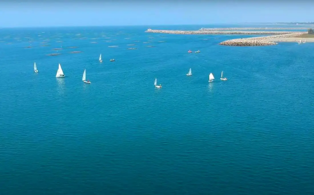
A sailing class going on off Tainan's Yuguang Island.
With over 100 islands and a coastline of over 1500 KM on the main Island, warm tropical weather, and constant winds, Taiwan is known as a world-class sailing location. Sailing in Taiwan can be an exhilarating experience that provides a unique perspective on the island’s stunning coastline and surrounding waters. With its rich history and culture, Taiwan has become a popular destination for adventure seekers and travelers looking to explore its natural beauty via sailboat.
Brief Historical Background of Sailing in Taiwan: Even though Taiwan has thousands of islands and hundreds of kilometers of coastline, it still does not have a strong sailing culture as compared to other countries. The recreational boating industry in Taiwan only really began in 2009, when the Fisheries Agency began making floating docks for more recreational craft. Those docks are now filled to capacity, so prices are on the rise and demand is high. Boat owners are hopeful that Taiwan's authorities can further expand recreational marinas in Taiwan soon. Non-powered sailing in Taiwan is regulated by the coast guard, but all you have to do is send your itinerary to the coast guard via a smartphone app. Where to Sail in Taiwan: 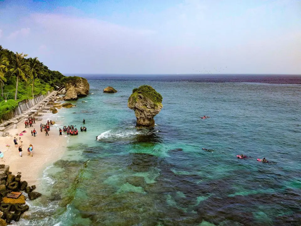
Xiaoliuqiu (aka Little Liuqiu, Lamay Island, or Lambai Island) is a small island paradise off the southwestern coast of Taiwan. The island is known for its clear water, amazing coral reefs, white sand beaches, and quiet laid back atmosphere. Only a short half hour boat ride from the Taiwan mainland, the island is easily accessible. In addition, the island is small enough that you can round the entire island by scooter in a matter of minutes.
Background: In 1622, a Dutch ship crashed on the island, two years before the Dutch began to rule Taiwan, and all but one of the crew members were killed by the aboriginal tribe living on the island at the time. In retaliation, the Dutch sent a force to massacre the natives on the island. 300 men, women, and children were suffocated alive in a large cave, and the rest of the people were put into slavery by the Dutch. This was known as the Lamey Island Massacre. Later Chinese people began inhabiting the island in 1645. Later the island fell into Qing, Japanese, and ROC rule. Currently the island is a township of Pingtung County with a population of over 10,000 people. Most of the people on the island rely on fishing and tourism for a living. The island also has one of the largest concentrations of temples in Taiwan. Xiaoliuqiu started to become a major tourist destination after 2004, reaching over 400,000 tourists per year. Regulated Inter-tidal Zones: in 2015 restrictions were placed on the inter-tidal zones in Xiaoliuqiu so that only those with a licensed guide could visit them and swimming is prohibited. These restrictions apply specifically to the Dafu Harbor inter-tidal zone (north of Dafu Harbor), Yanziping Beach, and the Shanfu Harbor Inter-tidal zone (north of Shanfu Harbor). Although there are other inter-tidal zones, these are not regulated. When to go: Anytime! Xiaoliuqiu is a tropical island that has warm water and temperatures (above 25 degrees Celsius) year round. However it is a little cooler and more windy during the winter, and you should be sure to avoid Typhoons during summer (ferries will be cancelled if there is a Typhoon). However, it can get really crowded during summer break in July-August, so go during the off-season to avoid the crowds. Tours: You can book multiple tours such as snorkeling, scuba diving, SUP experience, Kayak Sailing, submarine ride, and more through Klook or KKday, such as the Xiaoliuqiu Experience Pass. Booking a hotel: Booking accommodation on the island can be difficult in summer months and on weekends, when rooms can be fully booked for months in advance. Some places we have stayed at that I recommend are Yujing 6.8, which is a four story house near Dafu Harbor (you can book on Agoda here or Booking.com here), Boliu B&B (柏琉民宿) which is also a nice newly renovated hostel right on the main street near lots of restaurants (you can book on Agoda here or Booking.com here), Haichan Hostel which is a traditional three-sided Taiwanese mansion near the beach (you can book on Agoda here or Booking.com here), and Baisha Bay B&B which is a great place near the main harbor that is only one story so there are no stairs (you can book on Agoda here or Booking.com here). All of the owners of these places were very helpful, and even helped me to move my luggage and rent scooters. Some hostels require that you pay for my room in advance via bank wire transfer (this may not be an option if you are a foreign traveler, so make sure they accept credit cards if you do not have a Taiwan bank account), but you should not have to do this if you book through Agoda or another hotel booking site. Looking for a hotel? Find out where to stay in our Taiwan hotels guide or search for the best hotel deals in Taiwan here. You can also book Wifi and SIM cards for Taiwan on Gigago here. Need travel insurance? Compare prices on Insubuy here. Just to let you know, if you book using the links above, we get some commission at no cost to you, and you can help support our blog. You can click here to receive $5 USD on your first Klook purchase. How to get there: The only way to get there is via ferry from Donggang's Dongliu Ferry Terminal. The ferry ride takes about 30 minutes. There is a ferry leaving from Donggang roughly every hour from 7 AM to 5 PM. You can purchase a tickets at Donggang Fishing Harbor (東港漁港), or through a tour agency such as Klook here or here, or KKday. Parking: There is free scooter parking and paid car parking at the fishing harbor (30 NT per car), but the fishing harbor does not allow overnight parking. Overnight parking near the fishing harbor can cost up to 180 NT per day, so consider parking further away if you want to save money on parking. Public transport: There are many shuttles to and from Zuoying HSR station that leave hourly. The cost is about 200-300 NT per trip. You can book discounted HSR tickets on Klook here. You can book a shuttle from Zuoying to Donggang on Klook here. Scooter Rental: Price: expect 300-400 NT per day. You can book a scooter through Klook here or KKday here. You can also check out our scooter rental guide here. Be sure to book your rental in advance, especially during summer weekends. Ask for help from your hostel owner if needed. Helmet wearing is not very much enforced, but it's still the law, and you should definitely wear one for your own safety. Bicycle Rental: Looking for bicycle rentals in Taiwan? You can search on KKday here and search for tours on Klook here. You can also check out our Taiwan cycling guide here. Price: Ferry ride: about 410 NT per round trip, about 30 minutes. The public ferry goes to Dafu Fishing Harbor (大福漁港), and private ferries go to Baishawei Fishing Harbor (白沙尾漁港). There are ferries that leave at least hourly from about 8 AM to 5:00 PM. Scooter rental: about 300 NT per day. There is a gas station on the back side of the island. Snorkeling: about 300 NT per hour Scuba diving: around 2500 NT for 2-3 hours SUP experience: About 1000 NT for half a day. Kayak Sailing experience: about 2000 NT for 2 hours. Submarine adventure: about 2000 NT. You can purchase a tickets at Donggang Fishing Harbor (東港漁港), or through a tour agency such as Klook here or here, or KKday. Map: Please see below: 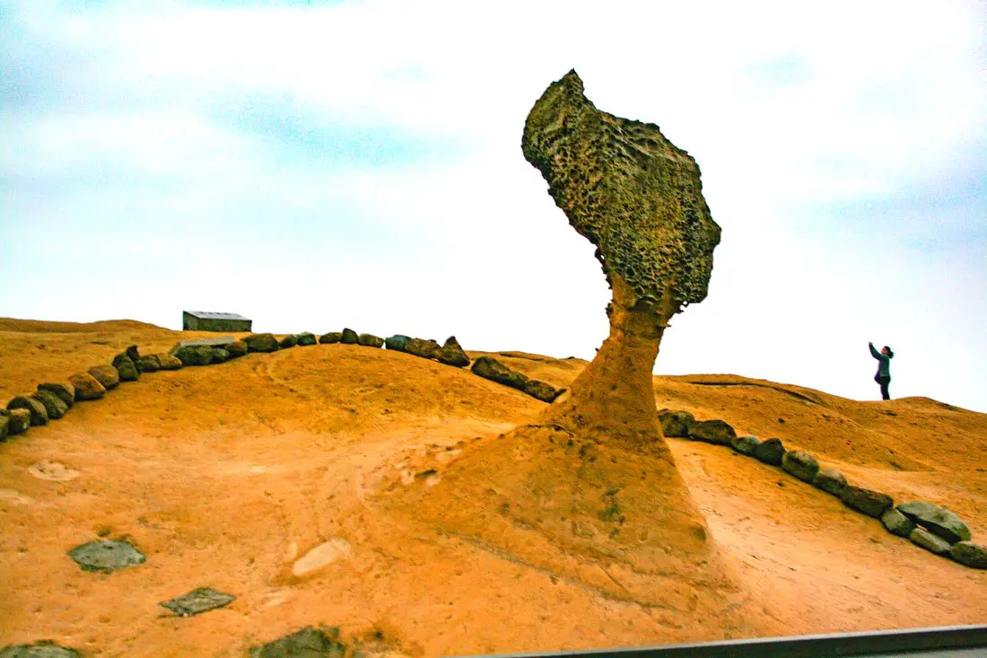
Taiwan's northern coast is an amazing, beautiful area with unique geology and rocks, lots of sandy beaches, amazing mountain views and hikes, old streets, night markets, historical sites, and much more to discover. Don't not come here.
Brief Historical Background: The sandstone that forms Northern Taiwan was created between 10 and 20 million years ago and was pushed out of the sea along with northern Taiwan thousands of years ago. Sediment under the ocean millions of years ago was uplifted thanks to the collision of the Eurasian and Philipine plates. The rocks have then been slowly eroded away by wind and water, creating odd shapes that you see today. You can see similar formations at Yehliu Geopark. What is now Keelung and Taipei was once part of Basay aborigine lands. The area around Yilan was inhabited by the Ketagalan Aboriginal tribe, whose language is now extinct. The name Yilan comes from this language. Chinese settlers from Fujian began living in the Taipei Basin during the Dutch rule in the 1600s. Keelung was first settled by the Spanish in 1626, as their first settlement in what became their rule of northern Taiwan until they were defeated by the Dutch and left Taiwan in 1642. The Qing Dynasty then ruled western Taiwan starting from the late 1600s. The capital of Taiwan was moved to Tainan. In 1891, the first train connecting Keelung and Taipei was completed. During this time, the Qing Dynasty built many forts near Keelung in response to the Opium Wars and the Sino-French War. During the Japanese Era, the capital of Taiwan was moved to Taipei and a round-island railway was completed. Currently a High-Speed Rail extension is planned for Yilan, and is expected to be completed by 2036. The northern coast of Taiwan is a popular weekend destination for the nearly 8 million people who live in the greater Taipei area. Basic Taiwan Travel Tips:
When should you go to Taiwan's Northern Coast? In my opinion, the best weather in Taipei is from March-May, and October - November, when the temperatures stay around 26 degrees Celsius and there is not as much rain. Summers are also nice, with the most sunny weather, but also hot and rainy. Winters can be cold (but not below freezing) and usually wet. Overall, there is no wrong answer as to what time of year you should visit Taipei. You will have a great time here at any time of year. Hotels on Taiwan's Northern Coast: We recommend Fullon Hotel which has locations in Tamsui and Fulong near the beach (book on Booking.com here, Tripadvisor here, Agoda here, or Hotels.com here). We have stayed at and recommend Gold Mountain Ranch, which is a horse ranch and glamping destination in Jinshan. You can book a night at Gold Mountain Ranch on Klook here. You can also check out our full blog on the ranch here. We have also stayed at and recommend Hai Xia Your Home which is right in front of Fulong Beach (book on Booking.com here, Tripadvisor here, Agoda here, or Hotels.com here). Looking for a hotel? We recommend booking through Booking.com here, which provides the best quality selection of accommodation in Taiwan. Find out where to stay in our Taiwan hotels guide or search for the best hotel deals in Taiwan here. Tours of Taiwan's Northern Coast: There are many tour itineraries that you can enjoy along Taiwan's Northern Coast that will take you to multiple destinations and arrange transportation. For more information, you can check out Tripadvisor here, KKday here, or Klook here, which are both great tour websites that can connect you with the right tour and tour guide for you. Here are some of the most popular tours of Taipei on Tripadvisor:
You can book a customized tour of Taiwan's North Coast on TripAdvisor here, Klook here, or KKday here. Attractions along Taiwan's Northern Coast: There are many attractions that you can enjoy along Taiwan's Northern Coast such as Yehliu Ocean World, Yehliu Geopark, National Museum of Marine Science and Biology, Heping Island Park, Ju Ming Museum, New Taipei Gold Museum, Futian Leisure Farm, Fort San Domingo, 13 Levels Archaeology Museum, Bat Cave, Candlestick Islet, Activities along Taiwan's Northern Coast: Don't forget that there are many activities available along Taiwan's Northern Coast such as Wakeboarding, Surfing, Speedboat Surfing, SUP / Paddle Boarding, Diving, Snorkeling Kayaking, Canoeing, Water Biking, River Tracing / Canyoneering, ATVing, Horse Riding, Archery, Tree Climbing, Glamping, Motorcycling, Motorbike Tour, Dragon Boat Racing, Shen'ao Rail Bike, and more on Tripadvisor here, Klook here, or KKday here. Just to let you know, if you book using the links above, we get some commission at no cost to you, and you can help support our blog. Some of the Klook links may not work if you are using an Ad blocker. You can click here to receive $5 USD on your first Klook purchase. How to get there: The only way to get to Taiwan is via airplane. Planes leave daily from Taipei's Songshan and Toayuan Airport. Taoyuan Airport: Taoyuan is Taiwan's largest airport and typically has cheaper flights and more flight times to choose from. It's about an hour's journey from Taoyuan Airport to the center of Taipei. You can travel via MRT, HSR, bus, or taxi to get to Taipei. You can get 30% off the Taoyuan Airport VIP lounge on KKday here. Songshan Airport: Songshan is a small airport in Taipei's city center, and can be a convenient option for people traveling within Asia. The airport is right on the Taipei MRT brown line. You can book cheap flights to Taiwan on KKday here, Trip.com here, CheapO Air here, or Kiwi here. How to get around Taiwan's Northern Coast: Northern Taiwan's transportation system is convenient and safe. There are many options you can consider to get around along Taiwan's Northern Coast below: By Train: Gets you to Keelung, Fulong, and Yilan along the north and east parts of the North Coast. Book tickets via the normal train (TRA) on Klook here. By MRT: (Mass Rapid Transit, Metro train, subway) – Easily gets you around Taipei and Tamsui. You can purchase a discount easy card to use on the MRT from Klook here or KKday here. You can also book an MRT travel pass on Klook here. By Bus: Buses run along the entire northeast coast, but they may be slow and there may not be many busses during weekdays. You can also book tickets to travel to Shifen via inter-city bus on Klook here. You can also book a Taipei Sightseeing: Hop On, Hop Off Open Top Bus on TripAdvisor here. By Taxi: You can take short rides for about 150 NT, or hire a Taxi for a day for around 150 USD. You can search for private chartered cars on KKDay here. By Car: If you are looking for car rentals, you can also search Qeeq here, Klook here, or KKday here. You can also check out our car rental guide here. By Scooter: Looking for scooter rental in northern Taiwan? You can search on Klook here or KKday here to search for options. You can also check out our scooter rental guide here. By Bicycle: Cycling is the best way to enjoy Taiwan's landscapes if you have the time and energy. Looking for bicycle rentals in Taiwan? You can use Taiwan's many Youbike sharing stations, or search for rentals on KKday here, and search for tours on Klook here. You can also check out our Taiwan cycling guide here. You can also book a cycling tour on TripAdvisor here. For more information, check out our Taiwan transportation guide here. Here is a map of the locations we will cover in this blog:
Taiwan's outer islands are some of the most beautiful and scenic places in the whole country, and each of them can be considered a secret paradise. You can find the best beaches, snorkeling, and diving on these islands. You can also find rich and important historical sites here. Transportation may be difficult, but you will never regret visiting Taiwan's outer islands, and no trip to Taiwan should be complete without doing it.
In this blog, we will introduce the main outer islands in Taiwan that are open to tourists (there are 166 islands in Taiwan, this blog only covers a few), point out their unique traits, and compare them to each other. This way you can best prepare for your trip to the outer islands, and at the same time know what you are missing out on. All the outer Islands are great, and I highly recommend visiting them all if you can. When to visit:
How to get there:
Where to stay: Looking for a hotel? We recommend booking through Agoda here, which provides the best quality selection of accommodation on the islands. Tours: There are many tours available on the islands, including scooter rentals, boat tickets, and other activities. For more information, book with Klook here or KKday here. Map: Please see a map of the islands covered in this blog below: 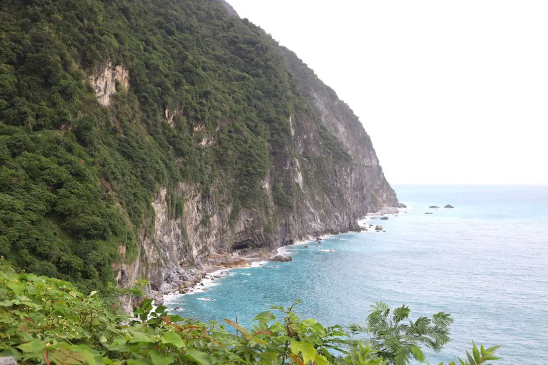
Taiwan's East Coast has the most beautiful scenery in Taiwan. From the deepest marble gorge in the world to outer islands, mountains, rivers, and huge sea cliffs, there are unmissable natural wonders for you to explore. In addition, there are endless outdoor activities and water sports that you can take part in here.
When to go: The best time to go they say is around May when it is not too hot and there are no northeasterly winds or typhoons. The typhoon season lasts from around June to October. The busy season is during summer break from June to August, during which time it can be hard to book a hostel or airplane ticket. Winter is the less crowded season, but the water will be colder, there will be constant wind (which could cancel transportation), and it will rain more often. How to get there: By Plane: Traveling to Taitung or Hualien by plane is the fastest way to get there. The trip only takes one hour from Taipei, and there are planes that leave daily through Mandarin Airlines and Uni Air. From Taitung, where you can switch to Saily Air which will take you the rest of the way to Green Island or Orchid Island. A plane ticket to Taitung takes about one hour and costs about 5000 NT per round trip. You can book discount tickets to Taitung on KKday here. By Train: The train ride from Taipei to Taitung takes 3-4 hours and costs about 800 NT one way. Book tickets via the normal train (TRA) on Klook here. By Bus: Busses leave hourly from Taipei to the East Coast. A bus from Taipei to Hualien now only takes about 2.5 hours. You can book tickets to travel to Taiwan's East Coast via inter-city bus on Klook here. By Bicycle: Cycling is the best way to enjoy Taiwan's landscapes if you have the time and energy. Looking for bicycle rentals in Taiwan? You can search on KKday here and search for tours on Klook here. You can also check out our Taiwan cycling guide here. By Car/Scooter: From Taipei, a car ride to Taitung takes about six hours, and a scooter ride takes about eight hours. You can rent a scooter on Klook or KKday. Scooter rental is about 300 NT per day. You can check out our scooter rental guide here. You can also rent a car for about 1500 NT per day. You can rent a car on Qeeq here or Klook here. You can hire a driver or taxi, and you can charter a car here. You can check out our car rental guide here. Tours: There are many tours and activities available on Taiwan's East Coast such as snorkeling, diving, SUPing, Surfing, Speed Boating, Glamping, River tracing, Paragliding, Kayaking, Canoeing, River Tracing, River Rafting, River Tubing, Pack Rafting, Whale Watching, ATV / 4-wheeling, Paintballing, Water Biking, Glamping, Cycling, Ziplining, Horse Riding, and many others, which you canbook through Klook here or KKday here. Accommodation: Looking for a hotel? We recommend booking through Agoda here, which provides the best quality selection of accommodation on the islands. Yilan: We have stayed at and recommend Ying Shih Guest House, a resort in Datong Township near Taipingshan and Fan Fan Hot Spring, and Jiaosi Hotspring Hotel, a hotel with hot springs in each room. We have also stayed at Toucheng Leisure Farm, a recreational farm and experience center in Toucheng (you can book on Agoda here). Hualien: We also have stayed at and recommend Dream Taiwan Homestay (Agoda / Booking.com), a high quality hostel for the money in downtown Hualien, Farglory Hotel (Agoda / Booking.com), right next to Farglory Ocean Park with amazing views of Hualien, and Goldenflower B&B (Agoda / Booking.com) in Yuli right next to Sixty Stone Mountain. You can find out where to stay in our Taiwan hotels guide or search for the best hotel deals in Taiwan here. Taitung: We have stayed at and recommend the Papago International Resort in Chishang, which is a five star hotel with private villas with pools for each room, and Mountain and Ocean B & B in Taimali, which is a quiet and affordable B&B right next to the beach. Looking for scooter rental in Taiwan? Click here or here to search for options. If you are looking for car rentals, you can also search here. You can also book Wifi and SIM cards for Taiwan on Gigago here. Just to let you know, if you book using the links above, we get some commission at no cost to you, and you can help support our blog. You can click here to receive $5 USD on your first Klook purchase. 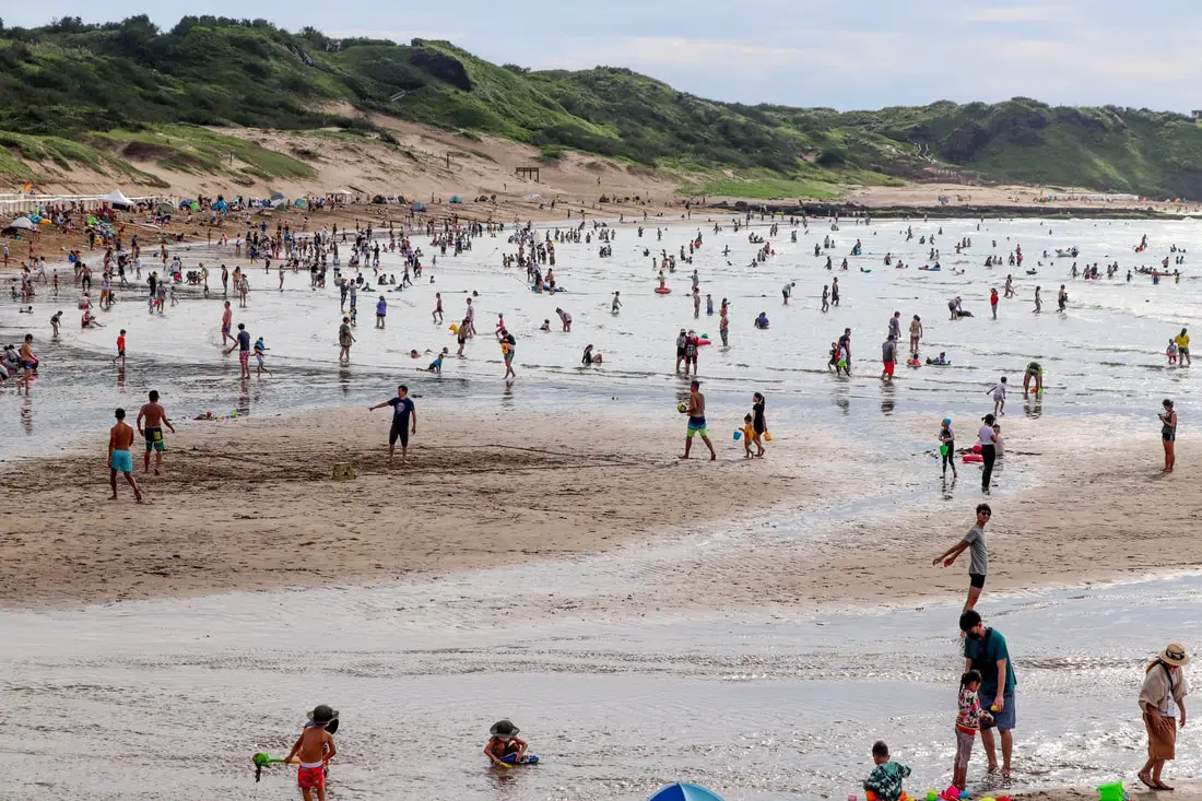
Taipei is not usually known for its beaches, but there are some great beaches just outside the city on Taiwan's Northern Coast, all within an hour's journey from the city center. Popular activities on these beaches include swimming, surfing, wind surfing, SUPing, paragliding, snorkeling, and more. Here is our guide to the very best beaches in Taipei.
When should you visit Beaches in Taipei? In my opinion, the best beach weather in Taipei is from April-November, when the temperatures stay above 26 degrees Celsius. Summer is the best time to go when it is hottest and taking in the dip in the ocean is the most refreshing. Winters can be cold (but not below freezing) and usually wet, but you can still enjoy the beaches or surfing in a wet suit. Hotels Near Beaches Taipei: We recommend Fullon Hotel which has locations in Tamsui and Fulong near the beach (book on Booking.com here, Tripadvisor here, Agoda here, or Hotels.com here). We have also stayed at and recommend Hai Xia Your Home which is right in front of Fulong Beach (book on Booking.com here, Tripadvisor here, Agoda here, or Hotels.com here). Looking for a hotel? We recommend booking through Booking.com here, which provides the best quality selection of accommodation in Taiwan. Find out where to stay in our Taiwan hotels guide or search for the best hotel deals in Taiwan here. Safety and Etiquette at Beaches Taipei: Taiwan has a unique beach culture that may be different than other countries. Please be aware of the following general information:
Tours in Taipei: There are many tour itineraries that you can enjoy in Taipei that will take you to multiple destinations and arrange transportation. For more information, you can check out Tripadvisor here, KKday here or Klook here, which are both great tour websites that can connect you with the right tour and tour guide for you. Here are some of the post popular tours of Taipei on Tripadvisor:
Water and Beach Activities in Taipei: Hiking, Wakeboarding, Surfing, Speedboat Surfing, SUP / Paddle Boarding, Diving, Snorkeling Kayaking, Canoeing, sailing, Water Biking, River Tracing / Canyoneering, River Tracing, River Rafting, River Tubing, Pack Rafting, ATVing, Horse Riding, Glamping, Motorcycling, Motorbike Tour, Dragon Boat Racing, and more on Tripadvisor here, Klook here, or KKday here. Just to let you know, if you book using the links above, we get some commission at no cost to you, and you can help support our blog. Some of the Klook links may not work if you are using an Ad blocker. You can click here to receive $5 USD on your first Klook purchase. How to get to beaches in Taipei: Taipei's transportation system is convenient and safe. There are many options you can consider to get around in Taipei below: By Train: Gets you to beaches like Hepoinh Island, Fulong, and Wai'ao. Book tickets via the normal train (TRA) on Klook here. By Bus: Buses can be tricky. Long-range buses such as Ubus and King Bus are easier to understand and cheaper than the local train. Most city buses will get you to the beaches along the north coast but it may take a while. You can also book tickets to travel to Shifen via inter-city bus on Klook here. You can also book a Taipei Sightseeing: Hop On, Hop Off Open Top Bus on TripAdvisor here. By Taxi: You can take short rides for about 150 NT, or hire/charter a Taxi for a day for around 150 USD. You can search for options on Klook here or KKday here. By Car: If you are looking for car rentals, you can also search Qeeq here, Klook here, or KKday here. You can also check out our car rental guide here. By Scooter: Looking for scooter rental in Taipei? Click here or here to search for options. You can also check out our scooter rental guide here. By Bicycle: Cycling is the best way to enjoy Taiwan's landscapes if you have the time and energy. Looking for bicycle rentals in Taiwan? You can use Taiwan's many Youbike bike sharing stations, or search for rentals on KKday here, and search for tours on Klook here. You can also check out our Taiwan cycling guide here. You can also book a Sunset Riverside Bike Ride and Historical Tour, 4 Hour Cycling in Taipei, Ultimate 8-Hour Cycling City Tour, or Taipei City Bike Tour with Night Market Experience on TripAdvisor here. For more information, check out our Taiwan transportation guide here. Map of Beaches: Check out our map below of the beaches we will cover in this blog. 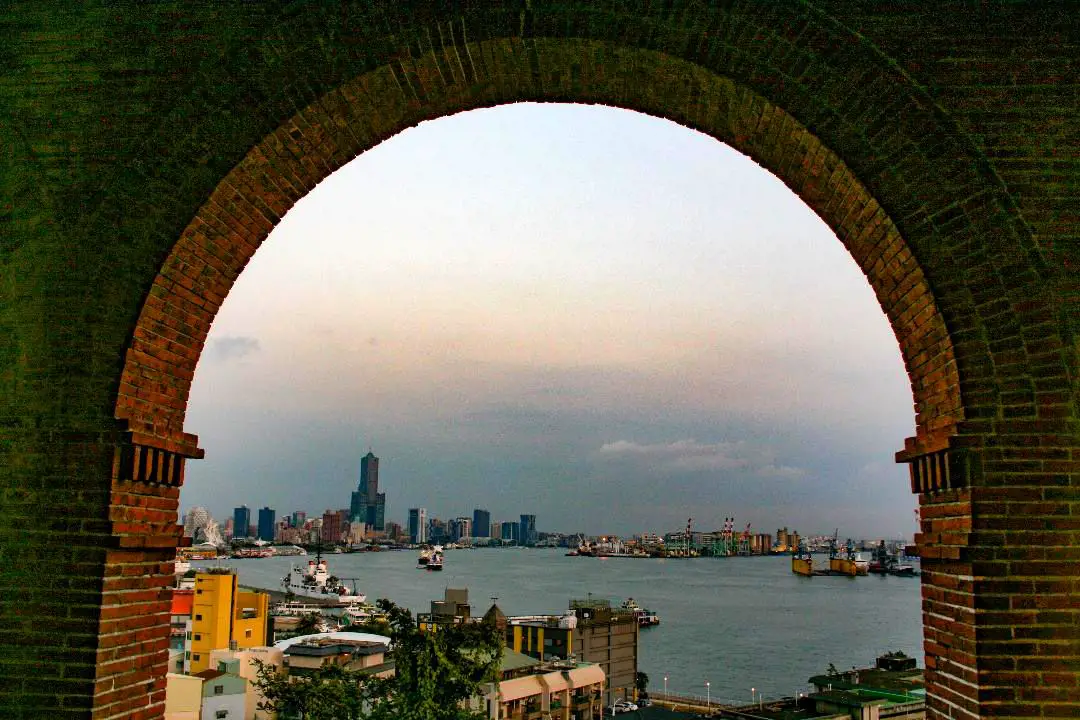
People often don’t realize that Kaohsiung has a lot to offer to tourists. There are many amazing historical and natural sites to see, as well as amazing food, shopping, and interesting culture. Many of the places down south aren’t represented as well in English as other sites in Taipei, which is why we want to help everyone realize what a great place it is. I lived in Kaohsiung for three years and it was like living in paradise every day (I wish I still lived there).
Below I will list some of the best places in Kaohsiung that I have visited. I will be sure to update this blog as I visit more places (and take more photos) later. When to go? Kaohsiung is great year round, but it can get a little hot in the summer, and Typhoon season and the heavy rain season last from about May to October. If you are afraid of the heat and rain then you can visit during winter when the temperatures are mild and the climate is dryer. How to get around in Kaohsiung? By Scooter/Car: As always, we recommend renting a scooter as the best way to see Taiwan. Getting around in a car is also a convenient option as there is plenty of parking pretty much everywhere in this less crowded county. Looking for scooter rental in Kaohsiung? You can check out Klook here or KKday here to search for options. You can check also out our scooter rental guide here. If you are looking for car rentals, you can search Qeeq here, KKday here, or Klook here. You can also check out our car rental guide here. By Public Transport: You can also a great deal of Kaohsiung by taking the MRT, light rail, train, inter city bus, local bus, taxi, or bicycle (U-bike rental). You can book tickets to travel to Kaohsiung via inter-city bus on Klook here. You can book tickets to Kaohsiung via high speed rail (HSR) on Klook here or KKDay here. Book tickets via the normal train (TRA) on Klook here. You can also book a Kaohsiung Travel pass here. By Bicycle: Cycling is the best way to enjoy Taiwan's landscapes if you have the time and energy. Looking for bicycle rentals in Taiwan? You can search on KKday here and search for tours on Klook here. You can also check out our Taiwan cycling guide here. Accommodation We have stayed at and recommend Chao She Hotel (you can book on Agoda here, Booking.com here, Hotels.com here, or Expedia here) IHI Sanduo Travel Hotel (you can book on Agoda here, Booking.com here, Hotels.com here, or Expedia here), and Mingli Hotel (you can book on Agoda here, Klook here, or Hotels.com here) which are three inexpensive and high quality choices in downtown Kaohsiung. I also have stayed at and recommend Kaohsiung Meinong Rabbit Paul Homestay B&B (you can book on Agoda here, Booking.com here, or Trip.com here), a quiet B&B in rural Meinong, and Chengching Lakeside Resort (you can book on Agoda here, Booking.com or Trip.com here)and the Grand Hotel Kaohsiung (you can book on Agoda here, Booking.com here, Hotels.com here, or Expedia here) which both offer breakfast buffet and free entrance into Chenqing Lake Park. I have also stayed at the 85 sky tower which offers great views of the city; you can search for rooms in the 85 sky tower on Agoda here, Booking.com here, Hotels.com here, Expedia here, or Trip.com here). Find out more about where to stay in our Taiwan hotels guide or search for the best hotel deals in Taiwan here. We recommend booking through Agoda here, which provides the best quality selection of accommodation on the islands. You can also book Wifi and SIM cards for Taiwan on Gigago here. Need travel insurance? Compare prices on Insubuy here. Tours: You can find more tours and activities in Kaohsiung such as Pier 2, Meinong Hakka Museum, Hamasen Railway Museum, Suzuka Circuit Park, i-Ride Kaohsiung Visual 5D Flying Theater, National Science and Technology Museum , Senya Village Restaruant, Austin Land, Ski School Indoor Ski Slope, and many more on Klook here or KKday here. Just to let you know, if you book using the links above, we get some commission at no cost to you, and you can help support our blog. You can click here to receive $5 USD on your first Klook purchase. Map: 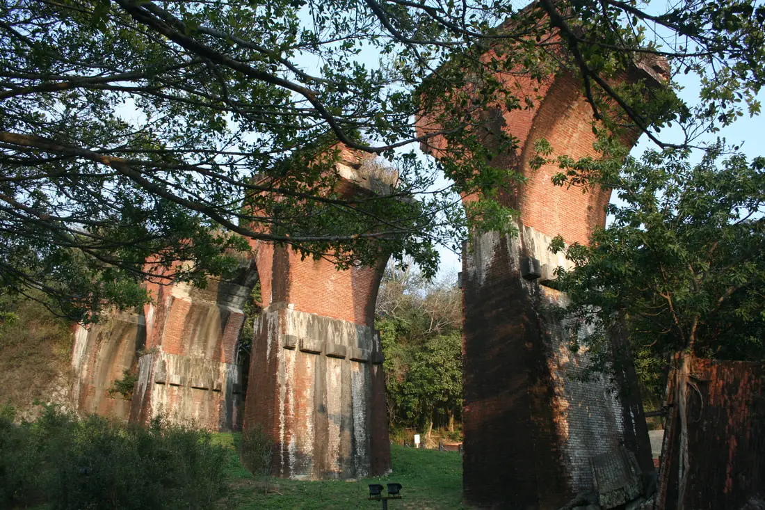
For you expats or foreigners who have never left Taipei, Miaoli is a large rural county in central Taiwan. For years I myself never visited, because I didn't know what was there and had no reason to go. It turns out there are quite a few attractions here in this secret paradise.
Below I will list out some of the best places in Miaoli that I have visited. I will be sure to update this blog as I visit more places later. How to get around in Miaoli? As always, we recommend renting a scooter as the best way to see Taiwan. However, you can also a great deal of Miaoli by taking the train, inter city bus, or local bus. Getting around in a car is also a convenient option as there is plenty of parking pretty much everywhere in this less crowded county. By scooter: Looking for scooter rental in Miaoli? Check out Klook here or KKday here to search for options. You can also check out our scooter rental guide here. You can also check out our car rental guide here. By car: If you are looking for car rentals, you can also search Qeeq here, Klook here, or KKday here. You can also check out our car rental guide here. By bus: You can book tickets to travel to Miaoli via inter-city bus on Klook here. You can book tickets to Miaoli via high speed rail (HSR) on Klook here or KKDay here. Book tickets via the normal train (TRA) on Klook here. By Bicycle: Cycling is the best way to enjoy Taiwan's landscapes if you have the time and energy. Looking for bicycle rentals in Taiwan? You can search on KKday here and search for tours on Klook here. You can also check out our Taiwan cycling guide here. Tours: There are many tours and activities available in Miaoli such as Schokolake Chocolate Factory, Shangshun World, West Lake Resortopia, Suweila Manor, Baba Kengdao, Hobbit Valley, Zhuo Ye Cottage Duck Box and more on Klook here or KKday here. Accommodation: We have stayed at and recommend Beautiful Landscape Resort, a fish farm and resort near Nanzhuang Old Street (you can book on Agoda here, Booking.com here, Hotels.com here, or Expedia here), and Yuan Motel, a high class car motel which includes a great breakfast buffet (you can book on Agoda here, Booking.com here, Hotels.com here, or Expedia here). We also recommend Flying Cow Ranch which includes cabins and camping right on the tourist ranch; you can book a room on Agoda here, Booking.com here, or Trip.com here. Looking for a hotel? Find out where to stay in our Taiwan hotels guide or search for the best hotel deals in Taiwan here. You can also book Wifi and SIM cards for Taiwan on Gigago here. Need travel insurance? Compare prices on Insubuy here. Just to let you know, if you book using the links above, we get some commission at no cost to you, and you can help support our blog. You can click here to receive $5 USD on your first Klook purchase. Map: You can see a map of all the places that we will visit in this blog below: 
Hualien is the largest county in Taiwan and is considered by many to be the most beautiful. It includes a breathtaking coastline along the Pacific Ocean, including cliffs thousands of meters high, marble gorges, fertile valleys, and a large section of Taiwan's central mountain range. Hualien is simply a must-stop location on your trip to Taiwan.
Historical Background Hualien was first inhabited by Sakiraya aborigines and was known as Kilai. Later the Spanish came here to pan for gold for a brief period. Afterward, the first Han Chinese settlers came to the area in 1851 and named the place Hualien after the swirling delta of the Liwu River. During the Japanese era, many Japanese people were relocated here to develop agriculture. Now Hualien is the key population center on Taiwan's East Coast. When to visit? Hualien is great year round, but it can get a little hot in the summer, and Typhoon season and heavy rain season last from about May to October. If you are afraid of the heat and rain then you can visit during winter when the temperatures are mild and the climate is usually dryer. Where to stay? The best hostel I’ve ever stayed at is “When Happiness Knock Your Door” “幸福來敲門” in Hualien. The hostess will go out of her way to make you comfortable and her rooms are kept extremely nice. Also it was one of the few hostels I’ve ever been to that has an elevator. Her price is well below the quality you will enjoy. She has almost a perfect rating on Booking.com and Agoda. You can book When Happiness Knock Your Door on Agoda here, Booking.com here, Hotels.com here, Expedia here, Kayak here, TripAdvisor here, or Klook here. We have also stayed at and recommend Dream Taiwan Homestay (Agoda / Booking.com / Expedia / Hotels.com), a high quality hostel for the money in downtown Hualien, Farglory Hotel (Agoda / Booking.com / Expedia / Hotels.com), right next to Farglory Ocean Park with amazing views of Hualien, and Goldenflower B&B (Agoda / Booking.com) in Yuli right next to Sixty Stone Mountain. You can find out where to stay in our Taiwan hotels guide or search for the best hotel deals in Taiwan here. How to get to Hualien? You can book tickets to travel to Hualien via inter-city bus on Klook here. Book tickets via the normal train (TRA) on Klook here. Need travel insurance? Compare prices on Insubuy here. How to get around in Hualien: As always, we recommend renting a scooter as the best way to see Taiwan. However, you can also a great deal of Tainan by taking the train, inter-city bus, local bus, biking, or just walking. Getting around in a car is also a convenient option as there is plenty of parking pretty much everywhere in this less crowded county. Scooter Rental: Looking for a scooter rental in Hualien? You can search KKday here or Klook here to look for options. You can also check out our scooter rental guide here. Car Rental: If you are looking for car rentals in Hualien, you can also search Klook here or KKDay here. You can also check out our car rental guide here. By Bicycle: Cycling is the best way to enjoy Taiwan's landscapes if you have the time and energy. Looking for bicycle rentals in Taiwan? You can search on KKday here and search for tours on Klook here. You can also check out our Taiwan cycling guide here. Tours: You can find more tours and activities in Hualien such as Surfing, Paragliding, SUP / Paddle Boarding, Kayaking, Canoeing, River Tracing, River Rafting, Whale Watching, Snorkeling, Diving, ATV / 4-wheeling, Paintballing, Farm Dream Estates Zoo, Water Biking, Oyster Harvesting, Shrimp Harvesting, Indigenous Experience, Glamping, Cycling, Ziplining and much more on Klook here or KKday here. You can also book Wifi and SIM cards for Taiwan on Gigago here. Just to let you know, if you book using the links above, we get some commission at no cost to you, and you can help support our blog. You can click here to receive $5 USD on your first Klook purchase. Map: Please see the map below for the areas we will cover in the blog. 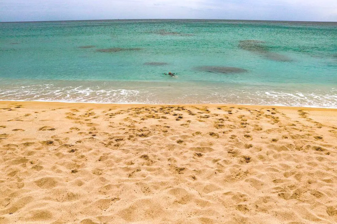
Yes, you should go to Kenting. Kenting has some of the best natural scenery in Taiwan, from beautiful white sand beaches that are warm year round to limestone mountains with hundreds of caves and waterfalls to explore. Although it may not be a world class beach resort destination yet, it should definitely be on your list on your trip to Taiwan.
Historical Background: The area around the Hengchun Peninsula was once coral that has been uplifted over millions of years. The first people to live here were Taiwan aboriginals, from the Paiwan and Puyuma tribes (who caused the Rover Incident as portrayed in Seqalu: Formosa 1867). Kenting was first settled by Han farmers and fishermen during the Qing Dynasty. The word Kenting comes from two words that mean cultivate (ken3 墾) and strong man (丁 ding1). During that time, a group of strong men (or Zhuang Ding 壯丁) came from Guangdong, who were basically Chinese pioneers of the area to cultivate the land, hence the area was named Kenting for them. The aboriginal people were mostly assimilated with the local Chinese population. The area was considered to be made into a park during the Japanese occupation due to it being the only tropical location in the Japanese Empire, but was never officially created. During the Japanese era, Nanwan was used as a whaling area and there were a few fishing villages here. The Whaling industry continued here in the ROC era until the international ban on whaling in 1986. Kenting National Park was established in 1984 as the first national park in Taiwan after WWII. Kenting became a major vacation spot, becoming a center for hostels and hotels for travelers. Kenting is considered by many to have the best beaches in Taiwan. This is because of its fine white sand and year-round warm temperatures and sunshine (it is in the tropical part of Taiwan after all). When to go: Summer is the best time to go because there is warm sunny weather and not a lot of wind. However, there are more people and there may be Typhoons. Winters are windy and colder, but the water is still warm enough to swim in. Winter is a better time for activities like hiking and surfing. How to get there: By Car/Scooter: Take provincial highway 1 south to the bottom of Taiwan until it becomes provincial highway 26. After that keep going past Hengchun into Kenting National Park. Looking for scooter rental in Kenting? Click here or here to search for options. If you are looking for car rentals, you can also search Qeeq here, Klook here, or KKday here. You can also check out our car rental guide here. By Bus: Busses leave daily to Kenting from Zuoying HSR station, Kaohsiung Station, and Pingtung. You can book tickets to Kenting via high speed rail (HSR) on Klook here or KKDay here, or book tickets via the normal train (TRA) on Klook here. You can book tickets to travel to Kenting via inter-city bus on Klook here. Once in Kenting, you can save money by booking Kenting's bus pass. By Plane: There are direct shuttle busses to Kenting from Kaohsing's Xiaogang (KHH) Airport. You can search for cheap flights in Taiwan here. By Bicycle: Cycling is the best way to enjoy Taiwan's landscapes if you have the time and energy. Looking for bicycle rentals in Taiwan? You can search on KKday here and search for tours on Klook here. You can also check out our Taiwan cycling guide here. Where to stay: Looking for a hotel? Find out where to stay in our Taiwan hotels guide or search for the best hotel deals in Taiwan here. We recommend booking through Agoda here, which provides the best quality selection of accommodation in Taiwan. I have stayed at many hostels and hotels in Pingtung, and even almost bought a house here. Some places that I have stayed at and can recommend are Nanwan Kiki (book on Agoda here or Booking.com here), a B&B next to Nanwan Bay, Kenting's most popular Beach. There are also a few decent hotels near Kenting Street Night Market like Kenting Star Inn 888 (book on Agoda here, Klook here, or Booking.com here), or Kenting Dajianshan Hotel (book on Agoda here or Booking.com here). You will notice that none of these hotels are five star resorts (I do not come to Kenting to waste my time at a resort, but you can still search Agoda, Booking.com, or Klook here for those) but they are in my opinion the above have the best value for the money. How to get around in Kenting: 1. Rent a scooter - the best way to see Taiwan. Electric scooters that do not require a license are also readily available. For better range and speed, rent a gas scooter. You can search for scooter options here or here, and you can check out our scooter rental guide here. 2. Rent a car - more expensive than a scooter but may be more suitable for a large family. If you are looking for car rentals, you can also search Qeeq here, Klook here, or KKday here. You can also check out our car rental guide here. 3. Take the Kenting bus - cheap but slower than your own transportation, and it doesn't stop everywhere. You can book tickets to travel to Kenting via inter-city bus on Klook here. 4. Cycle - you can rent a bicycle or bring your own. This is a great way to enjoy the scenery at a slower pace. You can search on KKday here and search for tours on Klook here. You can also check out our Taiwan cycling guide here. 5. Hire a taxi - more expensive than a rental car but perhaps more convenient. You can also search for a car charter service here or here. Tours and Activities in Kenting: There are many activities available in Kenting, such as snorkeling, diving, SUPing, surfing, submarine riding, and river tracing. You can find more tours of Kenting on Klook here or KKday here. Just to let you know, if you book using the links above, we get some commission at no cost to you, and you can help support our blog. You can click here to receive $5 USD on your first Klook purchase. Places we will cover in this blog:
Map of sites in this blog: 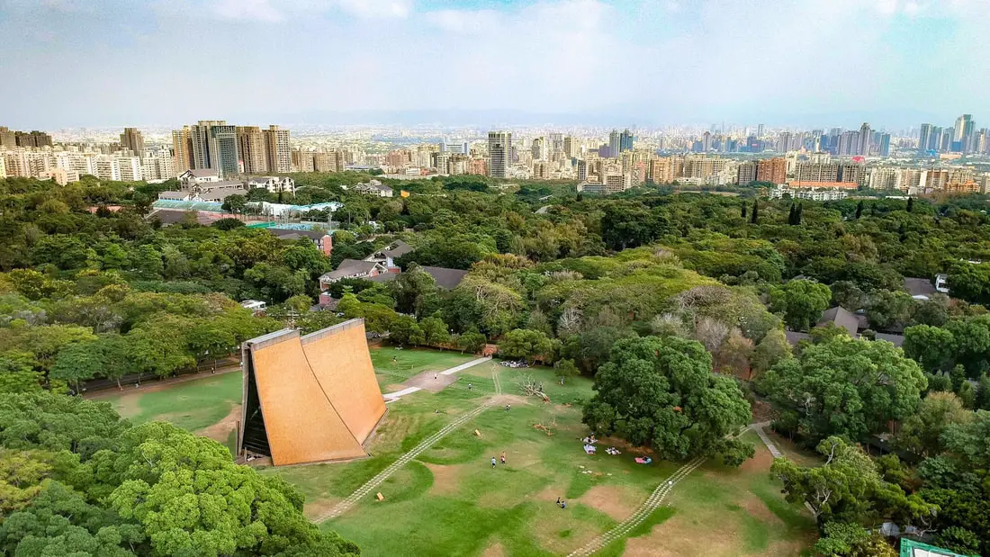
Taichung is the second largest city in Taiwan, and includes a vibrant city, delicious food, amazing coastline, and dazzling mountains. In addition, Taichung's central location in Taiwan makes it easy to visit other nearby counties. In this blog, we will show you some of the most worthwhile sites to see on your next trip to Taichung.
When to visit: It is best to visit from April to November when the weather is warm and less windy. There is a constant, cold wind from December to March especially along the coast. However, the winter in general is more dry. Where to stay: Most of the accommodation you will find is near the city center. If you will only visit downtown, you can consider a day trip from Taipei. We have stayed at and recommend the Norway Forest Travel Hotel, a convenient hotel right in front of Taichung Station (you can book on Booking.com here, Agoda here, or compare prices on Kayak here), and Sin Fu Business Hotel which is also a great value for the money and great quality in downtown Taichung (you can book on Agoda here or compare prices on Kayak here). Looking for a hotel? We recommend booking through Booking.com here, which provides the best quality selection of accommodation in Taiwan. Find out where to stay in our Taiwan hotels guide or search for the best hotel deals in Taiwan here. Basic Taichung Travel Tips:
How get to Taichung? You can book tickets to travel to Taichung via inter-city bus on Klook here. You can book tickets to Taichung via high speed rail (HSR) on Klook here or KKDay here. Book tickets via the normal train (TRA) on Klook here. How to get around in Taichung: As always, we recommend renting a scooter as the best way to see Taiwan. However, you can also a great deal of Hsinchu by taking the train, inter-city bus, or local bus. Getting around in a car is also a convenient option as there is plenty of parking pretty much everywhere in this less crowded county. Scooter Rental: Looking for scooter rental in Taichung? You can search Klook here or KKday here to look for options. You can also check out our scooter rental guide here. Car Rental: If you are looking for car rentals in Taichung, you can also search Qeeq here, Klook here, or KKDay here. You can also charter a car on KKday here. You can also check out our car rental guide here. By Bus: You can book a Taichung sightseeing bus on KKday here. By Bicycle: Cycling is the best way to enjoy Taiwan's landscapes if you have the time and energy. Looking for bicycle rentals in Taiwan? You can search on KKday here and Klook here. You can also check out our Taiwan cycling guide here. For more information, check out our Taiwan transportation guide here. Tours: There are many tours of Taichung available on on KKday here or Klook here, such as an Instagram Day Tour, Historic Downtown and Sun Cake DIY Experience, Taichung Railway Station Walking Tour, Local Market Biking Tour, Aboriginal Food Tour, and much more on KKday here or Klook here. Attractions: There are many amazing sites and attractions in Taichung, such as Gaomei Wetlands, Rainbow Village, Luce Chapel, Rainbow Village, Wuling Farm, Nantun Old Street, Xinshe Flower Garden, Lihpao Land Theme Park, National Museum of Natural Science, Wonder New Land Children's Park, Carton King Creative Park, Jurassic Planet Park, Museum of Illusions, Lavender Cottage, Okuma Center Fishing Museum, Basian Forest Recreation Area, Wooderlife Gaming Area, Dasyueshan Recreation Area, Wufeng Lin Family Garden, Moncoeur Garden, Yukids Island, Shoe Wonderland Factory Tour, Lihpao International STS Race Circuit, Muxinquan Leisure Farm, Guguan Hot Springs, Miyahar, Fushoushan Recreational Farm, Xinshe Castle, National Taichung Theater, and many more which are covered in this blog. You can also book a Taichung pass for multiple attractions on Klook here or here. Activities: Taichung has lots of indoor and outdoor activities available, such as Scuba Cube Hotel Indoor Diving Experience, Batting Cages, Indoor Skiing and Sledding, Car Race Track, Pilot an Aircraft, Glamping, Archery, Trampoline Center, Off-road ATVing, Hiking, see cherry blossoms, stargazing, Aboriginal Food Tour, cooking class, and much more on KKday here or Klook here. Just to let you know, if you book using the links above, we get some commission at no cost to you, and you can help support our blog. You can click here to receive $5 USD on your first Klook purchase. Map: See below for a map of places we will cover in this blog: 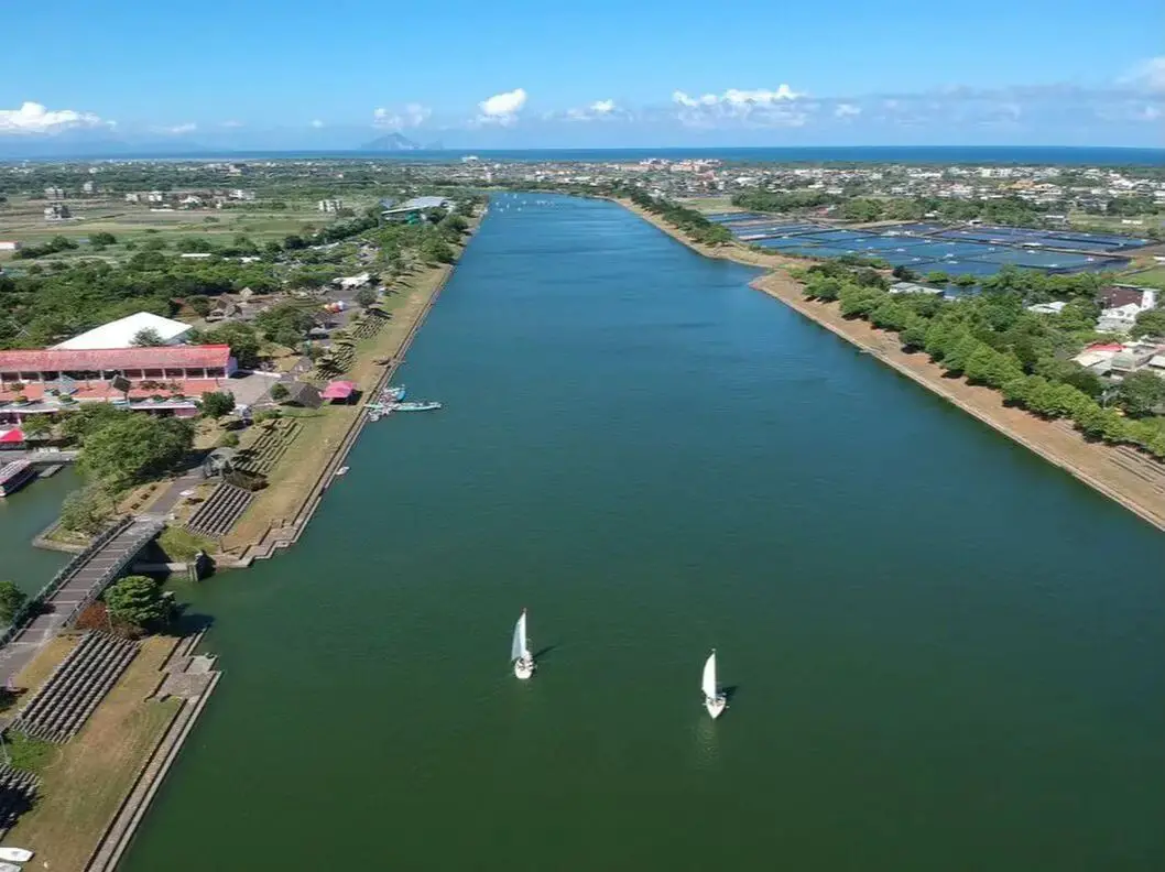
Yilan is a gem on Taiwan's northeast coast. It has rugged mountains, waterfalls, a flat coastal plain, a volcanic island, hot springs, and some of the best beaches in Taiwan. In addition you can find night markets, seafood markets, museums, and much more to explore here. It is definitely worth a stop on your next trip to Taiwan.
Historical Background of Yilan: Before Chinese settlers came, the area around Yilan was inhabited by the Ketagalan Aboriginal tribe, whose language is now extinct. The name Yilan comes from this language. The town Toucheng literally means "first town" in Chinese, because it was the first settlement in Yilan, settled in the late 1700s. With the nearby Wushih and Touwei Harbors around the same time, it became the economic focal point of Yilan. However, in the late 1800s and early 1900s Wushih Harbor and Touwei Harbor silted in, reducing their function. With the advent of the Japanese-built Yilan railway line in the mid-1900's, as well as constant floods and continual silting of the harbors, Toucheng Old Street quickly lost its importance economically and fell into decay. The Japanese also built logging railways up to Taipingshan to harvest lumber. The first path between Yilan and Hualien was a trail built in the Qing Dynasty that was completed in 1876, in order for the Qing to better control aboriginal peoples on the east coast. Later after Japan took control of Taiwan, they widened the path and built 9 bridges and 14 tunnels along the way, making it drivable for cars (one way only) by 1932. Because much of the road was next to cliffs that underwent constant landslides, it was considered one of the most dangerous roads in the world at the time. In the 1980s the ROC government further widened the road, and the two-lane highway was completed in 1990. In 2020, the section of road between Su'ao and Dong'ao was bypassed by a tunnel. Currently Yilan has a population of over 450,000. An High-Speed Rail extension is planned for Yilan, and is expected to be completed by 2036. When to go? The best weather in Yilan lasts from about March-November. During winter months there is constant rain due to the northeasterly winds. How get to Yilan? You can book tickets to travel to Yilan via inter-city bus on Klook here. You can book tickets to Yialn via high speed rail (HSR) on Klook here or KKDay here. Book tickets via the normal train (TRA) on Klook here. How to get around in Yilan? As always, we recommend renting a scooter as the best way to see Taiwan. However, you can also a great deal of Yilan by taking the TRA train, inter-city bus, or local bus. Getting around in a car is also a convenient option as there is plenty of parking pretty much everywhere in this less crowded county. Scooter Rental: Looking for scooter rental in Yilan? You can search Klook here or KKday here to look for options. You can also check out our scooter rental guide here. Car Rental: If you are looking for car rentals in Yilan, you can also search Klook here or KKDay here. You can also check out our car rental guide here. Bicycle Rental: Cycling is the best way to enjoy Taiwan's landscapes if you have the time and energy. Looking for bicycle rentals in Taiwan? You can search on KKday here and search for tours on Klook here. You can also check out our Taiwan cycling guide here. Tours and Activities: You can purchase tours and tickets for many activities in Yilan such as Su'ao Crayon Castle, Taipingshan, Turtle Island, International Children's Festival, Lanyang Museum, Toucheng Leisure Farm, Zhang Mei Ama Capybura Farm, Bambi Land, Yinong Ranch, National Center for Traditional Arts, Taxi Museum, Glamping, Camping, ATV / 4-wheeling experience, SUP / paddle boarding, Ximeng Forest Theater, Surfing, Kayaking, Horse Riding, River Tracing, River Rafting, River Tubing, Pack Rafting, Water Biking, Snorkeling, Canoeing, Shrimping and many others through Klook here or KKday here. Accommodation: We have stayed at and recommend Ying Shih Guest House, a resort in Datong Township near Taipingshan and Fan Fan Hot Spring (you can book on Agoda here or Booking.com here), and Jiaosi Hotspring Hotel, a hotel with hot springs in each room (you can book on Agoda here, Booking.com here, Hotels.com here, Expedia here, or Trip.com here). We have also stayed at Toucheng Leisure Farm, a recreational farm and experience center in Toucheng (you can book on Agoda here, Booking.com here, Hotels.com here, Expedia here, on Klook here, or on Trip.com here). We recommend booking through Agoda here, which provides the best quality selection of accommodation on the islands. Find out where to stay in our Taiwan hotels guide or search for the best hotel deals in Taiwan here. You can also book Wifi and SIM cards for Taiwan on Gigago here. Need travel insurance? Compare prices on Insubuy here. Just to let you know, if you book using the links above, we get some commission at no cost to you, and you can help support our blog. You can click here to receive $5 USD on your first Klook purchase. Map: You can find a map of places we will cover in this blog below: 
Hsinchu is not only Taiwan's technological hub, but is also rich with historical sights, Hakka culture, and natural beauty. It has numerous old streets, preserved Japanese-era and Qing-era buildings, zoos, mountains, lakes, rivers, beaches, and much more to explore. It is definitely worth a stop on your next trip to Taiwan.
History of Hsinchu: After the settlement of the area by Han Chinese farmers in about 1711, what was then known as Zhuqianshe became the most important economic area in northern Taiwan. By 1723, a walled city was built here out of bamboo, because brick walls were forbidden for fear of a revolt against the Qing authorities. The name Zhuqiancheng (竹塹城) literally means bamboo moat city. The bamboo-walled city had four gates and its perimeter was about 1.4 KM long. In 1806, the city was upgraded with earthen walls. In 1828, the city walls and gates were finally made into brick, with the perimeter covering 2.7 KM, and walls 5 meters high, the center of the city being the Chenghuang City God Temple. In 1901, the Japanese government decided to redesign the City of Hsinchu and destroyed all the gates and walls except the existing East Gate. In the ROC era, the Hsinchu Science Park was established in 1980 under President Chiang Jingkuo, and was made to model silicon valley. TSMC, Taiwan's most important corporation, was formed in 1987 with its headquarters in the park and created a technological hub, making Hsinchu indispensable to Taiwan's economy. When to visit: It is best to visit from April to November when the weather is warm and less windy. There is a constant, cold northeasterly wind from December to March especially along the coast. However, the winter in general is more dry. Where to stay: Most of the accommodation you will find is near the city center. If you will only visit downtown, you can consider a day trip from Taipei. We have stayed at and recommend the Golden Motel a high quality motel near Green Grass Lake (you can book on Agoda here, Booking.com here, Hotels.com here, Expedia here, or Trip.com here), and CD Motel, another high quality motel in downtown Hsinchu (you can book on Agoda here, Booking.com here, or Trip.com here). Unfortunately I cannot recommend any further hotels that I have stayed at in Hsinchu because usually we stay at my wife's uncle's house. You can find out where to stay in our Taiwan hotels guide or search for the best hotel deals in Taiwan here. You can also book Wifi and SIM cards for Taiwan on Gigago here. Need travel insurance? Compare prices on Insubuy here. How get to Hsinchu? You can book tickets to travel to Hsinchu via inter-city bus on Klook here. You can book tickets to Hsinchu via high speed rail (HSR) on Klook here or KKDay here. Book tickets via the normal train (TRA) on Klook here. How to get around in Hsinchu: As always, we recommend renting a scooter as the best way to see Taiwan. However, you can also a great deal of Hsinchu by taking the train, inter-city bus, or local bus. Getting around in a car is also a convenient option as there is plenty of parking pretty much everywhere in this less crowded county. Scooter Rental: Looking for scooter rental in Hsinchu? You can search Klook here or KKday here to look for options. You can also check out our scooter rental guide here. Car Rental: If you are looking for car rentals in Hsinchu, you can also search Qeeq here, Klook here, or KKDay here. You can also check out our car rental guide here. By Bicycle: Cycling is the best way to enjoy Taiwan's landscapes if you have the time and energy. Looking for bicycle rentals in Taiwan? You can search on KKday here and Klook here. You can also check out our Taiwan cycling guide here. Tours: You can find more tours and activities in Hsinchu such as You can find more tours and activities in Hsinchu such as river tracing, wild hot springs, white water kayaking, backpack rafting, Little Ding Dong Theme Park, Leofoo Village Theme Park, Window on China Theme Park, glamping, camping, stone spa, horse riding, Yukids Island, Tom and Bei Bei Parent Child Paradise, bee keeping experience, cycling, dried persimmons experience, Jump Wave Trampoline Park and more on Klook here or KKday here. Just to let you know, if you book using the links above, we get some commission at no cost to you, and you can help support our blog. You can click here to receive $5 USD on your first Klook purchase. Map: See below for a map of places we will cover in this blog: 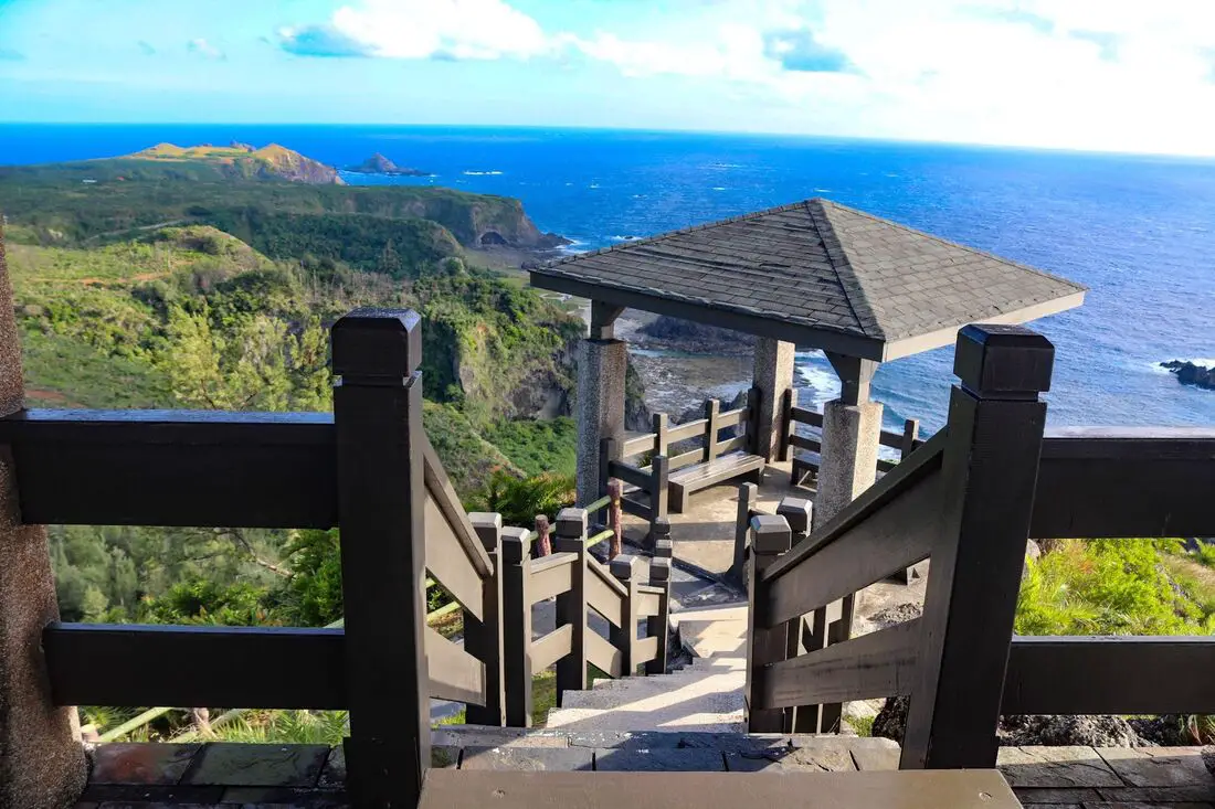
Green Island is a paradise off the southeastern coast of Taiwan. Once a prison for political enemies of the KMT, it is now a tourist hot spot. It is one of the best places to snorkel and dive in Taiwan, one of only three saltwater hot springs in the world, and it also includes amazing volcanic rock formations and scenery all around the island.
Background: Green Island is the remnant of a volcano that formed millions of years ago and is part of the Luzon Volcanic Arc. Today you can see lots of volcanic rock all along the shoreline. Green Island is the seventh largest Island in Taiwan. Green Island became inhabited hundreds of years ago by the Tao indigenous people (達悟族) (aka Yami people 雅美族, which is a name coined by the Japanese, but the native people prefer Tao), which are thought to have traveled from the Batanes Islands in the Philippines, and then to Orchid Island. It was called Jitanasey by the Tao people. It was also known to be inhabited by the Amis Tribe (阿美族) who reside today in Taitung. It was known by the Amis people as Samasana Island. The Island was first settled by Han Chinese fisherman from Xiaoliuqiu Island in 1813, who called the island Huoshandao (火燒島) or Bonfire Island. More Han settlers from Donggang arrived in 1850. In 1937 the American Steamship SS President Hoover ran ground at Green Island and all aboard were saved. To thank the people of Green Island, the US donated to build the Green Island Lighthouse which was designed by the Japanese and finished in 1938, at 33.3 meters or 109 feet high. Green Island also served as a penal colony for political prisoners' during the martial law era of Taiwan, which lasted from the late 9140s to the late 1980s. Some prisoners went on to help form the Democratic Progressive Party. The prison is now open to the public. Currently, the Island is powered by one diesel generator. It also includes an airport. Currently about 4500 people live on the island, and the main industries are tourism and fishing. Weather and Climate: The island has a tropical rainforest climate, with average high temperatures between 20 and 30 degrees year round. The rainy months are in summer, especially due to Typhoons, but the most sunny days are also in summer (expect a lot of sun), and the most rainy days are in winter. Summer is the tourist season, but spring and fall are also popular times to visit. Winters are said to be dreary, cold, and have constant northeastern winds that can stop airplanes and ferries from departing to the island. When to go: The best time to go they say is around May when it is not too hot and there are no northeasterly winds or typhoons which can cancel your transportation to the island. Typhoon season lasts from around June to October. The busy season is during summer break from June to August, during which time it can be hard to book a hostel or airplane ticket. Winter is the less crowded season, but the water will be colder, there will be constant wind (which could cancel transportation), and it will rain more often. Rules to Consider:
How to get there: By Plane: The only planes to and from Green Island come from Taitung City in Southeastern Taiwan. From Taipei, there are daily flights from Songshan Airport to Taitung, where you can switch to Daily Air which will take you the rest of the way to Green Island. You can book discount tickets from Taipei to Taitung on KKday here. Flight times: As of the time of this blog, there were six flights per day by Daily Air Corporation from about 8 AM to 4 PM (Please note their website is only in Chinese). The flight from Taitung to Green Island takes about 15 minutes. Please note that the aircraft are small and flights can be cancelled due to high winds or unfavorable weather. Costs: NT 1428 to Green Island and NT 1360 from Green Island. By Boat: You can purchase boat ferry tickets through a tour agency such as Klook here or KKday here. There are two places that offer ferry rides to Green Island: Houbihu Harbor (恆春後壁湖漁港) in Pingtung and Fugang Harbor in Taitung (臺東富岡漁港). However, to get there from Houbihu you need to stop in Lanyu, so I will focus this blog on departing from Fugang Harbor. There are also about three ferry companies that operate at both harbors. Both companies leave from both harbors at the same time and arrive at the about same times for the same prices (1200 NT per person round trip/600 NT per single trip). Ferry Boat costs: 1200 NT per person round trip (600 NT per single trip) from Taitung. Ferry companies have roughly the same price. Ferry Boat Times*: 7:30 AM departure from Fugang Harbor, 8:20 AM arrival to Green Island. 8:30 AM departure from Green Island, 9:20 AM arrival to Fugang Harbor. 9:30 AM departure from Fugang Harbor, 10:20 AM arrival to Green Island. (permanent set time) 10:30 AM departure from Green Island, 11:20 AM arrival to Fugang Harbor. (permanent set time) 11:30 AM departure from Fugang Harbor, 12:20 PM arrival to Green Island. 12:30 PM departure from Green Island, 9:20 PM arrival to Fugang Harbor. 13:30 PM departure from Fugang Harbor, 14:20 PM arrival to Green Island. (permanent set time) 14:30 PM departure from Green Island, 15:20 PM arrival to Fugang Harbor. (permanent set time) 15:30 PM departure from Fugang Harbor, 16:20 PM arrival to Green Island. 16:30 PM departure from Green Island, 17:20 PM arrival to Fugang Harbor. *Note: the above times change according to the seasons. There may only be one boat per day during winter, while all the boat times may be available during summer break and weekends. Please double check which times are available before you go. You can purchase tickets through a tour agency such as Klook here or KKday here. Getting around the island: Rent a scooter! The island is small so you should not need to rent a car. You can rent bicycles but you will not be able to travel as fast. You can also hire a driver to take you on tours. Ask your hostel for more rental information. They can help you book a rental in advance. Scooter Rental: Price: expect 400 NT per day. You can book a scooter rental for Green Island on Klook here or KKday here. It may be better to book your scooter rental in advance, especially during summer weekends. Ask for help from your hostel owner if needed. I am 100% percent certain you do not need a Taiwan local license to rent scooters here, however they may ask for an international license (but I'm fairly sure they will let you rent without one). Helmet wearing is not enforced at all as you will quickly find, but it's still the law. Also be careful to not hit any goats because they wander as they please. There is only one gas station next to Nanliao Fishing Harbor. Car Rental: Price: expect 2000 NT per day. You can rent a car for Green Island using KKday here. By Bicycle: Cycling is the best way to enjoy Taiwan's landscapes if you have the time and energy. Looking for bicycle rentals in Taiwan? You can search on KKday here and search for tours on Klook here. You can also check out our Taiwan cycling guide here. Accommodation: Booking accommodation on the island can be difficult in summer months and on weekends, when rooms can be fully booked for months in advance. AirBnb has the most choices, however there is also better quality selection on Agoda.com. We stayed at and can recommend Fire Island Guesthouse, which is a high quality B&B on right on the east coast of the island. My hostel did not require that I pay for my room in advance via bank wire transfer (as was the case on Lanyu), but they required me to pay in cash. Expect to pay 2000 - 4000 NT per night for a standard double room on Green Island. Tours and Activities: There are many companies offering snorkeling, diving, SUPing, and other tours on Green Island. You can search for tours on Klook here or KKday here. You can also book discount tickets to Zhaori Hot Spring on KKday here. You can also book Wifi and SIM cards for Taiwan on Gigago here. Just to let you know, if you book using the links above, we get some commission at no cost to you, and you can help support our blog. You can click here to receive $5 USD on your first Klook purchase. Map: Please see a map of all the locations covered in this blog below: 
Taitung has some of the most beautiful scenery in Taiwan, two amazing offshore islands, a striking coastline, deep mountains, and most of all it is bursting with unique aboriginal culture, with indigenous people making up over one-third of the population. It is an unmissable stop on your next trip to Taiwan. Here we have compiled our full guide to Taitung County.
Historical Background: Taitung has been inhabited by the Amis Aboriginal Tribe which has lived there since at least 1500 BC, and over 35% of the people that live there are Taiwan Aborigines. The area is still a center for Amis rituals and traditional ceremonies, as well as aboriginal culture. The east rift valley was also settled by aboriginal tribes such as the Puyuma which relocated from Pingtung. Qing dynasty Chinese farmers started settling there in 1875, as a reaction to the Mudan Incident of 1871 (in which a crew of shipwrecked Japanese sailors were beheaded by Taiwan aborigines) and the Japanese punitive expedition to Taiwan in 1874. After the Japanese took control of Taiwan, Taitung's main industries were growing sugar cane and rice. The eastern railway line was completed in 1926, linking Taitung to the rest of Taiwan. After the ROC took control of Taiwan, Taitung Airport opened in 1981, which further improved transportation links to the region, however, Taitung has remained relatively undeveloped when compared to the rest of Taiwan, and the population of about 200,000 has been in decline for years. However Taitung has become an important tourist destination, and the local government has invested heavily in tourism development. With its untamed and undeveloped landscape, towering mountains, beautiful coastline, and vibrant aboriginal culture, Taitung has become a tourist hot spot in Taiwan. When to go: The best time to go they say is around May when it is not too hot and there are no northeasterly winds or typhoons which can cancel your transportation to the island. The typhoon season lasts from around June to October. The busy season is during summer break from June to August, during which time it can be hard to book a hostel or airplane ticket. Winter is the less crowded season, but the water will be colder, there will be constant wind (which could cancel transportation), and it will rain more often. How to get there: By Plane: Traveling to Taitung by plane is the fastest way to get there. The trip only takes one hour from Taipei, and there are planes that leave daily through Mandarin Airlines and Uni Air. From Taitung, where you can switch to Saily Air which will take you the rest of the way to Green Island or Orchid Island. A plane ticket to Taitung takes about one hour and costs about 5000 NT per round trip. You can book discount tickets to Taitung on KKday here. You can also book cheap flights to Kinmen on Trip.com or CheapO Air. You can also search for cheap flights in Taiwan here. By Train: The train ride from Taipei to Taitung takes 3-4 hours and costs about 800 NT one way. Book tickets via the normal train (TRA) on Klook here. By Car/Scooter: From Taipei, a car ride to Taitung takes about six hours, and a scooter ride takes about eight hours. You can rent a scooter from Taitung Station on Klook or KKday. Scooter rental is about 300 NT per day. You can check out our scooter rental guide here. How to get around: Rent a scooter! Unless you are travelling with small children or elderly people you should not need to rent a car. You can rent bicycles but you will not be able to travel as fast. You can also hire a driver to take you on tours. By scooter: You can rent a scooter from Taitung Station on Klook or KKday. Scooter rental is about 300 NT per day. You can check out our scooter rental guide here. By car / taxi: You can also rent a car for about 1500 NT per day. You can rent a car on Qeeq here or Klook here. You can hire a driver or tax; you can charter a car here. You can check out our car rental guide here. By Bicycle: Cycling is the best way to enjoy Taiwan's landscapes if you have the time and energy. Looking for bicycle rentals in Taiwan? You can search on KKday here and search for tours on Klook here. You can also check out our Taiwan cycling guide here. Accommodation: Booking accommodation in the Taitung can be difficult in the summer months and on weekends. We suggest a better quality selection on Agoda.com. We have stayed at and recommend the Papago International Resort in Chishang (you can book on Agoda here, Booking.com here, Hotels.com here, or Expedia here), which is a five star hotel with private villas with pools for each room, and Mountain and Ocean B & B in Taimali (you can book on Agoda here, Booking.com here, Hotels.com here, or Expedia here), which is a quiet and affordable B&B right next to the beach. You can also find out where to stay in our Taiwan hotels guide or search for the best hotels in Taiwan here. You can also book Wifi and SIM cards for Taiwan on Gigago here. Need travel insurance? Compare prices on Insubuy here. Tours: There are many companies offering snorkeling, diving, SUPing, Surfing, Speed Boating, Glamping, River tracing, and other tours in Taitung. You can find more tours of Taitung on Klook here or KKday here. Just to let you know, if you book using the links above, we get some commission at no cost to you, and you can help support our blog. You can click here to receive $5 USD on your first Klook purchase. Map: See a map of the places we will cover in this blog below: 
This month marks the 10th anniversary of this blog, so to celebrate I am making a blog tracing back our first round-island trip lasting 14 days and 13 nights made in 2014. During this journey we rented a car in Taipei, and circled Taiwan clockwise, visiting Taroko Gorge, Kenting, Xiaoliuqiu, Alishan, Sun Moon Lake, and many more places along the way. I am the kind of guy who likes to bask in nostalgia, but also I hope that laying out this experience in the open as well as the lessons we learned about travel in Taiwan along the way (and what I know now in 2024) will be helpful to other foreigners coming to Taiwan.
Some background on why this trip happened: This was not our first trip to Taiwan. Scott and I had been Latter-day Saint missionaries in Taiwan from 2011 to 2012 in the Taichung Mission, which covers Taichung to Pingtung but nothing north or east of that. We still had a lot of friends in Taiwan that we missed, we missed Taiwanese food, and there were the entire north and east parts of the island for us to explore. We decided it would be a once-in-a-lifetime opportunity to tour Taiwan now because later on in our lives we would likely have work and family obligations that would not allow us to take a 14-day trip around Taiwan. Being poor college students at the time, we had a very limited budget (for reference, I was making 700 USD a month as a janitor and I could only save about half of that after rent and food). Originally another friend planned to come with us, but he backed out because he got married. Scott's brother Matt decided to come along too. Just so you know, Scott and I know Chinese, but Matt doesn't. It makes traveling easier to know the language but you can still get by in Taiwan without it. The Plane Ride: We took the cheapest flight available on Shenzhen Airlines, which had many flights for cheap to the US at the time. For 700 USD we bought a round trip from LA to Beijing to Taipei and back. Renting a car in Taiwan: Before we began our trip, we planned on rounding the island by Scooter. This can be a fun way to explore Taiwan. As a side note, you can book a Motorcycling experience on Klook here, or a half-day Motorbike Tour on KKday here. If you are looking for a multi-day, in-depth tour of Taiwan via motorbike, we recommend contacting [email protected] who schedules regular 10-day motorbike tours of Taiwan. The tour guide is a long-term expat in Taiwan who has been giving riding tours of Taiwan for 16 years now. You can also check out our scooter rental guide here. After crunching the numbers, we figured that we could rent a car for just as cheap as three scooters, and we wouldn't have to worry about rain or luggage. A scooter would be 300 NT per day, and for three people 900 NT per day, but we found a car rental place that would rent us a small Nissan March for 700 NT a day (that car company was called Good Cars 固得汽車 in Zhonghe, you can find their information in our Taiwan Car Rental Guide here). After arriving at Taoyuan International Airport, we took a bus to Taipei and made our way to Zhonghe at a friend's house and picked up the rental car. At the end of the trip, we found the price was a few thousand NT more than we expected because of highway tolls (about 1.5 NT per kilometer). SIM Card: I bought a pre-paid SIM card from Taiwan Mobile for 500 TWD that lasted the whole trip. I think it was only a few GB of data, but I had a crappy phone and was not using much data. Map: Check out a map of places we visited on this trip below: 
Xinwu Green Tunnel (aka Xinwu Green Corridor 新屋綠色走廊) is a popular cycling path along the west coast of Taoyuan through a belt of trees that resembles a green tunnel. Here you can enjoy the landscape, find roadside food options, and also understand more about the culture and history of the area. It is one of the most popular cycling destinations in northern Taiwan.
Historical Background: Since prehistoric times, the area around Xinwu was home to indigenous Taiwanese plains aborigines. There was no large-scale Dutch or Chinese settlement in the area during the Dutch rule of Taiwan. During the Qing Dynasty, Chinese settlers began to settle the area and begin farming. One prominent family that came to settle in Xinwu was the Fanjiang family. Later, the clan expanded further and further inland and created new homes, Qixinwu (起新屋) in Chinese, and the name Xinwu for the area stuck. You can still visit the Fanjiang Family's ancestral home dating back to the Qing Dynasty in Xinwu, however, it is not covered in this blog. Yong-an Fishing Harbor was established in 1953 and is a secondary-class port. Before that, it was known as Kaotouwu Port (崁頭屋港) which dates back to the 1800s during the Qing Dynasty, located on the north side of the mouth of the Shezi River. Originally a small fishing port, Yong-an Fishing Port has expanded over the years, including dredging channels and extending to allow for larger fishing vessels. The Xinwu bike path is about 4 KM long and takes about 2-3 hours to complete. The area is usually busy on holidays and weekends. Price: Free Hours: 24/7 Where to stay: Looking for a hotel in Taoyuan? We recommend the Novotel Taipei Taoyuan International Airport which has great service and is conveniently located right next to Taoyuan Airport, the MRT, and HSR station (you can book on Agoda here or Booking.com here). We also recommend the Fullon Hotel Taoyuan which also has great service and is located in downtown Taoyuan City (you can book on Agoda here or Booking.com here). Looking for a hotel? We recommend booking through Booking.com here, which provides the best quality selection of accommodation in Taiwan. Find out where to stay in our Taiwan hotels guide or search for the best hotel deals in Taiwan here. Activities in Taoyuan: Ice Skating, Rock Climbing, Mountain Climbing, Cycling, High Ropes, Ziplining, Archery, Vietnamese BBQ, Batting Cages, Glamping, Van Camping, Photo Shoot, Turkish Mosaic DIY, Thai Massage, Painting, Baking, Go Karting, Imax Theater, Japanese Style Buffet, Tourist Factory Experience, peach and fruit picking, Ring-making DIY, handmade popsicle DIY, and more on on Tripadvisor here, Klook here, or KKday here. How to get there: By Car: Take expressway 61 to Taoyuan and take the exit near Xinwu. The Green Tunnel is just west of the expressway. There is limited free parking near the green tunnel and Yongan Harbor, and also paid parking nearby. The green tunnel is about 3 KM down the coast from Yongan Harbor. If you are looking for car rentals, you can also search Qeeq here, Klook here, or KKday here. By Scooter: Take provincial highway 15 south from Taipei and stop at the Green Tunnel or Yongan Harbor. The green tunnel is about 3 KM down the coast from Yongan Harbor. Looking for scooter rental in Taoyuan? Search Klook here or KKday here to look for options. By Bus: From Zhongli TRA Station, you can take bus 5027A west to the harbor. The green tunnel is a about 3 KM down the coast from Yongan Harbor. You can book tickets to travel to Taoyuan via inter-city bus on Klook here. Book tickets via the normal train (TRA) on Klook here. By Bicycle: Once you arrive at Yongan Harbor, there are many bike rental places available at the mouth of the harbor and along the bike path. Cycling is the best way to enjoy Taiwan's landscapes if you have the time and energy. Looking for bicycle rentals in Taiwan? You can use Taiwan's many Youbike sharing stations, or search for rentals on KKday here, and search for tours on Klook here. You can also check out our Taiwan cycling guide here. You can also book a cycling tour on TripAdvisor here. For more information, check out our Taiwan transportation guide here. Map: See below: 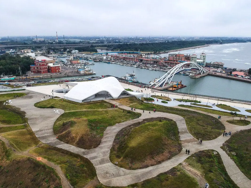
Yongan Fishing Harbor in Xinwu Township of Taoyuan is popular for its tourist seafood market, beautiful pedestrian bridge, as well as the newly created Yongan Conch Cultural Park (永安海螺文化體驗園區), which is a cultural and artistic center for the area. There are also great seaside bike paths nearby. Here you can enjoy the landscape, shop for freshly caught seafood, and also understand more about Hakka culture and the history of fishing in Taiwan. It is one of the most popular tourist destinations in Taoyuan.
Historical Background: Yong-an Fishing Harbor was established in 1953 and is a secondary class port. Before that it was known as Kaotouwu Port (崁頭屋港) which dates back to the 1800s during the Qing Dynasty, located on the north side of the mouth of the Shezi River. Originally a small fishing port, Yong-an Fishing Port has expanded over the years, including dredging channels and extending to allow for larger fishing vessels. The current port is 27,600 square meters, with room for approximately 450 vessels in total. Now there are about 99 small fishing vessels that dock in the harbor. The main catches here are mackerel, squid, black scraper, bonito, shark, and yellowtail fish. "Yong-an Sea-view Bridge 永安觀海橋" was completed in 2002 and is 110 meters long and 20 meters tall. It is a large iron arched bridge spanning Yong-an Fishing Port. In the evening it also lights up with colorful LED lights. Yong-an Sea-view Bridge attracts many photography enthusiasts, Instagrammers, and sunset watchers. Yong-an Fishing Port opened a tourist seafood market in 2004, making the surrounding coast become a popular tourist destination. It includes a two-story fish auction hall, where fishing vessels load and unload their catches. Since its opening, the tourist seafood market has seen tens of thousands of visitors every year. Yongan Conch Cultural Park was completed in 2021. Sitting on 5.6 Hectares, the white building is meant to resemble a "conch curved shell" and symbolizes the Hakka people's spirit to take on the ocean (Yongan Harbor is the only fishing port in Taiwan mainly dominated by Hakka ethnic group). Designed by Dai Xiao-qin (戴小芹), it integrated elements such as Hakka Culture, marine life, and local ecology. It is also a green, energy saving building that won the 21st Public Construction Quality Award. Price: Free Hours: Yongan Seafood Market: 9 AM to 7 PM every day Yongan Conch Cultural Park : 9 AM to 5 PM Tuesday to Sunday Where to stay: Looking for a hotel in Taoyuan? We recommend the Novotel Taipei Taoyuan International Airport which has great service and is conveniently located right next to Taoyuan Airport, the MRT, and HSR station (you can book on Agoda here or Booking.com here). We also recommend the Fullon Hotel Taoyuan which also has great service and is located in downtown Taoyuan City (you can book on Agoda here or Booking.com here). Looking for a hotel? We recommend booking through Booking.com here, which provides the best quality selection of accommodation in Taiwan. Find out where to stay in our Taiwan hotels guide or search for the best hotel deals in Taiwan here. Activities in Taoyuan: Ice Skating, Rock Climbing, Mountain Climbing, Cycling, High Ropes, Ziplining, Archery, Vietnamese BBQ, Batting Cages, Glamping, Van Camping, Photo Shoot, Turkish Mosaic DIY, Thai Massage, Painting, Baking, Go Karting, Imax Theater, Japanese Style Buffet, Tourist Factory Experience, peach and fruit picking, Ring-making DIY, handmade popsicle DIY, and more on on Tripadvisor here, Klook here, or KKday here. How to get there: By Car: Take expressway 61 to Taoyuan and take the exit near Xinwu. The harbor is just west of the expressway. There is limited free parking near the harbor, and also paid parking nearby. If you are looking for car rentals, you can also search Qeeq here, Klook here, or KKday here. By Scooter: Take provincial highway 15 south from Taipei and stop at Yongan Harbor. Looking for scooter rental in Taoyuan? Search Klook here or KKday here to look for options. By Bus: From Zhongli TRA Station, you can take bus 5027A west to the harbor. You can book tickets to travel to Taoyuan via inter-city bus on Klook here. Book tickets via the normal train (TRA) on Klook here. By Bicycle: Cycling is the best way to enjoy Taiwan's landscapes if you have the time and energy. Looking for bicycle rentals in Taiwan? You can use Taiwan's many Youbike sharing stations, or search for rentals on KKday here, and search for tours on Klook here. You can also check out our Taiwan cycling guide here. You can also book a cycling tour on TripAdvisor here. For more information, check out our Taiwan transportation guide here. Map: See below: 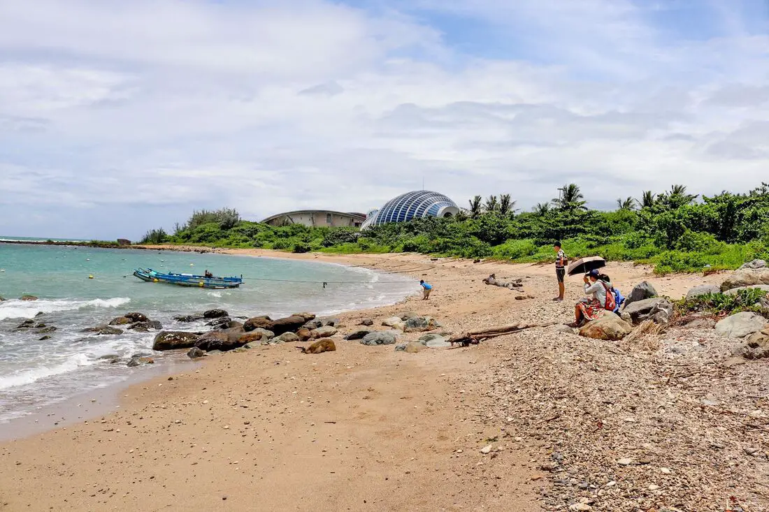
Houwan Beach in Kenting is a small beach near the Aquarium. It features a short yellow sandy beach, as well as clear water that is relatively warm year round. In addition, the beach has sunshine for most of the year. Popular activities include surfing, swimming, and sunbathing. It has everything you would want from a Kenting beach but it is smaller and there are fewer people than other beaches.
Background: Houwan is a small fishing town in Kenting after which the beach is named. The name literally means "back bay" in Chinese. Kenting was first settled by Chinese farmers during the Qing Dynasty. The word Kenting comes from two words that mean cultivate (ken3 墾) and strong man (丁 ding1). During that time, a group of strong men (or Zhuang Ding 壯丁) came from Guangdong, who were basically Chinese pioneers of the area to cultivate the land, hence the area was named Kenting for them. The area was considered to be made into a park during the Japanese occupation due to it being the only tropical location in the Japanese Empire, but was never officially created. Kenting National Park was established in 1984 as the first national park in Taiwan after WWII. Kenting became a major vacation spot, becoming a center for hostels and hotels for travelers. Kenting is considered by many to have the best beaches in Taiwan. This is because of its fine white sand and year-round warm temperatures and sunshine (it is in the tropical part of Taiwan after all). Usually, this beach is free of people and crowds even on weekends. Hours: 24/7 Price: Free When to go: Summer! It's when the water is warmest and the sun is hottest. However there will be more people in summer, and there could be Typhoons. Spring and Fall are also good times to go, as there will be less visitors and cooler temperatures. Winter is an okay time to go as well, it will be warmer than the rest of Taiwan and the water will still be warm enough to swim in. How to get there: By Car/Scooter: Take Provincial highway 1 south to the bottom of Taiwan until it becomes Provincial highway 26. After that keep going past Checheng and then turn west onto Houwan Road until you reach the beach. There is free parking near the beach. Looking for scooter rental in Pingtung? Click here or here to search for options. You can also check out our Taiwan scooter rental guide here. If you are looking for car rentals, you can also search here. You can check out our car rental guide here. By Bus: Busses leave daily to Kenting from Zuoying HSR station, Kaohsiung Station, and Pingtung. Get off at Shanghouwan上後灣. You can book tickets to Pingtung via high speed rail (HSR) on Klook here or KKDay here, or book tickets via the normal train (TRA) on Klook here. You can book tickets to travel to Pingtung via inter-city bus on Klook here. By Plane: There are direct shuttle busses to Kenting from Kaohsing's Xiaogang (KHH) Airport. You can book cheap flights to Kinmen on Trip.com or CheapO Air. You can also search for cheap flights in Taiwan on Kiwi here. Accommodation: I have stayed at many hostels and hotels in Kenting, and even almost bought a house here. Some places that I have stayed at and can recommend are Nanwan Kiki (book on Agoda here, Booking.com here), a B&B next to Nanwan Bay, Kenting's most popular Beach. There are also a few decent hotels near Kenting Street Night Market like Kenting Star Inn 888 (book on Agoda here, Klook here, Hotels.com here, Expedia here, or Booking.com here), or Kenting Dajianshan Hotel (book on Agoda here, Booking.com here, Hotels.com here, or Expedia here). You will notice that none of these hotels are five star resorts (I do not come to Kenting to waste my time at a resort, but you can still search Agoda, Booking.com, Hotels.com, or Expedia for those) but they are in my opinion the above have the best value for the money. Looking for a hotel? Find out where to stay in our Taiwan hotels guide or search for the best hotel deals in Taiwan here. We recommend booking through Agoda here, which provides the best quality selection of accommodation in Taiwan. Tours and Activities in Kenting: There are many activities available such as snorkeling, diving, SUPing, surfing, submarine riding, and river tracing. You can find more tours of Kenting on Klook here or KKday here. Map: Please see below: 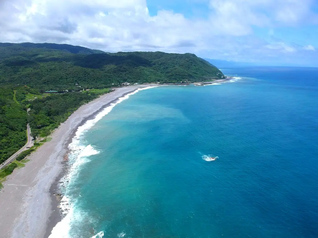
Xuhai Village is a place with amazing coastline in Mudan Township of Pingtung County. Due to its remote location, there are not many people and the landscape is mostly pristine. It may be the most beautiful stretch of coast on the main island of Taiwan.
Background: The area around Xuahi Village was originally named "Mudan Bay" because it is the site of the Mudan Incident in which nearly 100 shipwrecked Japanese sailors were massacred by local Paiwan tribespeople. The first settlers in the area arrived in the early 1900s during the Japanese era, and were mainly aboriginal people and Hakka people from other parts of Taiwan. In 1980 Xuhai Harbor was built to help the local economy and protect ships on the east coast during Typhoons. The population in the area is about half what it was in the 1980s as younger people have moved to big cities for better work opportunities. Even though there are over 450 registered households, only about 120 people regularly live here. Xuhai Village is also the start point of the Alangyi Trail 阿塱壹古道, which connects the east coast here from Pingtung to Taitung. Hours: 24/7 Price: Free Hotels: I have stayed at many hostels and hotels in Kenting, and even almost bought a house here. Some places that I have stayed at and can recommend are Nanwan Kiki (book on Agoda here, Booking.com here), a B&B next to Nanwan Bay, Kenting's most popular Beach. There are also a few decent hotels near Kenting Street Night Market like Kenting Star Inn 888 (book on Agoda here, Klook here, or Booking.com here), or Kenting Dajianshan Hotel (book on Agoda here or Booking.com here). You will notice that none of these hotels are five star resorts (I do not come to Kenting to waste my time at a resort, but you can still search Agoda or Booking.com) but they are in my opinion the above have the best value for the money. Looking for a hotel? Find out where to stay in our Taiwan hotels guide or search for the best hotel deals in Taiwan here. We recommend booking through Agoda here, which provides the best quality selection of accommodation in Taiwan. Tours and Activities in Pingtung: There are many activities available in Kenting, such as snorkeling, diving, SUPing, surfing, submarine riding, and river tracing. You can find more tours of Kenting on Klook here or KKday here. How to get there: By Bus: You can take bus 304 or 304A to Gangzai Nei station, and the sand dunes are about a half hour walk away. You can book tickets to travel to Pingtung via inter-city bus on Klook here. By Car/Scooter: Take County Highway 200 to Jiupeng in Pingtung. The sand dunes are very big and obvious along the coast. Looking for scooter rental in Pingtung? Click here or here to search for options. If you are looking for car rentals, you can also search here. By Bicycle: Cycling is the best way to enjoy Taiwan's landscapes if you have the time and energy. Looking for bicycle rentals in Taiwan? You can search on KKday here and search for tours on Klook here. You can also check out our Taiwan cycling guide here. Map: See below: 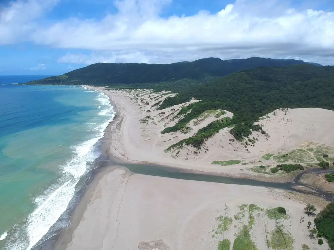
The Jiupeng Desert (aka Jioupeng Desert 九棚大沙漠 or Gangzhi Desert 港仔大沙漠) is a row of sand dunes along the coastline near Jiupeng Village, Manzhou Township, Pingtung County, and are the largest sand dunes in Taiwan. The area is not actually a desert but is formed from strong northeast winds along the coast, creating large dunes of sand despite the fact that Taiwan is a wet, tropical island.
Background: The area around Jiupeng Village was named because of nine villages in the area. The first settlers in the area arrived in the early 1900s during the Japanese era. The population in the area is about half what it was in the 1980s as younger people have moved to big cities for better work opportunities. Even though there are over 300 registered households, only about 100 people regularly live here. The sand dunes have become a popular spot for ATVing and off-roading, however some accidents and liability issues have hampered the industry. Usually you will not see many people here because the area is so remote. Hours: 24/7 Price: Free Where to stay: Looking for a hotel? Find out where to stay in our Taiwan hotels guide or search for the best hotel deals in Taiwan here. We recommend booking through Agoda here, which provides the best quality selection of accommodation in Taiwan. I have stayed at many hostels and hotels in Pingtung, and even almost bought a house here. Some places that I have stayed at and can recommend are Nanwan Kiki (book on Agoda here, Booking.com here), a B&B next to Nanwan Bay, Kenting's most popular Beach. There are also a few decent hotels near Kenting Street Night Market like Kenting Star Inn 888 (book on Agoda here, Klook here, or Booking.com here), or Kenting Dajianshan Hotel (book on Agoda here or Booking.com here). You will notice that none of these hotels are five star resorts (I do not come to Kenting to waste my time at a resort, but you can still search Agoda, Booking.com, or Klook here for those) but they are in my opinion the above have the best value for the money. Tours and Activities in Pingtung: There are many activities available in Kenting, such as Riding ATVs (four wheeling) on the beach snorkeling, diving, SUPing, surfing, submarine riding, and river tracing. You can find more tours of Kenting on Klook here or KKday here. How to get there: By Bus: You can take bus 304 or 304A to Gangzai Nei station, and the sand dunes are about a half hour walk away. You can book tickets to travel to Pingtung via inter-city bus on Klook here. By Car/Scooter: Take County Highway 200 to Jiupeng in Pingtung. The sand dunes are very big and obvious along the coast. Looking for scooter rental in Pingtung? Click here or here to search for options. If you are looking for car rentals, you can also search Qeeq here, Klook here, or KKday here. You can also check out our car rental guide here. By Bicycle: Cycling is the best way to enjoy Taiwan's landscapes if you have the time and energy. Looking for bicycle rentals in Taiwan? You can search on KKday here and search for tours on Klook here. You can also check out our Taiwan cycling guide here. Map: See below: 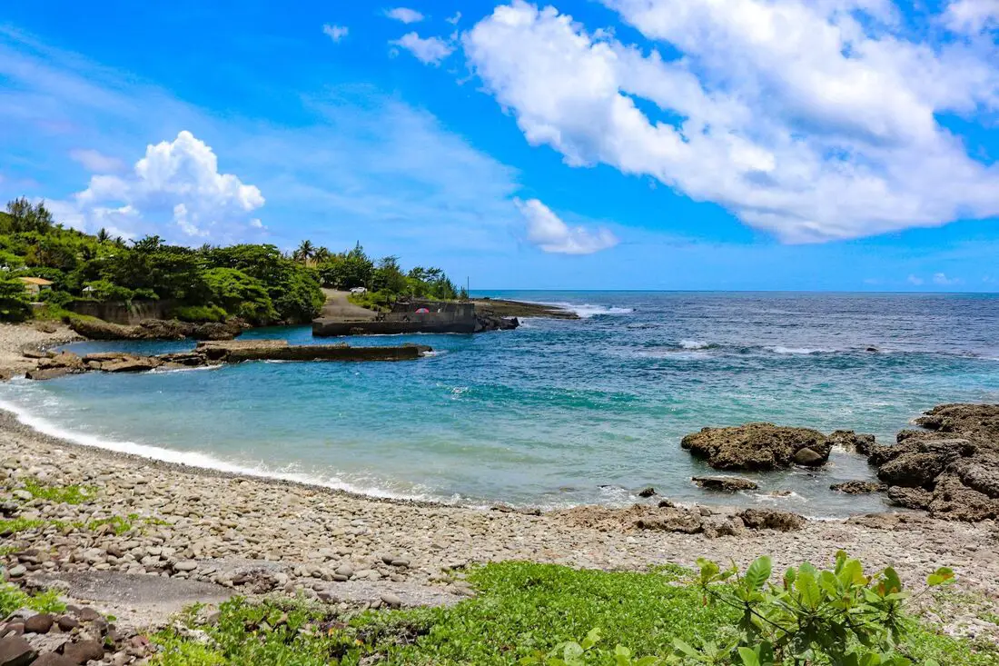
Nanren Fishing Harbor is known as the loneliest fishing harbor in Taiwan. It lies at the dead end of Nanren Road at the northern end of Kenting National Park, the end of the road along the east coast between it and Jialeshui. Here you can find pristine landscapes, an amazing shoreline, and more cows than people.
Background: The area around Jiupeng Village was named because of nine villages in the area. The first settlers in the area arrived in the early 1900s during the Japanese era. The population in the area is about half what it was in the 1980s as younger people have moved to big cities for better work opportunities. Even though there are over 300 registered households, only about 100 people regularly live here. Nanren Fishing Harbor currently lies in the northeast part of Kenting National Park, as part of the Nanren Nature Preserve, which includes Nanren Lake, a remote wetland area in the mountains of Nanren. Hours: 24/7 Price: Free Where to stay: Looking for a hotel? Find out where to stay in our Taiwan hotels guide or search for the best hotel deals in Taiwan here. We recommend booking through Agoda here, which provides the best quality selection of accommodation in Taiwan. I have stayed at many hostels and hotels in Pingtung, and even almost bought a house here. Some places that I have stayed at and can recommend are Nanwan Kiki (book on Agoda here, Booking.com here), a B&B next to Nanwan Bay, Kenting's most popular Beach. There are also a few decent hotels near Kenting Street Night Market like Kenting Star Inn 888 (book on Agoda here, Klook here, or Booking.com here), or Kenting Dajianshan Hotel (book on Agoda here or Booking.com here). You will notice that none of these hotels are five star resorts (I do not come to Kenting to waste my time at a resort, but you can still search Agoda, Booking.com, or Klook here for those) but they are in my opinion the above have the best value for the money. Tours and Activities in Pingtung: There are many activities available in Kenting, such as snorkeling, diving, SUPing, surfing, submarine riding, and river tracing. You can find more tours of Kenting on Klook here or KKday here. How to get there: By Bus: The nearest bus stop is at Jiupeng Village via bus 304A, and it is about an hour walk (5KM) to the fishing harbor. You can book tickets to travel to Pingtung via inter-city bus on Klook here. By Car/Scooter: Take Couny Highway 200 to Jiupeng in Pingtung, then turn right onto Nanren Road. The fishing harbor is at the very end of the road. Looking for scooter rental in Pingtung? Click here or here to search for options. If you are looking for car rentals, you can also search Qeeq here, Klook here, or KKday here. You can also check out our car rental guide here. By Bicycle: Cycling is the best way to enjoy Taiwan's landscapes if you have the time and energy. Looking for bicycle rentals in Taiwan? You can search on KKday here and search for tours on Klook here. You can also check out our Taiwan cycling guide here. Map: See below: |
Author 作家I am an American expat who has extensive experience living, working, and traveling in Taiwan. In my day, I had to learn many things about Taiwan the hard way. But I have come to learn that Taiwan is one of the best places in the world for Foreigners to live. This blog does not represent the opinions of every foreigner in Taiwan. I am just trying to help others learn more about this beautiful country. Categories
|
 RSS Feed
